A Great Basin Birthday

We traveled America's Loneliest Road with a long-awaited destination in mind: Great Basin National Park. We initially thought we would take a winter trip to the park before landing ourselves in Utah for our axle appointment in March, but we ended up going to Utah early to get Tanner in to see a vet. Great Basin was put on hold, but not for as long as we expected. We needed to make another axle appointment, which would find us back in Utah at the beginning of June. We put Great Basin back on our agenda. This time, we would be coming from the west, and we chose the route that was a journey in itself.
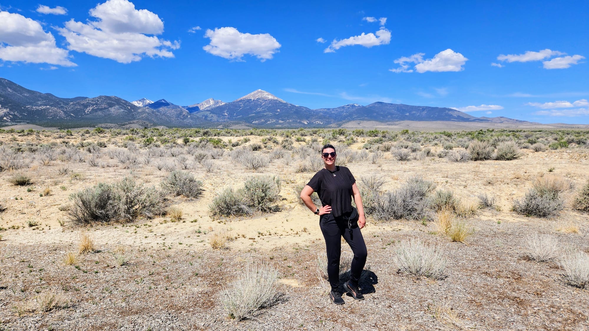
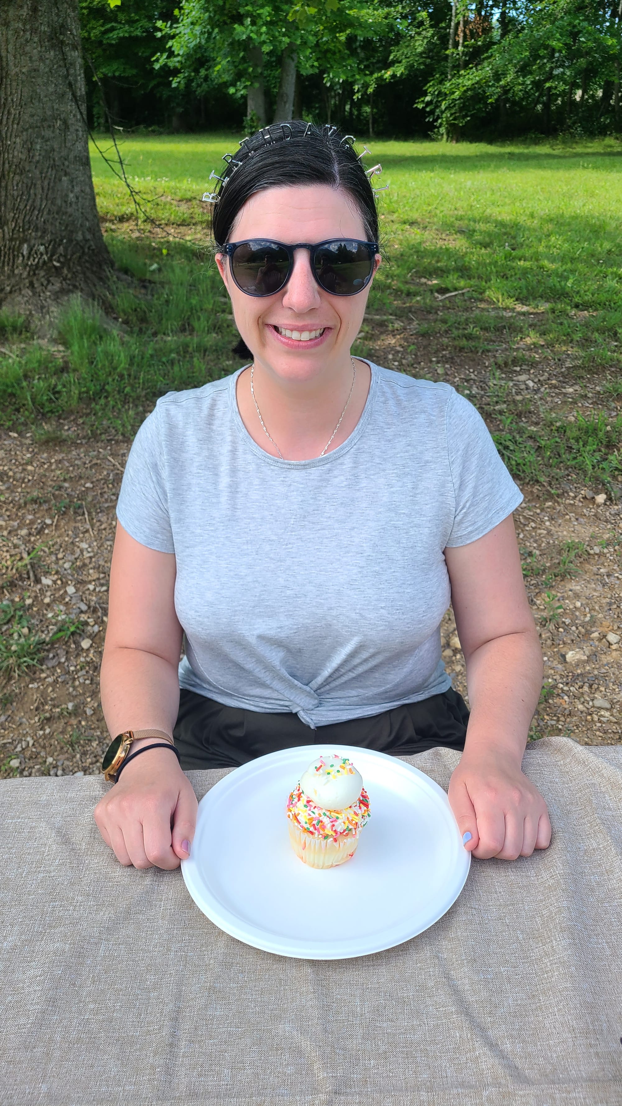
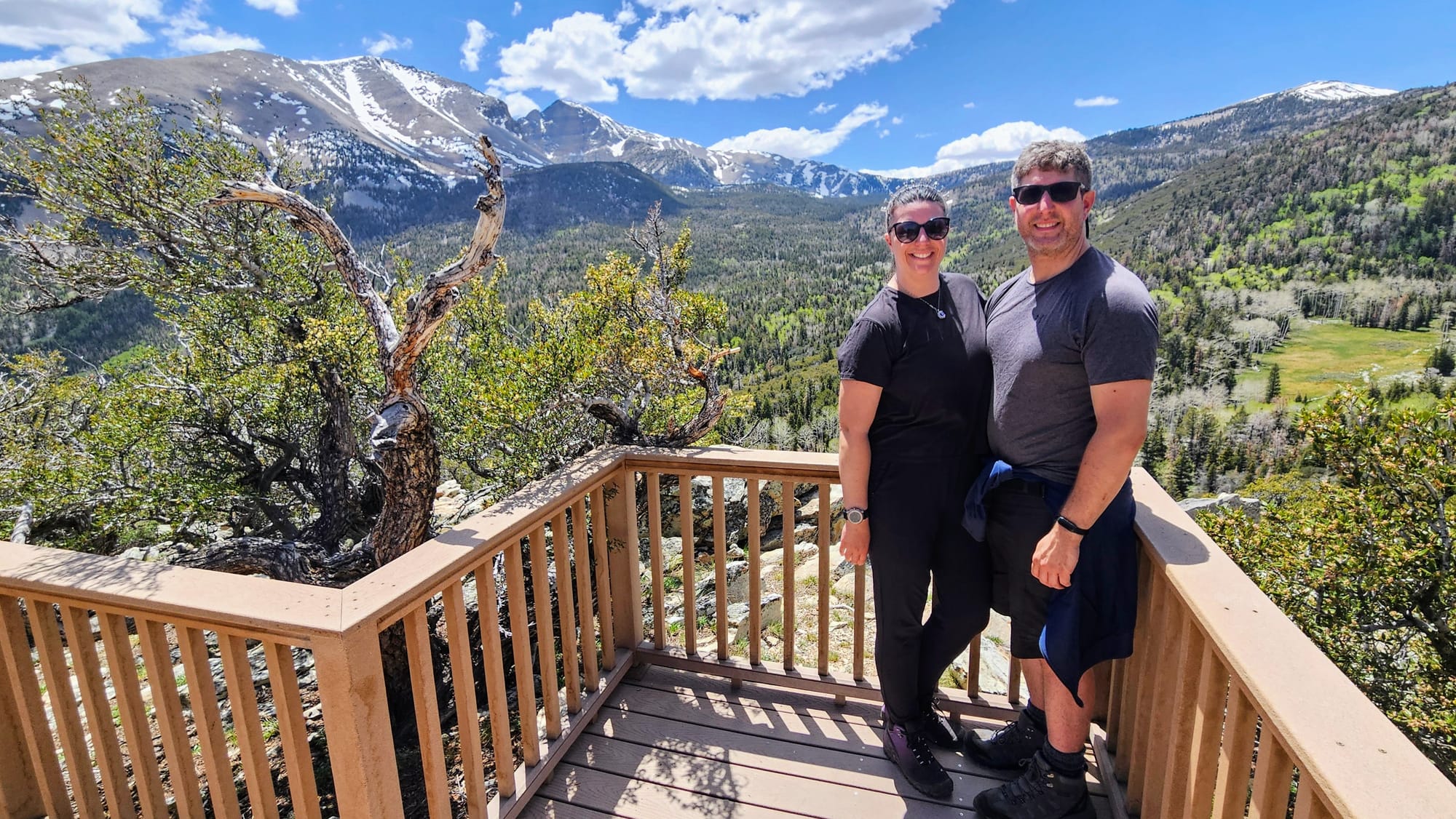
Our last stop on the Loneliest Road was Sacramento Pass, a beautiful BLM campground tucked away in the mountains and only a stone's throw from Great Basin National Park. We camped there for 2 nights, with plans to venture into the park on our full day in the area, Friday, May 30, which also happened to be my birthday.
Birthdays on the road are fun. In a lot of ways, we feel the country is our oyster and we have the freedom to place ourselves wherever we want. Sometimes this isn't the case, like when we're deep into travels, getting repairs, or can't reach a certain destination at a certain time, but we always find special ways to celebrate. This year, we didn't plan to be at a national park on my birthday, but it worked out that way, which we were excited about.

Birthdays on the road! Smoky Mountains, Big Bend/Mexico, Glacier, Mississippi, Lake Michigan, and New Mexico!
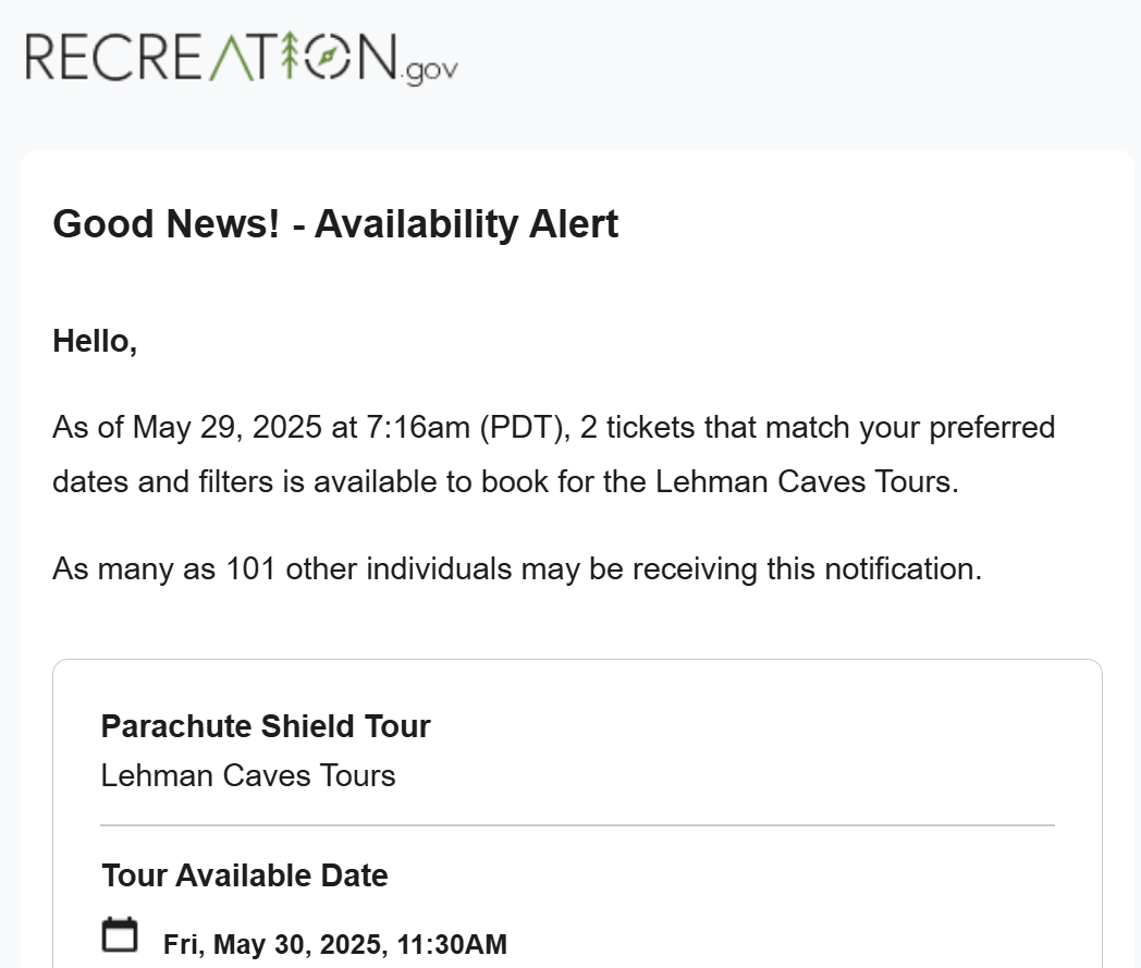
Our more spontaneous travel this year means that sometimes we need to pass on activities that require advanced planning. Great Basin offers cave tours, but by the time we knew when we were visiting, the tickets were all sold out. I set an alert on rec.gov, which sends emails if there are any cancellations. We're not always lucky, but this time, we got an alert that 2 tickets were available, right when I happened to be on my computer and able to immediately grab them. The email said I was one of 101 people being notified, so I felt like it was a little birthday gift that I was able to grab our spots with ease. We had our 1-hour Lehman Caves tour set for 11:30AM. This gave us time to do a little exploring before and after the tour.
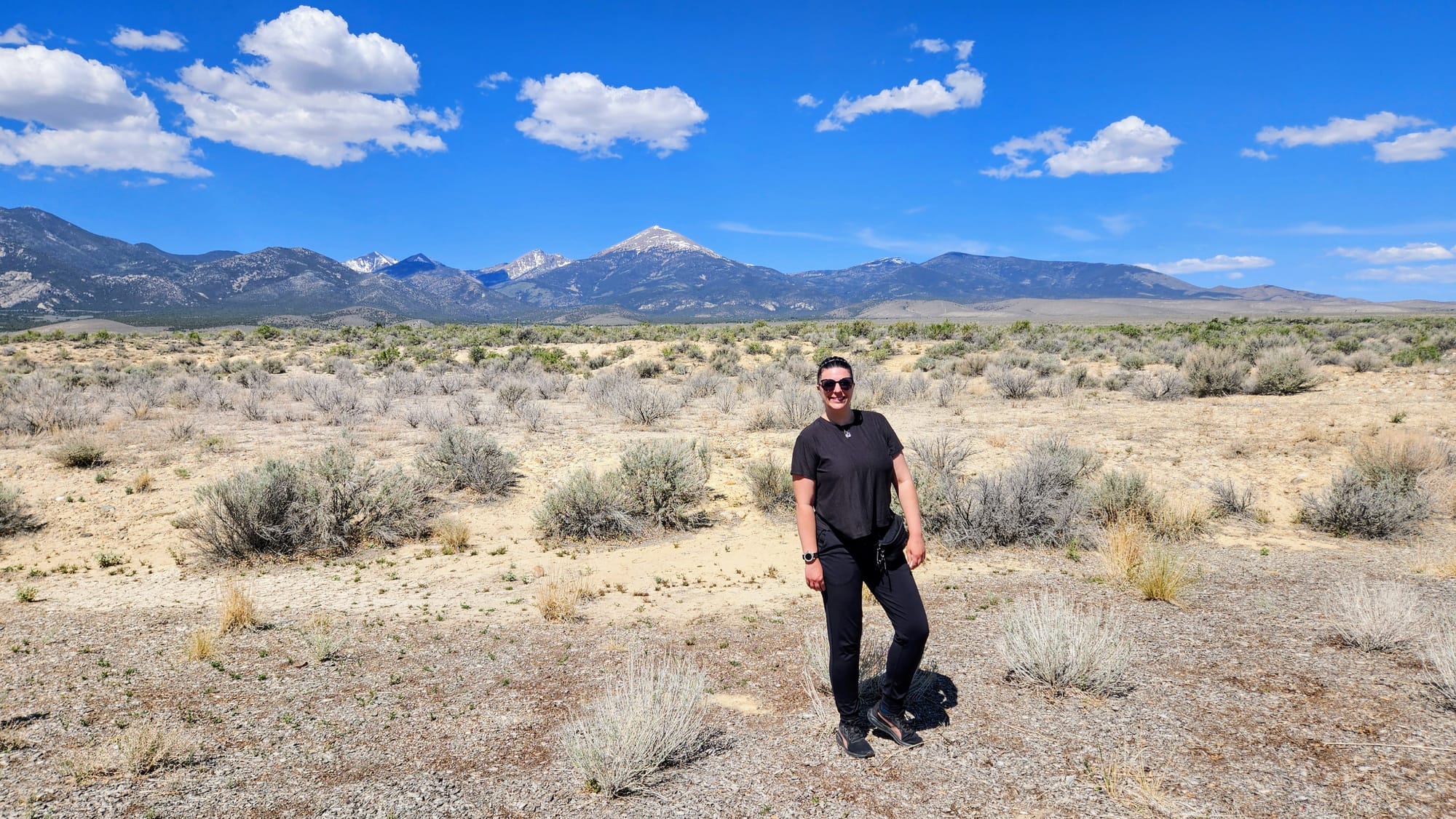
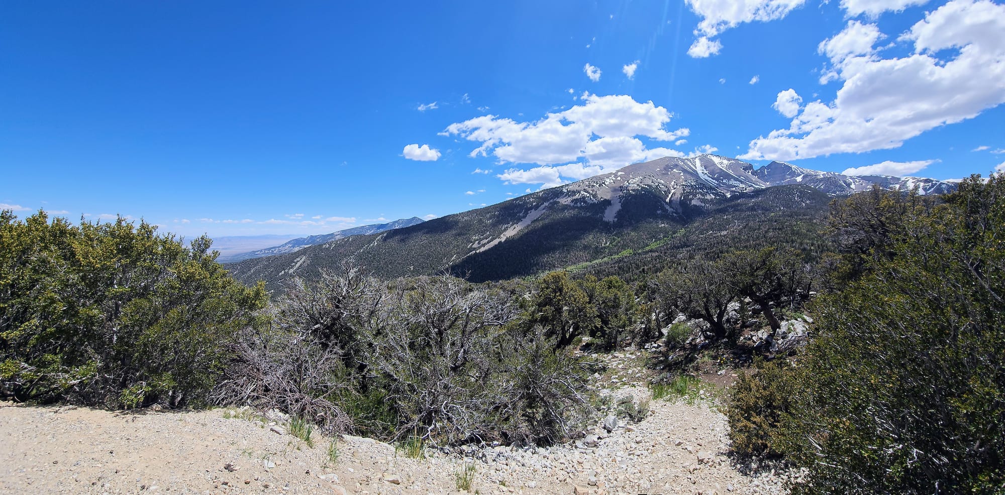
Great Basin National Park is only one small part of the Great Basin, which spans much of Nevada, Utah, and California, as well as parts of Oregon, Idaho, Wyoming, and even Mexico. Many of our travels, including those on the Loneliest Road, have been in parts of the Great Basin. The region is an endorheic watershed, meaning that the water it collects does not have an outlet to the ocean. Even though its known to have a more arid climate, the topography varies greatly. Both the lowest point (Badwater Basin in Death Valley) and highest point (Mount Whitney) in the contiguous US are located in the Great Basin. Even Great Basin National Park has widely varying landscapes and climates. On May 30, many parts of the higher elevations are still snow-covered, while the lower elevations' temperatures topped out in the 80s. This made planning our visit interesting. If we wanted to hike the lower elevations, we would need short sleeves and plenty of water. Lehman Caves is a constant 52 degrees, so layers would be important. Then, if we wanted to explore the higher elevations, we would need long sleeves and possibly even microspikes and poles!
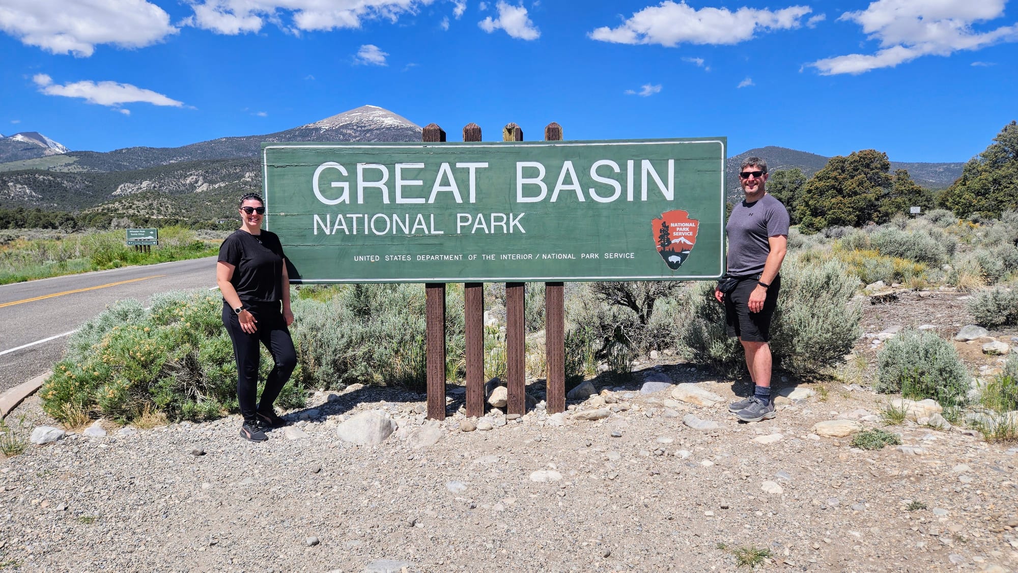
We began our visit with a stop to the Great Basin Visitor Center, the closest visitor center to our campground, technically still outside the park boundaries. We took some photos and got our park pin, before heading to the Lehman Caves Visitor Center, where our cave tour would begin. On the way, we stopped at the park sign.
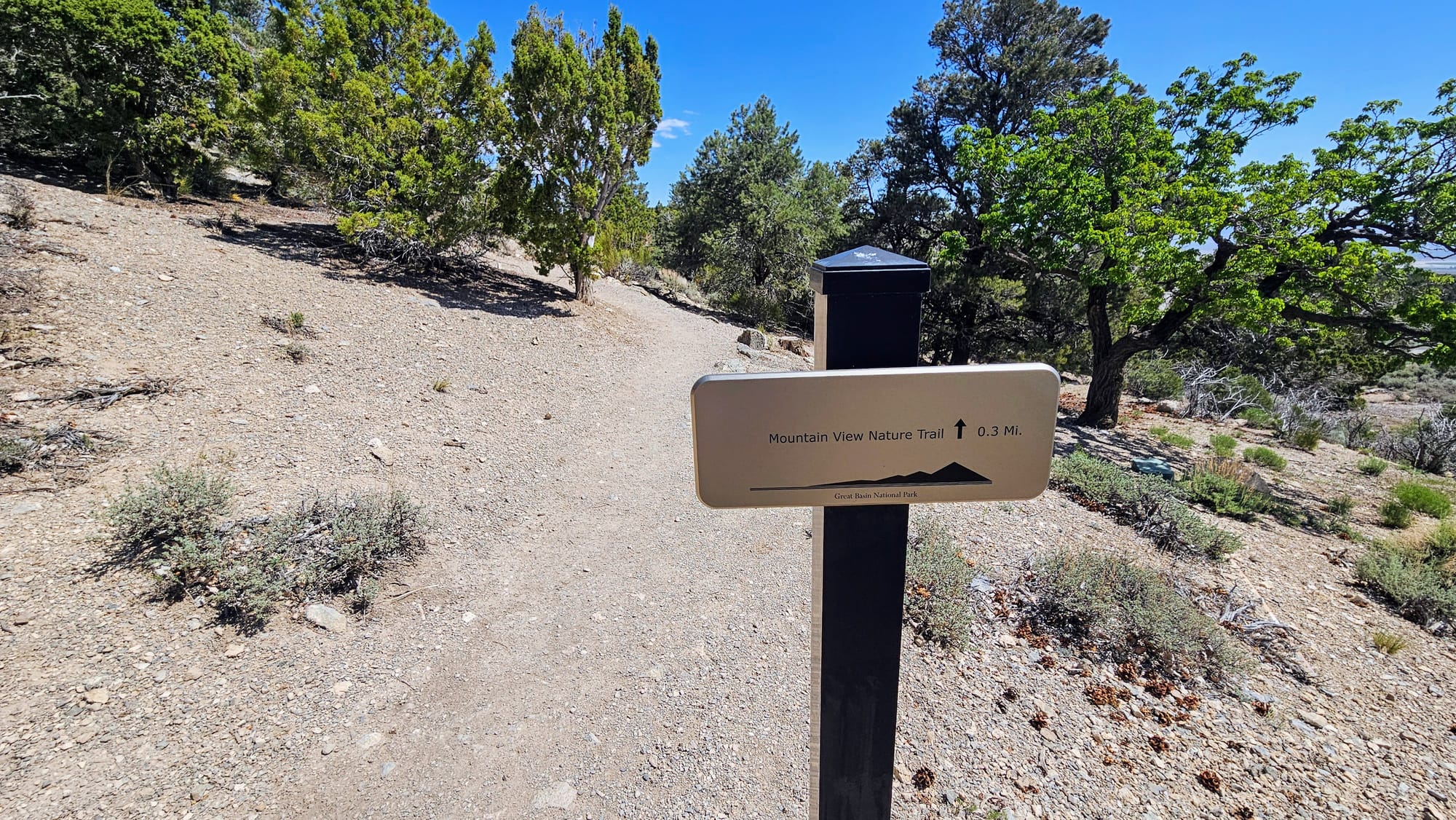
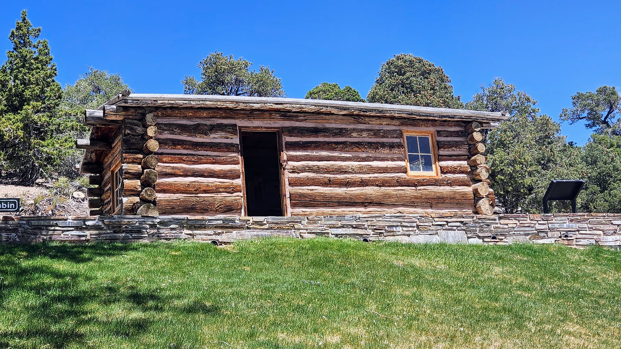
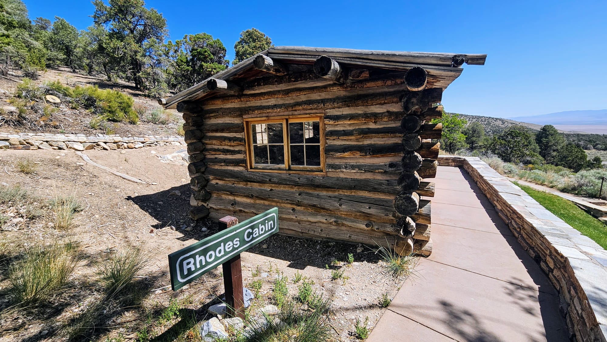
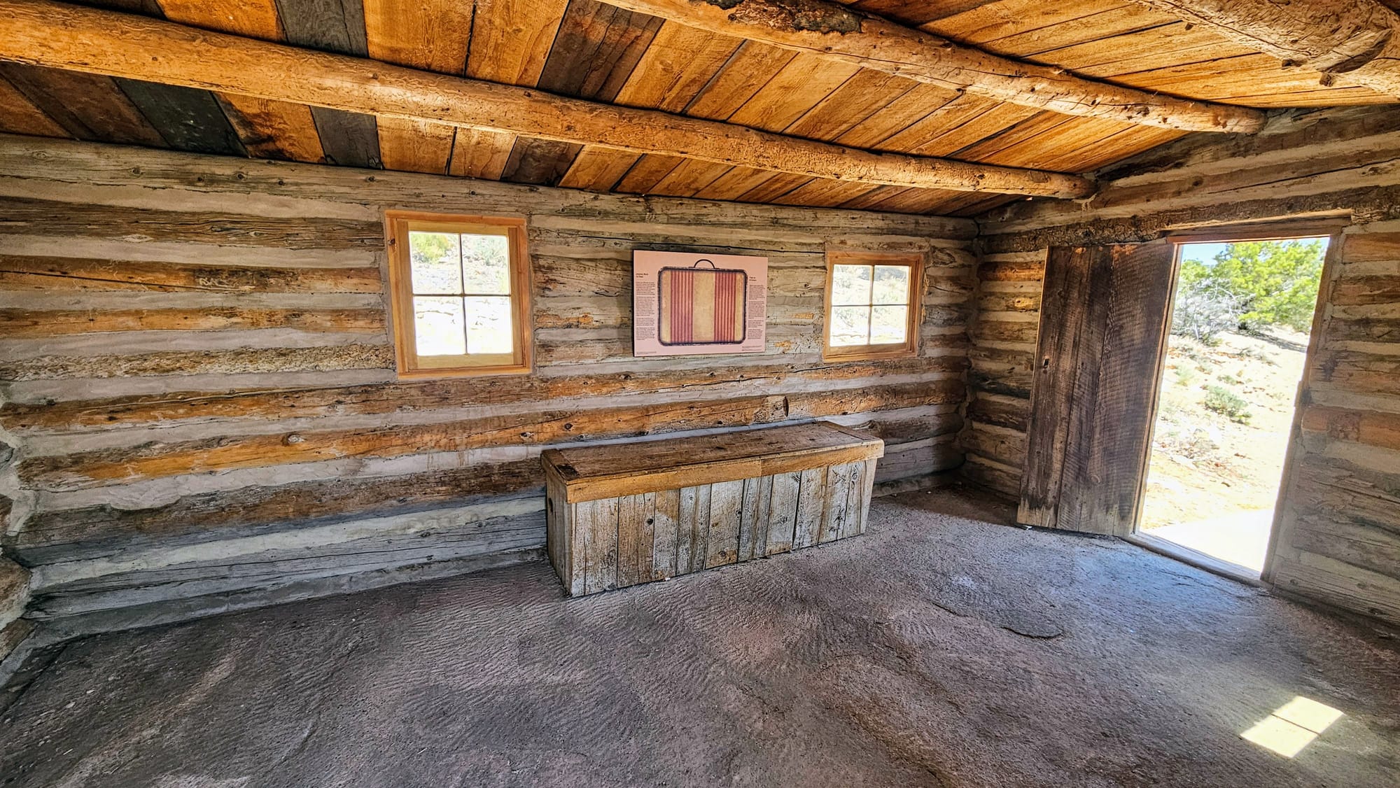
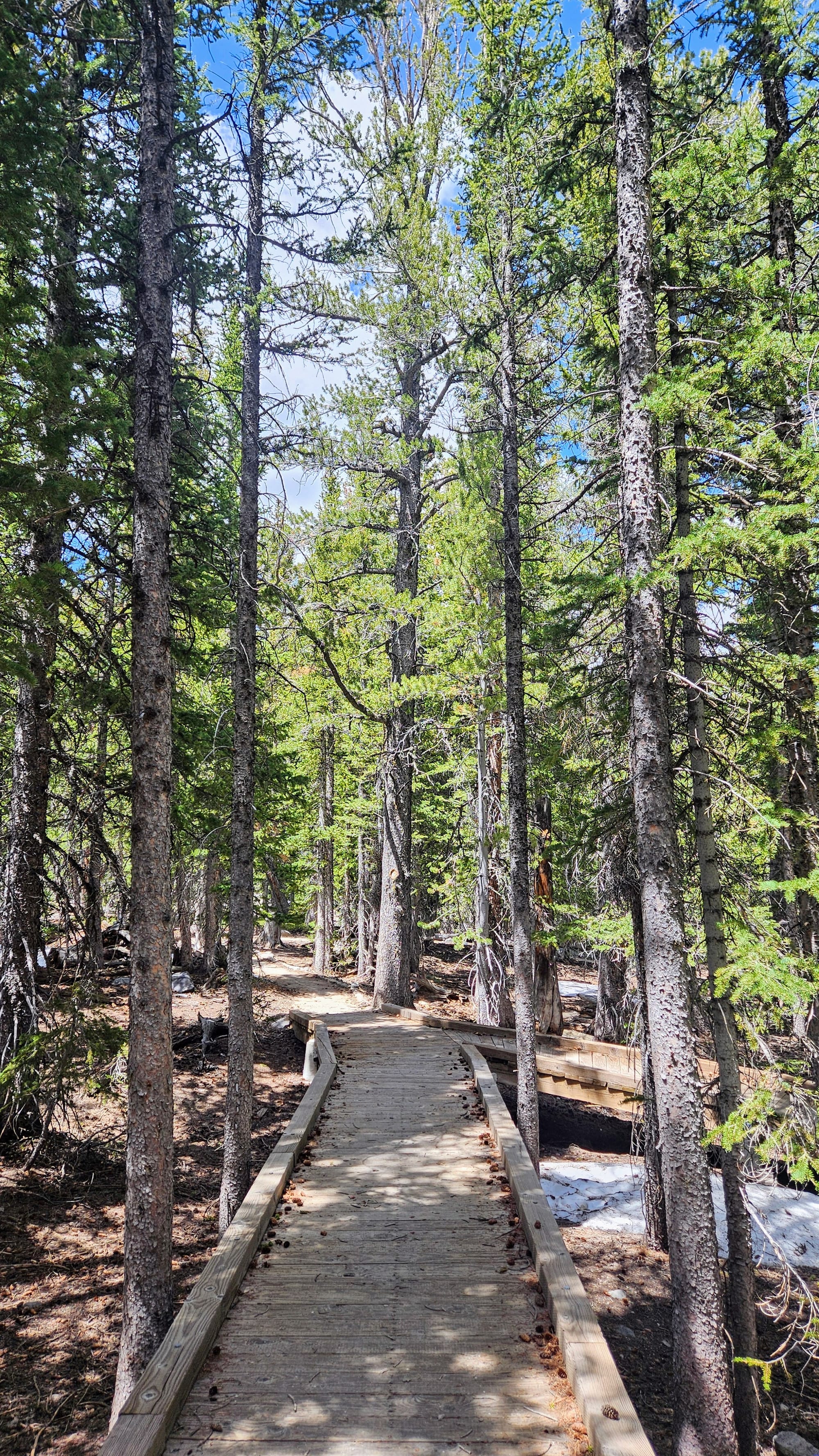
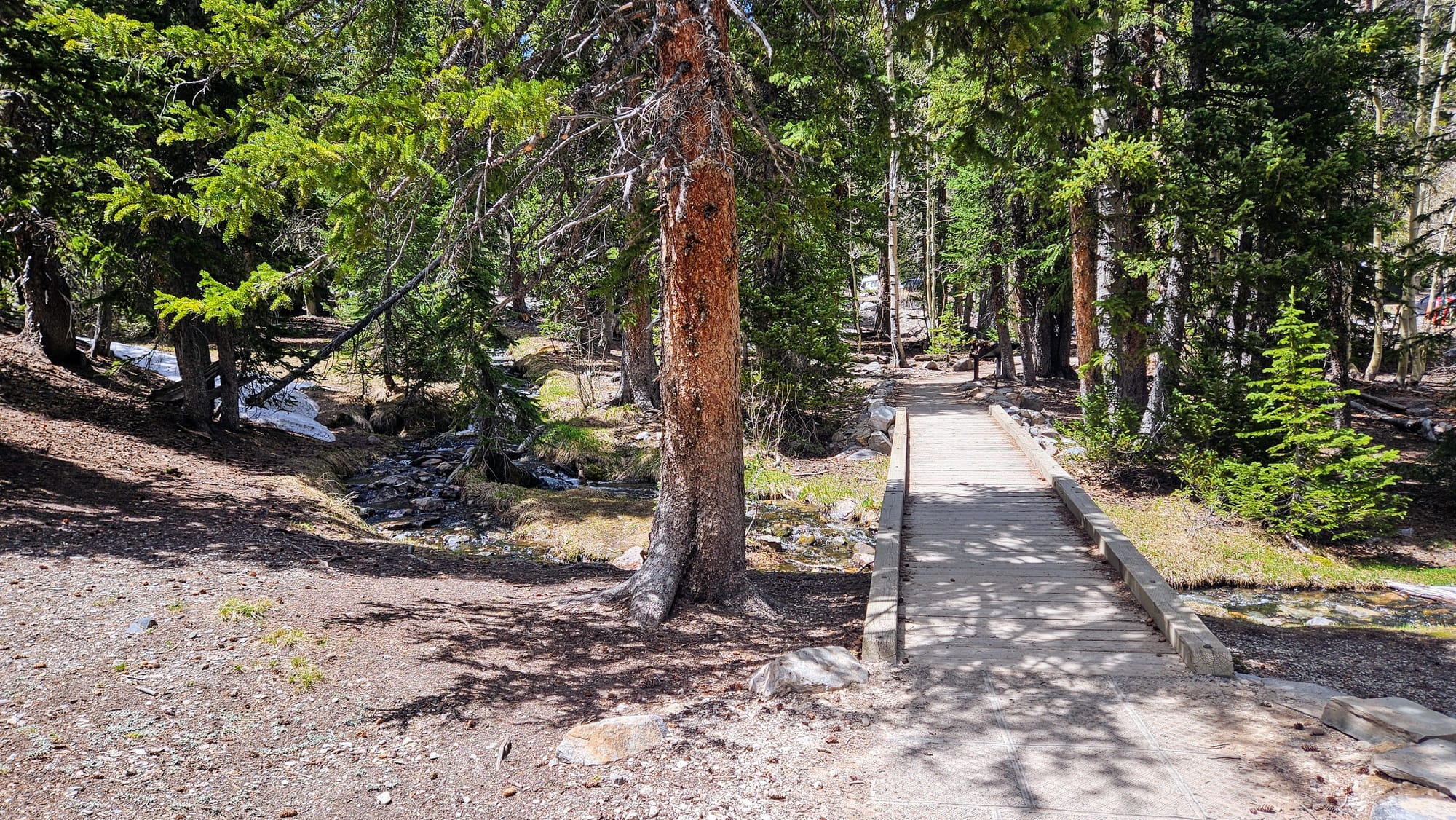
The Lehman Caves Visitor Center has lots to do, so we hung out there until check-in time for our tour. We took the Mountain View Nature Trail, an interpretive trail that introduced us to the history and landscape of the region. We used the self-guided tour on the NPS app to provide us information while we walked the trail. We started with Rhodes Cabin, built in the 1920s to accommodate tourists. Great Basin was so far from towns that staying overnight was a necessity. The Rhodes Cabin was one of several accommodations for visitors. In 1922, Lehman Caves became a national monument, and this cabin housed the caretakers.
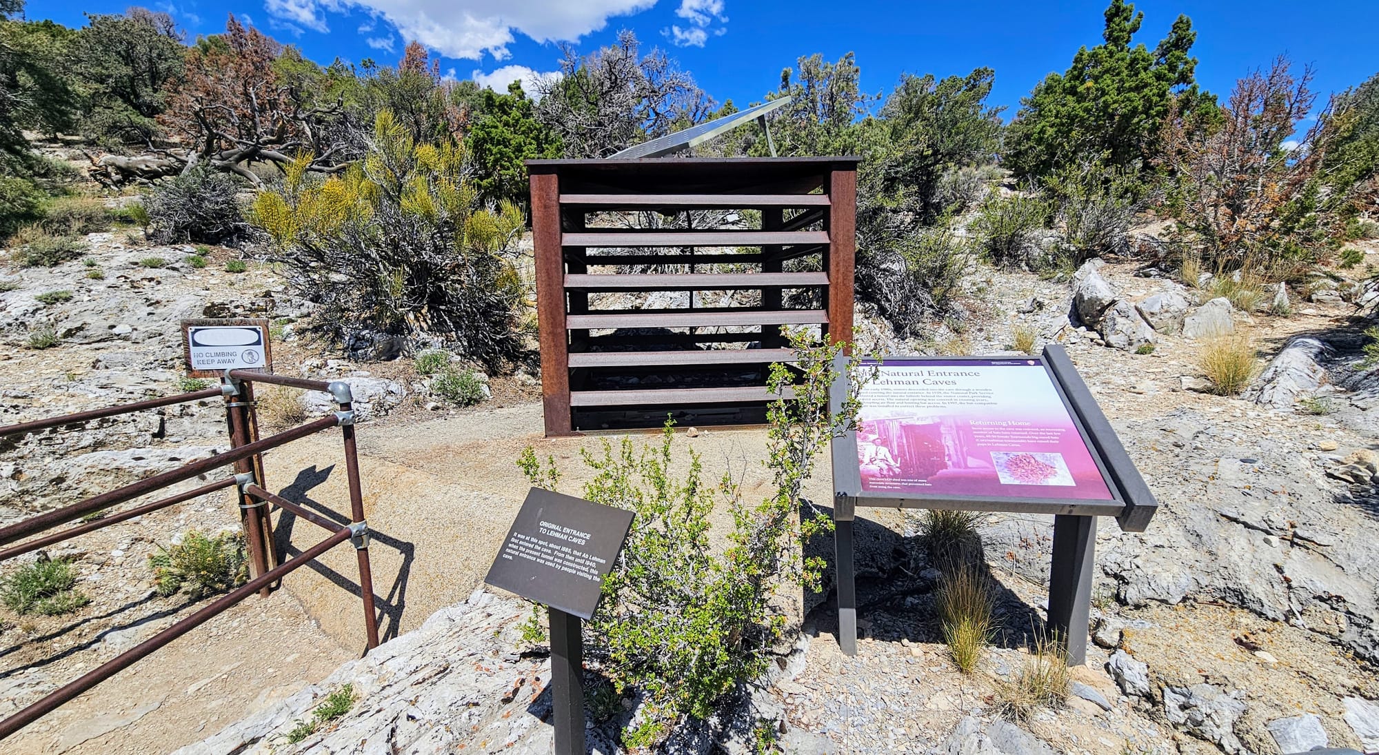
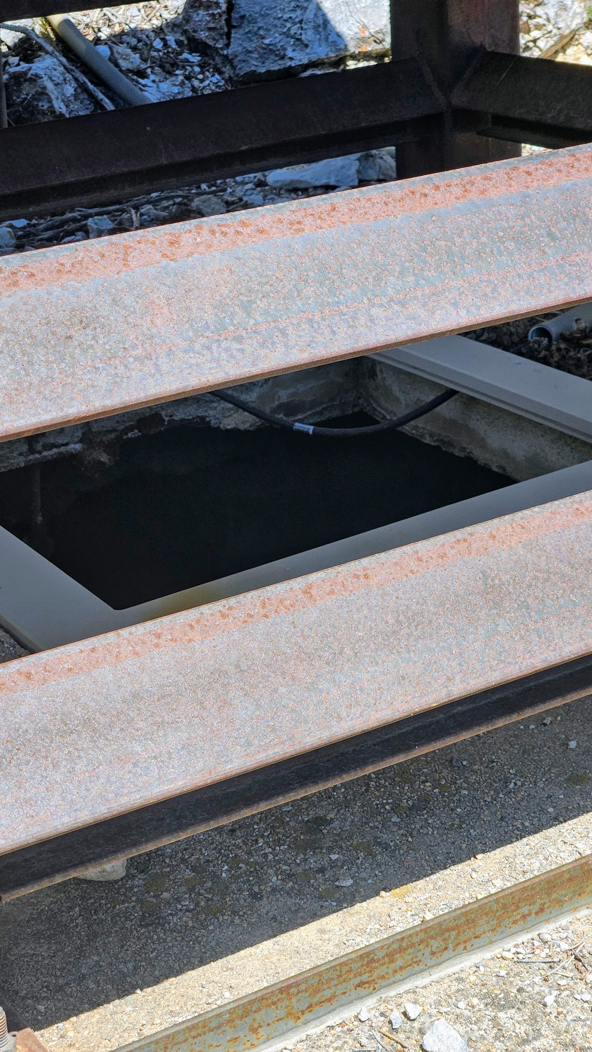
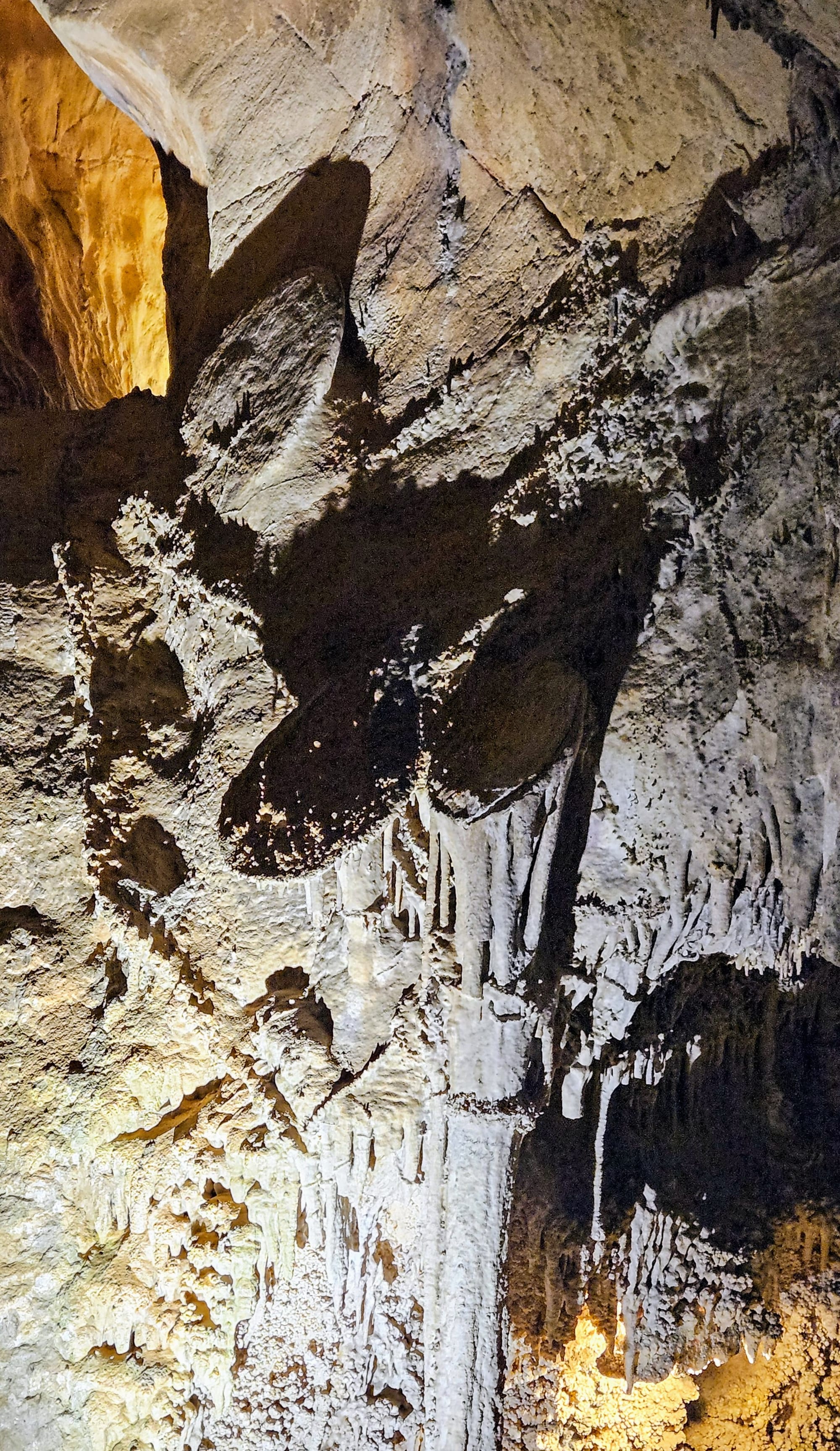
Signposts along the trail taught us about the plants and rocks found in the region, and showed us where we stood above the cave and how water seeps into the ground below, creating the underground cave formations over time. We also learned about Absalom Lehman, the explorer who owned the land surrounding the cave in the 1800s. His story of how he came upon the cave has been embellished, but after finding the natural entrance in 1885, he covered it up. This caused decreased airflow and was detrimental to the bat population and other animals. The natural entrance today is covered with a metal structure, leaving the space open for animals that use the cave for shelter, protection, and hibernation.
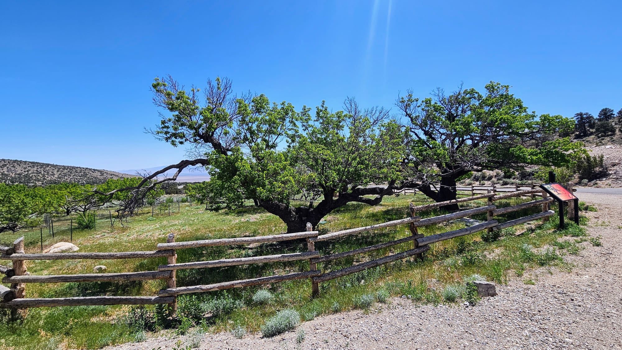
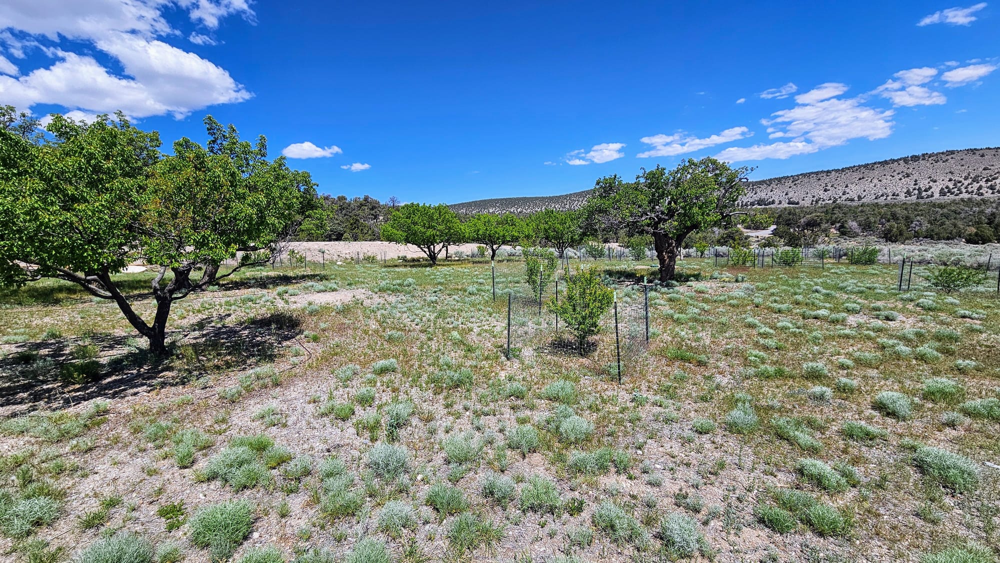
Lehman planted an orchard on his land, which still stands today and is maintained by the NPS. More fruit trees have been planted as part of conservation efforts.
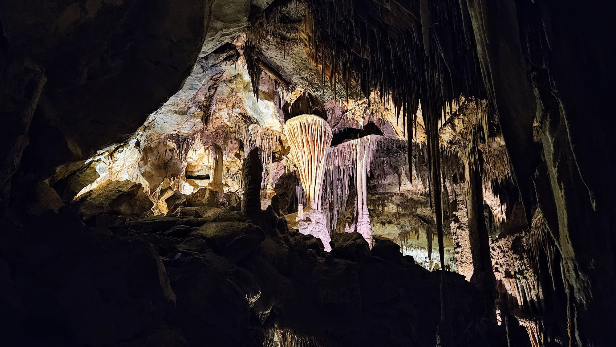
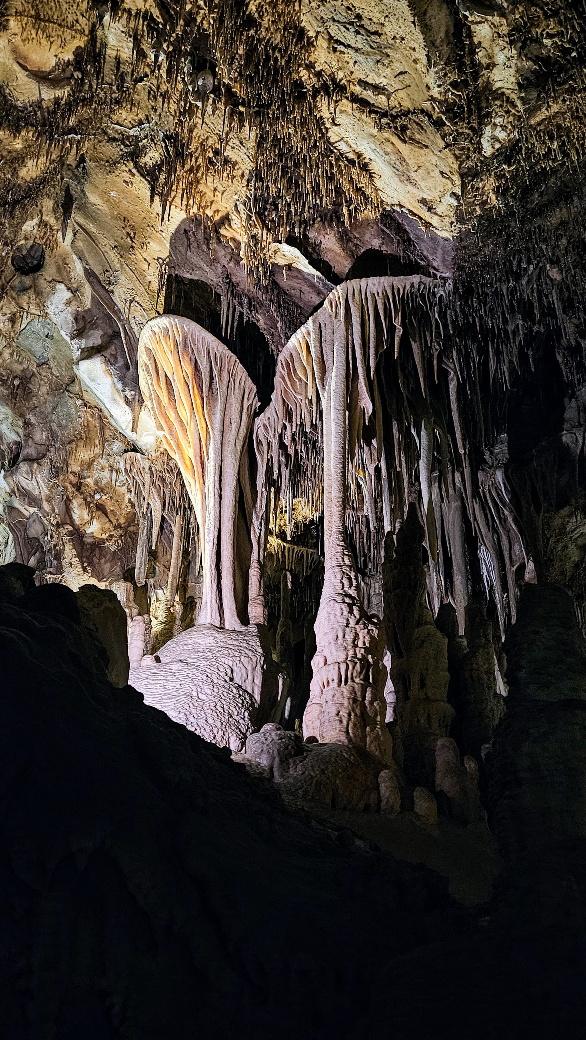
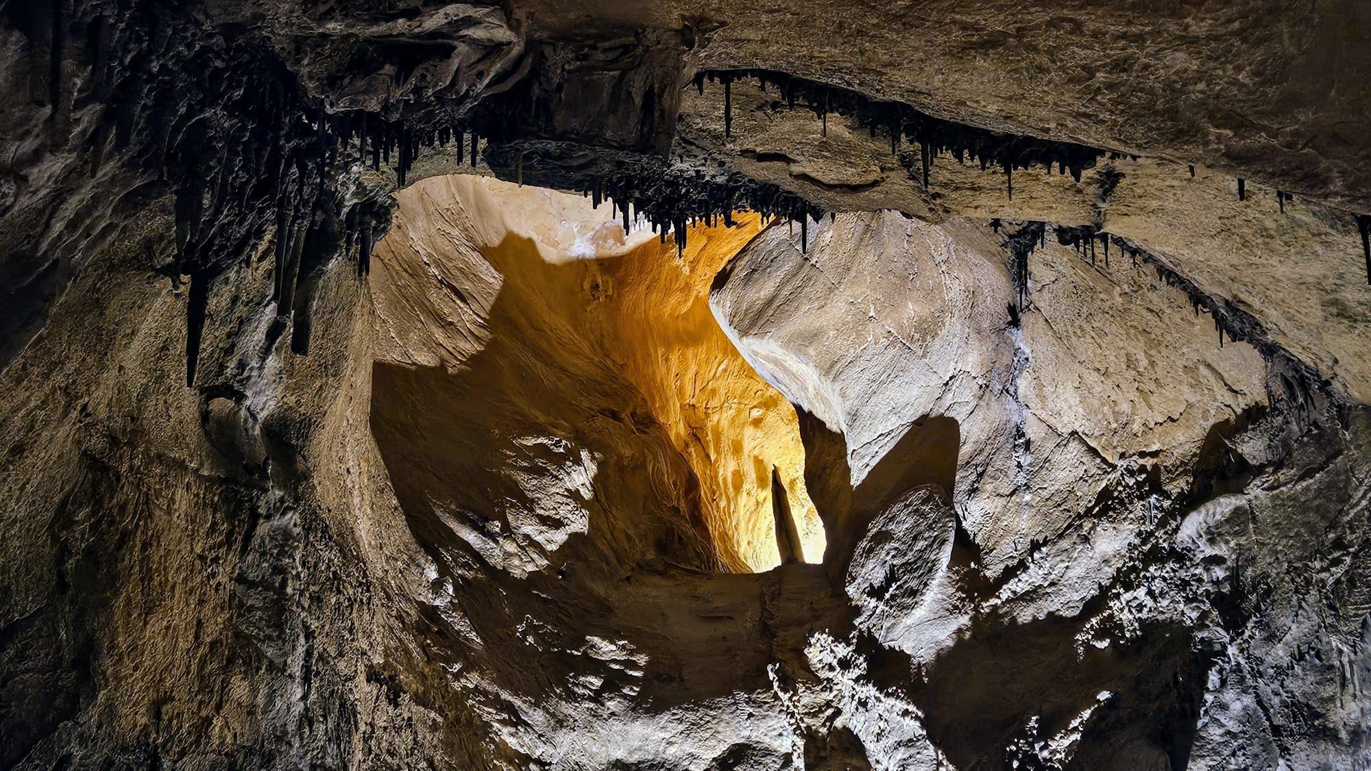
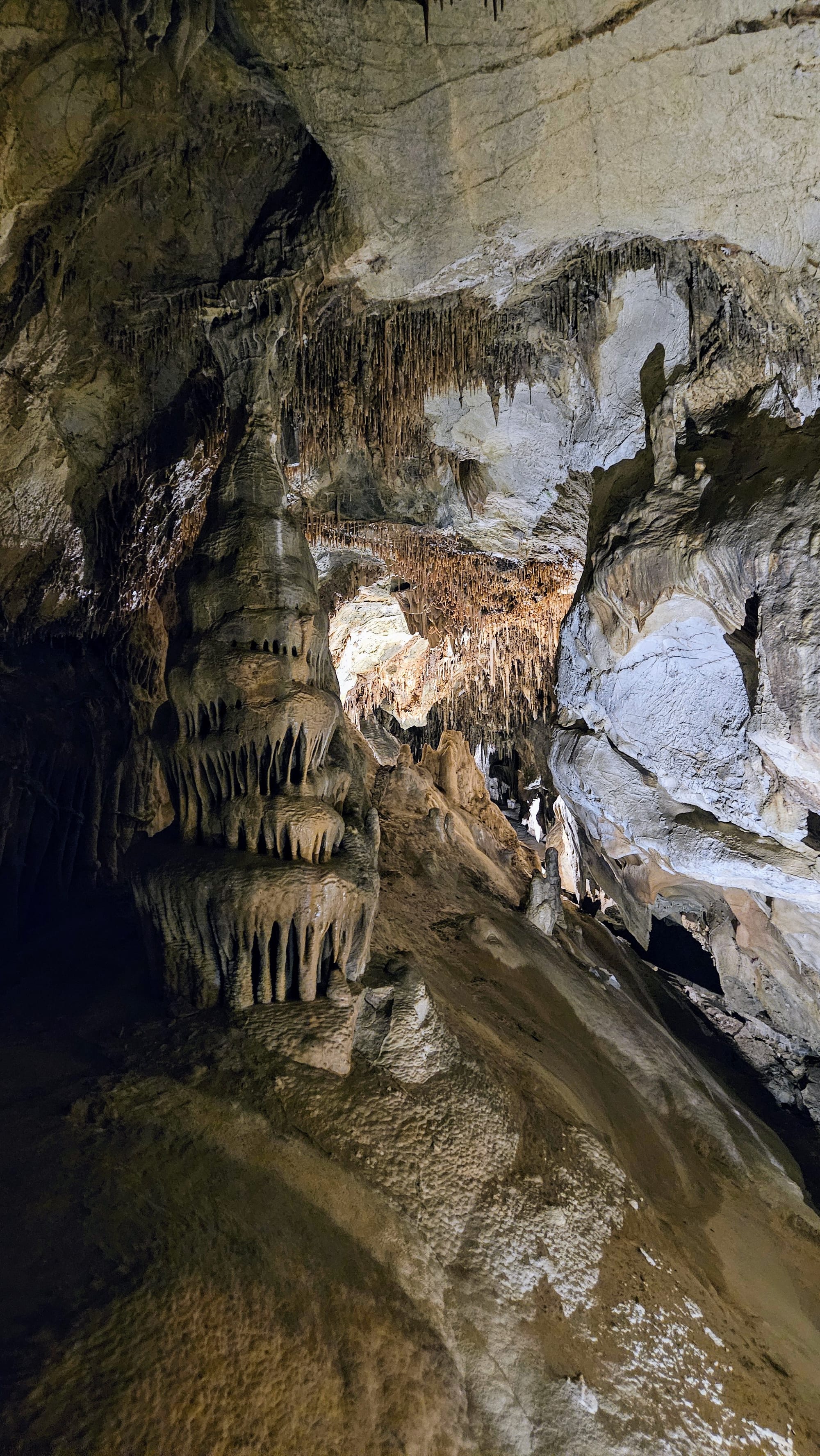
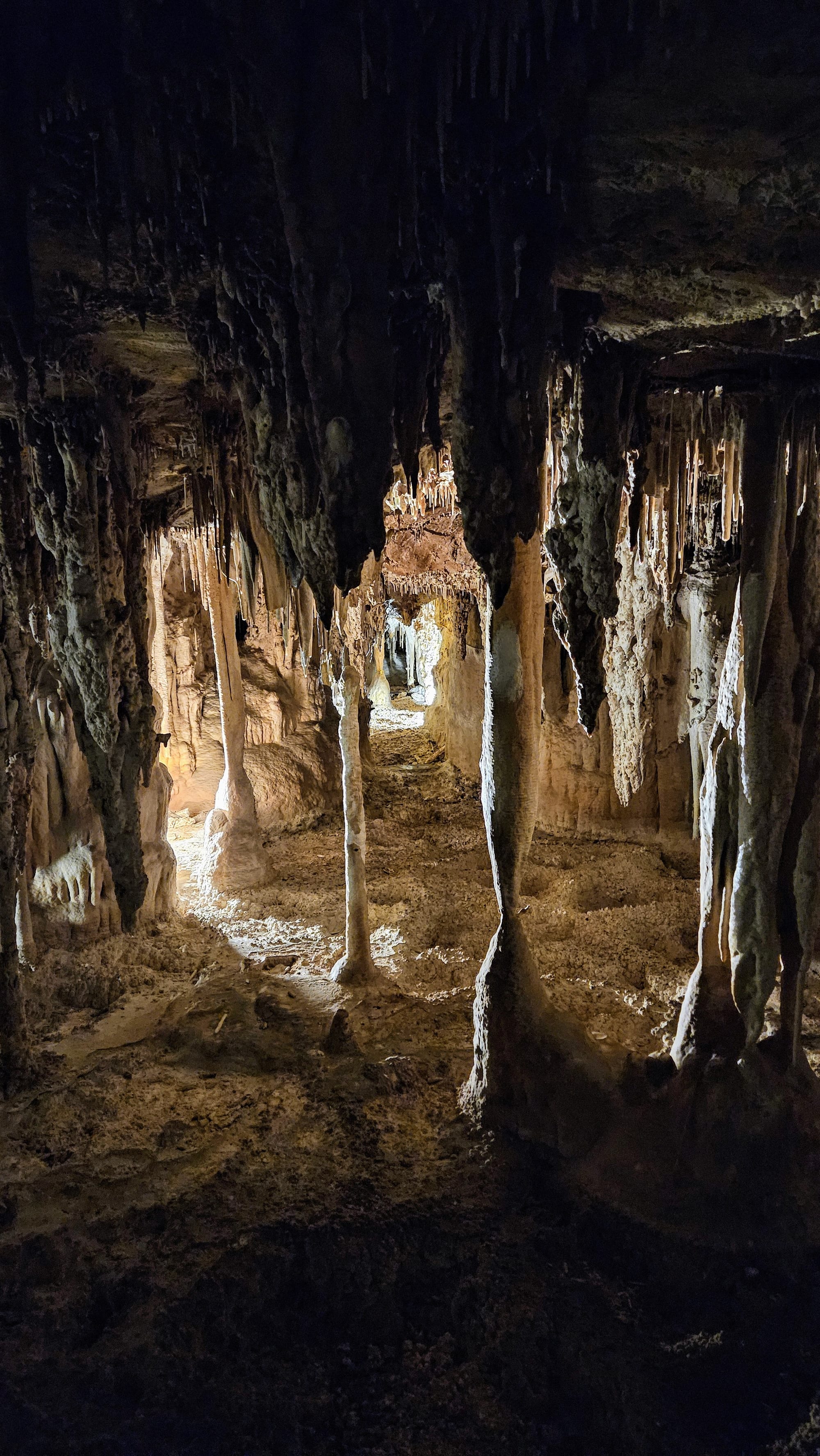
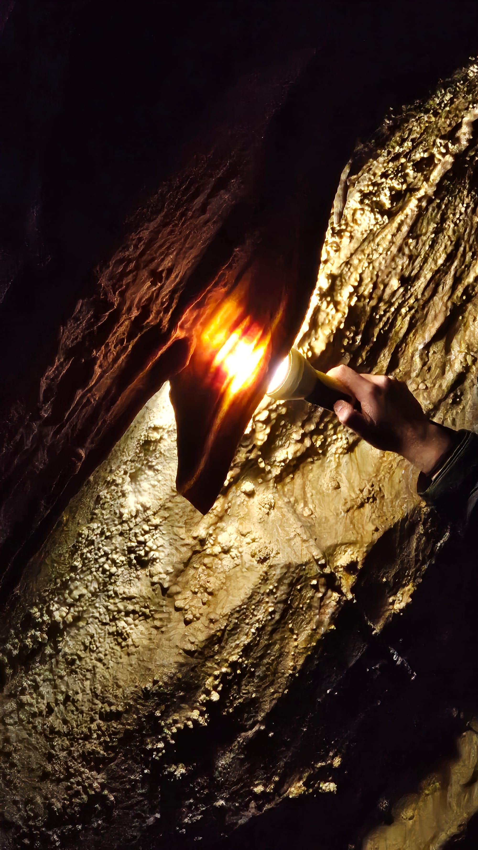
After our nature walk, we browsed some of the visitor center exhibits before it was time to meet our tour group. Great Basin offers two cave tours, the Gothic Palace Lantern Tour and the Parachute Shield Tour. We took the latter, which brought us to various rooms and features in the cave. We've done a lot of cave tours in our travels, and we always say that they're only as good as our guide. Fortunately, our guide Molly was great. She had ways of describing the formations that we had never heard before, that gave us a much clearer idea of how they are all formed. She pointed out formations that we hadn't seen before, like cave shields, of which Lehman Caves has more than almost any cave in the world. Well, actually, we probably passed by them in Carlsbad Caverns too, but our guide didn't point them out. And no one was surprised. The shields are formed when the water seeping into the cave gets blocked and pressured to spurt out into a fan-like shape. Some of the shields have flowstone coming off the bottoms of them, resembling parachutes, hence the name of the tour, Parachute Shield.

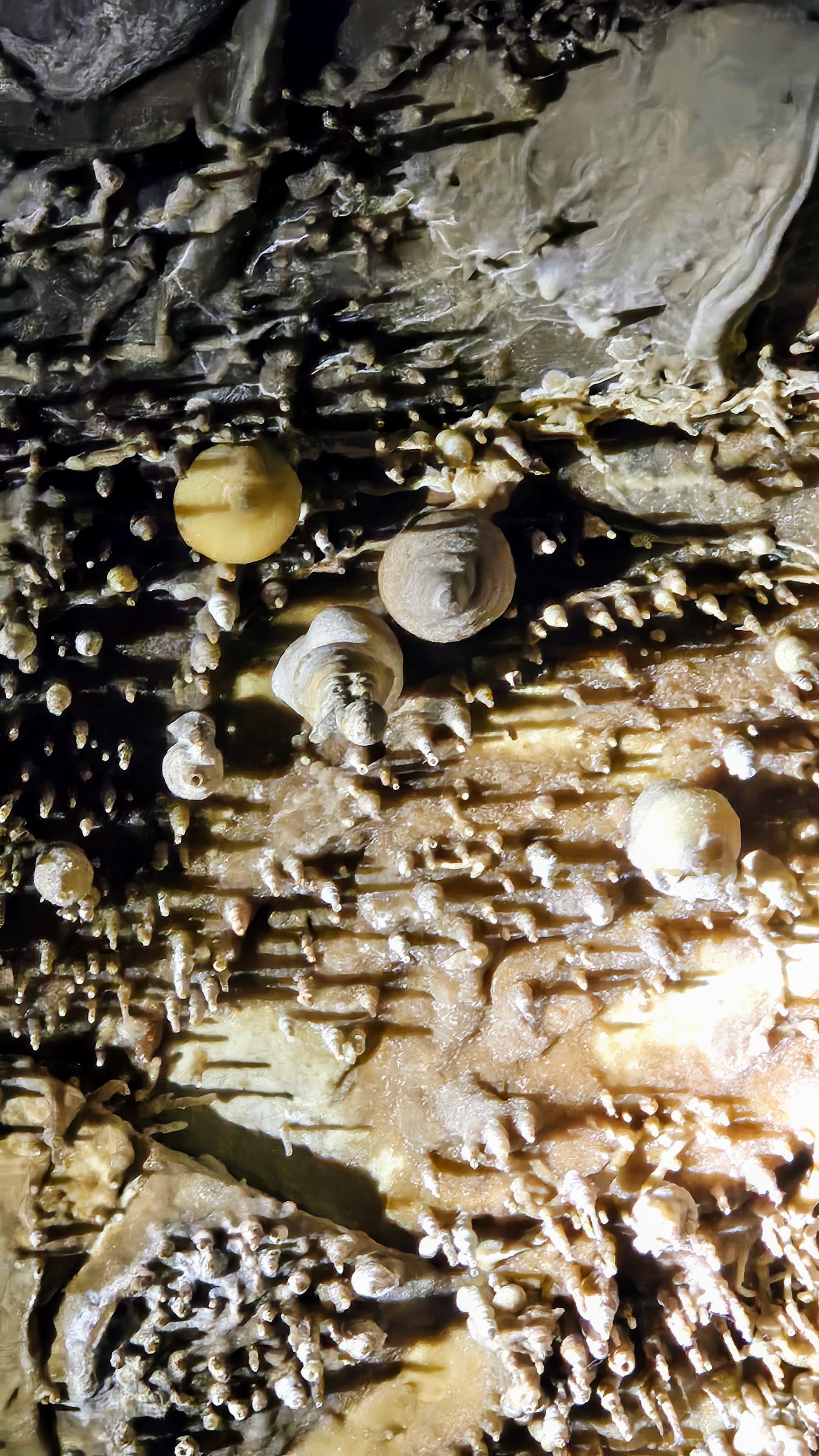
Another unique formation were the cave turnips, unknown to scientists how they are formed.
We also saw lots of other formations that we've gotten accustomed to in our cave visits, including translucent cave bacon, which always mesmerizes us, and a cave lake.
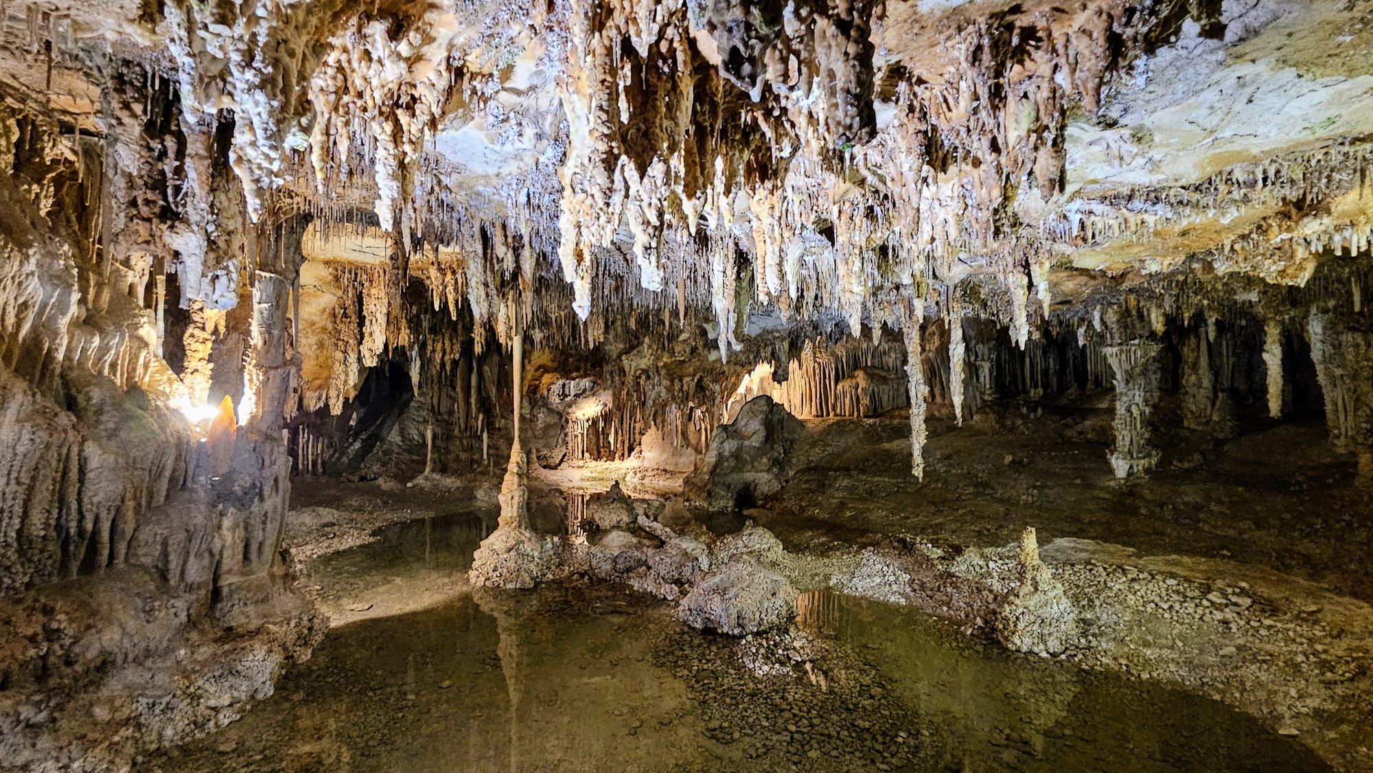

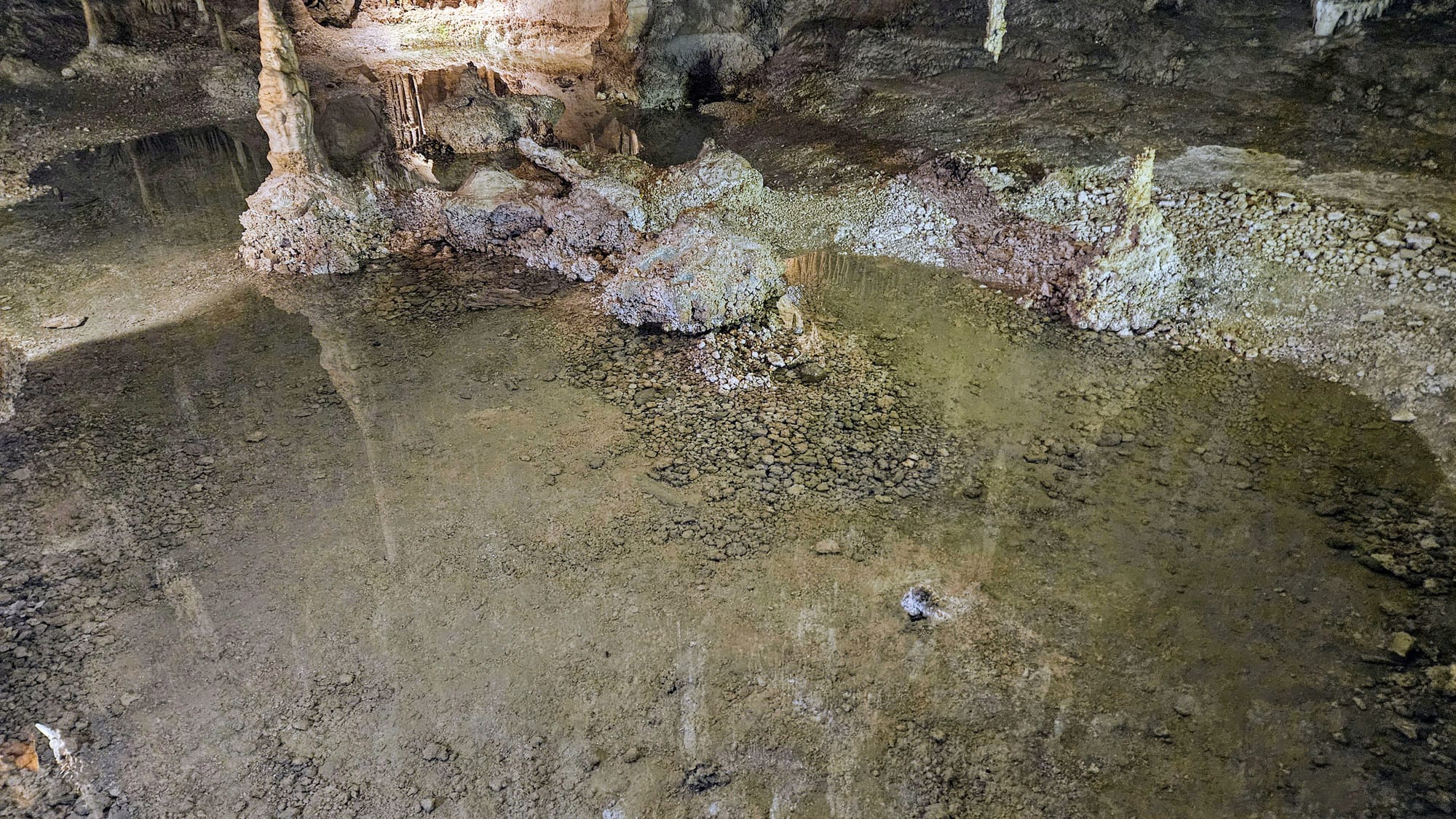
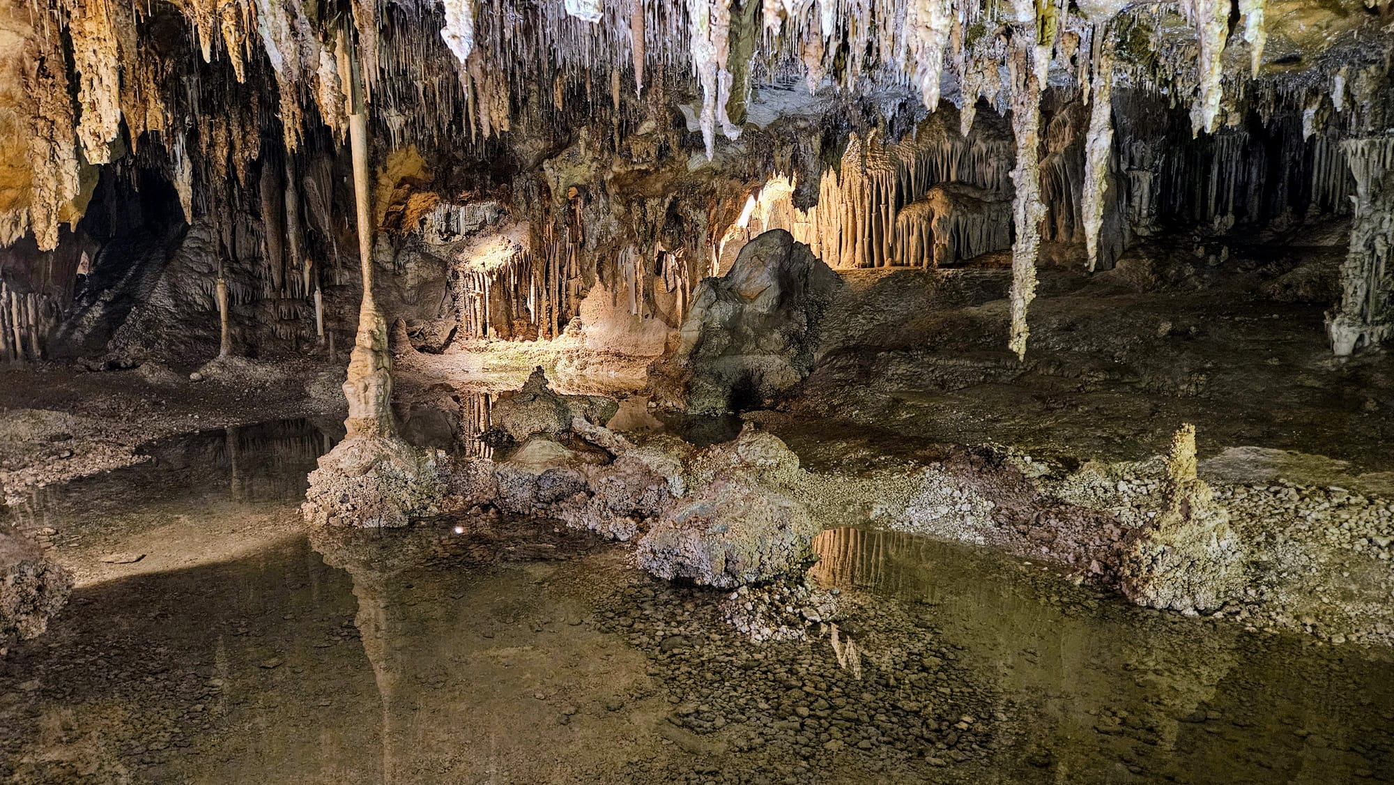
The lake is in an area called Cypress Swamp, aptly named for its resemblance to the swamps of the Gulf Coast. The room was relatively dry for springtime, and elevated walkways have been built for tours going through. We didn't need to worry about getting wet, but Molly mentioned that 2 years ago, the tour groups needed to wear raincoats because the snowmelt was so severe! This wasn't the first time that 2023 has earned a spot in tour narratives. When we did our Colorado River boat ride in Moab, our guide talked about the water levels in the river being crazy high. We're always amused when we hear how 2023's spring impacted various areas in the west, because it also very much impacted our RV life, too.
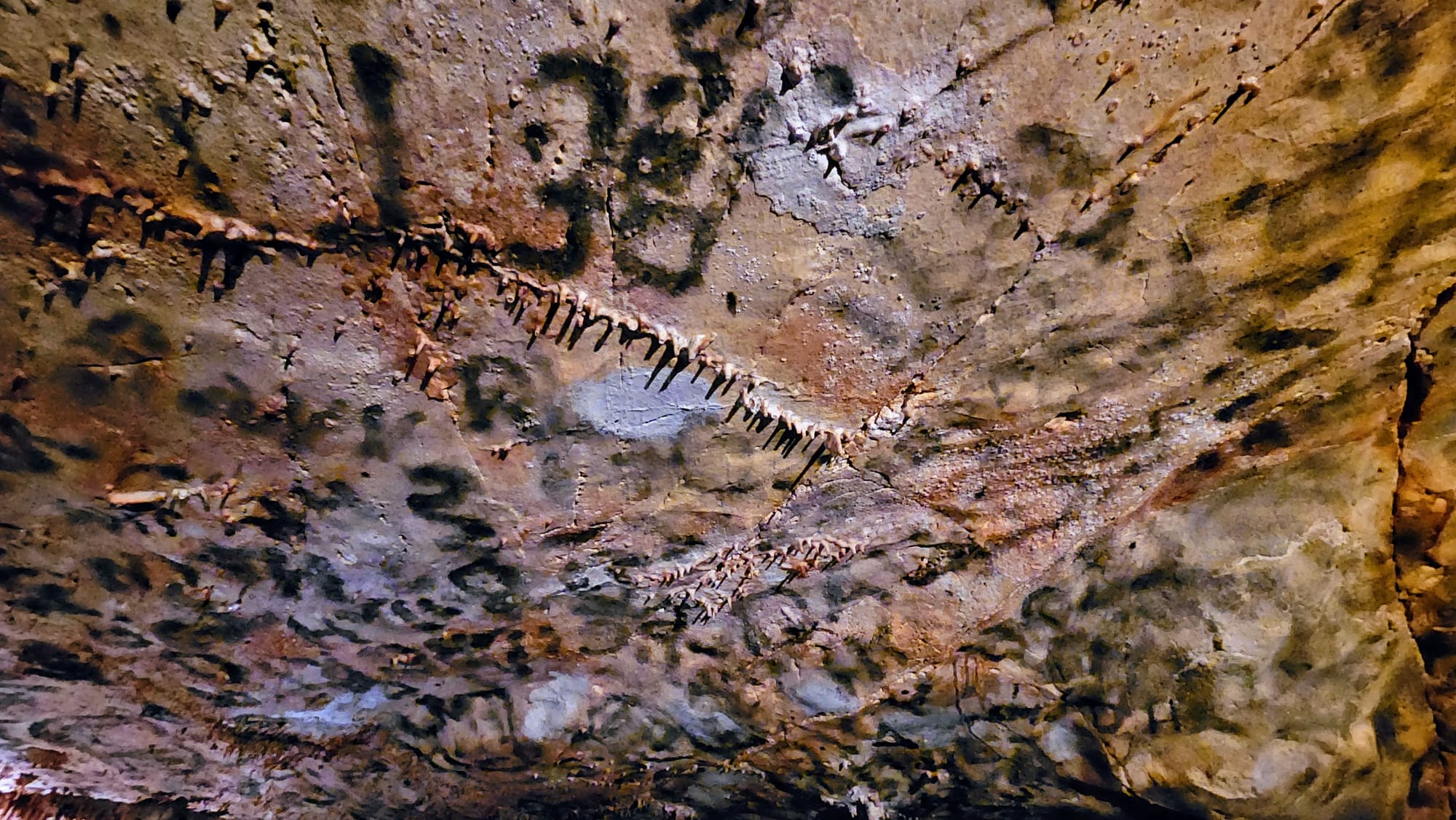
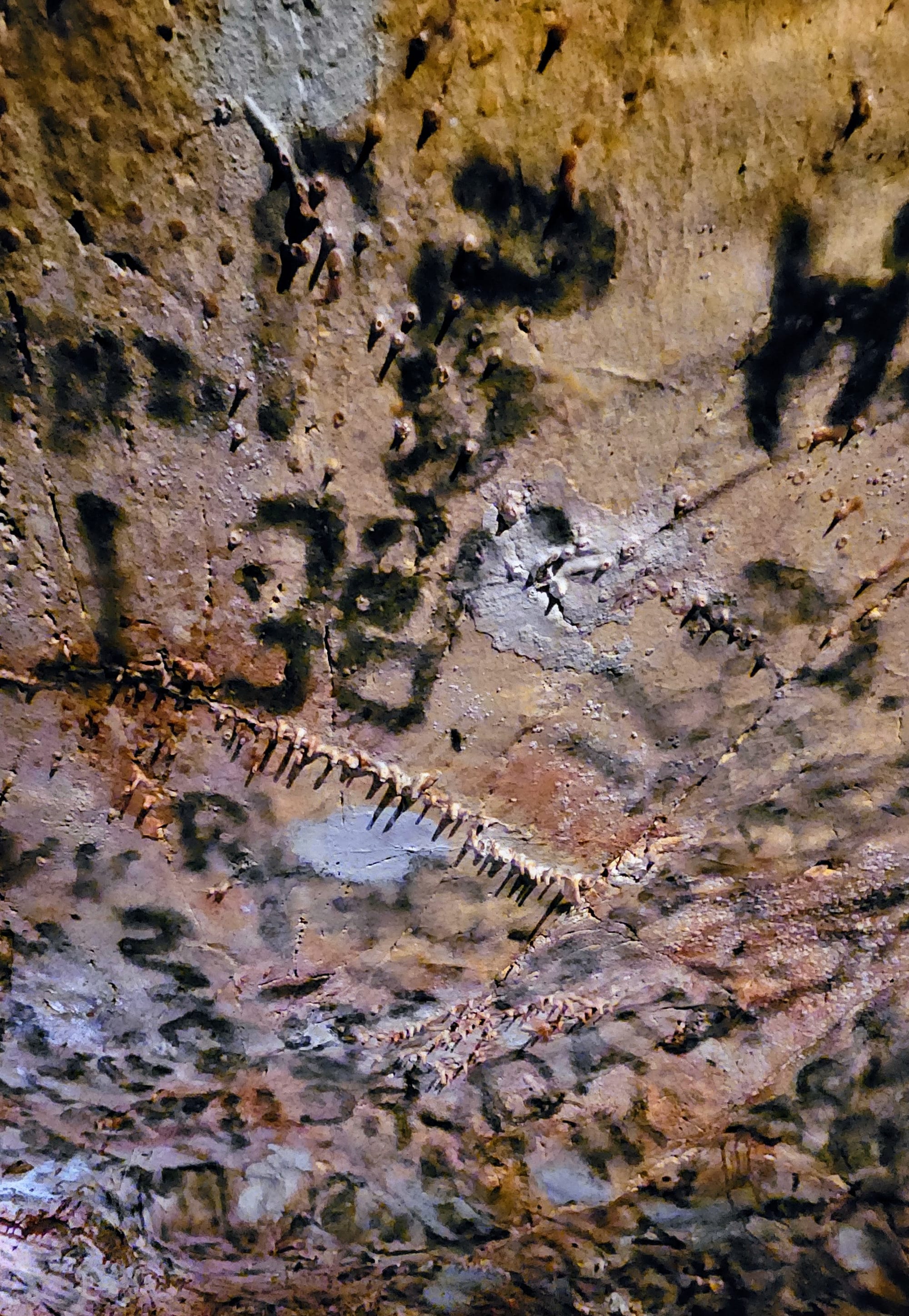
Our tour brought us to various rooms in the cave, but the Inscription Room was unlike any we had ever seen. This room is a testament to the fine line between historic documentation and graffiti. These inscriptions were made by early visitors to the cave. Even though nowadays, similar writing would be an act of vandalism, the NPS has kept these inscriptions as a way to create a connection with the past. Some people have visited the cave with the sole purpose of finding inscriptions made by their relatives. Over time, these inscriptions will disappear as the cave continues to form, but this will take many, many years. The reddish tint you see in the pictures below is from microbes eating away at the carbon inscriptions.
We were so glad we scored tickets to the cave tour. Some tours were available as first come, first served that day, but they were only 30 minutes long and we would have had to wait hours before getting a spot. Rec.gov cancellation alerts really worked out for us.
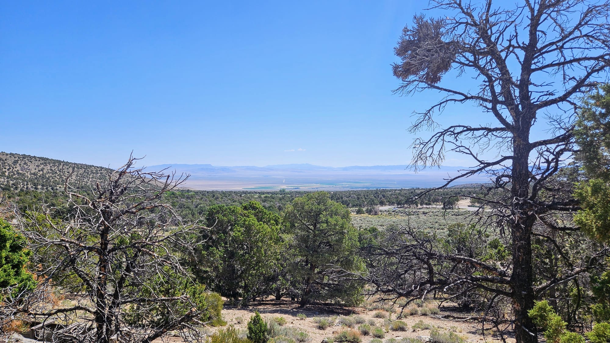
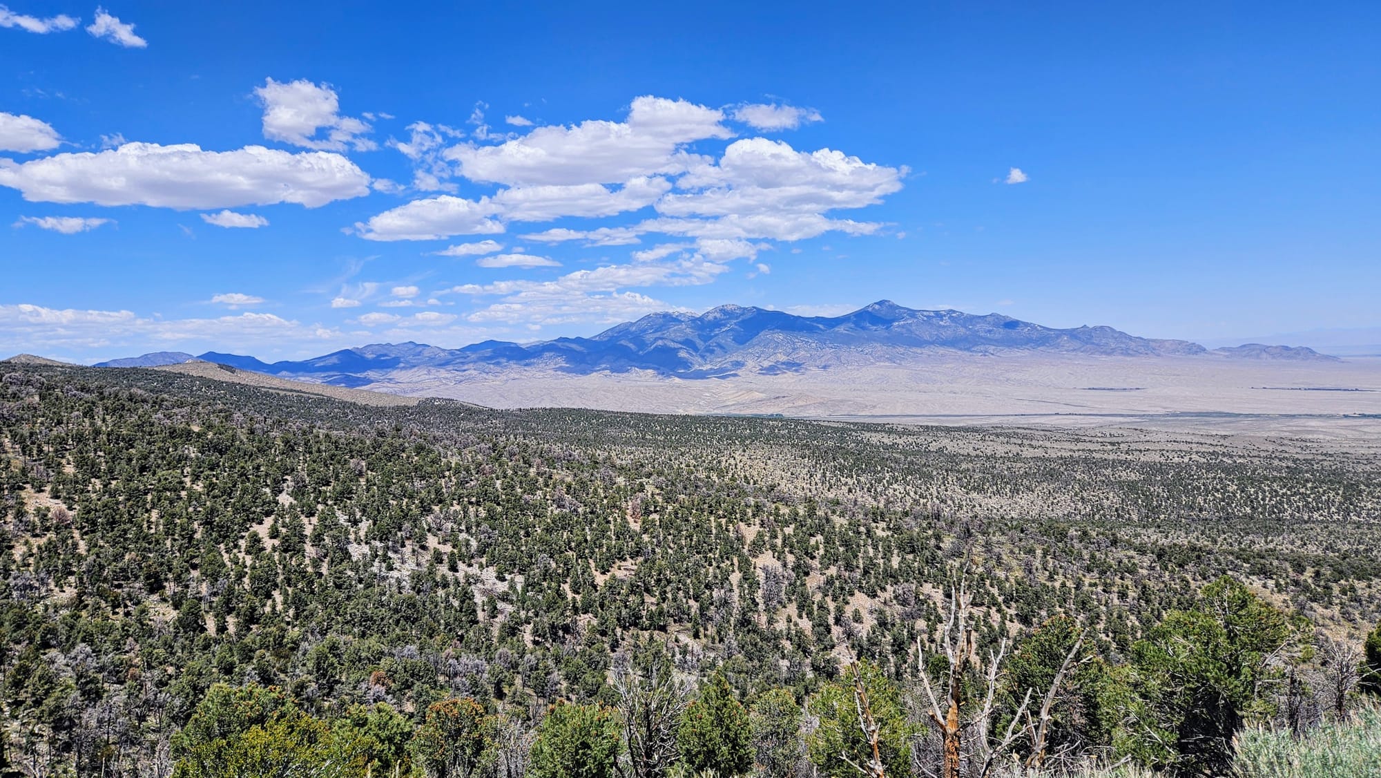
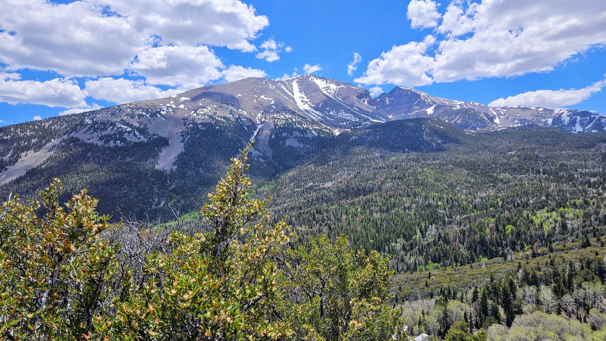
After our tour, we took the Wheeler Peak Scenic Drive to the higher elevations of the park. This is the main scenic drive through the park, is 12 miles long, and ends at elevations near 10,000ft. Because of this, the drive is closed in winters, but had opened shortly before we visited the park. This is the road that leads to some of the best hiking trailheads, of which we hoped to do a slightly longer one, but we needed to be conscious of time. So we stopped at a few of the overlooks to take photos and then ended with a shorter trail at the end of the road.
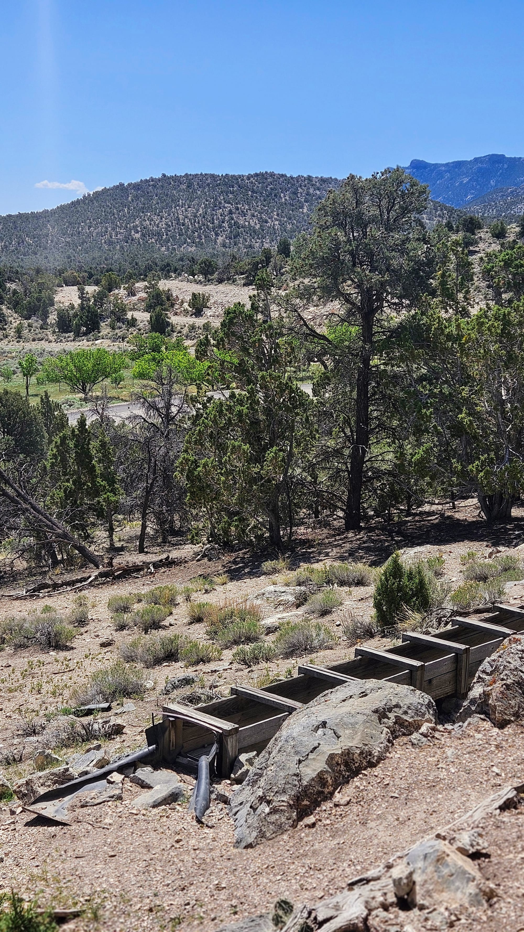
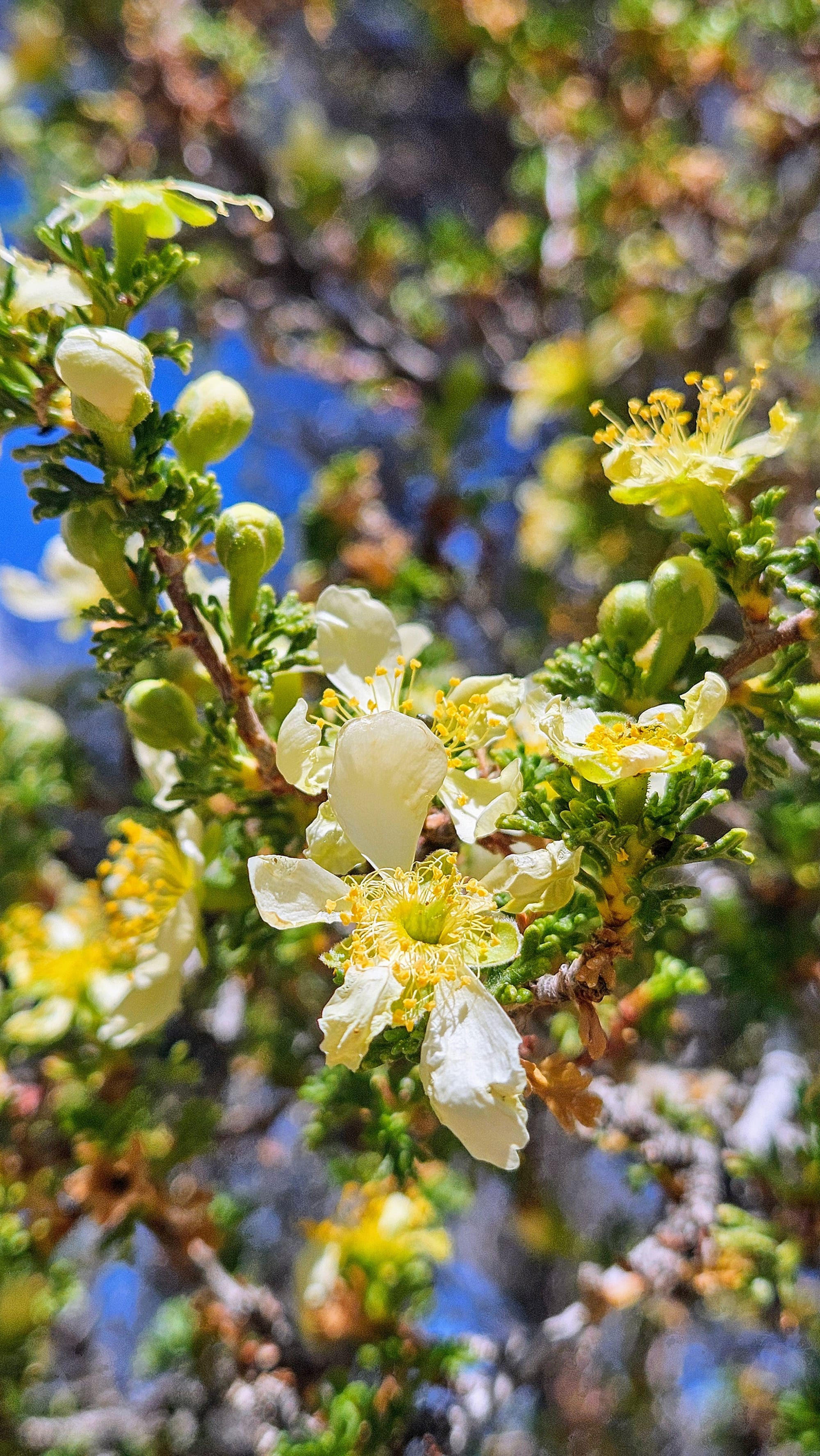
The first overlook wasn't actually an overlook at all, and it was our biggest mistake of the drive. We saw a pullout for the Osceola Ditch Trail that said 1/3 of a mile to the ditch. All Trails showed that the full trail was 2.7mi long, but we figured we could just take the short walk down to the ditch and see what it was all about. The Osceola Ditch is an irrigation ditch that was built in the late 1800s to supply water to the area's mining operations. Well, turns out the ditch really just looks like a big...ditch. We didn't have a good view of it due to the springtime foliage, and the trail leading to it was way steeper of a descent than we expected. As soon as we got to the ditch, we knew that the "view" was nowhere near worth the climb we'd endure on the way back up. We just reminded ourselves that cardio is good for us, tried to enjoy the wildflowers along the trail, and vowed to only do the obvious overlooks from here on out.
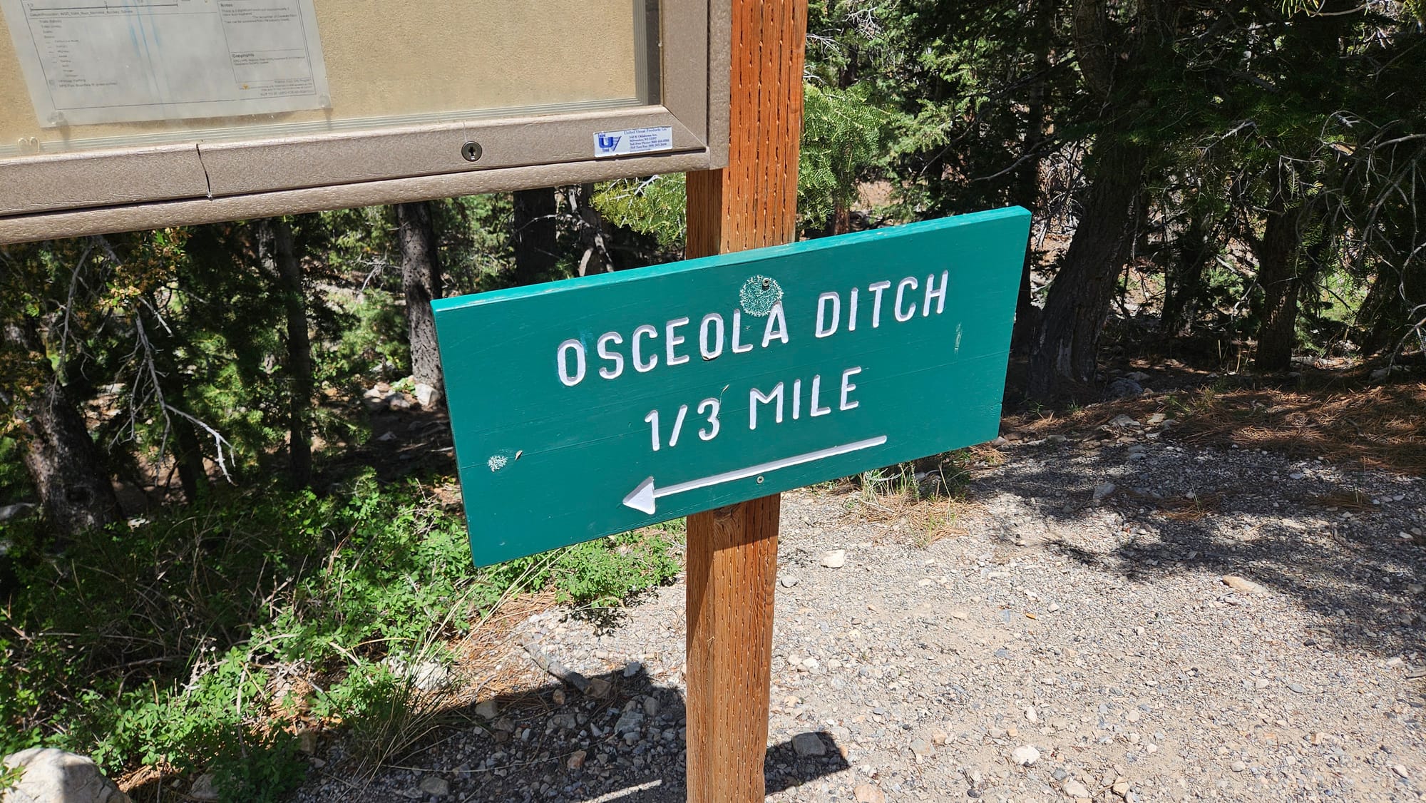
We imagine that those carving out time to take the full 2.7mi hike would have more fun, but we wish the national park sign hadn't enticed us with what seemed like a short, easy walk to a viewpoint.
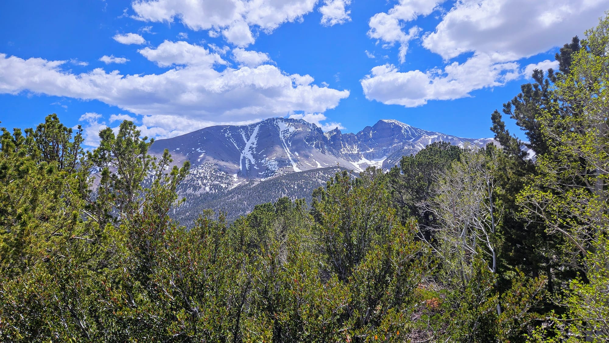
Mather Overlook at Wheeler Peak Overlook gave us more bang for our buck, but we must say, even though Wheeler Peak Overlook has a direct view of the named mountain, it was blocked by some trees. Mather Overlook had a few vista points and was our favorite stop.
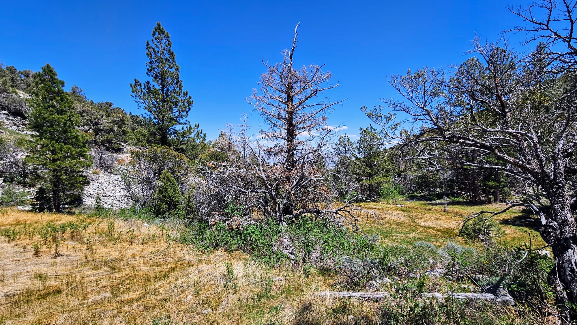
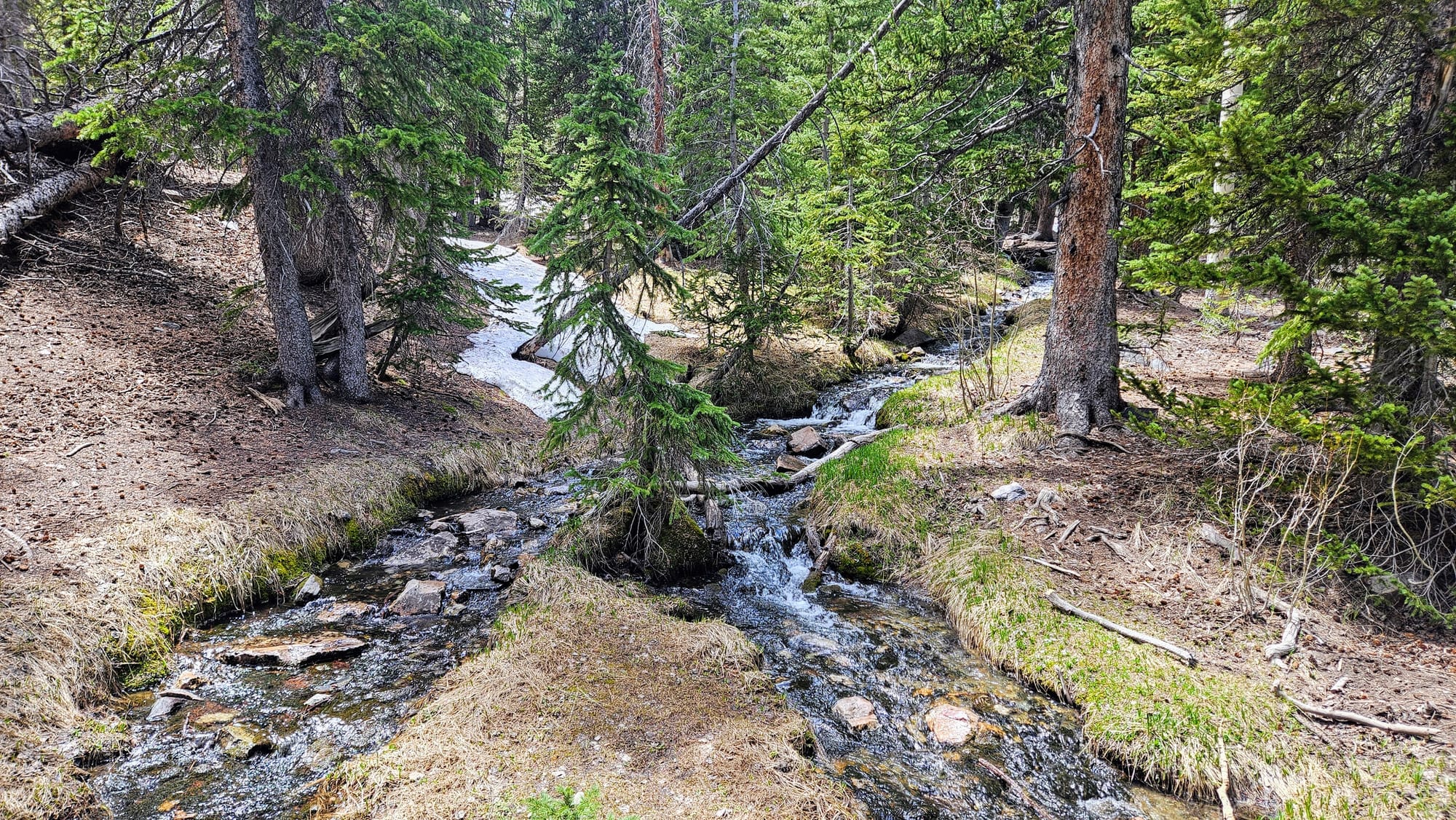
At the top of the road, we hiked the easy and accessible Island Forest Trail, which took us among the trees and the creek. Most of the snow had melted at this elevation and we had beautiful weather for our walk.
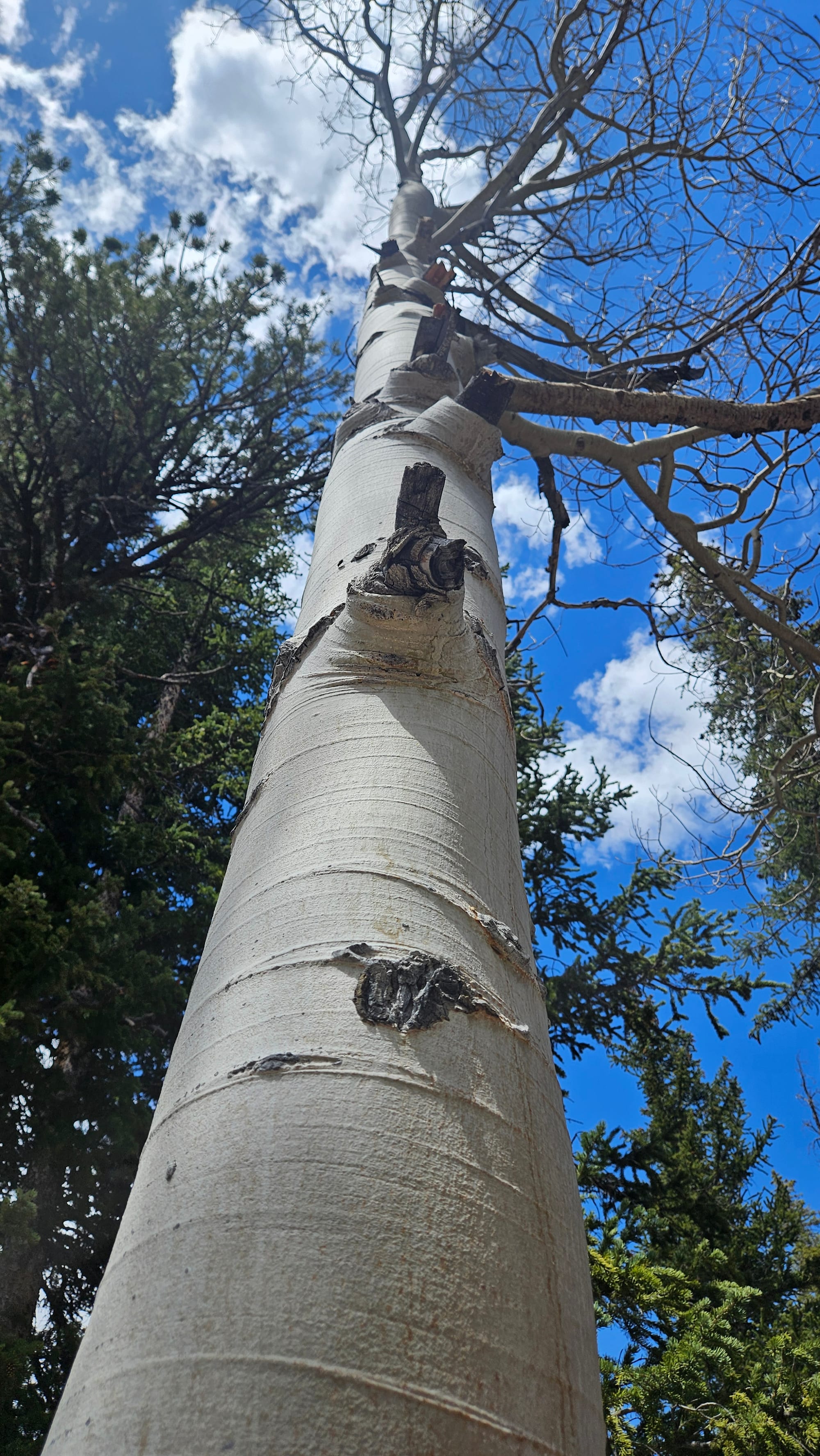
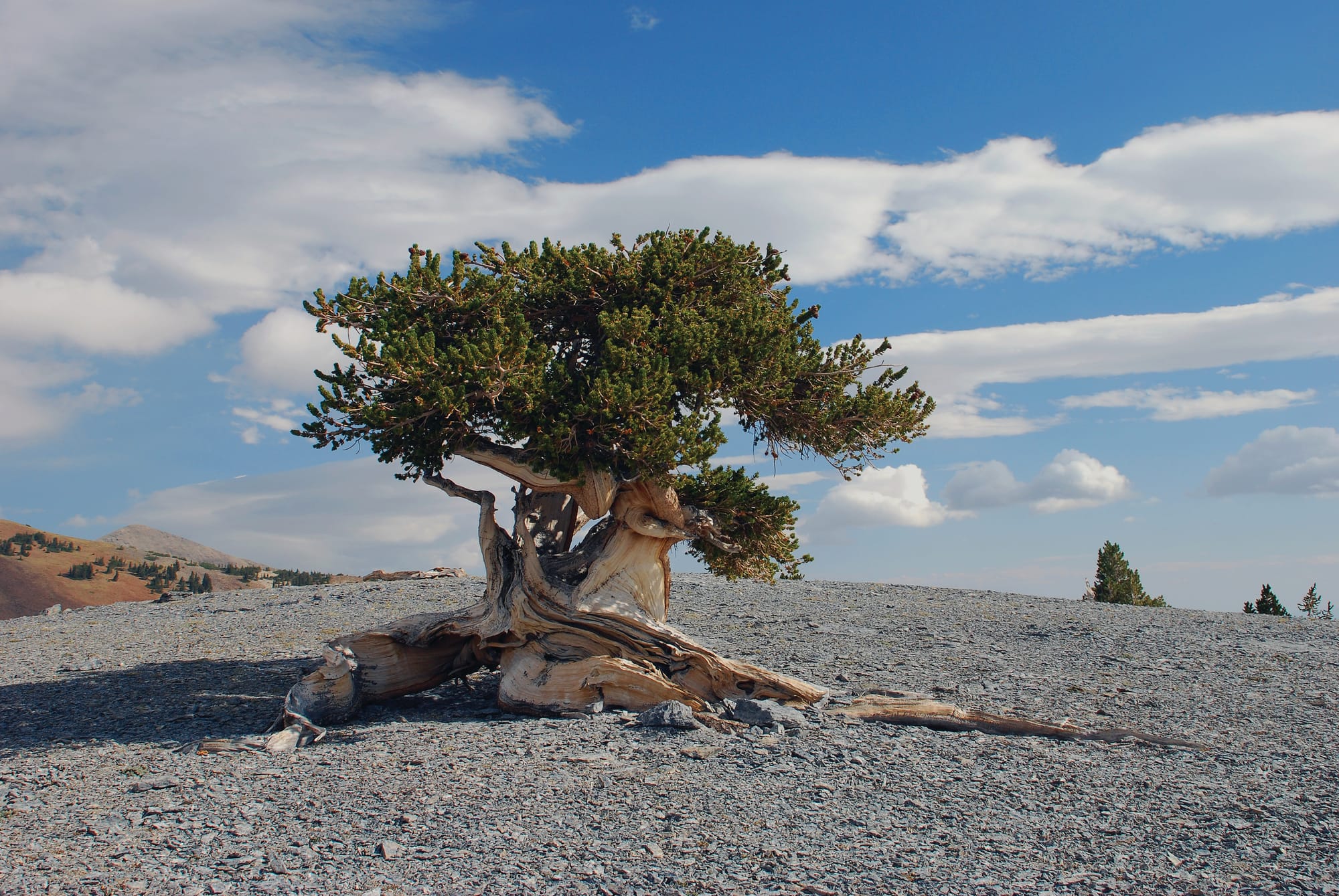
Our only regret was that we didn't have the time or energy to take one of the longer hikes that lead to the bristlecone pine grove. We would have loved to see these unique trees, some of the oldest non-clonal trees on earth. To get a photo of one of the groves would have been awesome. The bristlecones do sporadically grow at lower elevations and I'm pretty sure I saw one as we drove up Wheeler Peak Scenic Drive, but I couldn't spot it again on the way down. And so, I leave you with a photo of this tree, arguably the most iconic in the park. However, this one is even tougher to reach, as it's located in a part of the park that's back country access only, with no developed trails.
All in all, we had a spectacularly successful birthday celebration in the park. Looking back at all our years of RV life, it's hard to believe that 3 of the 4 of my birthdays on the road, and 2 of the 3 of Anthony's, have been celebrated with a national park visit. We joked with one of the rangers that national park visits are often a normal day for us, but we don't take for granted the truth of that statement. Great Basin was #38 of the 63, and probably the last one we'll be visiting for a while. We're happy that we got to experience such a special park on a special occasion. No matter where we celebrate, we'll always remember our birthdays on the road.