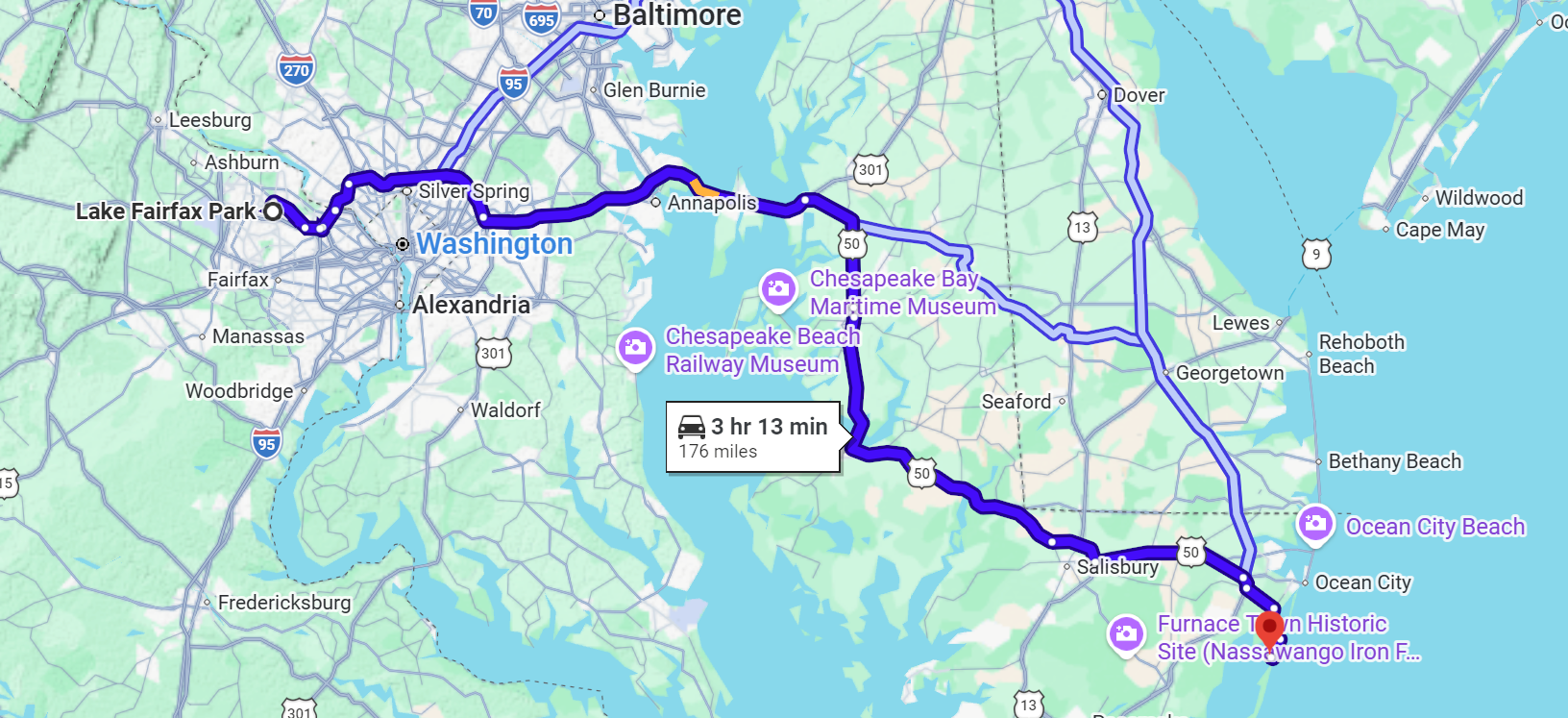
Avenues over Chesapeake Bay

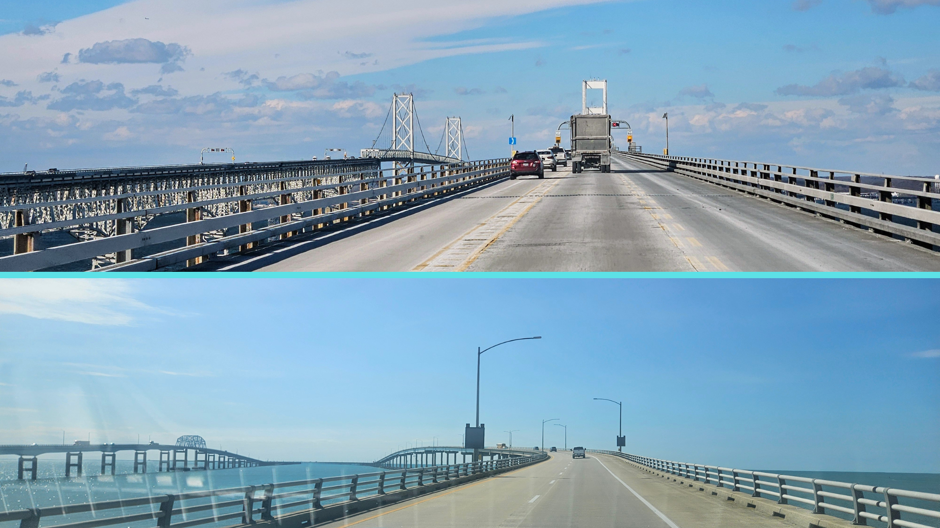
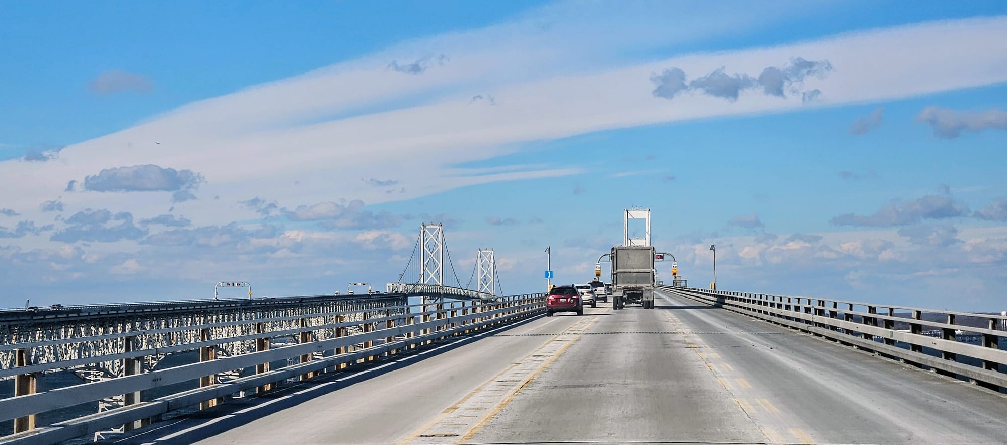
Maryland is a state we always look forward to reaching on our southward travels from New England. We've found some incredible campgrounds around the Washington, DC area, and beyond that, the state boasts water views that are to die for. Of course, where there's water, there are bridges, so for those who fear bridges, the phrase "to die for" probably takes on a whole new meaning. Having made the trek from Northeast to Southeast many times over the years, both with and without the RV, we've traversed bridges over many of the Mid-Atlantic's bodies of water. Then, as we established our favorite campgrounds for our yearly launches, we found ourselves leaving Delaware and hitting US50, which takes us straight over the Chesapeake Bay on the William Preston Lane, Jr. Memorial Bridge, better known as the Bay Bridge.
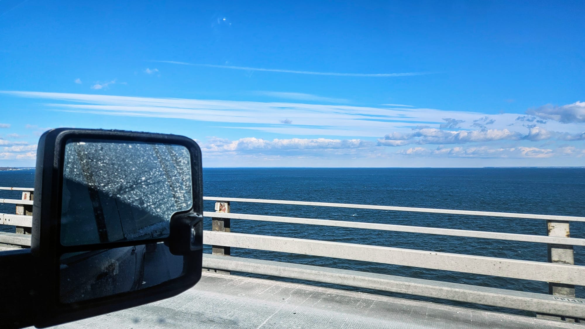
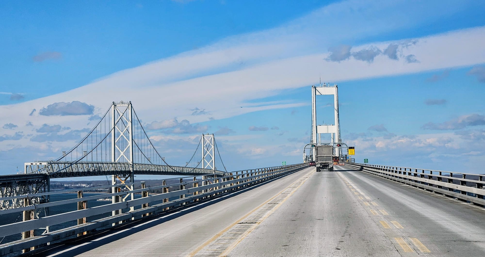
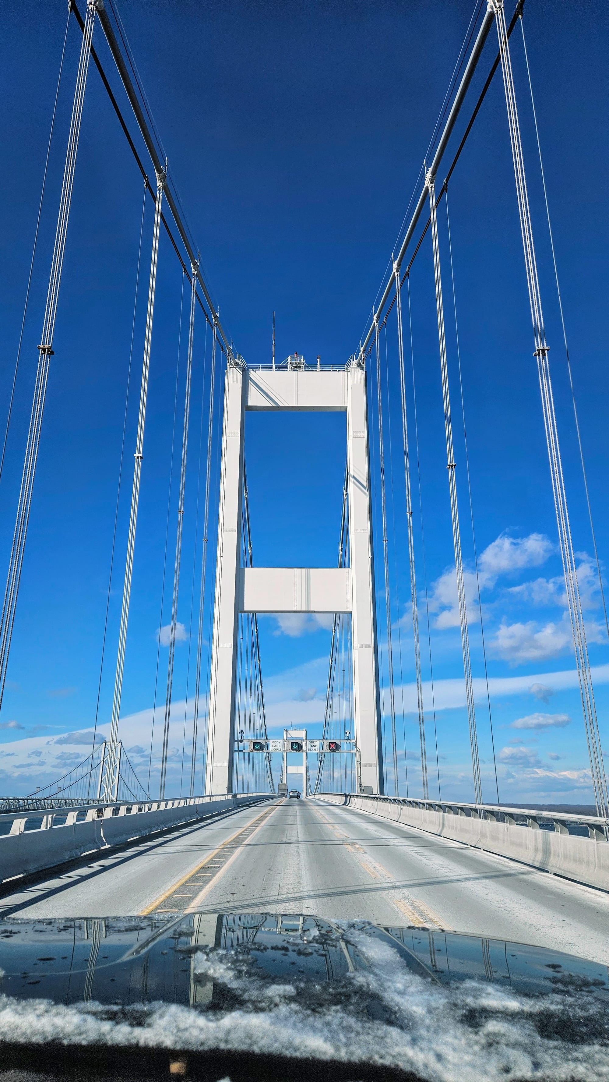
The Chesapeake Bay is the largest estuary in the country, with almost 4500 square miles of surface area. The northern portion is in Maryland and the southern in Virginia. We remember towing over the Bay Bridge for the first time and thinking it went on forever. When we looked it up, we read that it's 4.3 miles in length, but that's not the most interesting descriptor. Given its height of over 200ft above the water, and the fact that the height increases the bridge's exposure to dangerous weather elements, many consider this bridge the most terrifying in the US.
In January 2024, I posted an Instagram reel talking about the Bay Bridge and how it's served us well for reaching our Maryland campgrounds. I compared it to the Francis Scott Key Bridge, another option if we headed toward Baltimore from Delaware, instead of toward US50. Then, just 2 months later, news erupted that the Key Bridge had been hit by a container ship, causing the bridge to collapse. It killed 6 workers who were on the bridge at the time, and startled many commuters who needed to grapple with the emotions of the tragedy and the logistical upheaval of their drives. The bridge is being replaced, with an estimated completion date in the year 2030.
We don't have a phobia of bridges, but towing a trailer always adds to the pressure. Then when we hear stories like this, they stick out in our minds. We try our best to be extra prepared when our travel route takes us over water, particularly in regards to the weather. Besides one breezy drive over the Bay Bridge, we've never had any issues, and the views are always spectacular.
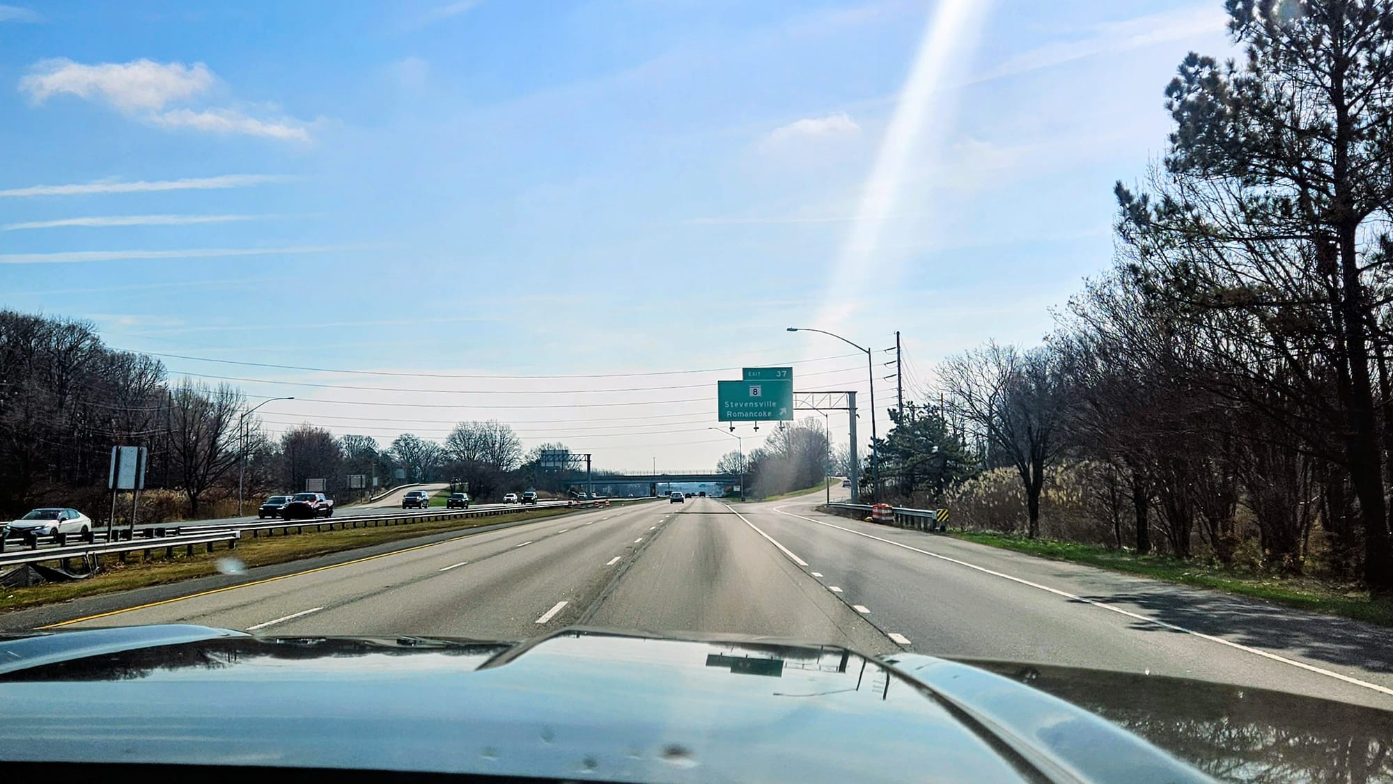
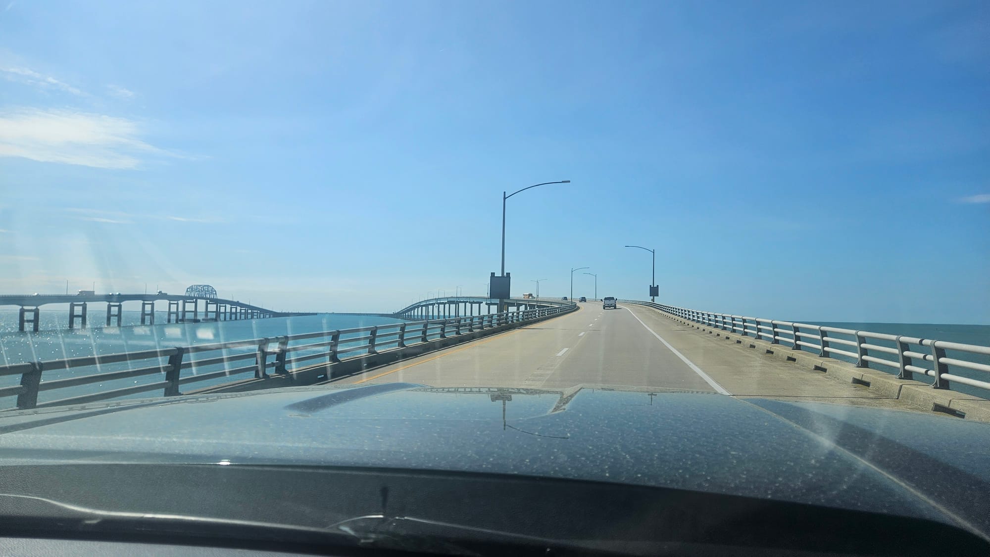
But then 2026 happened. Instead of camping in Delaware like we had the recent previous years, we stayed just outside Philadelphia. So, when it came time to continue down to DC, our route went over the Delaware Memorial Bridge and over to I-95, where we then crossed into Maryland. So where does the Bay Bridge come in, then? We actually ended up taking it in the reverse direction after our stay near DC. We decided to go over to Assateague Island for a few days to enjoy some much needed nature time. From Metro DC to the coast, it's a jaunt around the Capital Beltway to US50, which crosses the Bay Bridge in Annapolis and leads all the way to Assateague Island.
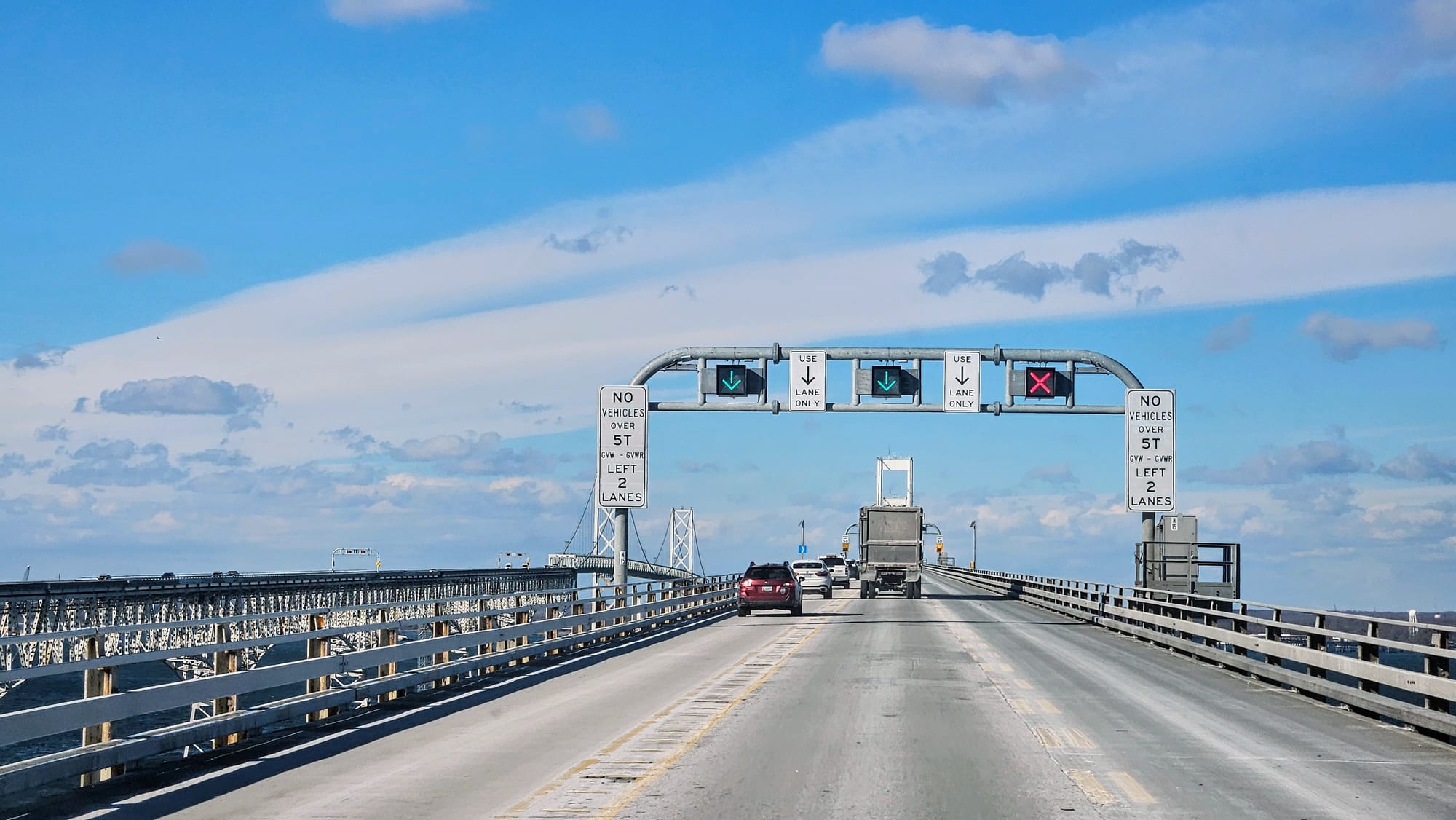
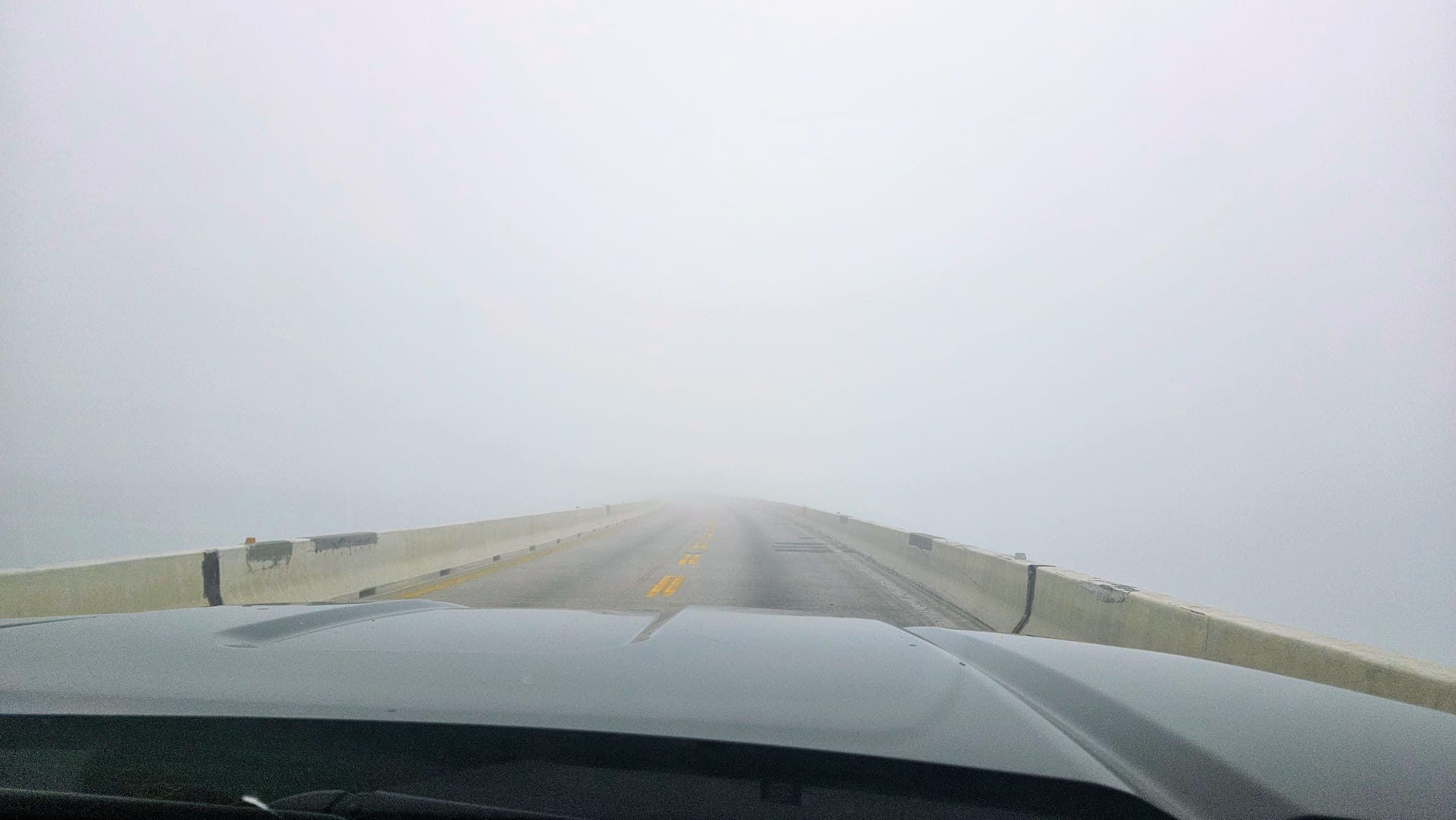
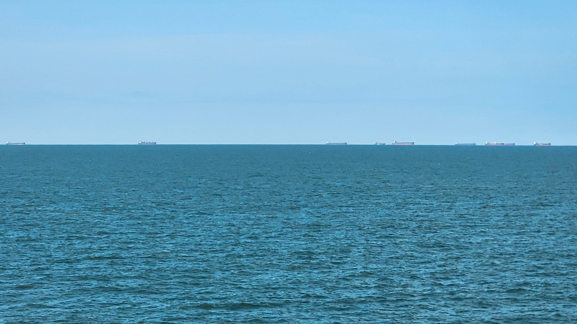
The morning of our travel day, fog was in the forecast. After a couple of days that felt like summer, temperatures began to drop, causing condensation to rise off the ground. We assumed that most of the fog would lift by the time we got on the road, and we were right...until we approached the Bay Bridge. Condensation rising from the road was no longer our problem. A big cloud of fog hovered over the Chesapeake Bay, giving the bridge its own weather. A few miles before our approach, we started seeing electronic signs: "Bay Bridge poor visibility. Use caution." We could see the cloud in the distance, but it looked so high up. But wait, so is the bridge. After years of traversing it without issue, we finally experienced first-hand its "weather exposure" factor.
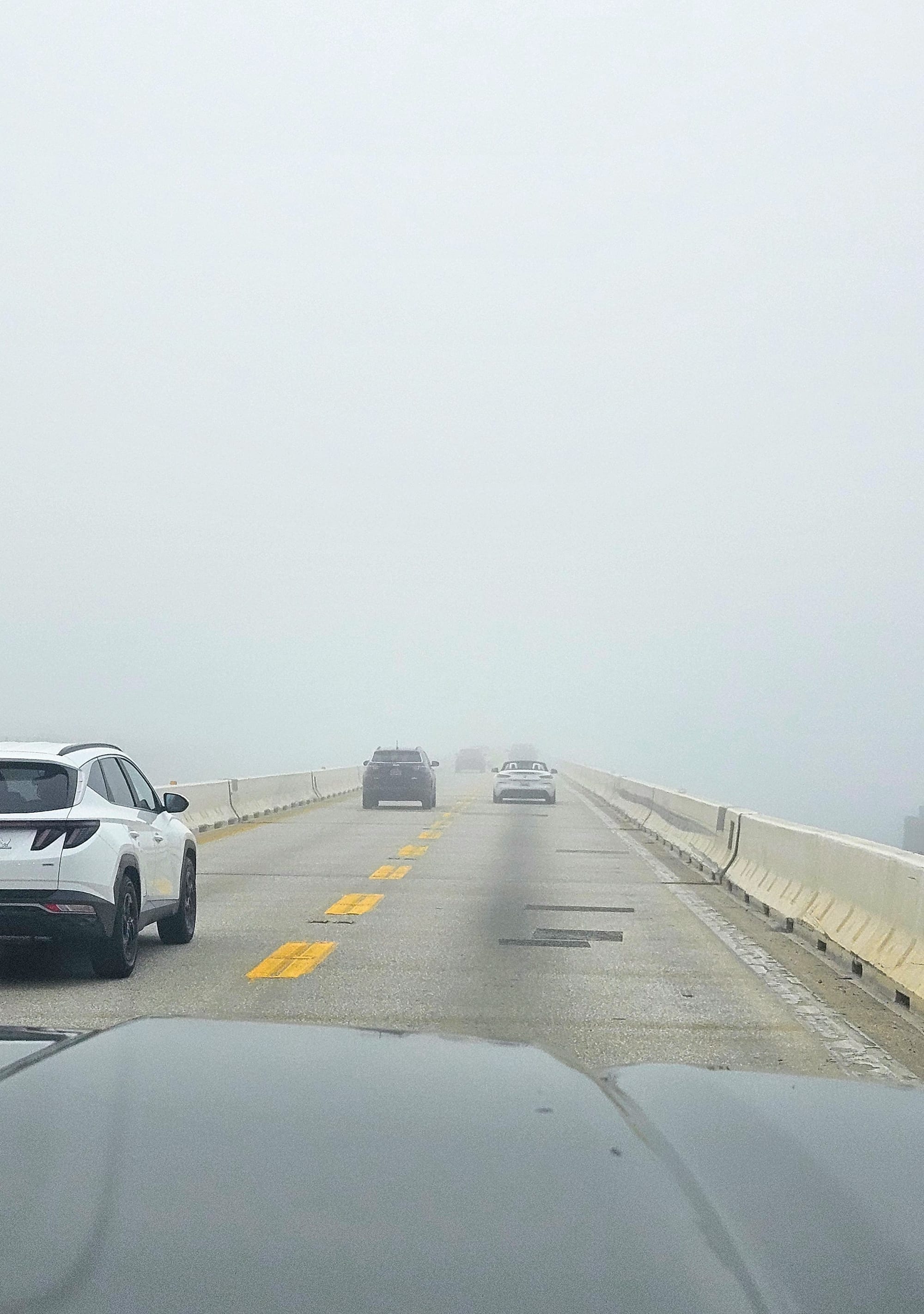
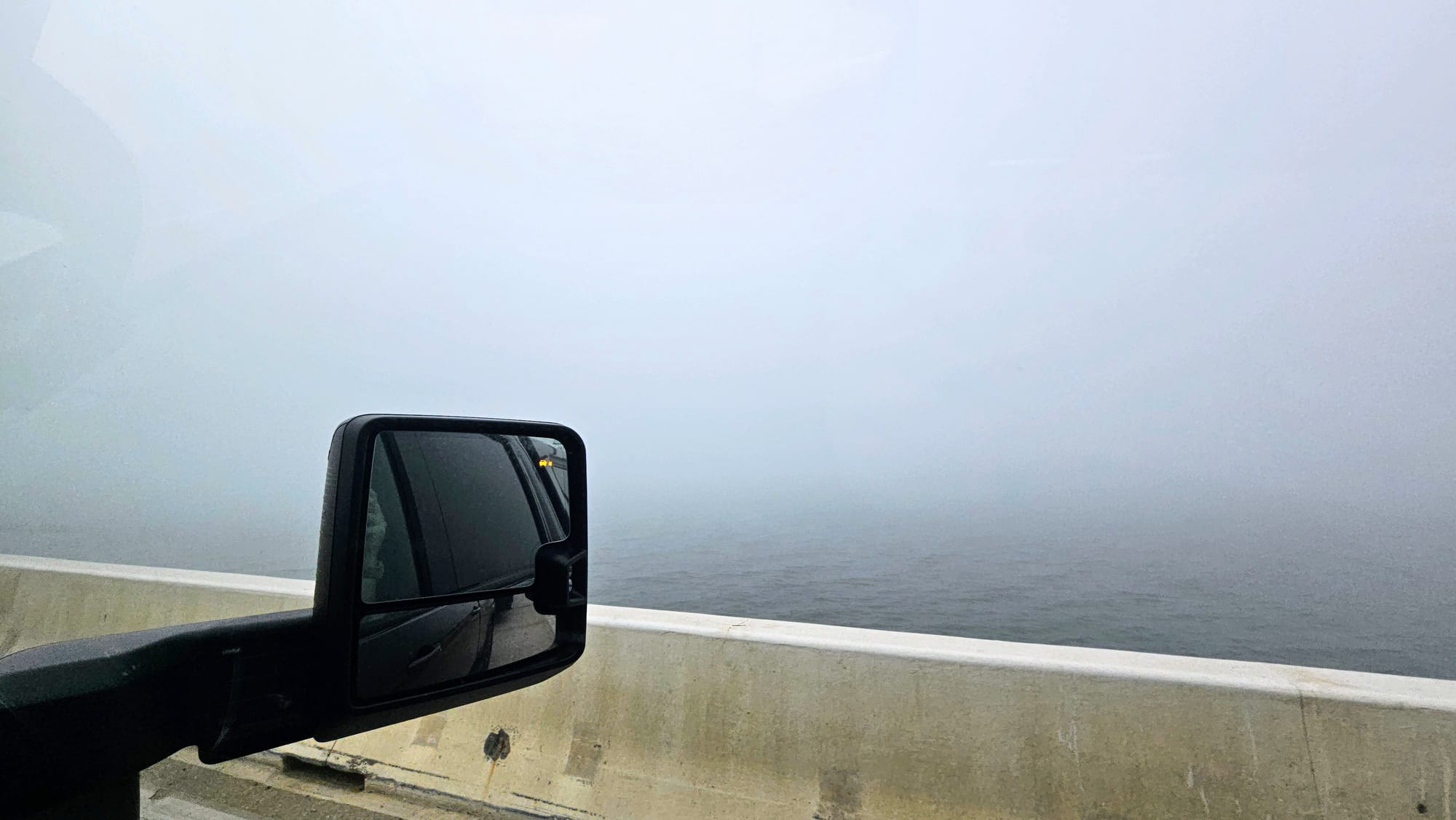
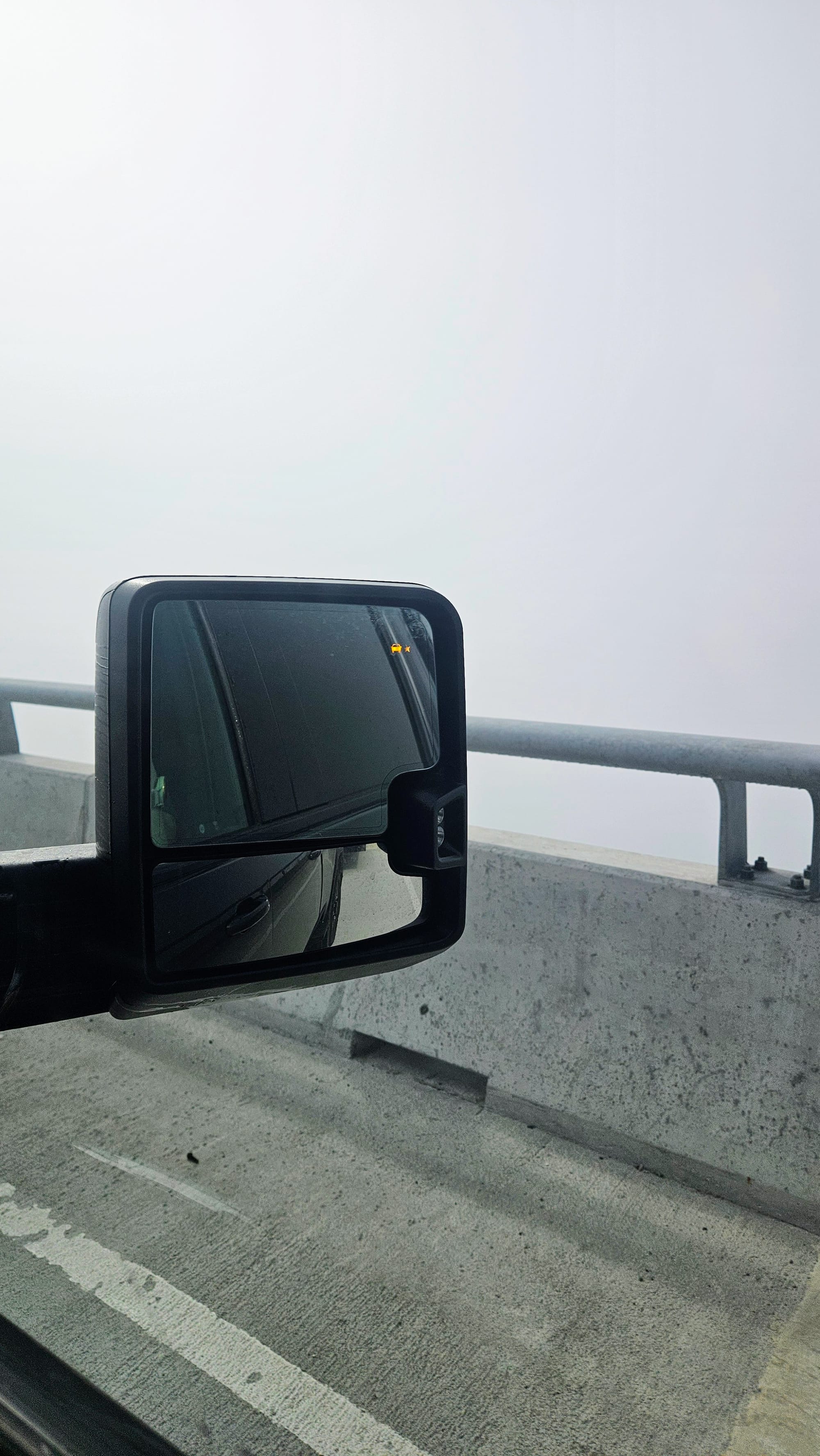
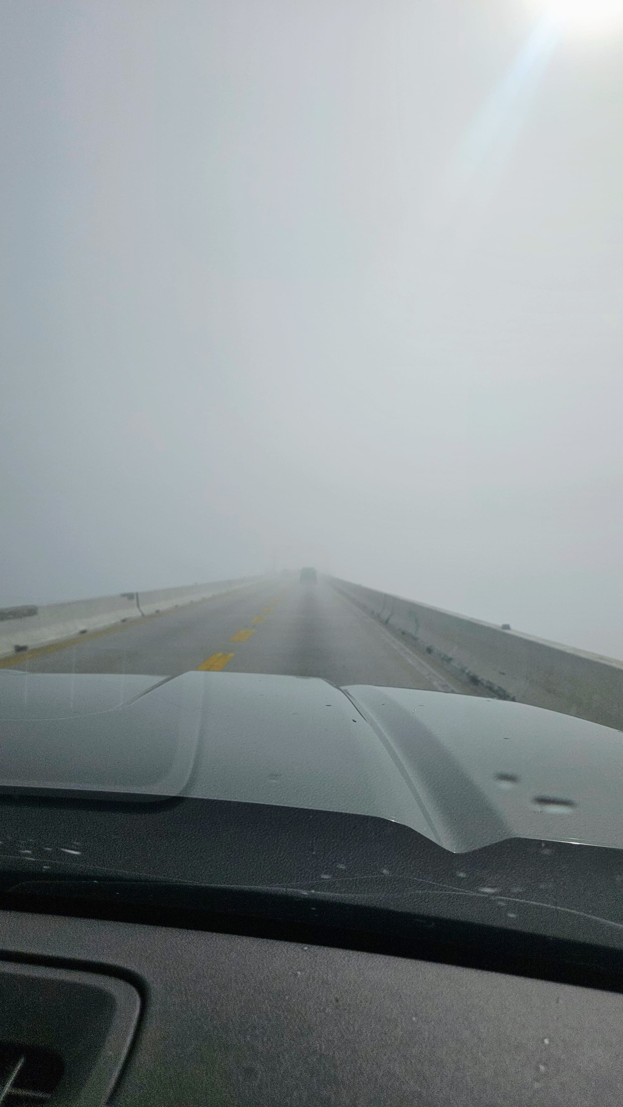
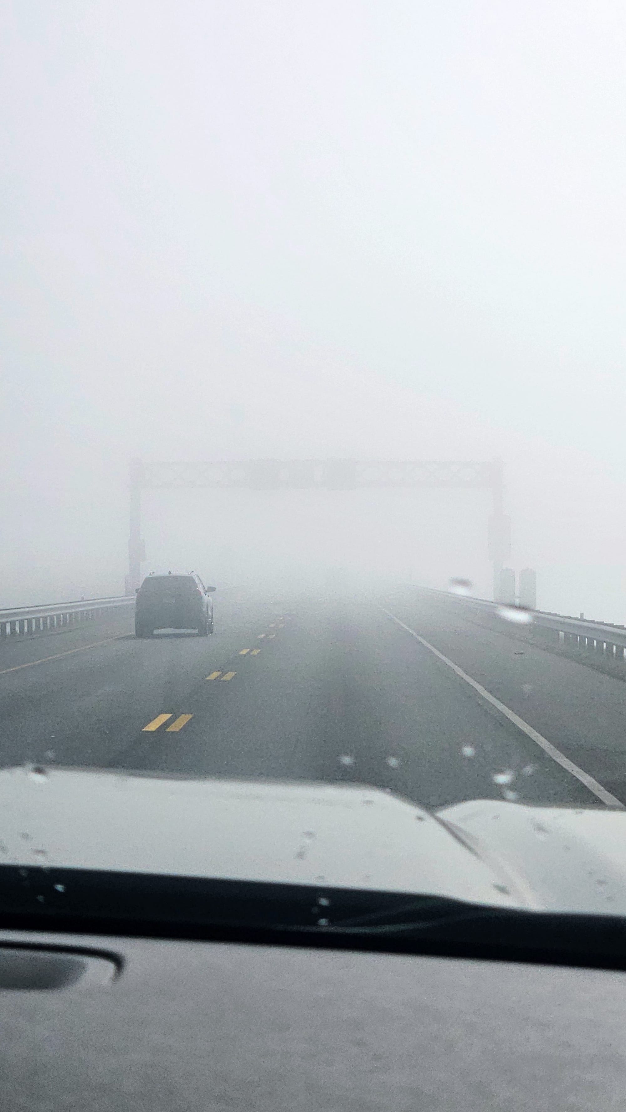
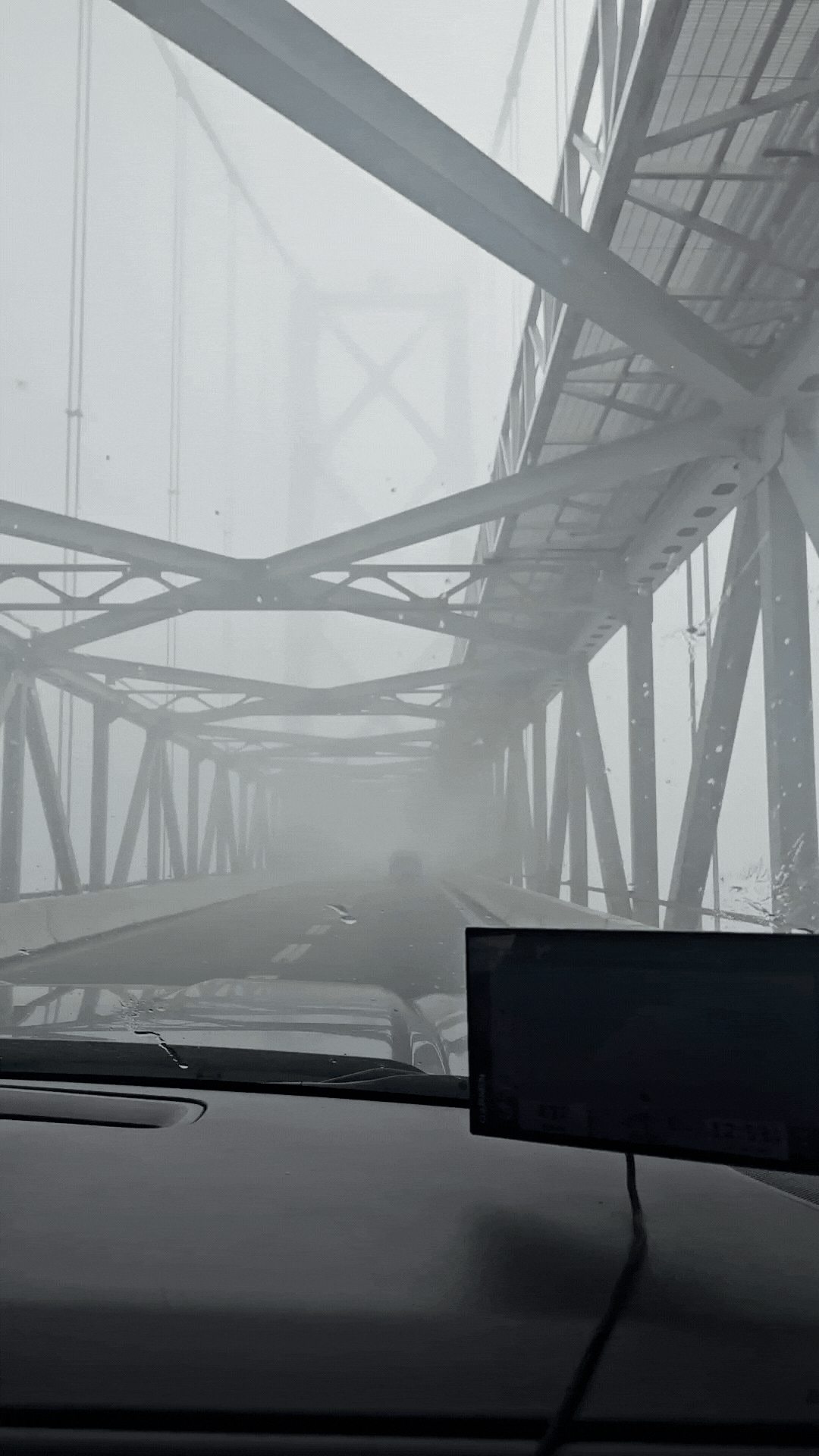
Hopefully you can tell from our giggly manner that we were in no real danger. We still had about 30ft of visibility in front of us, and despite the bridge's fear factors of length and height, it's actually easy to navigate, unlike some other bridges we've towed over which shall remain unnamed here but linked just because. And that drive also had poor visibility. Yikes.
We made it over the bridge, and in the blink of an eye, the skies were blue and the sun was beaming.
It was an interesting experience for sure, but we were already looking ahead to our next drive day. We would be heading south from Assateague, and how does one get from Assateague to Virginia?
Dun dun dun!
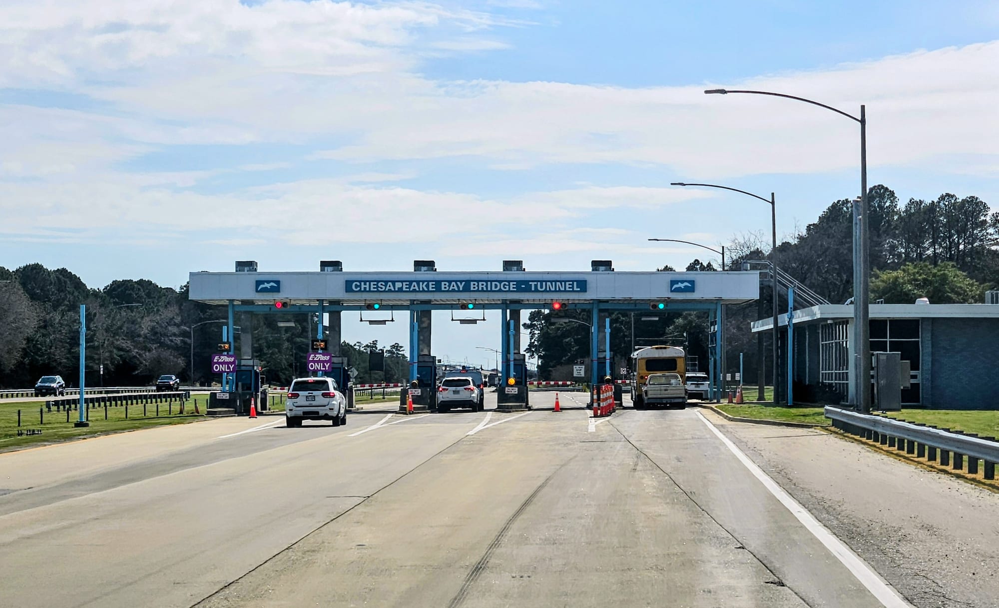
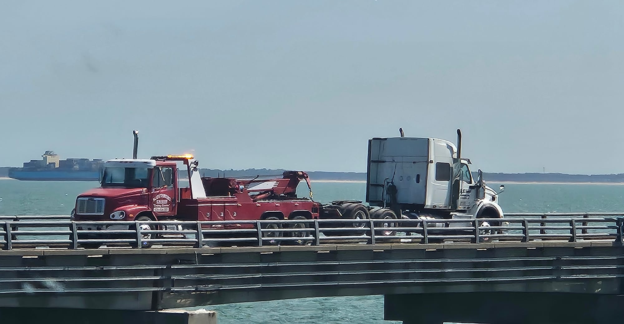
We were used to towing over bridges, but tunnels were another story. In our first years as RVers, we wouldn't have come close to the Bridge-Tunnel, but now in our 5th year, we knew we could handle it. But we didn't go in cocky. We prepared ourselves in mind, body, spirit, and trailer.
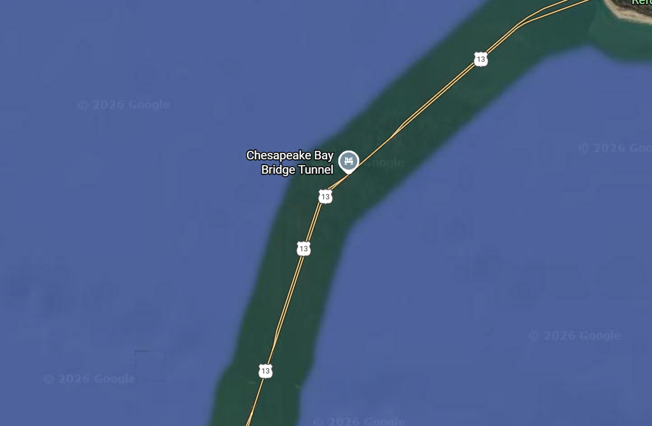
If you read our last post about our Assateague adventures, we linked to this archived blog post from our 2017 East Coast Road Trip. We went to Assateague on our way back from Florida, first stopping at Virginia Beach and then taking the Bridge-Tunnel over the Bay into Maryland. Funnily, we didn't even know that our route was taking us that way until we were on the final approach to the toll plaza. We knew about the Bridge-Tunnel, but didn't exactly know where it was. As we drove it and marveled at the feat of architecture, we did some research on it. In April 2017, it was the longest bridge-tunnel structure in the world, but that was its final month holding that accolade, before the Hong Kong–Zhuhai–Macau Bridge beat its length by double.
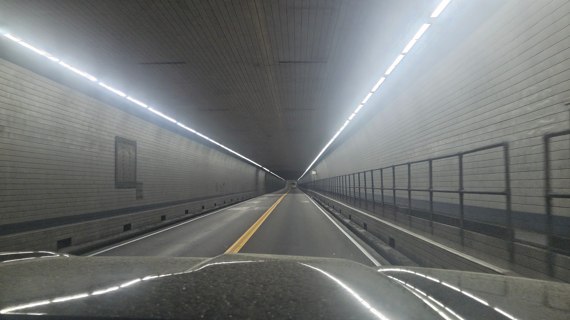
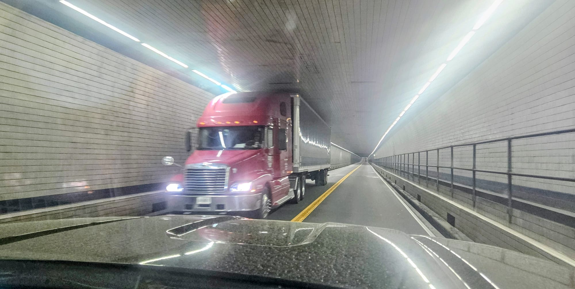
But, the stats of the Chesapeake Bay Bridge Tunnel (CBBT) are still noteworthy. 17.6 miles of alternating bridges and tunnels, including 12 miles of low trestle bridges, 2 high-level steel bridges, and 2 tunnels. The bridges are multilane and divided, so drivers don't need to worry about oncoming traffic. But then, the lanes merge into the tunnels, which then become narrow two-way roads of one lane in each direction. The tunnel entrances are built on 4 manmade islands. Finally, there are 2 miles of causeway on actual God-made land.
When we drove the CBBT in 2017, we were in a very normal sized Honda CRV. We've grown a little bit since then.
And with our growth comes extra precautions. The CBBT is perfectly traversible for RVs, as long as your height is less than 13'6 (the standard max height for interstates) and your width is no more than 8.5ft (again, standard width). There are propane restrictions and all vehicles carrying propane must have their tanks shut off at their valves.
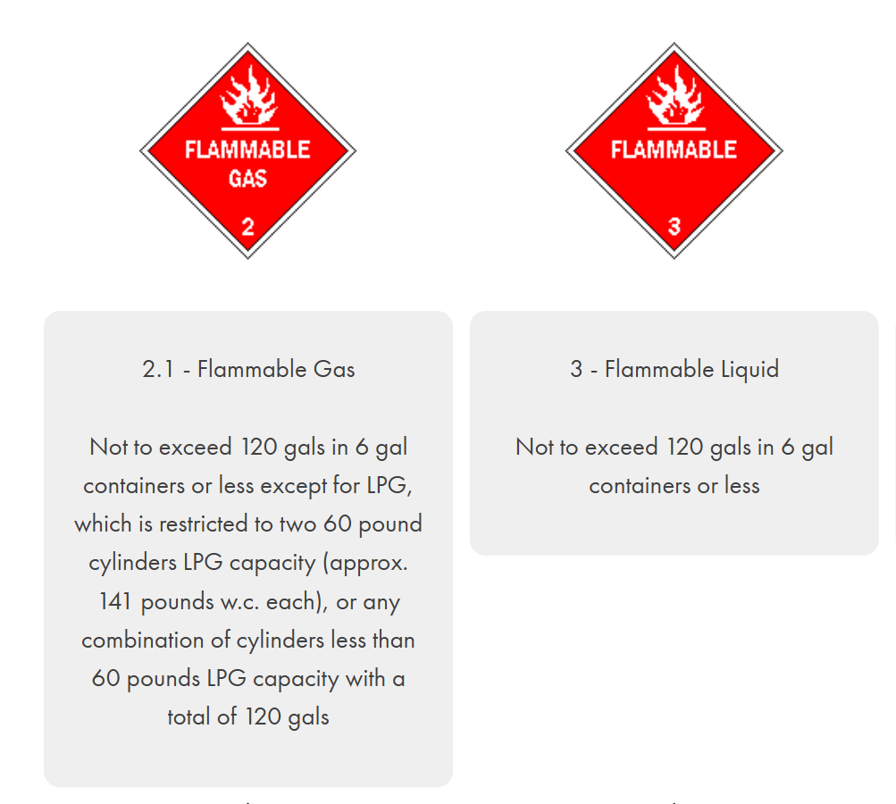
Now let's talk about these propane restrictions, because the internet is a 3-ring circus of false information for RVers who wish to take this route. I read everything from "RVs aren't allowed" to "RVs can't carry propane" to "RVs can totally carry propane and no one checks." This is mainly due to misinterpretations of a technical, but otherwise thorough, hazardous materials page on the CBBT website. We RVers work with propane all the time, but sometimes we forget what it actually is. Yes, it's a gas, but when it's in its cylinders, it's in liquid form. And as most of us know, it's flammable. If an RVer searches for "propane restrictions" for the Bridge-Tunnel, they don't get a direct hit from the CBBT website, but instead will yield results from AI (which says the wrong thing at the time of writing this post) and the countless forums of people stating their own misinterpretations. But, if you search "flammable gas," "flammable liquid," or "LPG," you'll land where you need to. Here are the regulations straight from the CBBT website. You'll see that, whether you define your propane as gas or liquid, you'll get a similar result. In essence, if you're carrying a normal RVer's amount of propane, like a couple of 20# cylinders, you are well within the limit.
The website also states that propane cylinders are subject to inspection, but most often, the toll workers will simply ask if your propane is off.
The tolls themselves are another important piece of information. They except EZ-Pass, but all the toll booths have bars, so you will need to stop. So don't expect to fly through with your RV without talking to the toll worker, even if you have a transponder. They will want you to roll down your window and verify that you have shut your propane off. Our EZ-Pass stopped working recently, and while we typically go through the lanes and hope it'll charge us the discounted rate according to our license plate, for this toll, we kept it simple and paid cash. For our 4-axle vehicle, it cost us $26.
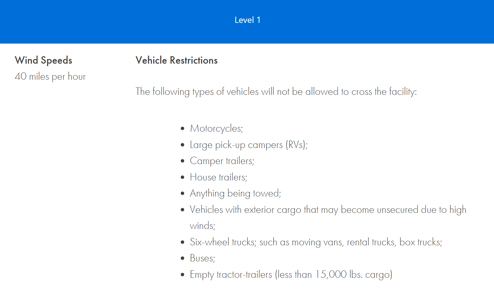
Since we're now a high profile vehicle unlike our days of sporty SUV travel, we needed to check wind conditions ahead of time. If winds reach 40mph, the CBBT bans RVs under the Level 1 restriction.
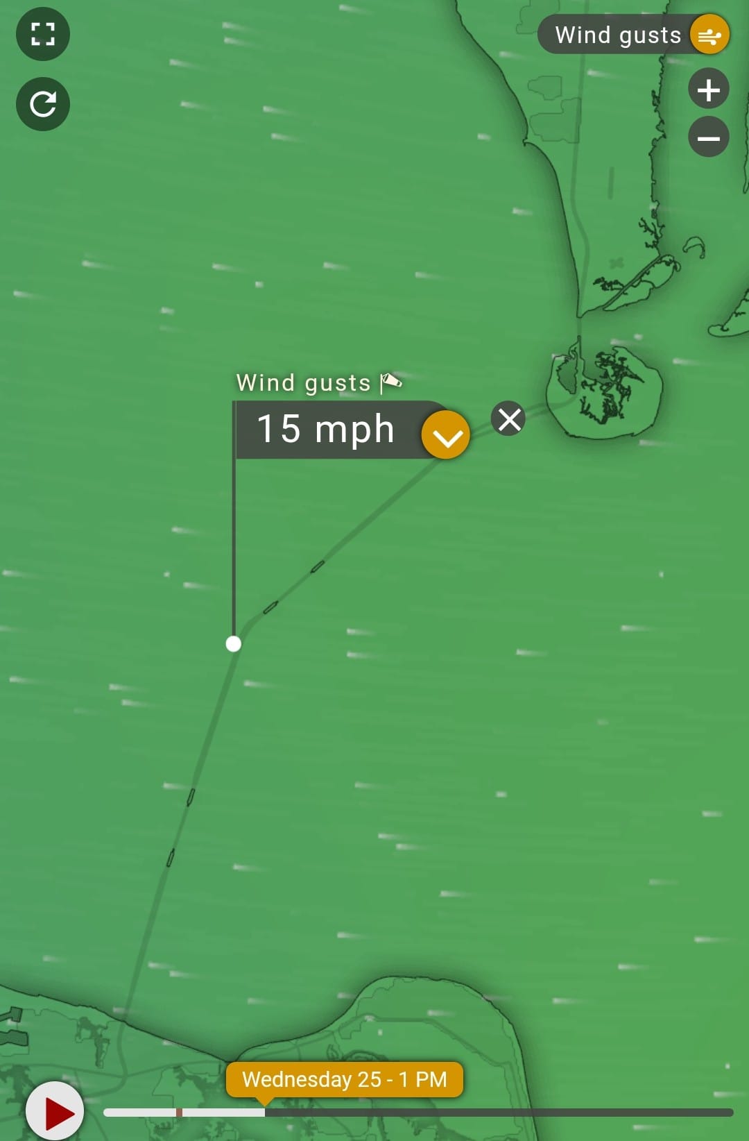
I used the Weather Radar app to look at the wind and wind gust speeds for around the time we'd be traveling. With winds in the 5-10mph range and gusts no more than 15mph, we were good to go.
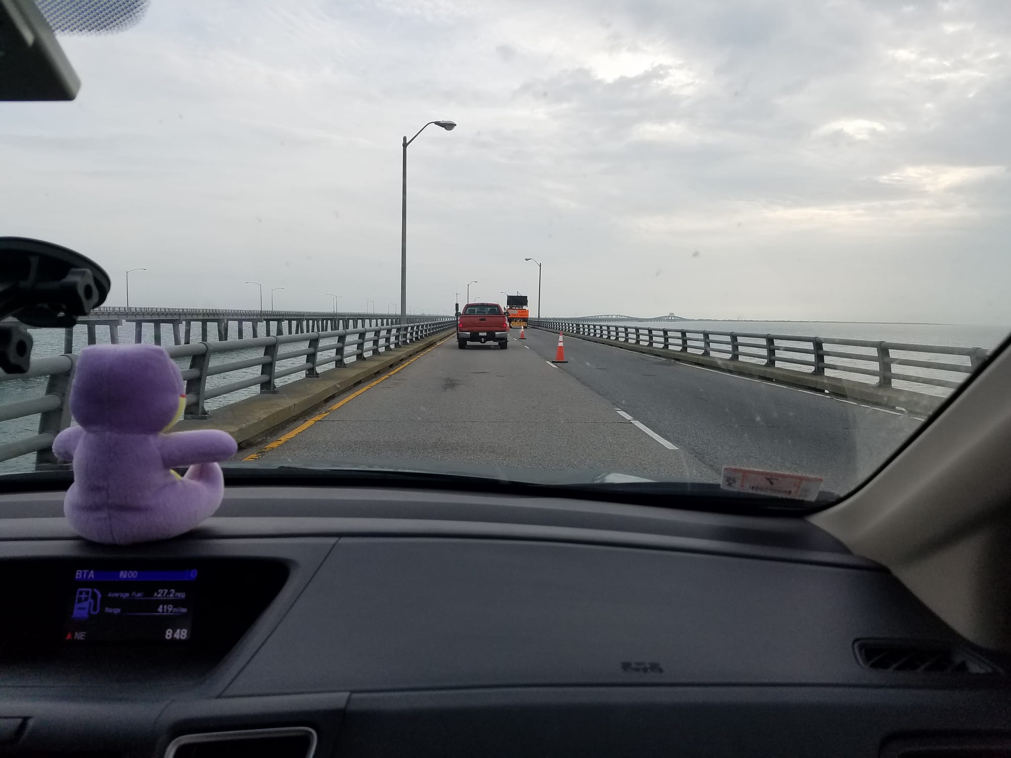
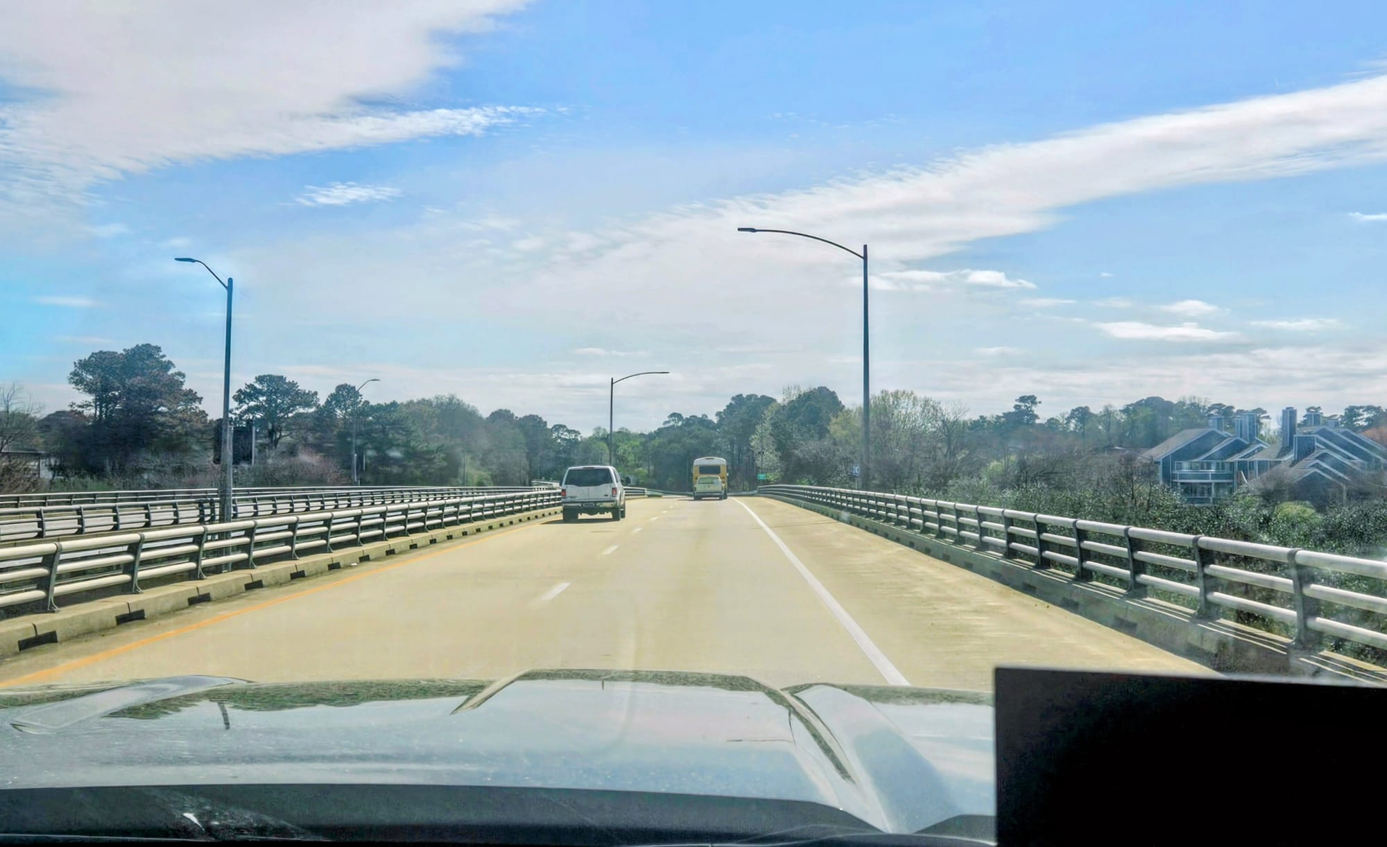
Our other preparations are ones we recommend to every RVer when facing a potentially intimidating journey. We kept our drive that day short, opting to overnight at a Harvest Host less than 60 miles from the end of the Bridge-Tunnel, giving us a 3-hour drive day total, not counting stops and traffic. We stopped for a break before the entrance so we could stretch our legs and use the bathroom. Once on the Bridge-Tunnel, we turned off our podcast so we could pay attention to the road. We obeyed the speed limits but also went slower when we felt we needed to. We didn't care if people got stuck behind us in the tunnels. If someone wanted to be a daredevil and pass us, they could do so on the bridges. Otherwise, we just kept our focus and stayed in our lane.
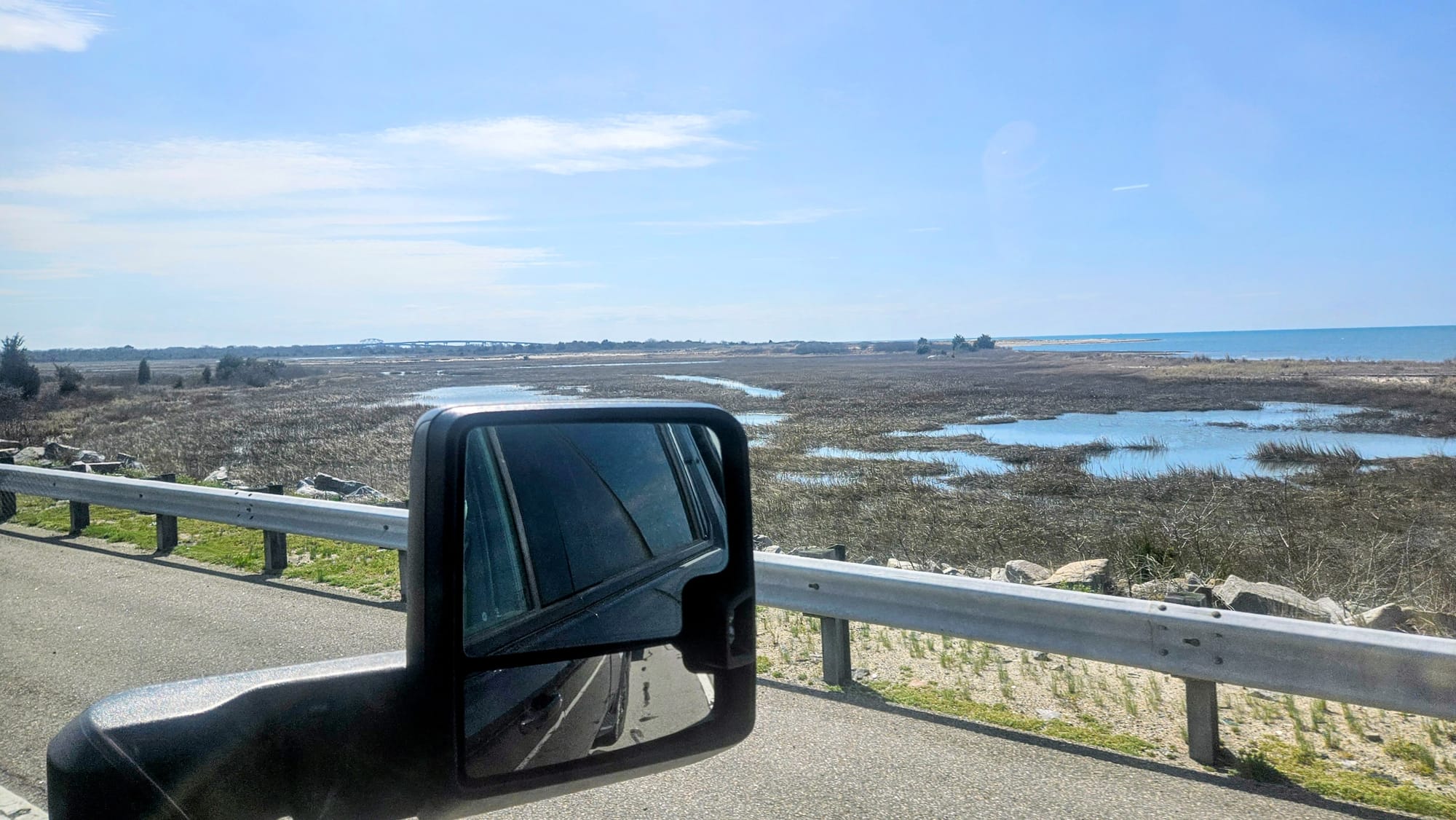
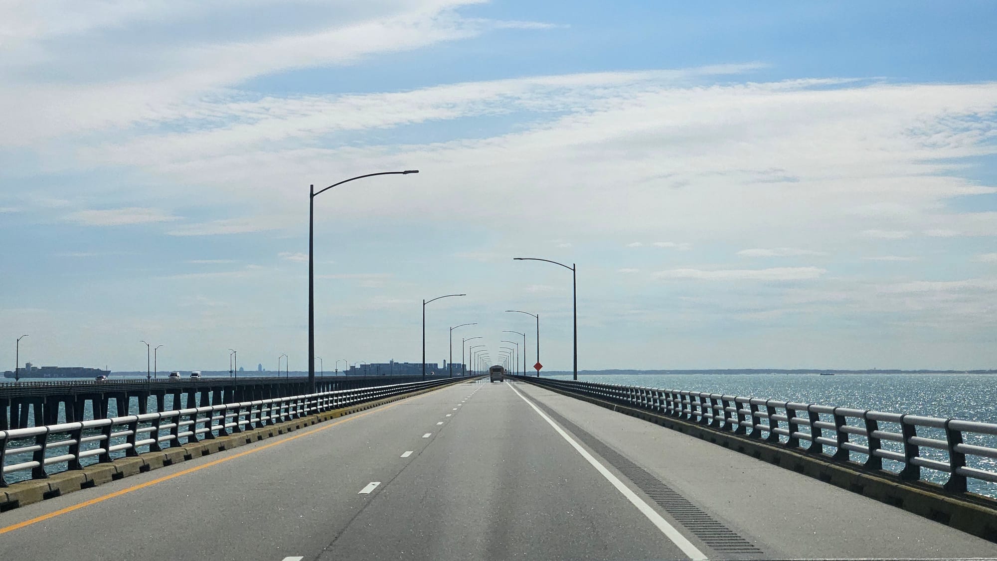
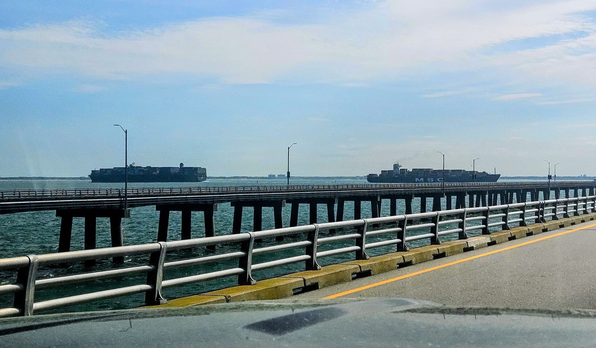
With views like that, the drive went by quickly, and compared to our foggy Bay Bridge traverse a few days before, we actually preferred this route over the Bay. Anticipating the drive ended up being worse than the drive itself.
We're hitting a lot of coastal regions on our travels this year, which means some high-pressure drive days will be inevitable. However, with research and preparation comes the confidence to not just complete these journeys, but even enjoy the views along the way. If the fog doesn't ruin them, of course.