RVing America's Loneliest Road, Part 1
The Backstory
As you probably know by now, we set out on Season 4 of travels with Utah as our main destination. We needed to get our axles repaired south of Salt Lake City and then planned to head to the Mighty 5 national parks. What happened before and after those plans depended highly on the timing of our travels, the state of our rig, and our frame of mind. We made great time getting out west from across the country and thought we'd have time to kill before our axle appointment. I dove into trip planning and tentatively chose to route us up through Nevada, first stopping at Vegas Bay and Valley of Fire before continuing northward to Great Basin National Park, a place that had eluded our travels thus far. March is still very much wintertime at Great Basin, so I needed to research which nearby campgrounds would be open. I went into RV Trip Wizard and perused the map. That's when a street name caught my eye: The Loneliest Road in America. It was US50, the road that runs north of Great Basin. Naturally, I was intrigued, so I read up on the road and how it came to be.
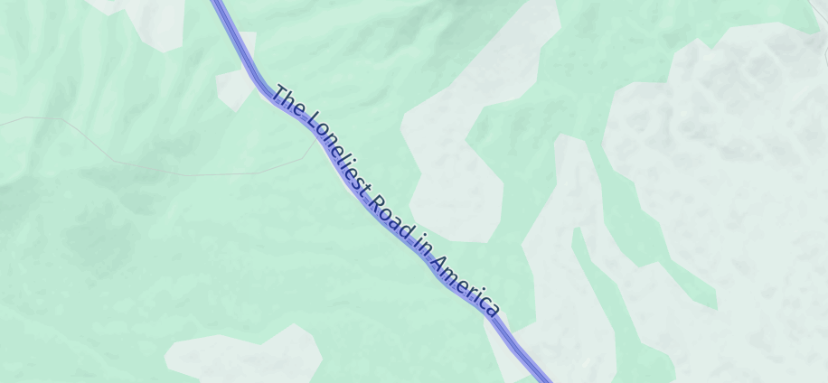
In 1986, Life Magazine published an article deeming the stretch of US50 across Nevada as the "Loneliest Road in America," warning people that traveling this road would be filled with obstacles and a dire lack of services. Once a route of the short-lived Pony Express and bustling with mining towns, US50 had become a place of the past. Only, the joke was on Life Magazine, because after the article came out, visitors flocked to the region out of intrigue and intrepidness. Nevada claimed the nickname, and the Loneliest Road in America became a thoroughfare for travelers seeking a more scenic route than I-80.
Turns out, this road isn't actually lonely and has a lot to boast. It's dotted with adorable small towns, has unique and gorgeous landscapes, and is rich with history. US50 is the first cross-country road built in the US, and the stretch through Nevada keeps the history alive with landmarks galore, showcasing old railway stations, mines, refurbished buildings, and plenty of folklore.
Seeing the potential of a wonderfully quirky blog post, I tucked the idea of traveling this road in the back of my mind, assuming that it would not be in the cards this year. I focused on our visit to Great Basin as our last stop before Utah, but it didn't end up happening. We needed to head to Utah early to get Tanner in to see a vet. Just like the Loneliest Road, Great Basin would need to wait.
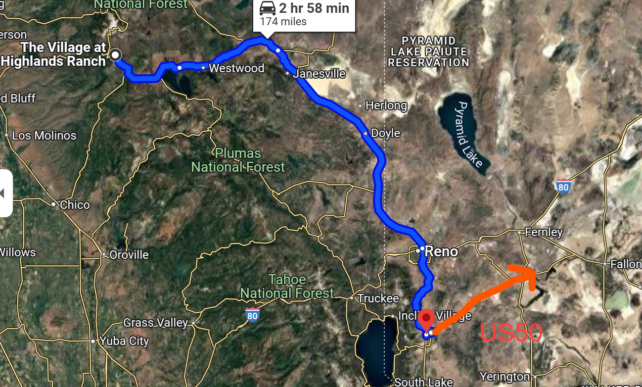
We didn't think Season 4 would return us to this part of the country, but our travels threw us a curveball. Our axles started giving us issues again, and we needed to schedule another axle appointment back up near Salt Lake City. After our Utah Redemption Tour, we desperately needed a change of scenery, and so we headed to California, where we spent a month. Our next order of business was to return to Utah, which meant traveling through Nevada. Our travel route worked out perfectly to duck down to US50 and hit the Loneliest Road in America from west to east, ending with Great Basin National Park.
Planning and Obstacles
Of course, we're far from the first nomadic content creators to have the idea to travel America's Loneliest Road. My planning brought me to dozens of blogs, guides, and vlogs with endless recommendations on what to do on US50 and in surrounding towns. It was overwhelming! So much for a road that's advertised as being in the complete boonies. We could spend a month along this road and never run out of things to do!
I mainly relied on two resources: This comprehensive guide/blog post from Honey Trek, and the Loneliest Road website, which has a free audio tour that would at the very least provide some infotainment during our drives. Otherwise, I pieced together a few recommended attractions from various influencers and also dove into Google Maps to see if I could find anything else that suits our interests.
Finding fun attractions is only one piece of the puzzle. We needed to ensure that we'd have places to sleep! The official "lonely" stretch of road is only 287 miles, which we could complete in one drive. Only, we were coming from Carson City and ending at Great Basin, so we'd be adding about 100 extra miles to our trek. Also, this is supposed to be a journey, so we didn't want to just rush through the entire thing in one day! We wanted to feel free to slow our pace and make stops along the way. At first glance, there were plenty of places to camp, many of which are first come, first served. This would give us the flexibility to go at our own pace and see where we end up. Lately, our more spontaneous drive days have worked in our favor, and so I decided we would plan less, wing it more.
Then the night before we were set to leave Carson City and begin our journey, I had second thoughts. An unexpected theme had emerged in Season 4, which was that we found ourselves having a lot of adventures that would be much easier in a van or small RV. I was concerned that this would be the case here. We can't live like vanlifers and just pull off wherever we want on our travels, experience the attractions, and then find camp for the night. We're big! I felt compelled to at least take another look at the campground options and create a tentative itinerary.
5 hours later, the clock struck 10PM, and my eyes were bleeding from looking at my computer screen far too long. With Anthony's input, I had come up with a few tentative itineraries, but we were in no state to get up the next morning and dive into any of them. We made the decision to stay put in Carson City for one more day.
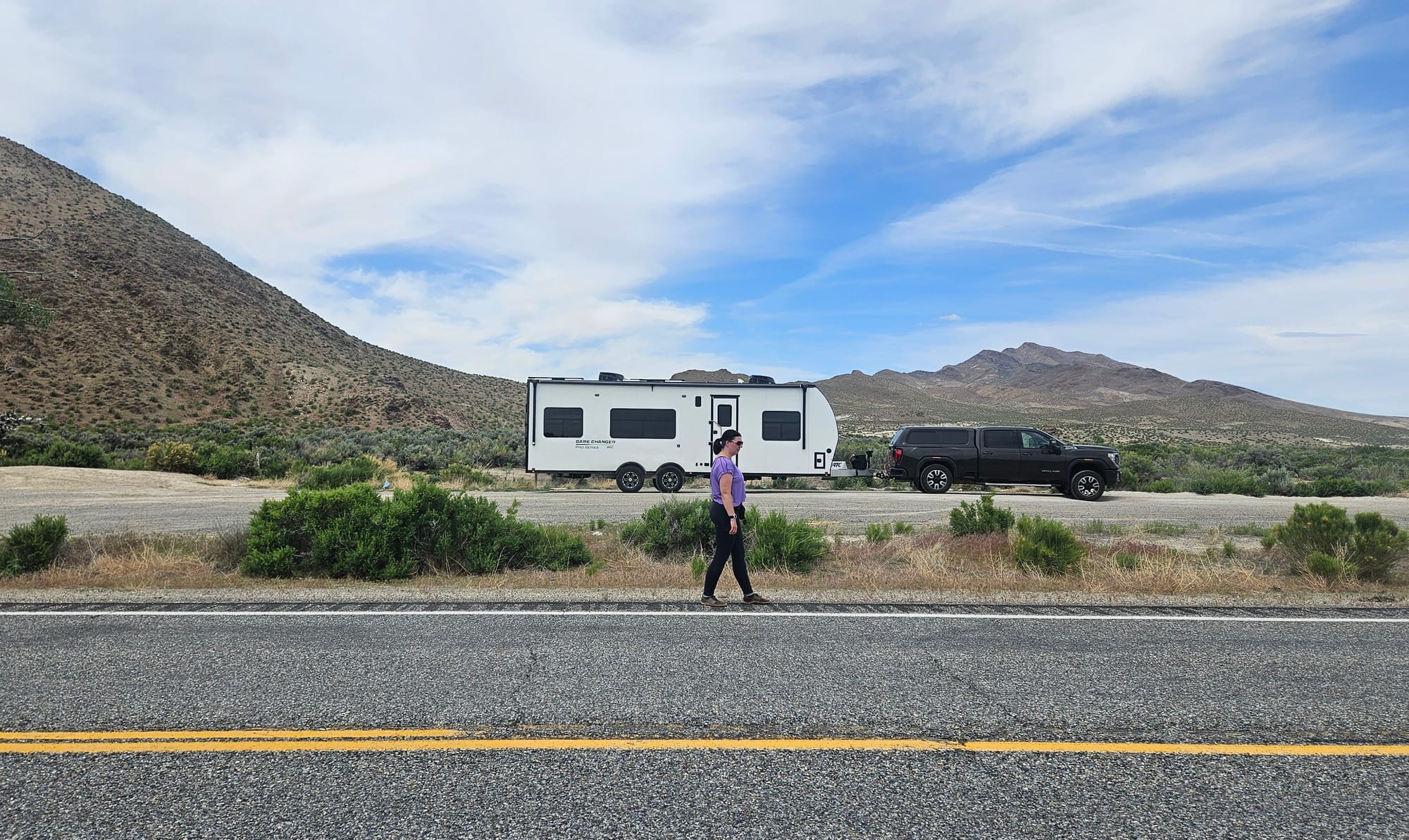
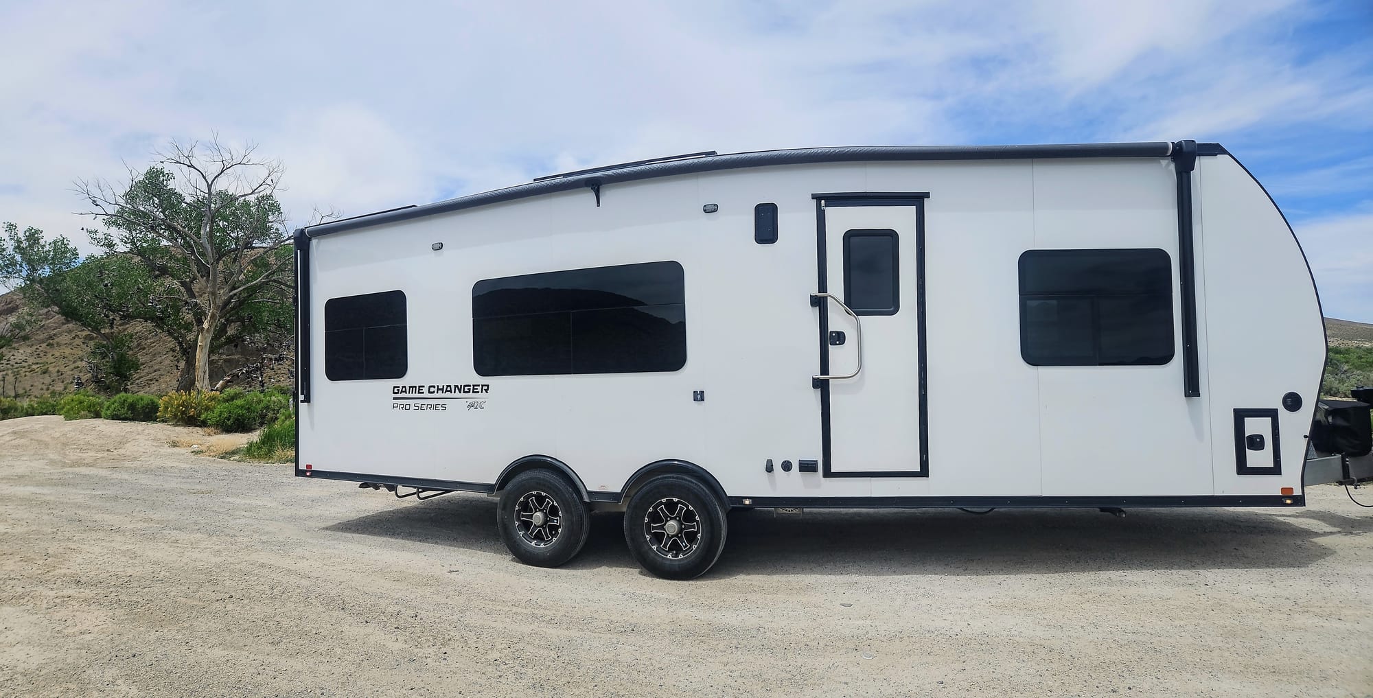
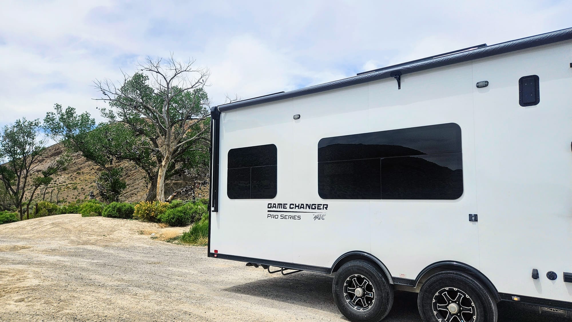
The extra time helped us suss out a general plan that would still let us be spontaneous, but with a little more knowledge under our belts. We'd still surely run into obstacles with our size, but instead of worrying about it, we'd just consider it information for the blog. What's it like to RV the Loneliest Road in America, with a medium-large RV with 56ft of combined length? And what's it like to do it with no advanced camping reservations? We were about to find out and take you along with us.
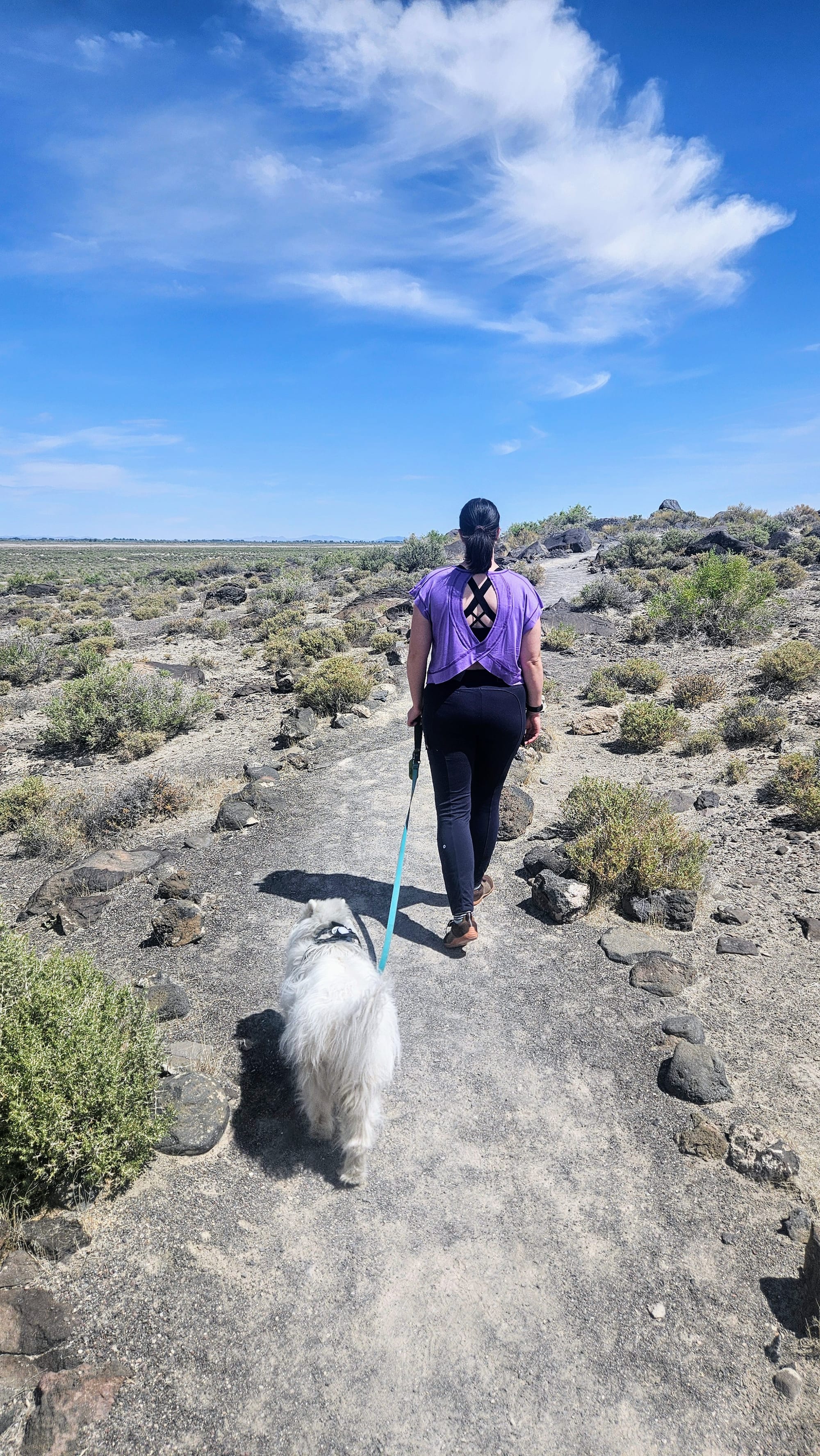
Day 1: Carson City to Austin
We left our Harvest Host in Carson City around 8:30am on Memorial Day. The drive to Austin without stops would be about 3 hours, but we had a few ideas in mind of where we would want to stop along the way, space permitting. Being in our long rig, we wouldn't have the opportunity to just pull over whenever we wanted. Even when we did pull over, we'd want it to be worth the effort. So, naturally we passed by and through a lot of places that others might find a worthy attraction, but we stuck with our highest priorities. We'll still mention a few "waypoints" – places we didn't stop but that are worth mentioning.
Waypoint 1: The town of Dayton
Dayton is only a half-hour from Carson City, so we didn't feel the need to stop so soon.
Honorable Mention: Chocolate Nugget Chocolate Factory
This chocolate factory has been family-owned for 3 generations. There are two locations, and one is located only a few minutes off US50, just west of Dayton. We've heard great things about their chocolate and considered making this our first stop, but we hit the road early and didn't want to wait around for its 9:30am opening time. Also, since it was Memorial Day, we didn't know if they'd even be open.
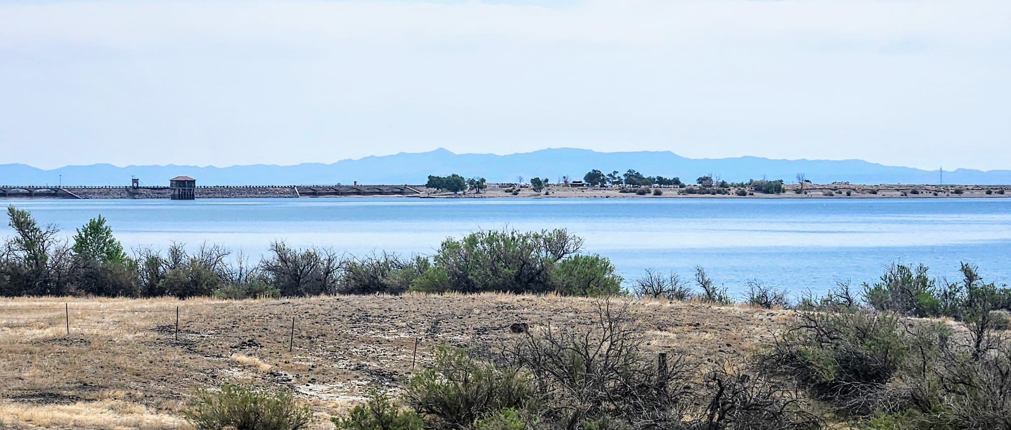
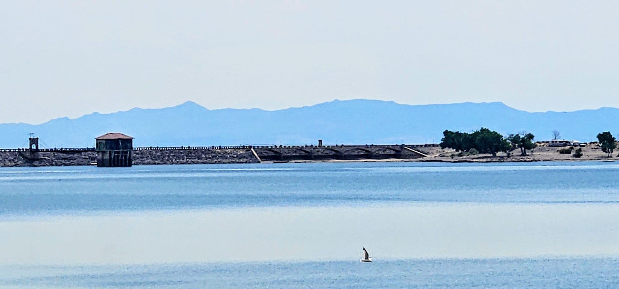
Waypoint 2: Lahontan State Recreation Area
Lake Lahontan is a reservoir on the Carson River that boasts 69 miles of shoreline. Recreation here abounds, and we even set this location as an option for camping, but it was too close to our starting point. We got some great views of the reservoir and dam as we drove by.
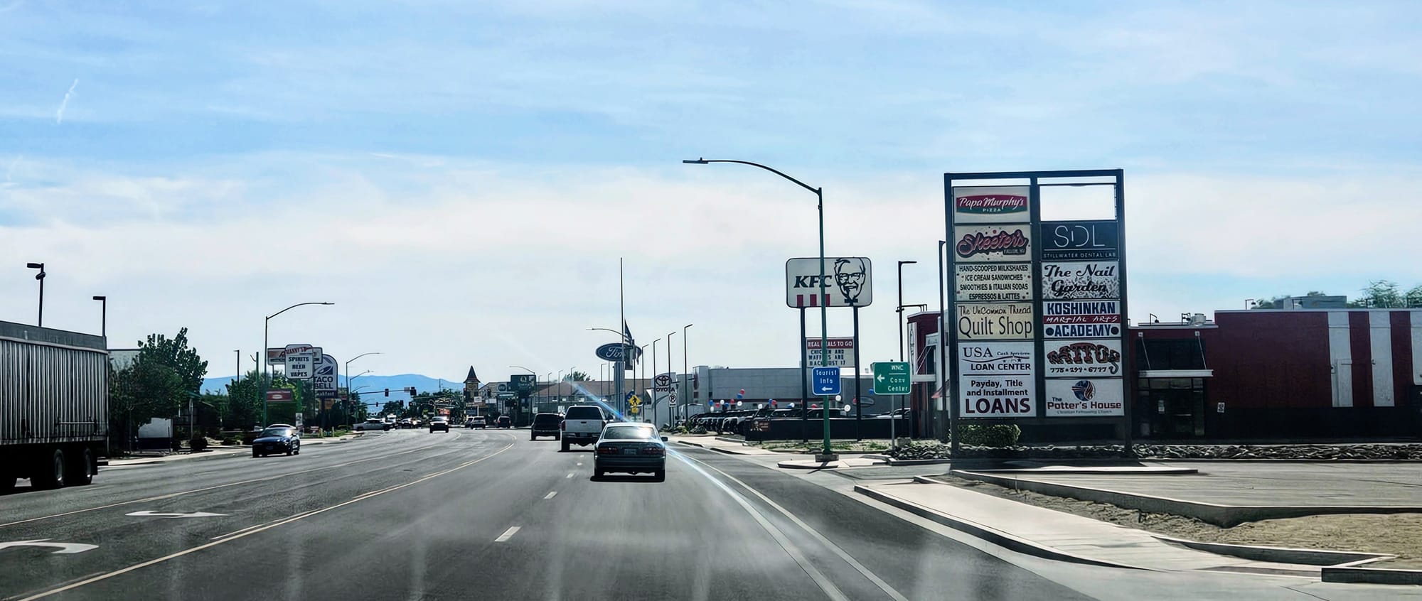
Waypoint 3: The town of Fallon
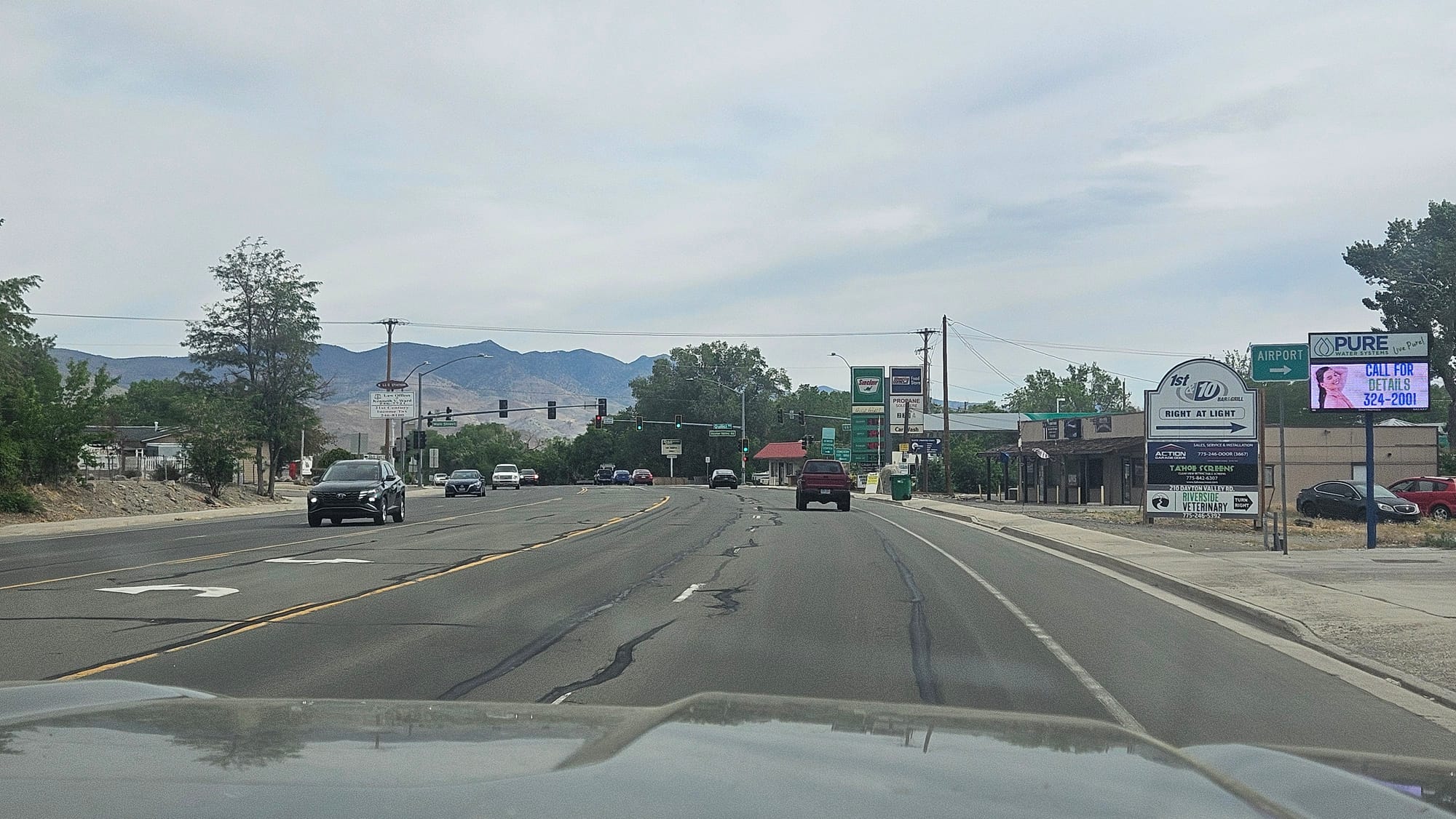
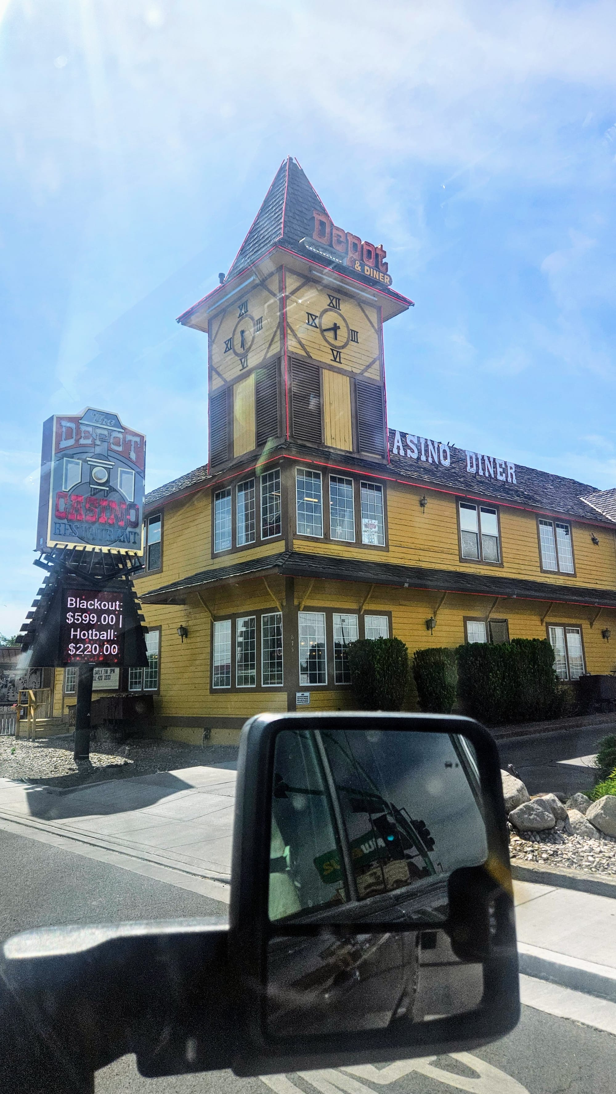
Fallon is a great place to get a mix of the historic and the modern. If you need to resupply, you can find a Walmart, Ace Hardware, Safeway, and a bunch of fast food restaurants. Our pit stop was coming up soon, so we drove through town and marveled at how quintessentially "Nevadan" it felt, with its small town feel and streets lined with casinos. Fun fact: The main road that runs through the town isn't Main St, but rather Maine St, named by state senator Warren W. Williams, because Maine was his home state.
Honorable mention: Stillwater Wildlife Refuge
This refuge is just a stone's throw off US50, and we tried really hard to figure out if we could fit it into our itinerary. Its 81,000 acres are a protective habitat for migratory birds, and visitors can enjoy several viewing areas including trails, an auto loop, and an observation deck. We thought it sounded like the perfect place for an ebike ride and picnic, but we weren't sure if we'd be able to tow into the refuge. The roads seemed fine from what we could see on Street View, but we couldn't guarantee a safe parking spot. We did read that there are two places in the refuge that allow camping, including RV camping, but no solid information on size limits. Then, when we decided to delay our Loneliest Road expedition a day, a few stops had to give, and Stillwater was one of them.
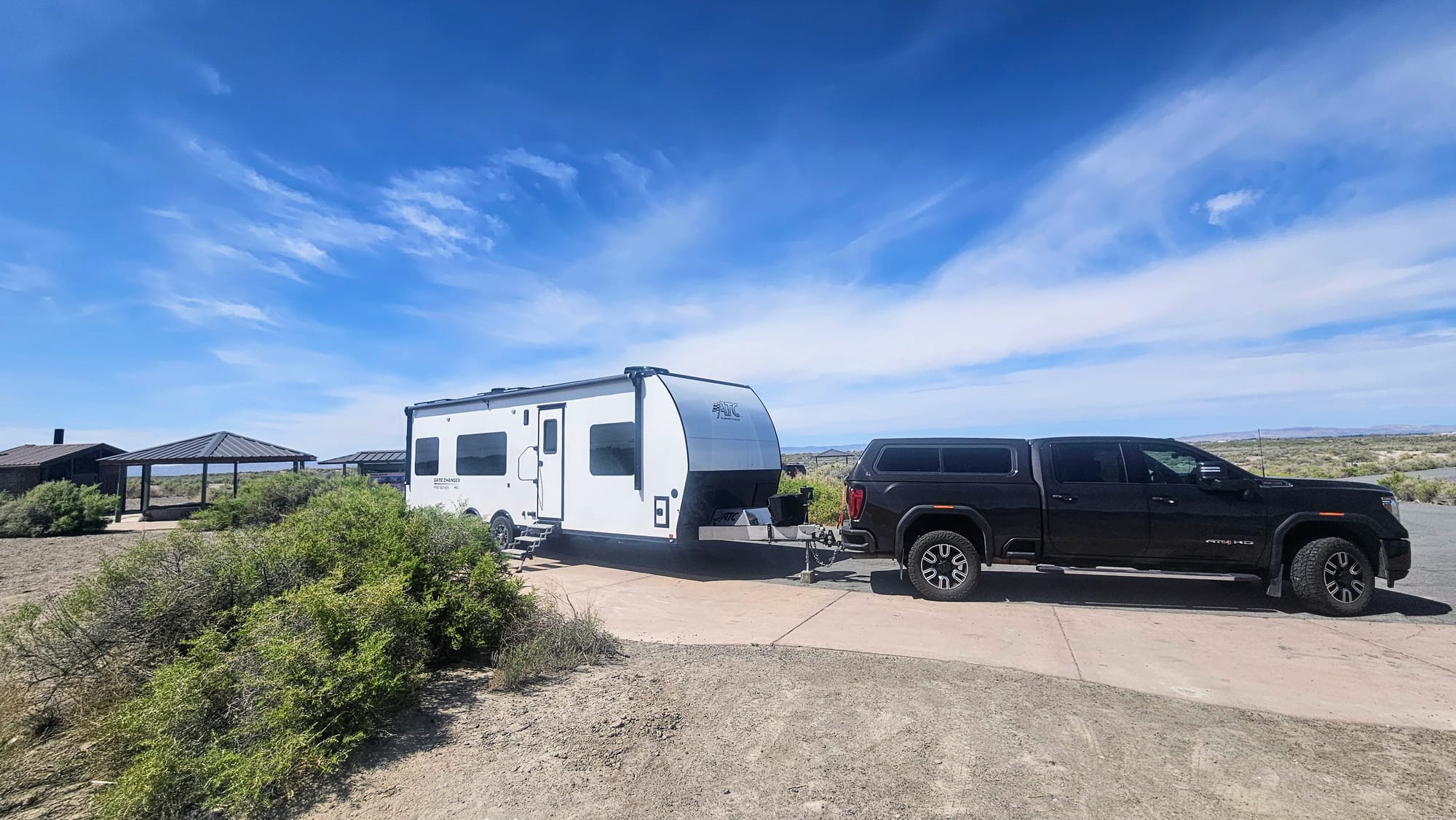
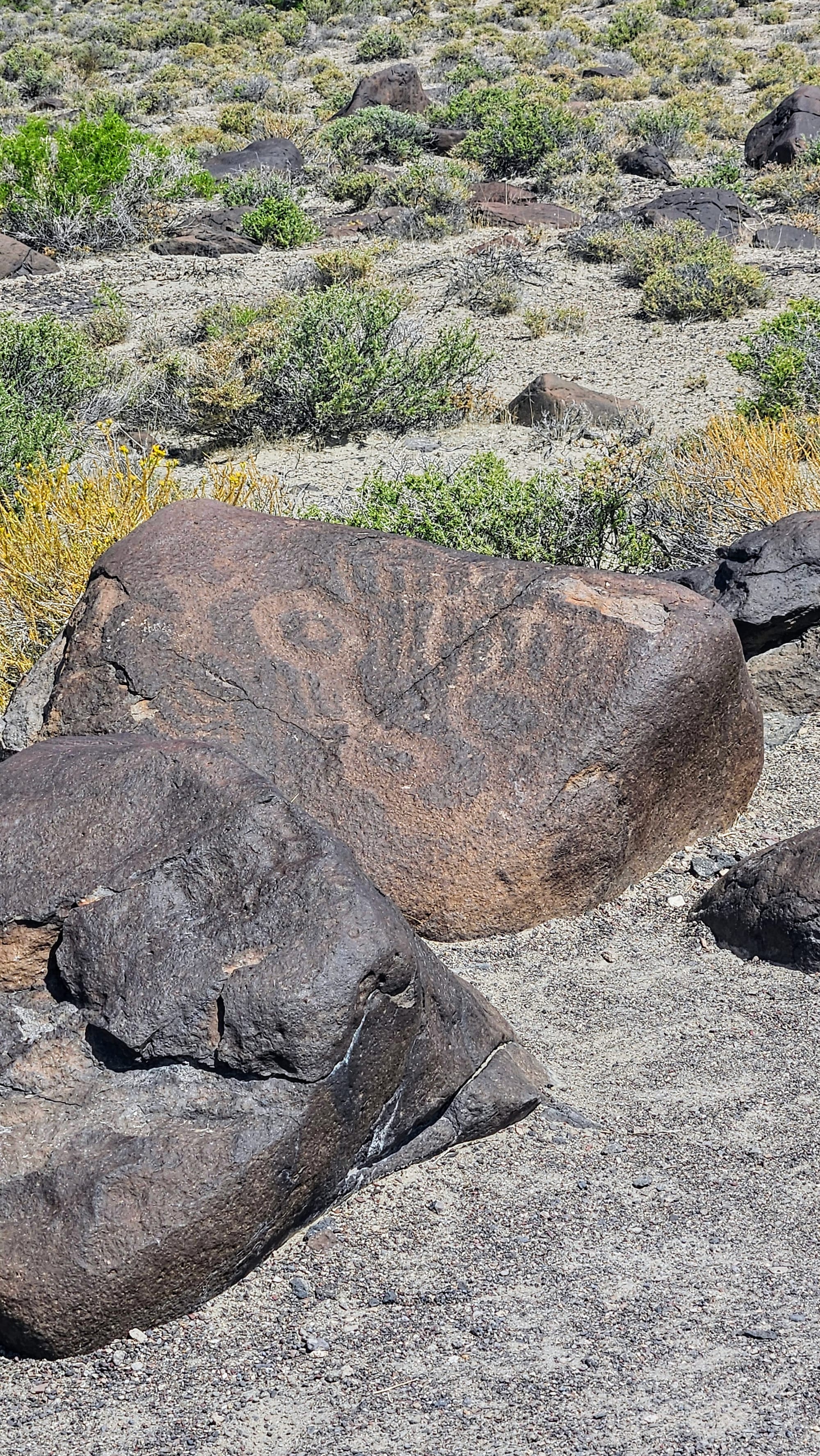
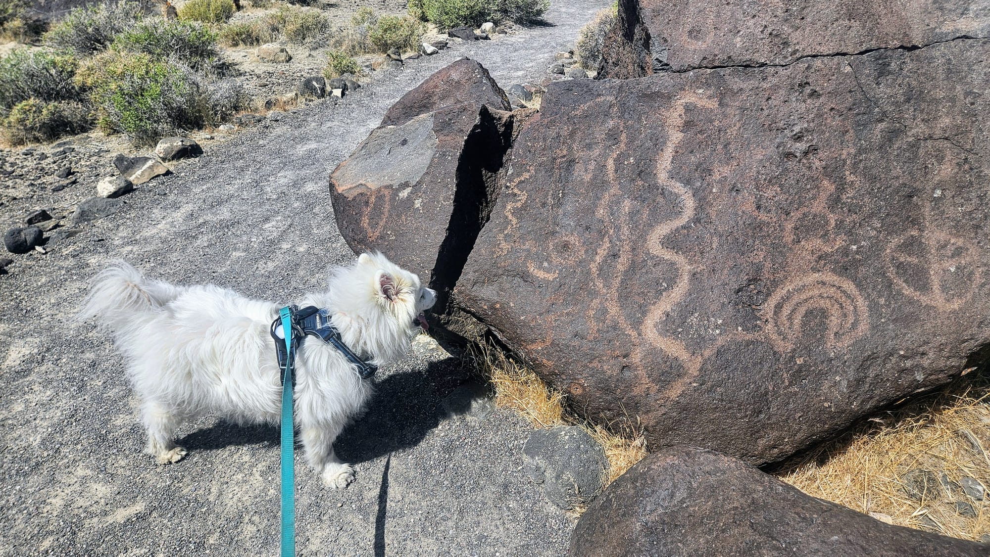
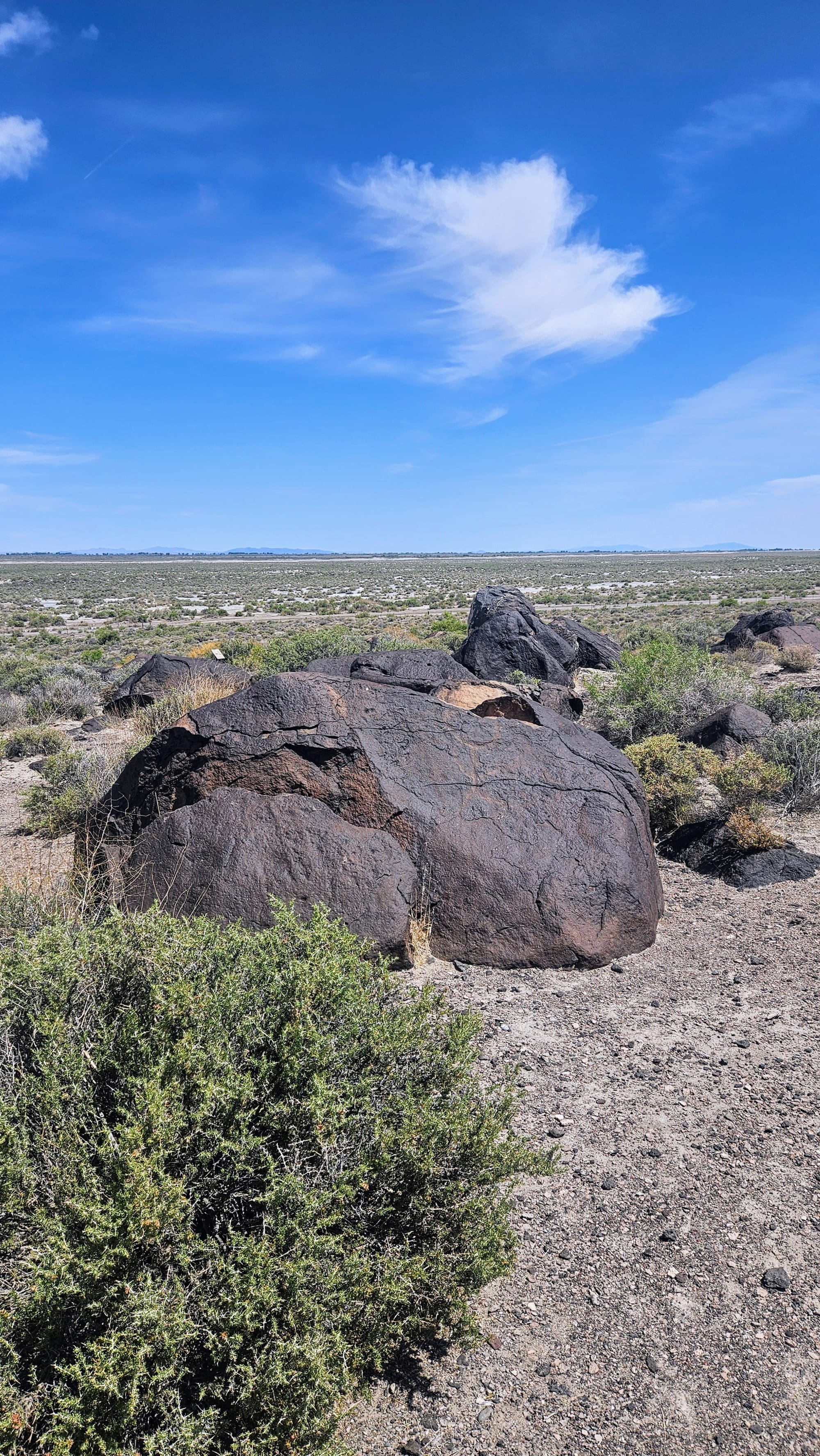
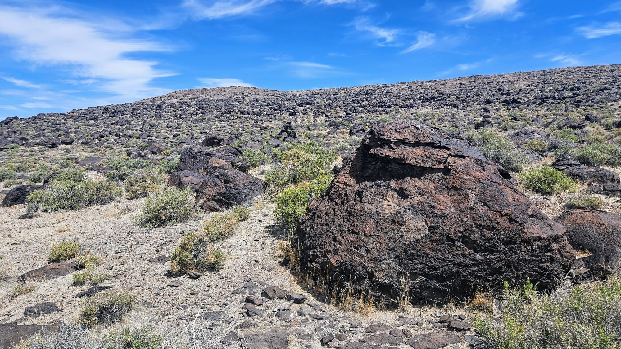
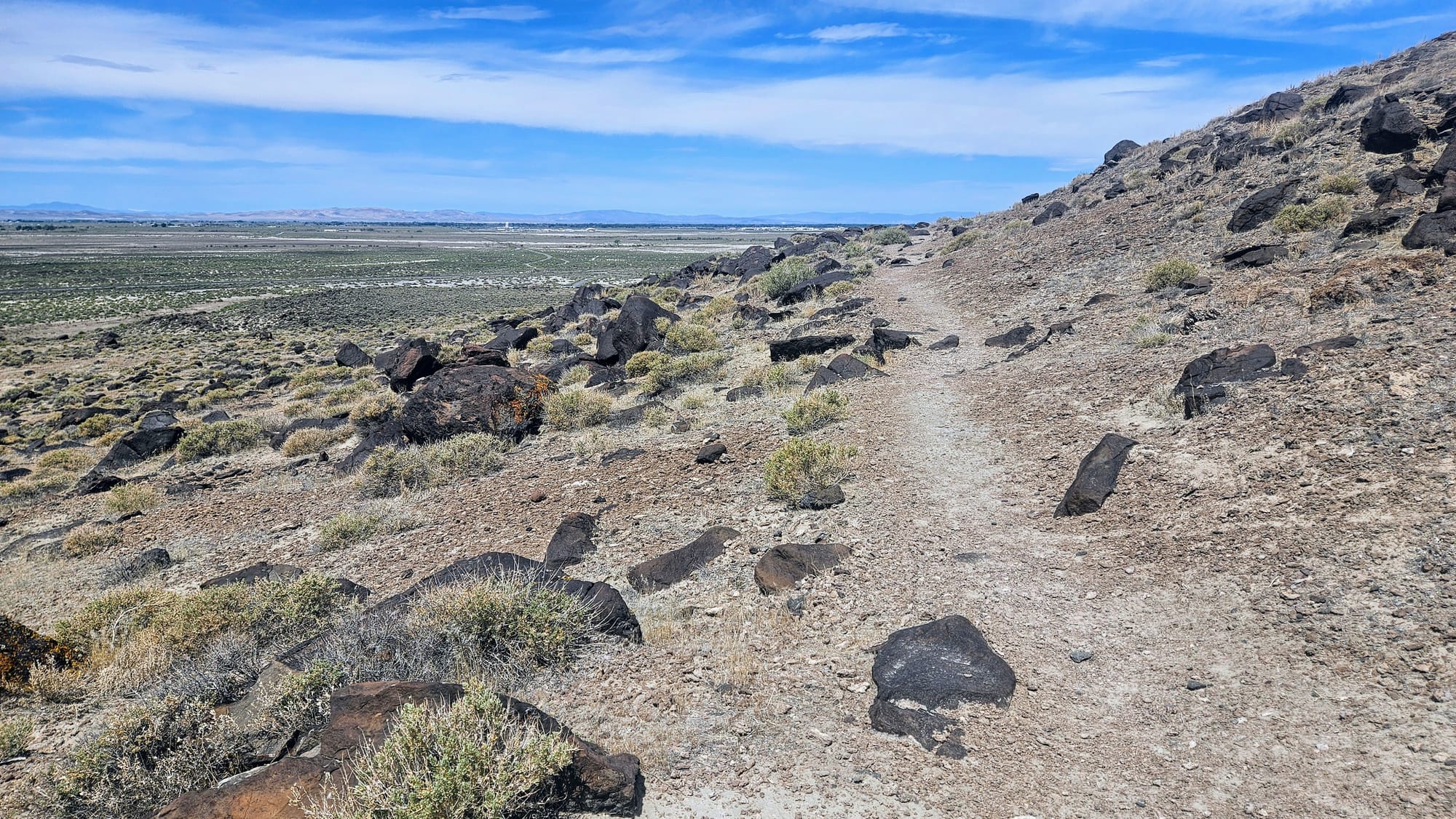
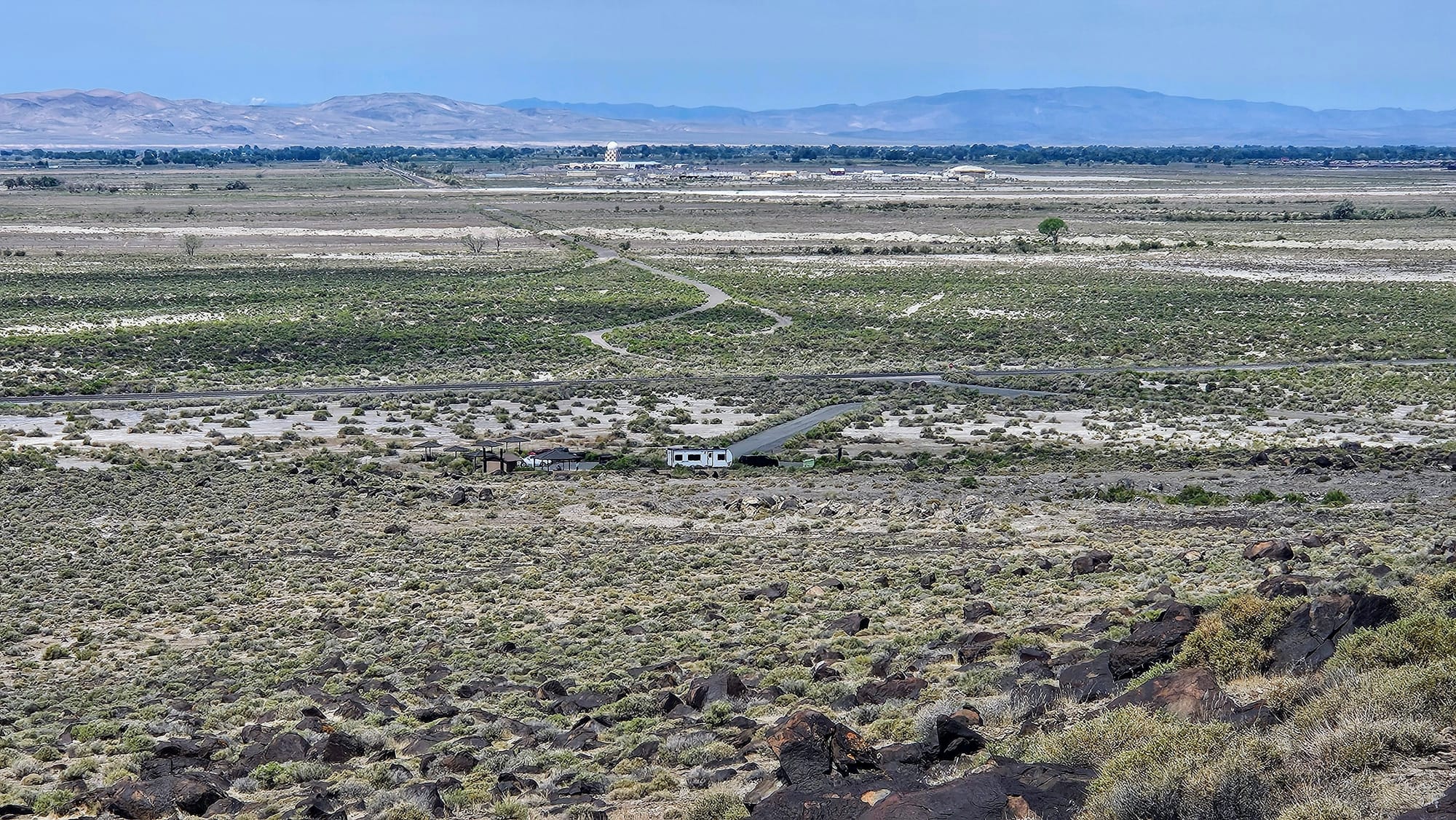
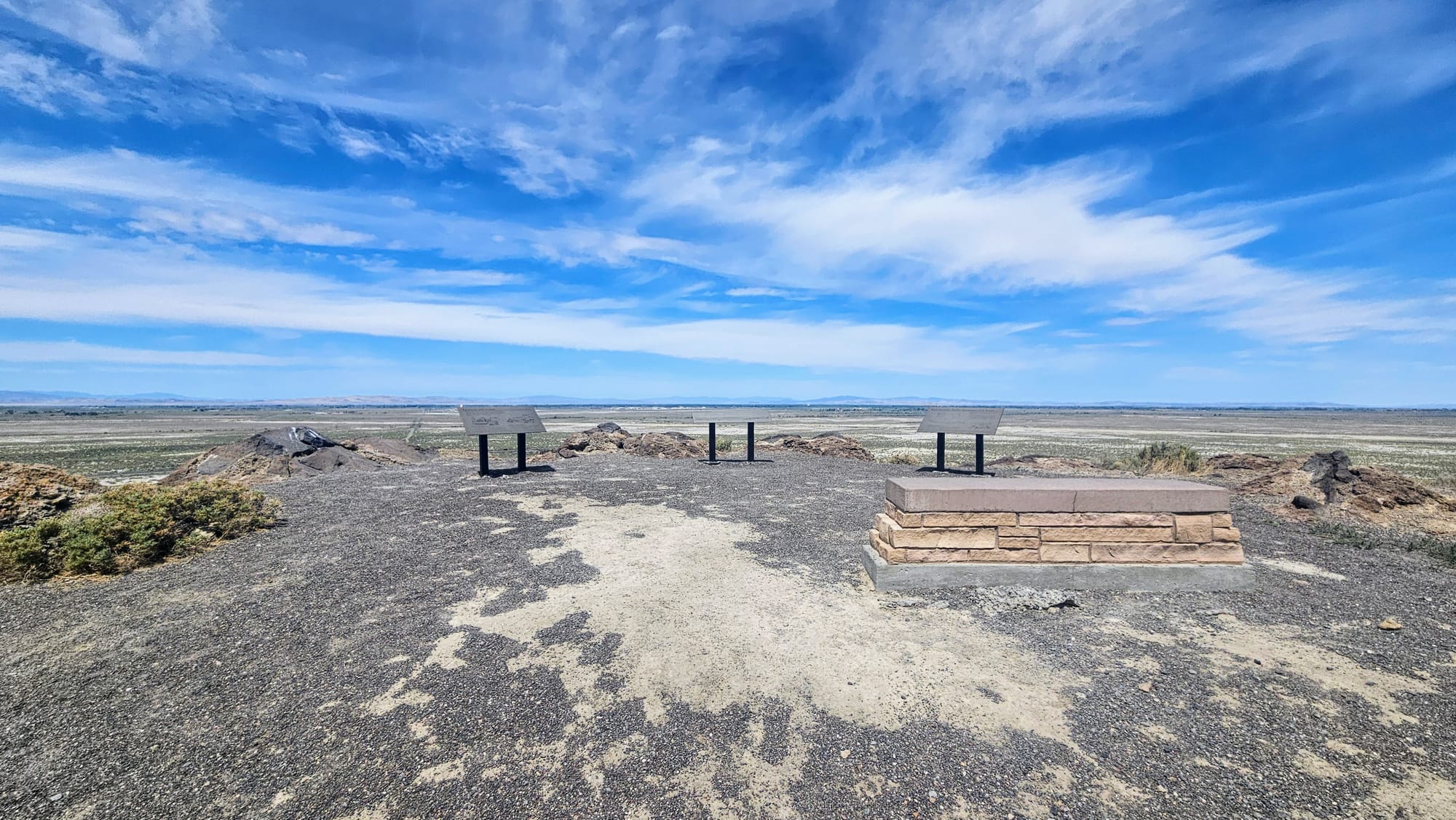
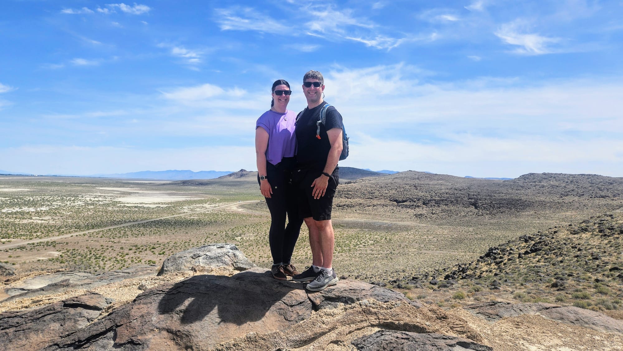
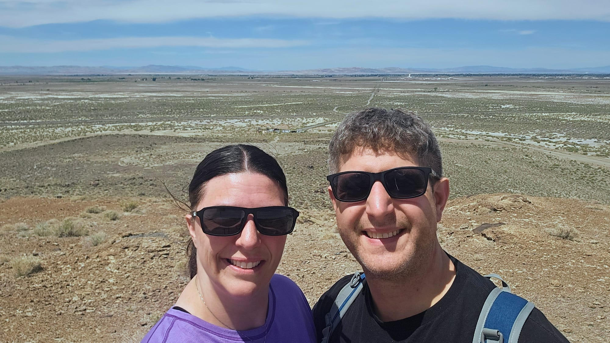
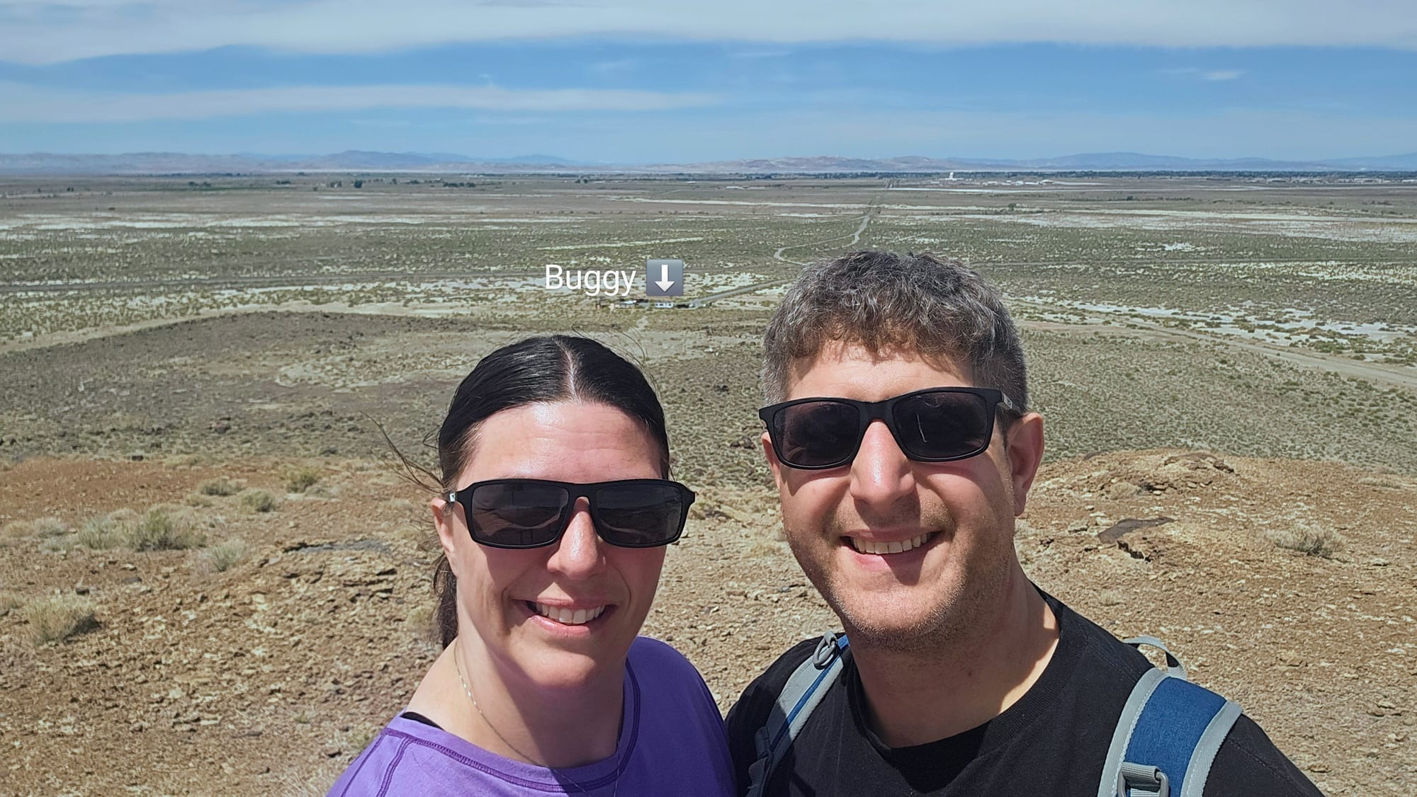
Stop 1: Grimes Point Archaeological Area
Even though Stillwater was too iffy to commit to it as a pit stop, we had high hopes for Grimes Point. Satellite view showed a cul de sac parking area, and even though it lacked RV parking, a travel trailer was pulled off to the side of the turnaround. There would only be room for one, and we hoped it would be us. We took a chance and planned to stop here right after going through Fallon. Here, we could walk Tanner and take a hike before the weather got too warm.
When we arrived, the car parking spots were full. We pulled over in the widest spot of the cul de sac, making sure people had room to get by us. Any other RVs would be out of luck, but if they needed to, they could park on the road leading up to the parking area. We just assumed we'd be the only ones crazy enough to RV up to the parking lot, and we were.
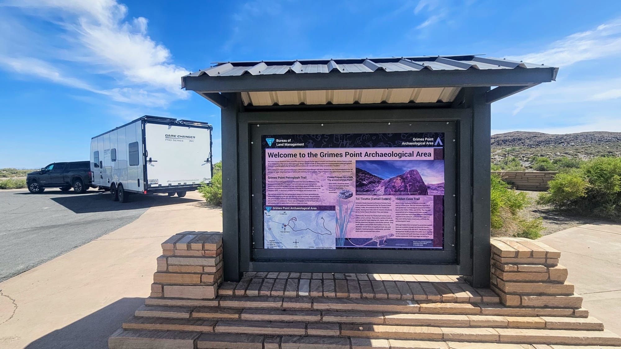
Grimes Point has a petroglyph trail and an overlook trail. Further up the road, or up a longer trail from this lot, is Hidden Cave, a trail that loops around a few small caves in the rock. We didn't have time for that hike, so we took Tanner on the shorter petroglyph trail, dropped him back at the trailer, and then hiked the 1.3 miles up to the overlook.
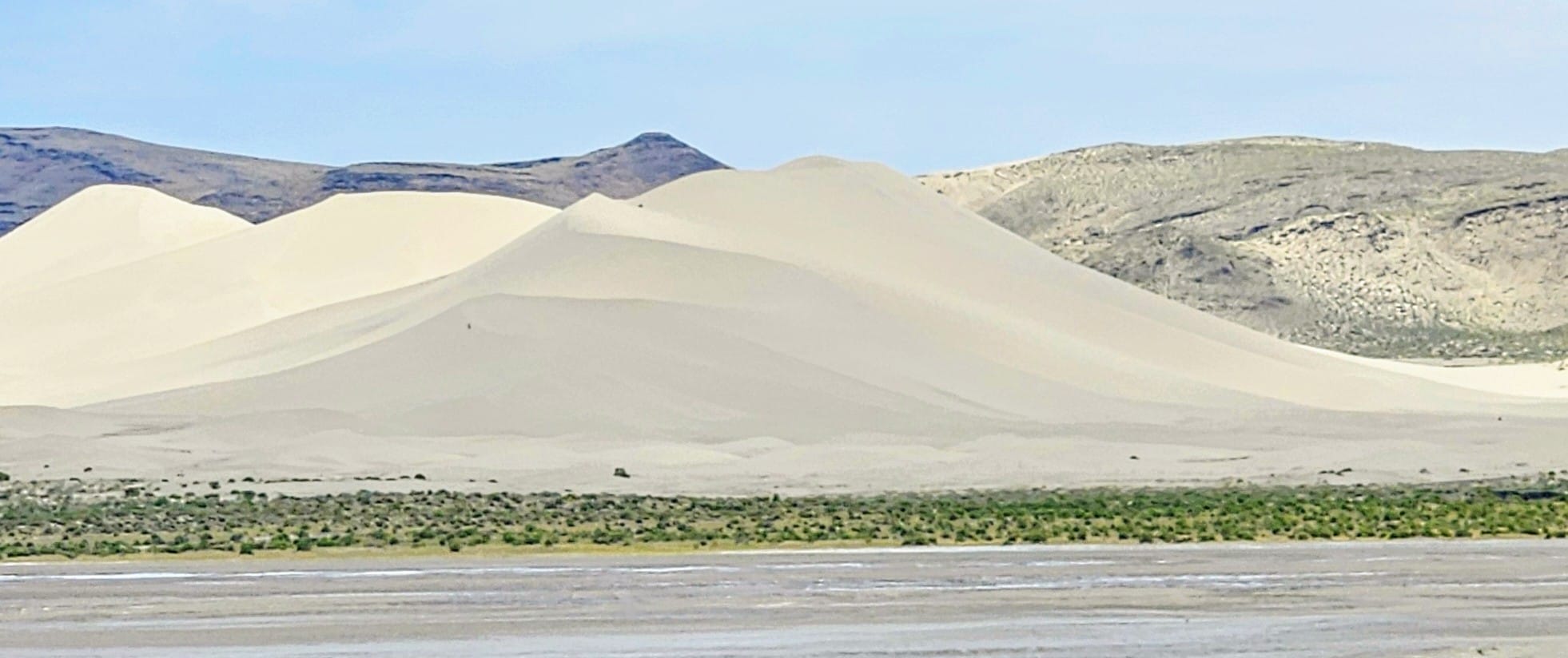
Waypoint 4: Sand Mountain Recreation Area
This was one place that we knew we'd fit with no problems, because its a toyhauler mecca! It's a designated OHV site owned by the Bureau of Land Management (BLM). Of course, we don't haul an OHV, but we were enthralled by the giant sand dune that seems to pop out of nowhere on the side of the road. The dunes are created by windblown sand that is blocked by the surrounding Stillwater Mountains. Sand Mountain is the largest dune in the system at 3.5 miles long, 1 mile wide, and 600 feet high. Not only is this the largest dune in the recreation area, but it's the largest in the entire Great Basin.
So why didn't we stop? Entry costs $40 because there is only a weekly pass, not daily. Entry is free on Tuesdays and Wednesdays, but we passed through a day too early. From a distance, though, we could tell this place was hopping! Lots of people chose to spend their day off riding the dunes and trails. Primitive camping is also allowed at the base of the dunes, but RVers need to be careful of the soft sand.
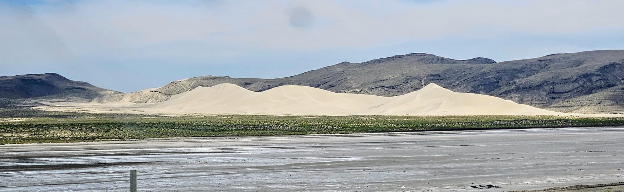
The sand dunes weren't the only fascinating feature on this stretch of the road. We also passed through Salt Wells, known for its history of borax mining and processing. We passed these salt flats just before reaching the dunes. This area lies within an endorheic basin. Water flowing through it evaporates or seeps into the ground, leaving behind salt and mineral deposits.
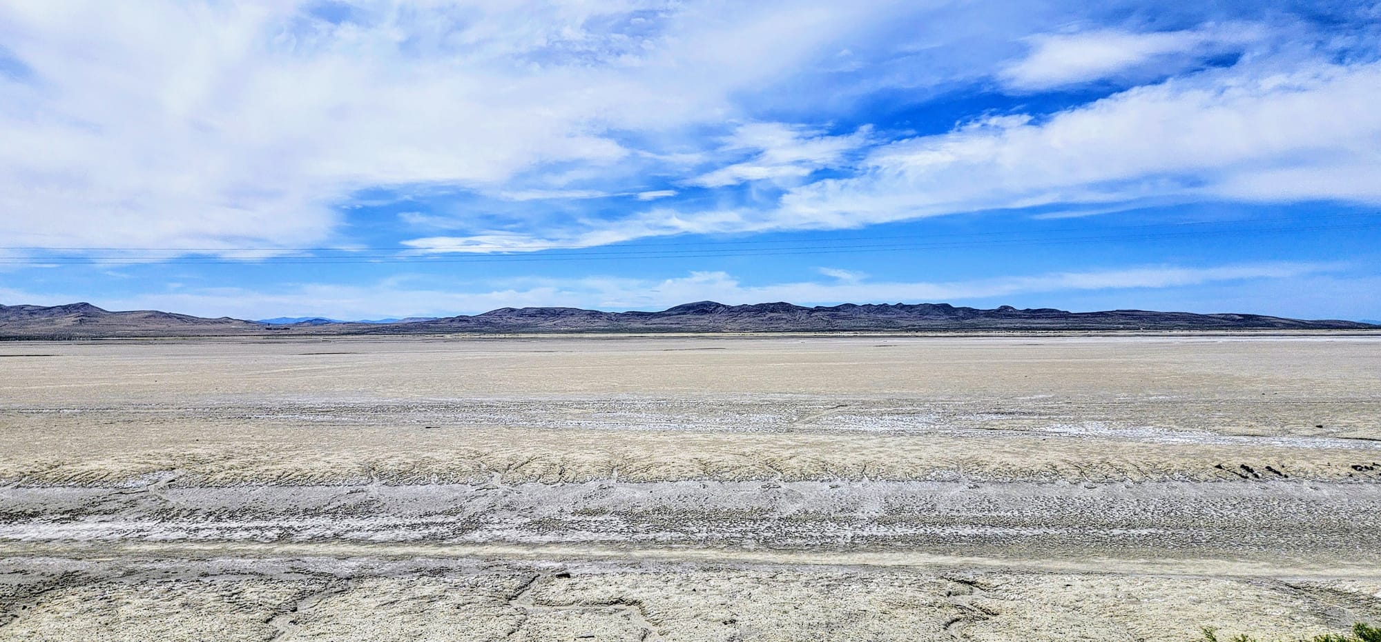
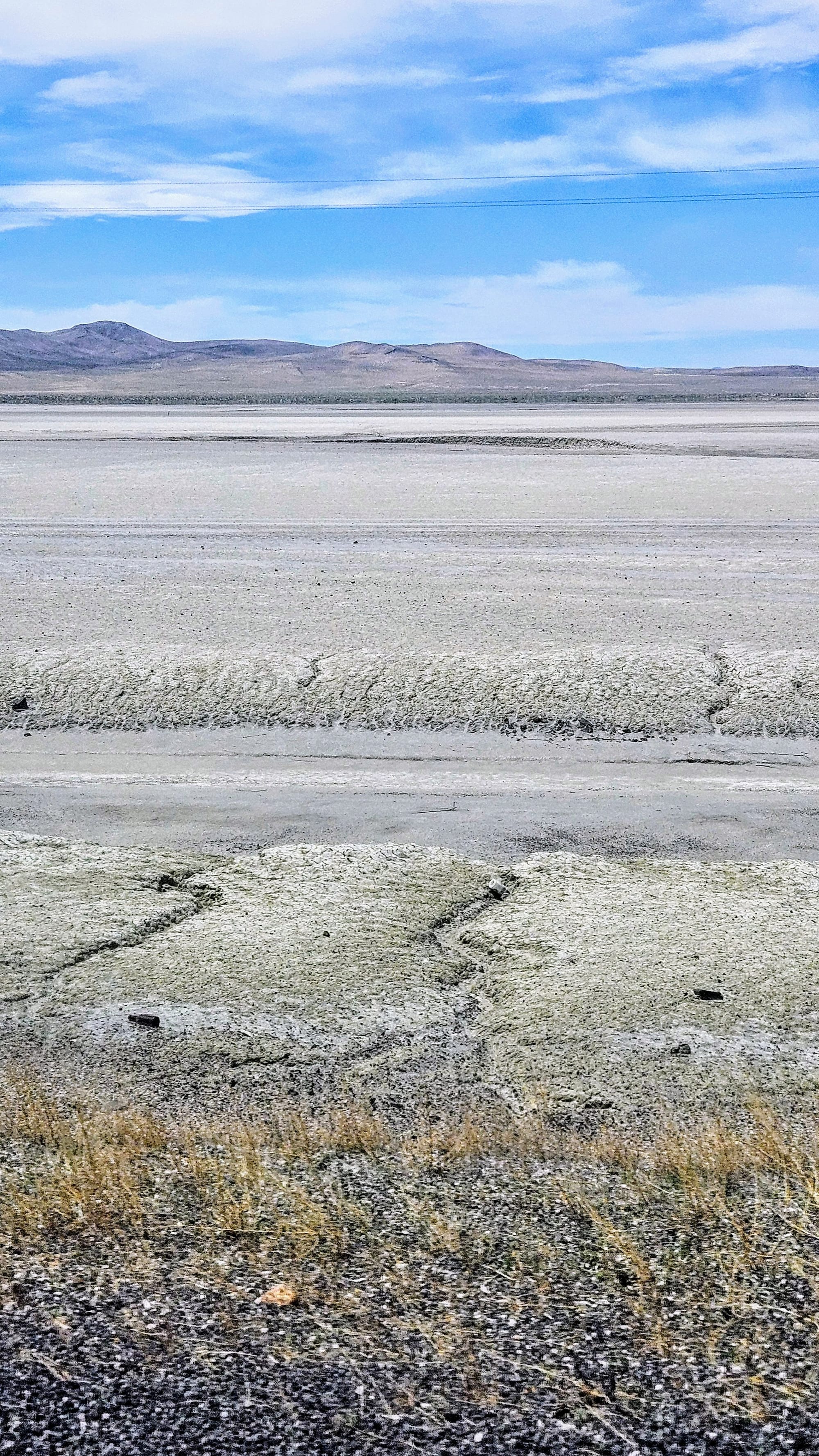
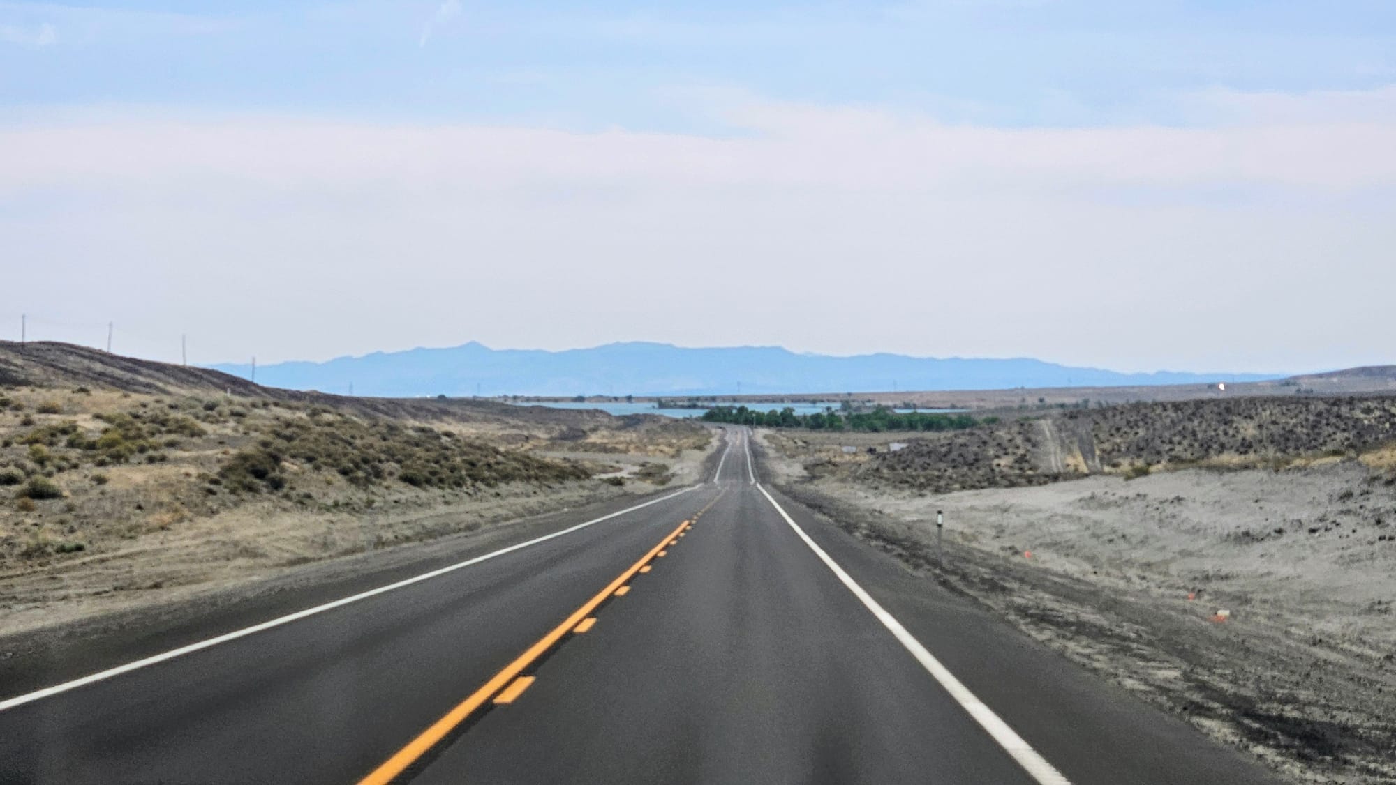
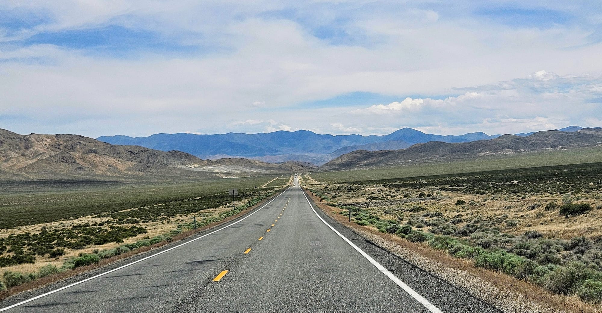
Once we ventured away from Fallon, we could feel the rural essence of the Loneliest Road. Even still, we had constant reminders that this title is a misnomer. We seldom had a moment where we couldn't see other vehicles on the horizon.
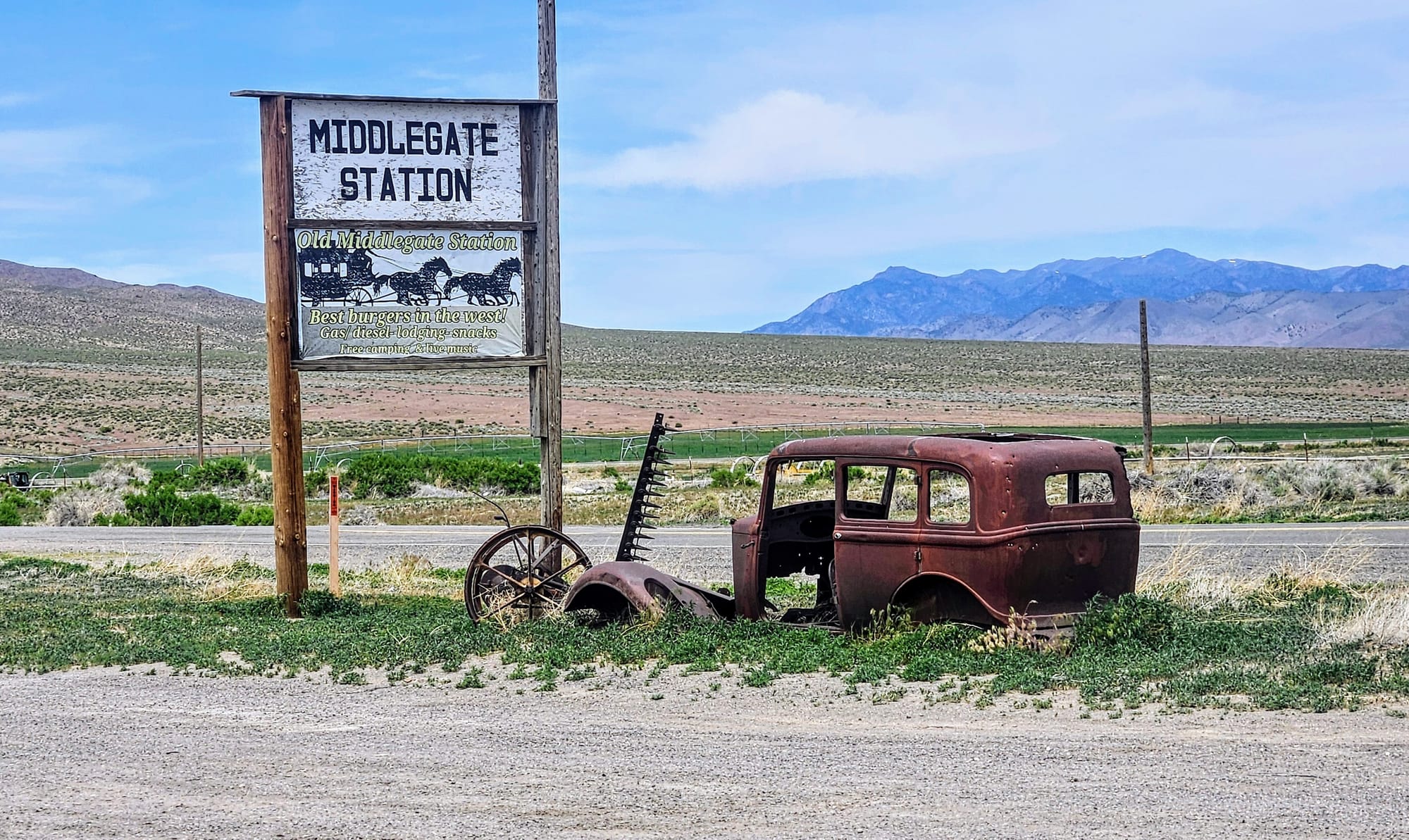
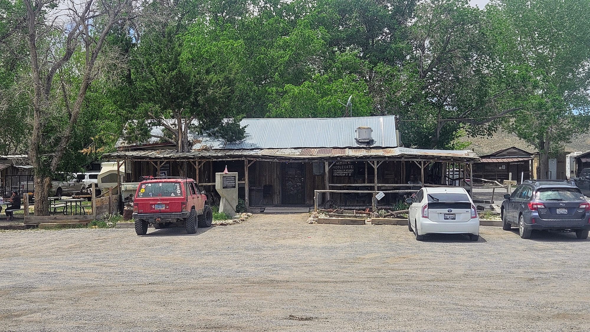
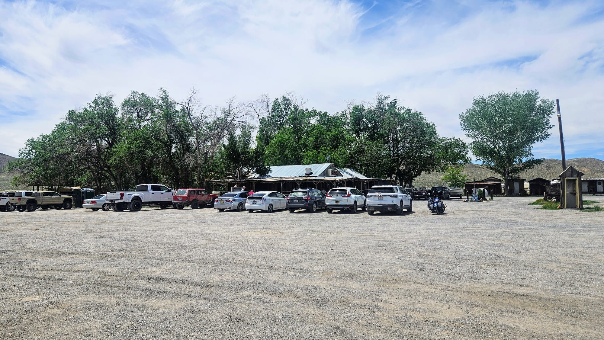
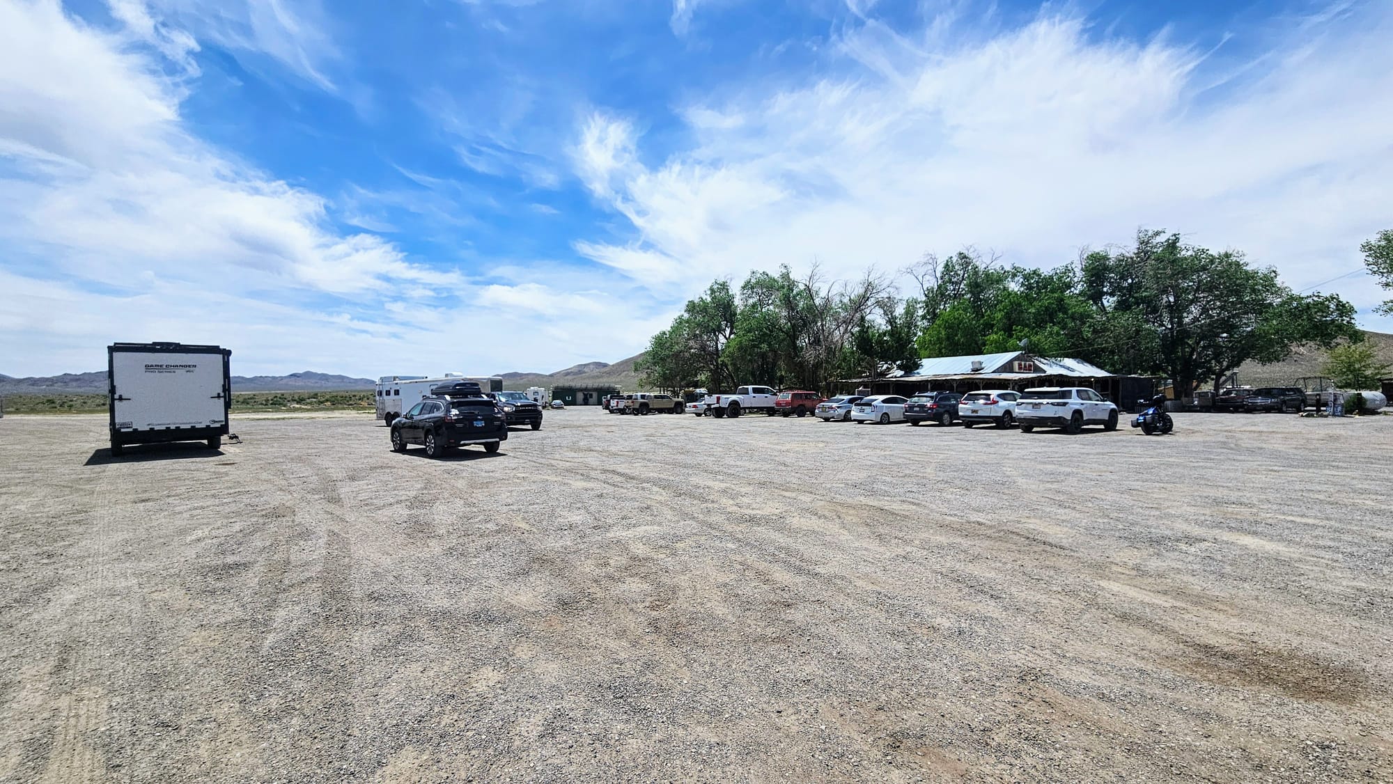
Stop 2: Middlegate Station
Middlegate Station is famous on the Loneliest Road. It's a bar and restaurant in the boonies, where weary travelers can stop for a bite, and RVers and truckers can hang their hats for the night. Middlegate Station boasts the "best burgers in the West" but is most known for their monster burger, a 4lb behemoth that comes with its own challenge: eat the whole thing and win a t-shirt! Or just get the monster burger because it's adorable, if you can bear to eat a cute face like this.
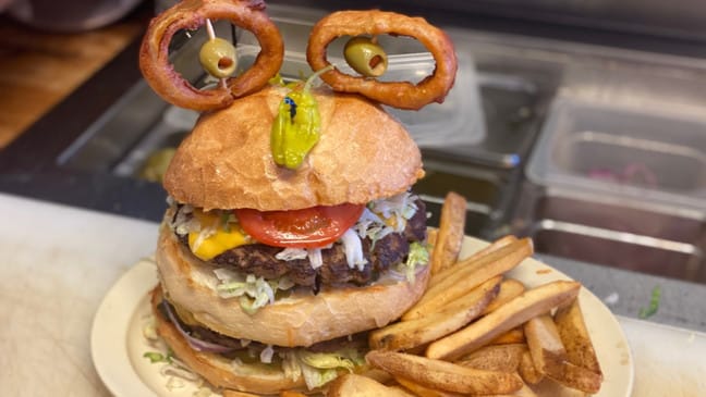
We were on the fence about stopping here, but as we approached the junction leading to the restaurant, we decided we were hungry enough to pop in for a bite. We had plenty of space to park the rig, despite the parking lot being fairly crowded. We went inside and found the least loneliest place on the entire Loneliest Road! The locals seemed to come out in droves that day for a Memorial Day drink, or 2, or 3. Almost every table was full and people were rowdy. We looked around to find staff to see if we could grab one of the outside tables, but we couldn't find anyone. We waited for a couple of minutes, but no one came over to us. And so we left, but not before getting jokingly ragged on by some drunk dude. We know we looked totally out of place.
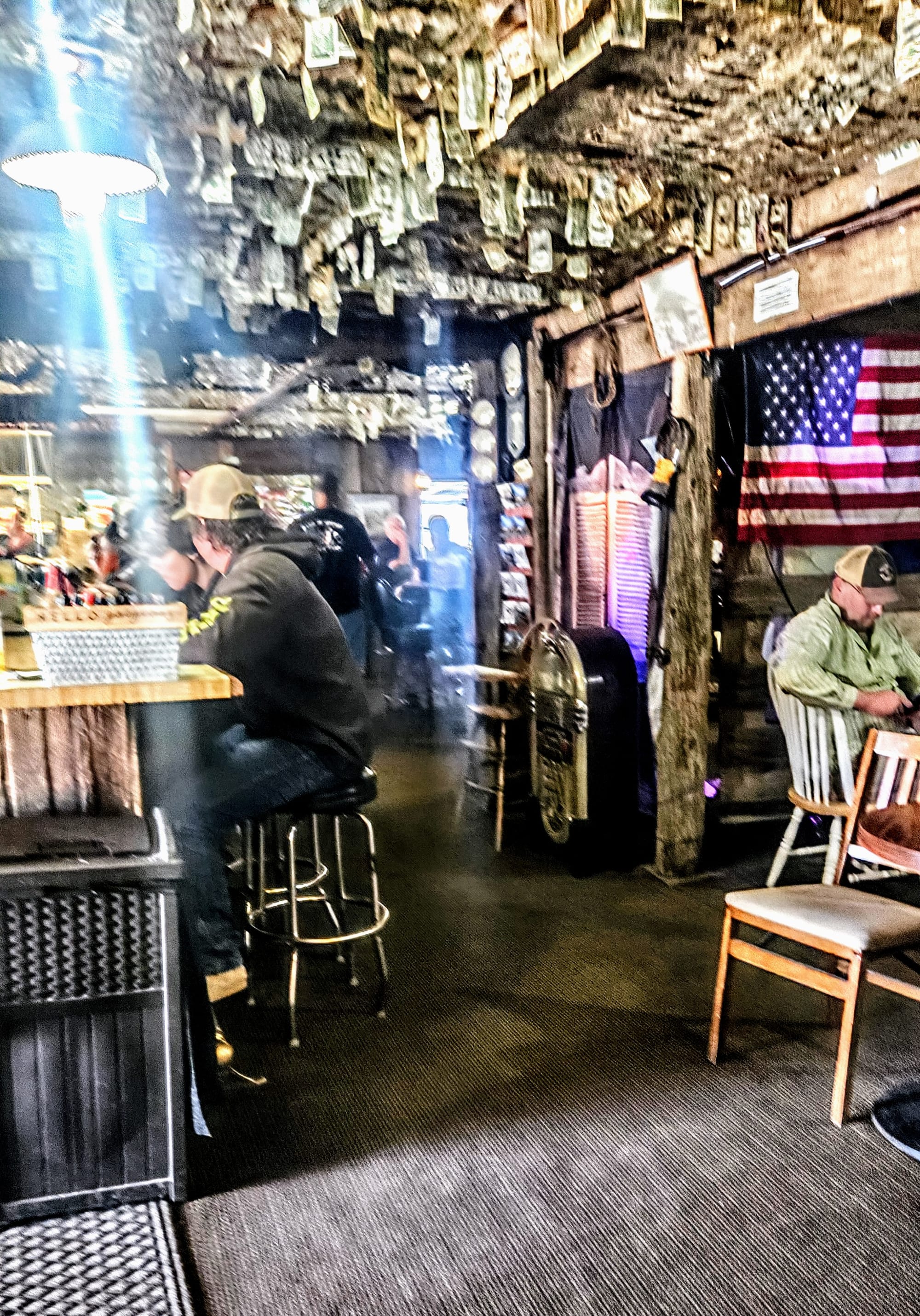
Inside pic is blurry because I snapped it quickly before someone else tried to be weird to us
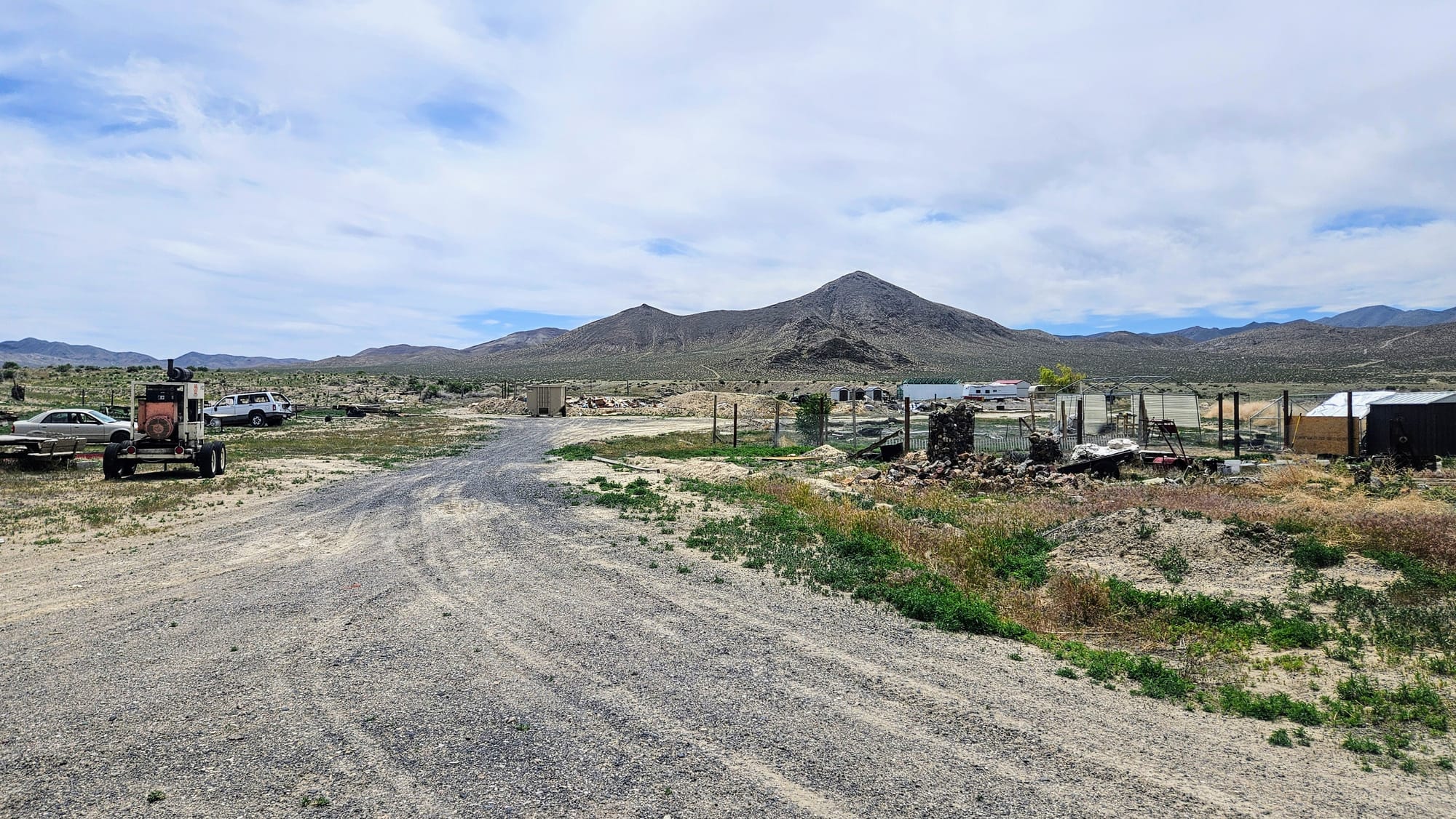
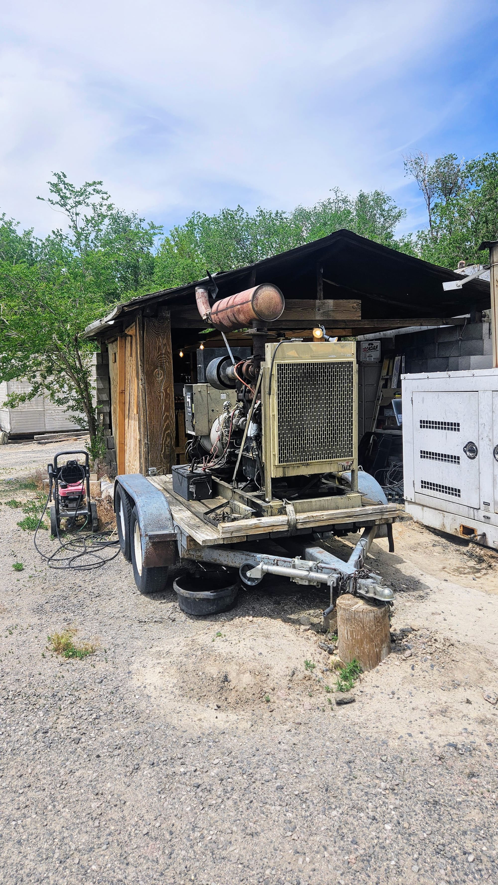
We imagine that on less busy days, this is just a little dive with nice staff and good food, but it just wasn't the vibe for us on this particular day. We made lunch inside the rig, and afterwards decided to walk behind the restaurant where there is a "campground." We knew about the overnight parking but didn't know about any official RV campground. It's more just a handful of stationary RVs and mobile homes. Overnighters stay in the parking lot, where many campers complain that the restaurant generator is too loud to get a good night's sleep. We walked right by it and it was loud, but we could hardly hear it from where we parked our rig. We were more turned off by the numerous junk piles and the wafting stench of fecal matter next to the generator. Glad to not be spending the night, we got back in the truck and headed a couple miles up the road to the Shoe Tree.
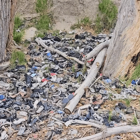
Stop 3: The Shoe Tree
Legend has it that one evening, two newlyweds were camping beneath a large cottonwood tree, when they got into an argument. The wife threatened to walk away, to which her husband replied, "If you want to walk, then you'll have to walk barefoot." He proceeded to throw her shoes into the tree and then drove away to a nearby bar. After telling the bartender his story, the bartender advised the husband to go back to his wife. He obliged. He returned to the tree, and his wife was still there. They made up and lived happily ever after. Years later, they returned to the tree with their first child, so he too could throw a pair of shoes up into the tree. Since then, the tree has become a resting place for old shoes, and to some, a symbol of marriage and fertility.
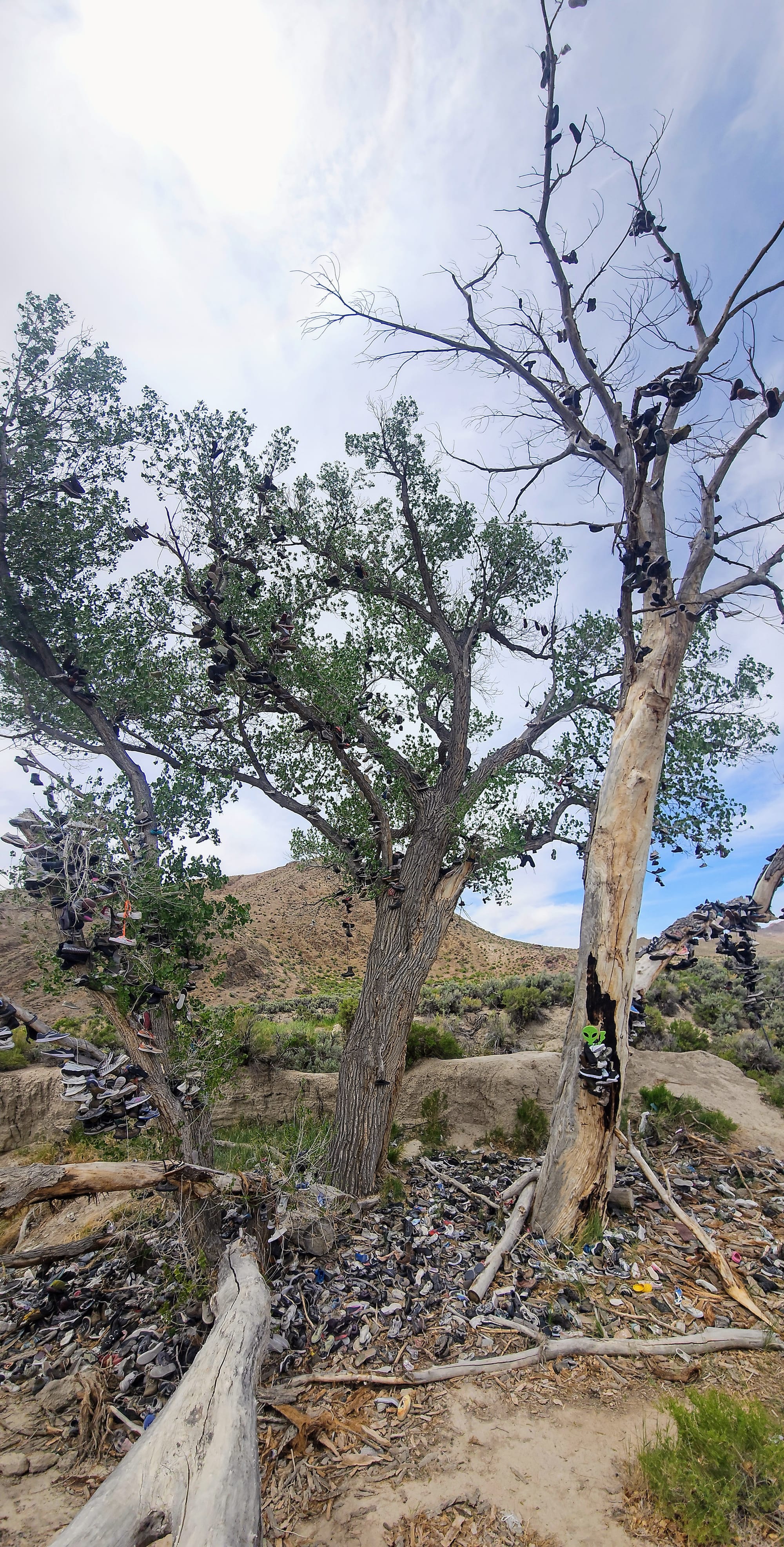
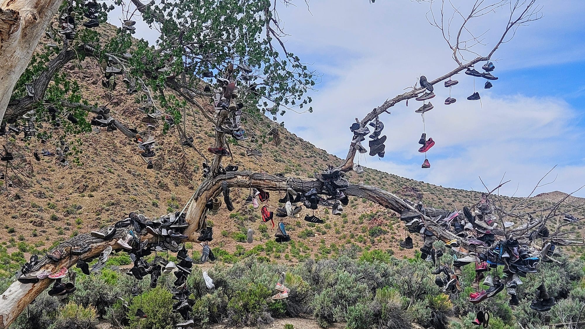
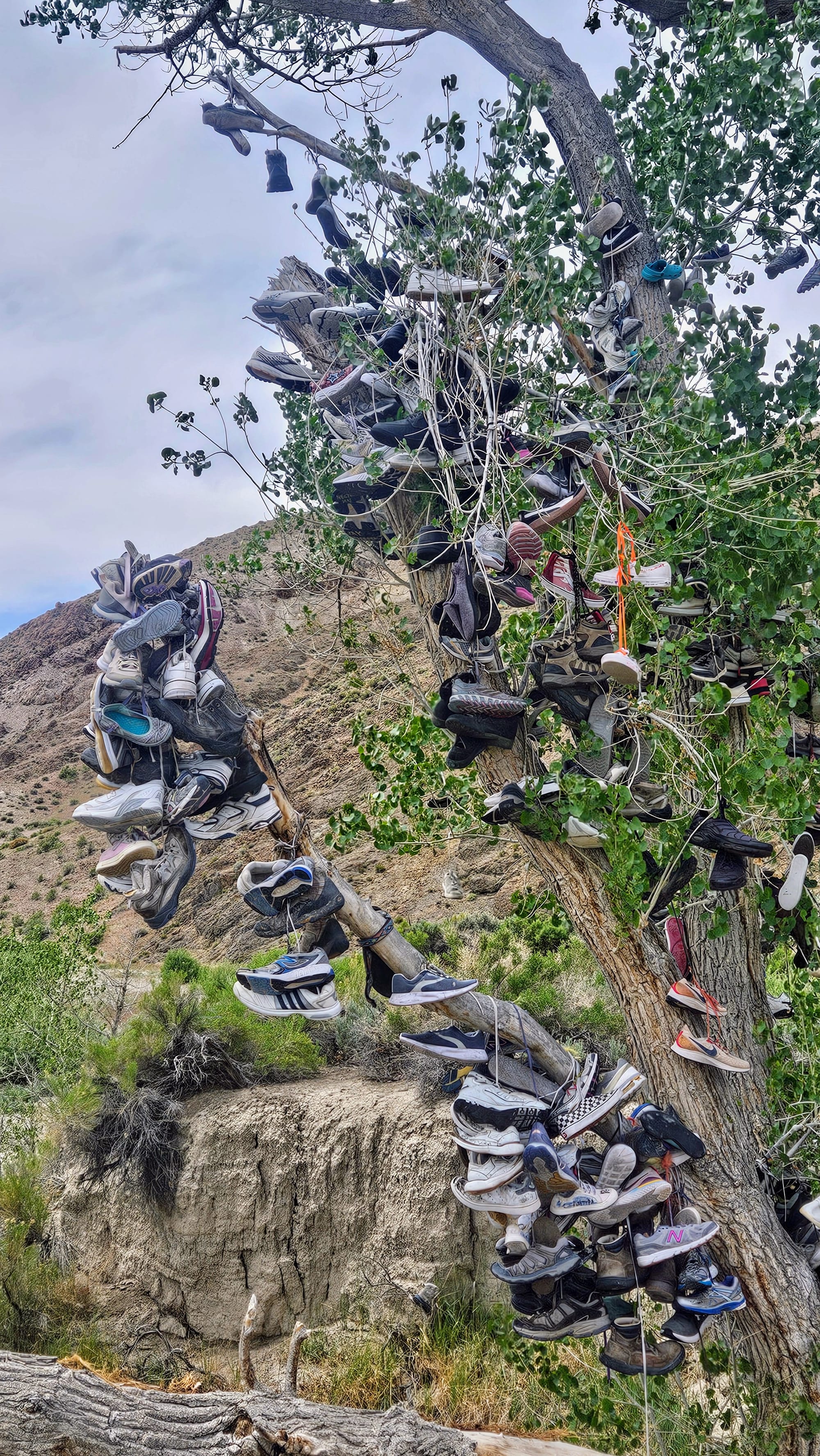
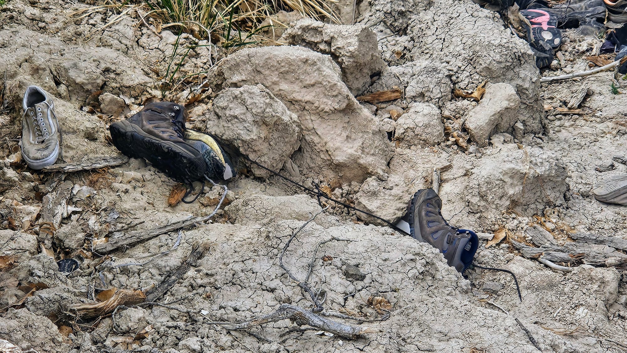
Unfortunately, the original tree was cut down by vandals in 2010, but visitors continue to adorn the nearby trees, and we went to add to the spectacle. We each had a pair of shoes that we would soon be getting rid of, and so we gave them new life among hundreds of their sole-mates.
My shoes didn't have laces, so I had no choice but to send them down into the pile on the ground. I convinced Anthony to try and throw his hiking boots over one of the branches, but throwing isn't exactly Anthony's strong suit. He got close, though!
It was certainly a quirky stop, but as we've said many times before, we enjoy a quirky roadside attraction. We just typically prefer one that smells a little less like feet. That aside, we felt proud to now have "ties" to this community.
After that, our sights were set on reaching Austin. We had been on the road for 6 hours and needed to get gas and find a campsite for the night. So far, we had chosen to stop at places that were an easy fit for our RV, but all that was about to change.
To be continued.