The Utah Redemption Tour: Hoodoo's There?!


I try to get into 2019 Nicole's mindset, planning this epic roadtrip that would cover so many of America's greatest wonders. I remember that when planning our itineraries for the Mighty 5, Bryce Canyon in particular called out to me. The photos are just extraordinary, of a very landscape that makes you wonder, "How did Earth create this?" I've always loved weird and unique destinations, but this place was weird, unique, and stunningly beautiful. The anticipation for visiting this national park grew. This would surely be a place that photos just don't do justice.
We're lucky to have technology at our fingertips when planning trips, but I can only imagine what people used to think arriving to a place like Bryce Canyon having little-to-no expectation of what they would see. We don't even have to go far back in history, to the first explorers who came across this landscape, though that must have been an unbelievable moment. But even just pre-internet days, where we would buy or borrow a few books and see a limited number of photos. I'm a diligent planner, probably borderline obsessive, so by the time we arrived to Bryce, we were fairly well-versed in what to expect.
Even still, as predicted, photos do not do this place justice. We've traveled a lot and seen a lot of incredible places, but very few have the reaction we witnessed at Bryce. Whether taking a hike or standing at an overlook, people would come upon the canyon for the first time, pause to take it in and say "Oh my God." Honestly, the only other time we saw this awe-inspired of a reaction by so many people was at the Grand Canyon.
The Geology
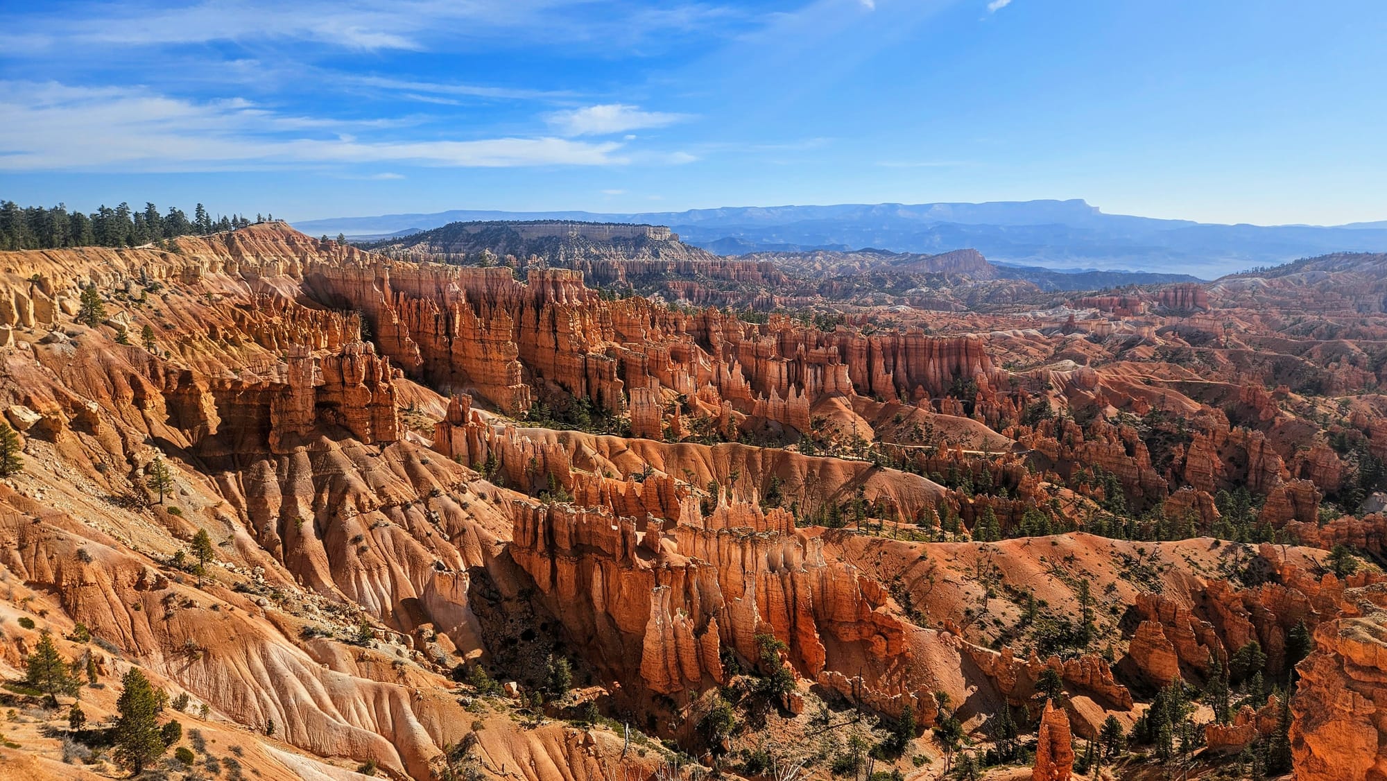
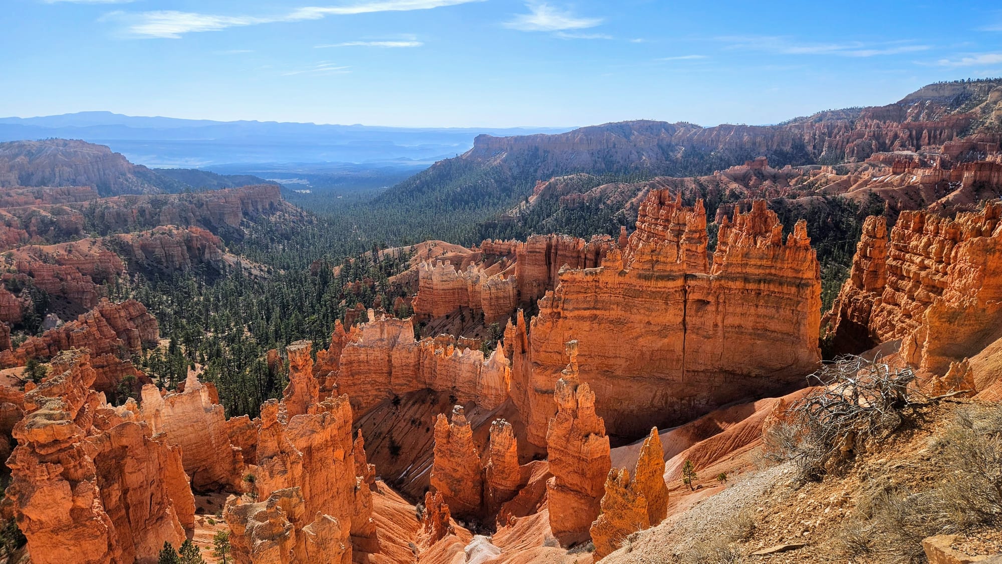
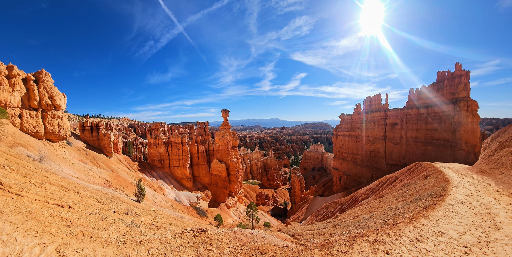
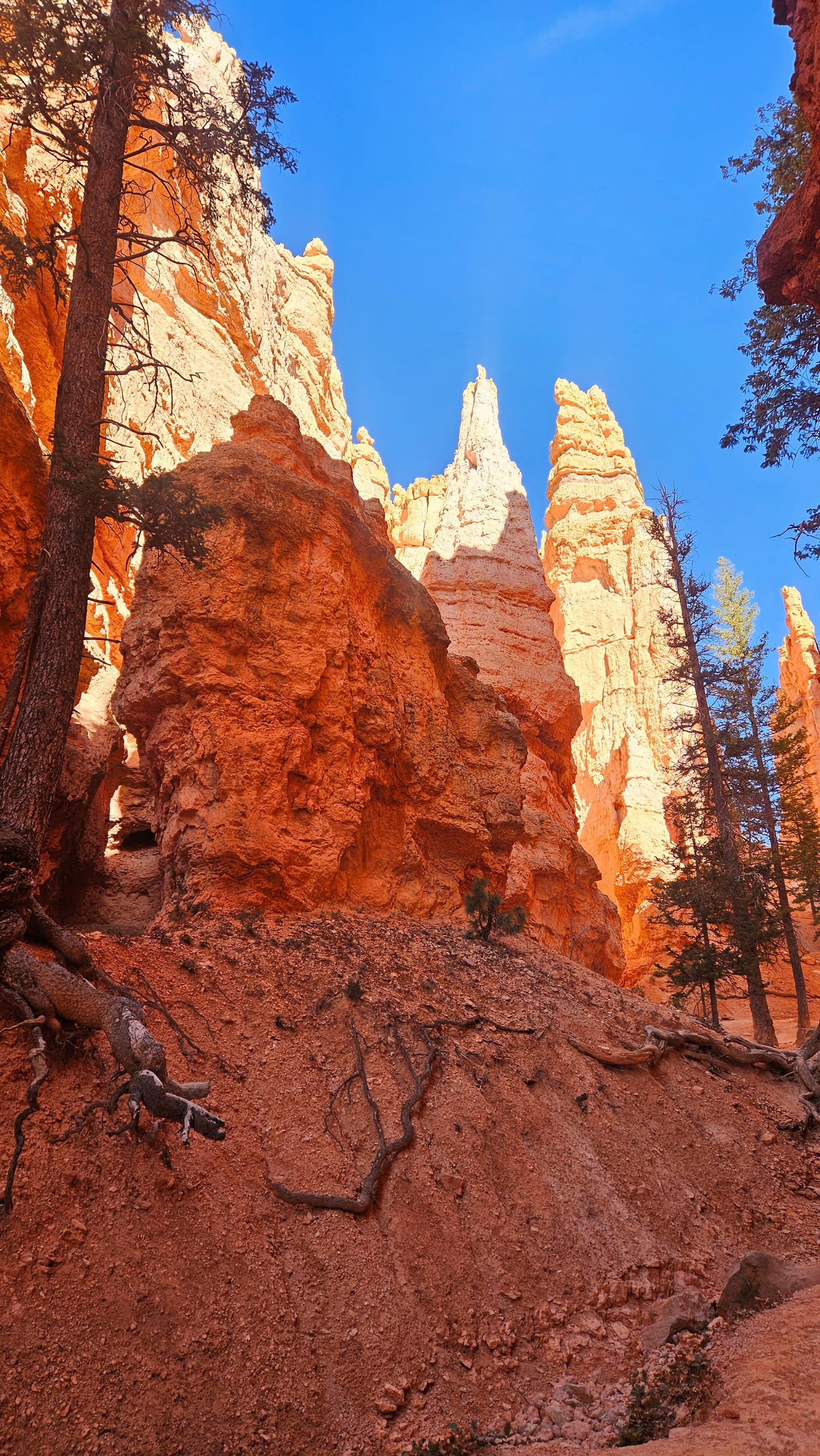
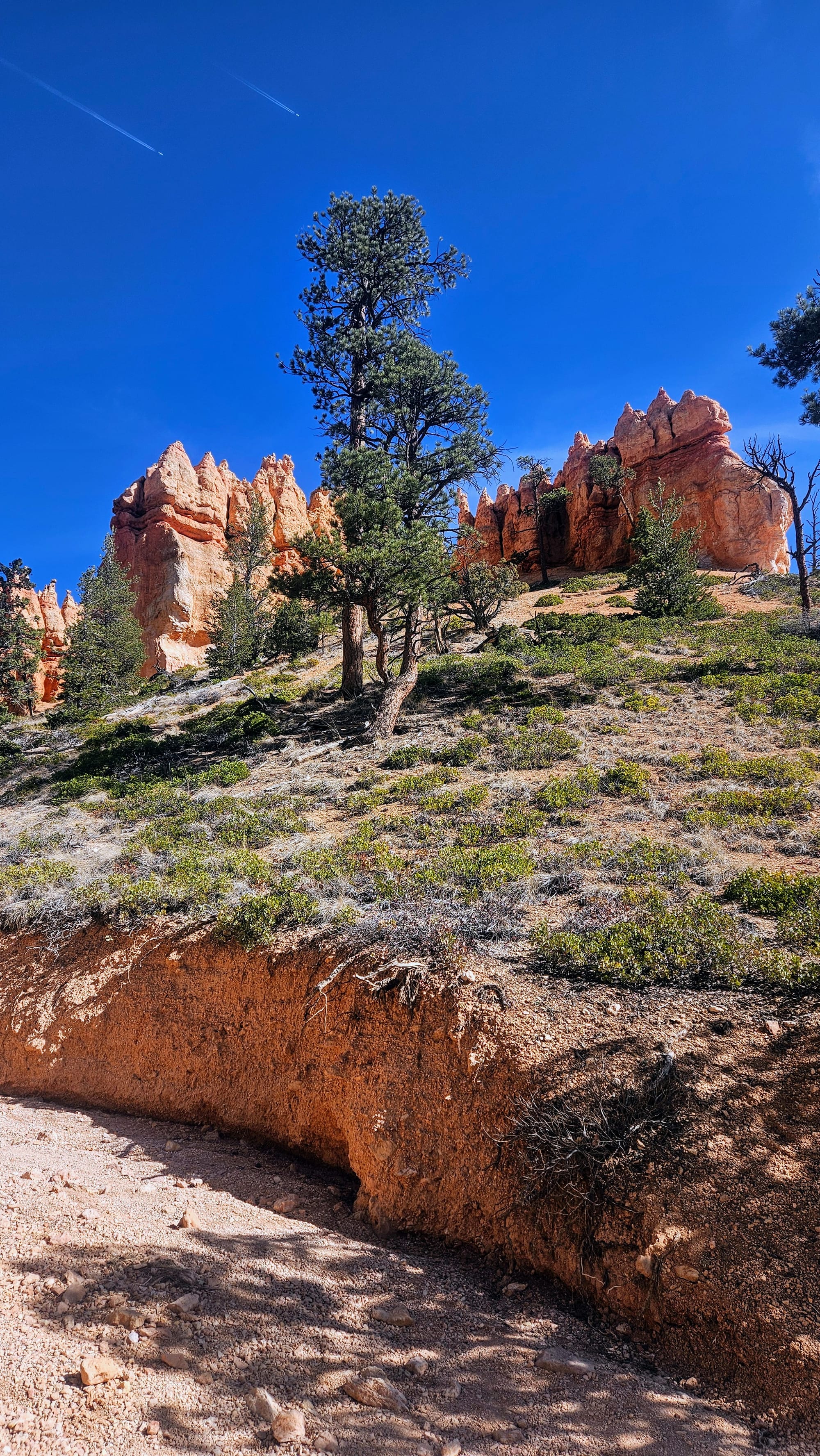
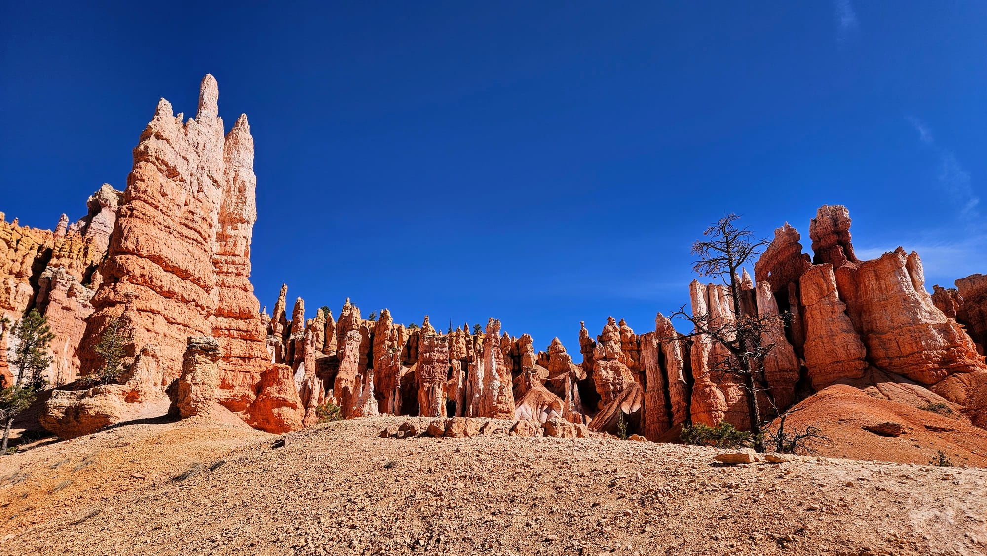
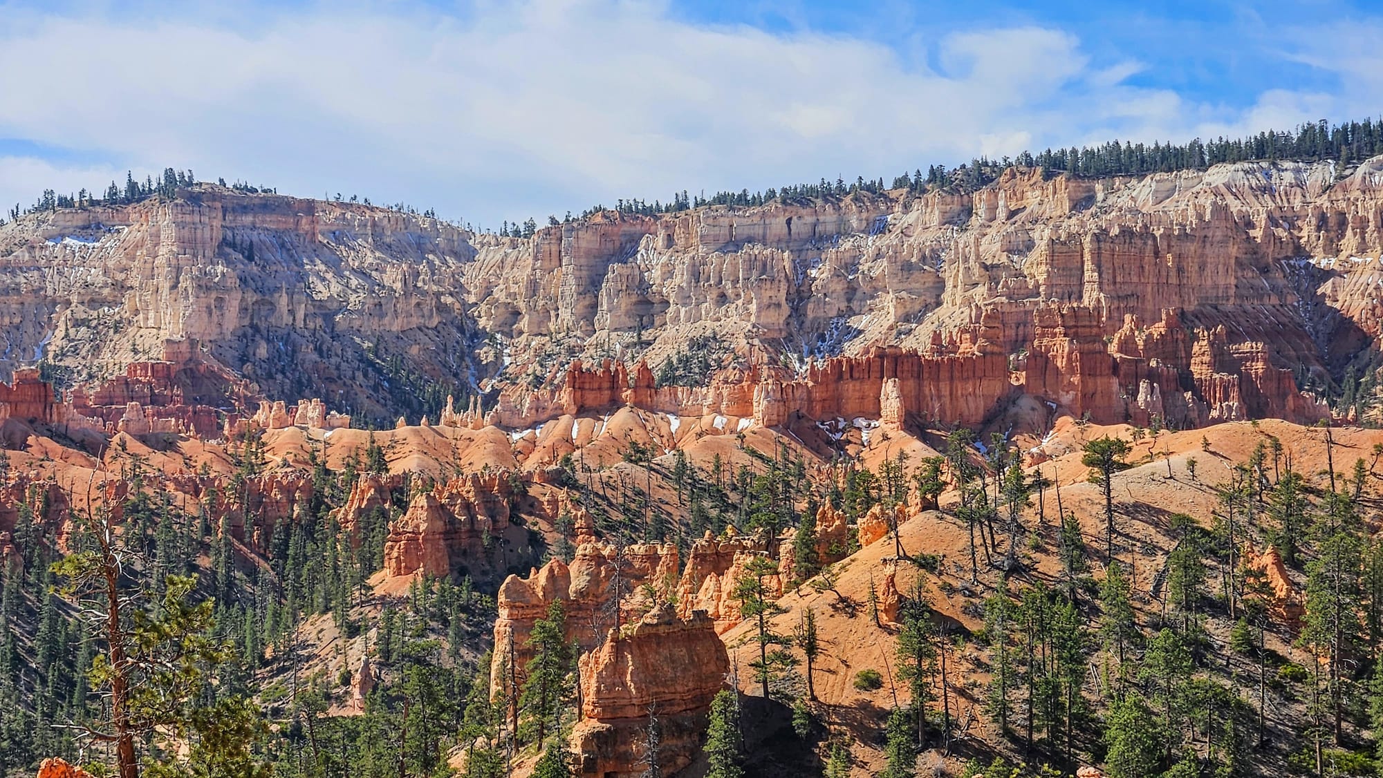
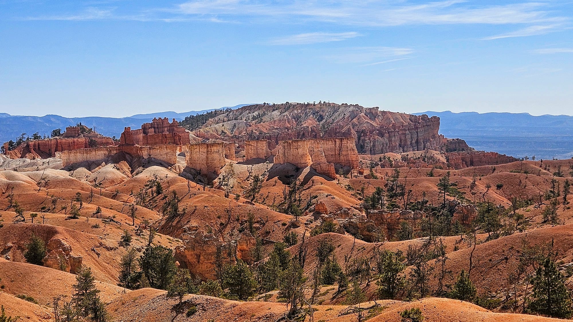
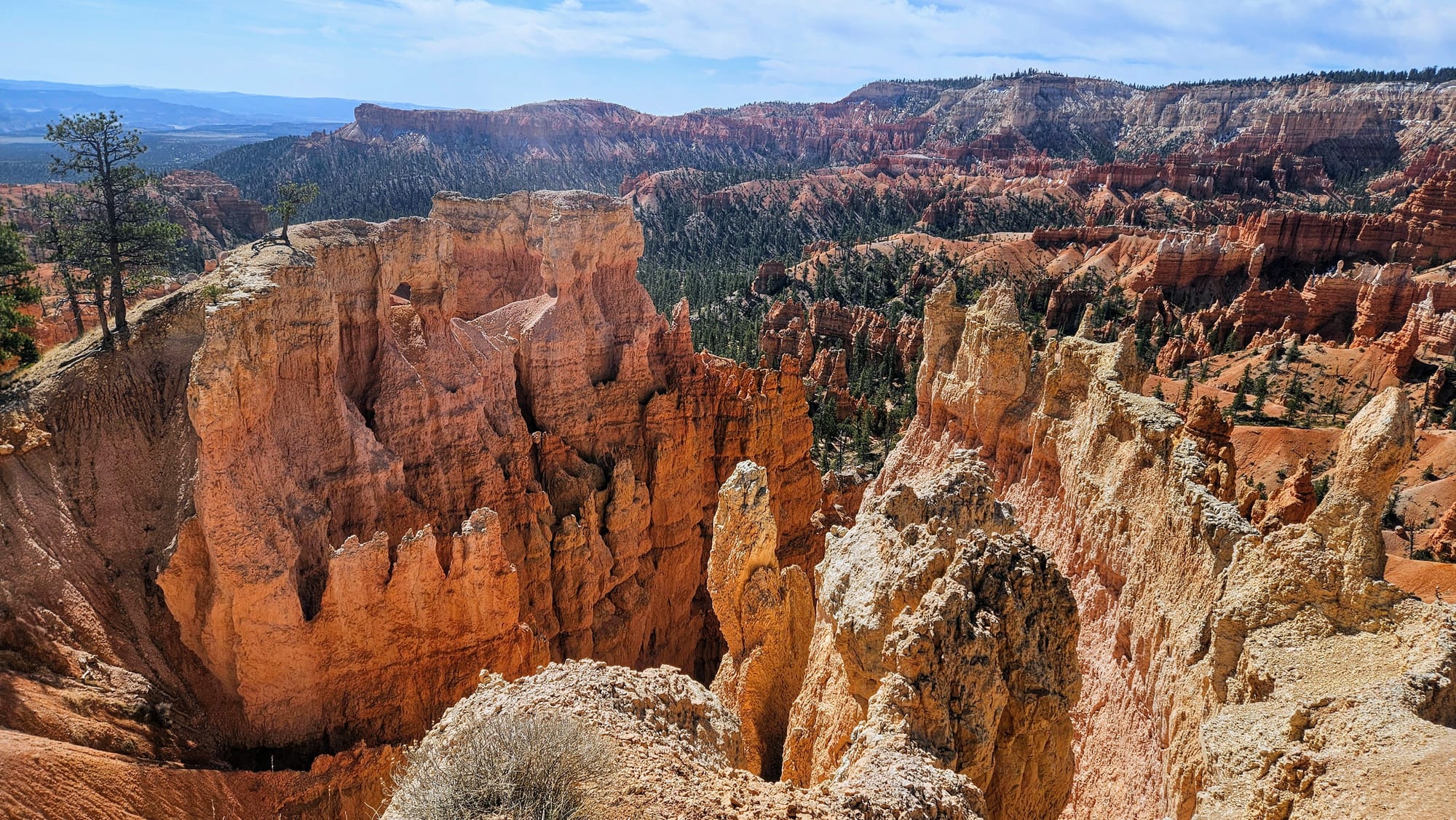
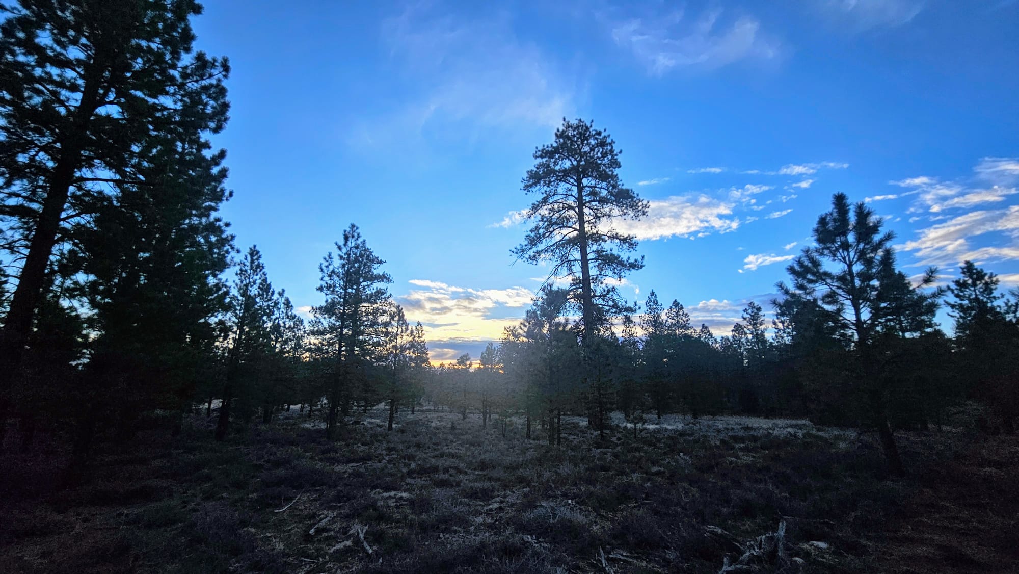
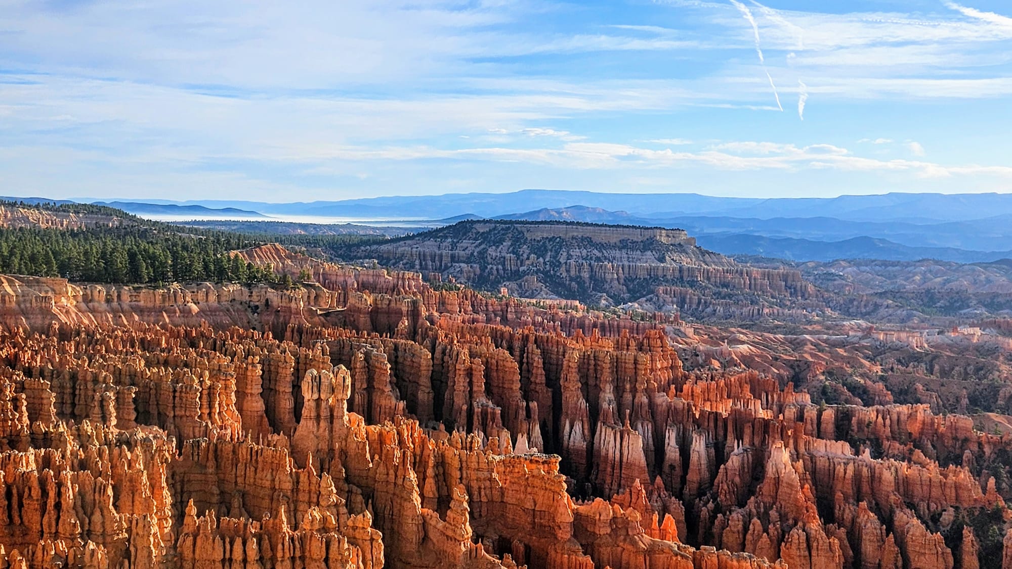
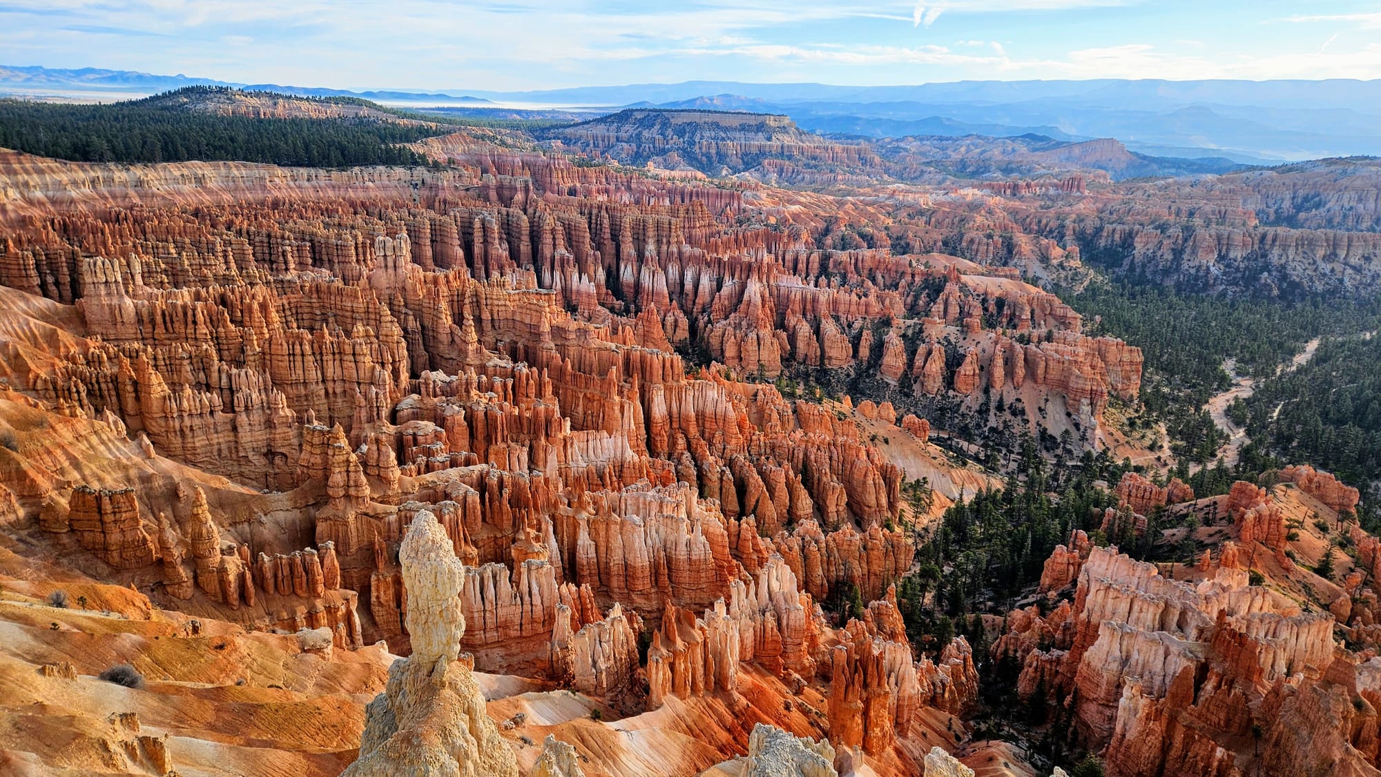
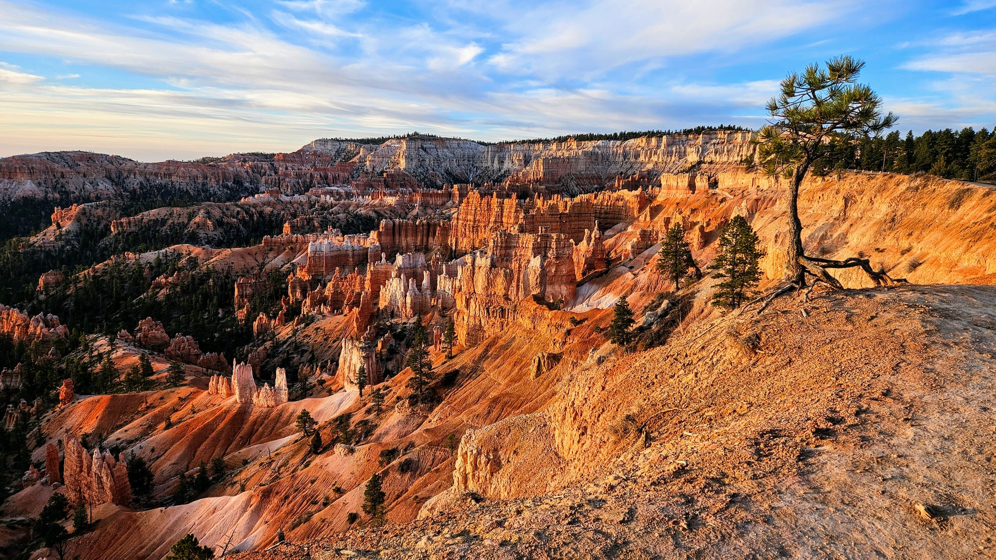
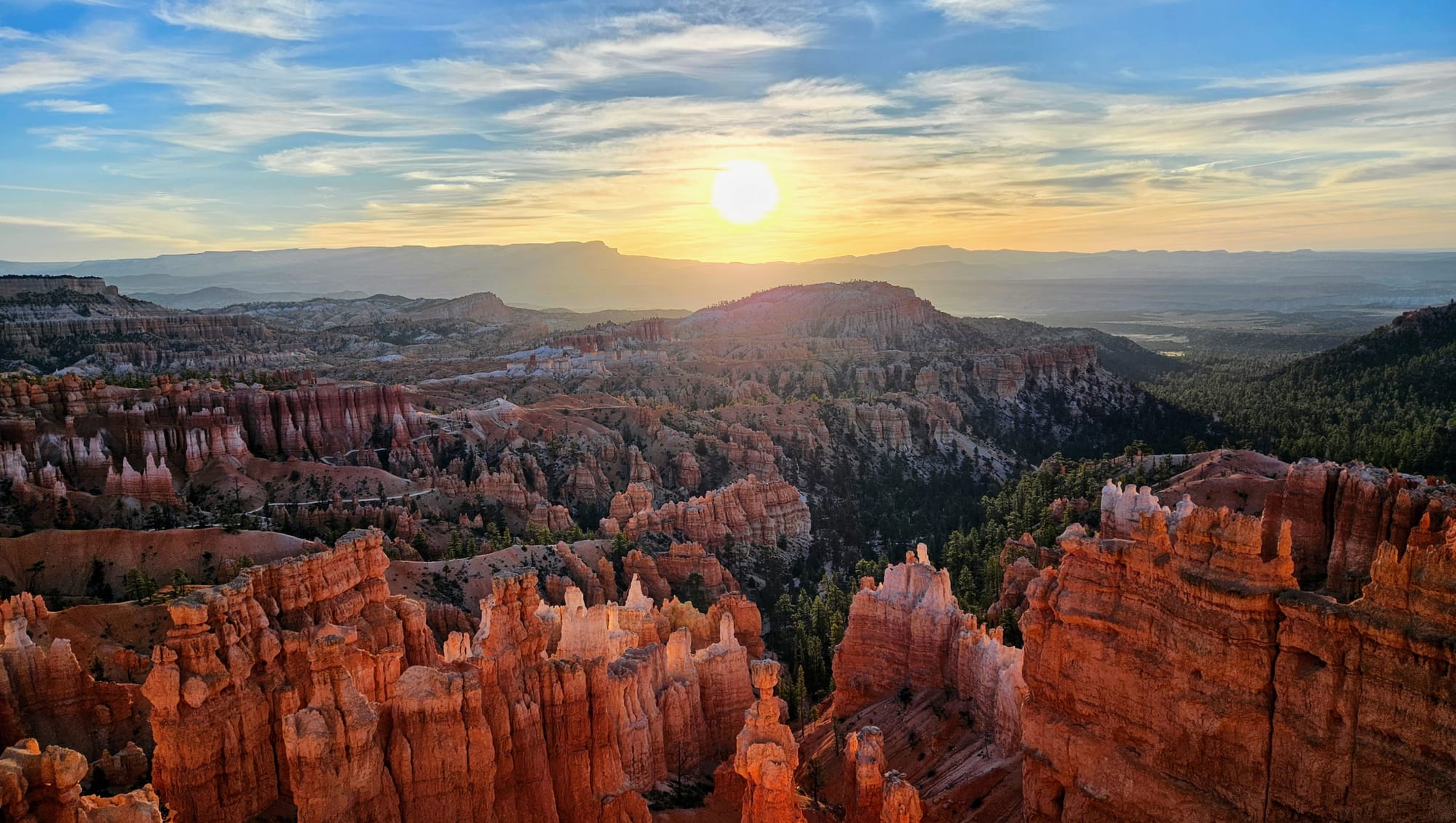
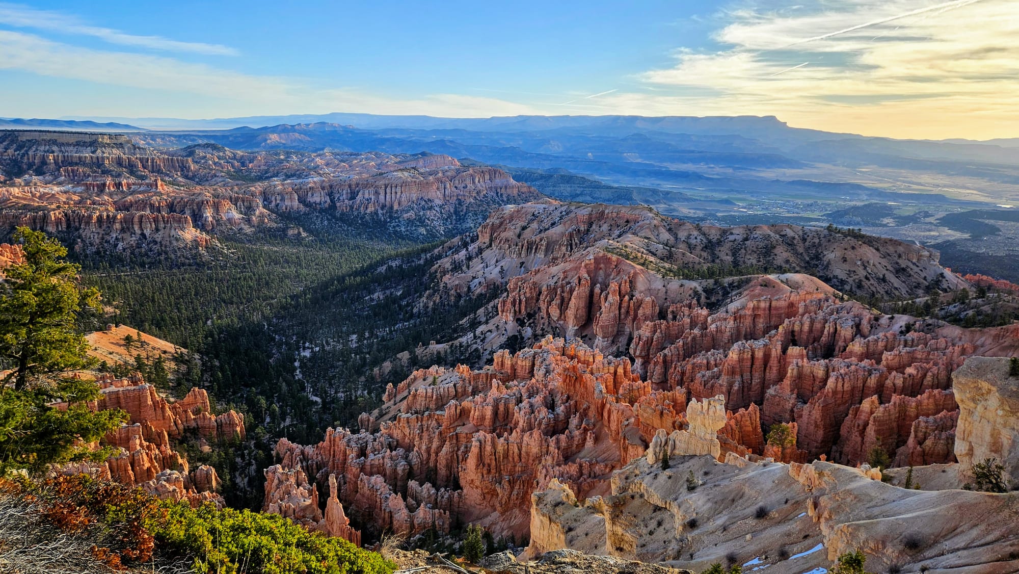
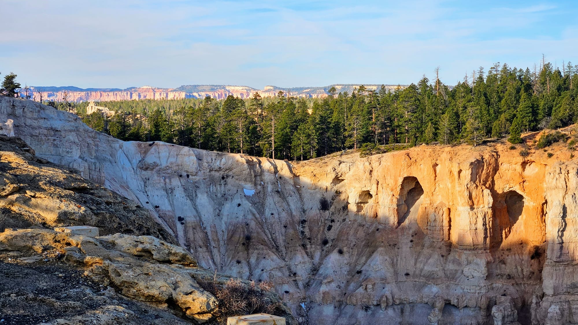
Despite its name, Bryce Canyon isn't actually a canyon at all. It's a series of bowl-shaped natural amphitheaters, made up of rock formations called hoodoos. Hoodoos are spires that have formed over time from frost wedging: erosion due to water and wind, plus the freezing and thawing cycles of the surrounding environment. Sounds familiar, doesn't it? So then how to these hoodoos look so different from the ones at, say, Goblin Valley? Bryce Canyon is higher in elevation and in a completely different climate. Notice the pine trees in the photo above? Evergreen forests can survive here! Melting snow, ice, and summer rains carve these pinnacles into their spikey looking shapes. Bryce Canyon has the largest concentration of hoodoos in the world. The term "canyon" stems from the rainwater that falls into the amphitheaters, gathering into the Bryce Creek, which eventually flows into the nearby Paria and Colorado Rivers. However, unlike a typical canyon, the flowing waters below are not responsible for carving through these mesas and plateaus.
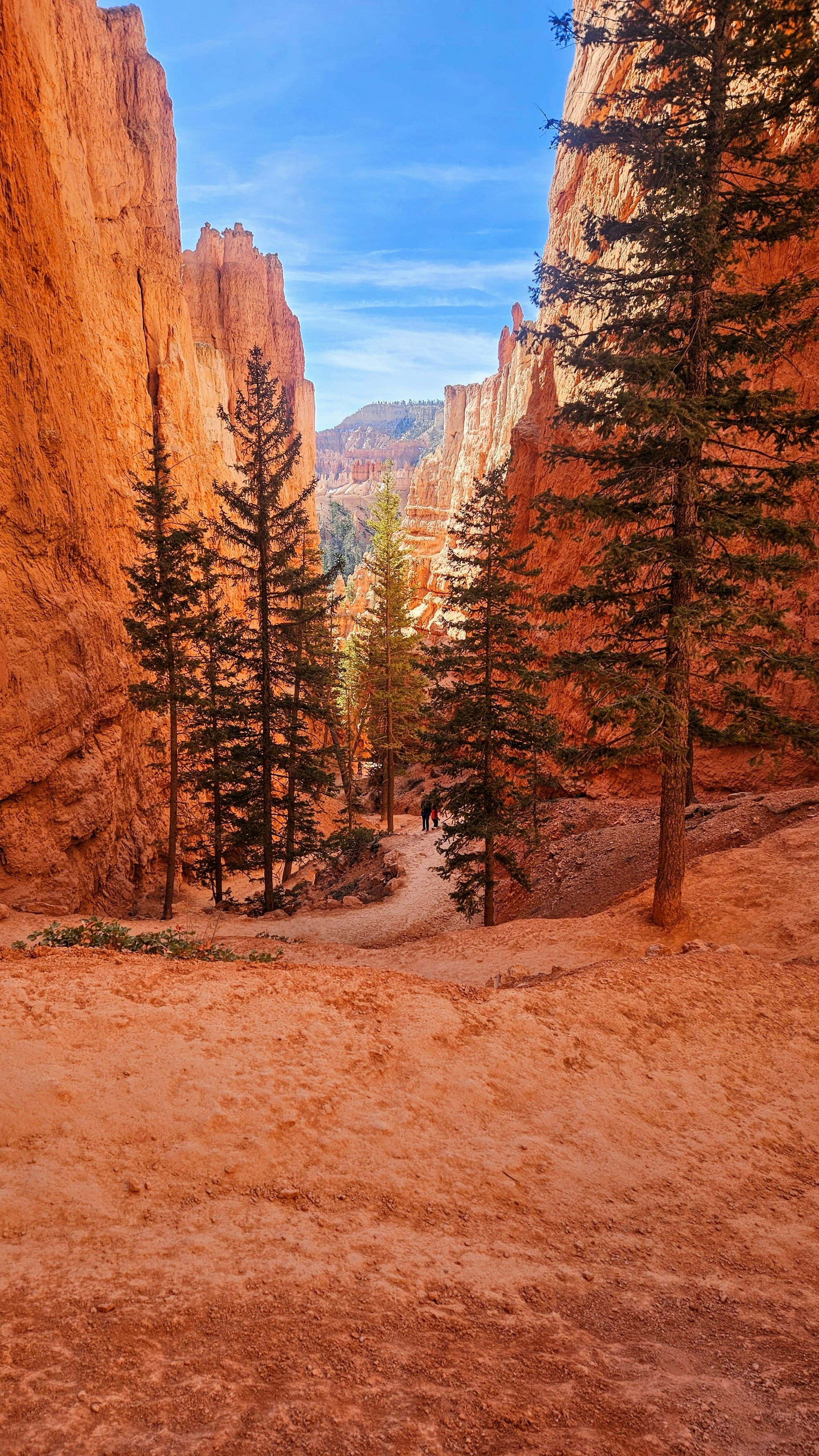
We can't explain how wonderful it felt to be back underneath pine tree canopies. It had been months! The air felt different and we could smell the piney aroma. Our associations with evergreens run deep, reminding us of home and of so many places that have become an important part of our travels, like Glacier, Yellowstone, and the Grand Canyon.
The Campground
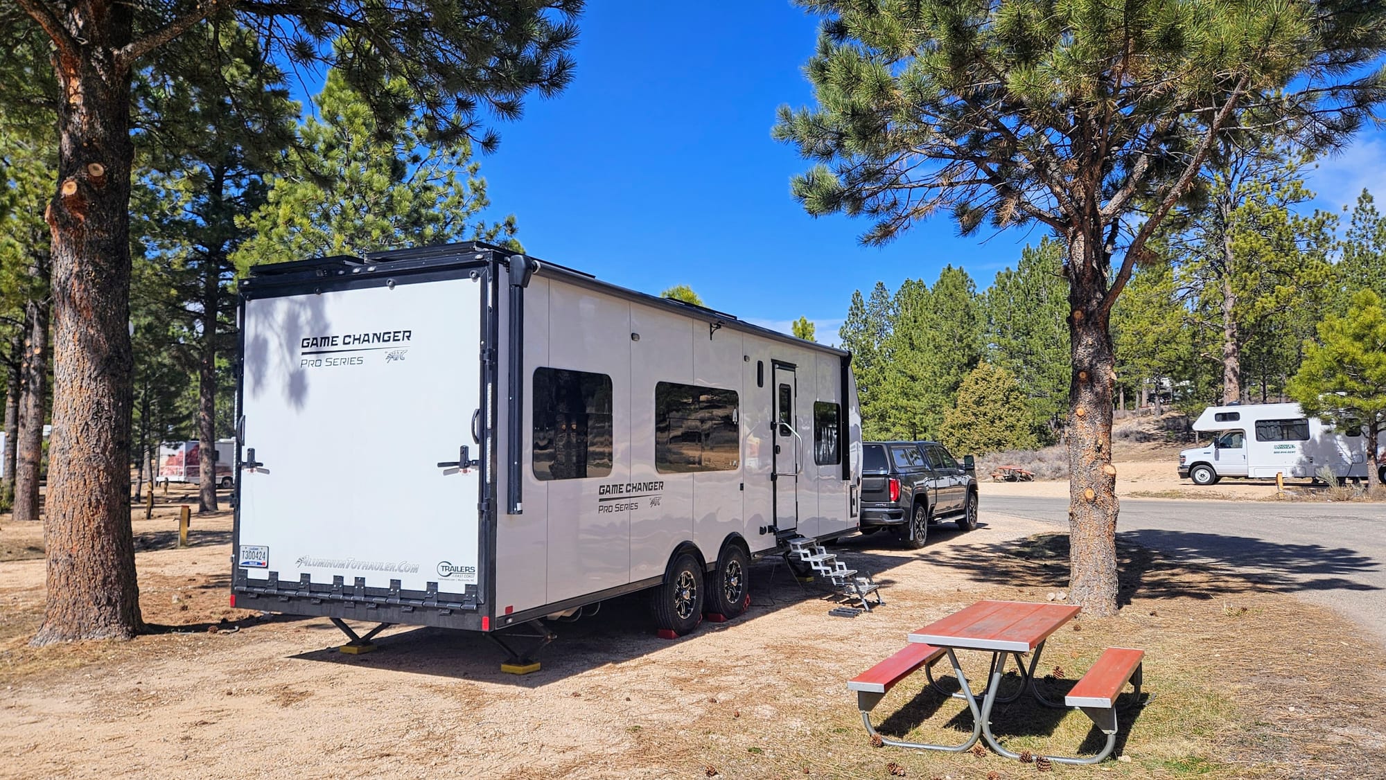
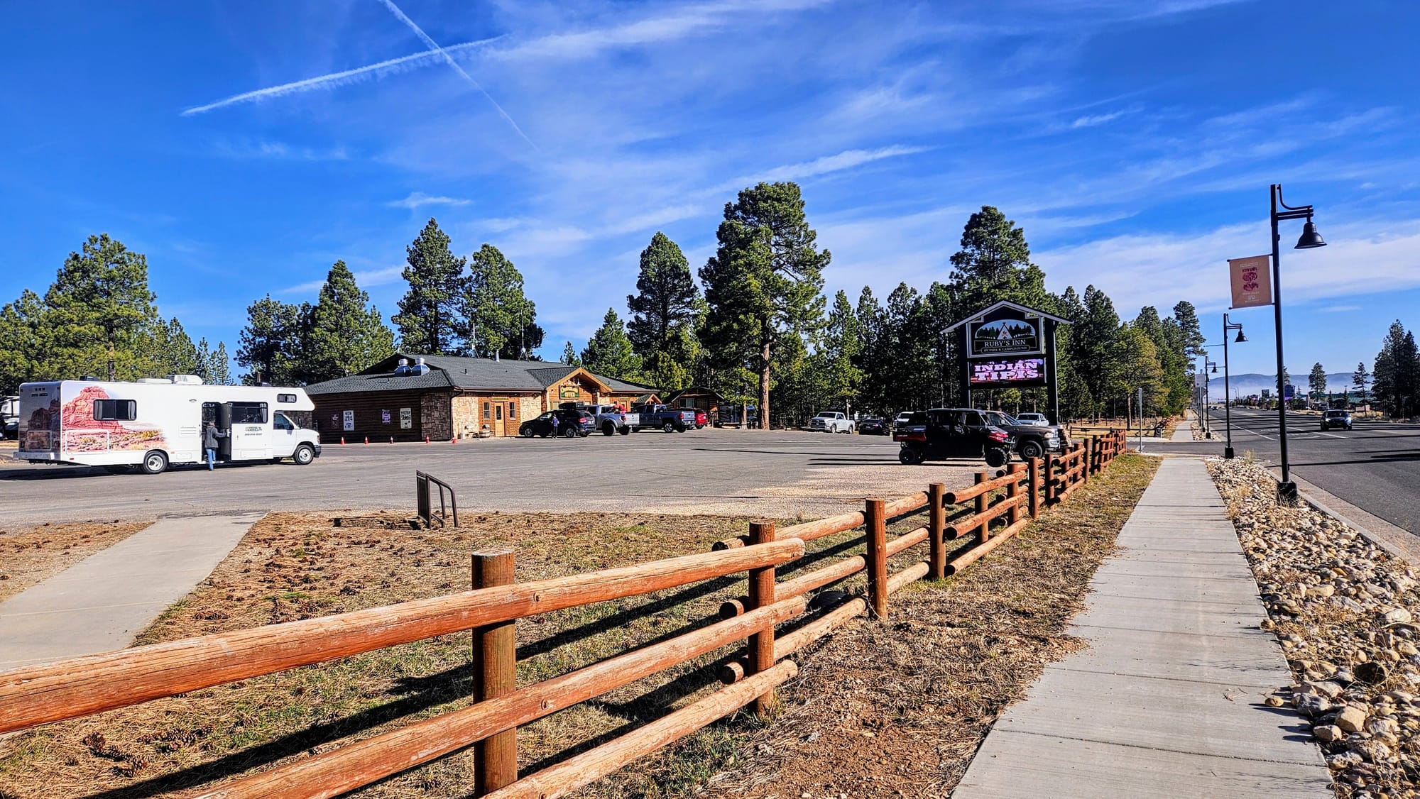
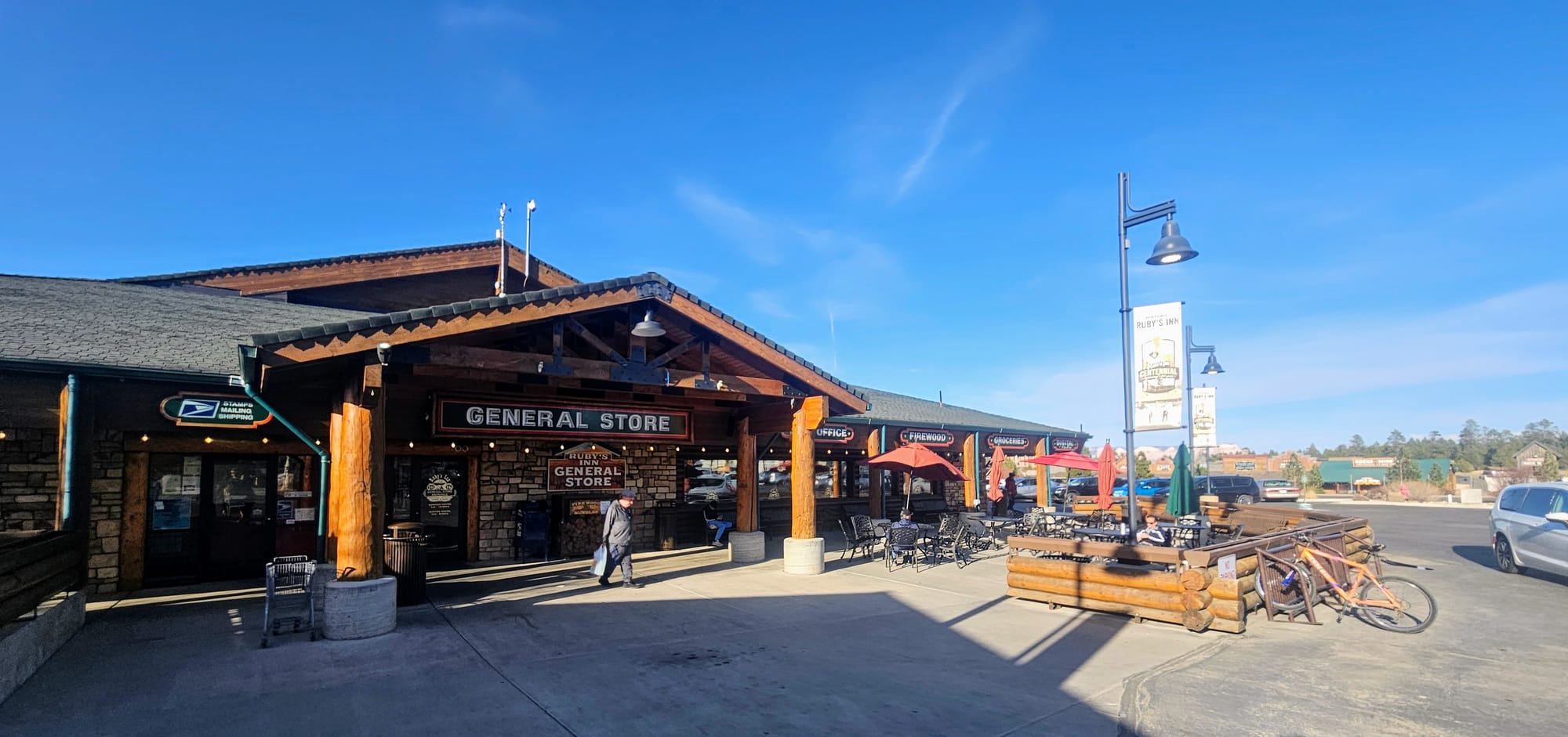
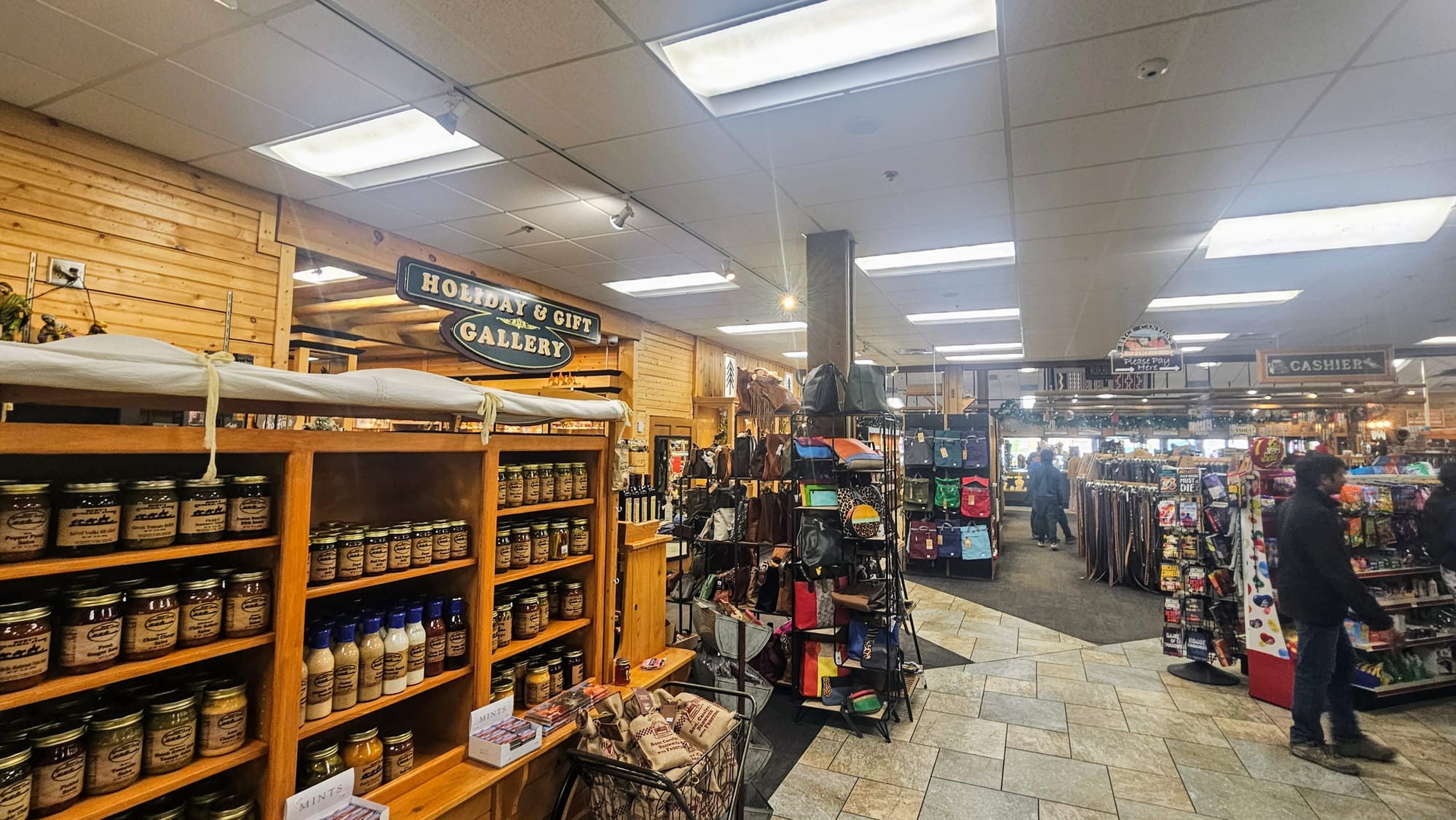
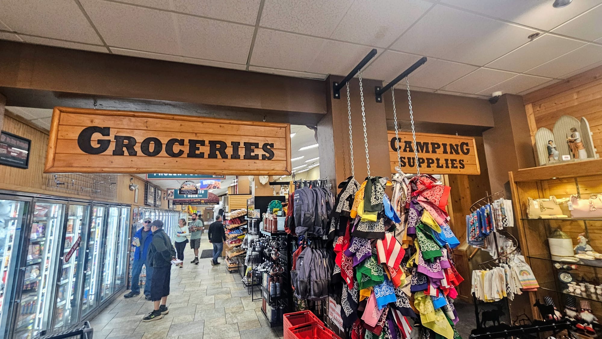
We stayed at Ruby's Inn RV Park and Campground, making this our only full hookup RV park stay in our entire redemption tour. We couldn't have picked a better home-base for our Bryce Canyon adventures. The campground was right in downtown Bryce Canyon City. Scratch that. The campground was Bryce Canyon City. Turns out, the family that owns the campground owns pretty much every other place in this area. Beyond the inn and campground, there is a gas station/car wash/auto shop, plus lots of stores and attractions. The general store is the go-to stop for all things souvenir, grocery, art, and clothing/accessories. It reminded us of a mini Wall Drug. Across the street are more shops, including a rock shop and ice cream stand. There are restaurants, a dinner show, and a rodeo. We came in the off-season, so many attractions were still closed for winter. This was the big trade-off. We would have loved to spend more time exploring Bryce Canyon City, seeing a rodeo and then taking a horse-drawn wagon ride into the national park, but instead we had less crowds. The campground was never close to full, but it was respectably crowded. Definitely one of those places where we felt like the only people not on vacation. That's always fun, coming off like the curmudgeons who stay tucked inside their rig all day, only to emerge for a couple hours, go to the park, and come straight back just to be hermits again.
The campground also wasn't fully functioning yet. The pool wasn't open, but campers were allowed to use the one at the inn. The dump station and office bathrooms were also closed, but there were plenty of bathhouses and a dump station across the street at the gas station.
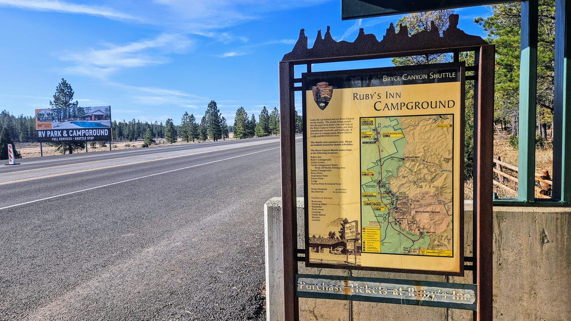
What we cared about most, this campground had: A fantastic laundry room, a good amount of space in our site, plenty of places to walk, and the pièce de résistance, a Bryce Canyon shuttle stop right out front.
When we checked in, we were given a large informational catalog that showed all of the shops, restaurants, and attractions in the area, as well as the history of Ruby's Inn. Reuben "Ruby" Syrett and his wife Minnie had dreams of owning a ranch, and so in 1916 they bought land and moved them and their children out to the plateau. Six weeks later, a visitor asked them if they had ever seen Bryce, but they hadn't traveled out that way yet. They inquired what it was, and the visitor responded, "Just a hole in the ground." Now imagine seeing Bryce Canyon after only this amount of information! Of course, when Ruby and Minnie ventured over to see this "hole," they were left speechless by its beauty and grandeur. Eventually, the couple built a lodge at Bryce, but they ended up agreeing to give it up to the NPS when Bryce became a national park site. However, they missed their life of hospitality and decided to build a new inn outside the park. Ownership of Ruby's Inn has remained in the family to this day.
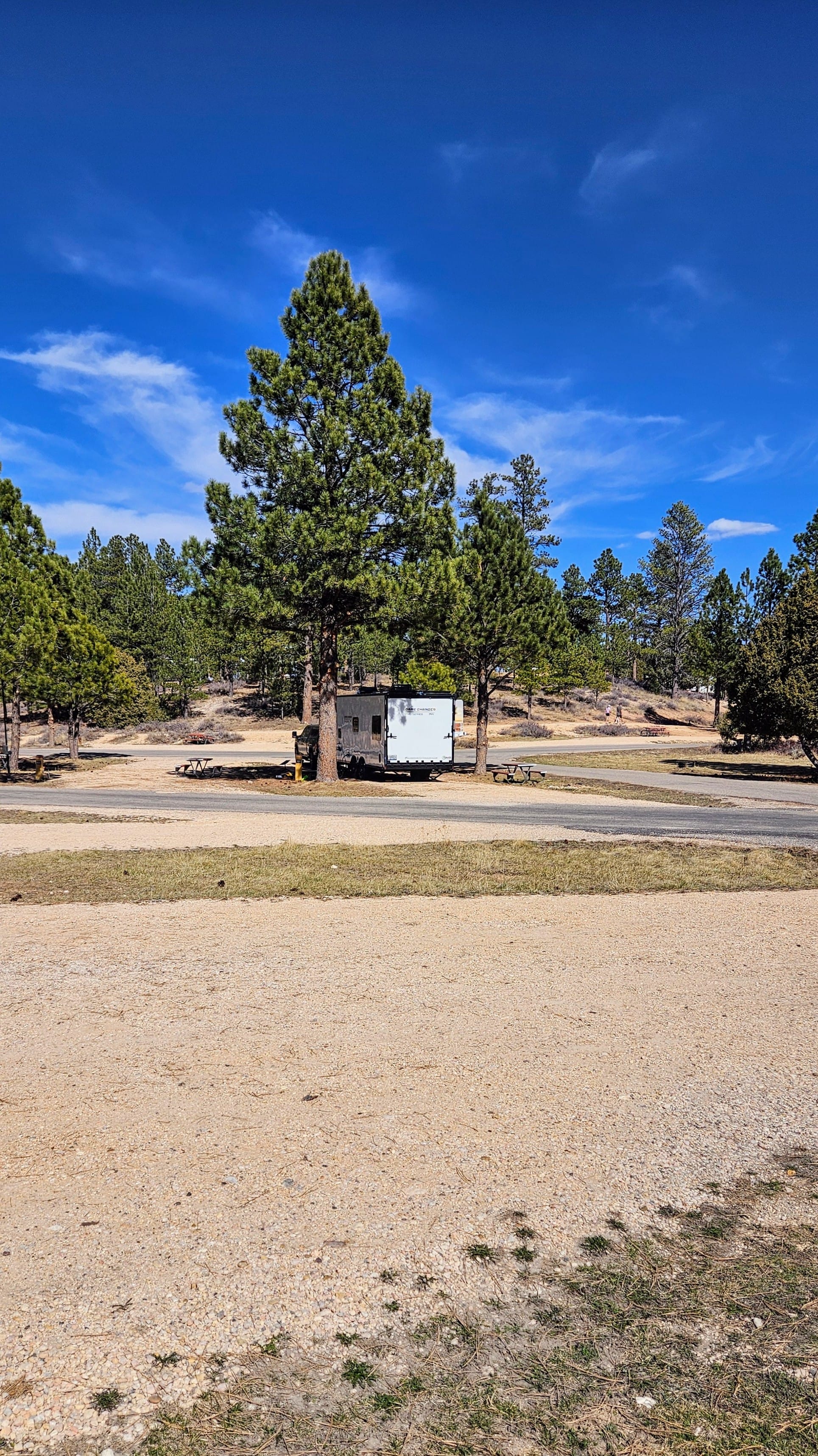
Site 101, pull-thru, FHU
Picnic table, fire ring, end of row
Campground recommended? Yes
Campsite recommended? Yes
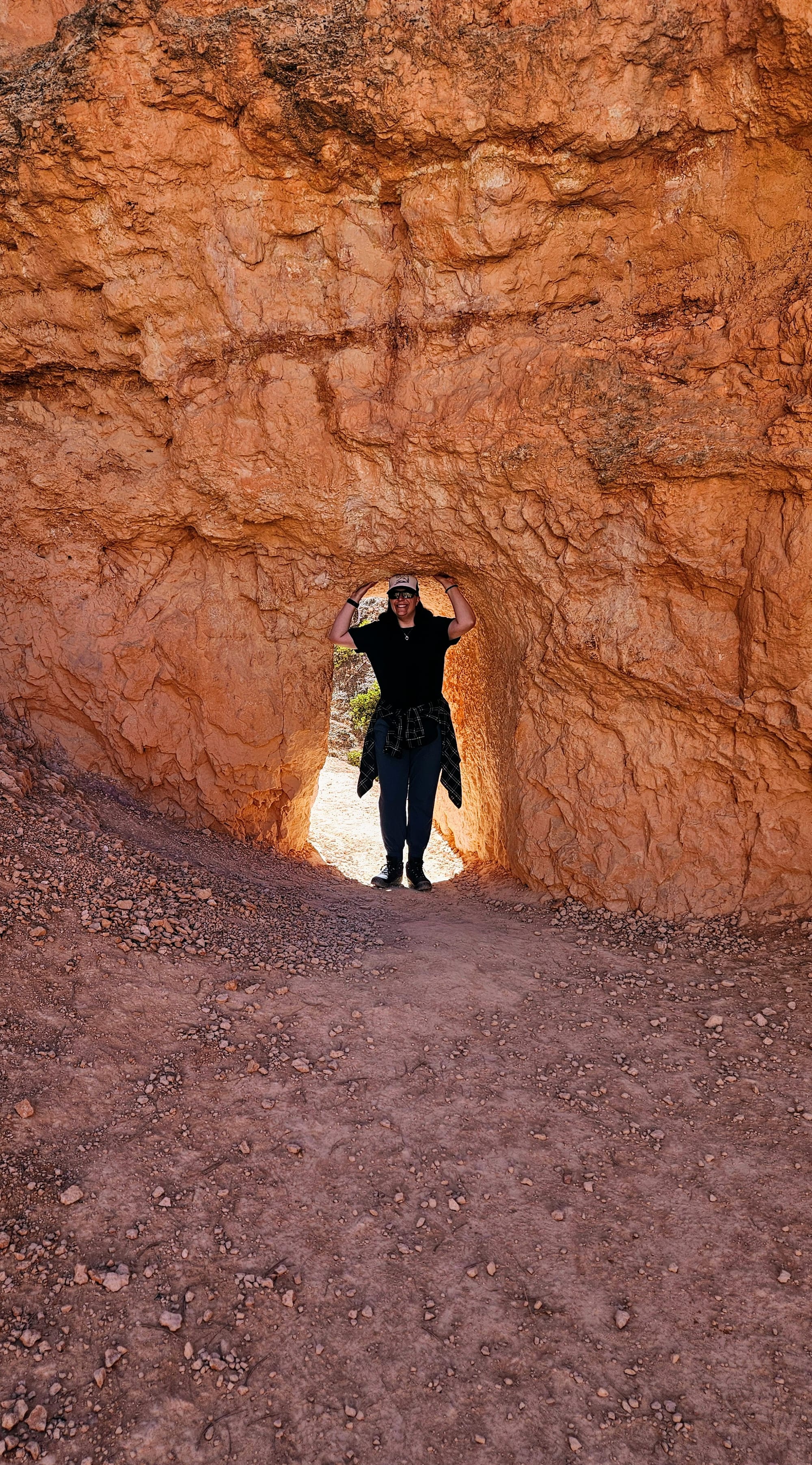
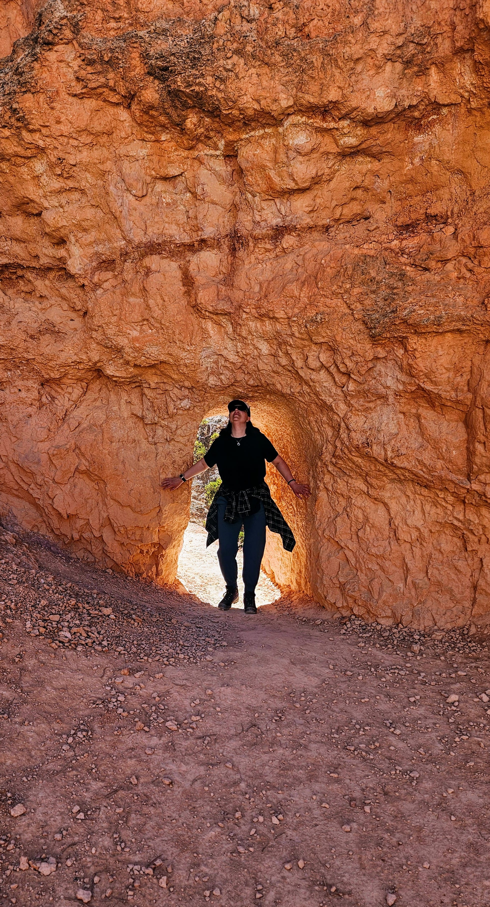
Navajo and Queens Garden Loop Hike
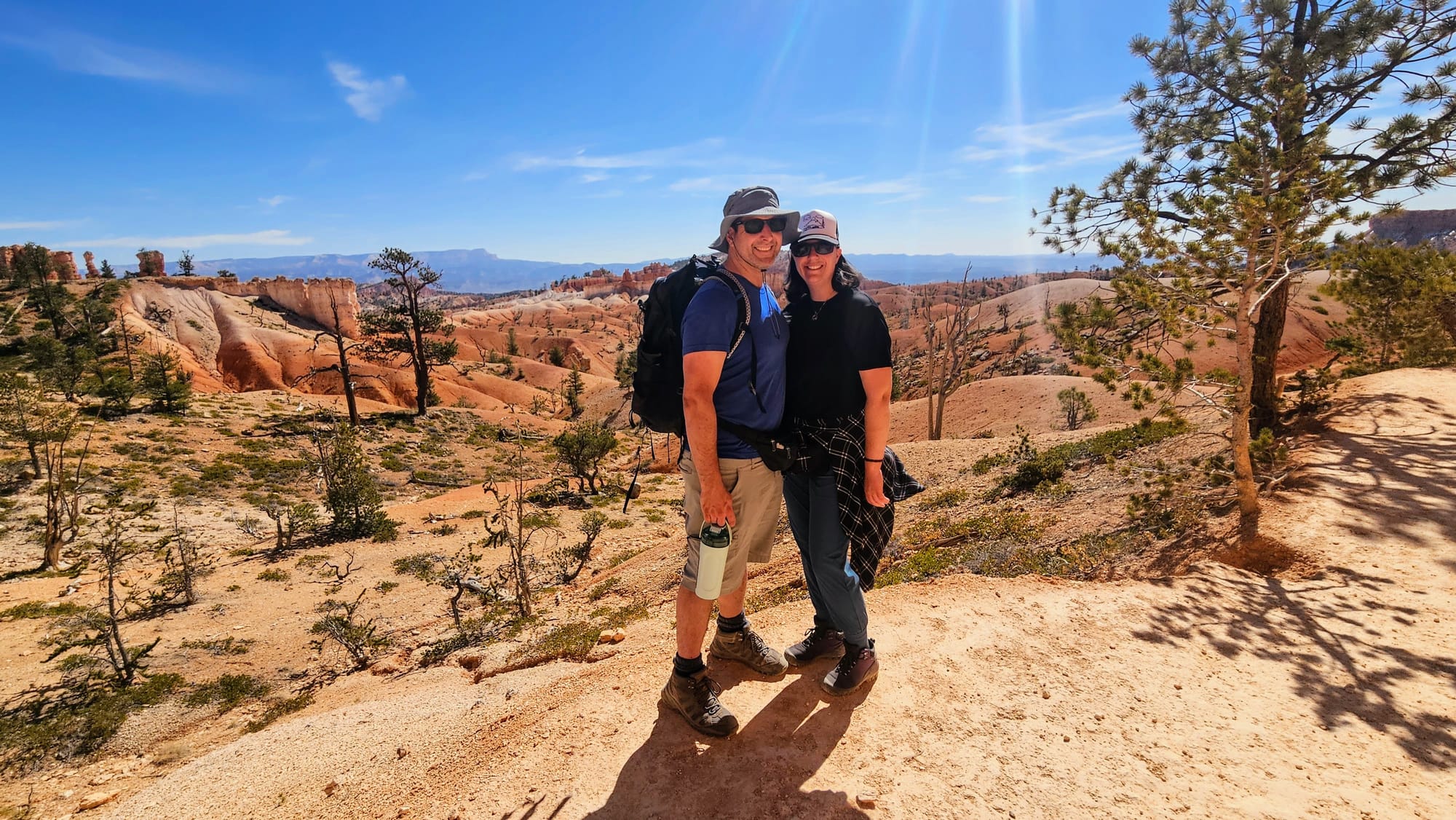
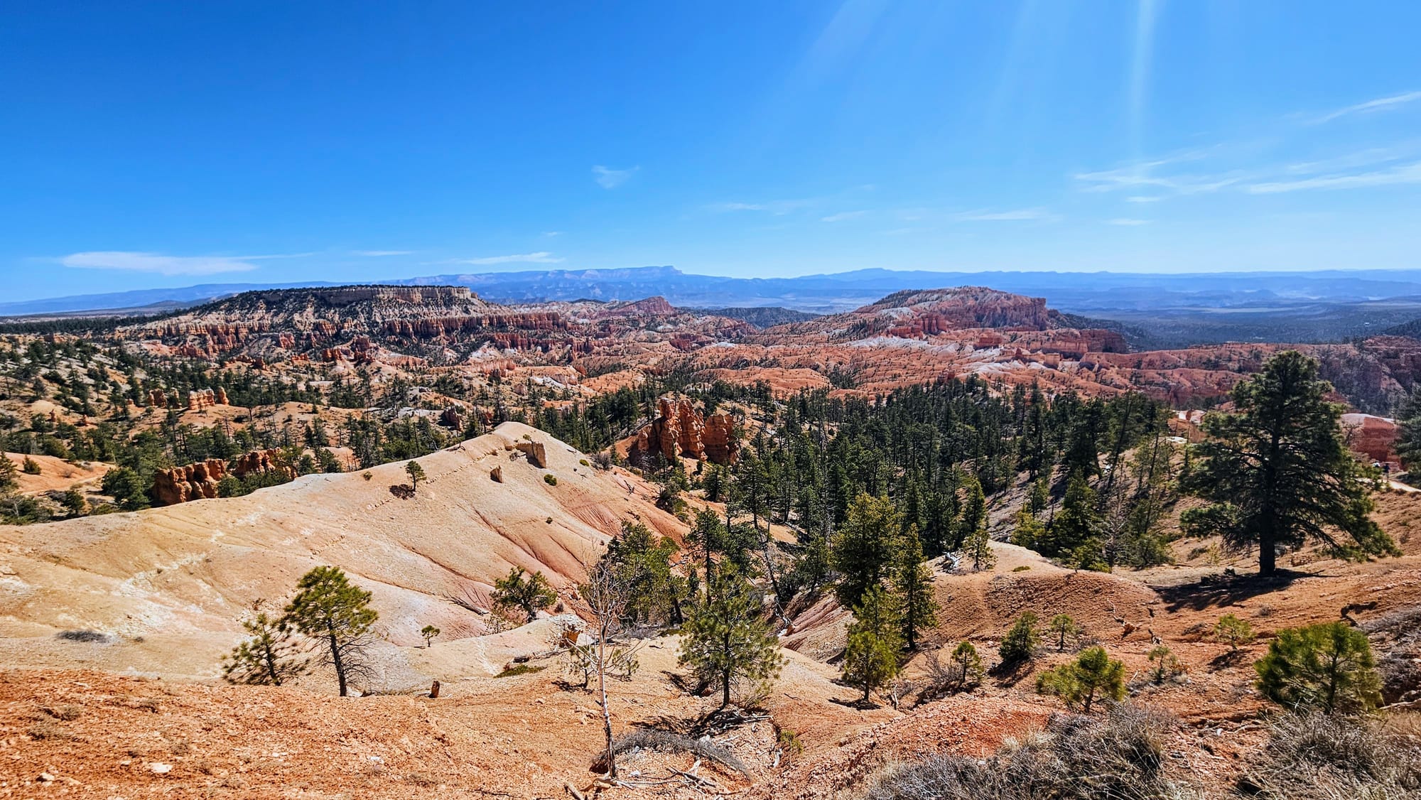
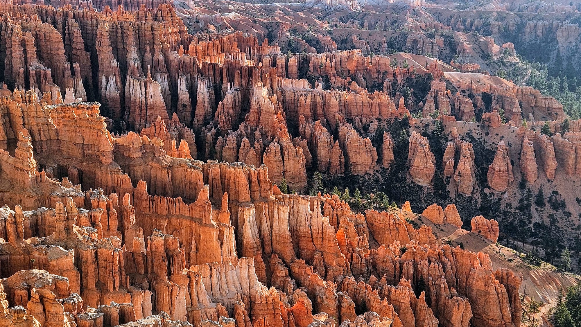
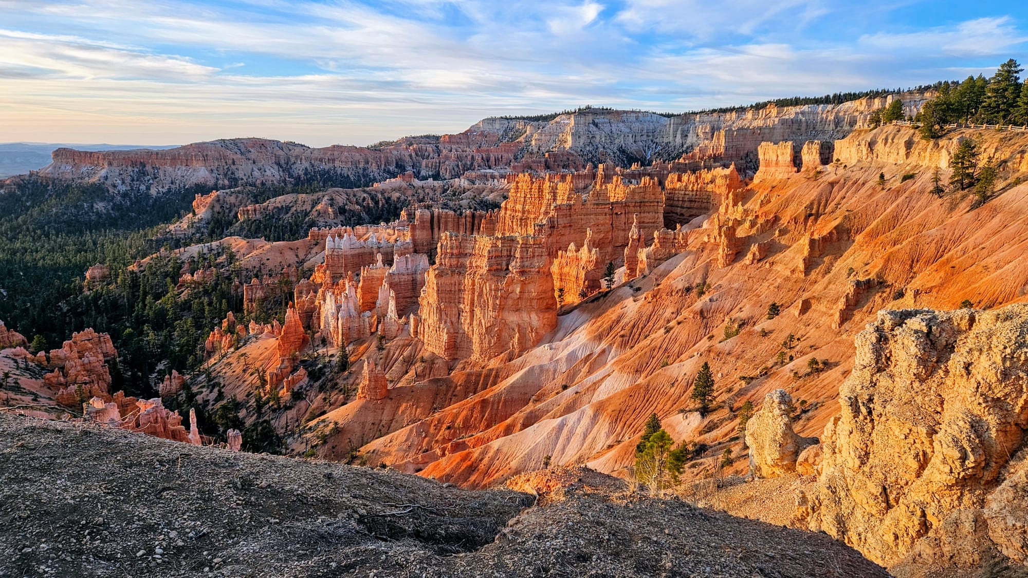
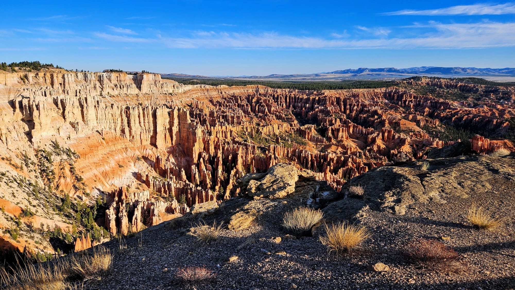
Our choice of an introduction to the national park was an easy one. We wanted to see the hoodoos from the rim, and we wanted to hike below rim. We could think of no better trail than the Navajo and Queens Garden Loop. It's the most popular park trail on All Trails, but there are lots of ways to lengthen and shorten the hike. We felt that the 3-mile loop would be perfect. We'd get some good elevation gain and see the hoodoos from various vantage points. It's rare to see a trail as decorated with waypoints as this one. 14 scenic views/features that other All Trail users found worthy of mentioning.
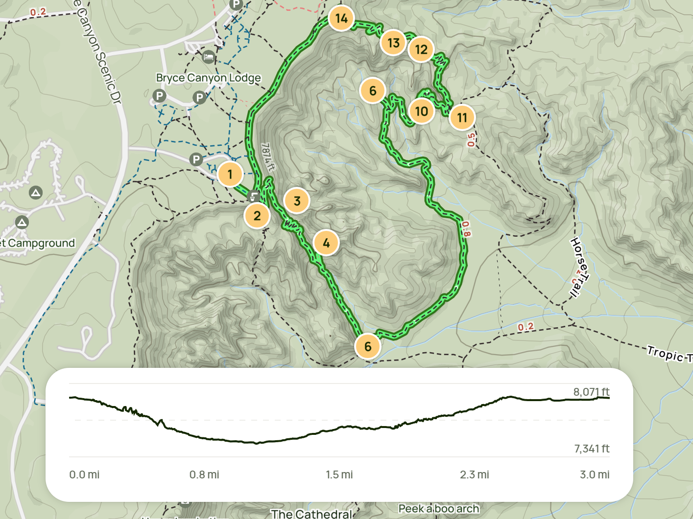
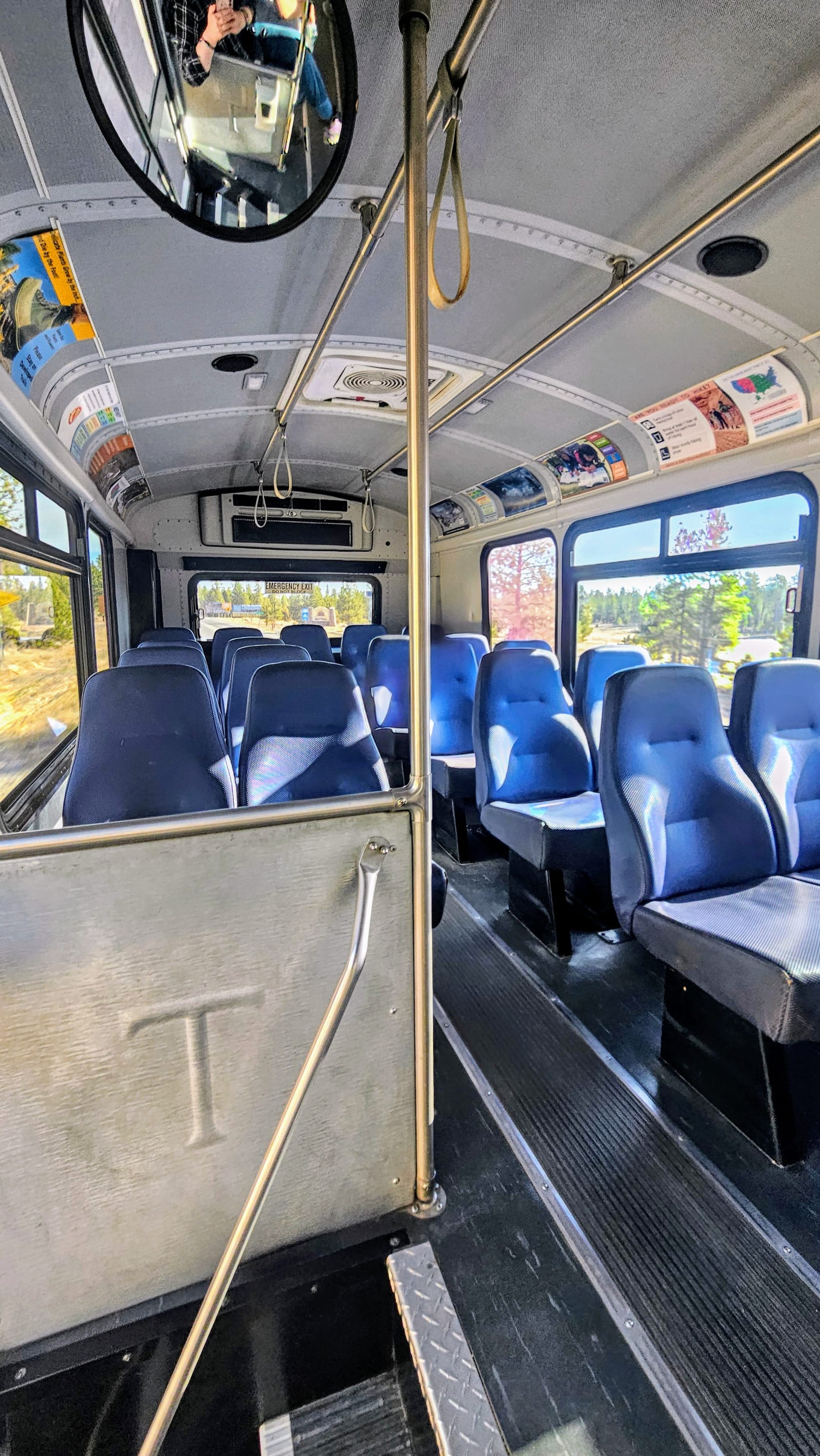
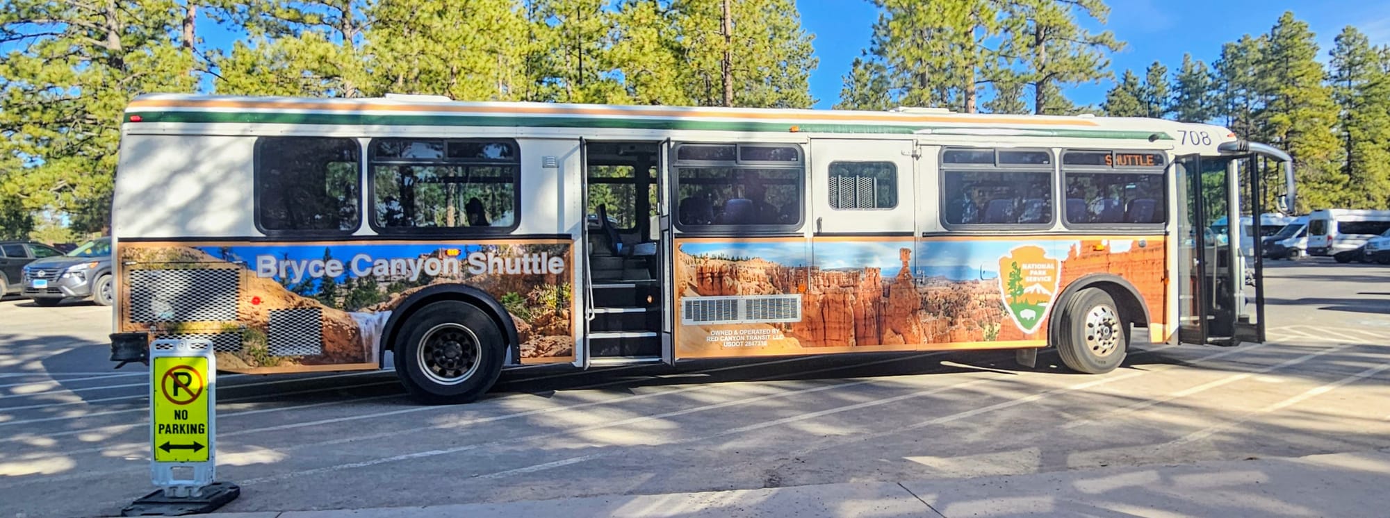
We took the shuttle into the park. As Bostonians, efficient public transportation is always something we forget can actually exist. This shuttle system was great. The buses arrived on time, and along the way we got to listen to narration of the various stops. Our ride was very peaceful. It was a Friday morning and we were only 1 of 3 couples on the shuttle. Our stop was Sunset Point, where we'd begin our hike. We could have gotten off early at Sunset Campground and walked across the road to Sunset Point, but we decided instead to stay on the extra 20 minutes to the actual Sunset Point stop, to orient ourselves a little more in the park and listen to more narration.
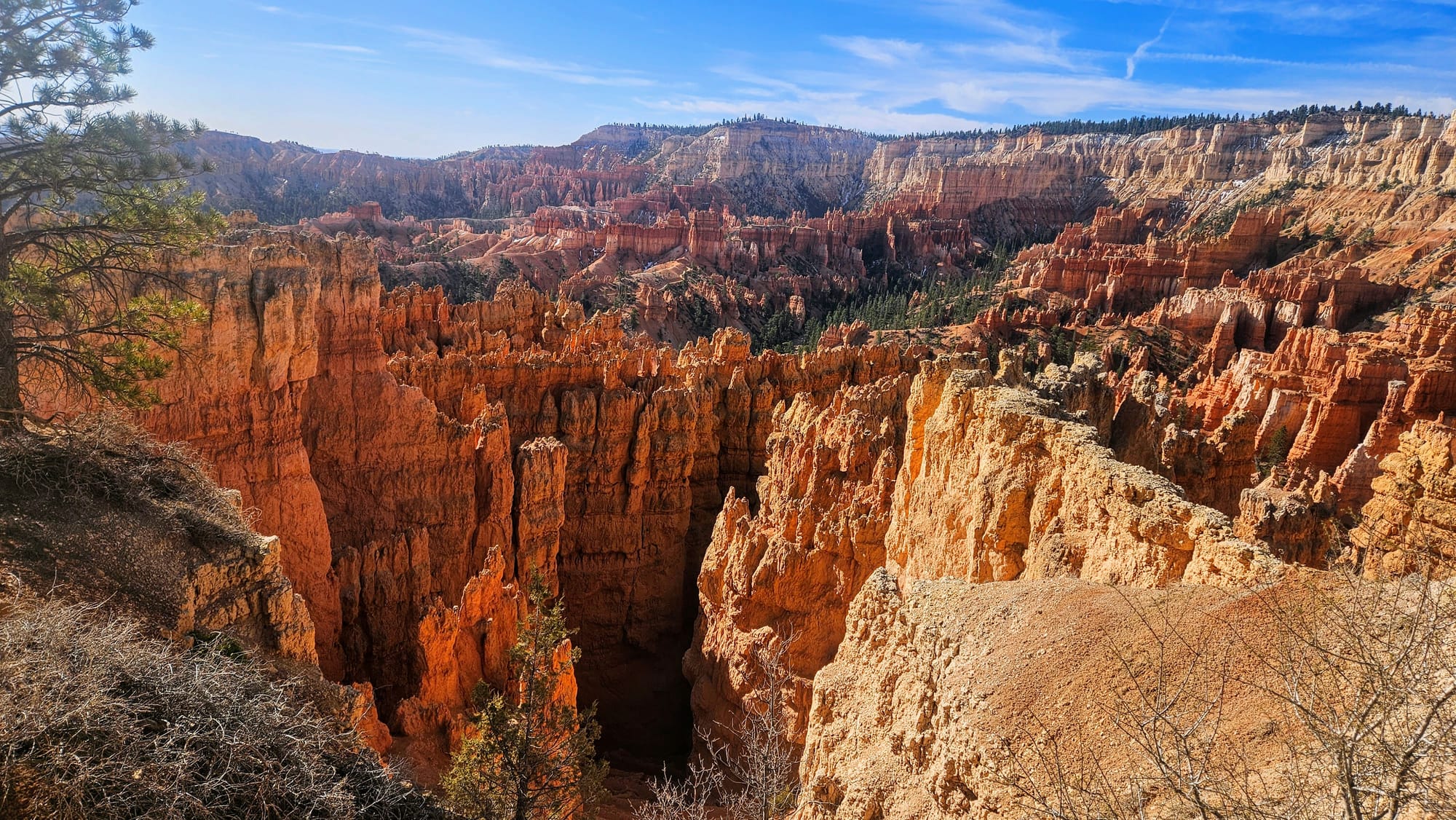
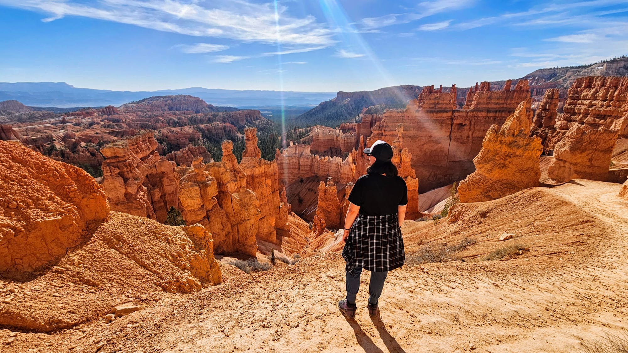
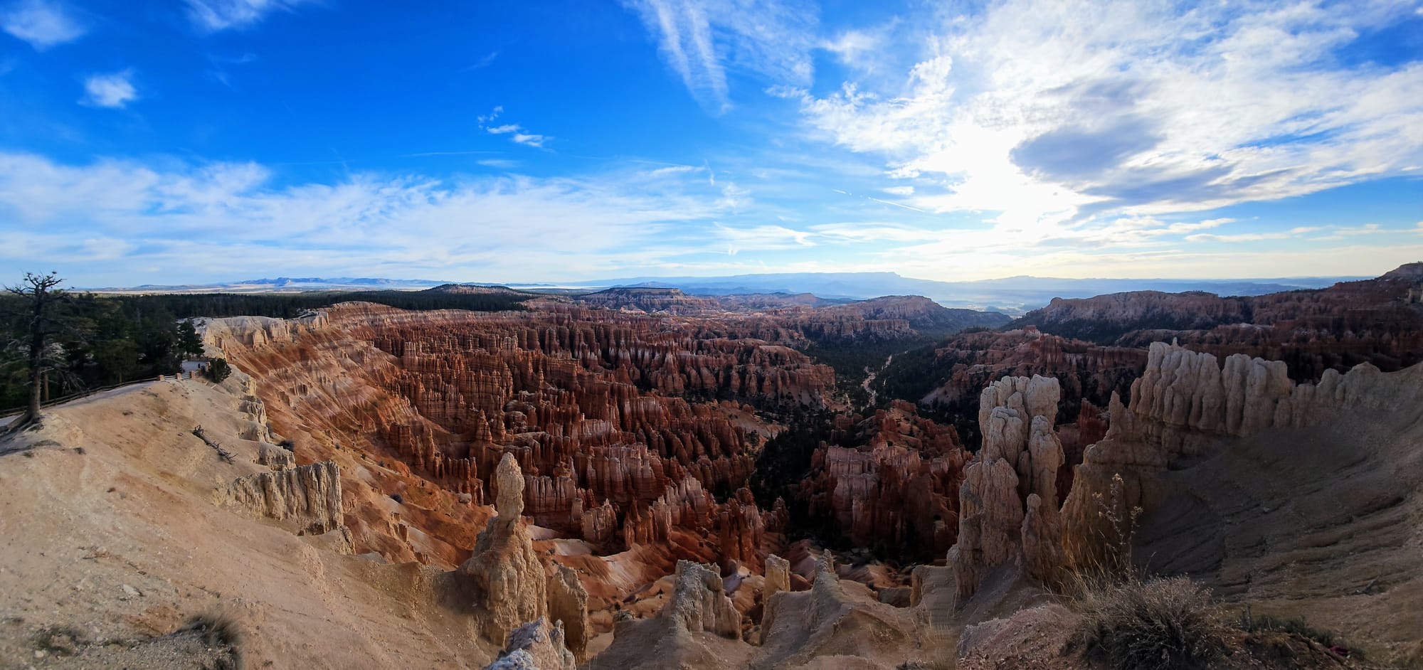
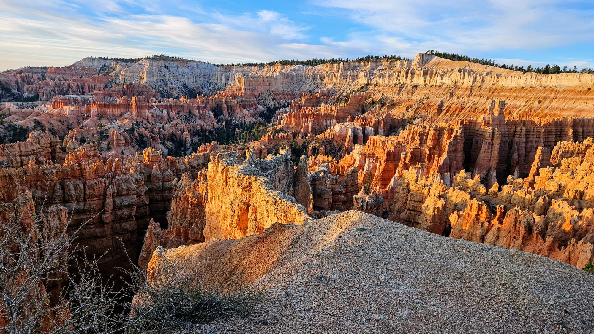
We took our time starting our hike, exploring the rim and seeing the hoodoo amphitheaters from above. It was hard to fully register that we were finally there, in the flesh. This was not only one of our most anticipated national parks of Utah, but of all the national parks. Visiting Bryce Canyon also officially meant we were over halfway in our list of visiting all 63 National Parks.
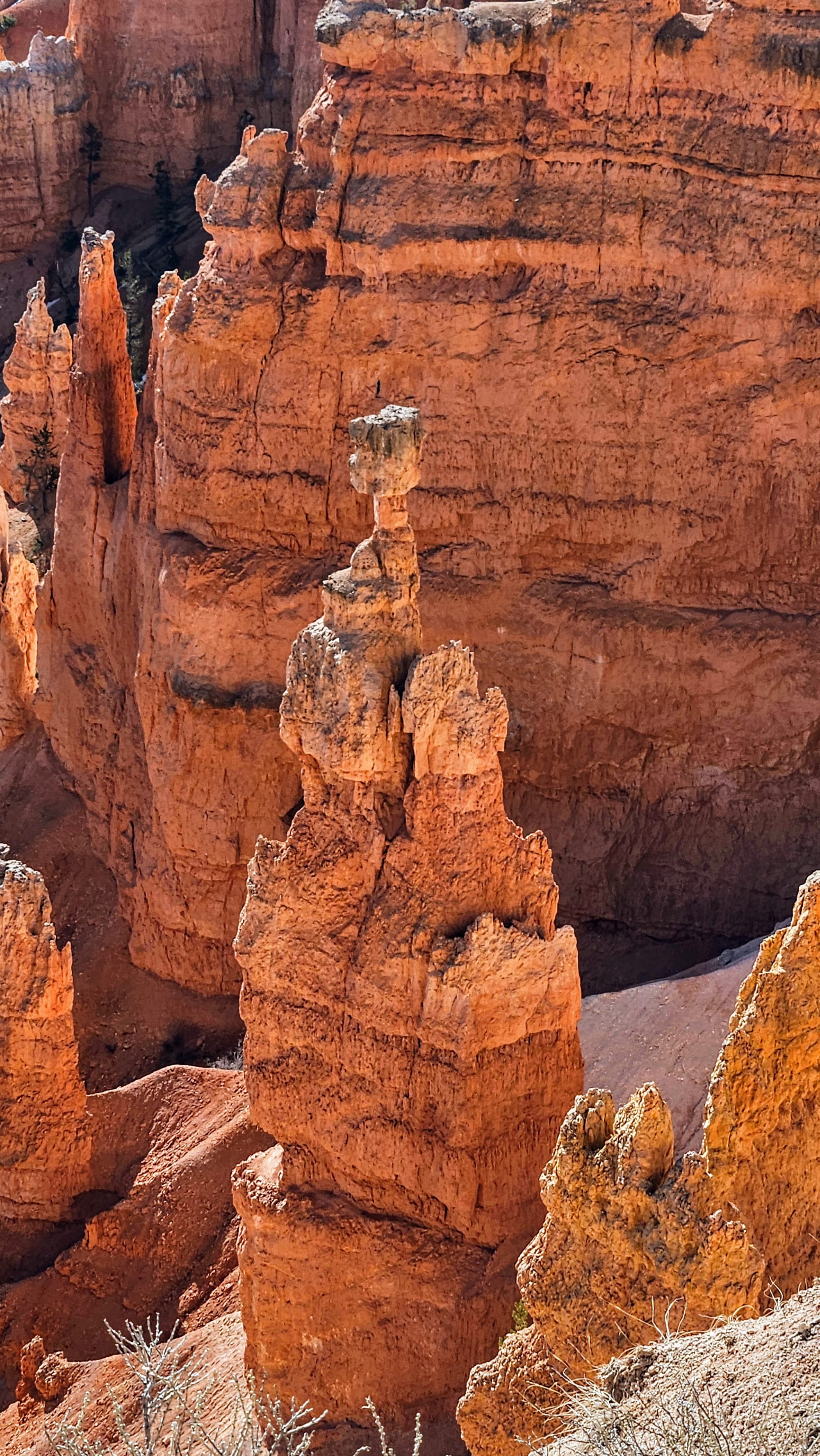
Thor's Hammer in the middle photo!
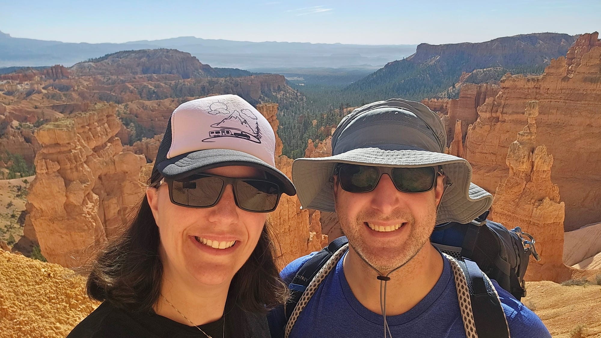
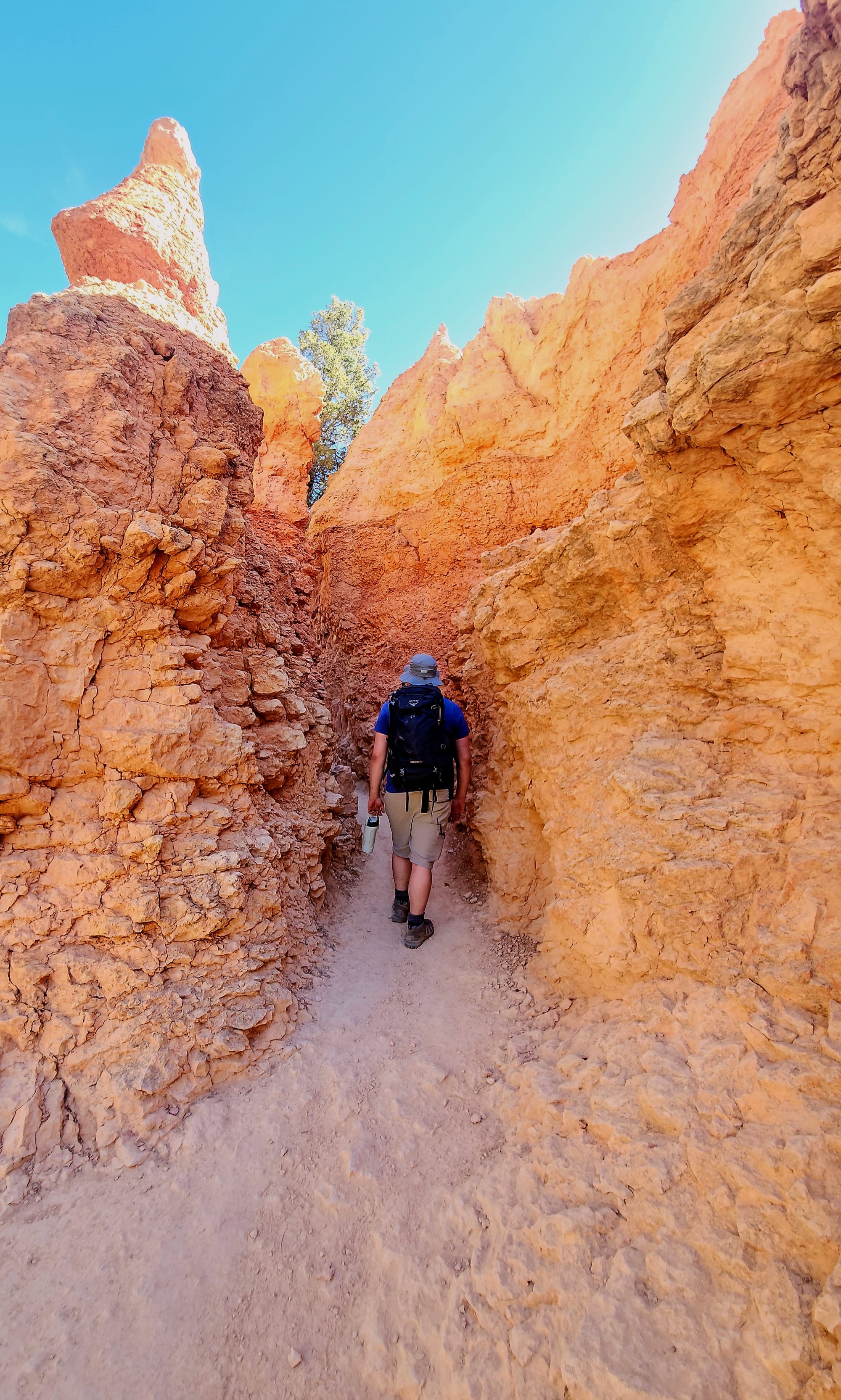
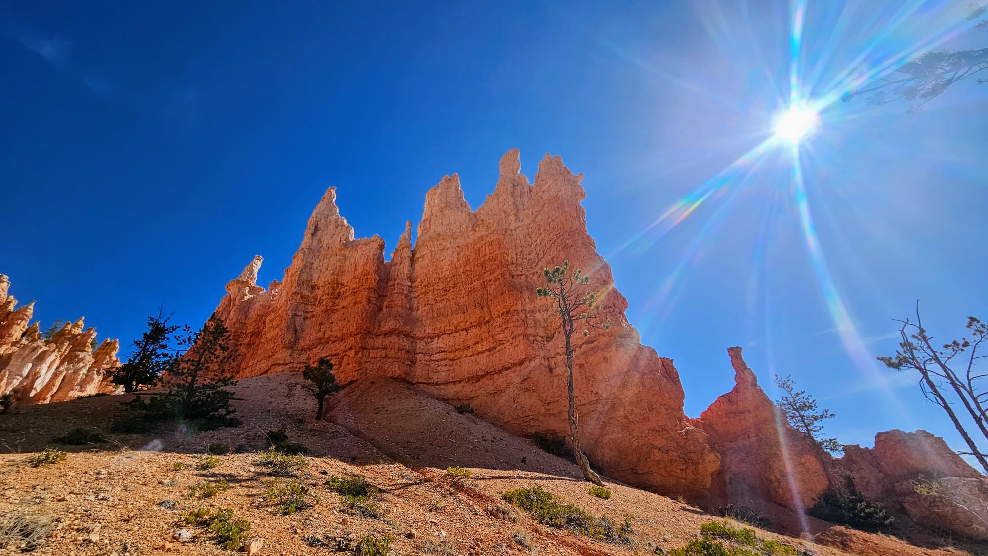
Our mountain-hiking bodies needed to get ready for descent first and climb at the end, tackling a 14% average grade and 30% steepest grade. We were glad to have our hiker legs by this point, and we had also successfully acclimated ourselves to the higher elevations. Though this was our first time hiking above 7,000ft and even topping at 8,000 at the rim, we felt great.
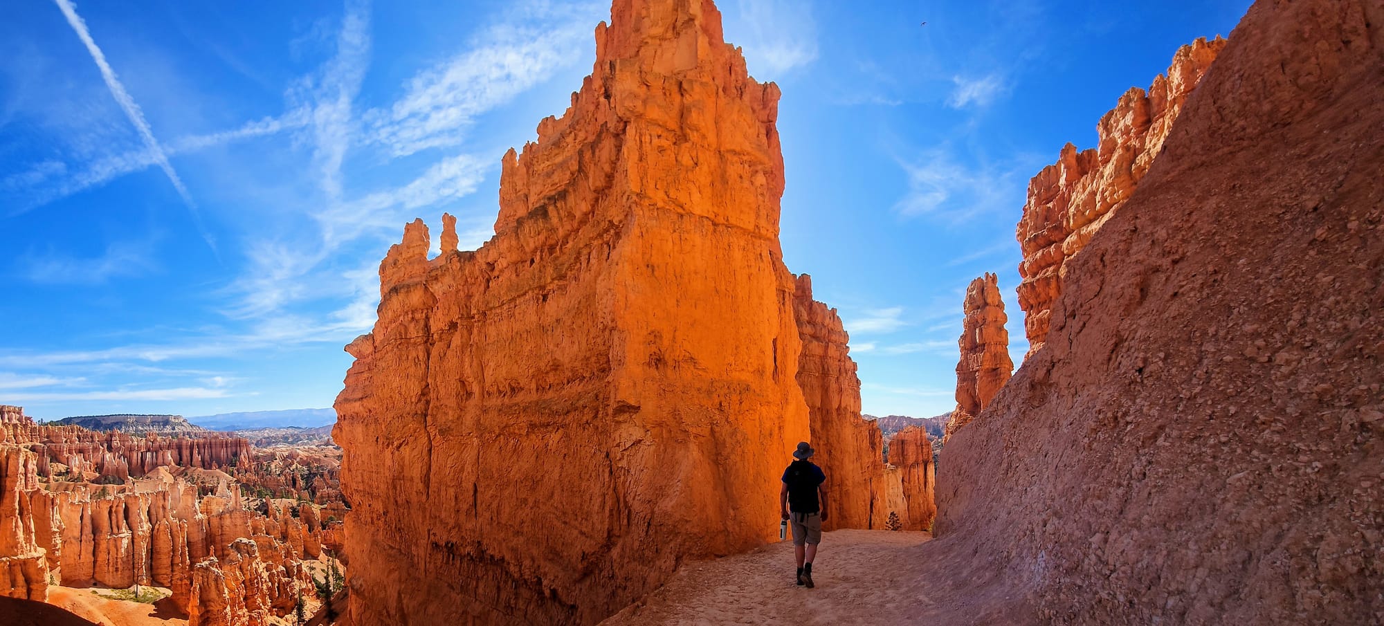
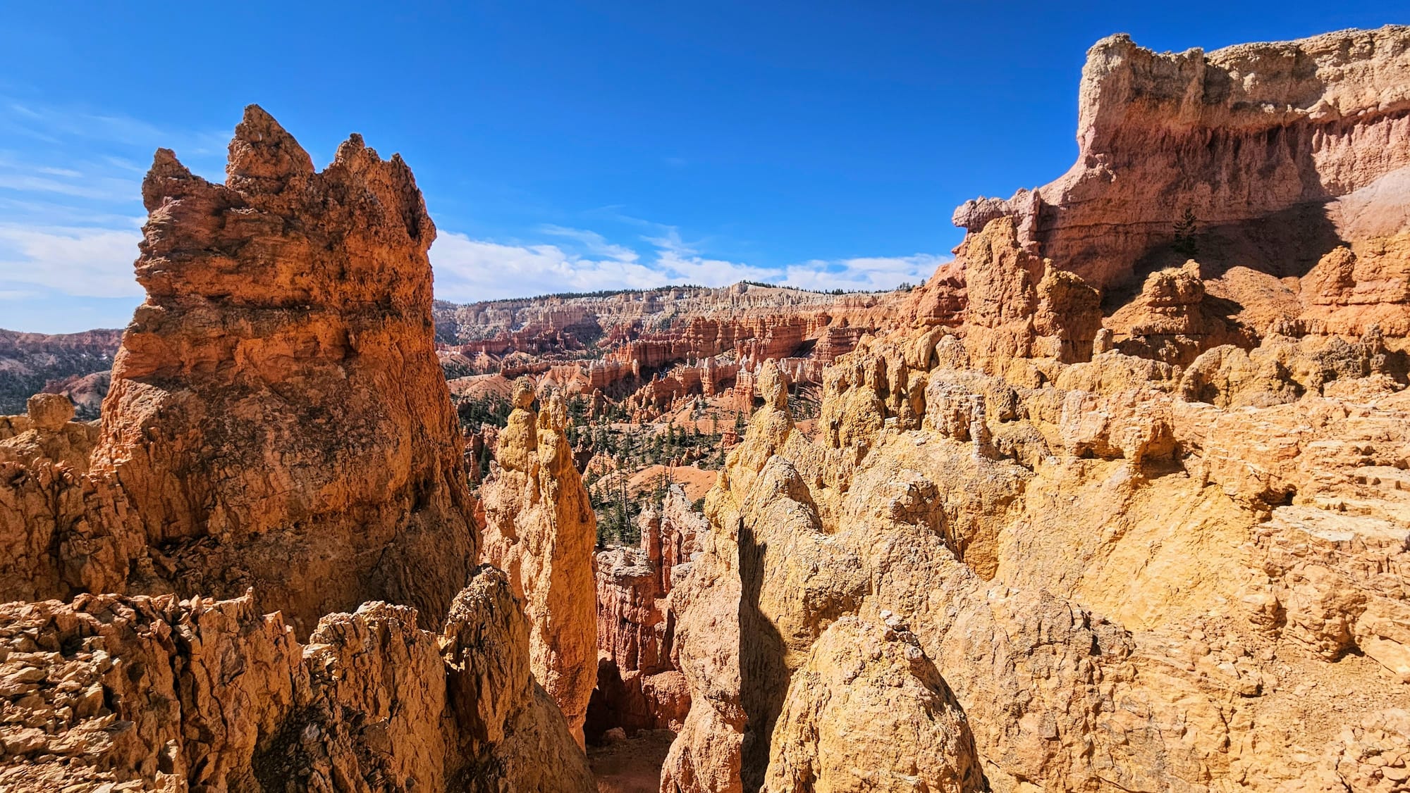
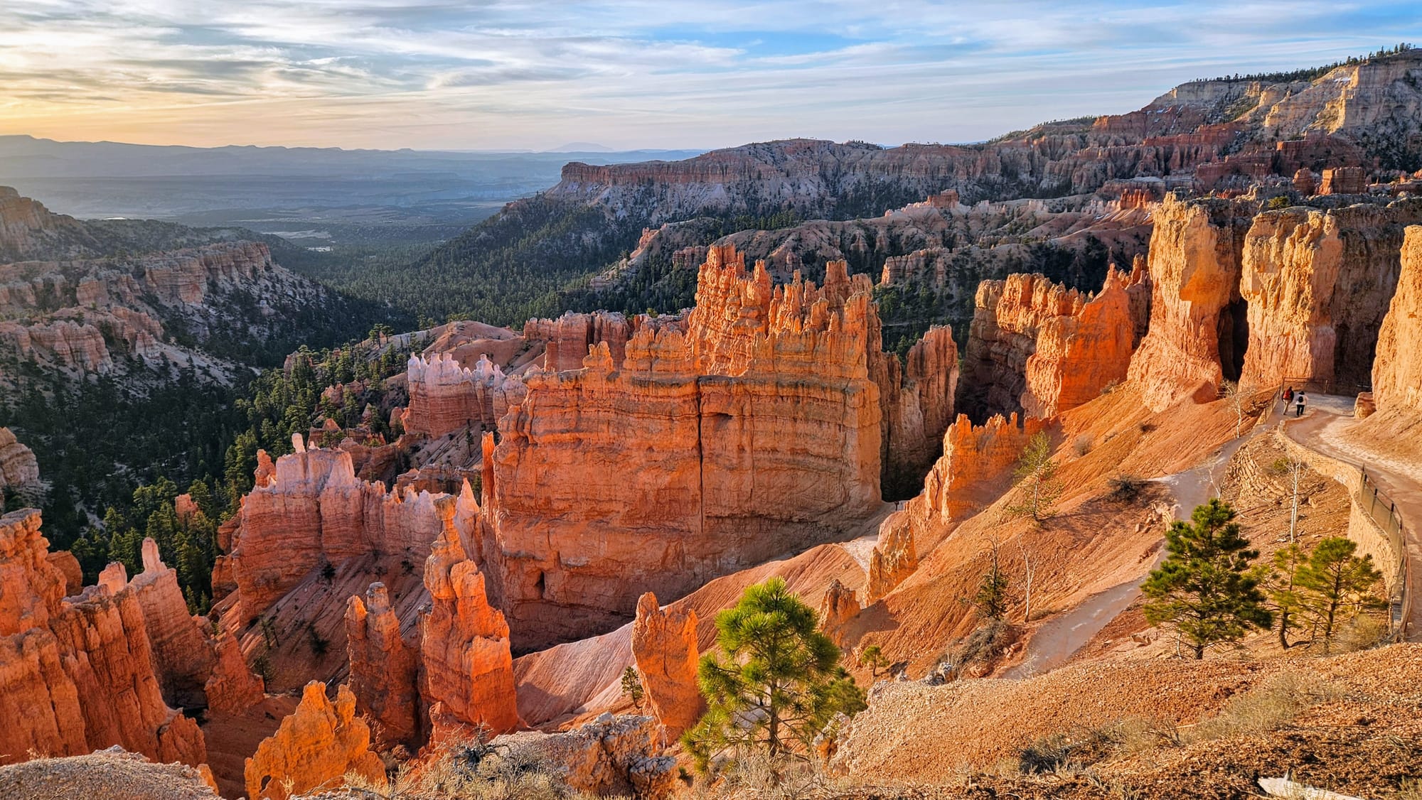
Descending into the canyon, we felt like we were walking in a giant castle.
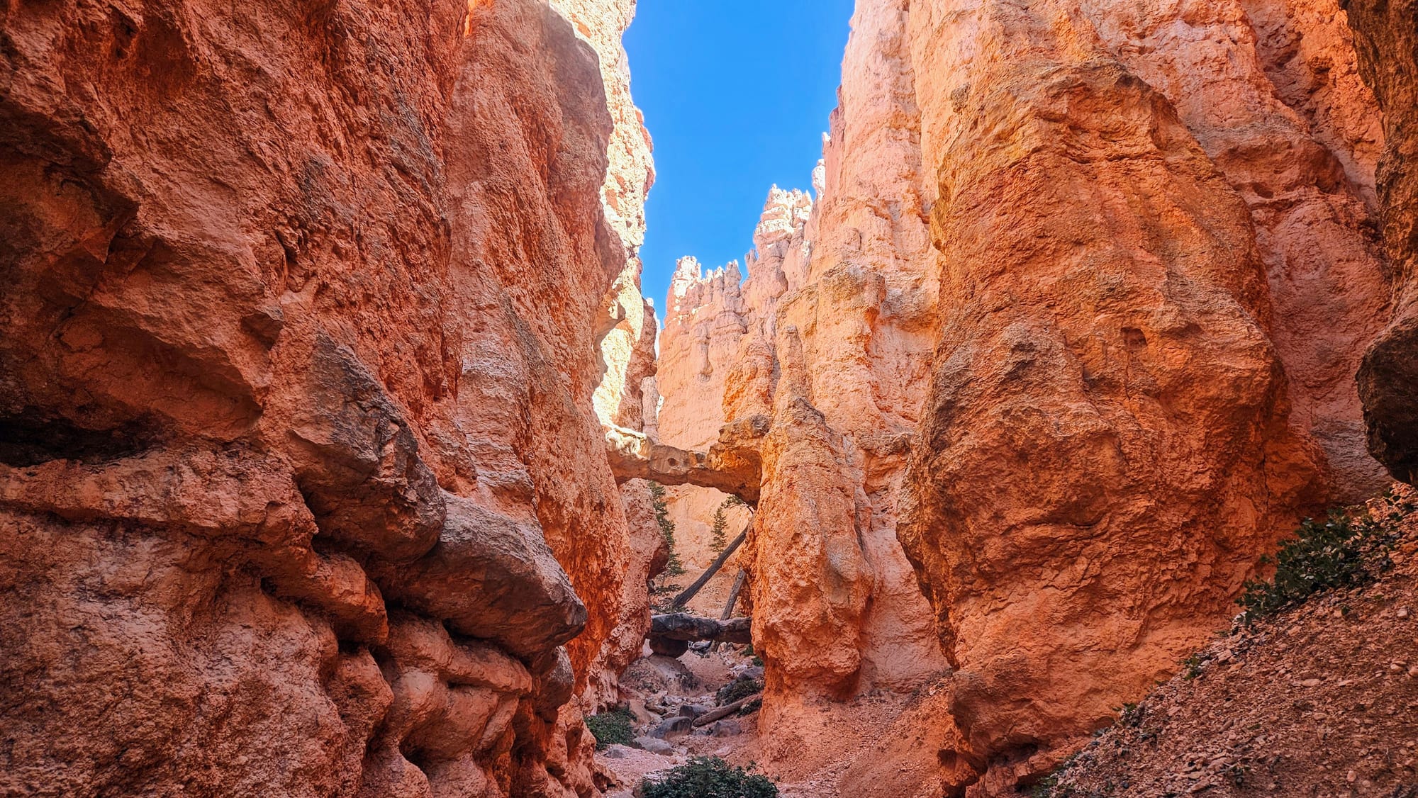
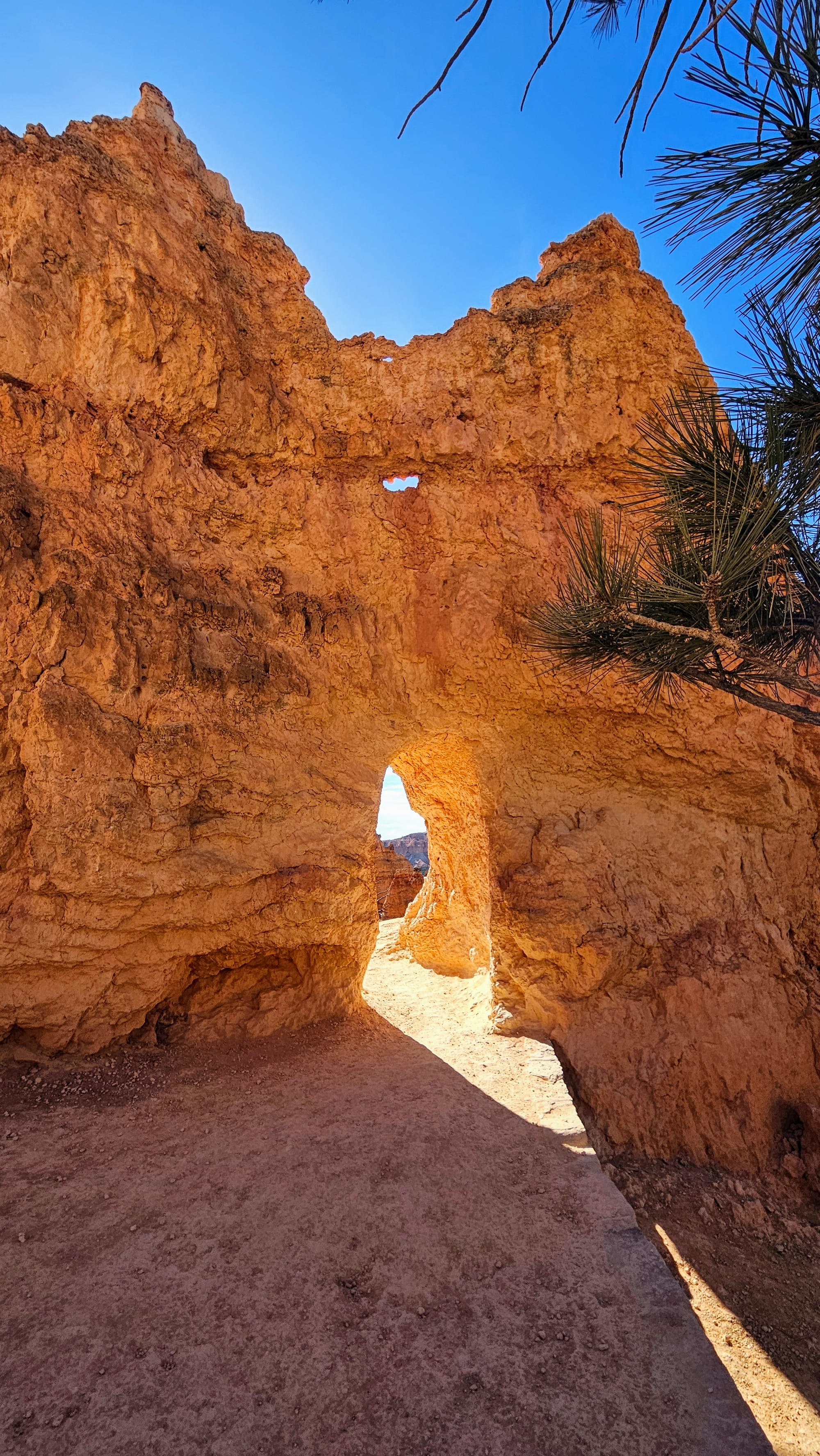
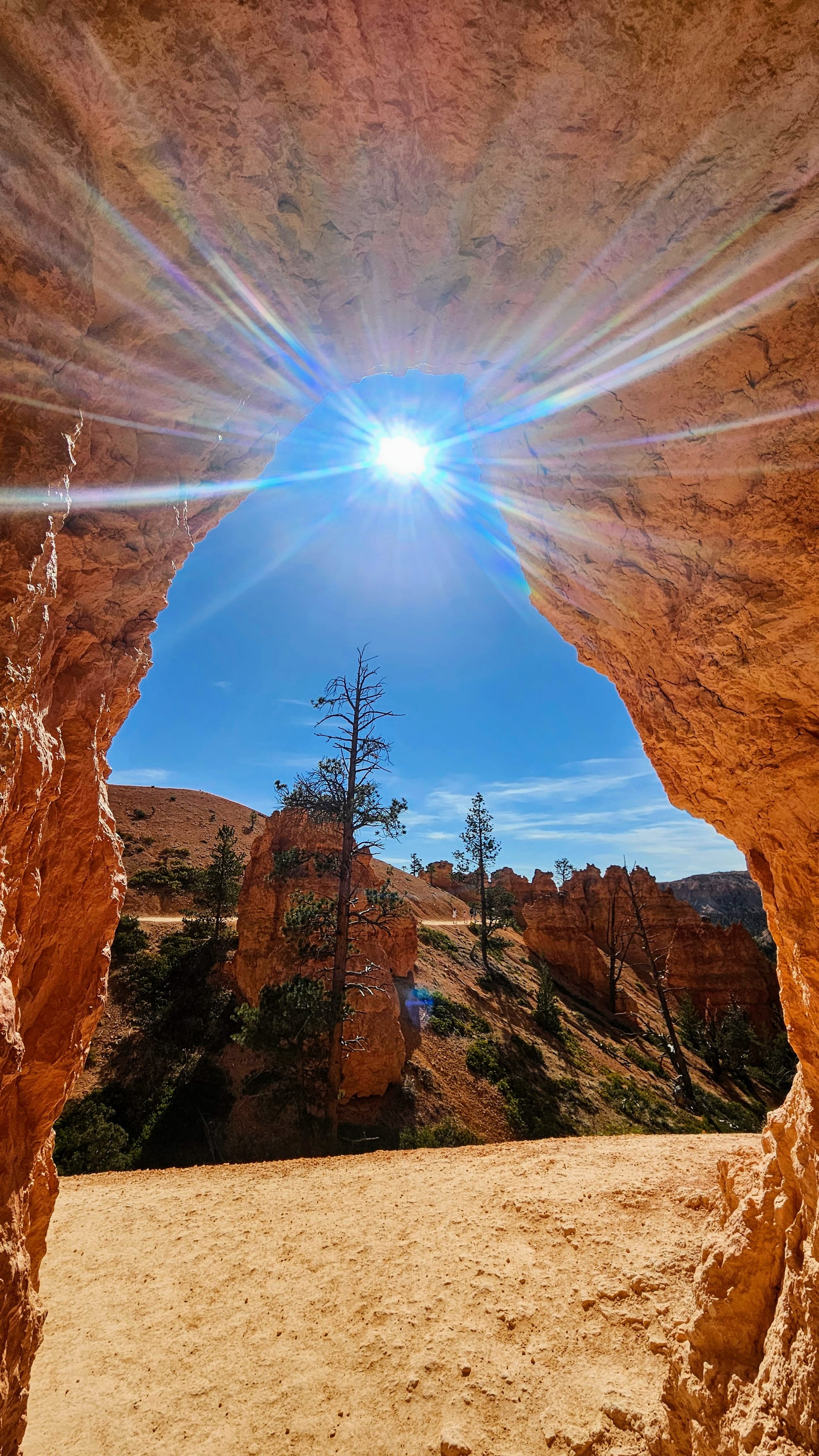
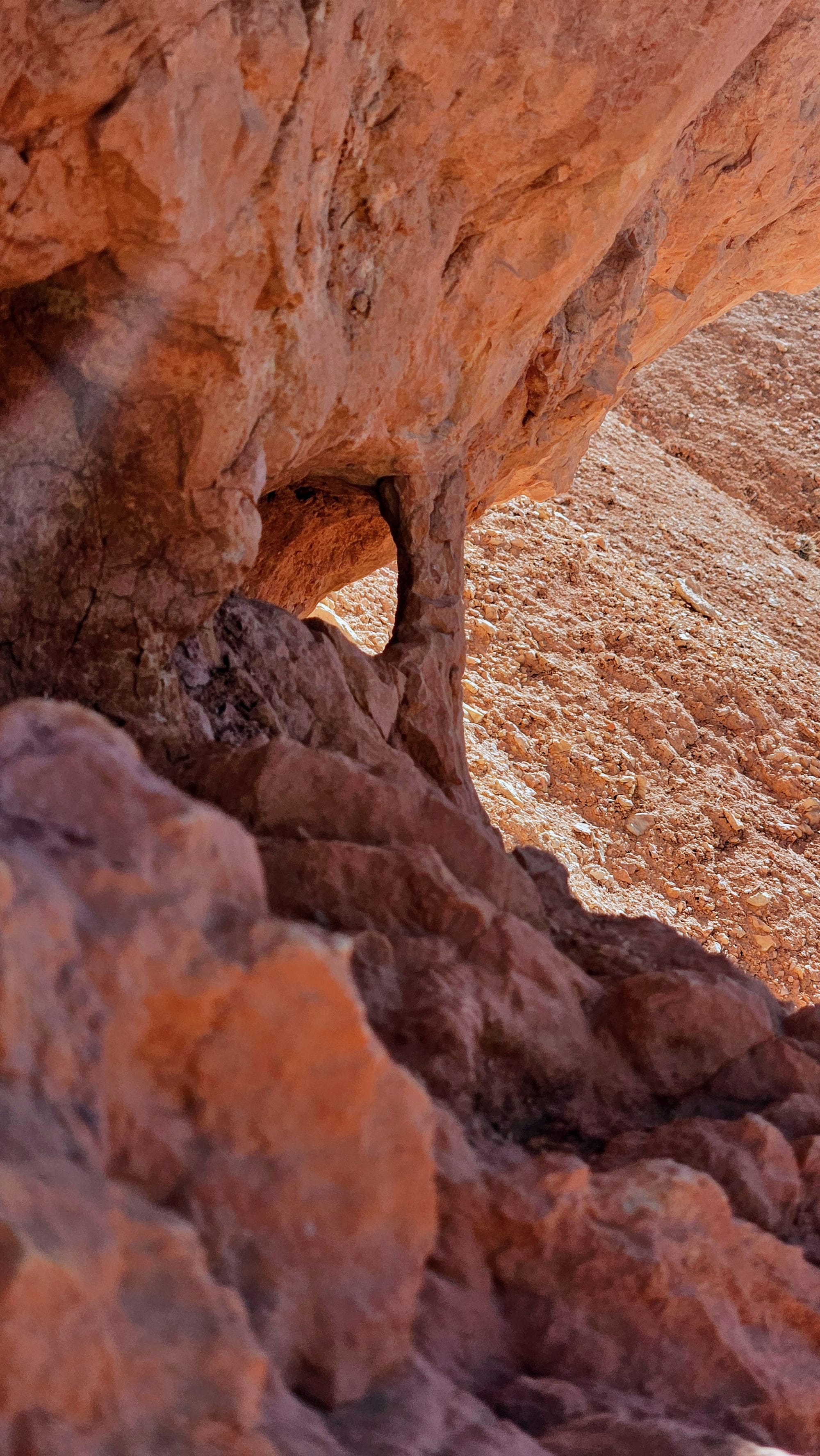
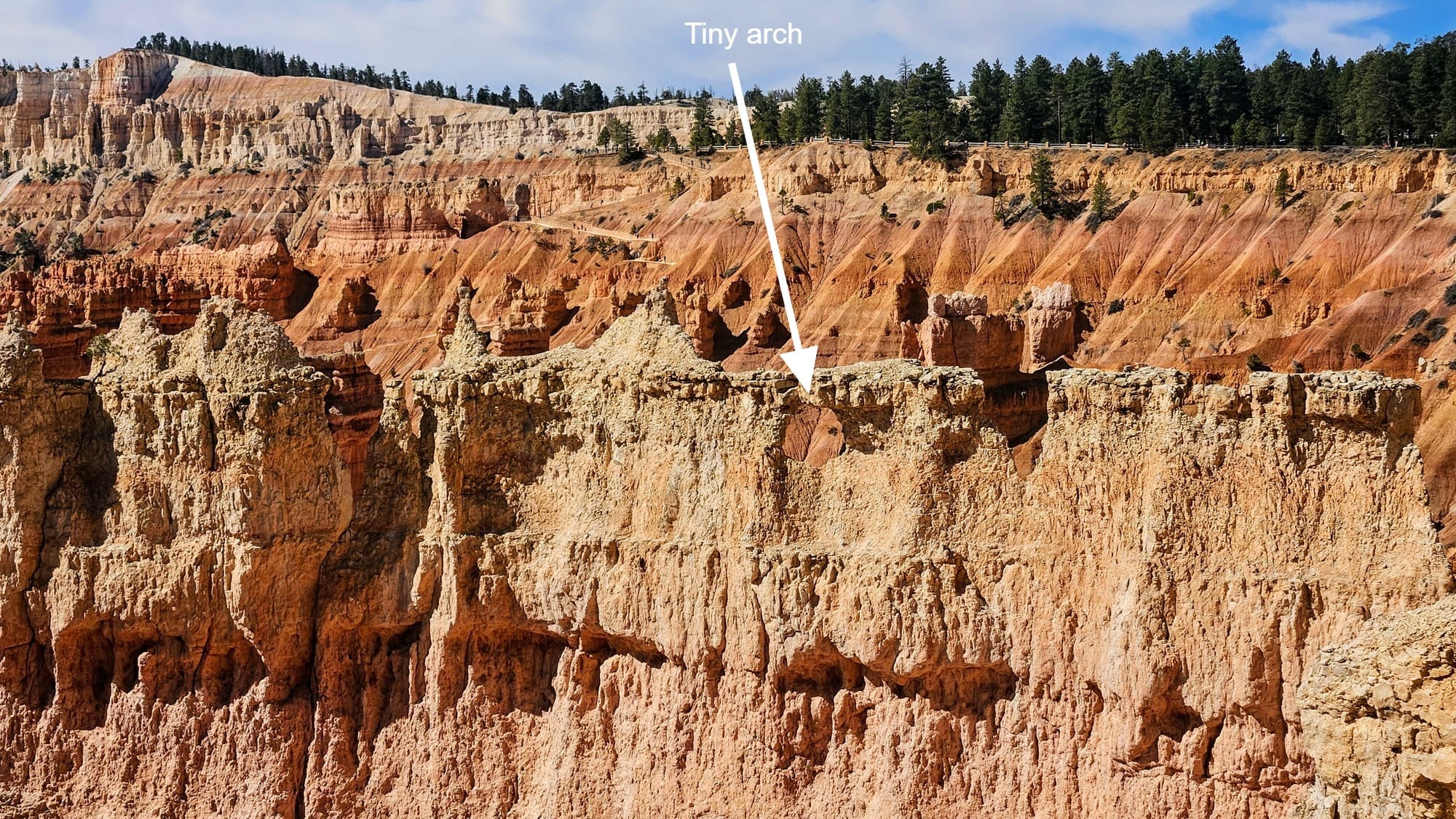
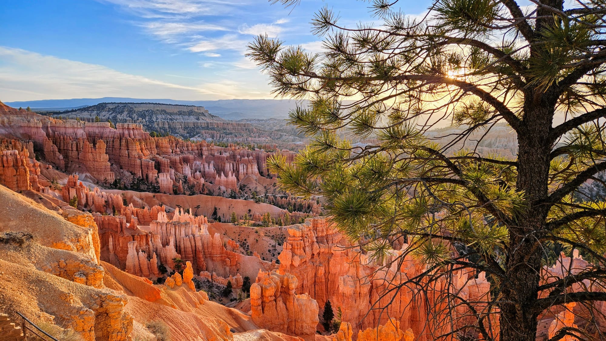
If you look closely at that last photo above, you will see not one, but two natural bridges. Even though the hoodoos are the main draw to this park, Bryce has lots of other formations, like natural bridges and arches. The rocks in this area are very susceptible to erosion, and so the arches are often short-lived.
We often hear people say that in order to truly experience a canyon, you need to hike down into it. This certainly gives you a new perspective on your surroundings, but with this non-canyon canyon, as soon as we descended to the bottom and could no longer see most of the hoodoos...
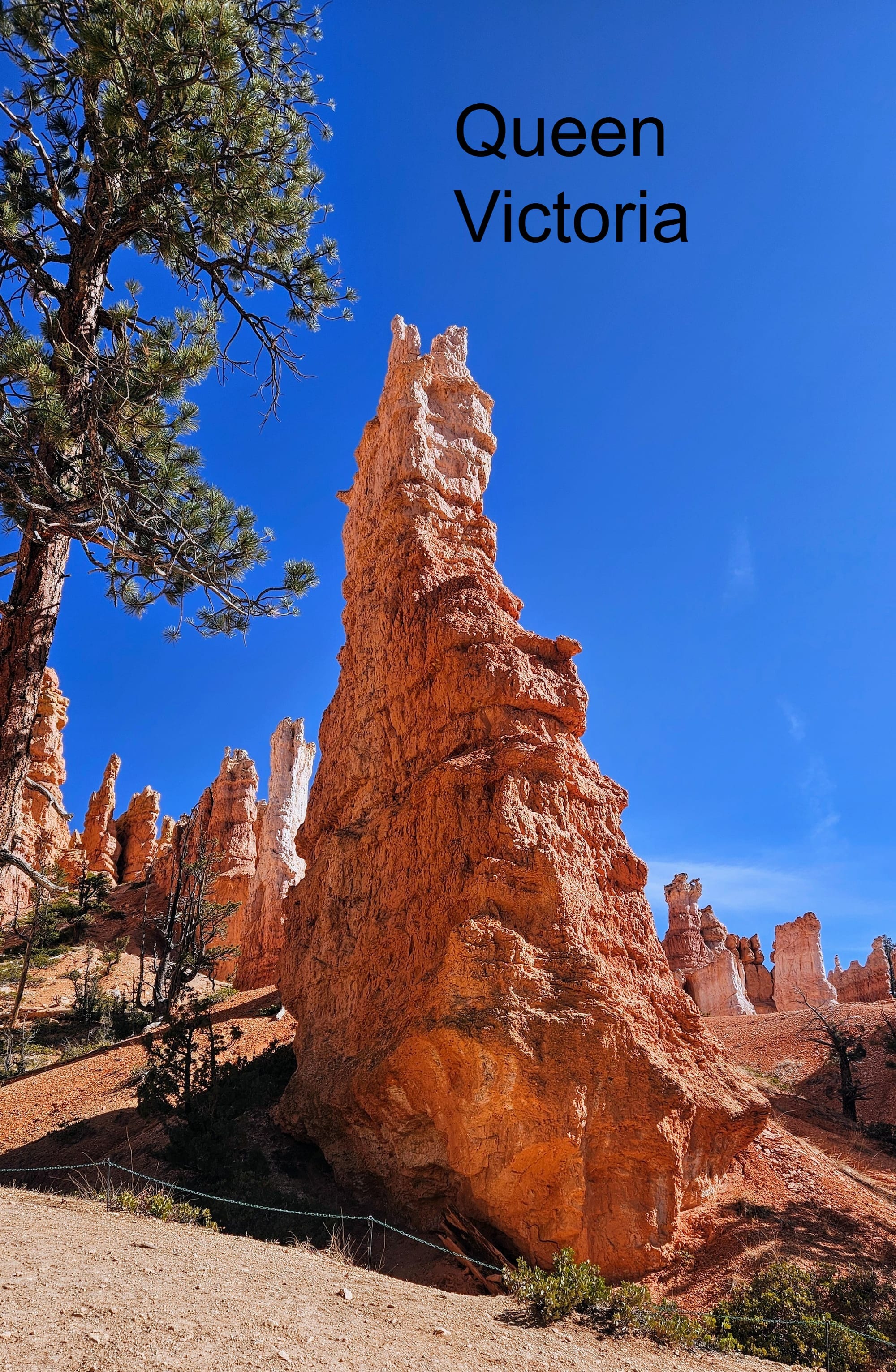
We looked forward to gaining some elevation again and seeing the east side of the trail, and it didn't disappoint. We got to the Queens Garden trail and took a short offshoot to see Queen Victoria (though we personally didn't see much resemblance. We blame erosion for this). Then we hiked under several arches before making our way to the final ascending switchbacks.
Taking the loop counterclockwise, the same way it's recorded on All Trails, was definitely the right choice. The ascent up towards Sunrise Point was a lot less steep than if we had ascended to Sunset Point. It's still a calf-burner at times, but the views are so enthralling that we barely noticed.
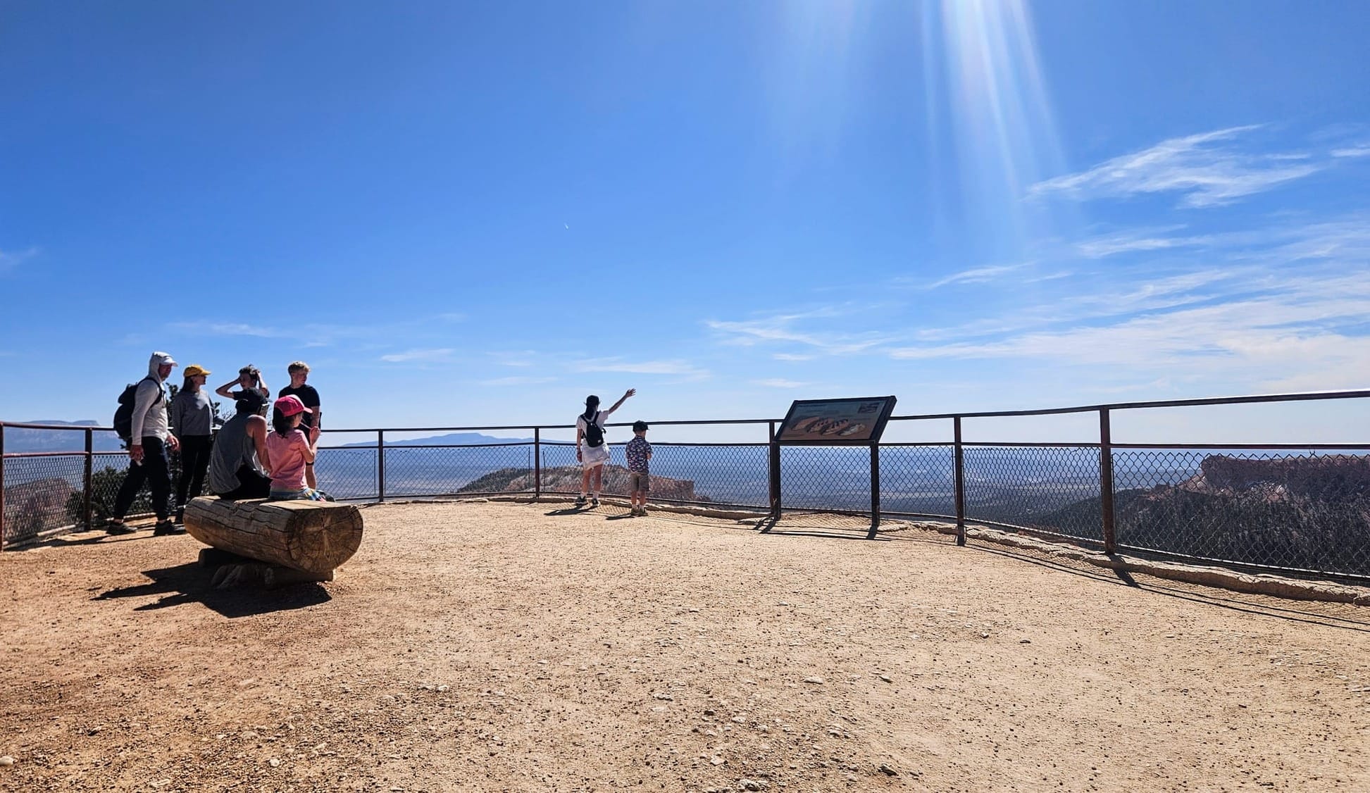
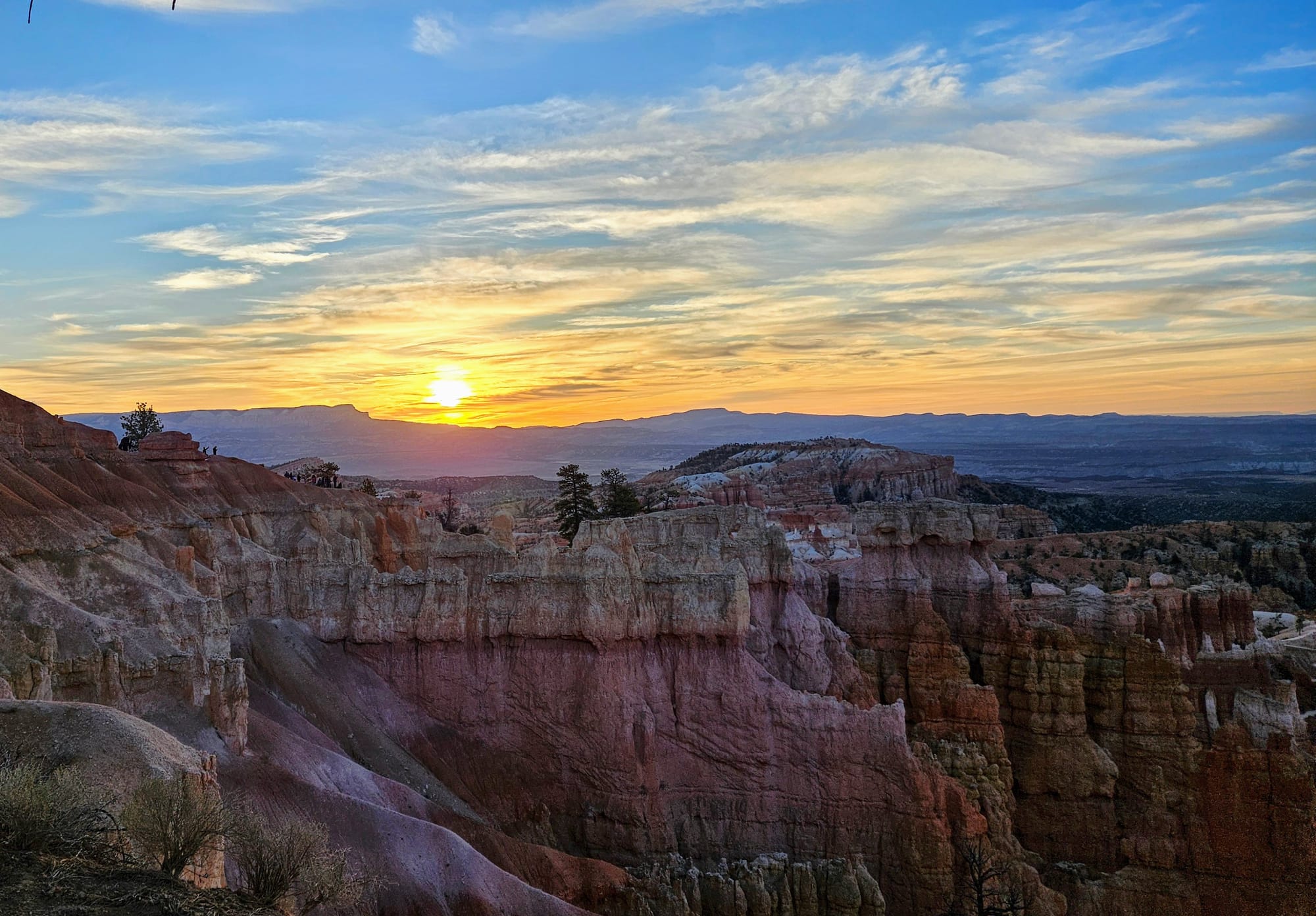
Are Sunset and Sunrise Points deceptive at Bryce?
You may recall in our last post that we discovered a deceptive overlook at Capitol Reef. Sunset Point was facing east! This is so people can see the glow reflect on the rocks opposite the sun, but for people actually wanting to see the sunset, they would need to face the other direction, and the view just isn't as good as other nearby overlooks. We heard that Bryce Canyon's Sunrise and Sunset Points might be the same orientation, and we needed to find out for ourselves.
We hit both points on our Navajo and Queens Garden hike, starting at Sunset Point and then ascending to Sunrise Point before connecting our loop via the Rim Trail. We made special note of which way everything was facing. Turns out, there's nothing to worry about here. Each point is oriented intuitively, with Sunrise to the east and Sunset to the west. Both overlooks are mostly panoramic views, and both are facing south. This means that you can go to either point for sunrise or sunset, and you can see both the sun and the glow reflecting off the rocks. Just be sure to give extra time to see the glow. It starts a short while after sunrise and before sunset, while the sun is still a distance above the horizon. We had our own experience here, which I'll be sharing shortly.
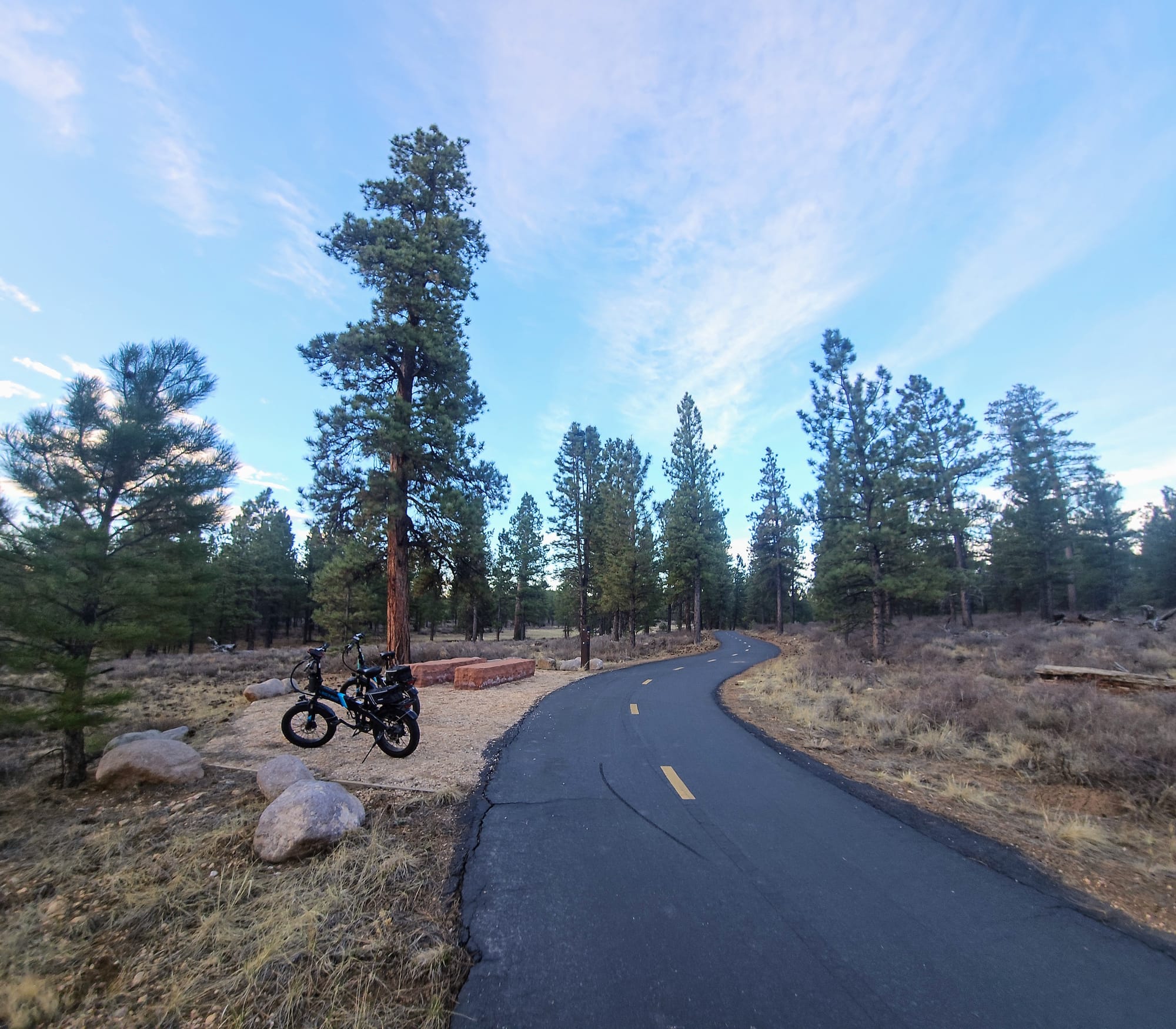
Ebike Ride to Inspiration Point
A multi-use trail for pedestrians and bikes spans state route 63 from Dixie National Forest to Bryce Canyon National Park. We could access it from across the street from our campground. What's better than an ebike ride in a national park? An ebike ride in a national park, when we don't need to share the road with vehicles! We hadn't used our ebikes since last summer and were due for a nice ride. We didn't know how crowded the weekend would get in Bryce. We were still in the shoulder season and were one week shy of Easter Weekend, but just in case, we planned an early bike ride right after sunrise on Saturday, April 12. It was a brisk one, only in the low 30s, but we never mind the cold. We're New Englanders!
From the campground, it would be 5 miles to Inspiration Point. We began with a ride through the pine trees and soon came to our very own Bryce Canyon entrance sign. How cute is that?! A smaller version of the sign just for those of us coming in on the shared use path! This was the first time we've ever taken a national park sign picture with our ebikes.
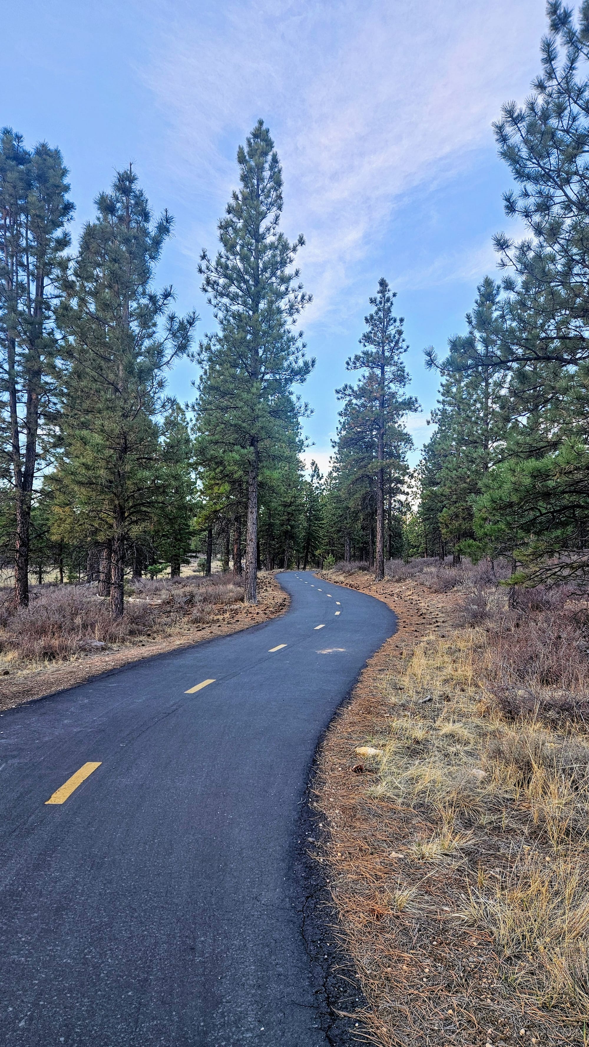
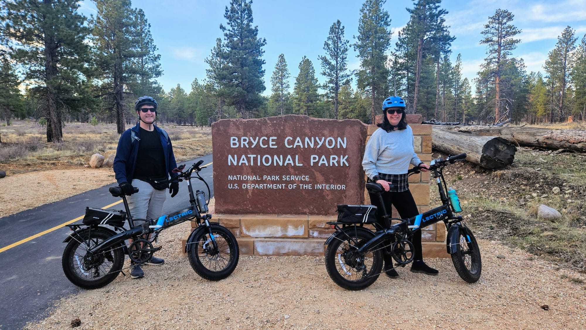
It was too early for the entrance gate to be open anyway, but we wondered how the park would handle the arrival of pedestrians and cyclists. Technically, an annual National Parks Pass is good for one vehicle, but when we're not in a vehicle, we're supposed to pay individually. Here, the bike path skirts the entrance gate entirely, and we didn't see any signs asking people to pay at the visitor center or anything. So, you didn't hear it here, but if you bike or hike into Bryce, you might be able to get in for free.
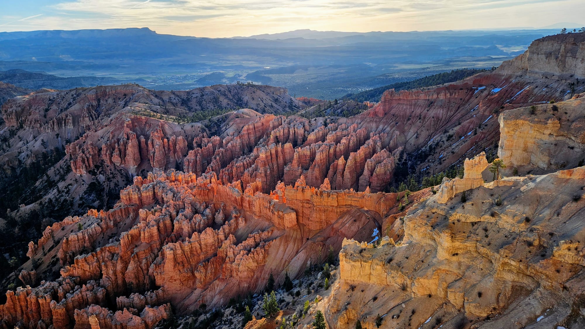
We made a short stop at the rim overlooks to see if the colors of the hoodoos looked different in the early morning light. They were a lot more vivid than the previous day. The sun had risen less than an hour beforehand.
The next segment of the ride was the wildlife segment. We saw many deer crossing signs, so we knew that this early in the morning, our chances of an encounter were high. Between Capitol Reef and Bryce, we started to wonder, do mule deer often travel in herds this large? We looked into it, and the herd sizes are very variable, with many traveling in solitude or small groups. However, when in a group, the typical size is 7. That's exactly how many we saw by the Fruita Schoolhouse at Capitol Reef. Here, though, the biggest herd we saw was 9. And they were definitely not expecting us.
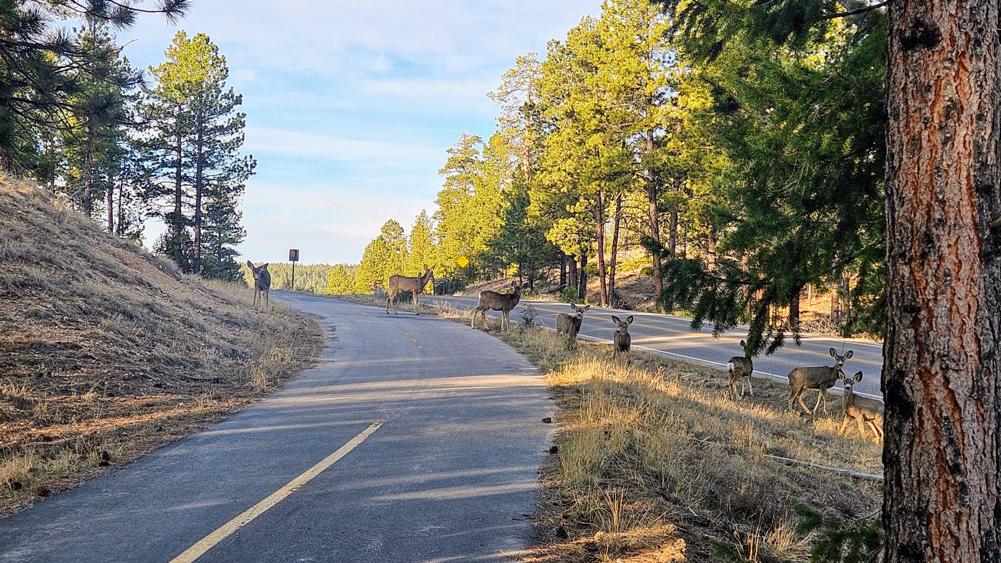
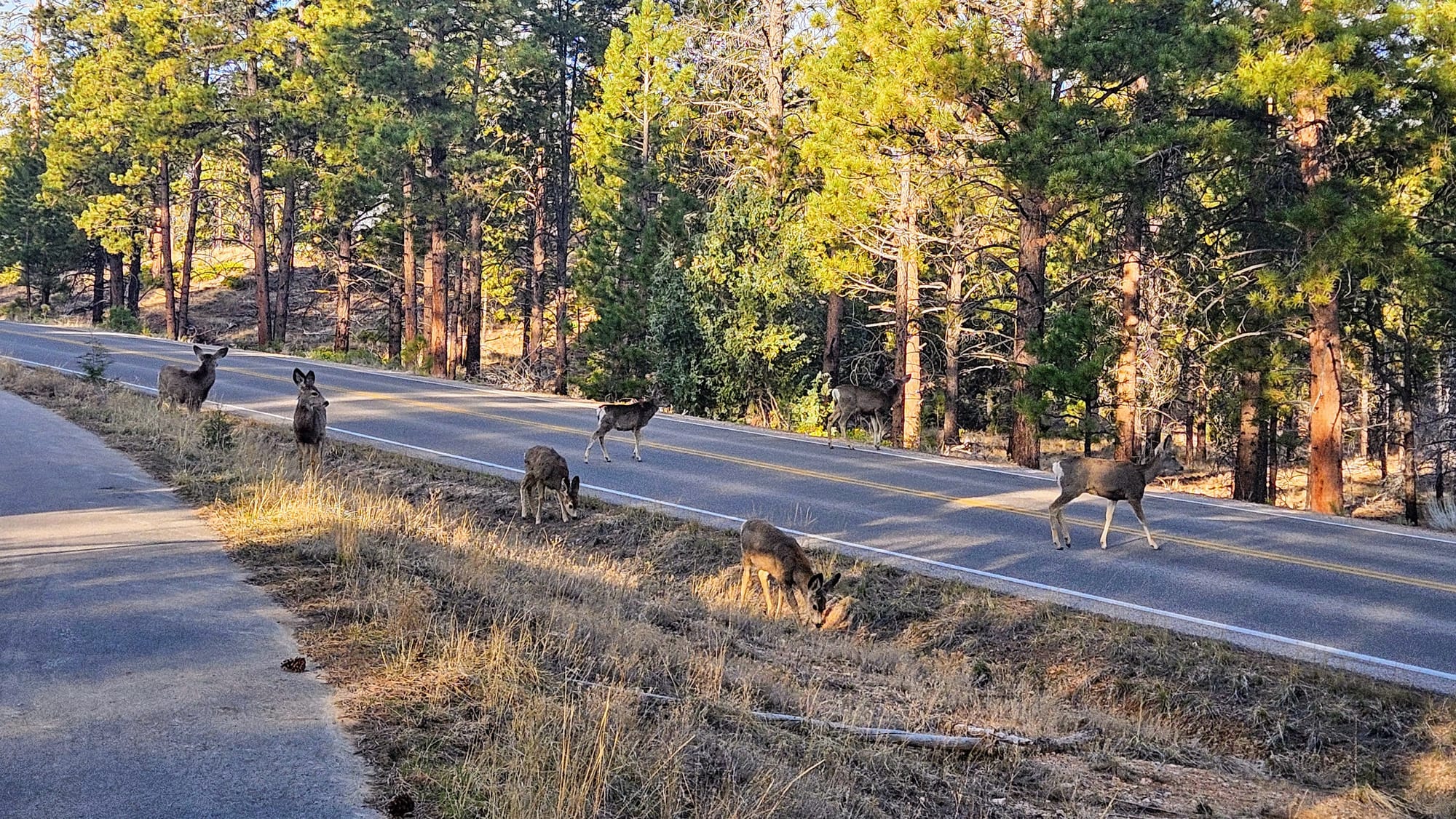
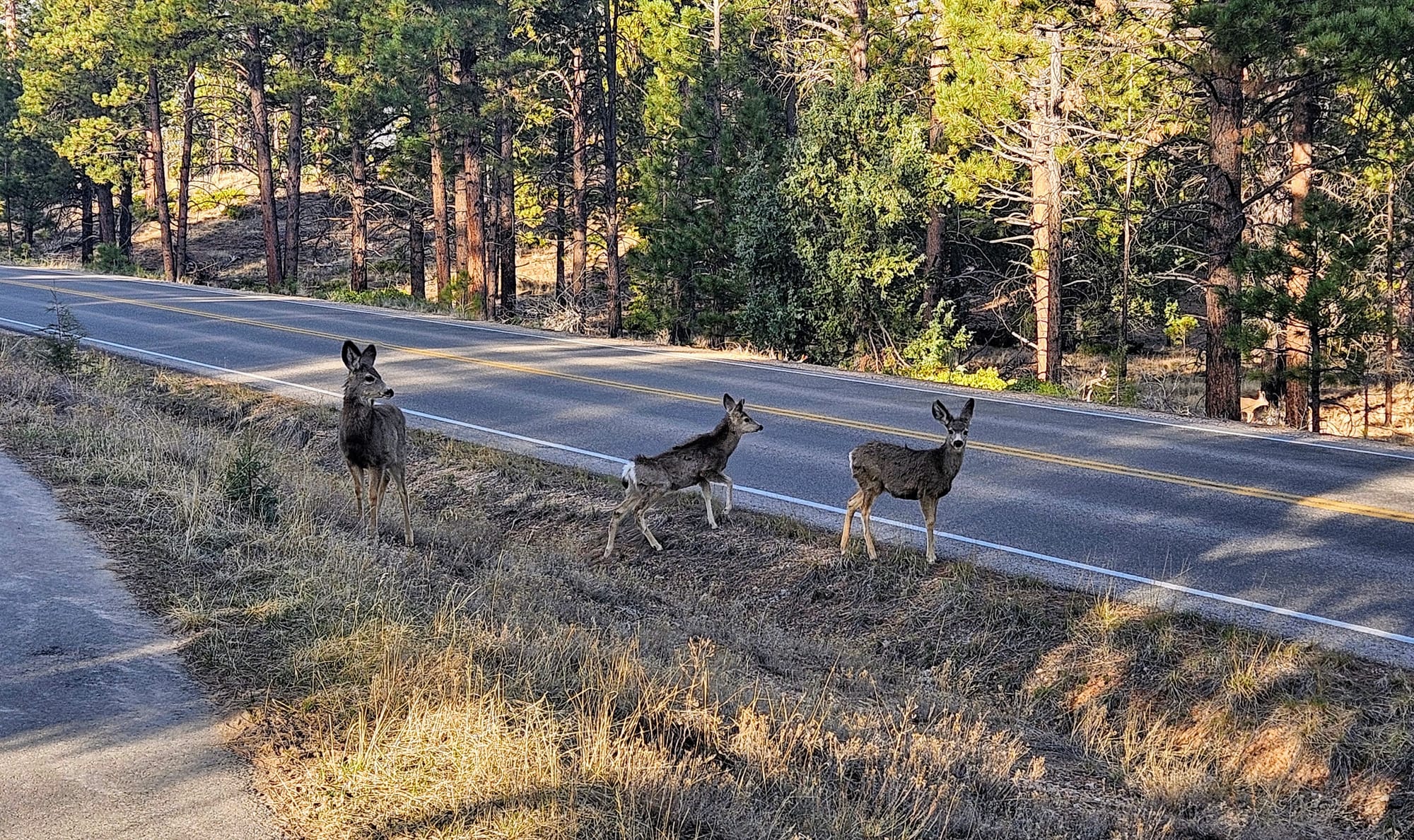
We tried to patiently wait for them to move, but then as soon as they crossed the bike path, they'd stop to look back at us...from the middle of the park road! We figured the best way to get them out of harm's way was to tell them we come in peace, and then slowly proceed forward, so they'd hopefully continue across the street in an attempt to get away from us. It worked.
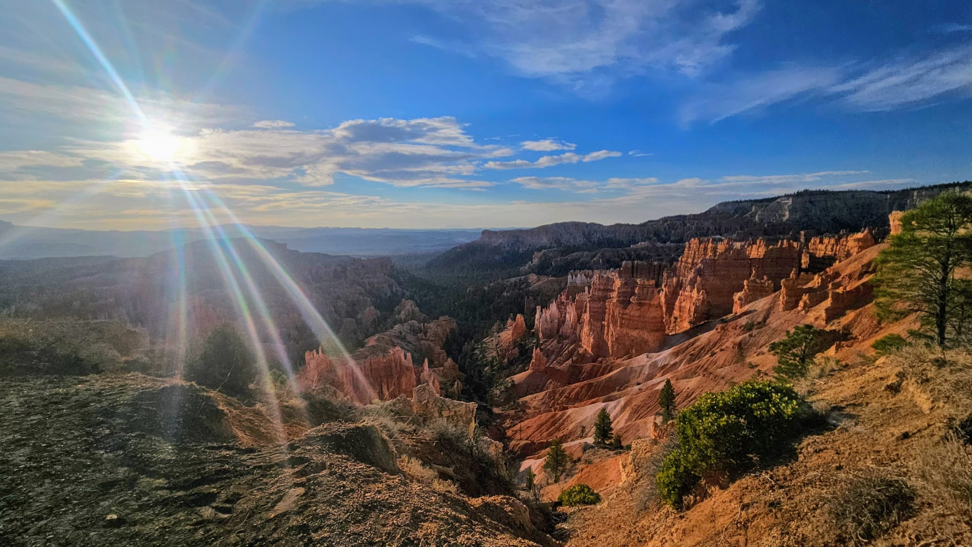
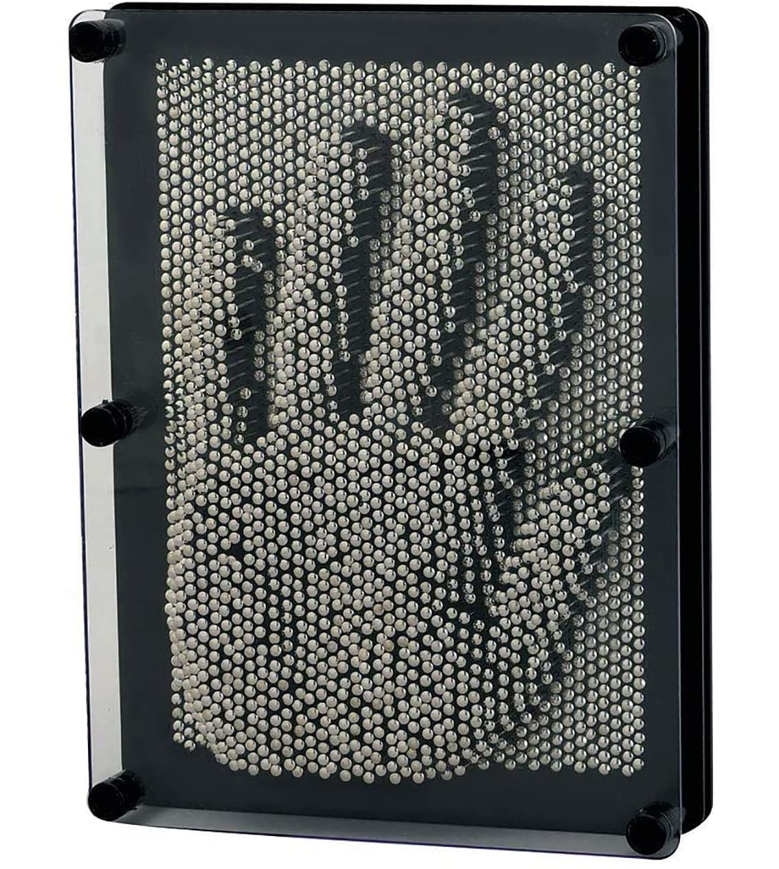
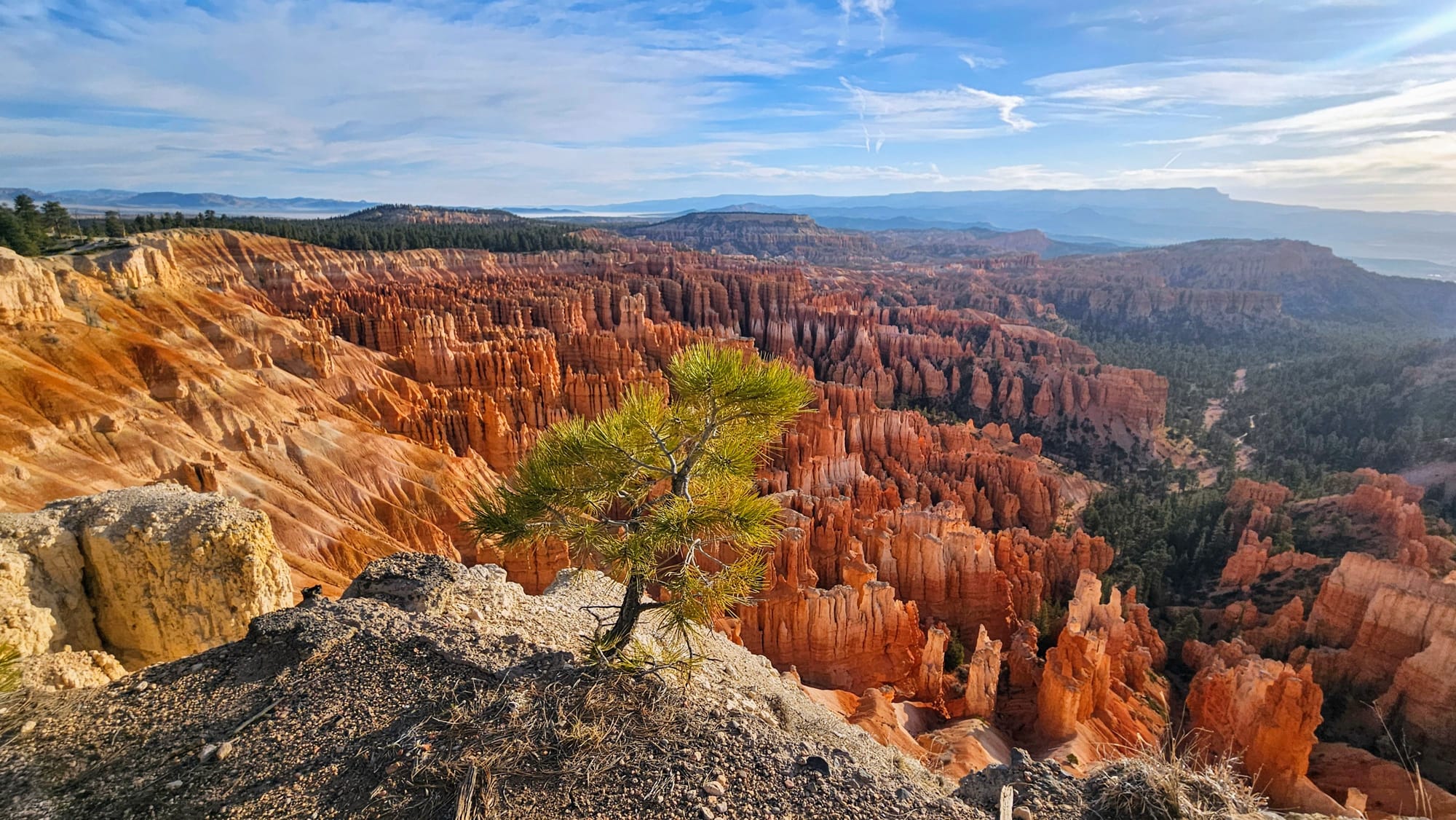
The multi-use trail ends at Inspiration Point, which offers views of the hoodoos from 8100ft. We parked our bikes and walked up to the lowest overlook. Then we noticed there were 2 more a steeper climb up. We didn't go all the way to the top, but we did climb to the 2nd overlook. We think the views from higher points are the best. The hoodoos look so tiny and crowded together! Kind of reminds me of one of these things.
But, we had plans the next day to go to an even higher overlook, at 8300ft, so the extra climbing could wait.
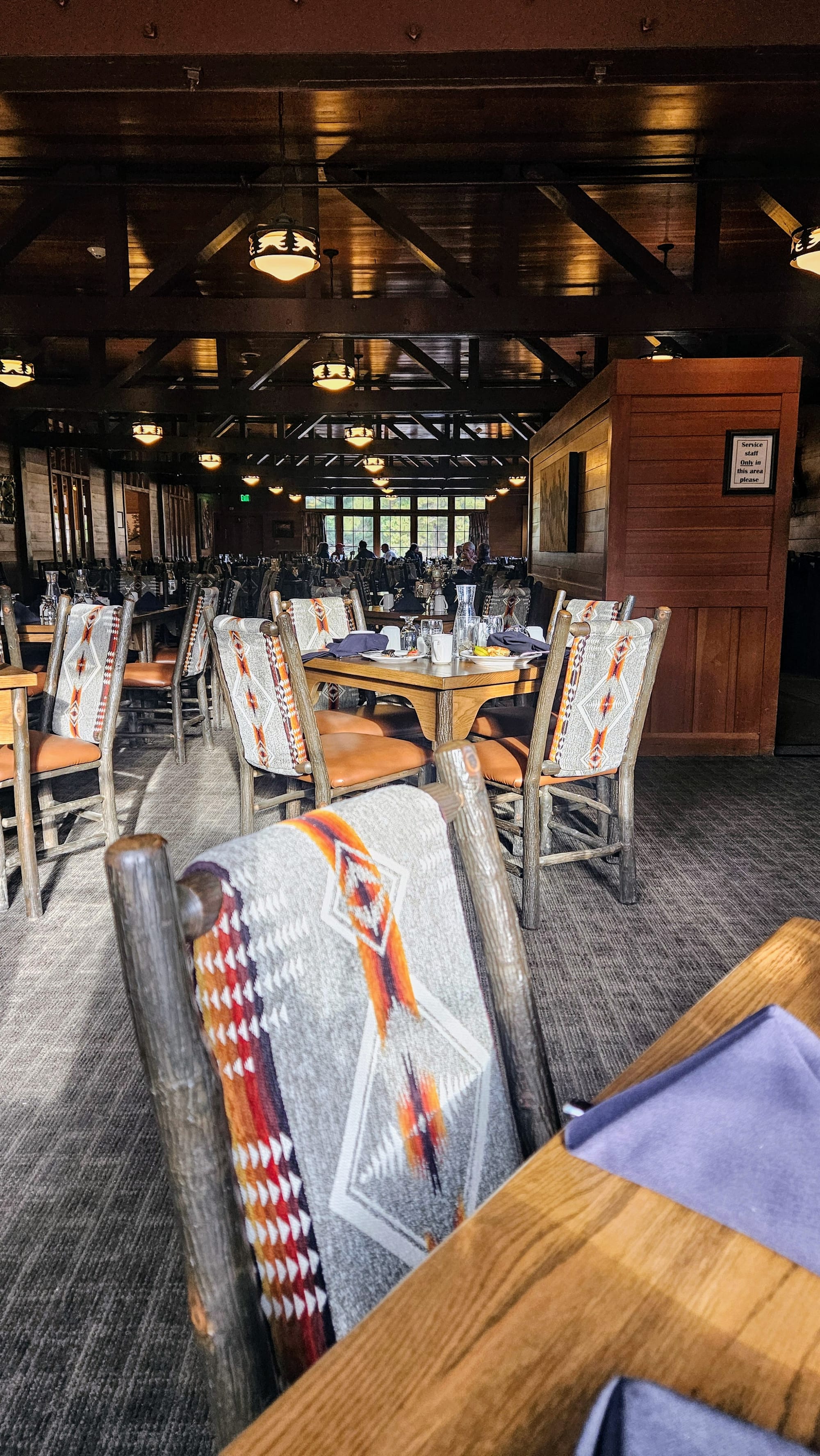
We worked up an appetite on our ride in, and so on the way back, we decided to grab breakfast at Bryce Canyon Lodge, the park's historic lodge that's been in operation since 1925.
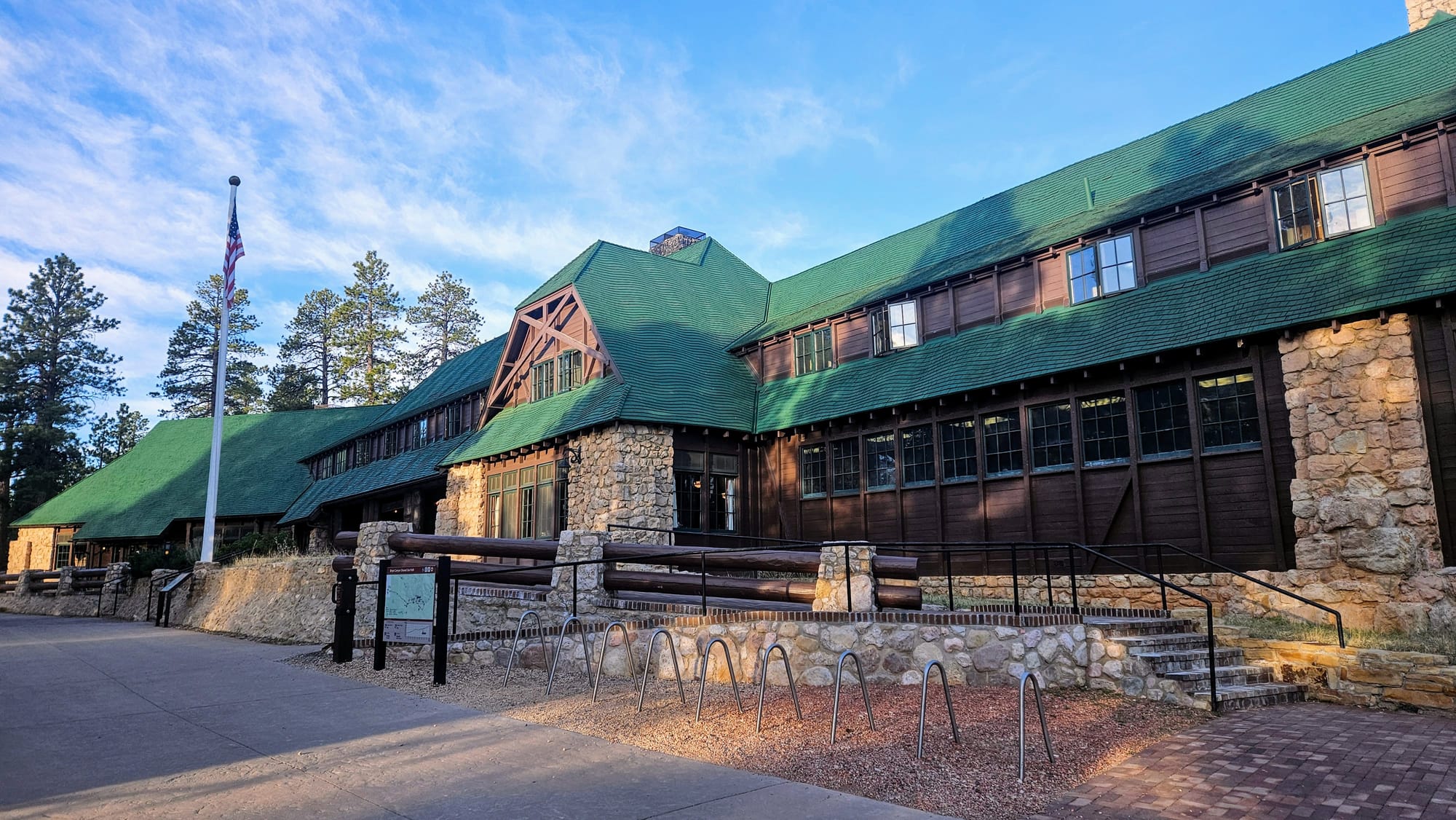
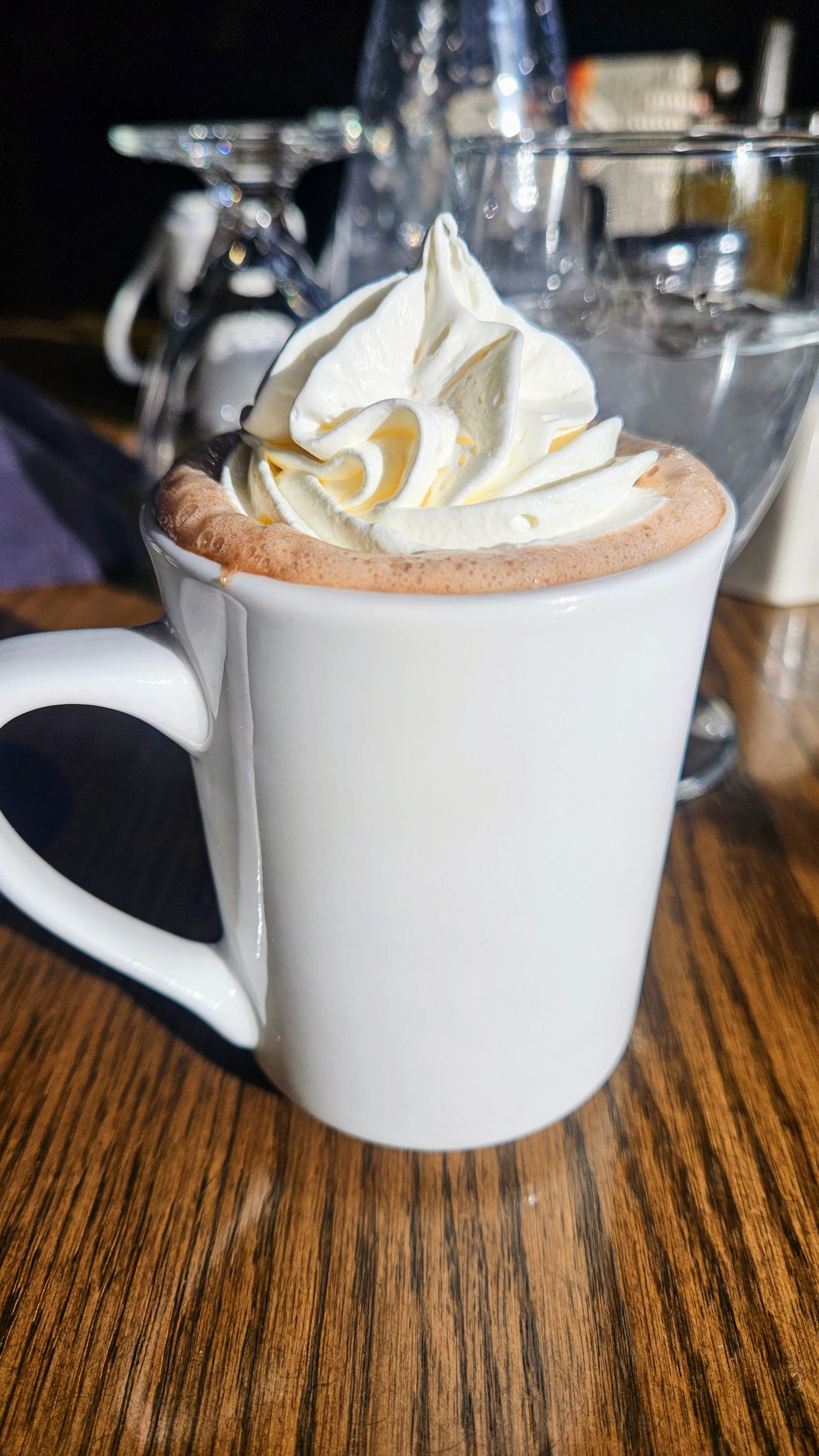
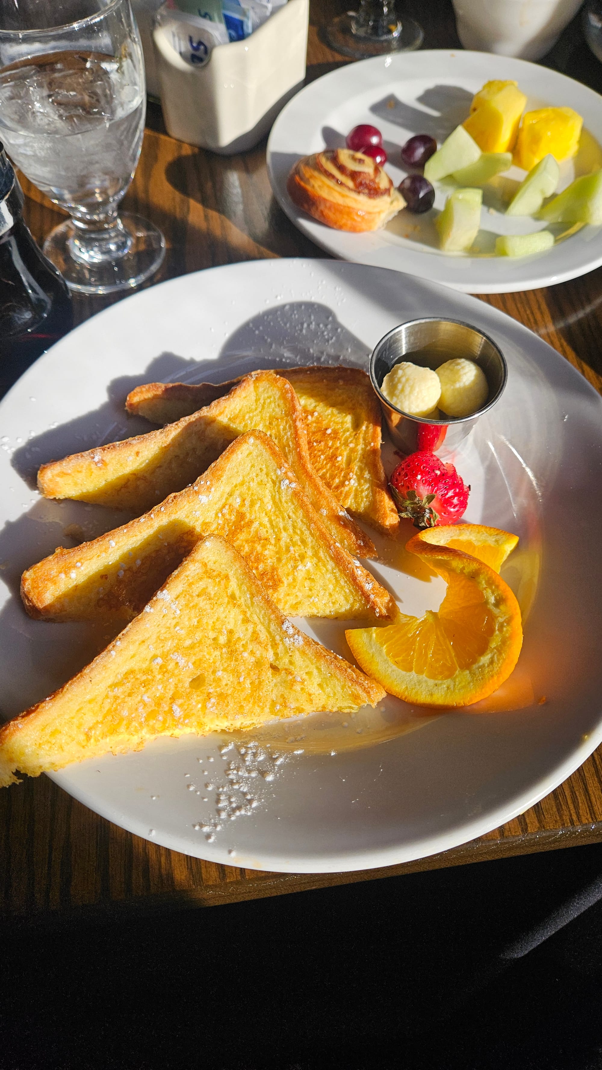
The lodge vibe was just the level of coziness for us to take a break and warm up with some coffee and hot chocolate. For breakfast, you can choose from an all-you-can-eat buffet or a few entrees. Anthony did the buffet and I had the sunrise French toast.
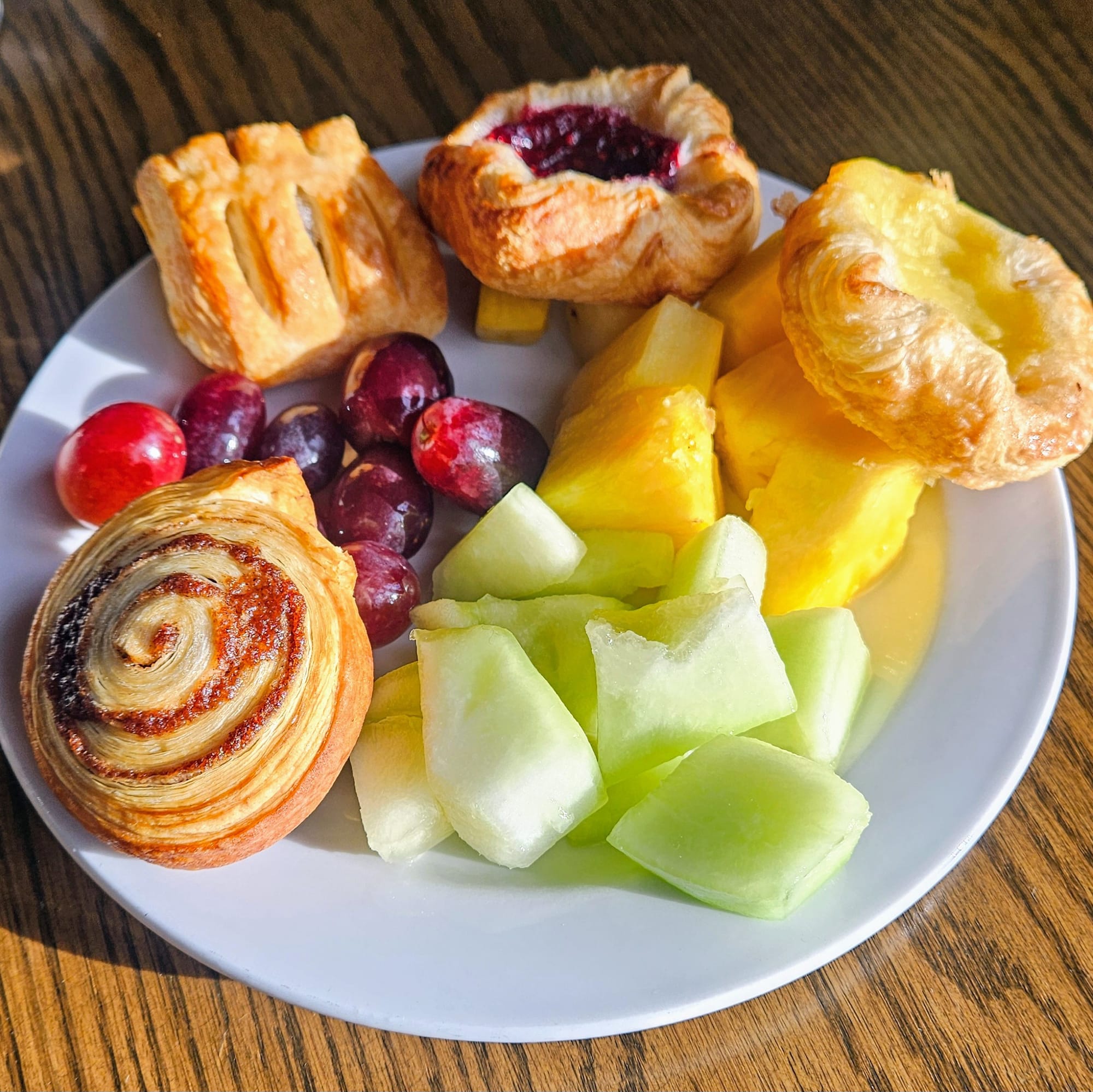
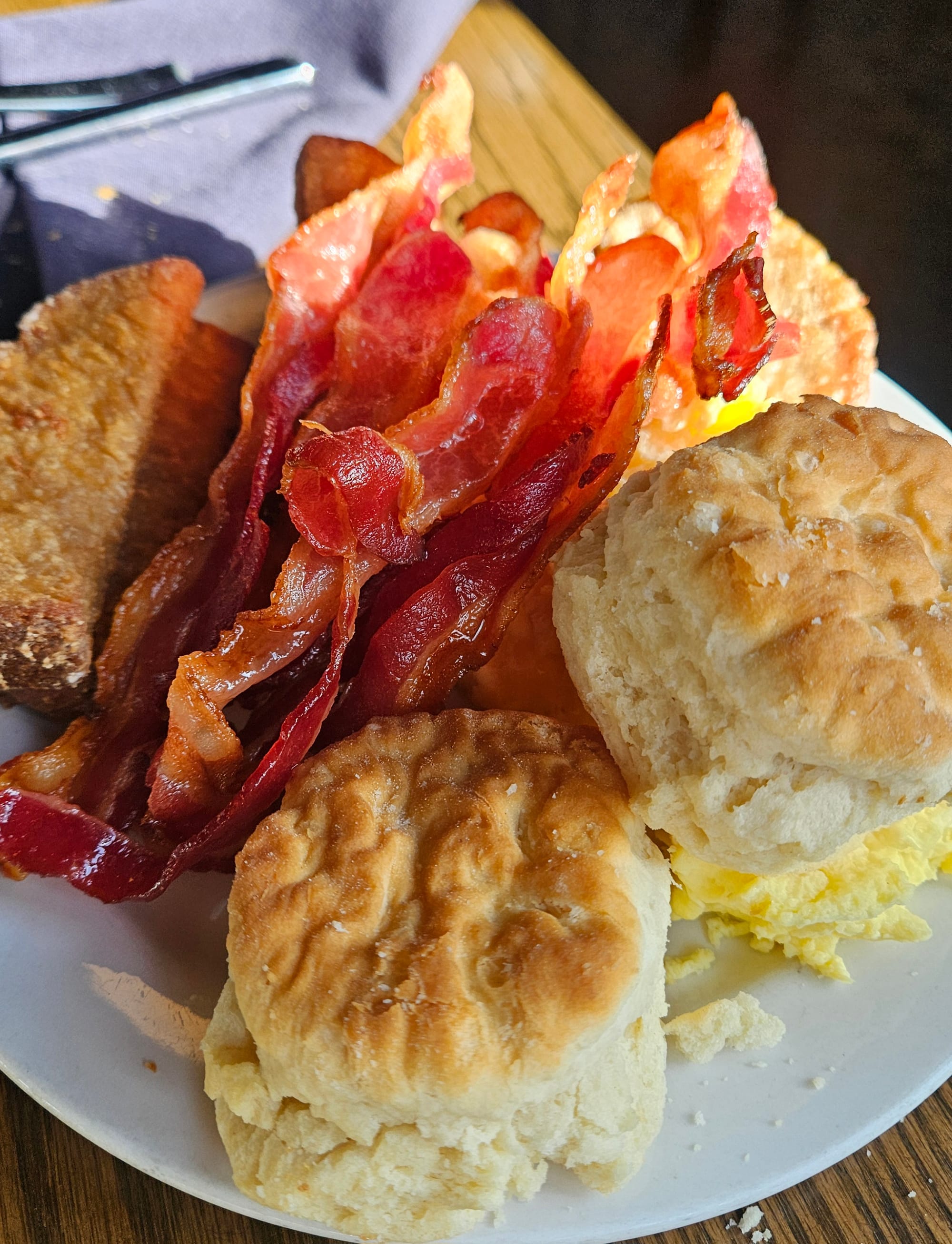
The ratings for this restaurant are average, but we thought the food was exactly as satisfying as we'd expect from a national park lodge. The buffet food could have been warmer and the biscuits definitely needed their gravy, but everything was cooked properly and had good flavor. The staff were also very friendly, with the hostess even coming to check on me during the meal to make sure I was perking up because I had told her I hadn't slept well that night. (She shamelessly threw shade by blaming the campground, but in reality it was just my monkey mind).
After breakfast, we whizzed back to camp. The return trip was mostly downhill, and the remaining 4 miles went by in a flash.
We loved this bike ride. The separate road from vehicles was a huge plus, and there were ample bike racks at every place we chose to stop. The scenery was the icing on the cake. The elevation gain is substantial, at about 670ft on the way in. We mostly kept our ebikes on PAS 2 to make our ride nice and leisurely.
Sunrise from the Rim
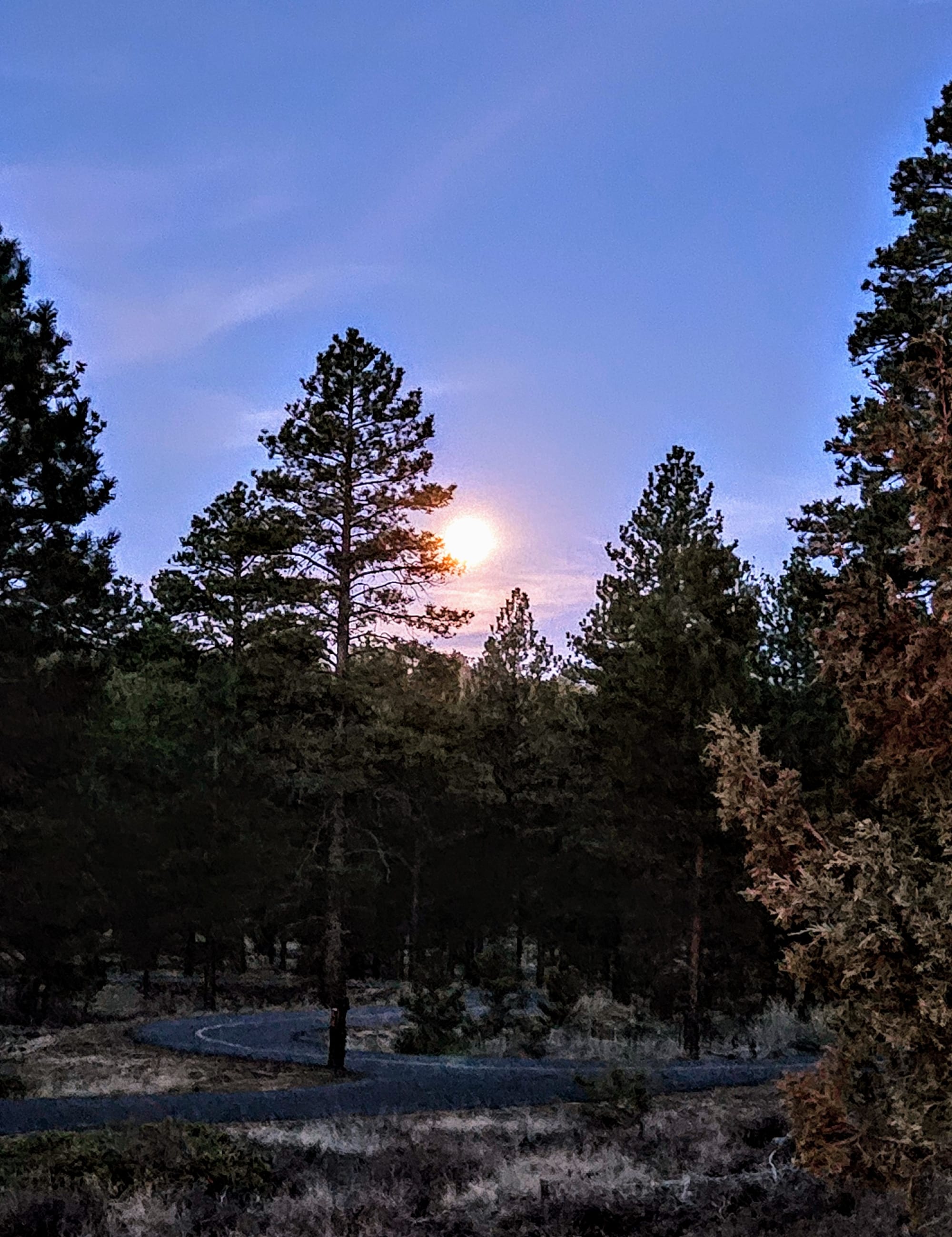
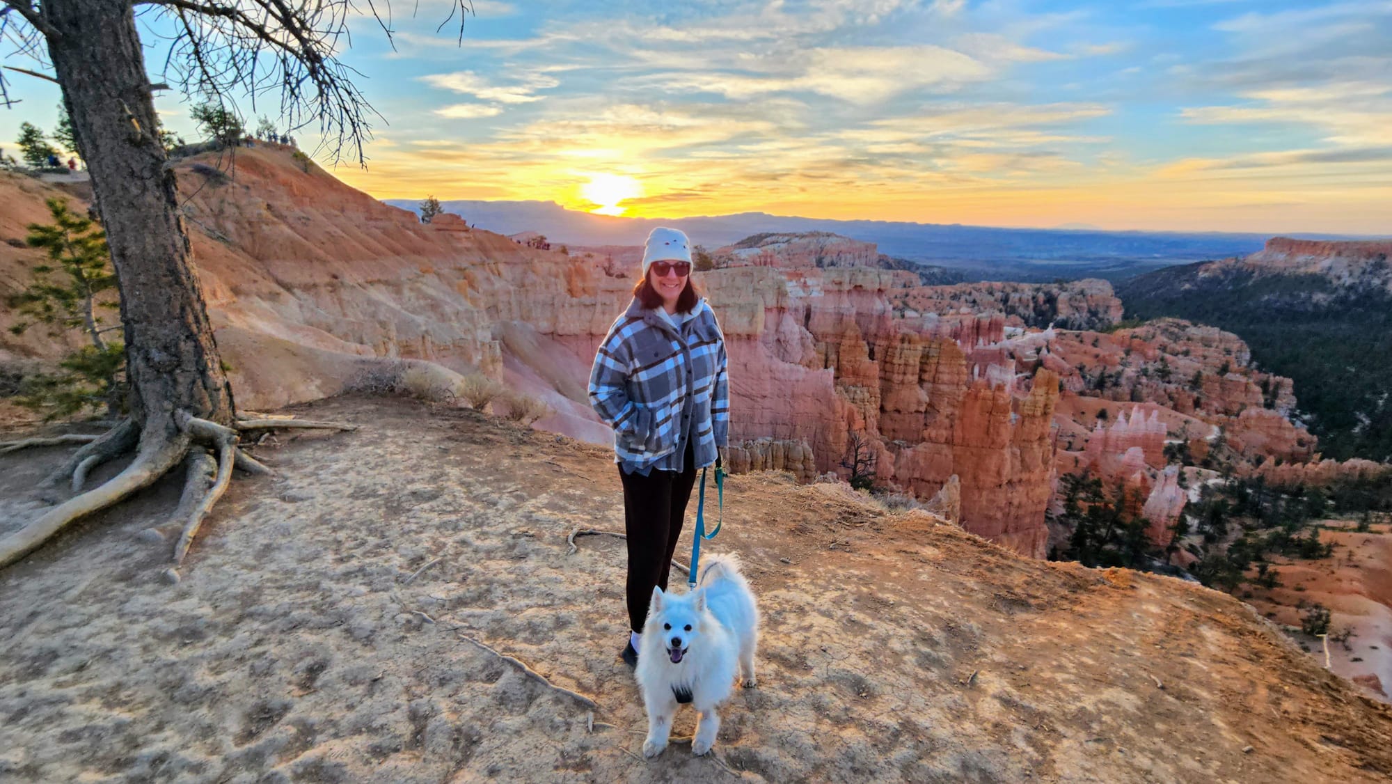
Saturday night brought the April full moon, which was still shining bright as we left for our final Bryce excursion Sunday morning. Time to see what sunrise at Sunrise Point was really like! Tanner accompanied us this time. Dogs are allowed on all paved sections of the national park, including overlooks and the Rim Trail between Sunrise and Sunset Points.
The sun was rising just before 7am and we got to the Sunrise Point parking lot a little before 6:30am. Another chilly morning, but surprisingly a decent number of people braved the cold. We were still able to grab an empty bench between Sunrise and Sunset Point. Like a perfectly timed handoff, the full moon set behind us just as the sun rose in front of us.
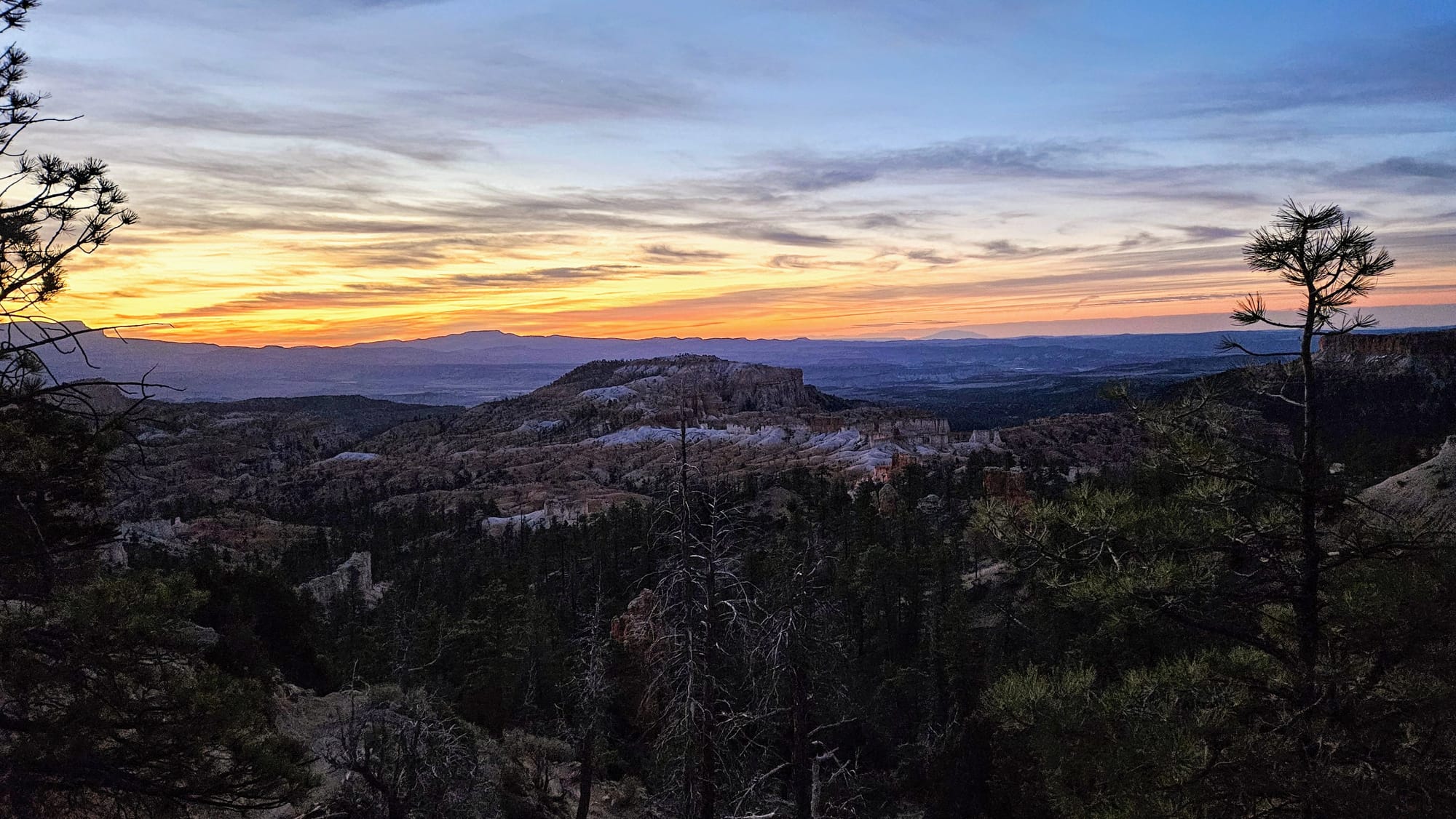

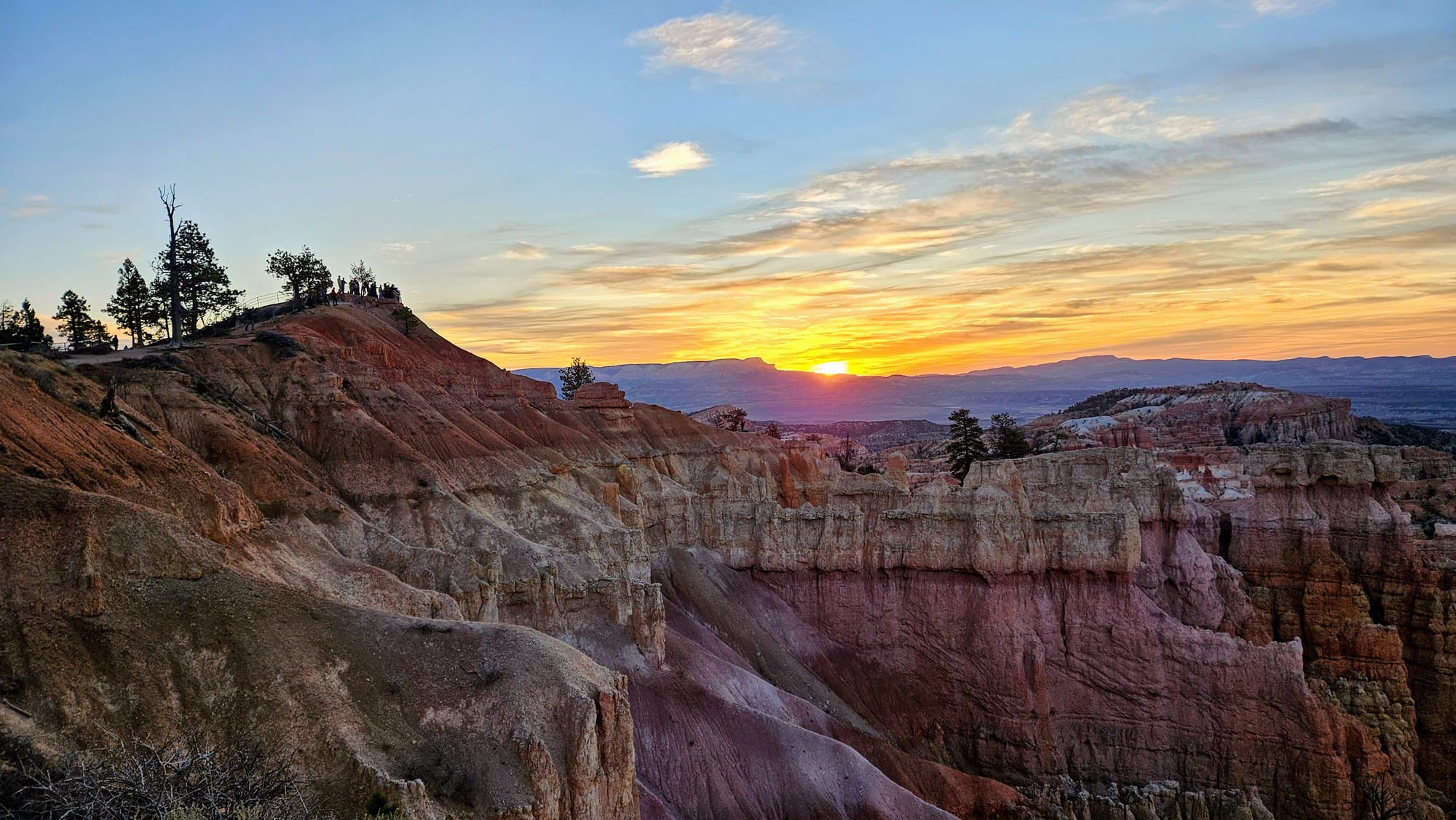
Once the sun rose high enough above the horizon, we were treated to the vibrant glow.
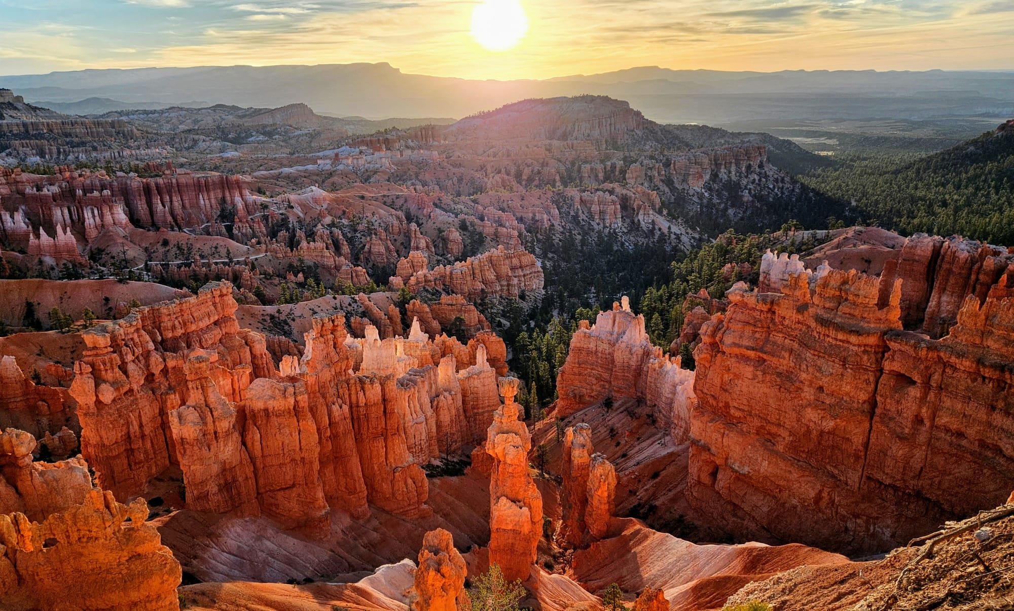
It was official. Bryce Canyon's Sunrise and Sunset Points do it right. You can watch either sunrise or sunset from either point, and you can roam the rim to get different perspectives. The added space also means that people can spread out instead of all funneling into one overlook. We had the best of both worlds, first with the sunset and then with the glow. There were just enough clouds to make the sunrise interesting while still allowing a vivid reflection on the rocks.
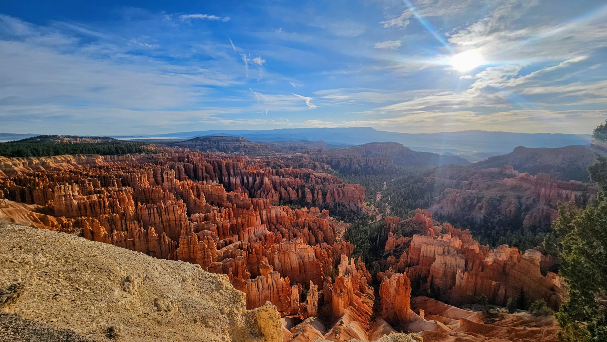
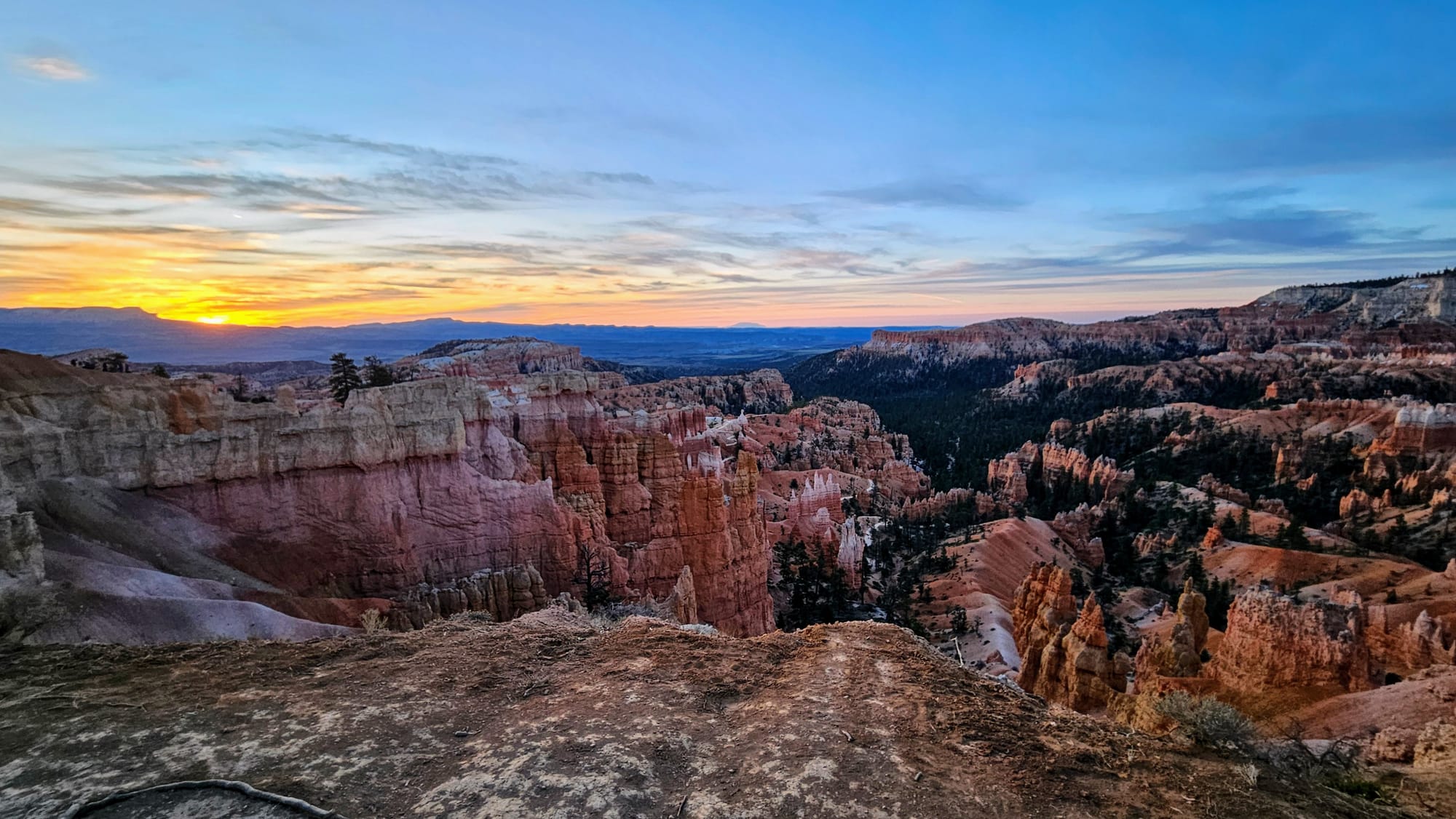
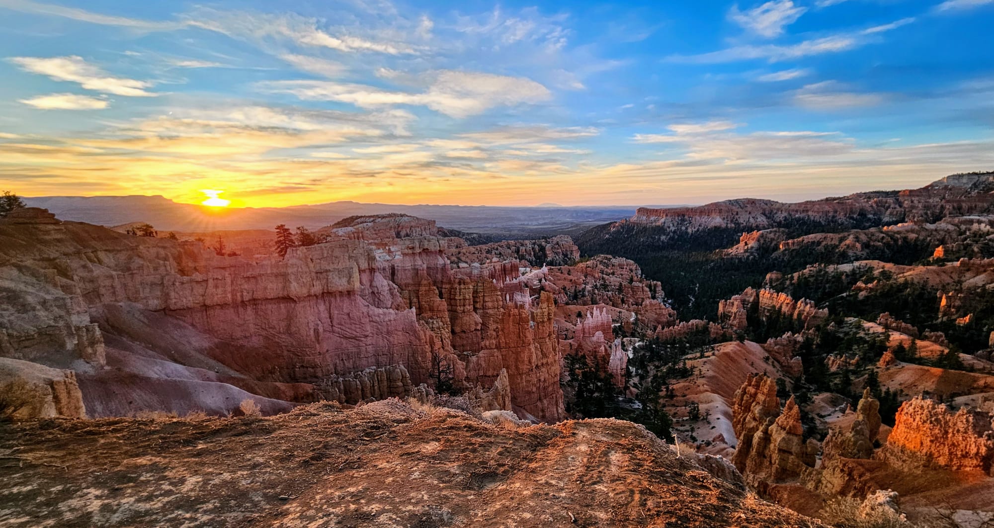
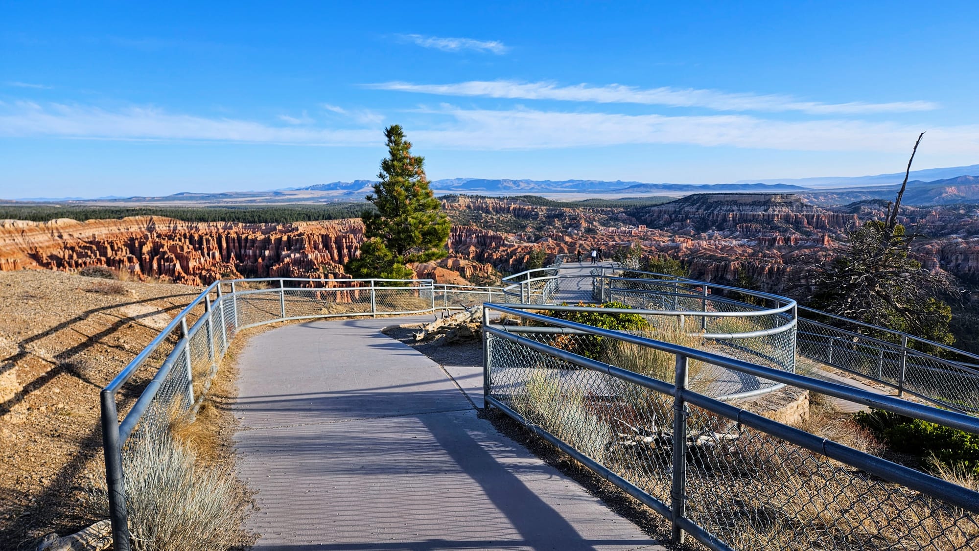
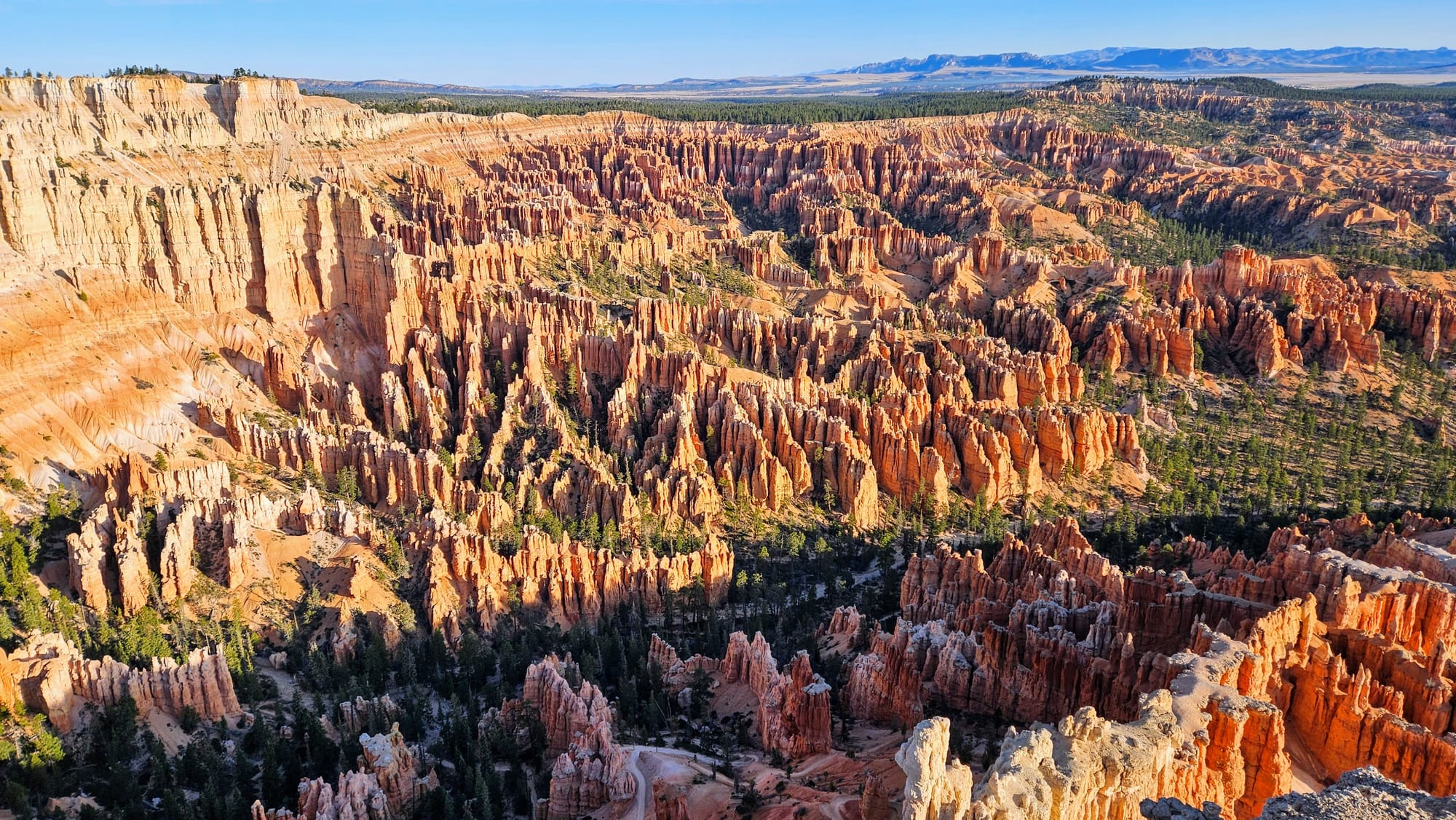
Bryce Point
For our last stop, we drove up to Bryce Point, the overlook at 8300ft that the NPS calls the "most iconic" of the park's viewpoints. We had only caught a little glimpse of this overlook from the shuttle on our first day in the park. In fact, it was our first glimpse of the amphitheaters in general. But the overlook itself is a short walk that leads to a platform on a cliff, with views in every direction.
I had built Bryce Canyon up in my mind for 6 years, and yet the park still exceeded my expectations. If you haven't noticed, it's a photographer's dream. It's unique, vast, and has so much color contrast and depth. The recreation here is great, and whether you're in the park or just outside it, there is always something to do or see. The forest was wonderfully peaceful, which was a perfect juxtaposition to the bustling RV park. We also lucked out with great weather. The cool mornings gave way to warm, sunny afternoons. The average temperature in April is typically in the 50s, but a warm front brought a spring heatwave, with temperatures reaching the high 60s and low 70s. Coming on the shoulder season, not everything was open, but we didn't need to deal with crowds. When we think about what we want from a national park, Bryce has it all. Already, we want to sing its praises as our favorite park of the Mighty 5, but we still have one more to go, and it's a favorite of many. Guess we'll just have to see where it ends up falling in our ranks.