Why RVing to Sequoia and Kings Canyon is so hard
When our travels this year brought us to central California, we thought long and hard about what destinations we'd want to include. Sequoia and Kings Canyon National Parks had been on our bucket list for years, but we were hesitant to RV to them for a few reasons, many of which we mentioned in our last blog post. Something else we noticed, though, was that RVing to these parks is logistically very difficult with a rig our size.
The Sierra Nevada Mountains span 430 miles along California's Central Valley and the Great Basin. RVing mountains in general can get pretty dicey at times, but the Sierras take it to a whole other level - literally. The mountain range has the tallest peak in the contiguous United States, Mount Whitney, at 14,505ft. What's most difficult about RVing to this mountain range is that the destinations people want to visit are vast, and the roads leading to them are often filled with twists, turns, and switchbacks in an attempt to navigate the changing elevations.
Sequoia and Kings Canyon National Parks comprise 900,000 acres of the Sierra Wilderness, and unlike many US national parks, camping inside them is not possible for any rig larger than a small motorhome. Generals Highway, the main road leading through the parks, has portions where the recommended length limit is no more than 22ft. That's the length of our truck alone! Between these restrictions and the fact that the park campgrounds are closed most of the year, we knew that we'd need to stay outside the parks. This is something we often choose to do anyway, so it's not a problem fundamentally. The issue arises when we discover that "outside the park" often means a very long, grueling drive to the features we want to see.
I had researched RV parks near Sequoia and Kings Canyon a few times during this season of travel, just in case our route brought us to the region. It was slim pickings. The easier campgrounds to access were well outside the parks, which meant we'd be dealing with drives over an hour just to get to the visitor centers. The campgrounds closer to the park entrances would cut our commute time down, but we'd need to take some gnarly roads to get our rig there. This realization is what made us initially scrap the Sequoia plan entirely. We didn't feel like RVing tight mountain roads, nor did we feel like driving an hour or more just to visit the park. The longer our drive, the less time we can spend exploring inside the park. Tanner is now 13 years old and still adjusting to being without Lily when we leave, so we can only leave him for a handful of hours at a time. To add to the difficulty, Sequoia and Kings Canyon are places where we want to spend more time and take longer hikes. We don't want to feel rushed.
Then we found ourselves in Central California for real, with time to head to Sequoia. Tanner has been doing well this year, gaining more energy and feeling pretty healthy overall, so we thought we could risk going into the mountains and planning a few longer days away from the rig. Back to RV Trip Wizard I went, once again researching our options for nearby RV parks.
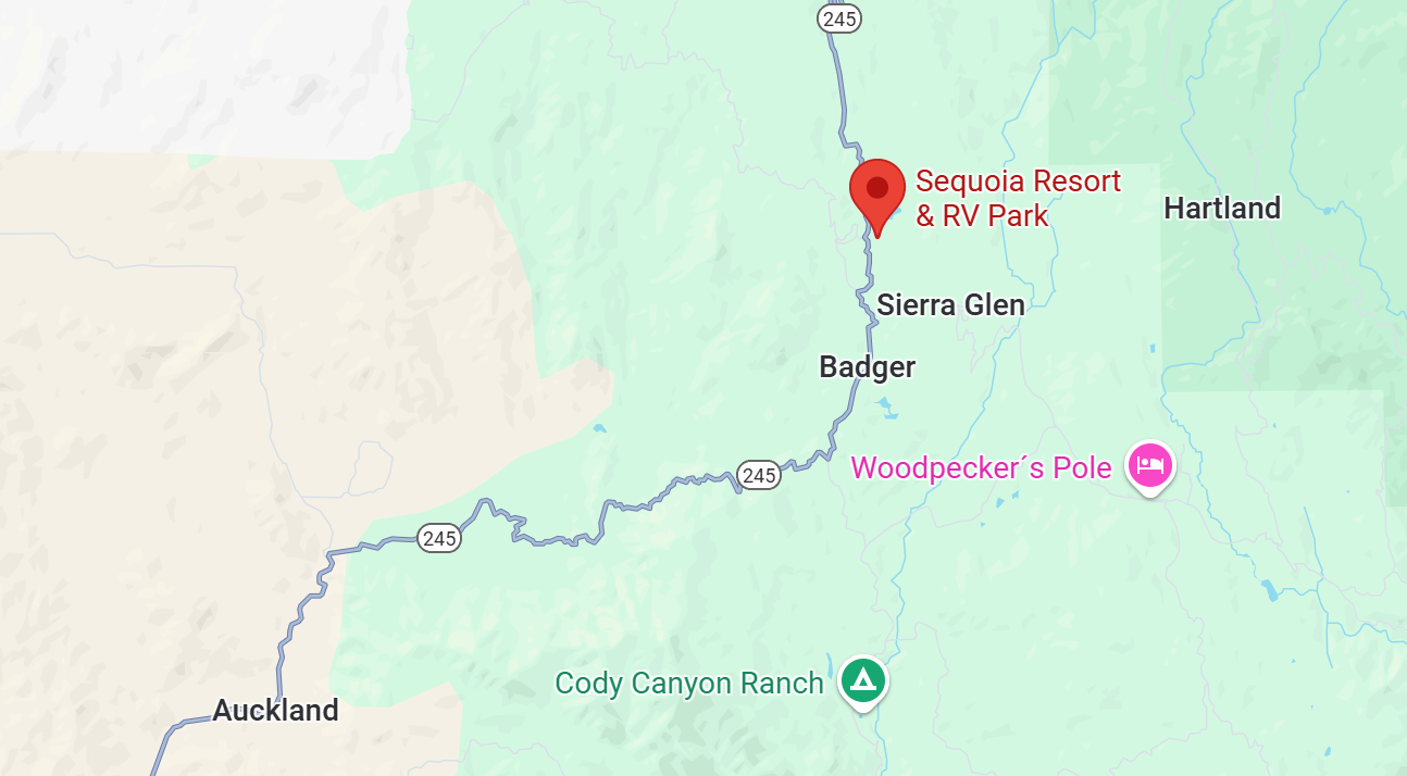
I narrowed our choices down to one of the couple of parks in Three Rivers, the gateway town for Sequoia, and Sequoia Resort, located close to the Kings Canyon entrance.
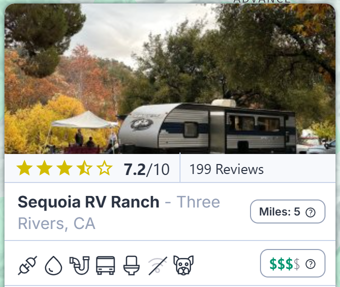
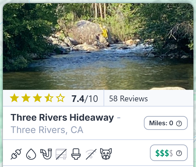
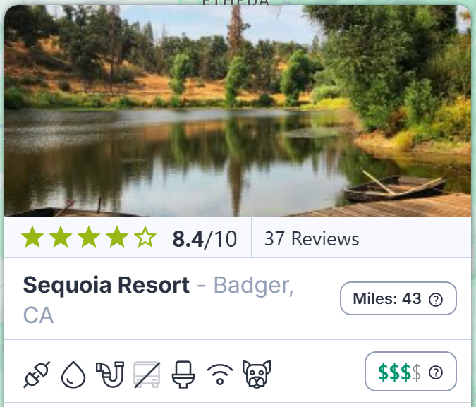
The Three Rivers campgrounds seemed more accessible and were only a short drive to the Sequoia entrance, but neither were rated great. Sequoia Resort looked beautiful and was rated much better, but many of the reviews stated that getting to the park was very challenging. Street Viewing the area confirmed this. We decided that, if we were going to head to the parks, staying in Three Rivers made the most sense. While this would get us into Sequoia quickly, Kings Canyon would be a long drive. We even talked about splitting our time between Three Rivers and Badger, but we didn't want to tack on more mountain driving just for a few nights' stay.
Our next obstacle was seeing if either of the Three Rivers parks had availability. They are small campgrounds, and we wanted to stay in the area for a week. Sequoia RV Ranch had only dry camping availability, but Three Rivers Hideaway said they could fit us in for 6 nights on full hookups with 30amp electric. We took it. Dry camping would have been feasible, but the week's forecast was saying high temps in the 80s and 90s. We wanted to run our ACs and not worry about draining our batteries when leaving Tanner during our excursions.
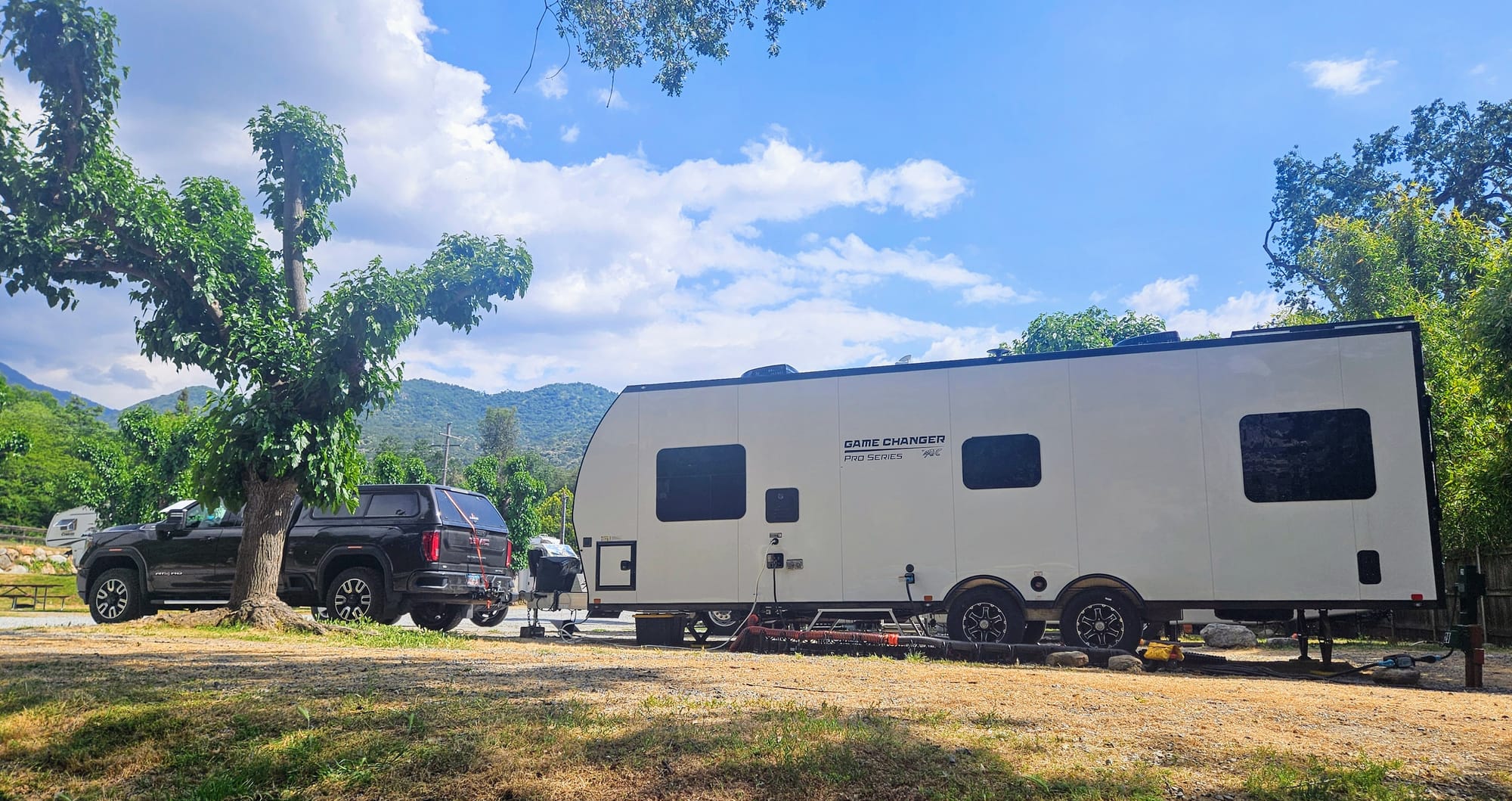
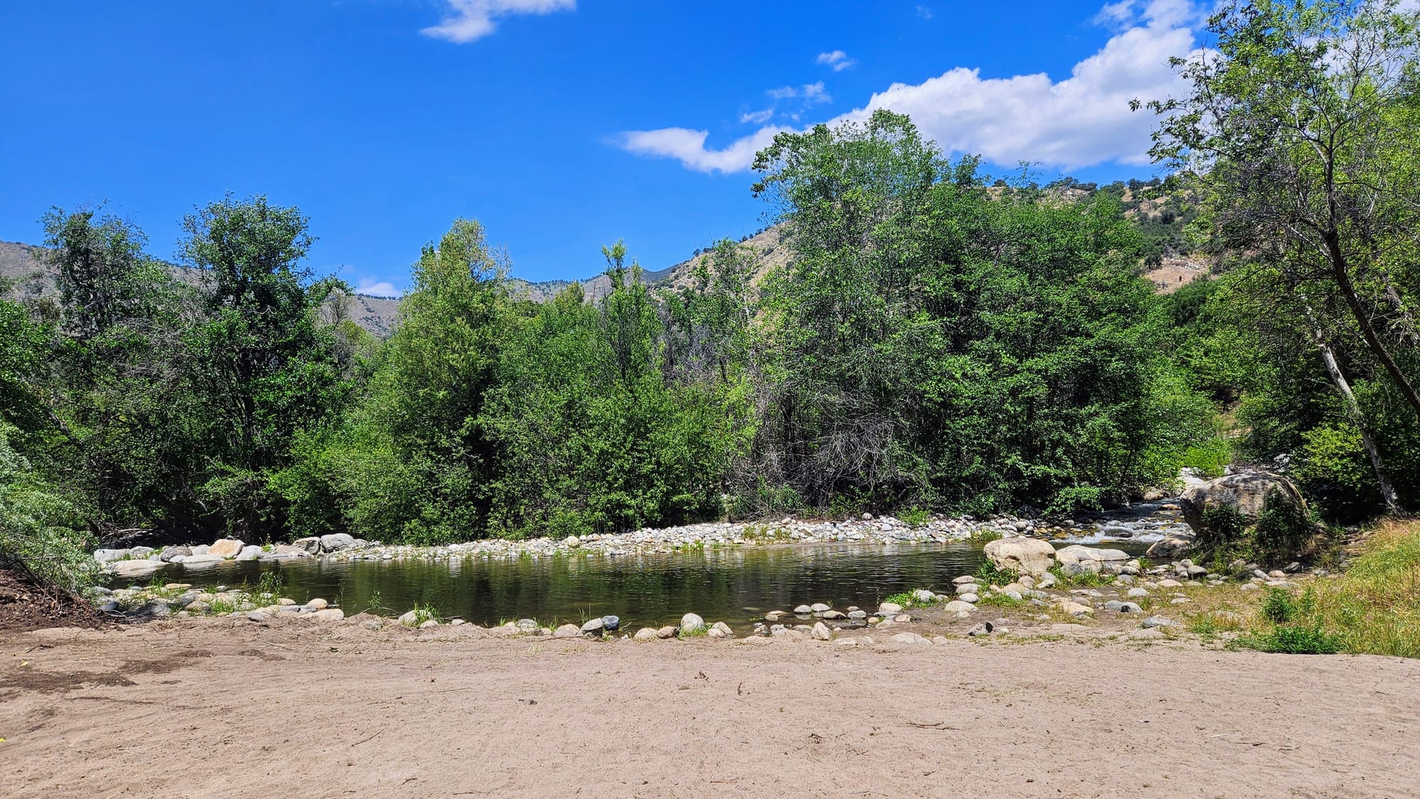
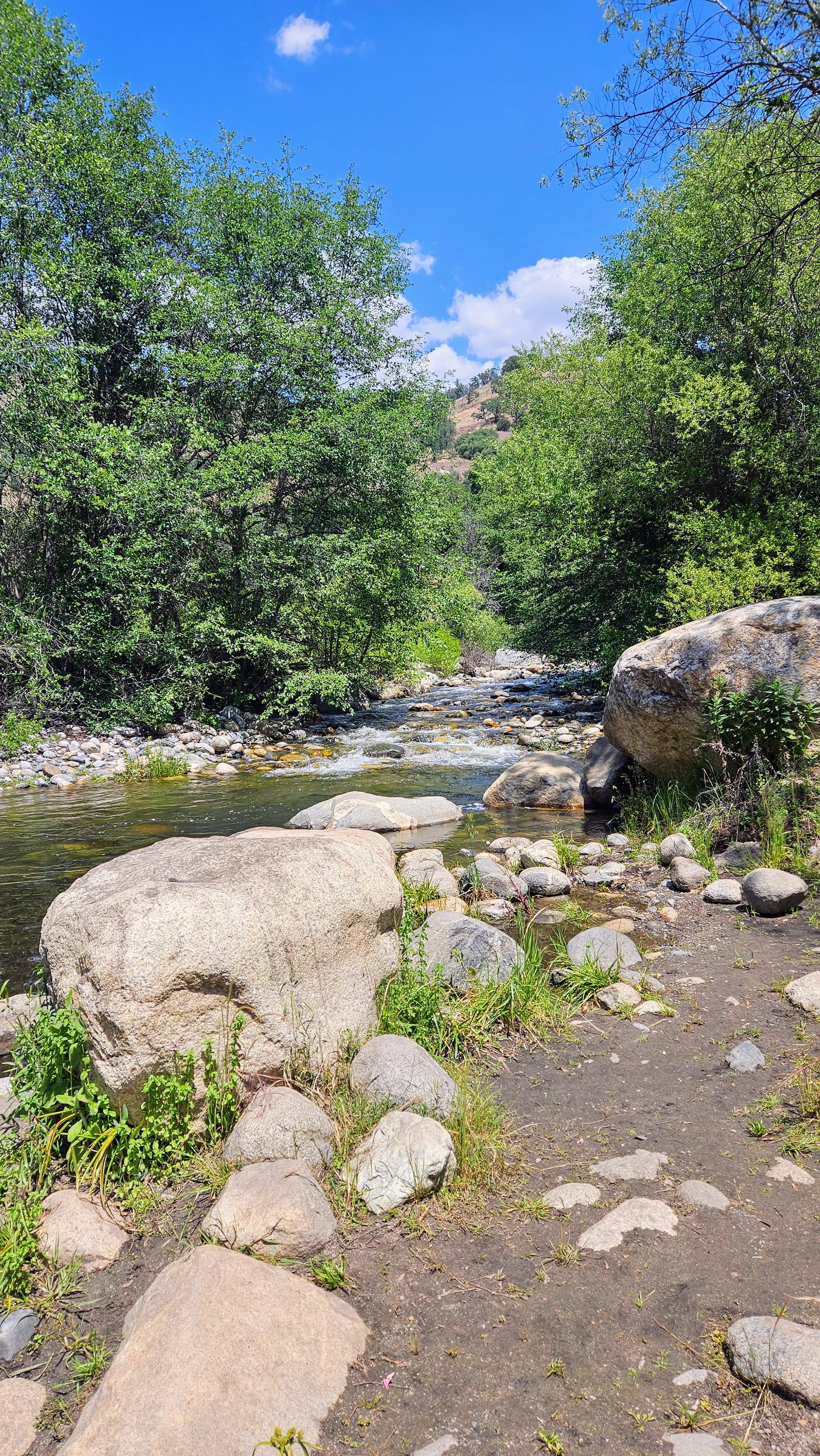
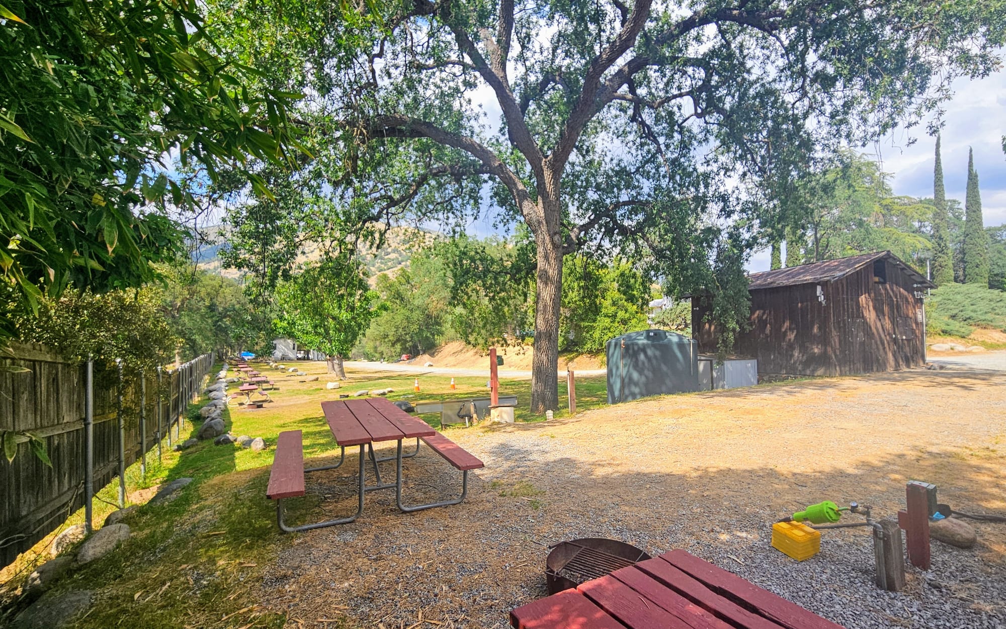
The town of Three Rivers is very small and mostly has lodges and a few shops/restaurants. Three Rivers Hideaway is also very small. The sites are close together and the roads are a bit tricky for big rigs, but everything is manageable. The staff do what they can, attempting to nestle the picnic tables and fire rings at the back of the sites so people don't need to recreate right next to their neighbor's sewer hose. The campground also has a small riverside beach, which they share with a company that offers whitewater rafting.
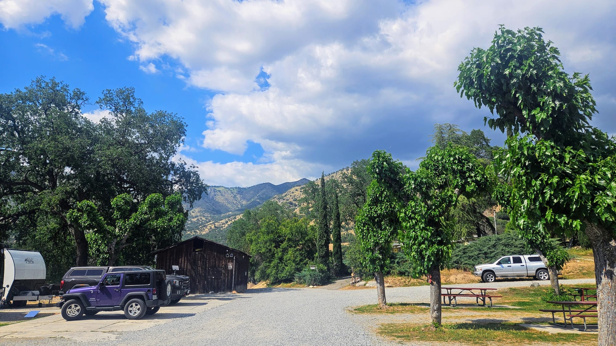
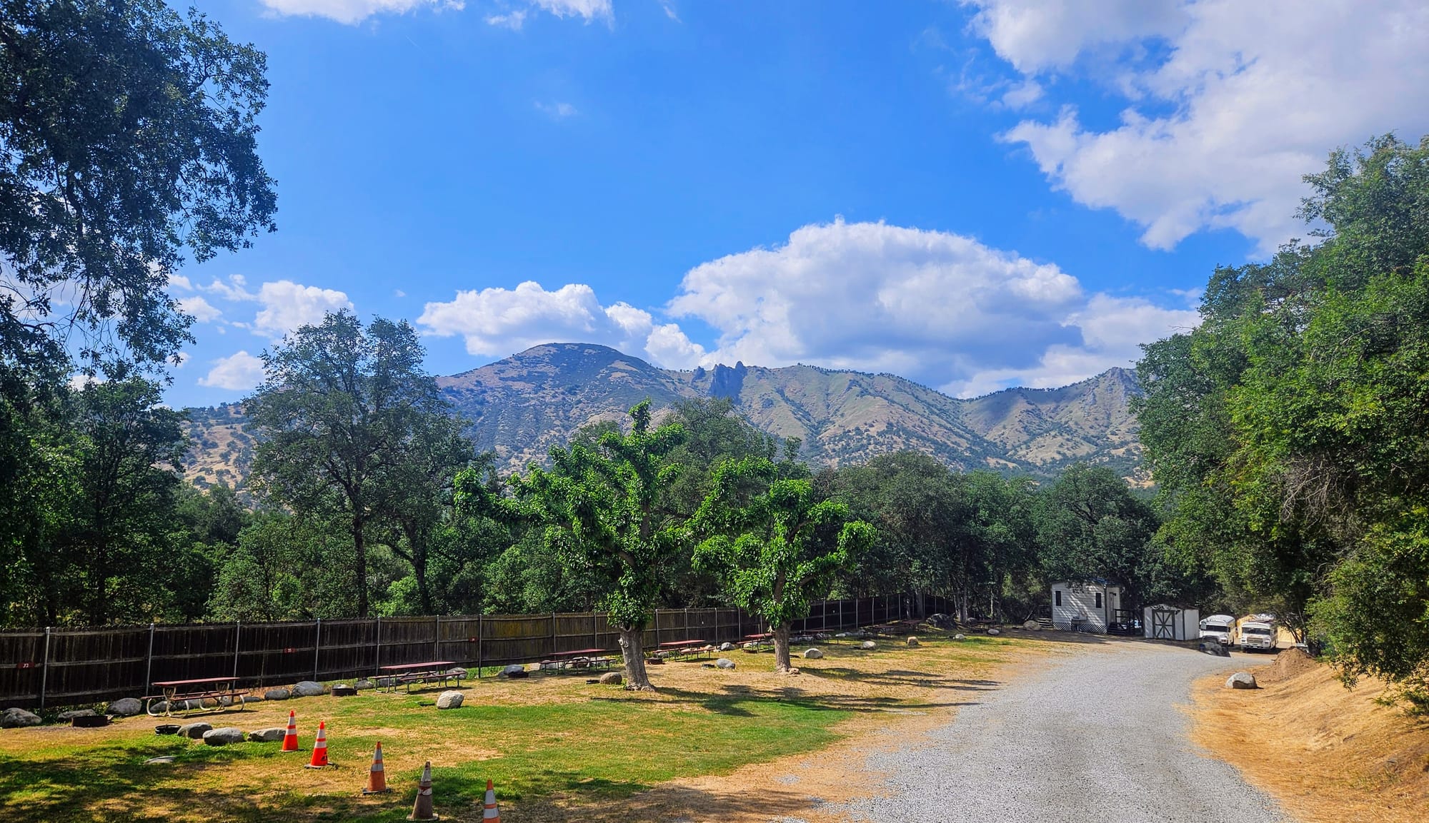
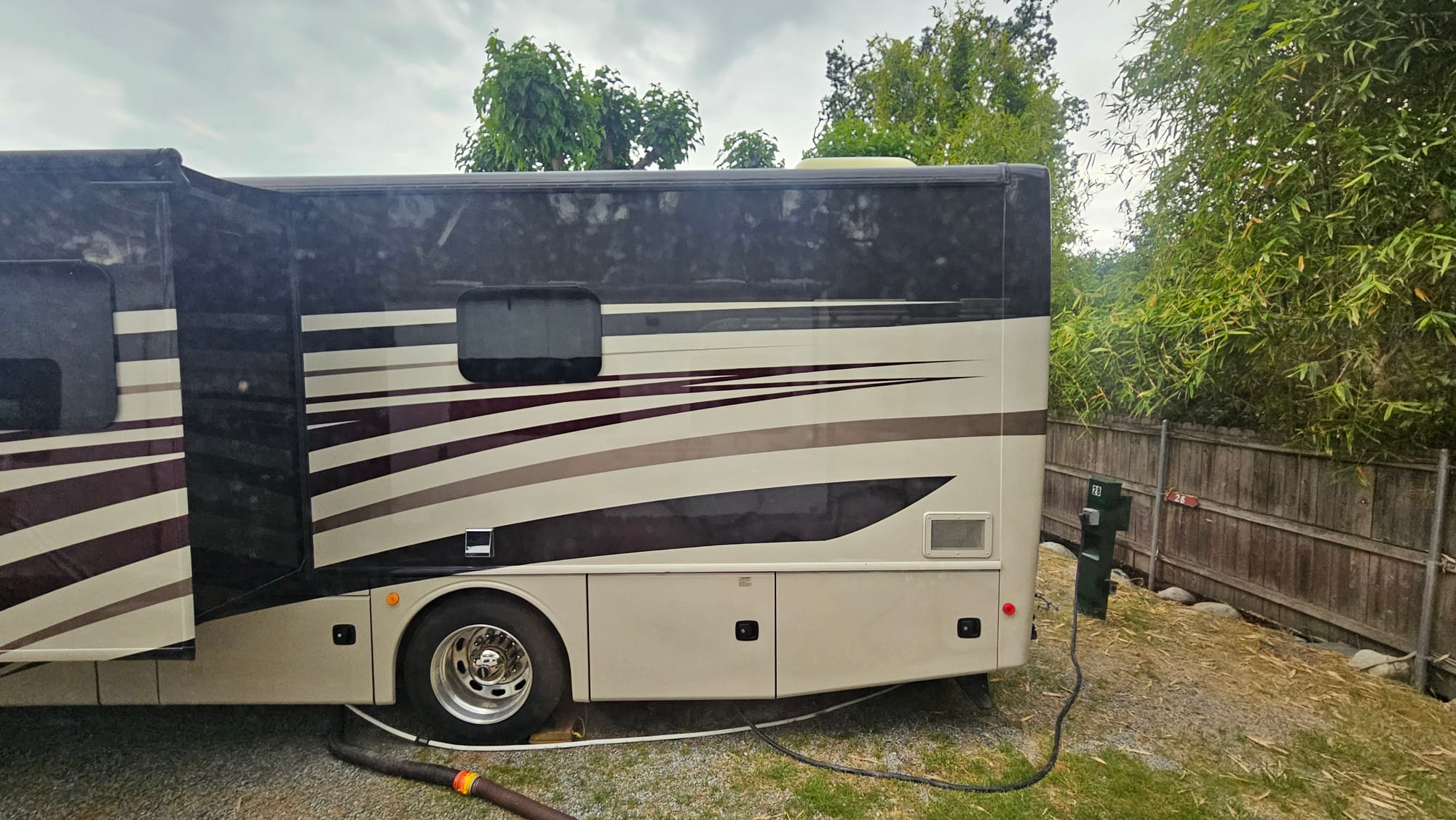
The 7.4/10 rating was accurate, in our opinion. The staff are very nice, as were our neighbors, which is good when we're all living on top of one another! However, as courteous as everyone is, there will definitely be noise. We were so close to our neighbs that we could hear them walking around their RV! We had issues with inconsistent water pressure. We also lost our power one of the days, which seemed to be a town-wide issue, but it wasn't pleasant given that the temps rose to 88°F that day! If you look closely at our rig pictures, you will see that we needed to put our Starlink dish on top of our truck to get uninterrupted service. Just one of the downsides of being back in the forest, but we made it work.
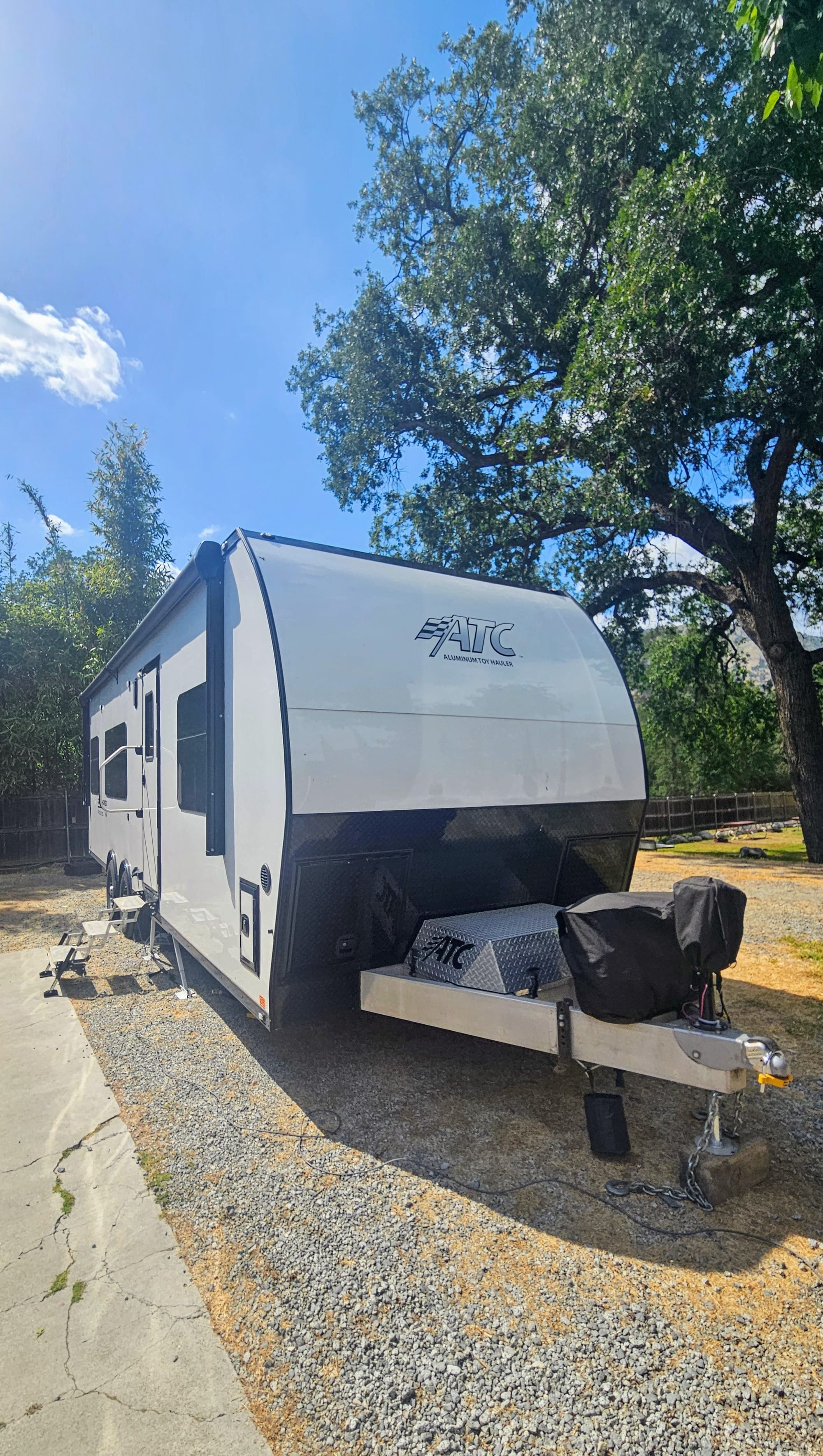

Site 29, back-in, FHU 30amp
Picnic table, fire ring
Campground recommended? Yes for proximity to Sequoia NP
Campsite recommended? Yes
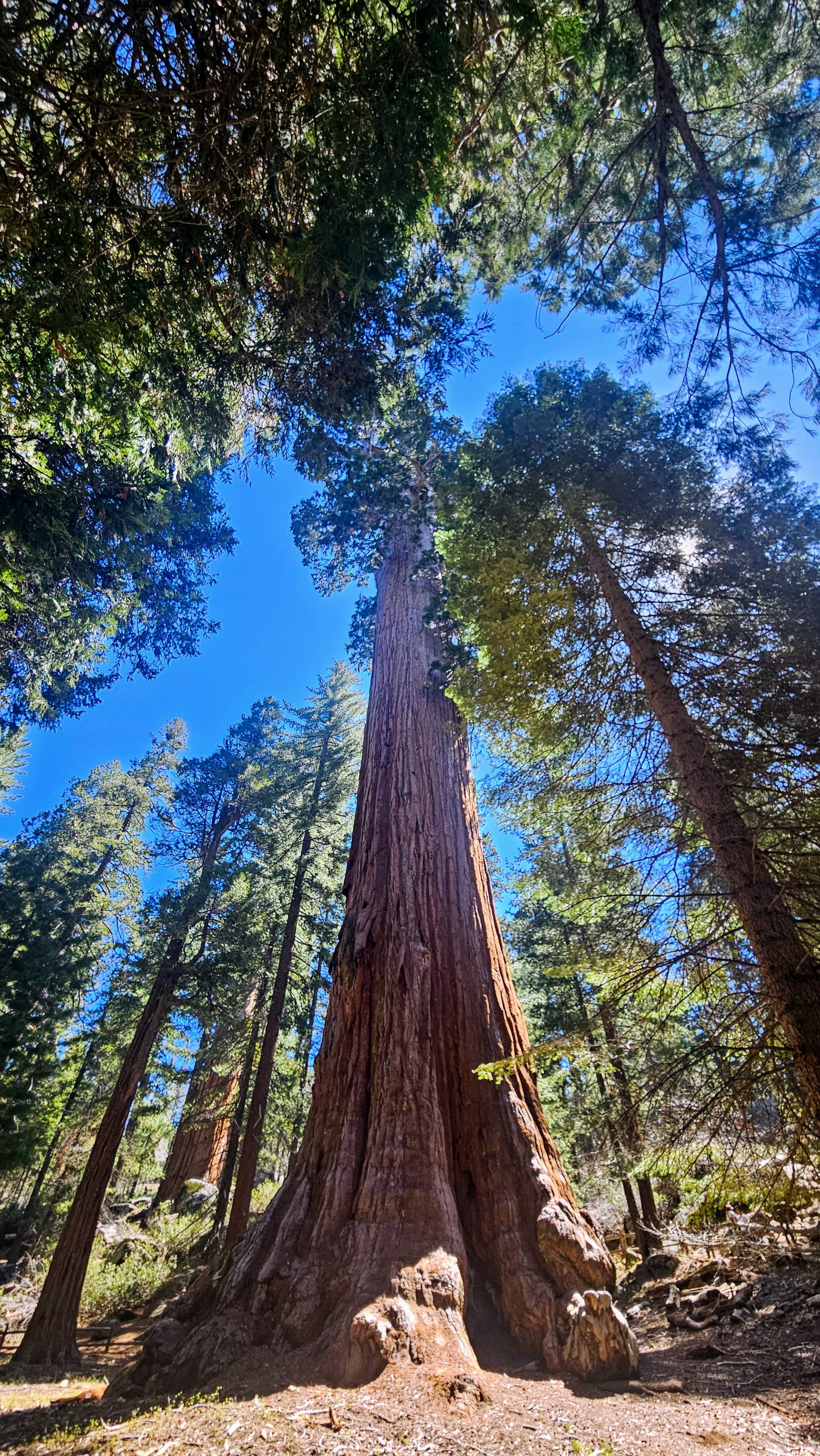
Of course, we booked the campsite for its location. We were just 10 minutes from the entrance gate to Sequoia. That didn't mean we had easy access to the whole park, though. Take our first excursion, for example, which we talked about in the last post. We drove up to the General Sherman Trail for a hike in the redwood groves. It took an hour and 10 minutes to get to the trailhead from our campground. Our 7-mile hike took almost 3.5 hours. Then we drove back in the fog, which forced us to go even slower than normal. All this, plus extra time to park, use the bathroom, stop at the visitor center, etc., and we were out for close to 6.5 hours, which is the maximum time we like to leave Tanner alone.
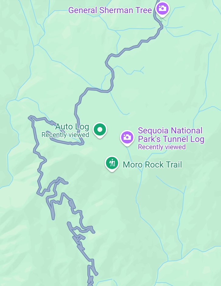
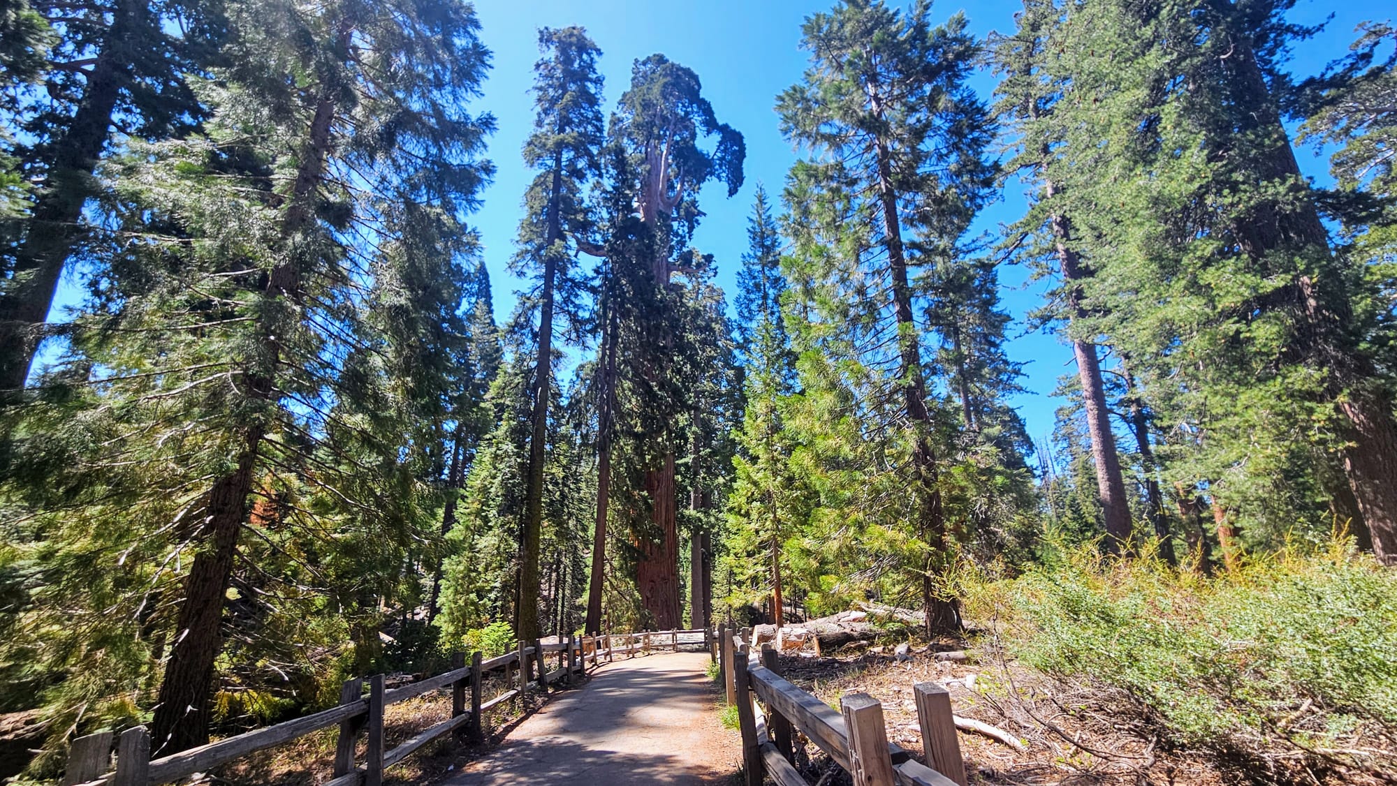
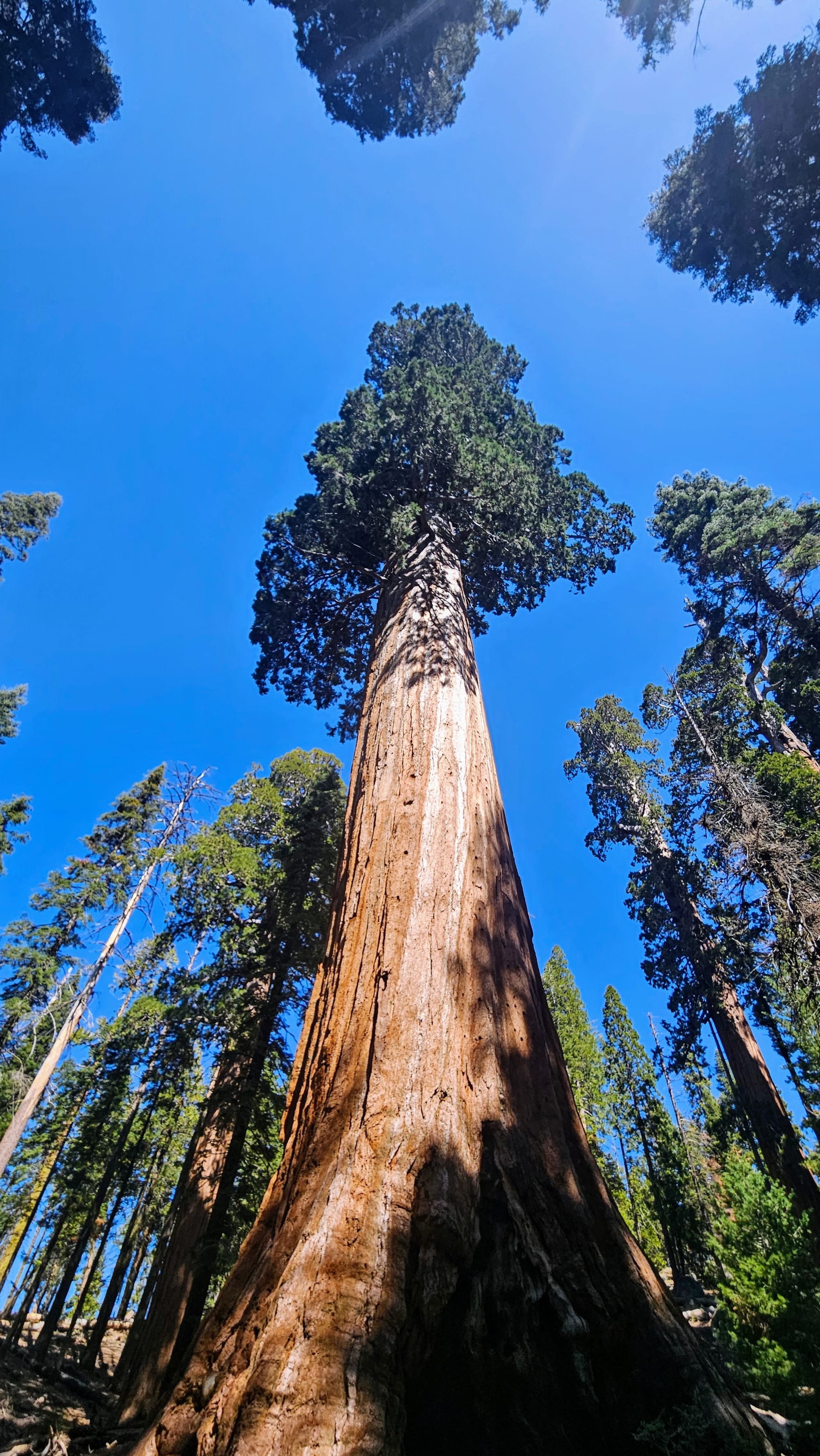
We wondered how we would navigate Kings Canyon knowing that much of our time would be driving to and from the park. At first we thought about taking Tanner with us and doing the entirety of Generals Highway, but we'd be limited to the overlooks because dogs aren't allowed on the trails. We also knew it would be a really long day for Tanner, and he gets stiff if he's in the truck for too long. So we decided to drive to Kings Canyon on our own and do a short hike by the General Grant Tree, the world's 2nd largest tree, but with a larger circumference than General Sherman. When we plugged directions into maps, we could get to the General Grant parking lot in about an hour and a half. Considering it took us an hour and 10 minutes to go to Sherman, this wasn't much worse. That's because even though the distance is longer, there was a road we could take as a cut-through that was likely faster than Generals Highway.

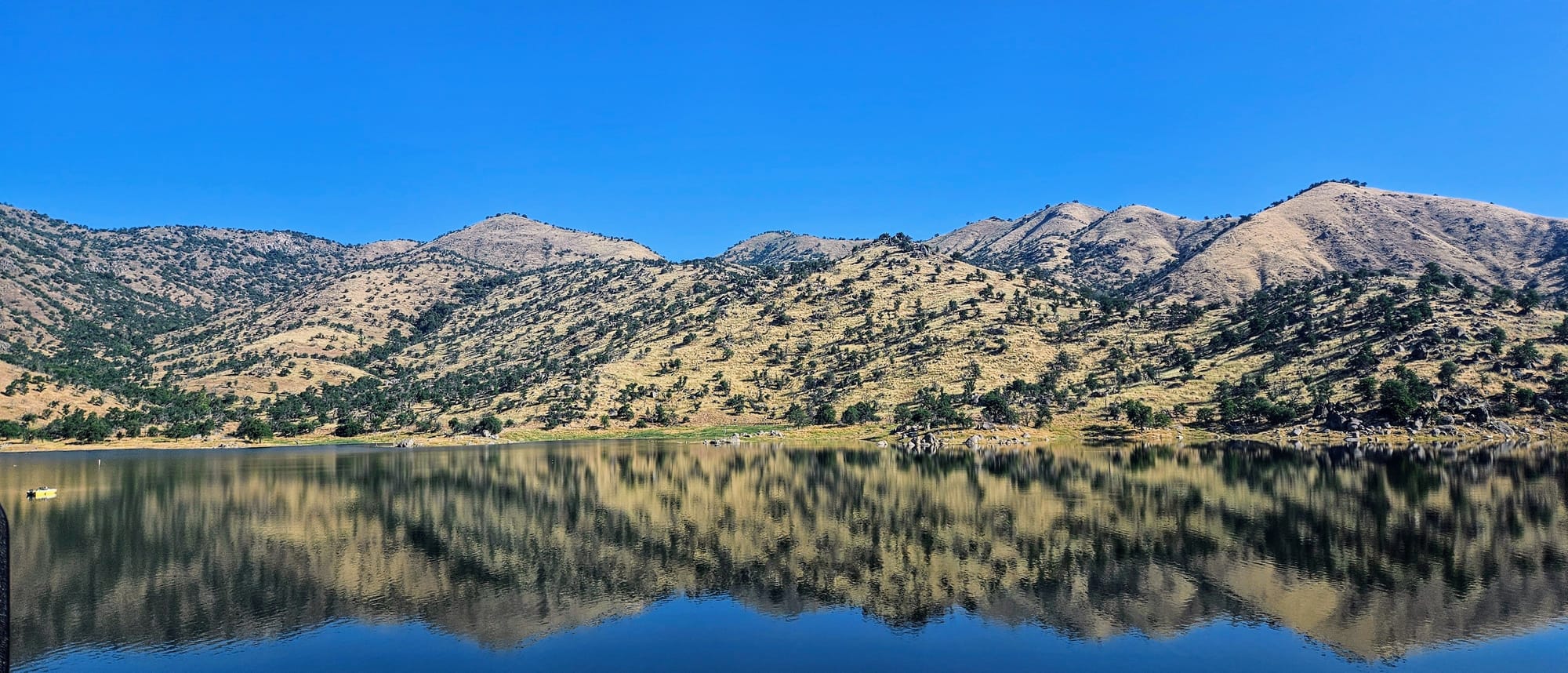
We set out on our journey, passing the beautiful blue waters of Lake Kaweah on our way to Dry Creek Road.
The drive started out fine, but soon we realized we had made a huge mistake, one that only out-of-towners would make. Google thought that people could take the southern section of the road at 55mph, but it was so narrow and curvy, we were lucky to hit 30mph.
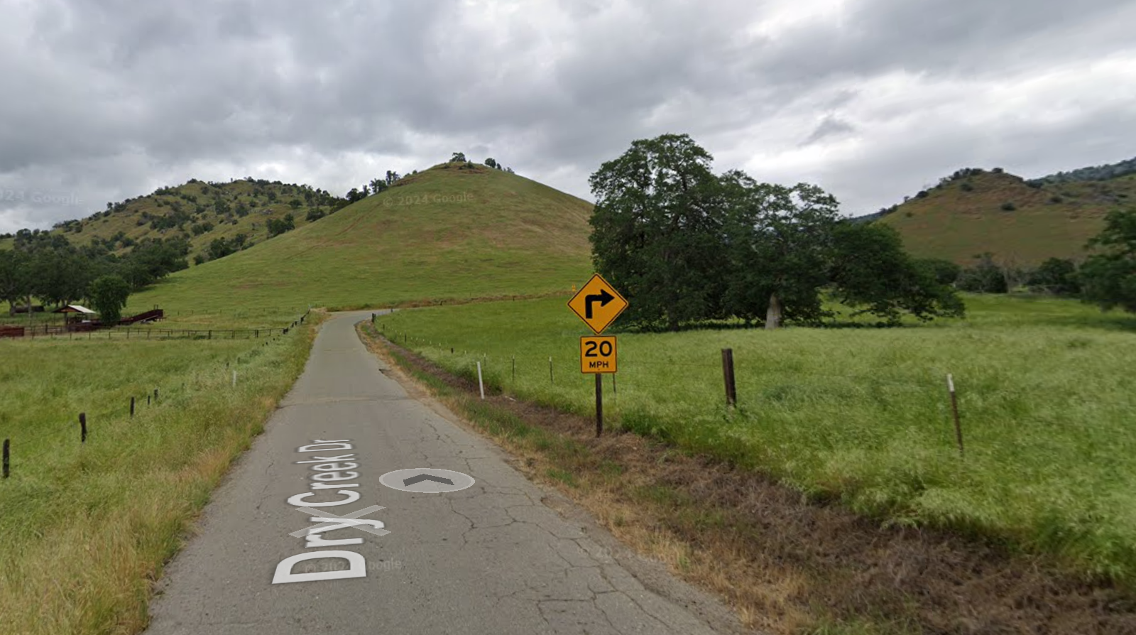
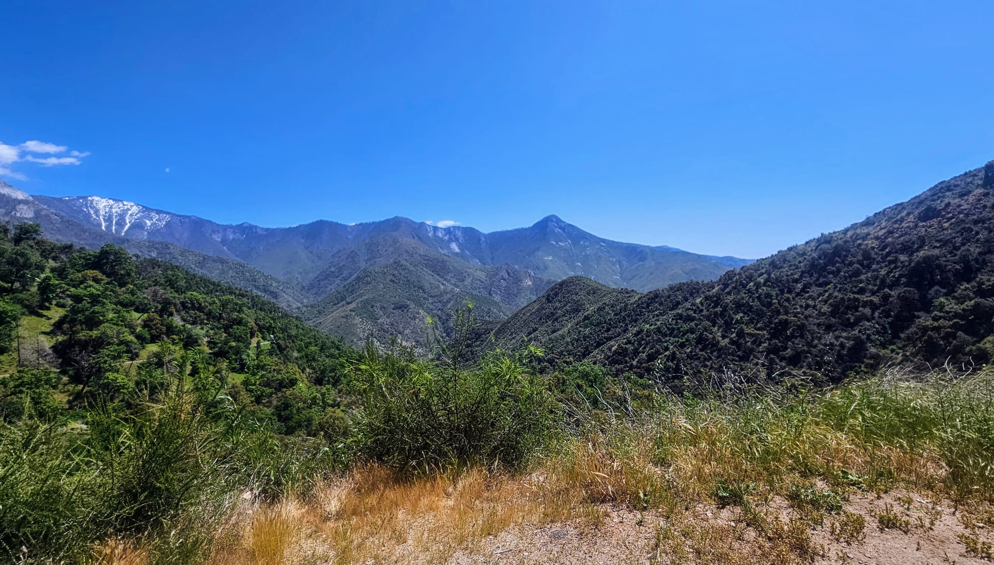
At least the views were pretty on the way up, and we saw lots of farm animals and wildlife. But every time we needed to slow down to take a curve or let someone else by, we knew we were depleting our time in Kings Canyon.
The road only got worse as we approached the junction with Route 245. This was before we hit the town of Badger and passed the entrance to Sequoia Resort, which had numerous signs stating "RVs welcome." You know why they announce that so much? Because the roads are so treacherous, no one would think RVs could fit up there! We certainly wouldn't have taken our RV up Dry Creek Road, but it didn't look like coming in from the west side of route 245 would have been a picnic, either.
We know RVers do it somehow, but with our length and turning radius, it's not worth the white knuckling. I will also say that this was the most carsick I have ever felt on a road since we got the truck. Usually I feel fine in the passenger seat, but this road almost did me in. I was so happy to finally arrive to the General Grant parking lot!
We had already decided that, no matter what, we were not taking that route back. Now that we knew that the "1 hour 32 minutes" was a total lie, we would be better off taking one of the other options. Curious as to why Google doesn't think taking Route 245 the whole way was a viable option? So are we. But even without that option, looks like we could take normal roads further west, or take the devil we know, Generals Highway, and try to enjoy the scenery. Even the normal roads would involve some twisty mountain roads, so no matter what we chose, we wouldn't be out of the woods for a while.
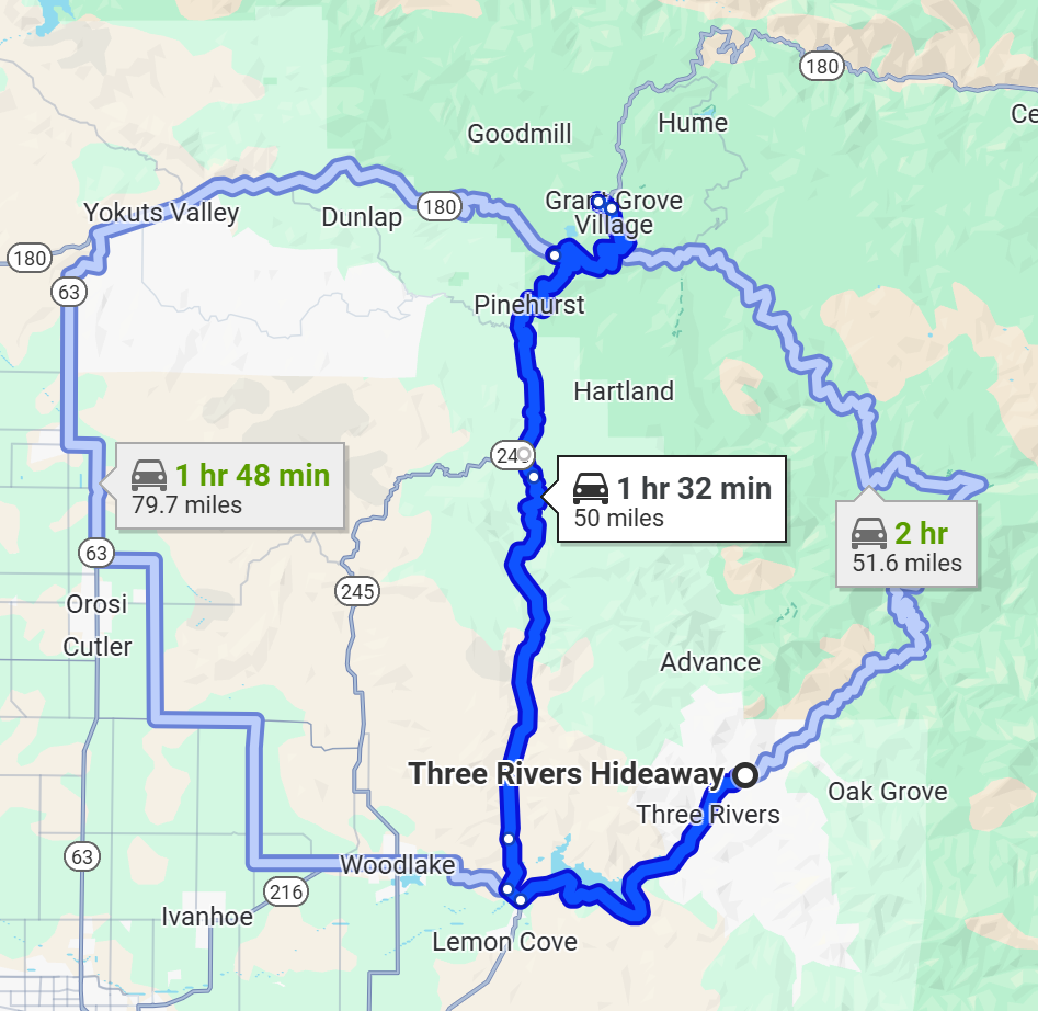
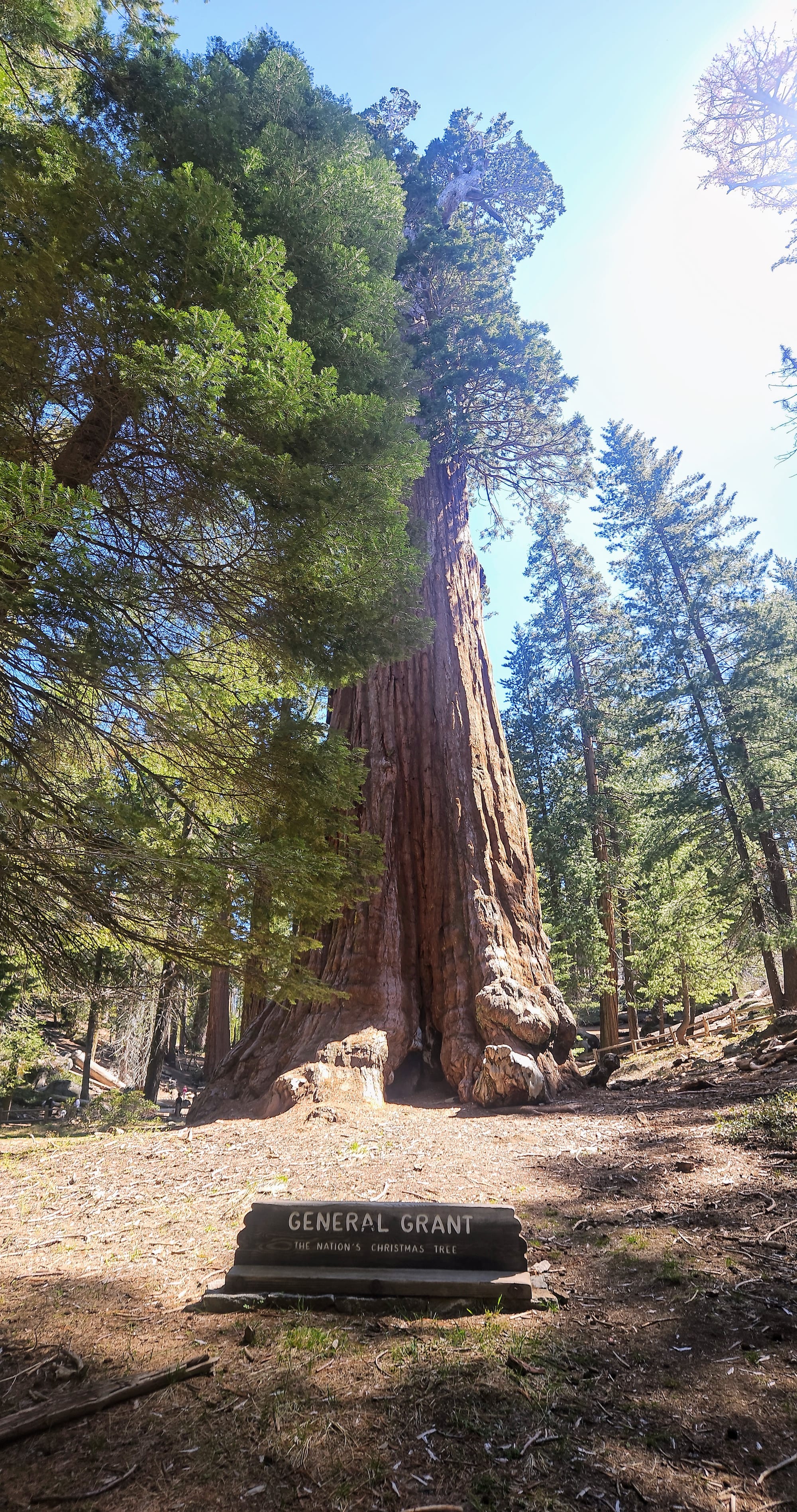
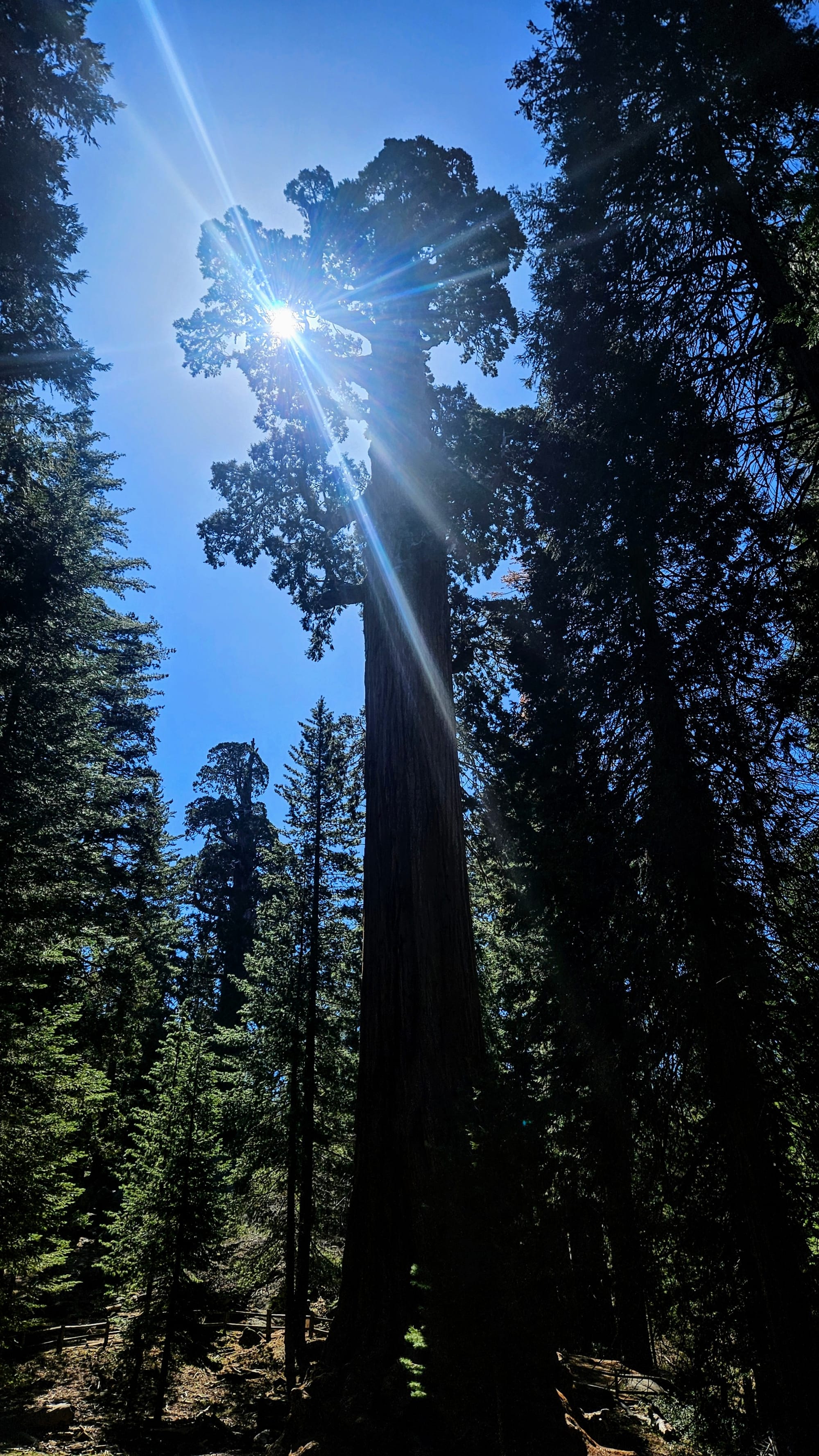
No sense in making a decision until we saw how long we'd be at the General Grant Trail. It's a short and easy hike on a paved path, but there are a few off-shoots you can take to see the tree and surroundings from different angles. The redwoods in Kings Canyon are often wider than those at Sequoia, and we felt even more dwarfed by these beauties. It was a beautiful walk.
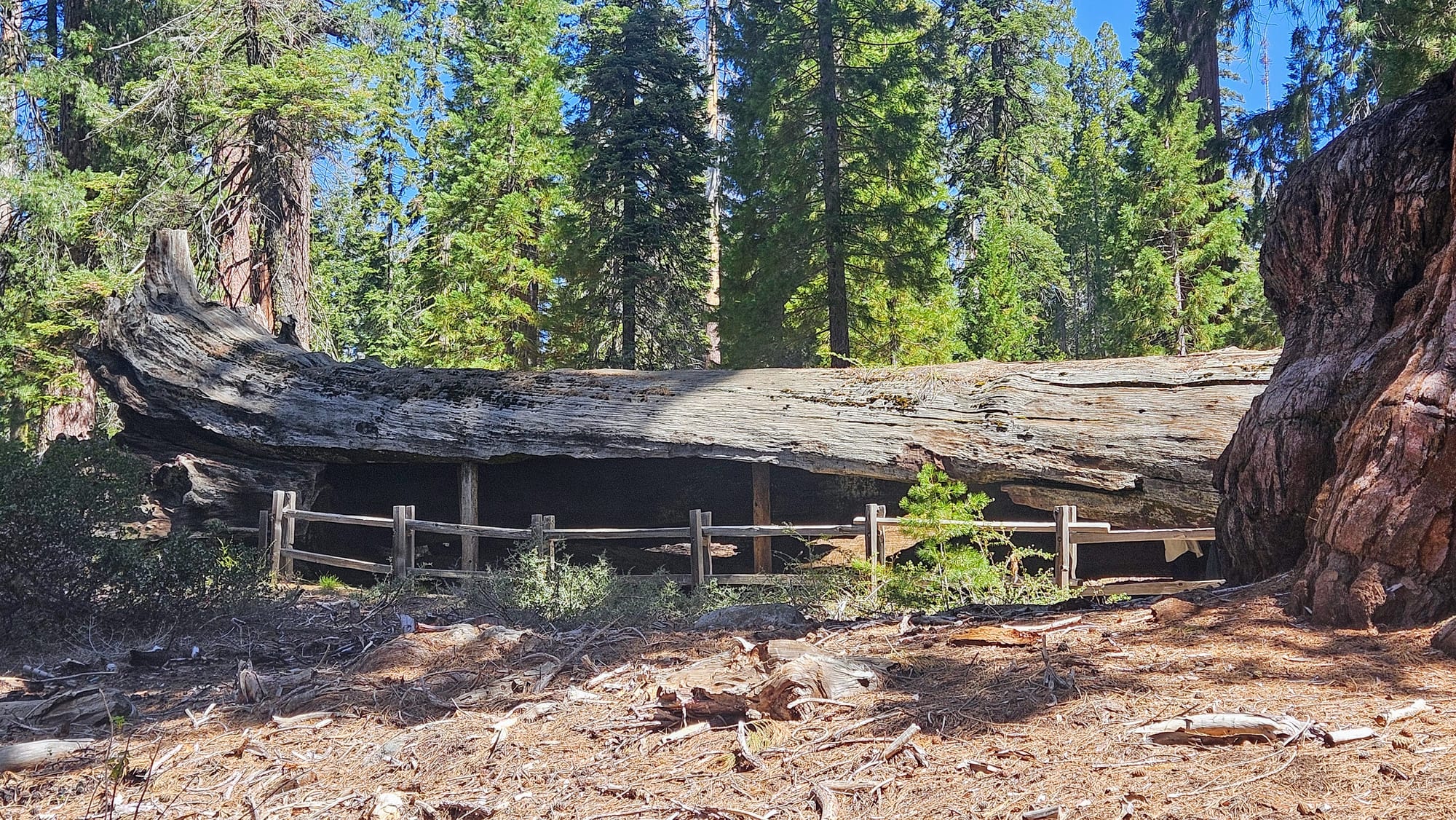
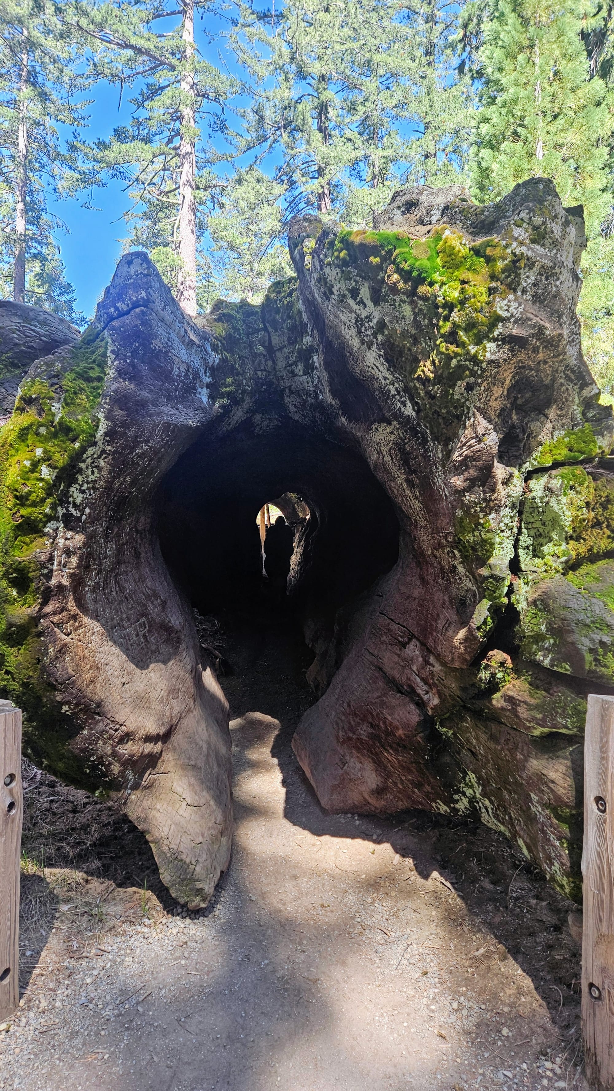
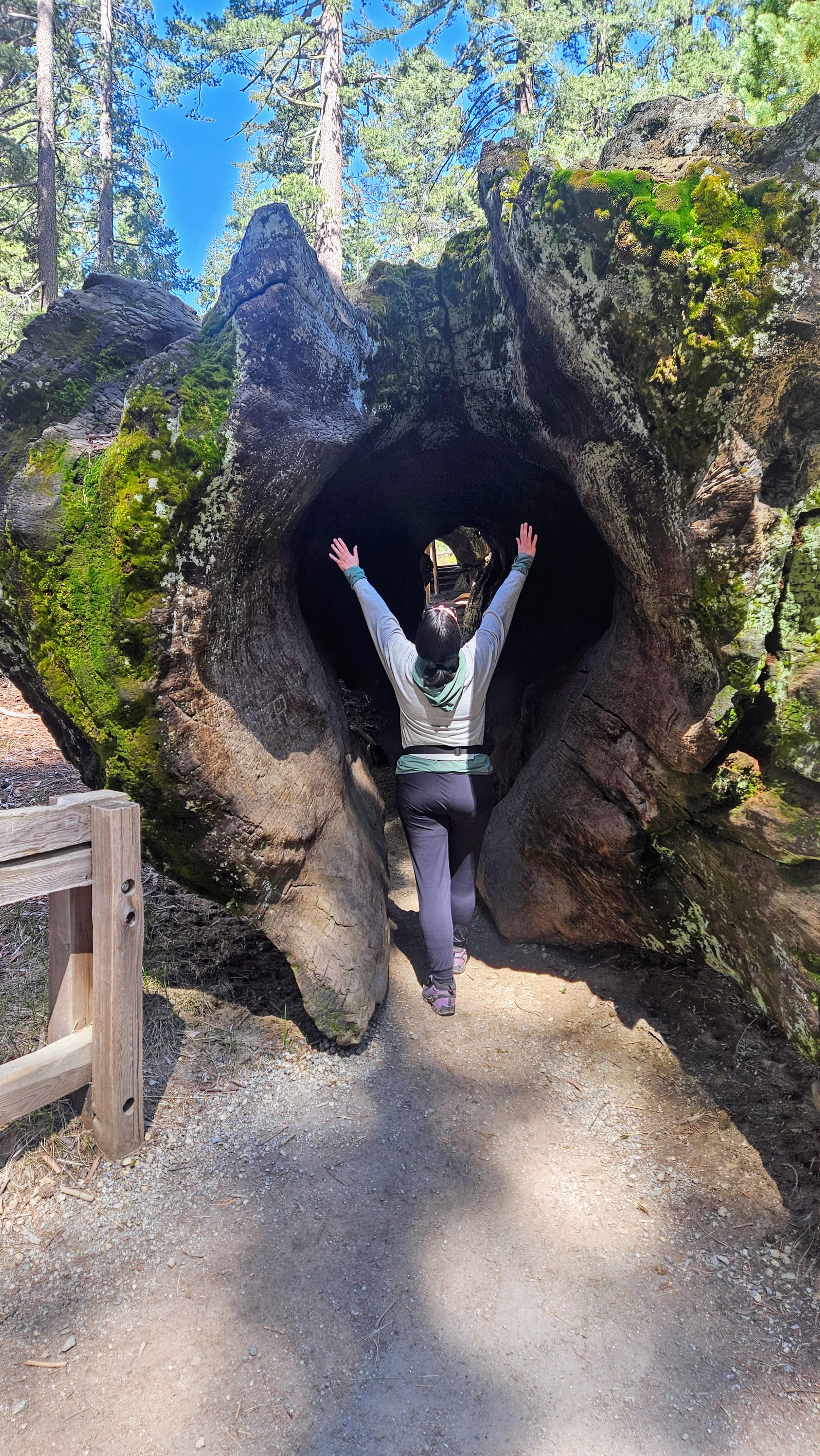
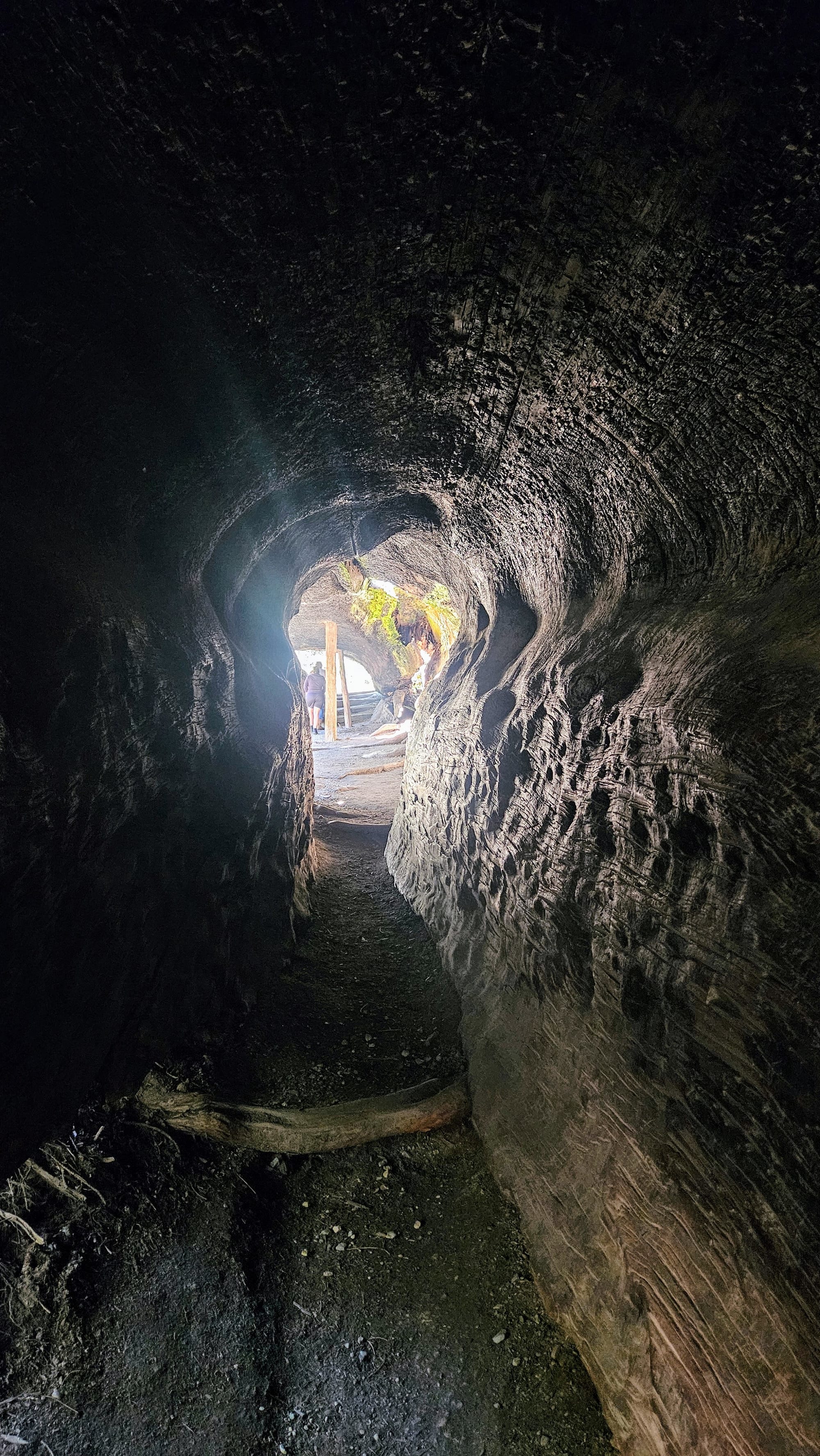
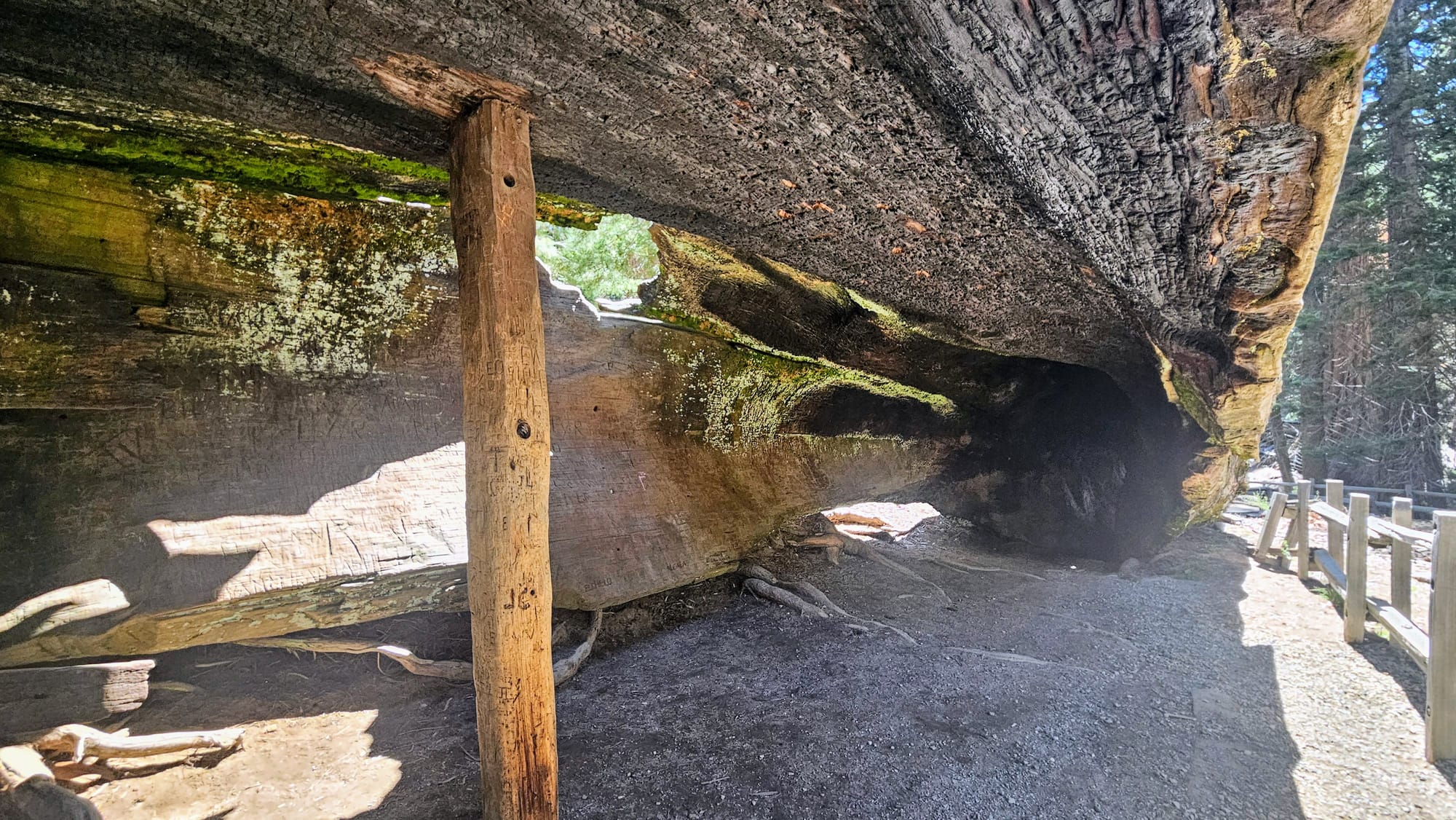
Something that we don't hear about nearly enough, though, is the fallen tree in the General Grant Grove that you can actually walk through length-wise. This is the Fallen Monarch, hollowed out by a fire, which caused it to fall a few hundred years ago. This tree has quite a unique history, serving as a temporary shelter for cattlemen Israel and Thomas Gamlin before they built their cabin (currently under restoration in the park), then as a hotel and saloon, and later as a cavalry stable. Yes, the tree is that big. It's about twice as wide as our trailer, actually, just to put its size into perspective. There is even a support beam inside the trunk!
We knew we'd feel much better about our excursion if we could see more of the park, and so we decided to take Generals Highway back to Sequoia. We knew that the worst part of the road would be the switchbacks as we made our way out of the park, and we already tackled them once, in the fog. Surely this time would be much better!
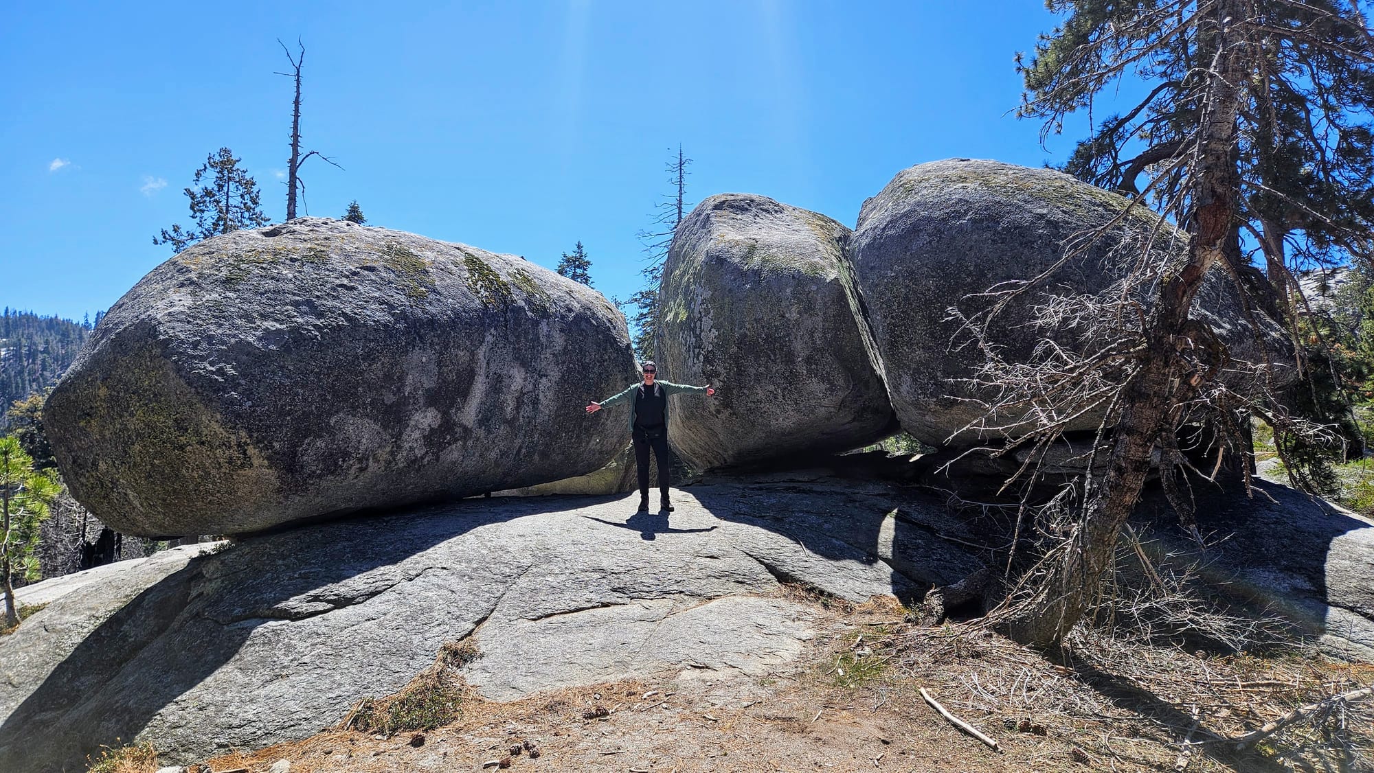
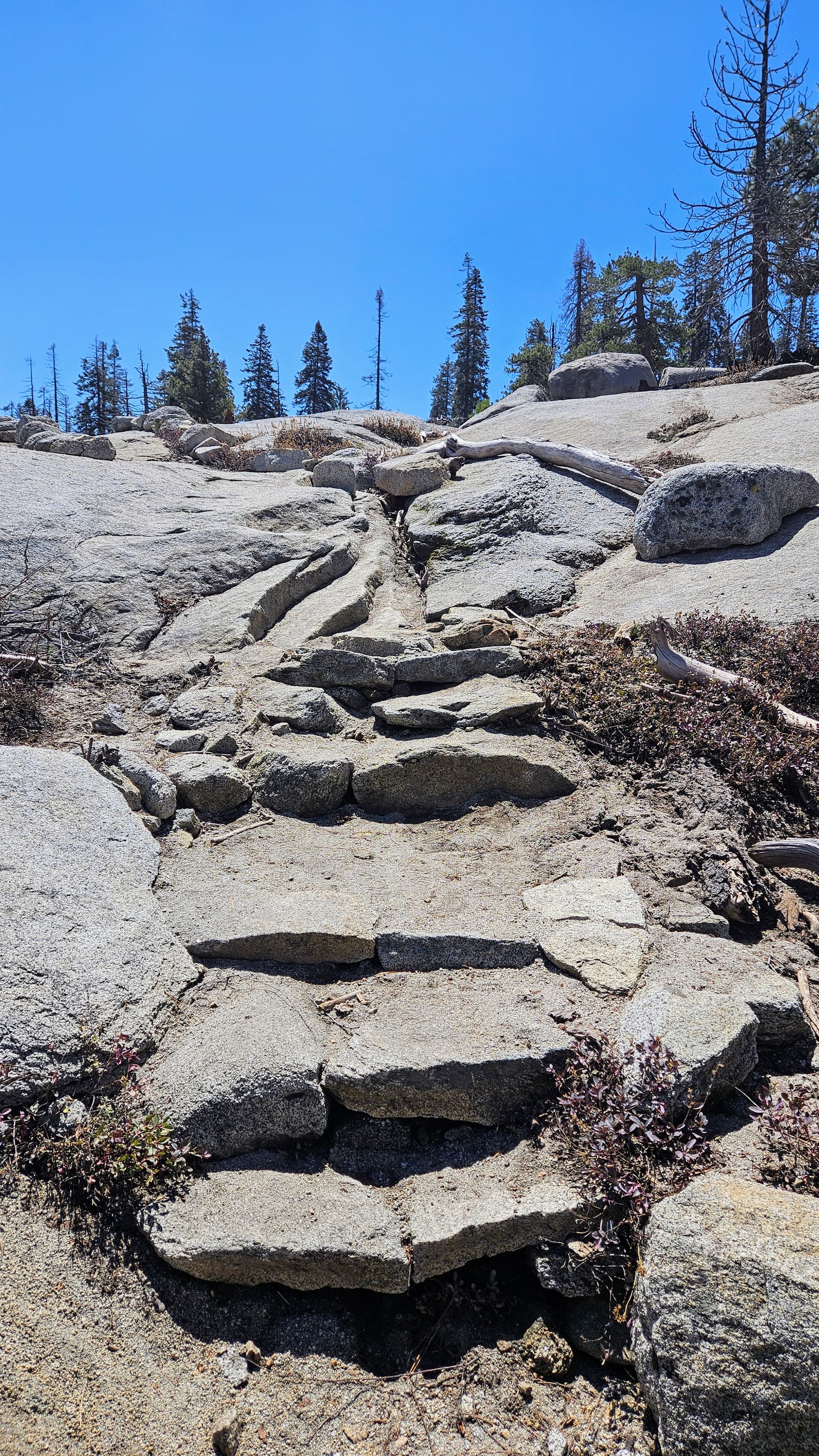
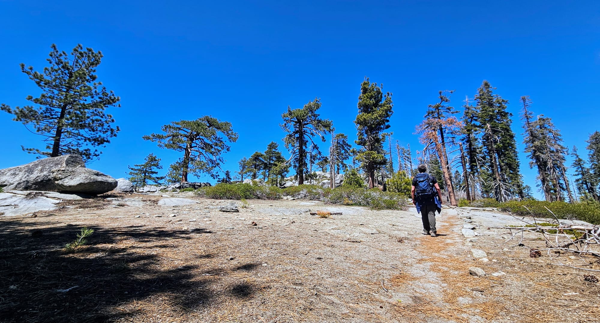
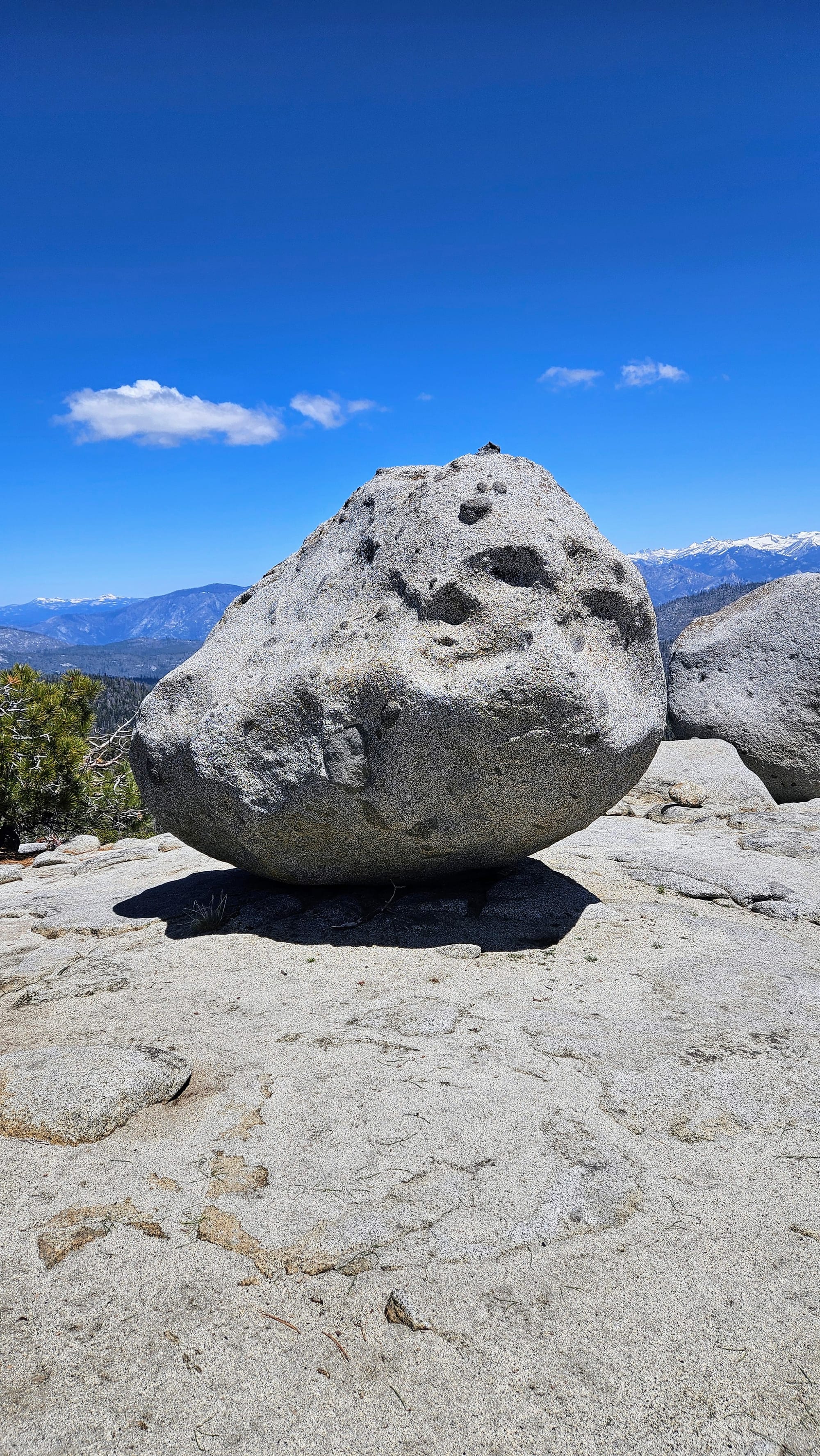
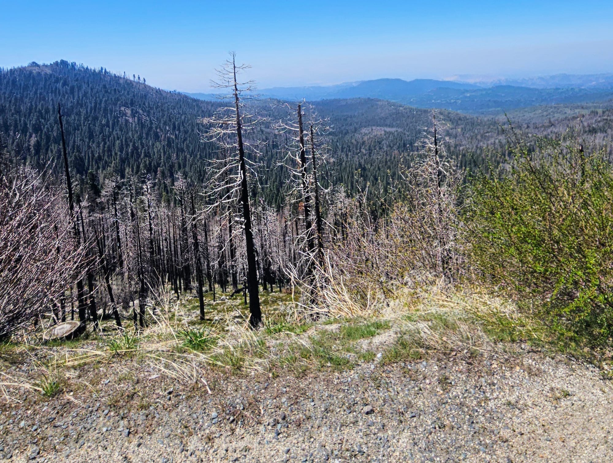
We kept a close eye on our timing but still were able to do a couple more short hikes. These also helped to break up the drive. First, we stopped at Buena Vista Trail, still in Kings Canyon. This trail took us through a burn area, up some incline and over a few downed trees, but overall the hike was fairly easy. It was also only 1 mile each way. The payoff at the end was huge, with 360-degree views of the mountains and plenty of places to walk/climb around. Also, we can't fully describe how good it felt to be hiking among granite boulders again. Just like home! Well, except for the high elevation. And the burns. And the bigger mountains. And the different foliage.
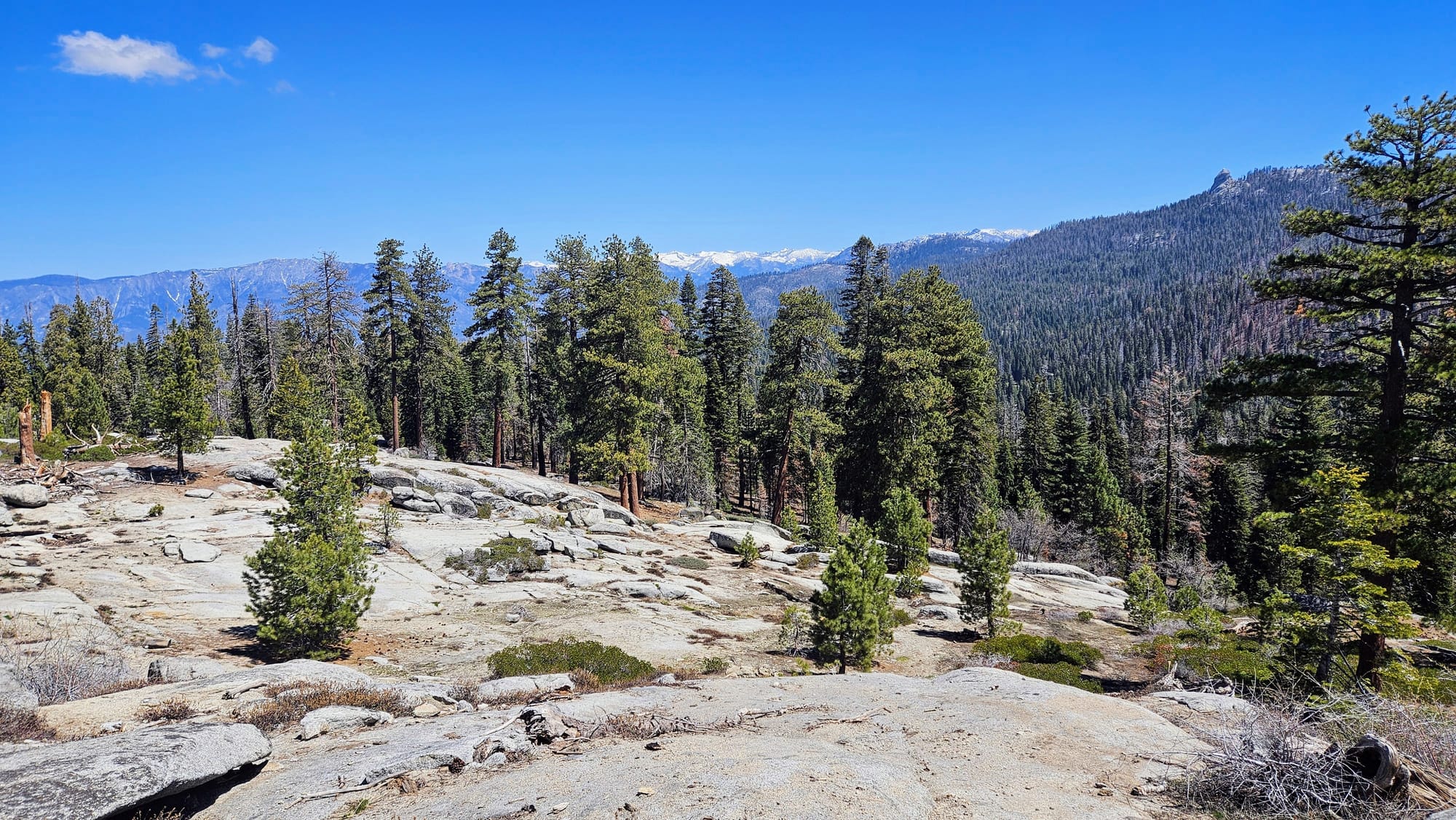
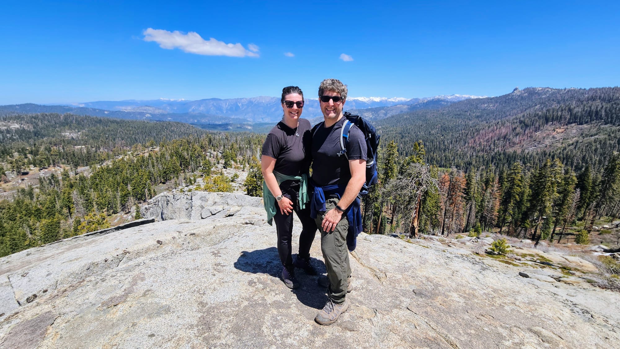
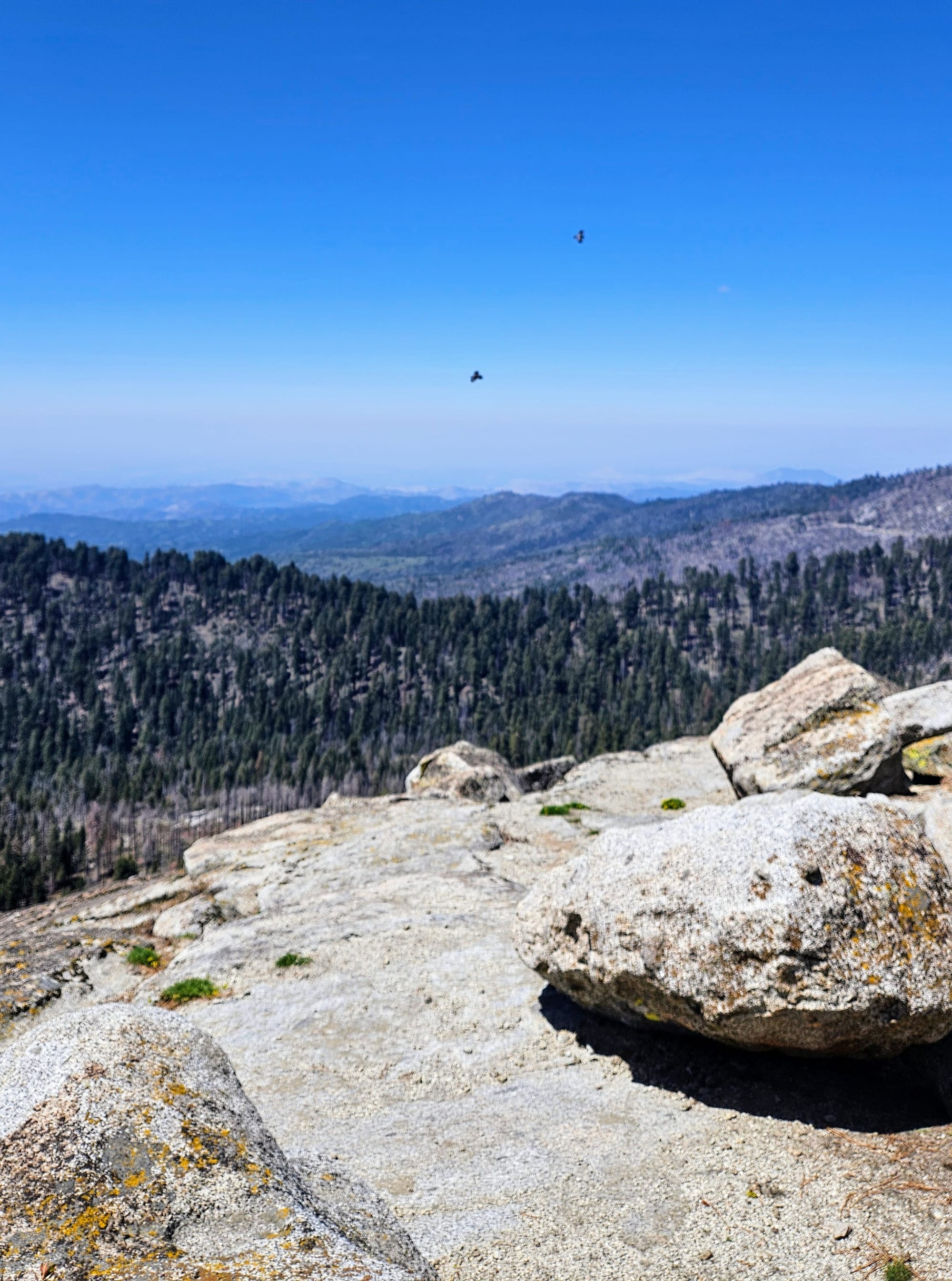
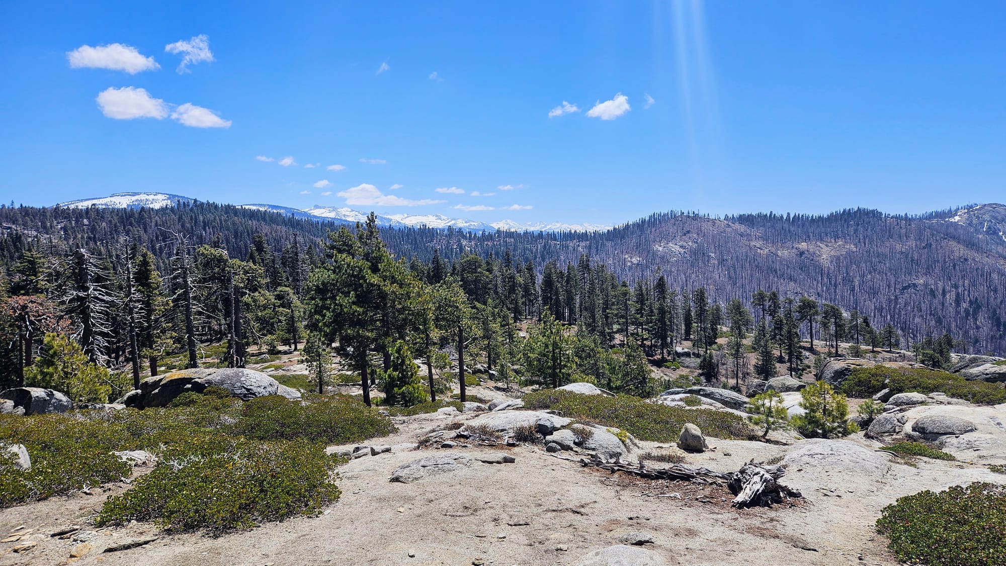
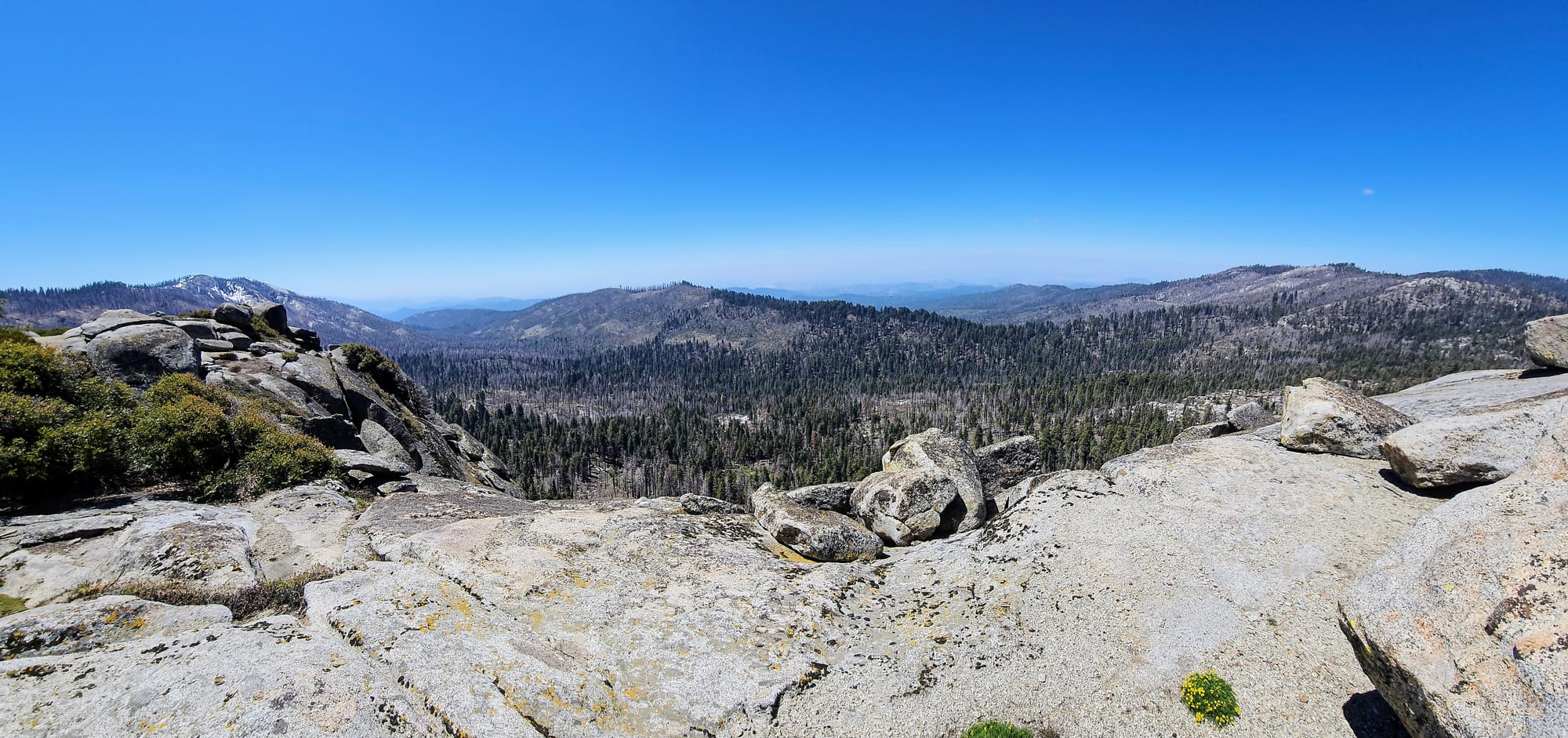
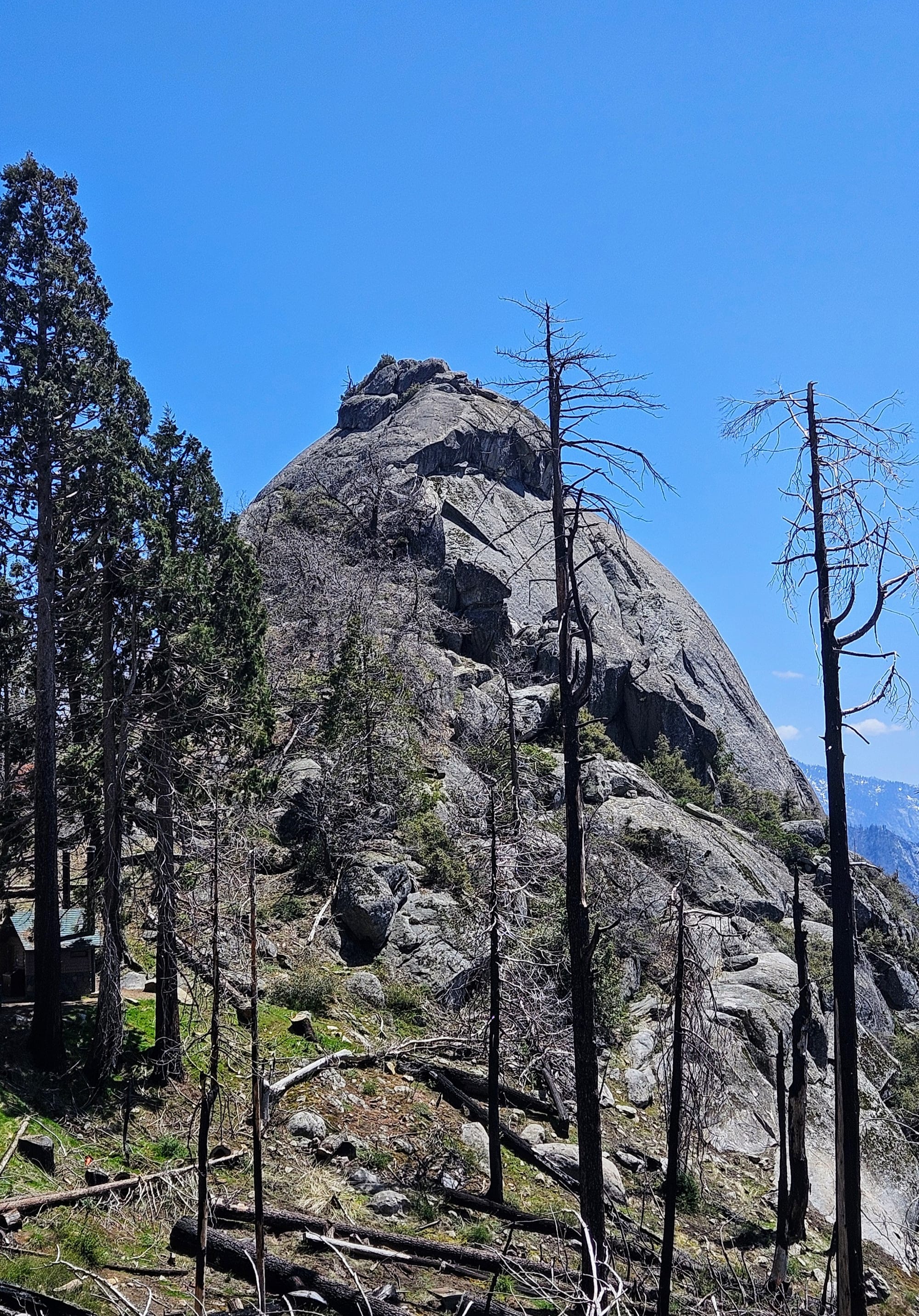
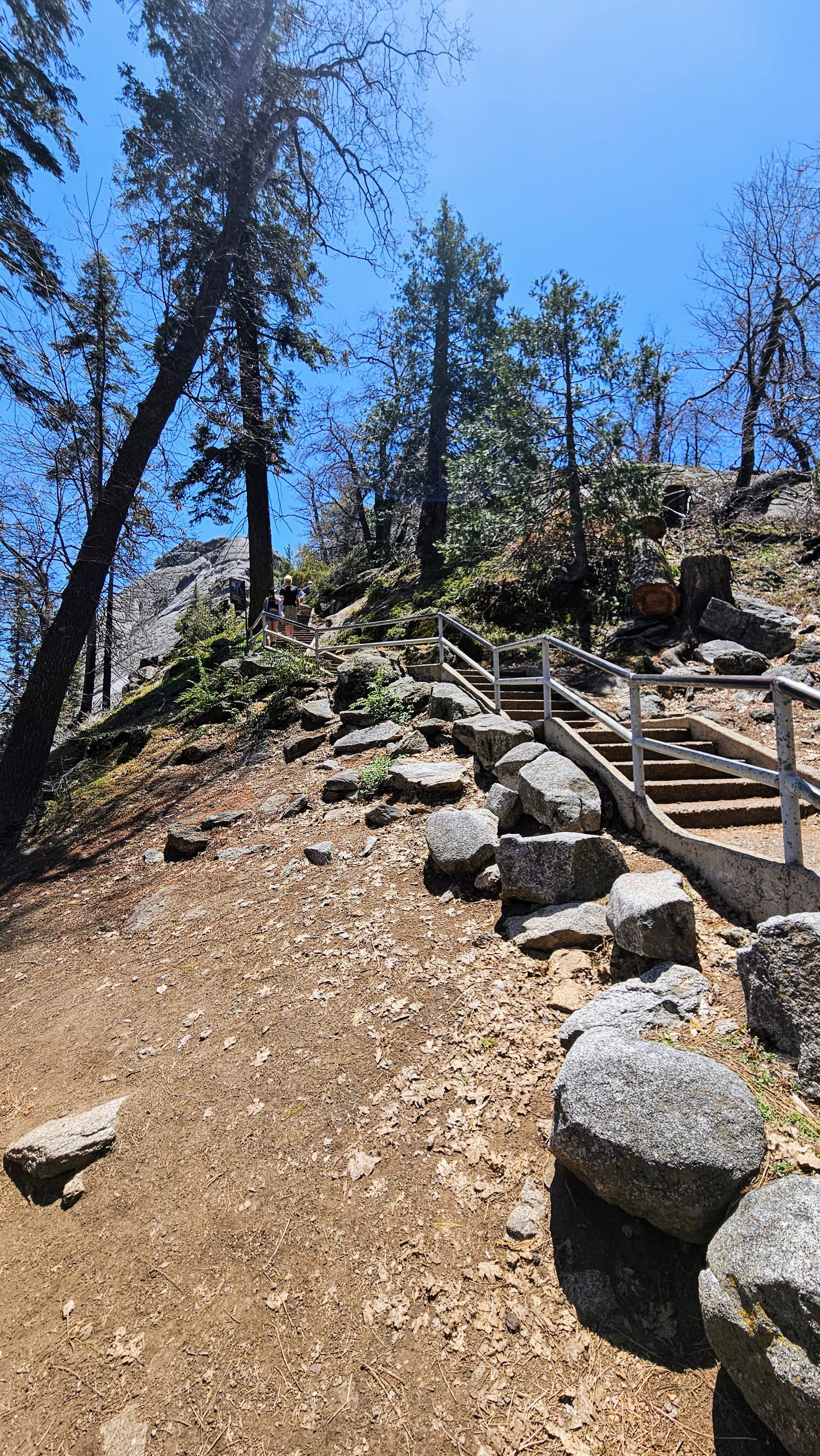
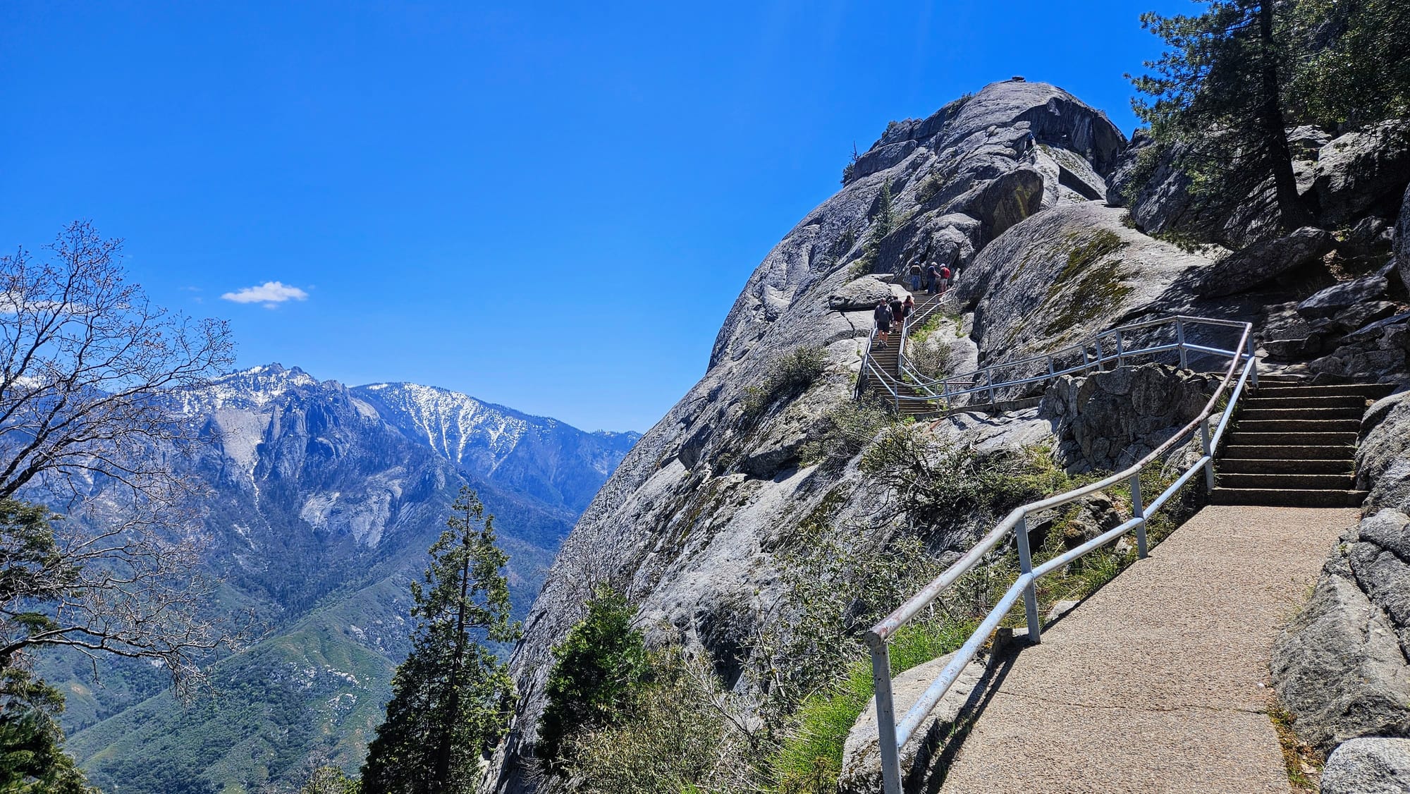
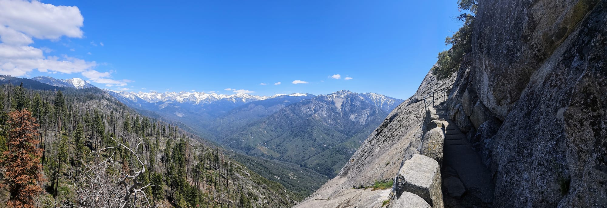
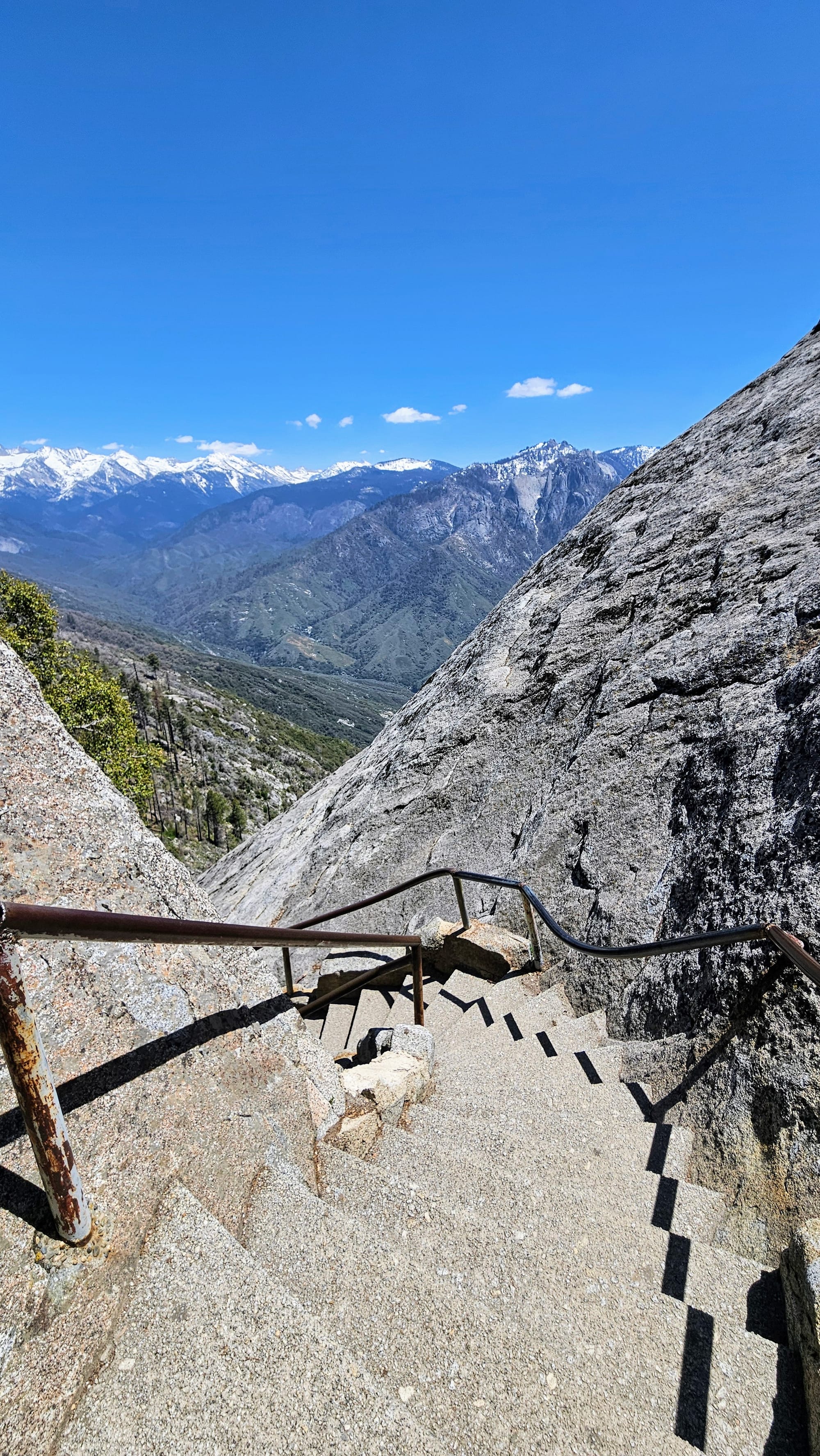
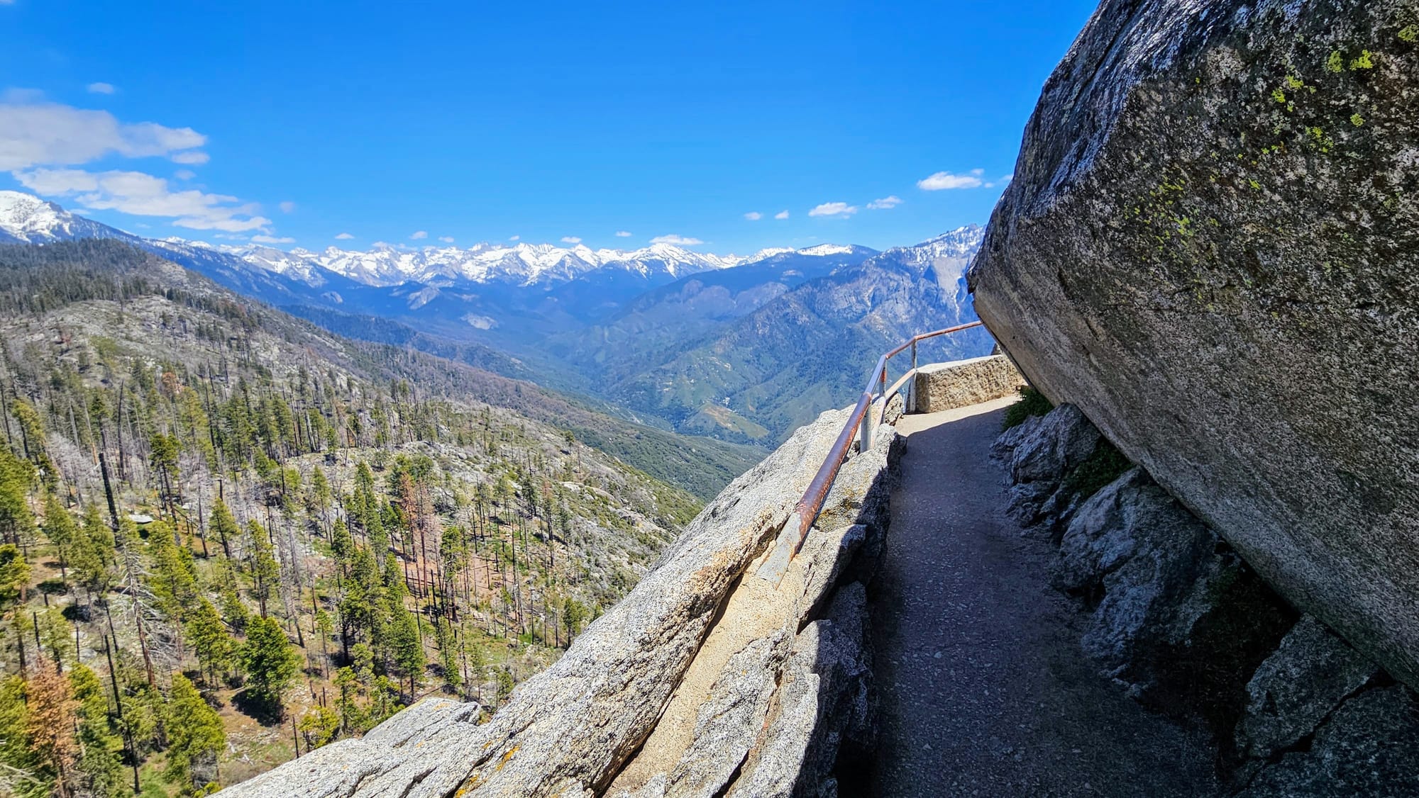
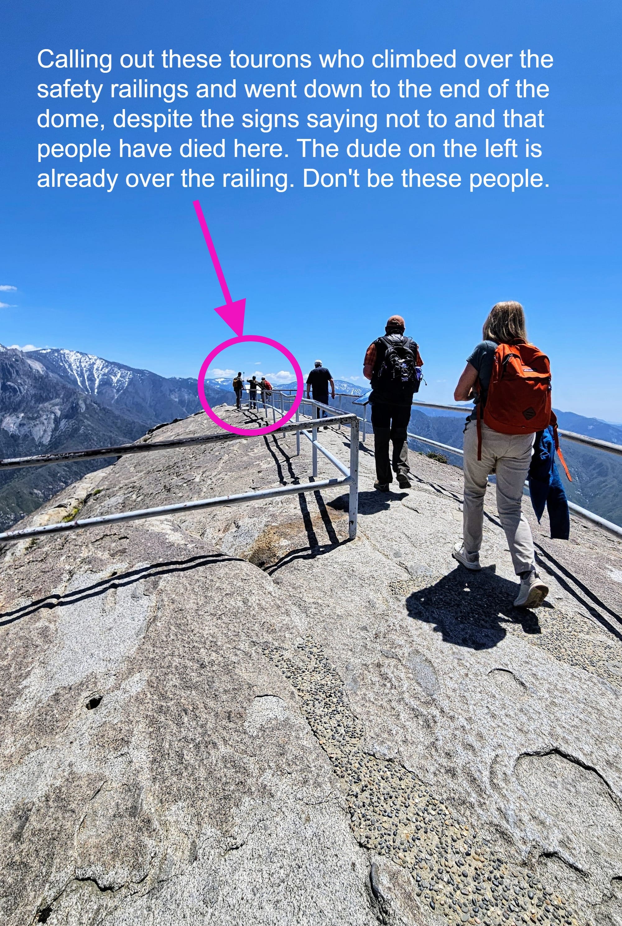
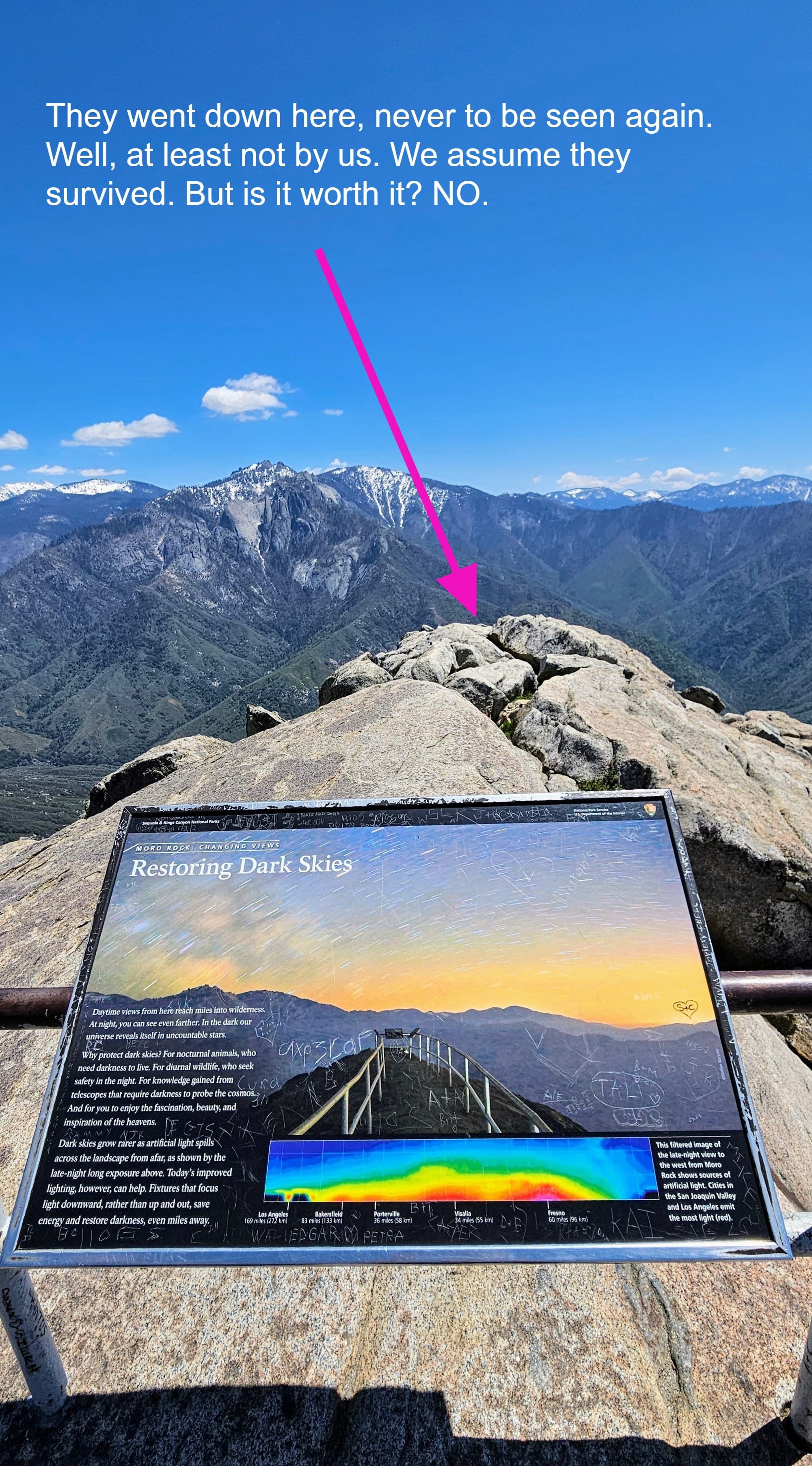
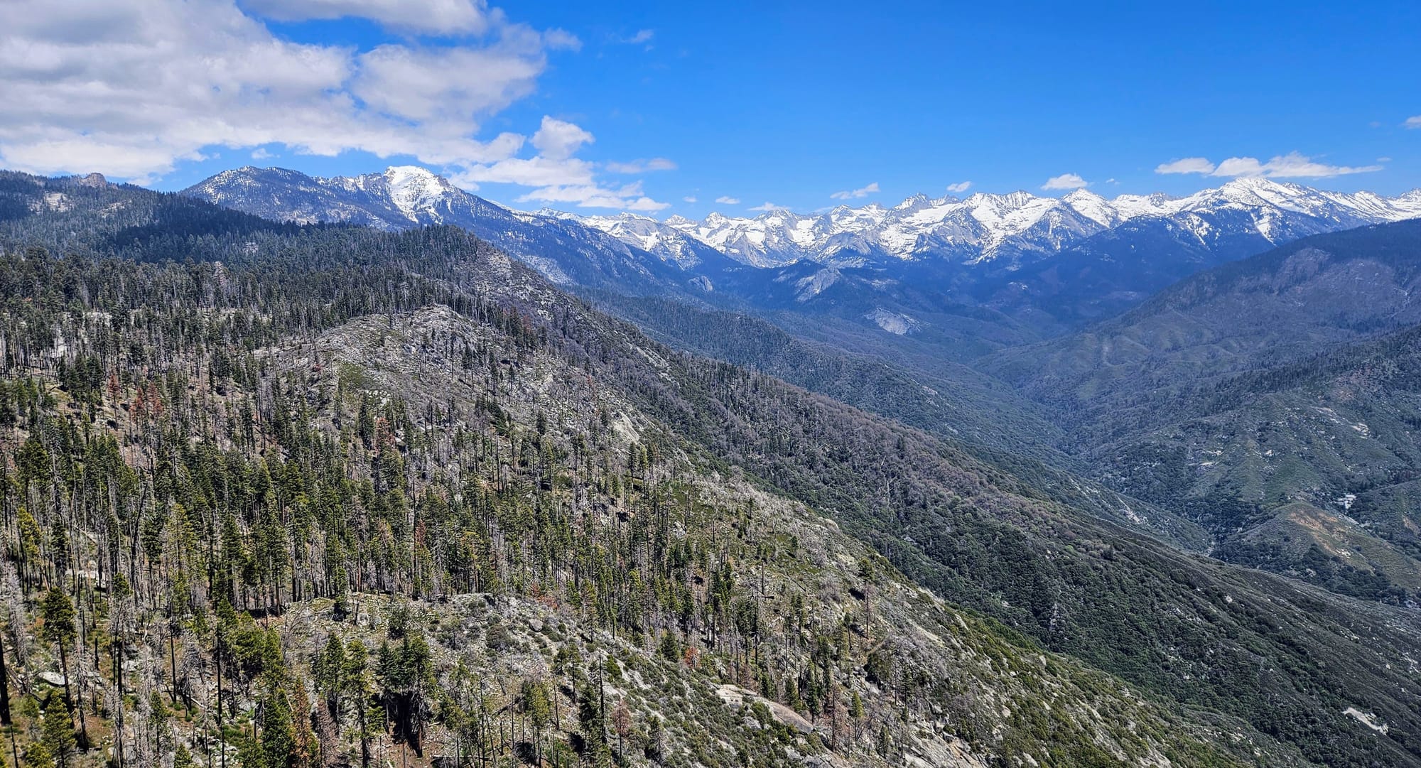
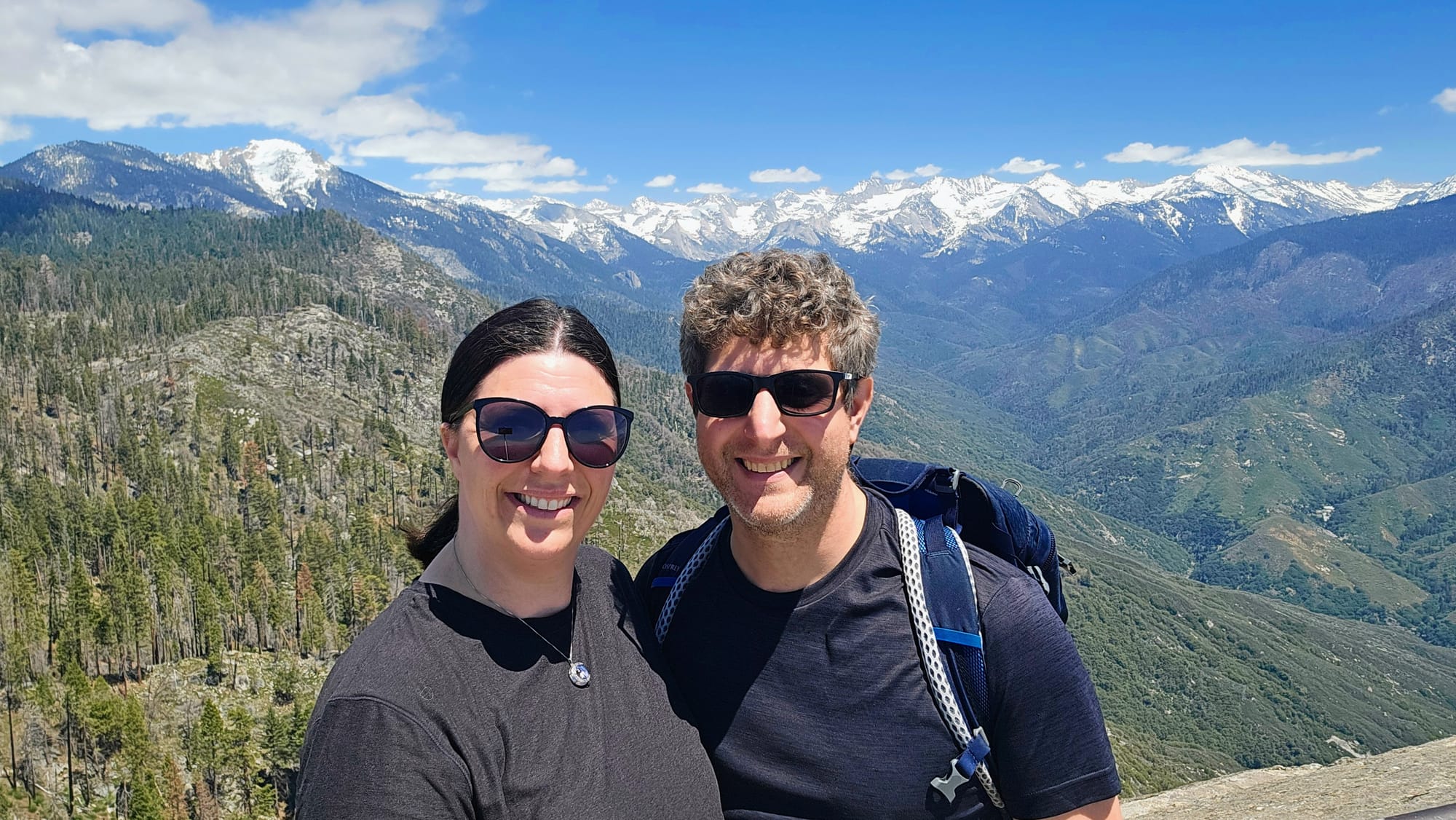
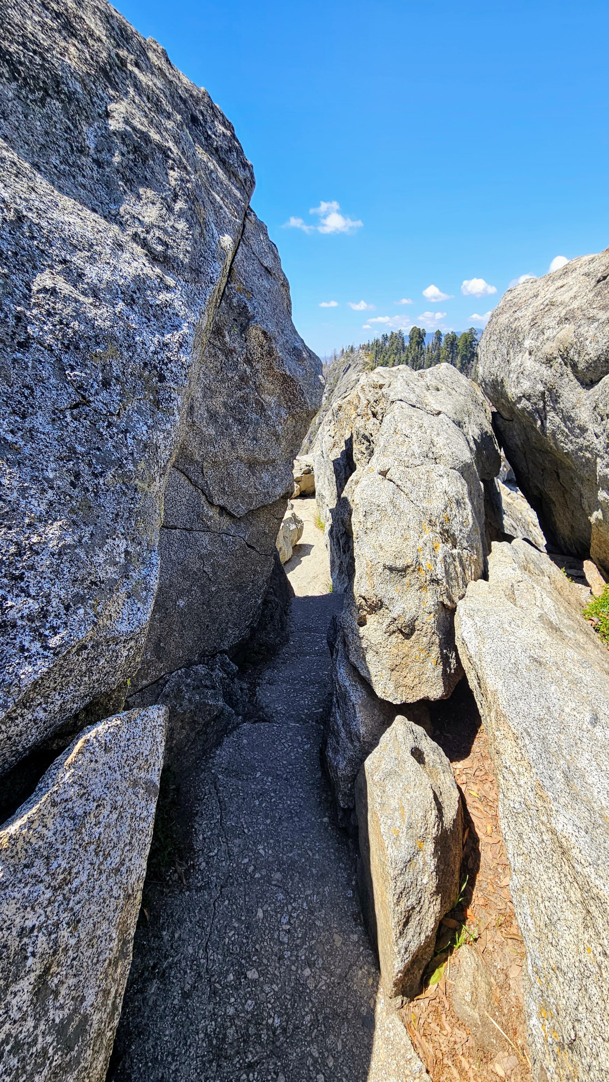
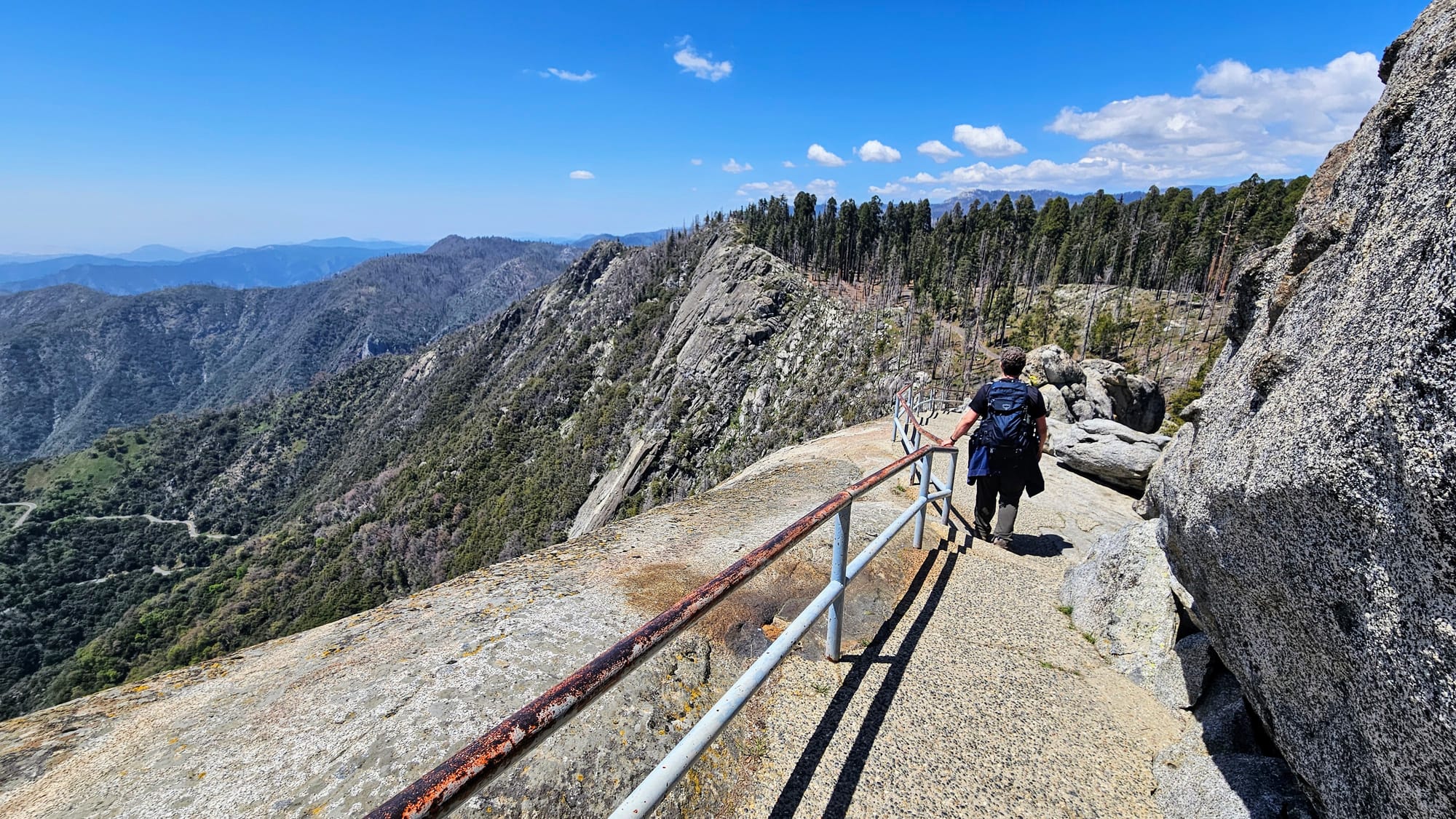
Back in Sequoia, we knew exactly what our last hike should be: Moro Rock. This is another trail that comes highly recommended, and it would be short and quick. Moro Rock is a granite dome, similar to Half Dome in Yosemite except smaller and way more traversable, thanks to a series of steps and railings that have been constructed up the side of the dome. It's only a half-mile each way, but the climb is a workout. At the top, you have incredible views of the Sierras including Mt. Whitney, the needle-like pinnacles of Castle Rock, and Generals Highway looking oh-so-tiny down below. Along the way are little lookouts, so those who don't wish to climb all 350 steps don't need to. The views are incredible from all points along this trail.
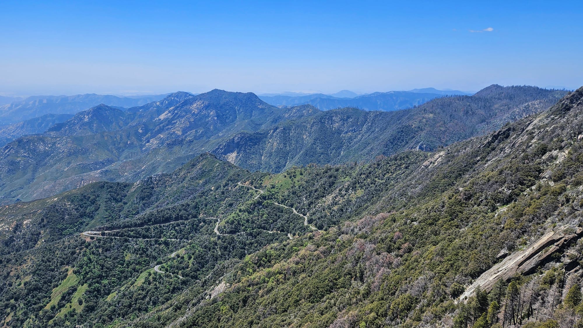
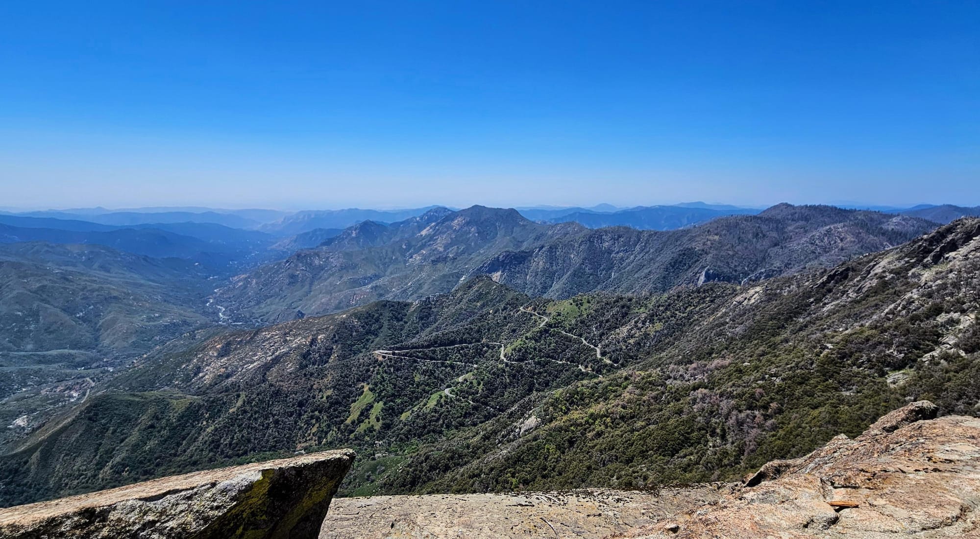
Taking Generals Highway was the right decision. The road was easier to traverse and we got to see some amazing views both from the road and on our hikes. We hiked a total of 3.5 miles that day and our full excursion lasted between 6.5-7 hours. We didn't have time to stop at any of the overlooks, but I did take some pictures out the window as we drove by.
National Parks 34 and 35 are officially pinned on the pin board! Overall, we think we did things right. We chose an RV park that wasn't up crazy mountain roads. Despite our time crunches, we got to see the variety that these parks offer, from the redwoods, to the mountain and river views, to the granite formations. But, we left a lot more to be discovered if and when we make our way back here. We had an inkling that Sequoia and Kings Canyon would be worth the extra effort to RV to the Sierras, and they were.
