Driving the Mesa Falls Scenic Byway in Caribou-Targhee National Forest


Between our visits to eastern Idaho and western Montana, we spent a lot of time trotting up and down US route 20 on the boundary of Yellowstone National Park. The road travels through the Caribou-Targhee National Forest and offers plenty of historic pull-offs that teach about the area, including its volcanic landscape and history of evergreen restoration. However, off the beaten path of US20 is the Mesa Falls Scenic Byway. It runs parallel to US20, through the national forest, from the town of Ashton on the south end, to Island Park on the north end.
We were staying in Island Park for a week and a half, at Henrys Lake State Park, a beautiful area about 25 minutes from West Yellowstone. Though our main goal was to visit the national park, we've learned to not ignore the surrounding national forests, as they too can offer incredible nature and recreation. To steer away from the crowds on 4th of July weekend, we ventured down to Ashton for a scenic drive along the byway. If what we read was true, we'd be rewarded with stunning views of the Tetons, rivers, and waterfalls. We decided to begin at the south end and make our way north, partially so that we'd finish closer to our campground, and partially to save the supposed best for last: Upper Mesa Falls.
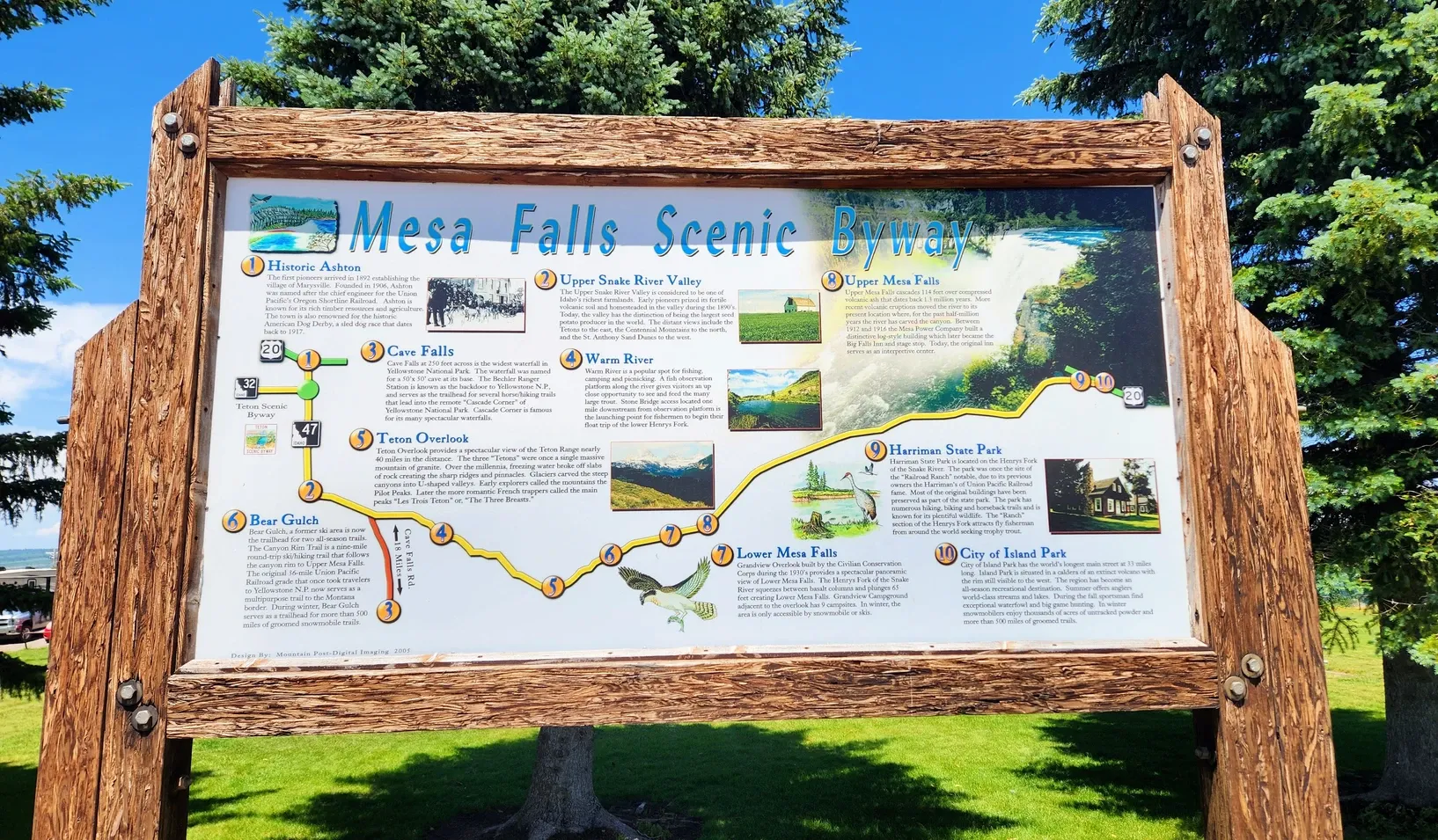
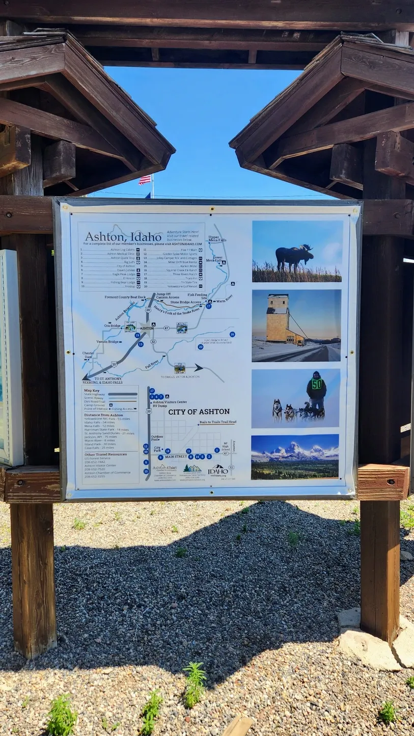
One thing we immediately noticed when we pulled over to get byway information, was that this route has all the makings for a killer audio tour, or even a brochure, of which we found neither. We found a map of the surrounding area, which included the scenic byway, and we also saw a sign at the Ashton Visitor's Center that listed out the different stops along the way. We took a picture of the sign, but it certainly didn't serve us as well as if we had a brochure in-hand with the same information. I scrounged around the internet and came across a couple of websites that tried to offer some more curation for this road, but it wasn't enough. Therefore, I made it my goal to create a Google Map of the stops along the scenic byway, to coincide with this blog post. Click the map image below to be taken to the Google Map. With each stop I list here on the blog, I'll include the information that was posted on the sign at the Visitor's Center, as well as some of our own tips and observations. Let's begin!

Ashton Visitor's Center:
Information on the Mesa Falls Scenic Byway can be found on either end of the road, but the Ashton Visitor's Center is more comprehensive. Even though we didn't find the specific byway map or brochure that we wanted, the workers at the Visitor's Center were willing to help in whatever way they could. Inside the Visitor's Center is also a plethora of information on the entire vicinity, including Grand Teton and Yellowstone National Parks, the nearby state parks, and the flora and fauna you might find in the region. There was an educational video playing in the corner and a table filled with activity books for kids. Even if the Visitor's Center is closed on the day you visit, there is a rack of pamphlets outside the main door, as well as the many signs and maps as soon as you pull in. There are restrooms, which are probably the biggest and cleanest I've ever seen at a Visitor's Center, and there is a picnic area and dog park. If you're RVing in the area, there's also a dump station for a $5 fee. While you can certainly begin your scenic drive on the north side, the Ashton Visitor's Center was a great place to regroup before heading off on our adventure.
From the Visitor's Center Information Board:
Historic Ashton: The first pioneers arrived in 1892 establishing the village of Marysville. Founded in 1906, Ashton was named after the chief engineer for the Union Pacific's Oregon Shortline Railroad. Ashton is known for its rich timber resources and agriculture. The town is also renowned for the historic American Dog Derby, a sled dog race that dates back to 1917.
Mesa Falls Scenic Byway Starting Point:

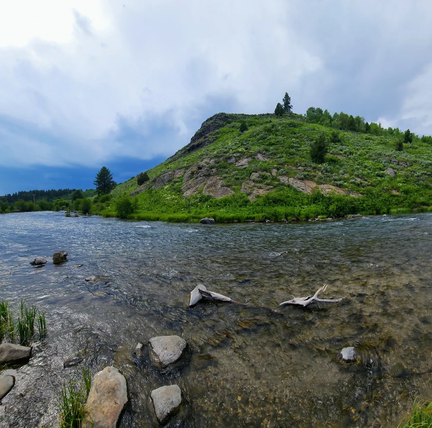
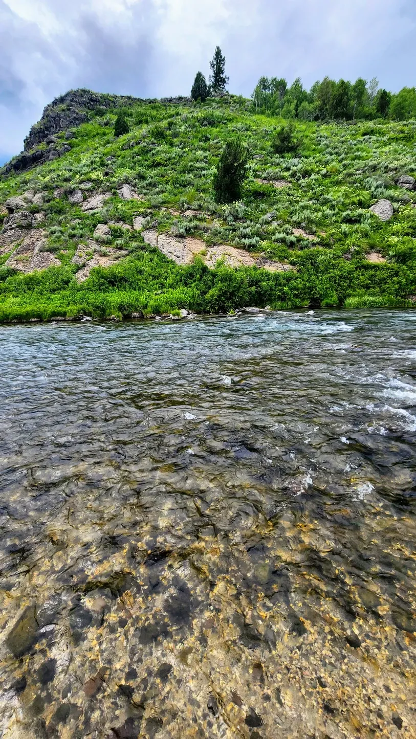
If coming from the Ashton Visitor's Center, the actual start of the scenic byway is a little ways up the road. Travel past downtown until you reach Route 47, and this will lead you to the start. Much of the byway runs alongside the Snake River, specifically Henrys Fork. The lush farmland is immediately apparent after turning onto Route 47. The fields are bright green, contrasting with the gray and white Teton mountains in the distance.
From the Information Board:
Upper Snake River Valley: The Upper Snake River Valley is considered to be one of Idaho's richest farmlands. Early pioneers prized its fertile volcanic soil and homesteaded in the valley during the 1890s. Today, the valley has the distinction of being the largest seed potato producer in the world. The distant views include the Tetons to the east, the Centennial Mountains to the north, and the St. Anthony sand dunes to the west.
Cave Falls Road Turnoff:
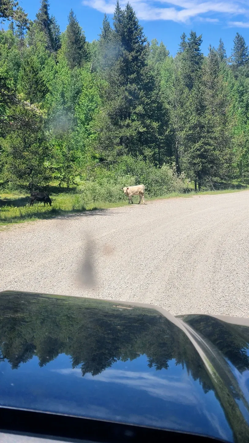
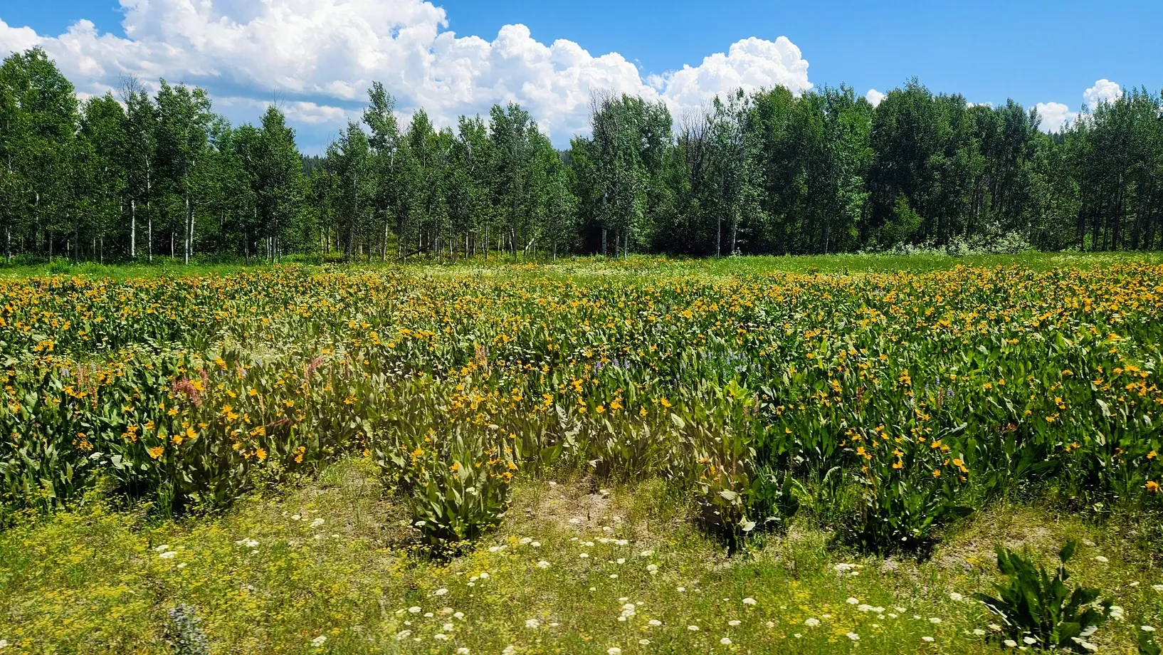
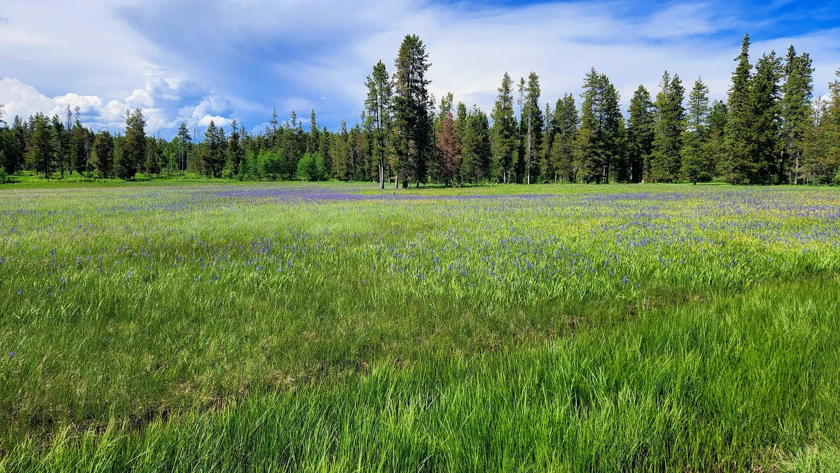
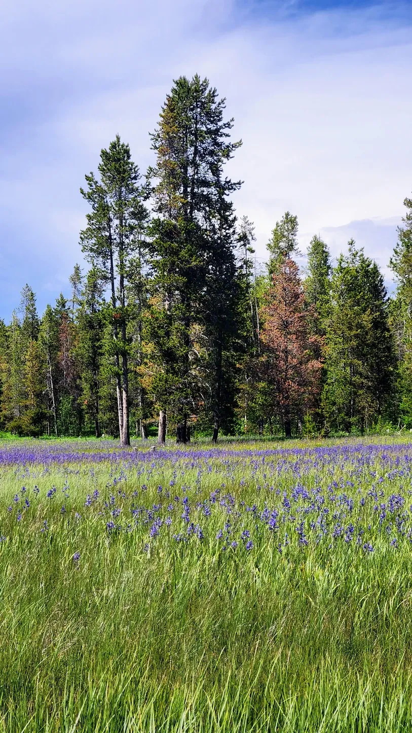
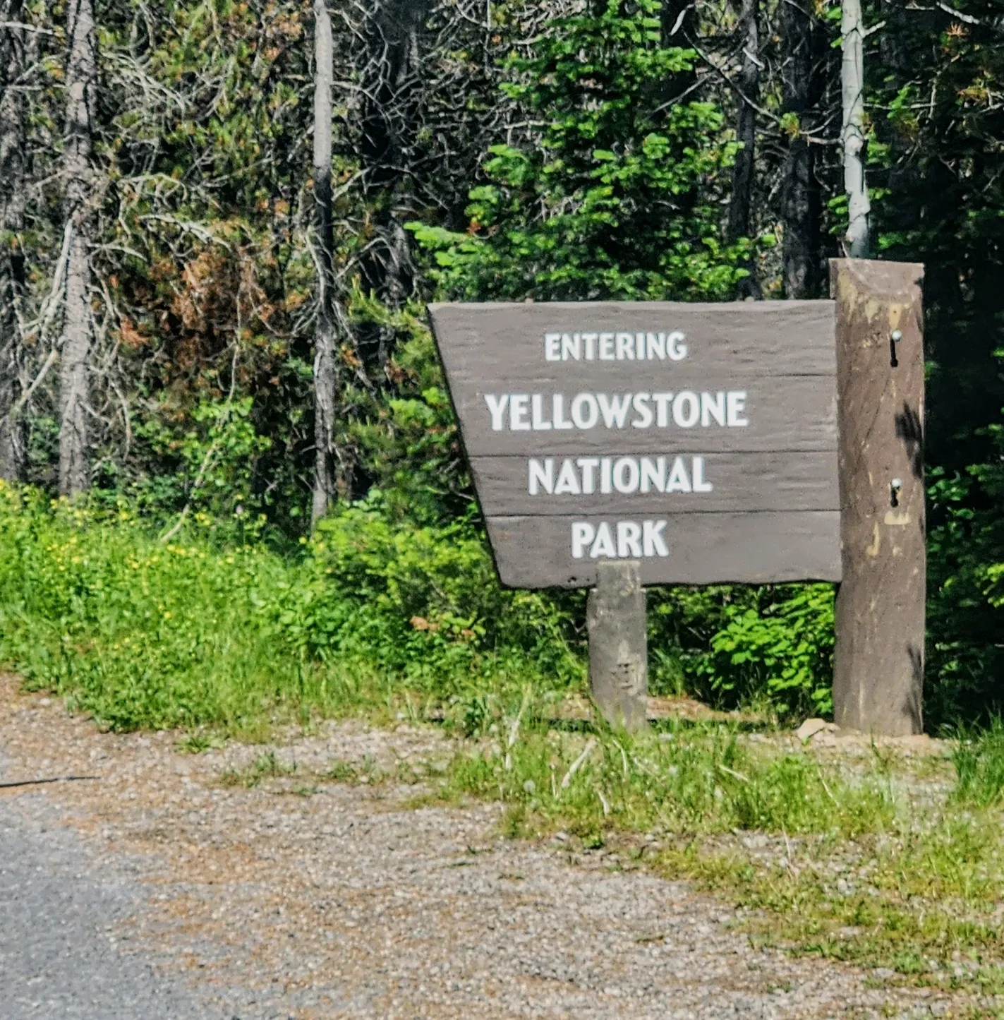
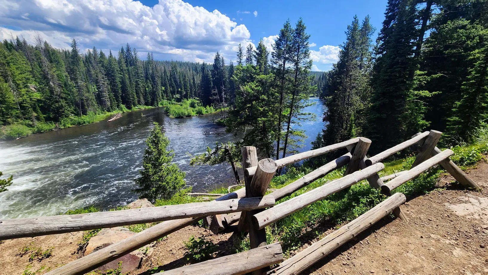
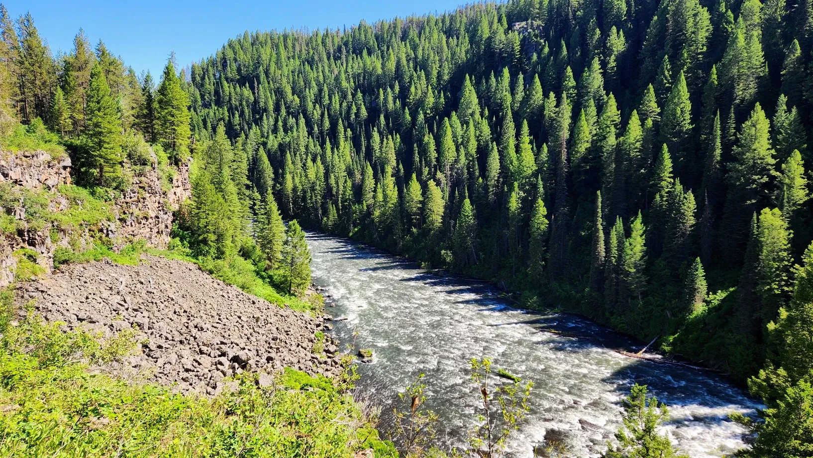
As soon as we began our journey on the scenic byway, we needed to make the decision whether or not to get off and take a detour. Cave Falls Road leads through a back area of the national forest and into Yellowstone, where it dead-ends at the junction of the Bechler and Fall Rivers. There lies Cave Falls, a powerful waterfall and central feature of Yellowstone's Cascade Corner. The road is 18 miles and much of it is gravel, but we chose to check it out and are glad we did. The summer season yields the most beautiful, colorful wildflowers. Fields of arrowleaf balsamroots and lupines colored the ground yellow and purple, and the meadows were shaded by aspen and pine trees. The further we went, the more secluded we felt. We passed the occasional ranch, with its cattle grazing and greeting us in the street, but besides them and a few four-wheel-drive vehicles, we were alone until we reached the national park border. (We set our truck to 4-wheel drive, but you can make it down the road without a 4x4).
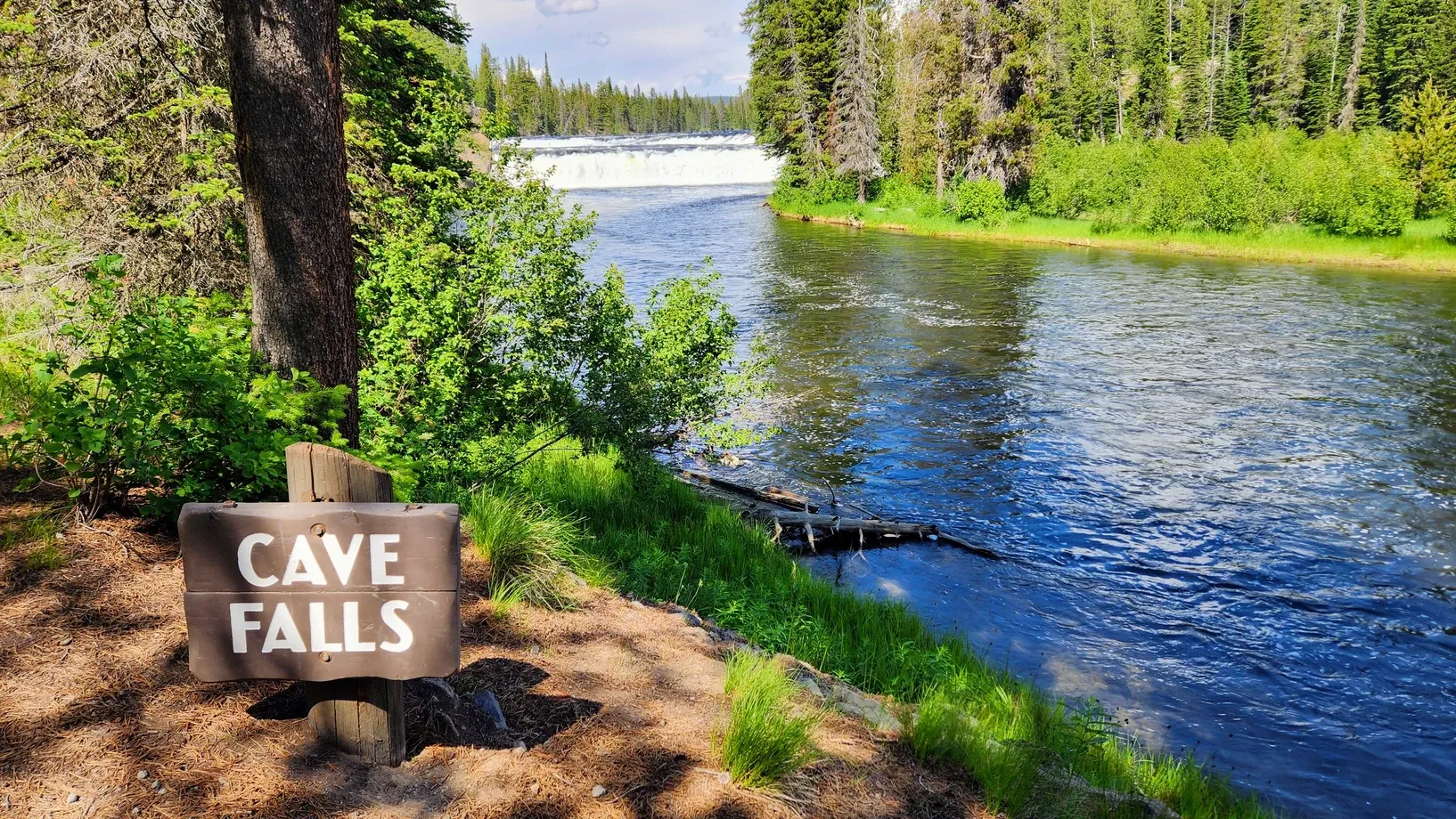
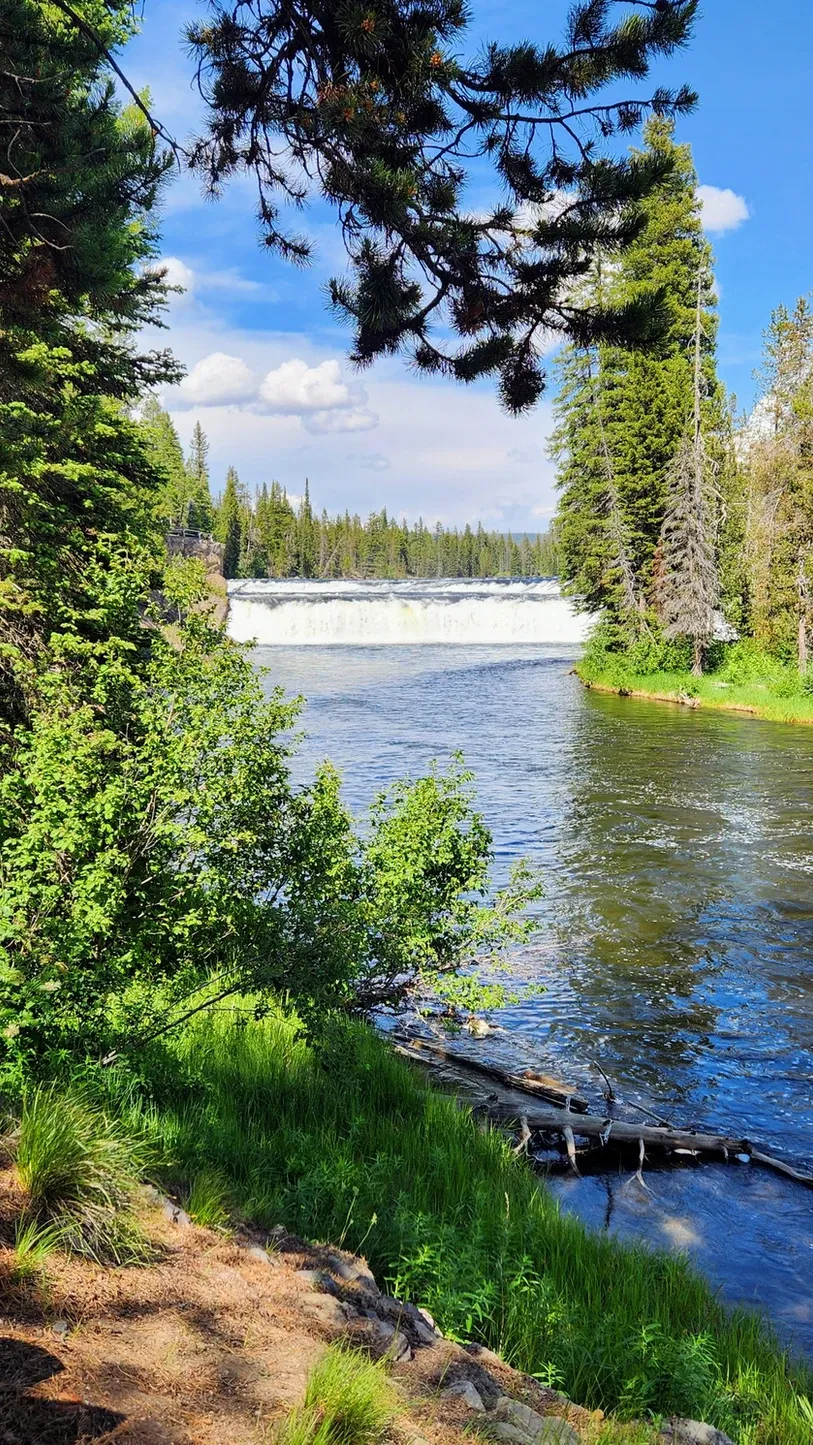
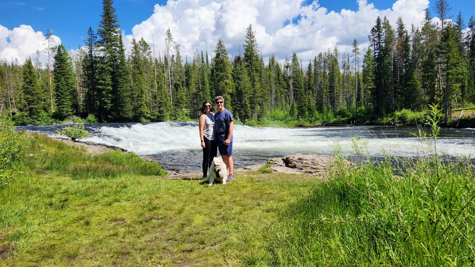
Cave Falls:
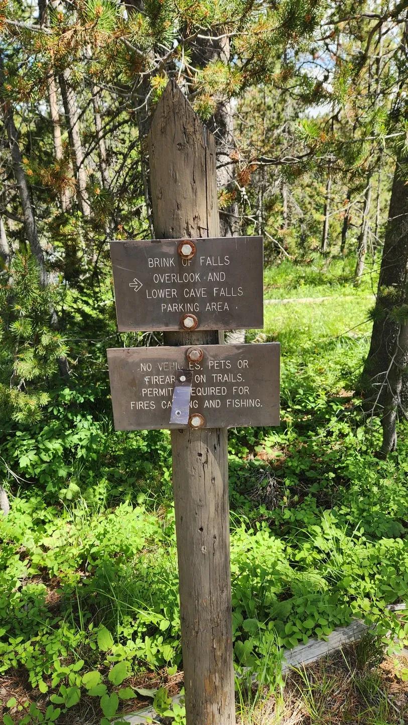
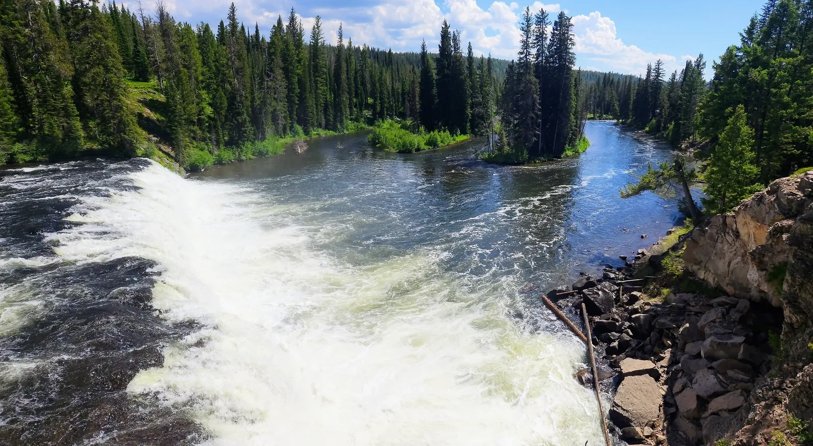
The Cascade Corner of Yellowstone National Park has a ranger station, the falls overlook, and some hiking trails leading to various waterfalls. Like all trails in the park, these were not dog-friendly, and since we took Tanner along for the journey, we stuck to the overlooks. Cave Falls was dramatic to see - and feel - as its mist reached us all the way up on the overlook. The overall area is small, with a few spots to park and some loops to turn around. There is also a small picnic area, but when we went, we only stayed outside the truck for enough time to take some photos, before the mosquitoes chased us away.
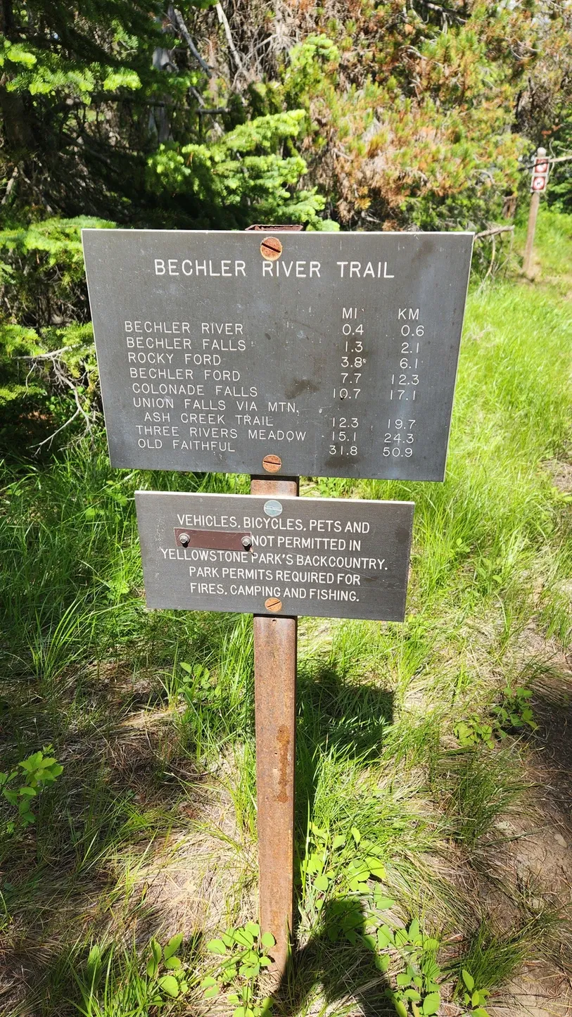
If you're planning on adding some hiking to your scenic drive, this is the place. One of the trail signs indicated the Bechler Falls was only a mile and a half up the trail, but we can't say if it's worth the trek, because looking it up online yielded more pictures of Cave Falls. If nothing else, the hike would be alongside the river, which was rushing with rapids and cascades. It's probably a nice hike no matter what.
From the Information Board:
Cave Falls at 250 feet is the widest waterfall in Yellowstone National Park. The waterfall was named for a 50'x50' cave at its base. The Bechler Ranger Station is known as the back door to Yellowstone, and serves as the trailhead for several horse/hiking trails that lead into the remote "Cascade Corner" of Yellowstone National Park. Cascade Corner is famous for its many spectacular waterfalls.

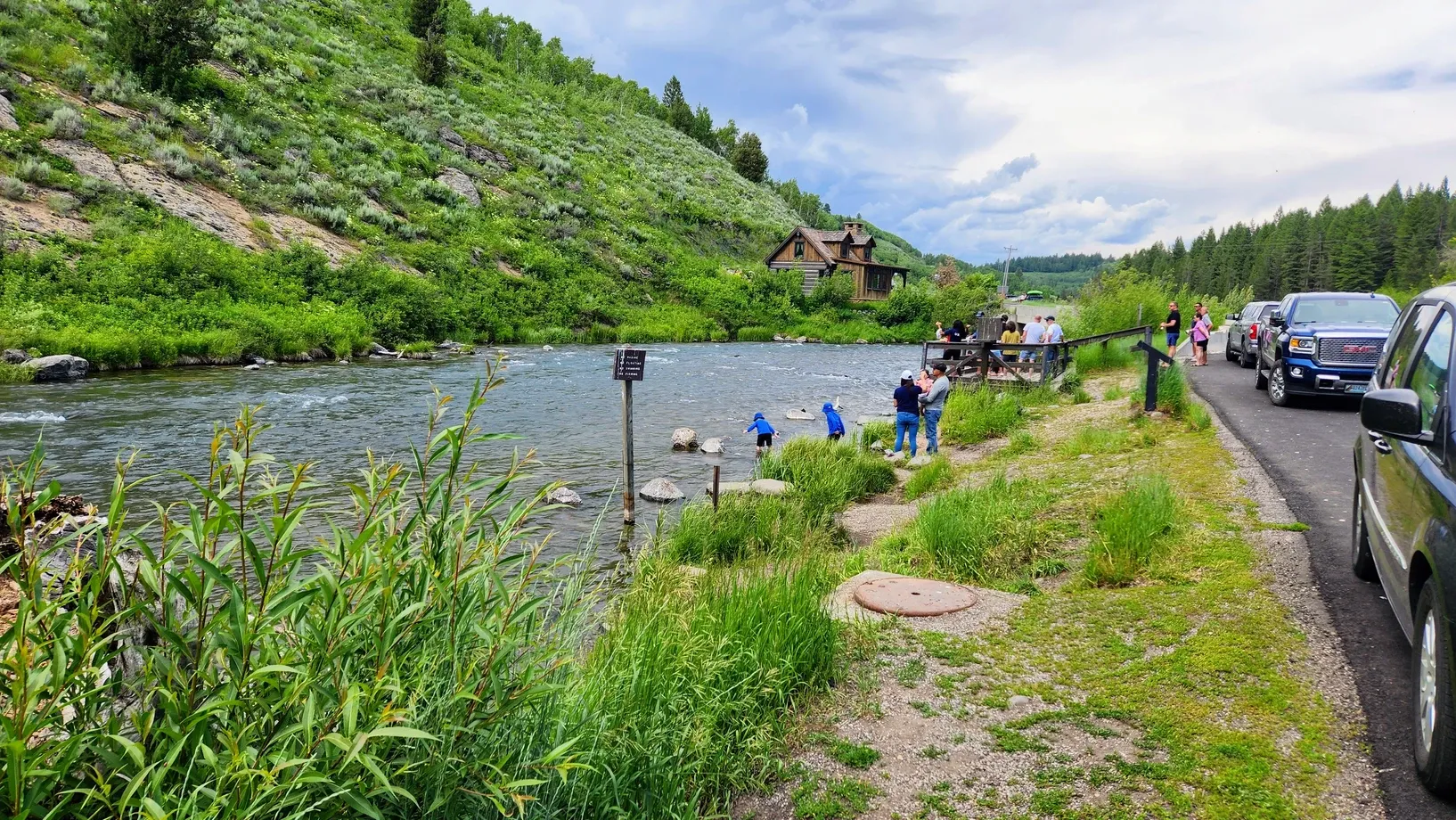
Warm River Trout Feeding Platform:
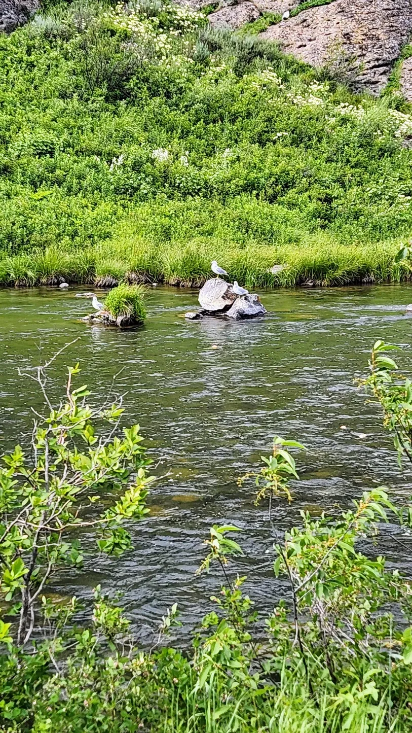
After making our way back to the Scenic Byway, our first official stop was the small town of Warm River, and by small, we mean the least populous town in the entire state of Idaho. In 2021, the population was 1. The Warm River joins up with Henrys Fork and Robinson Creek, and at a small pullout is a trout feeding platform. The Fred and Berta Lewies Memorial Trout Feeding Site commemorates a 1920s couple who owned a convenience store in town and started the tradition of feeding the trout. They began telling anglers to bypass this part of the river, and to this day, this section of the river is for feeding and not fishing. You can purchase pellets of food from a dispenser, but when we went, most people were throwing their own scraps of bread into the water. We didn't see any trout, but we heard a few squeals from visitors who did. The seagulls also seem to appreciate the bounty of food along this stretch of river.
From the Information Board:
Warm River is a popular spot for fishing, camping, and picnicking. A fish observation platform along the river gives visitors an up close opportunity to see and feed the many large trout. Stone Bridge access located one mile downstream from the observation platform is the launching point for fisherman to begin their float trip of the lower Henrys Fork.
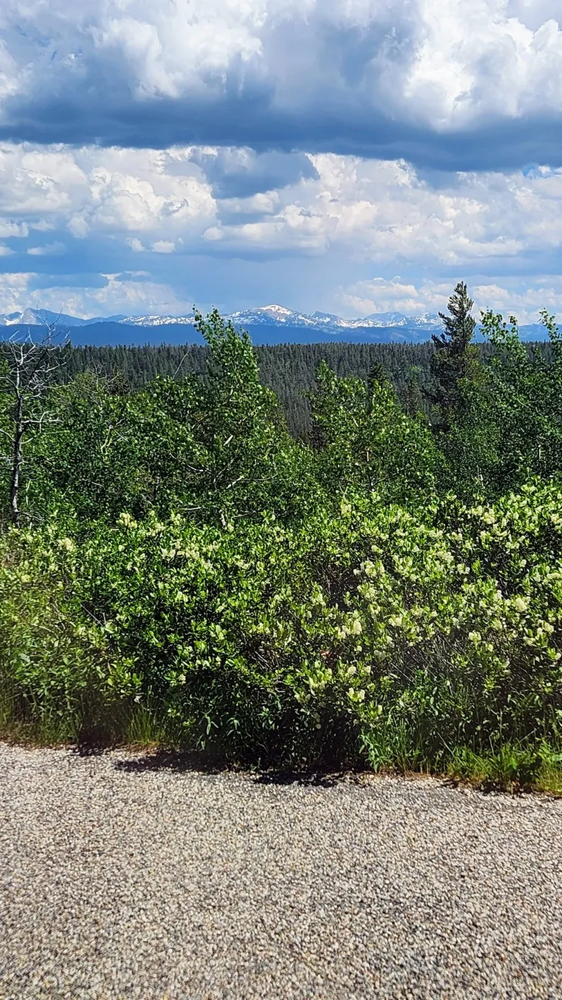
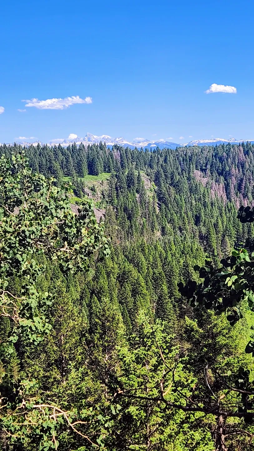
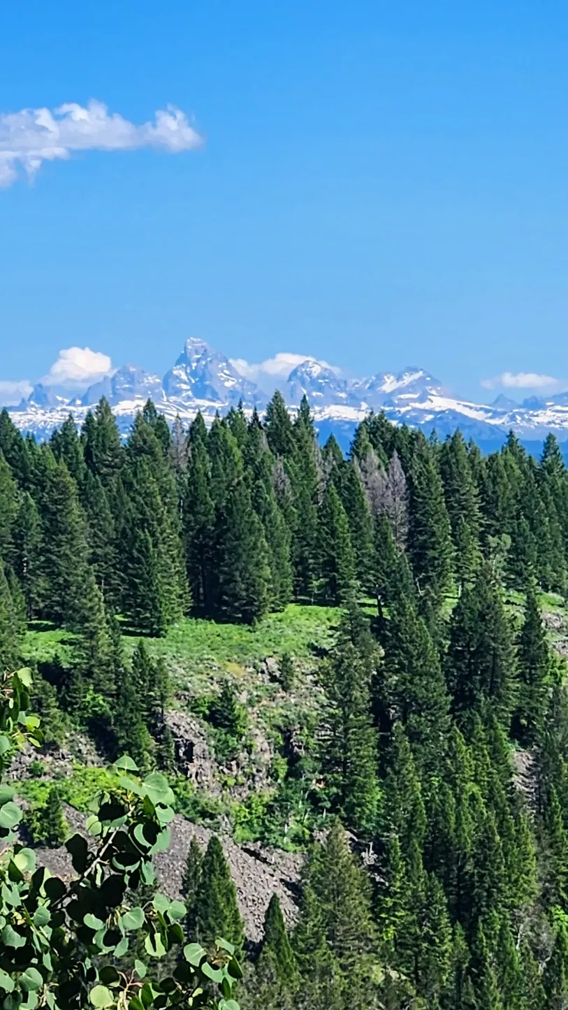
Making our way north on the Scenic Byway, we passed a couple of pullouts, one of which we assume was the Teton Overlook, though it wasn't marked. The clouds were rolling in, and while we could see a few mountains, we saw no great views of the Tetons, which were 40 miles away. We continued onward without stopping, but the Information Board did provide some interesting facts about the overlook:
Teton Overlook provides a spectacular view of the Teton Range nearly 40 miles in the distance. The three "Tetons" were once a single massive mountain of granite. Over the millennia, freezing water broke off slabs of rock, creating the sharp ridges and pinnacles. Glaciers carved the steep canyons into U-shaped valleys. Early explorers called the mountains the Pilor Peaks. Later, the more romantic French trappers called the main peaks "Les Trois Teton" or "The Three Breasts."
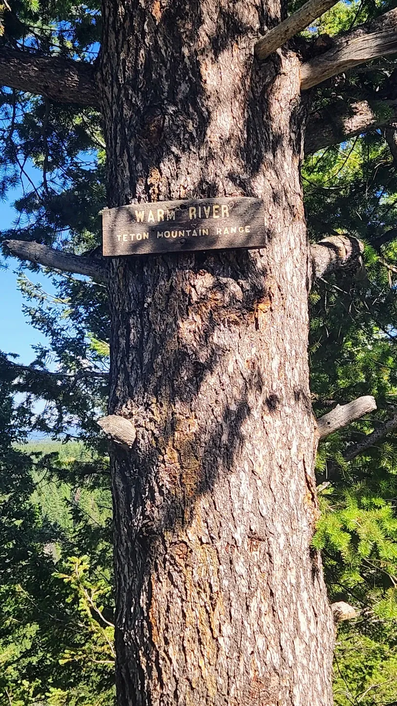
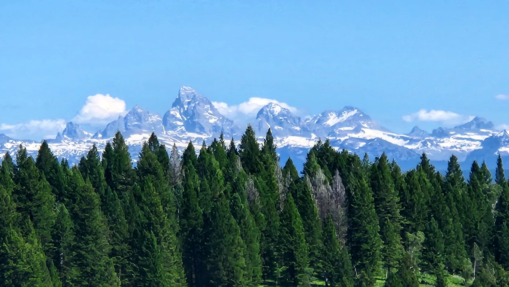
Editor's note: We ended up returning to the pullout on a clearer day and caught a view of Les Trois Teton in the distance. We still don't think it's a worthy enough pullout to include on the map, but wasn't a bad stop for a quick picture. Still had to zoom in quite a bit to capture the Tetons. The pullout is technically called Warm River Teton Mountain Range, as indicated by a small wooden sign on one of the trees.
Bear Gulch Trailhead:
The Bear Gulch trail leads to Upper Mesa Falls - if you feel like trekking the 9+ miles to get there instead of driving. Otherwise, this is a large pullout with a vault toilet, and a good midway stop along the way. If you do feel like hiking any of the trails around here, I did read a Google review that said it was the jumping off point to some of the best scenery this person had ever seen. So that's something.
From the Information Board:
Bear Gulch, a former ski area, is now the trailhead for two all-season trails. The Canyon Rim Trail is a nine-mile roundtrip ski/hiking trail that follows the canyon rim to Upper Mesa Falls. The original 36-mile Union Pacific Railroad grade that once took travelers to Yellowstone National Park now serves as a multipurpose trail to the Montana border. During winter, Bear Gulch serves as a trailhead for more than 500 miles of groomed snowmobile trails.
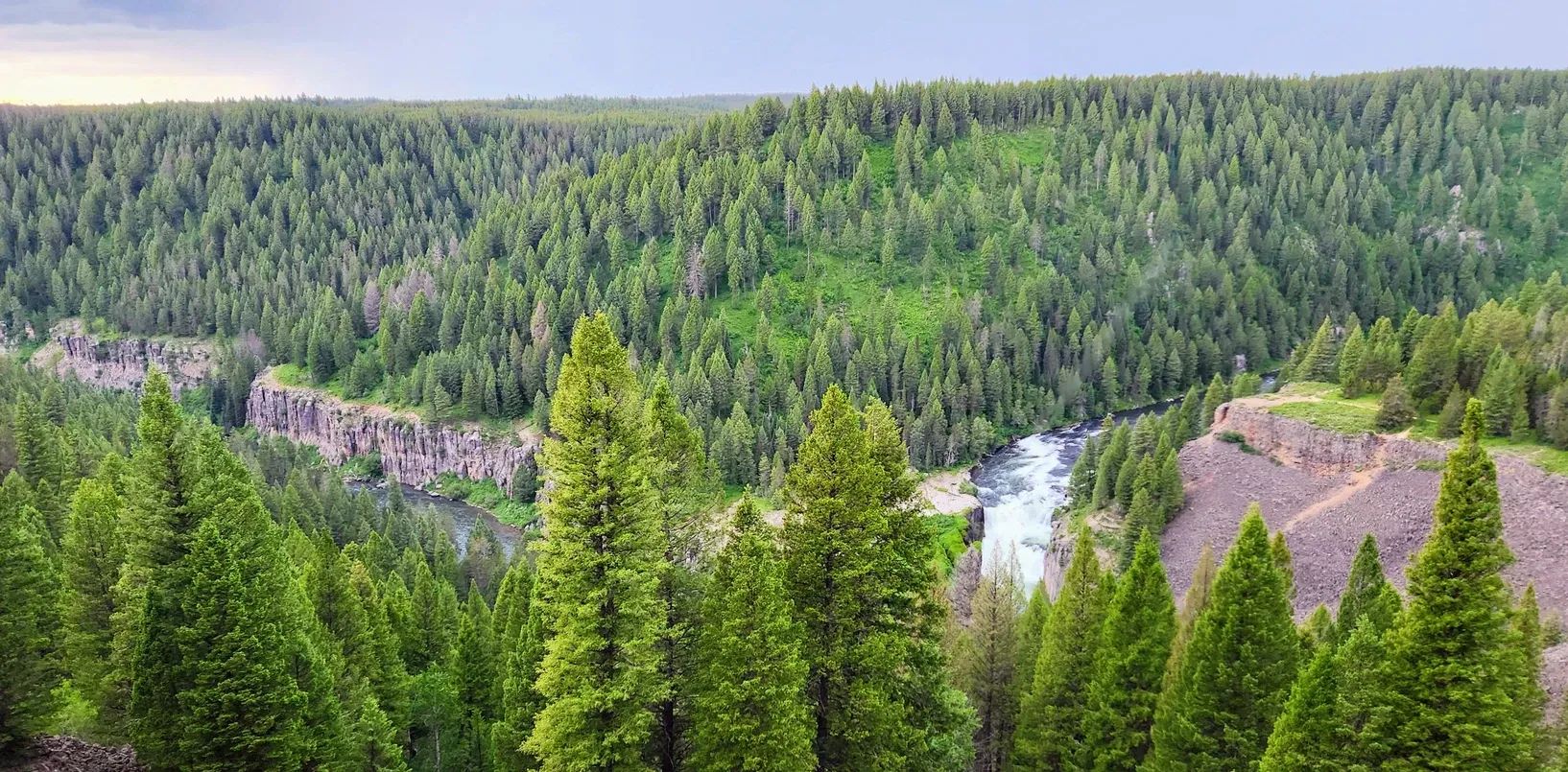
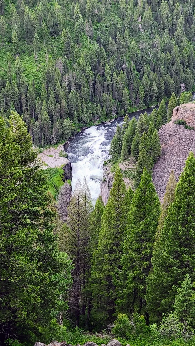
Lower Mesa Falls:
Soon, it was time to see the feature that's all the hype - and the namesake - of this scenic byway. Once upon a time, there were plans to build a power plant and convert the water into hydro-energy, but the plant never came to fruition, and today Mesa Falls stands as one of only two unmaintained waterfalls in Idaho. The falls carve into solidified volcanic rock, and we must say, the canyon is pretty spectacular.
From the Information Board:
Grandview Overlook, built by the Civilian Conservation Corps during the 1930s, provides a spectacular panoramic view of Lower Mesa Falls. The Henrys Fork of the Snake River squeezes between basalt columns and plunges 65 feet, creating Lower Mesa Falls. Grandview Campground, adjacent to the overlook, has 9 campsites. In winter, the area is only accessible by snowmobile or skis.

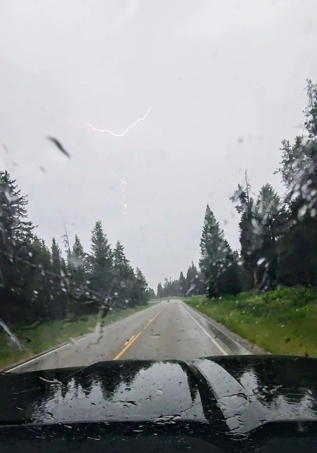
By this point, the clouds had turned darker and a storm started brewing. We quickly saw Lower Mesa Falls as thunder boomed above us, and right as we made our way back to the truck, the rain started pouring. We decided to put a pin in our scenic drive and view Upper Mesa Falls in nicer weather. On our way toward the northern terminus of the byway, we got caught in quite a lightning storm, but we were still able to appreciate the beauty of the forest surrounding us.
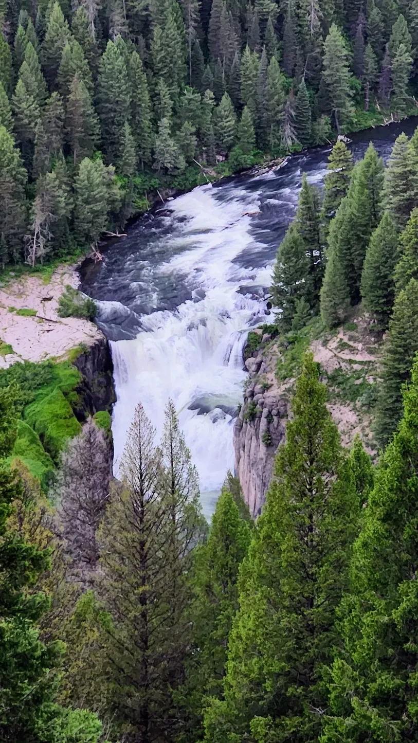
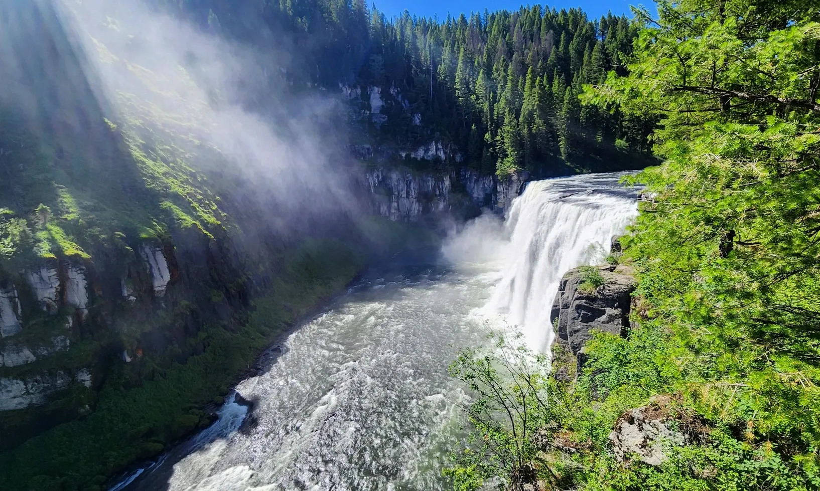
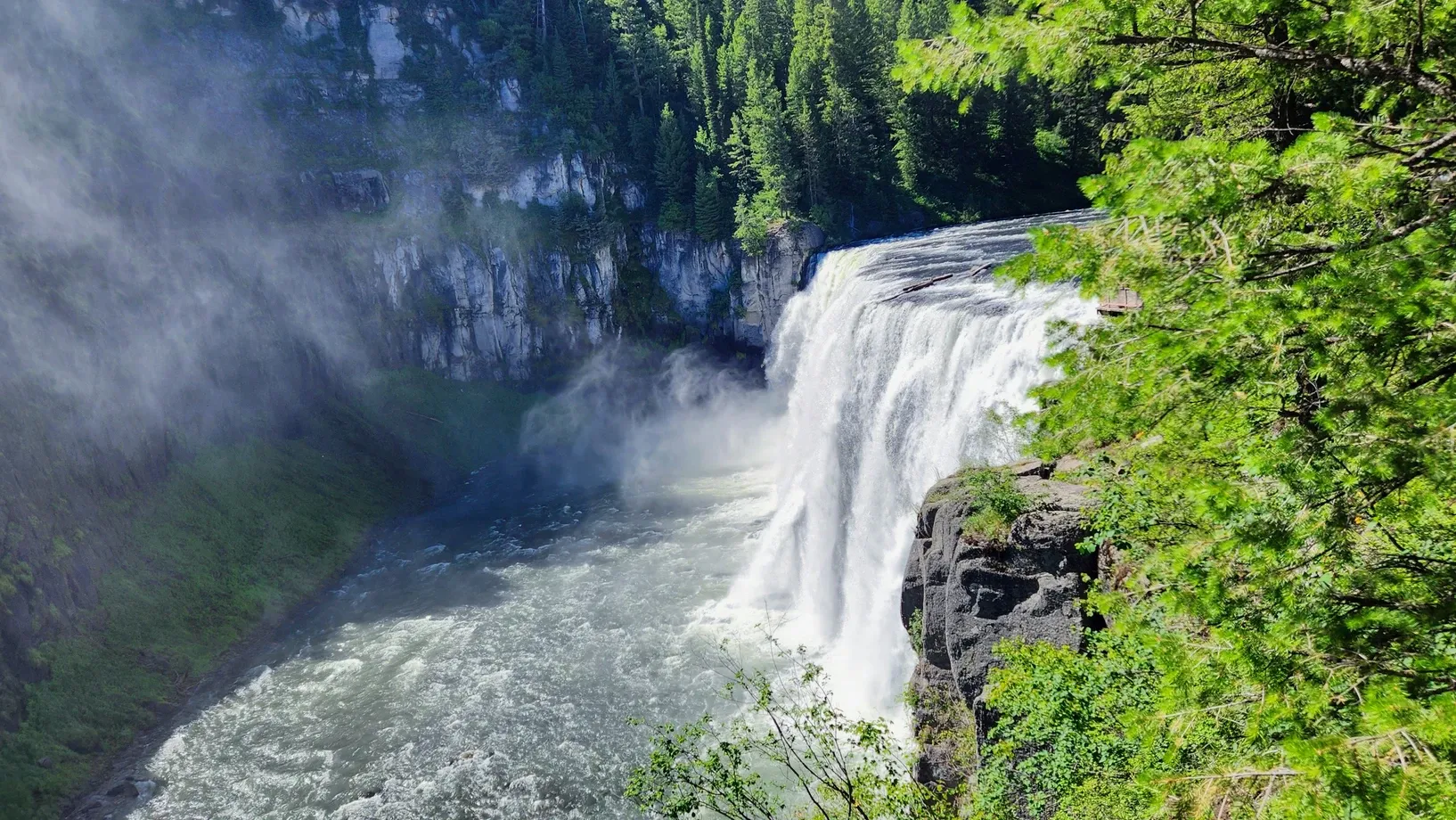
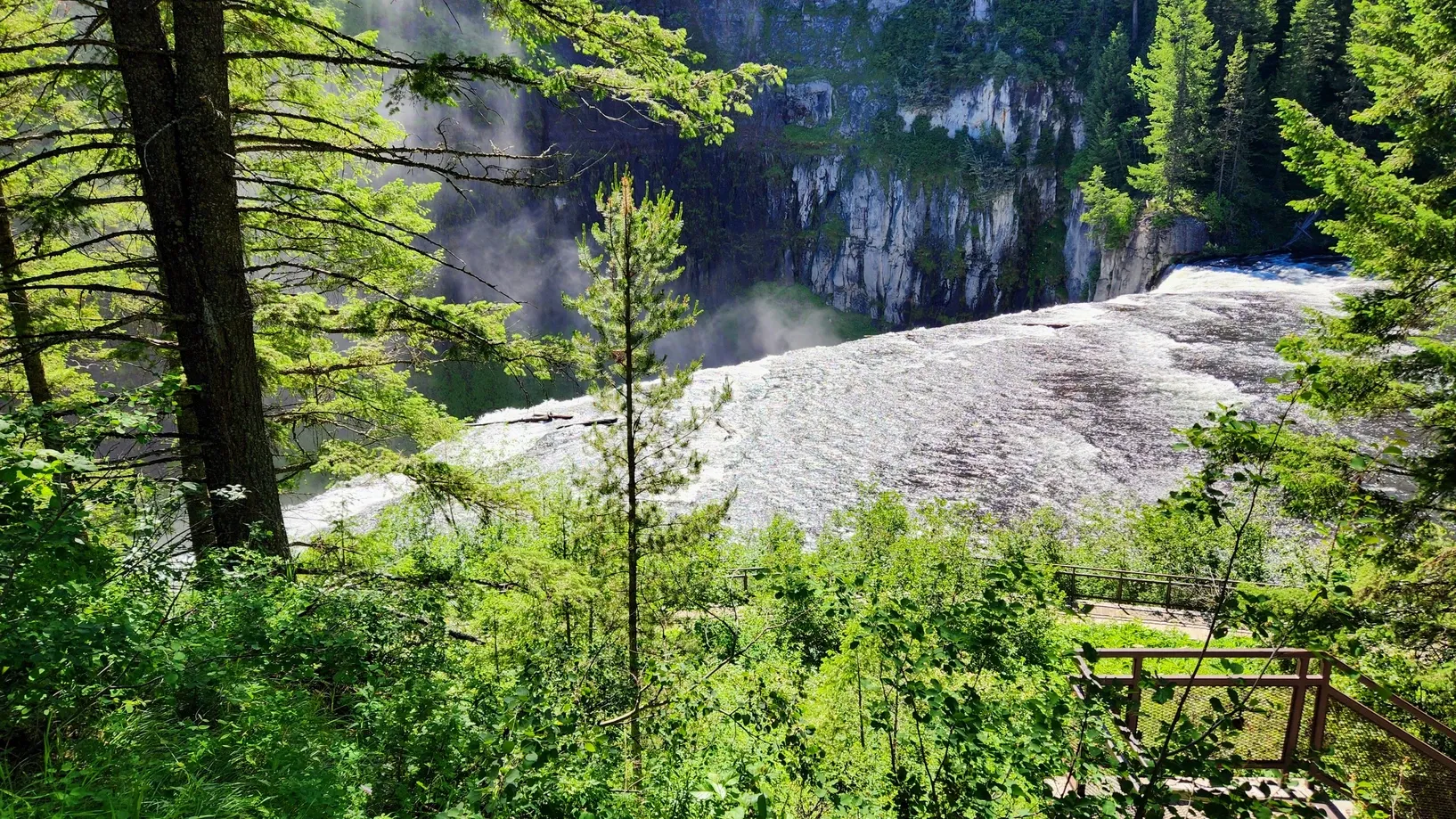
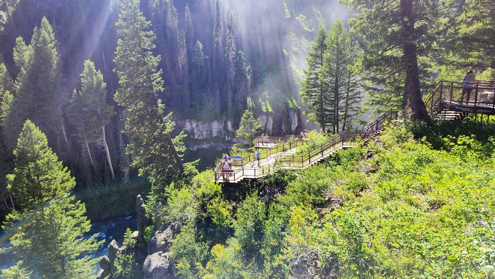
Upper Mesa Falls:
Driving the scenic byway from south to north means that the upper falls are the grand finale of the trip. We returned to the byway the following day to complete our drive. Upper Mesa Falls was a lot more crowded in the sunshine, but we didn't have to wait long to get a parking spot. Rangers were there directing people. The falls are big and powerful, and their mist was floating into the sky. There are multiple levels of walkways with different lookout platforms. Despite the crowds, we were able to squeeze our way to each lookout with ease, only we wish there was a way to see the falls from the front; the best views were from the side, which didn't really give the full perspective on the size of this waterfall. Equally spectacular is the canyon, lined with volcanic rock and evergreen trees. We've seen a lot of waterfalls in our travels and so we weren't exactly blown away, but we certainly see the appeal. The biggest problem with this "unmaintained" waterfall is that, instead of a hydropower plant, it's now a tourist attraction. The National Forest Service has done the best they can to keep it from getting too over-the-top, but when the appeal is there, so is the demand, and the NFS is capitalizing on it.
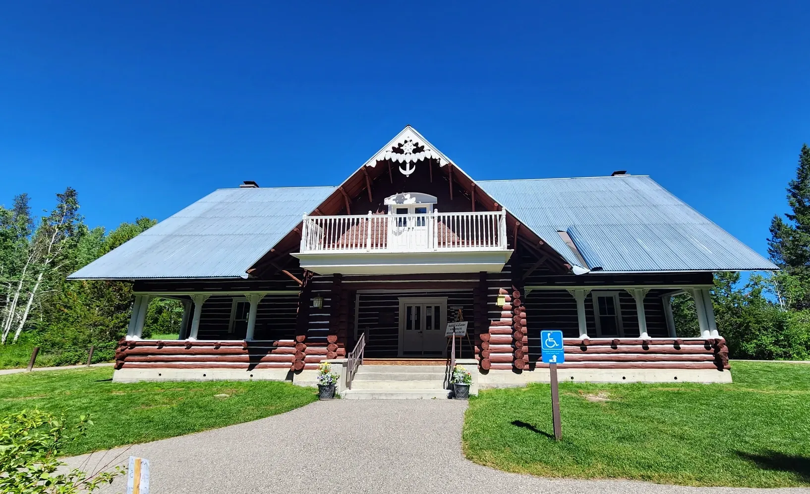
From the Information Board: Upper Mesa Falls cascades 114 feet over compressed volcanic ash that dates back 1.3 million years. More recent volcanic eruptions moved the river to its present location, where, for the past half-million years, the river has carved the canyon. Between 1912 and 1916 the Mesa Power Company built a distinctive log-style building, which later became the Big Falls Inn and stage stop. Today, the original inn serves as an interpretive center.
Mesa Falls Scenic Byway Info:
Just before reaching US20 from the byway, there is a pullout with an information board. This area serves as the north end of the byway, near Island Park. As we said, we recommend taking the byway from south to north, but both directions get you to each of the landmarks along the way.
From the Information Board:
City of Island Park: Island Park has the world's longest main street, at 33 miles long. Island Park is situated in a caldera of an extinct volcano with the rim still visible to the west. The region has become an all-season recreational destination. Summer offers anglers world-class streams and lakes. During the fall, sportsmen find exceptional waterfowl and big game hunting. In winter, snowmobilers enjoy thousands of acres of untracked powder and more than 500 miles of groomed trails.
One place that we didn't include in our byway map, but that many do tack onto their journey, is Harriman State Park. The east side of the park - a fishing pond - is located right by the northern end of the byway. The west side of the park is across US20. We stopped there briefly on our way down to Ashton, but being situated in a wildlife refuge, the hiking trails are not dog-friendly. There is also a historic site, but when we visited, they were holding an event, so not much reason for us to spend time there. Because of its location in a wildlife refuge, though, we hear bird, waterfowl, and animal sightings are plenty. It's also a fly fisherman's paradise. If you do decide to make the state park a stop on your scenic drive, you can add it to the beginning or end of your trip, either starting the day with some fishing or exploring/bird watching, or ending the day with a relaxing hike or bike ride.
From the Information Board:
Harriman State Park is located on the Henrys Fork of the Snake River. The park was once the site of the "Railroad Ranch" notable, due to its previous owners of the Harrimans of Union Pacific Railroad fame. Most of the original buildings have been preserved as part of the state park. The park has numerous hiking, biking, and horseback trails and is known for its plentiful wildlife. The "Ranch" section of the Henrys Fork attracts fly fisherman from around the world, seeking trophy trout.
If you find yourself driving US20 and have some extra time for adventure, the Mesa Falls Scenic Byway can be a great way to break up the monotony of your journey. Take it from us: we drove US20 enough to know that sometimes that road seems infinitely long. We appreciated our time getting to know what's on the other side.
Note: Some of the areas on the scenic byway require a fee, such as Cave Falls and the Upper Mesa Falls. Yellowstone charges $35 per vehicle, good for a 7-day permit. The National Forest Upper Mesa Falls fee was a cash payment of $5. If you have an America the Beautiful Pass, you can access these locations at no extra charge.