The Blitz East, Part 4: MO rain, MO problems

Our first time RVing through the Great Plains brought us some problems. We had many miles of high winds and dodging trucks that didn't know how to drive, park, or maneuver. Then, at our second campsite in Kansas, our truck got stuck in mud during the first big rainstorm the state had had in months. The storms kept coming and the roads were getting more and more washed out, but we were supposed to be towing over 470 miles the next day. We found ourselves facing an impossible decision:
- If we leave as planned, we will risk taking muddy, rutted, slippery roads with our trailer. We had already gotten our truck stuck and couldn't bear the thought of our home getting stuck or sliding off the road, too. Plus, more heavy rains were in the forecast, which makes towing stressful and dangerous.
- If we wait out the storms, we will face even more storms the following days. The weather forecast was predicting thunderstorms, high winds, and then a couple of days later, lows below freezing. That means that all the slick, muddy puddles would become slick, icy puddles.
All we could do was accumulate as much information as possible by checking the nearby road conditions, monitoring the weather, and preparing to leave at a moment's notice if need be. After we recovered our truck from the mud, we immediately scoped out the roads on the other side of the lake, and while nowhere near as bad as some of the sections of road we had seen earlier that day, our truck slid in a few places. We decided to see what the weather would bring overnight and then scope out again in the morning. After a night full of too much anxiety and too little sleep, we headed out at the first break in the rain, before dawn.
Driving the dark roads was scary. We kept our eyes peeled for any ruts that appeared in the headlights. Every minute or so, the sky would light up from a flash of lightning in the atmosphere. We drove slowly and carefully, paying close attention to our truck's handling.
It's hard to tell in the video the depth of some of the ruts. Some parts of the road were totally fine, while others had muddy grooves that were tough to avoid with the truck. We traveled every back road out of the park until we hit pavement. Given what we saw, we decided that the lesser danger would be to leave as soon as possible, before anymore weather could roll in.
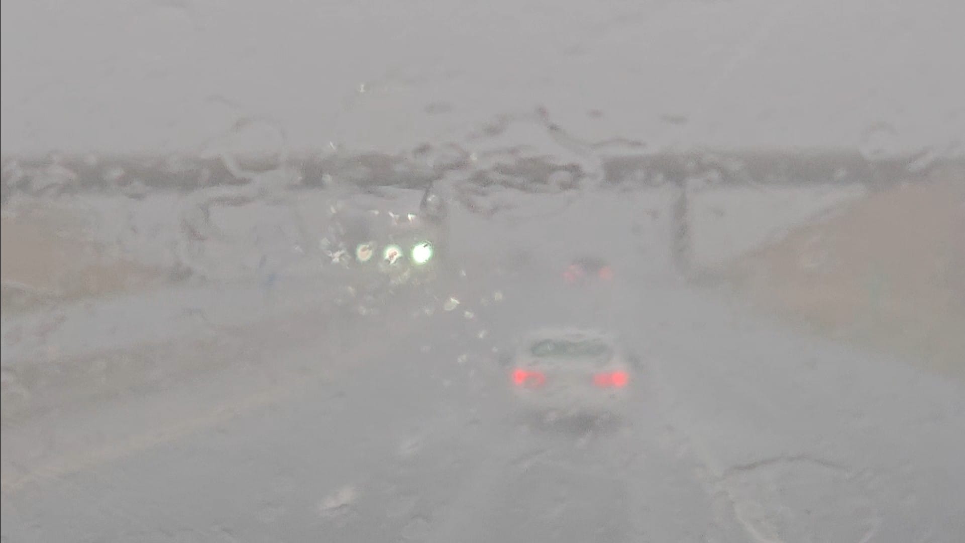
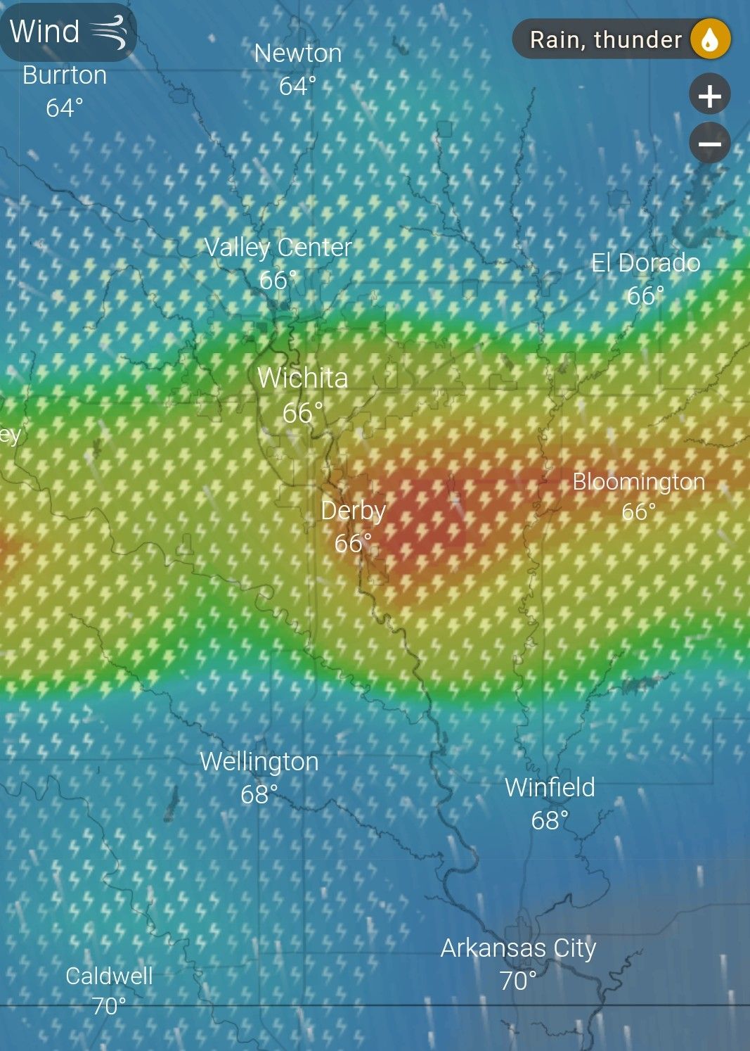
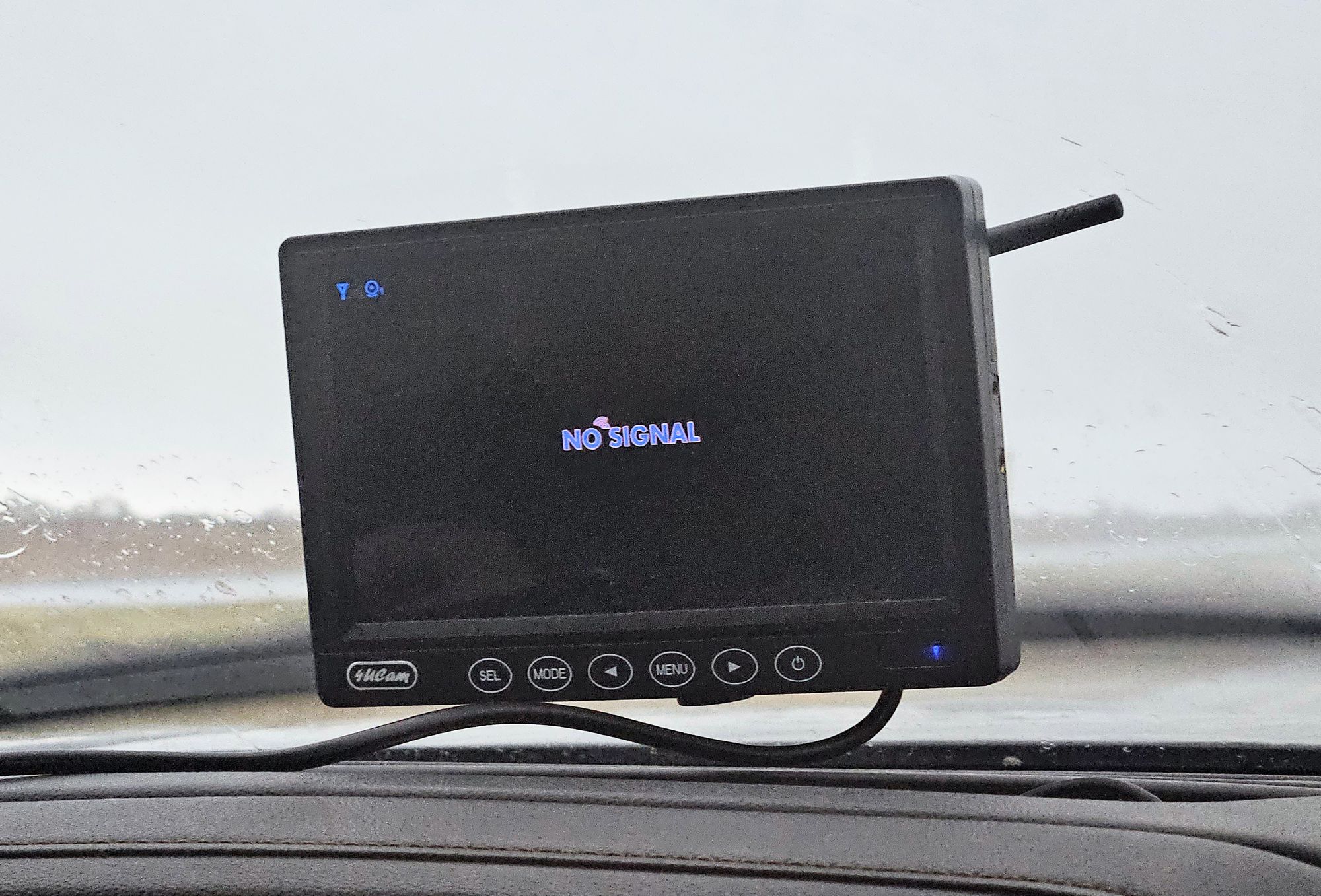
We finished packing and got on the road. The lake roads were passible and we felt so much better once we were on a main route, but our relief didn't last. As soon as we got on the interstate, the skies opened up. We had never experienced downpours this bad on a travel day. Visibility dropped to near zero, flash floods formed, and our backup camera got so wet that it lost signal. I checked the radar and saw that a band of storms was heading south, through Wichita, after criss-crossing the earlier band we had experienced that morning. The amount of rain dumped was something you'd expect in the tropics. In fact, the weather had been rainforest-level muggy, with humidity reaching 99% some days. We made a joke that the Kansas farmers prayed for rain, and God delivered. But all jokes aside, we were back to making tough decisions. The band of rain was narrow, stretching east-to-west. If we kept driving north, we could move beyond it. On the other hand, driving was not the safest. We'd have to go very slow, keep our hazards on, and be on the lookout for floods. We were also at the mercy of all the other vehicles, hoping they would take the same precautions.
We eventually stopped at a rest area. We needed to take a breather. We rushed to get us and the pets inside the trailer as the rain poured down. Once inside, I took a video out the door of a flash flood that was occurring next to us.
We didn't know how long we would stay. The crunch of a 470-mile travel day was weighing down on us, but we had already decided that, if we couldn't make it the whole way, that would be totally fine. We would just go as far as we could and find a place to park for the night.
We were stopped for about 20 minutes when I heard the rain let up. I checked my weather apps and saw that, for the next half-hour, the rain would be "moderate" before turning "heavy" again. I informed Anthony that, if we wanted to get north of this band of storms, we had a half-hour to do it and needed to leave immediately. We quickly got the pets back in the truck and headed on our way.
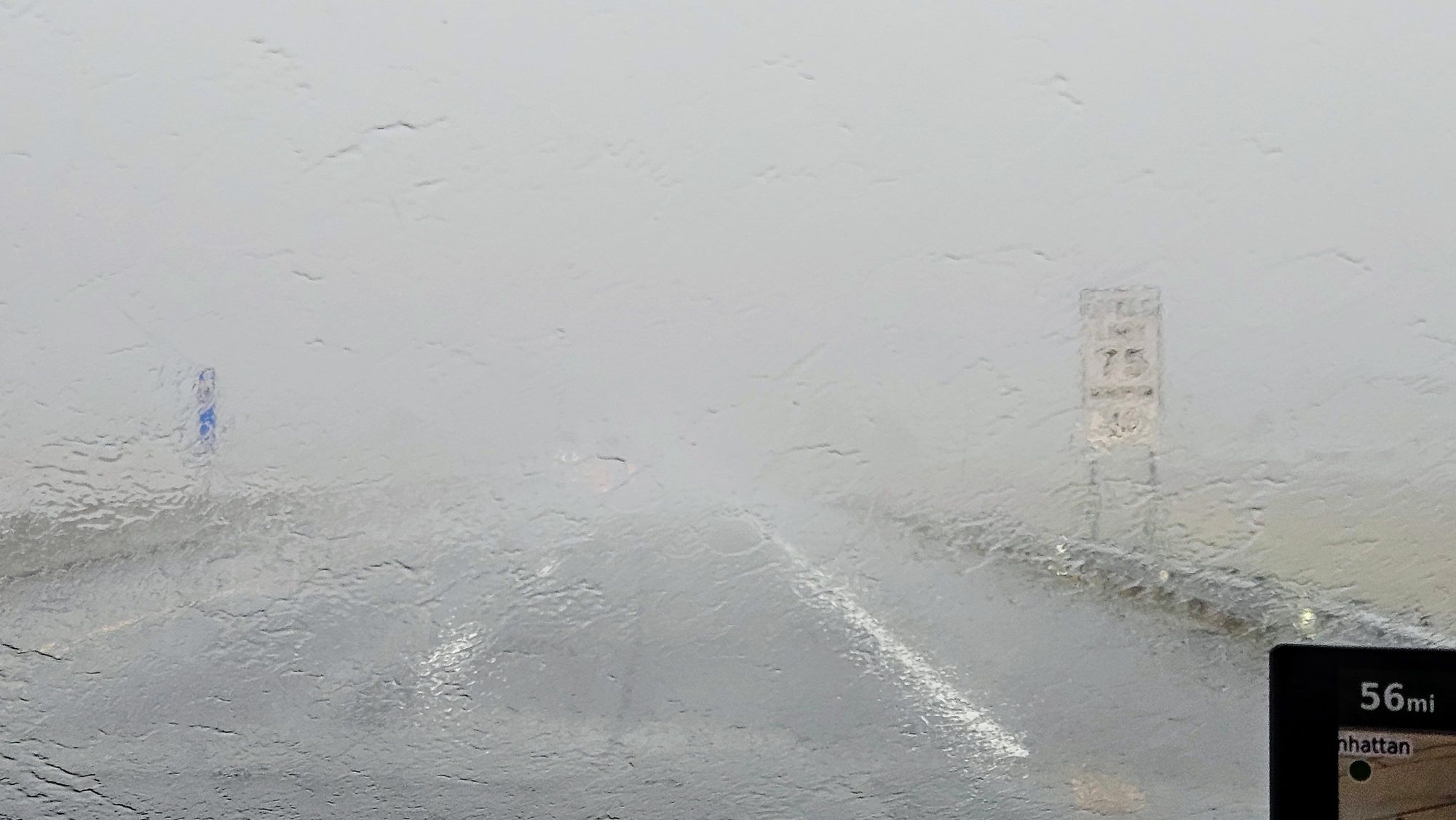
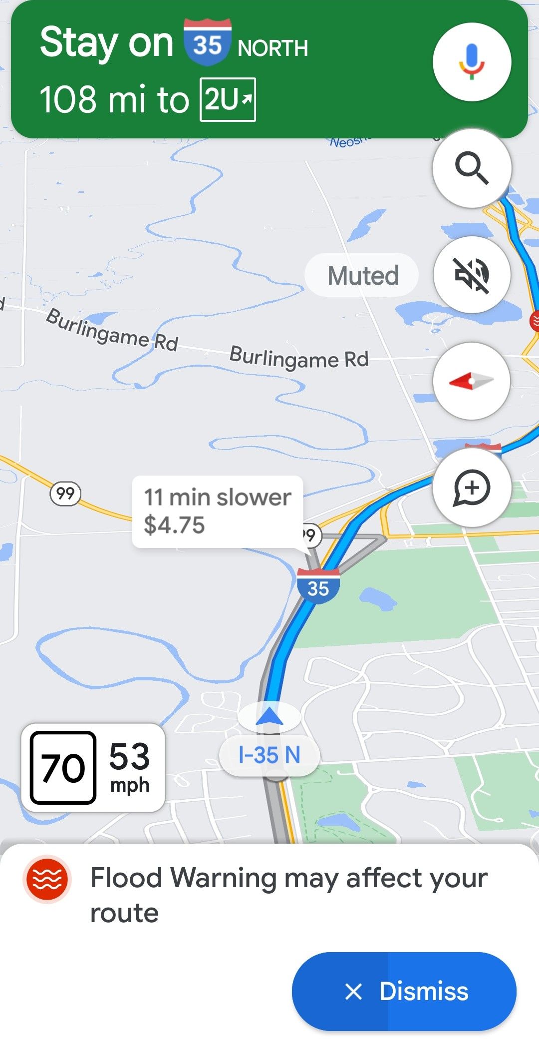
The timing could not have been worse. As soon as we drove the on-ramp back onto the interstate, the downpours started again, and this time they were even heavier. It could hardly be possible! Yet, the warnings popped up on my weather apps indicating that the rains had arrived 20 minutes early. Some areas were getting over 4 inches per hour! Google Maps issued flood warnings, some of which were right along the interstate. The coinciding message said that the flooded areas had gotten between 3 and 9 inches of rain already that morning.

We were already between the flood-warned mile markers and weren't sure if we'd come to any road closures. We kept looking, but we were able to stay on the highway, even as we passed directly through a flood-warned area.
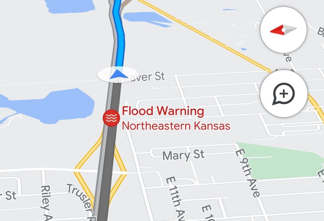
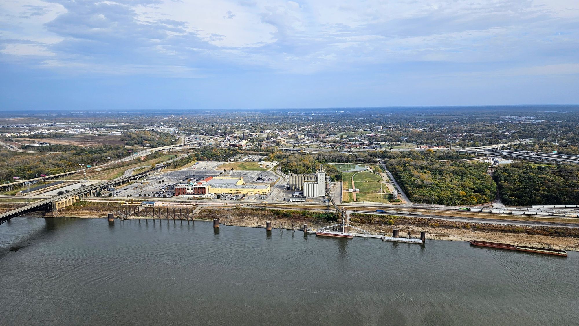
Though the band of rain seemed to stop at El Dorado, 30 miles northeast of Wichita, we didn't feel like we were out of the danger zone until Emporia, which is halfway between Wichita and Kansas City. This was the town that was flood-warned, and we continued experiencing heavy rains through this area. Once through Kansas City, finally the worst seemed to be behind us. We merged onto I-70, feeling good that we were back on our main Blitz East interstate, and even better that we were leaving Kansas in the rearview mirror.
Unfortunately, Missouri had its own problems. Though not nearly as bad as Kansas, we hit on-and-off downpours for the next couple of hours. We spent most of this stretch debating on whether we should push to reach our campground, or just pull off at a Walmart and finish the drive in the morning. Our destination was supposed to be Babler State Park, about 40 miles west of St. Louis. We had booked three nights there, knowing we'd need the break after our marathon drive day. Plus that way, we could venture into the city for some touristy fun. Then, there was all the work hanging over our heads. Remember how we weren't able to do work the day we got stuck in mud? That all still needed to be completed, and so if we stopped early and planned to drive two hours in the morning, it would only set us back even more. I had a deadline looming that was now less than 24 hours away on a project that wasn't even close to finished. Anthony had morning meetings.
As though nature wanted to assist in our decision, the rain cleared, and we even got little pops of sunlight from behind the clouds. Without the rain, we could just push the final two hours and arrive to our campsite on time. Only problem was, we would definitely run out of sunlight. We needed to be okay pulling into a state park campground in the dark, and state parks can get pretty difficult in the best of times, with tree cover, narrow roads, and no street lights. I street viewed the park roads and didn't see anything too alarming, and so we had our final answer. We would drive the remaining two hours, through sundown, and just hope that we could find our site easily.
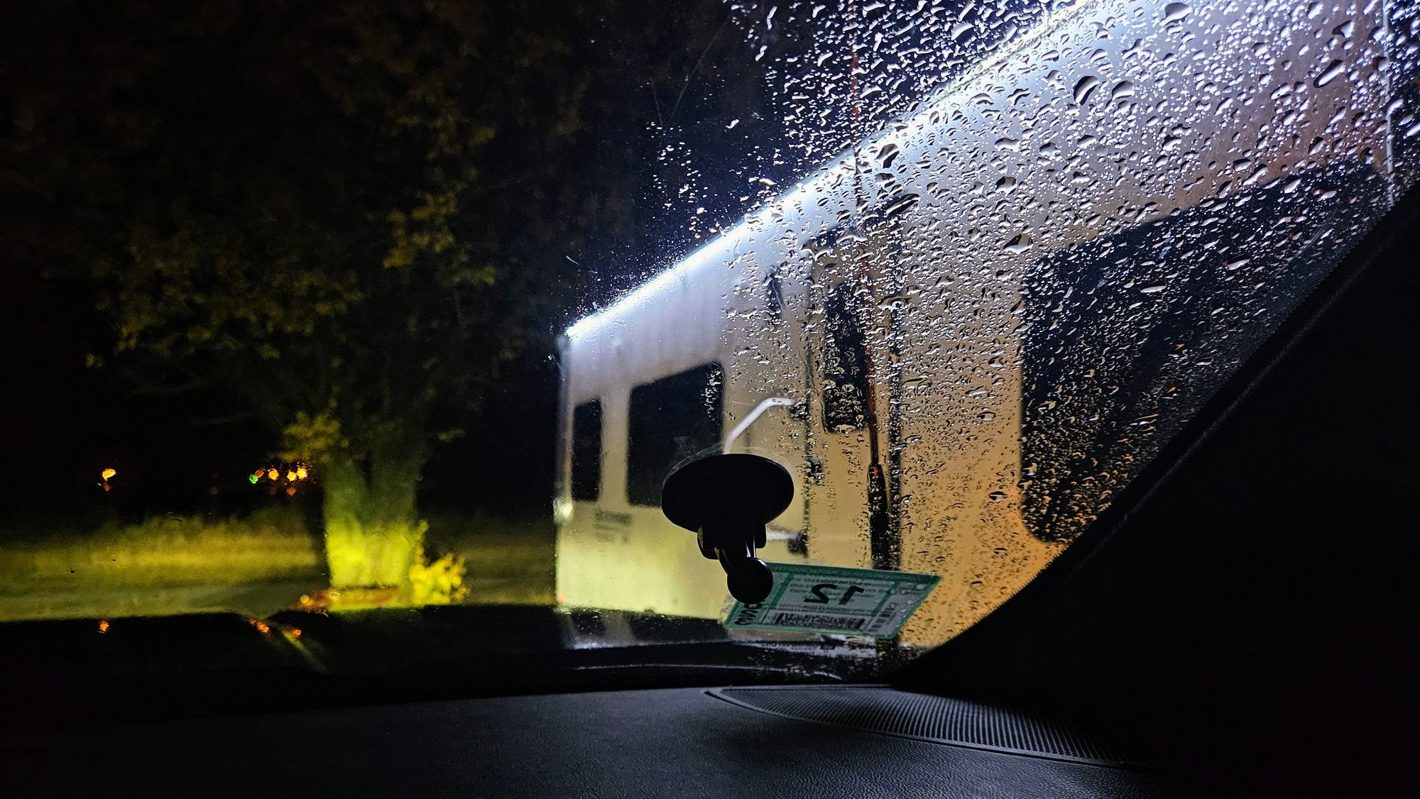
We seem to be getting ourselves into many pickles on this Blitz East, where no matter which choice we make, we're damned either way. Deciding to push onto Babler State Park opened up our whole morning, but the road to get there was not easy. As soon as we got off the highway, we hit fog. Then when our two GPS devices disagreed on which route to take to the park, we sided with one of them...the wrong one. We were forced on all these tiny, winding residential roads, which took us an extra 20 minutes beyond the estimated time on the GPS. After that, we were maxed out on stress and fatigue. We needed to get into our site as quickly as possible, only that wasn't in the cards, either. Unfortunately, my street views only showed the park roads that were actually decent. Let's just be honest: this state park is not conducive for RVs. The campground road was narrow and hilly. The loops were worse. There are even signs saying "tight turning radius" in the loops themselves. Then why allow RVs our size to stay there?! We were met with so many obstacles in that final stretch of the drive: Narrow turns, narrow roads, hills, trees, and poor signage. We started going down a wrong road in the campground before I noticed on the map. We were afraid to turn around at the end of the road because of the "tight turning radius," so instead I got out and spotted Anthony as he backed up the road. (Thanks to our helpful neighbor who saw what was happening and joined us with his flashlight).
When we were finally on the correct road, we found our campsite, but the angle meant we should approach it from the other side. Guess we'd be turning around after all. We went to the end of the road, hoping the "tight turning radius" wasn't actually so...but it was the smallest cul de sac we've ever seen in a campground. Several maneuvers and one tiny tap of a jackknife later - the only time we've ever jackknifed - we made it to our site. It was surrounded by trees on all sides, was barely wide enough to fit our trailer, didn't fit our stairs, and was on a slope. But we made it in. Then we needed to spend another 10 minutes making sure the truck fit, too. We got it in by mere inches, and put out our reflective triangles just in case. The last thing we needed was someone hitting our truck in the dark.
That concluded our new record longest drive day: ~475mi and 11 hours.
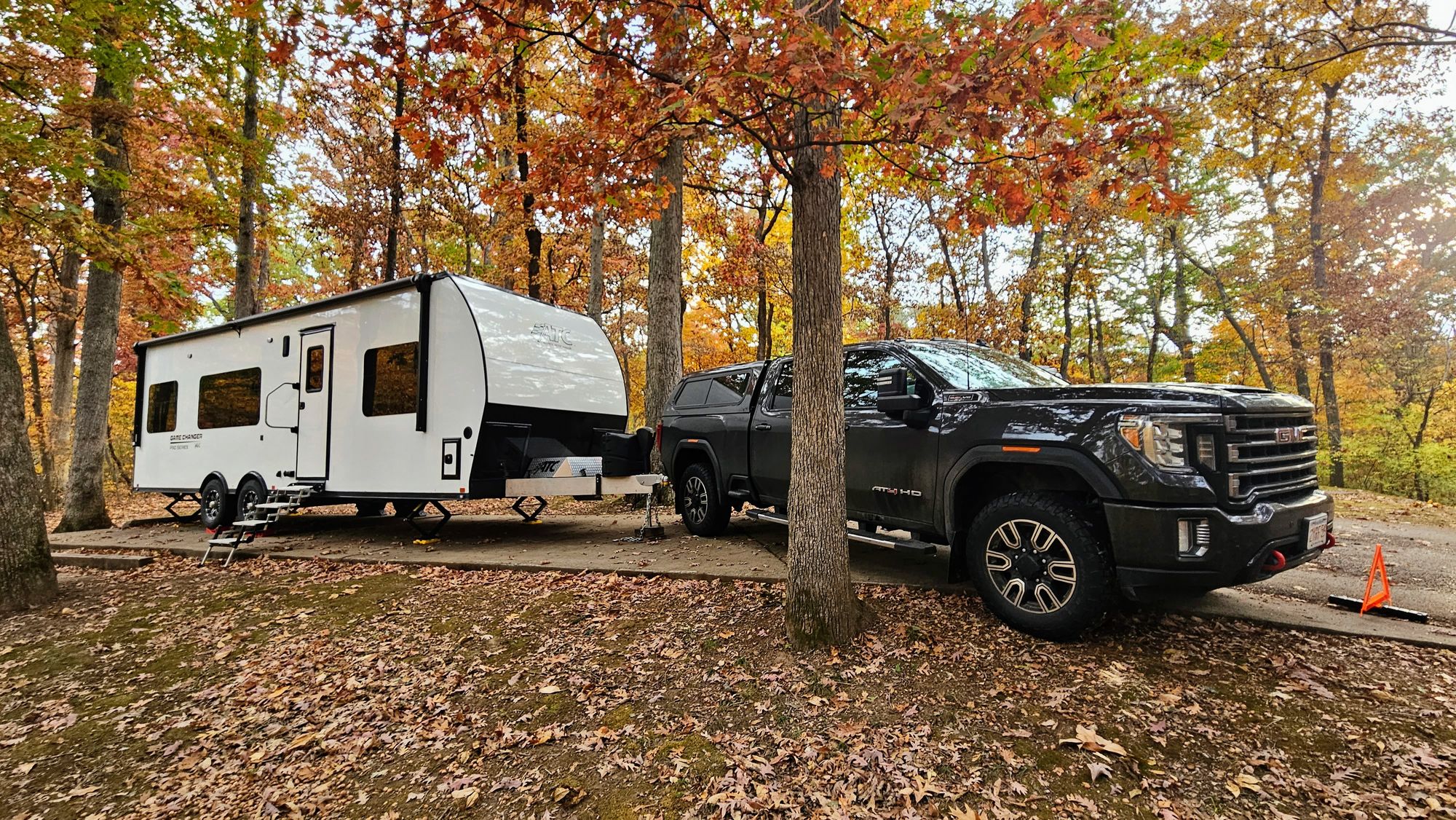
If we had known the trouble we would have faced getting around that state park, we 100% would have overnighted somewhere else. Granted, I wouldn't have met my deadline since I only met it with 20 minutes to spare, and Anthony would have needed to push his calls again, so at least we can give ourselves a pat on the back for being hard workers. By the end of it all, though, we were just depleted. In the daylight, our campsite was beautiful. It was a rustic, woodsy vibe that we usually love, but we were too whipped to appreciate it.
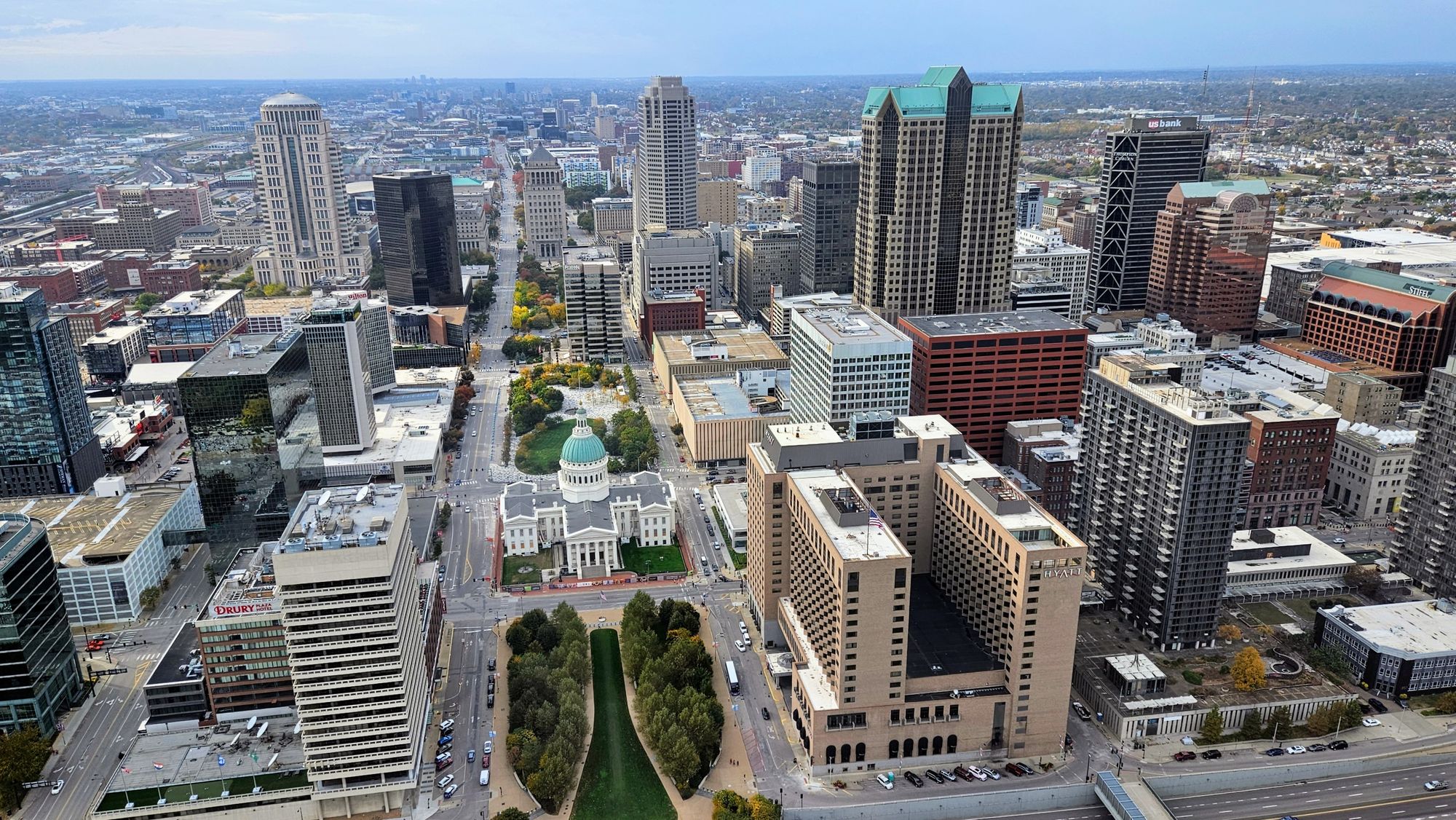
So much about exploring a place depends on everyone's mood and morale. We had been looking forward to seeing St. Louis for a while. We'd get a new national park pin, we'd see the Mississippi River - a landmark of our official entrance back to the eastern US - and we'd get to enjoy some Italian food that, to our surprise, the city is known for.
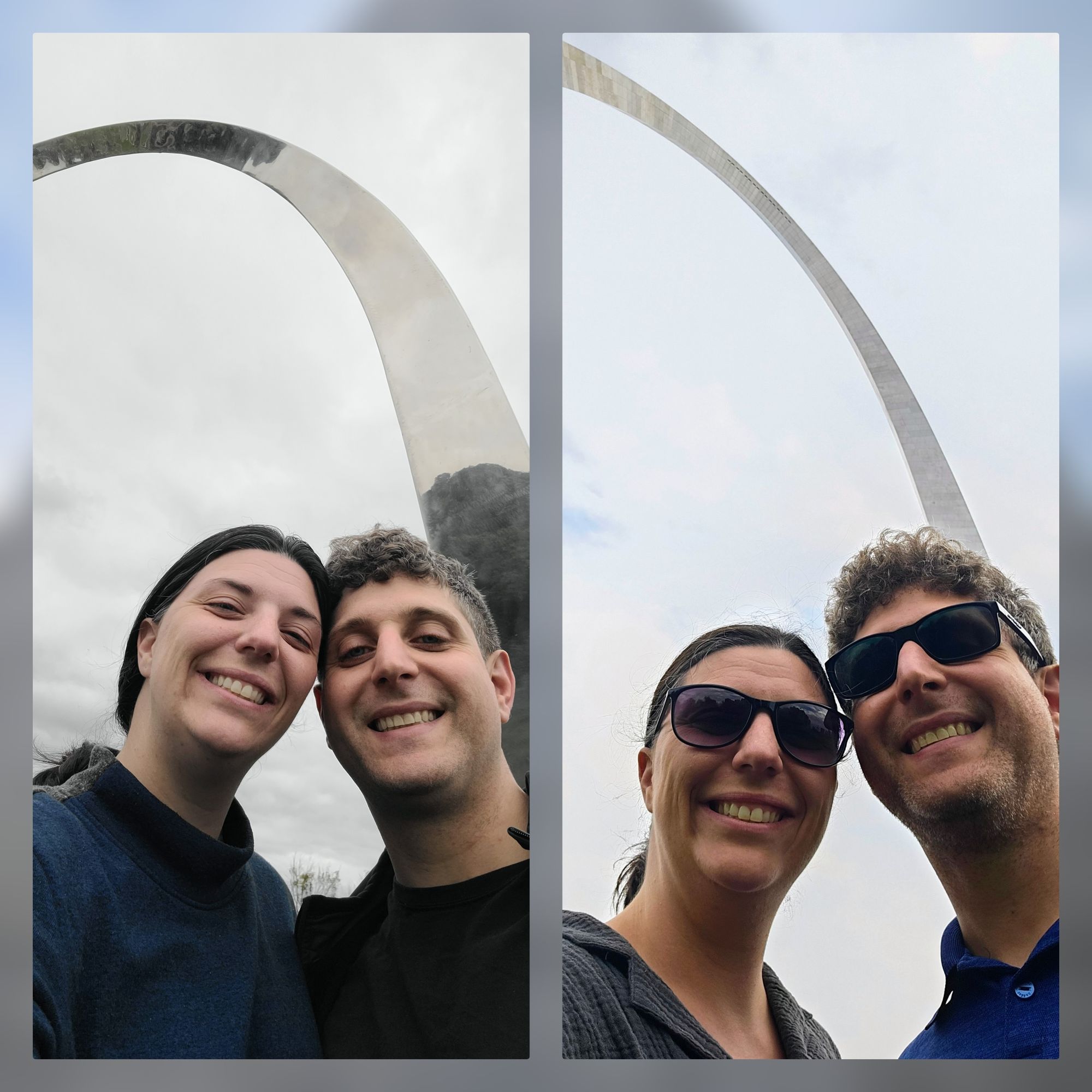
I had bought us combo tickets that would get us the tram to the top of Gateway Arch, a documentary on the construction of the Arch, and a riverboat cruise on the Mississippi. The tram and movie were booked for day 1, and the boat cruise for day 2. On day 1, we missed our documentary timeslot due to my cutting-it-too-close-to-deadline fiasco. We made it to our tram ride, and while we were there, asked the ticket agents if we could attend the later movie screening instead, which they granted.
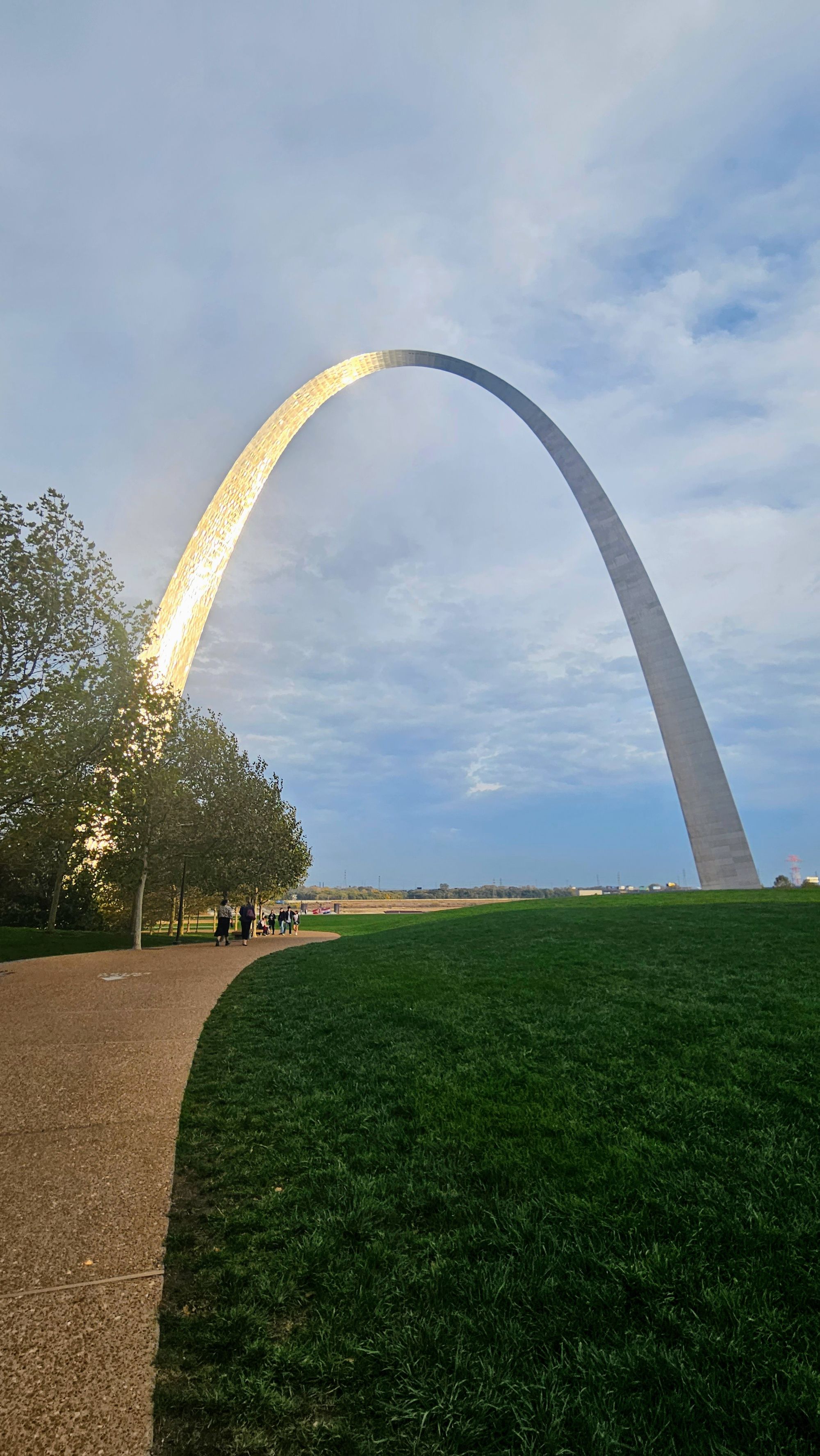
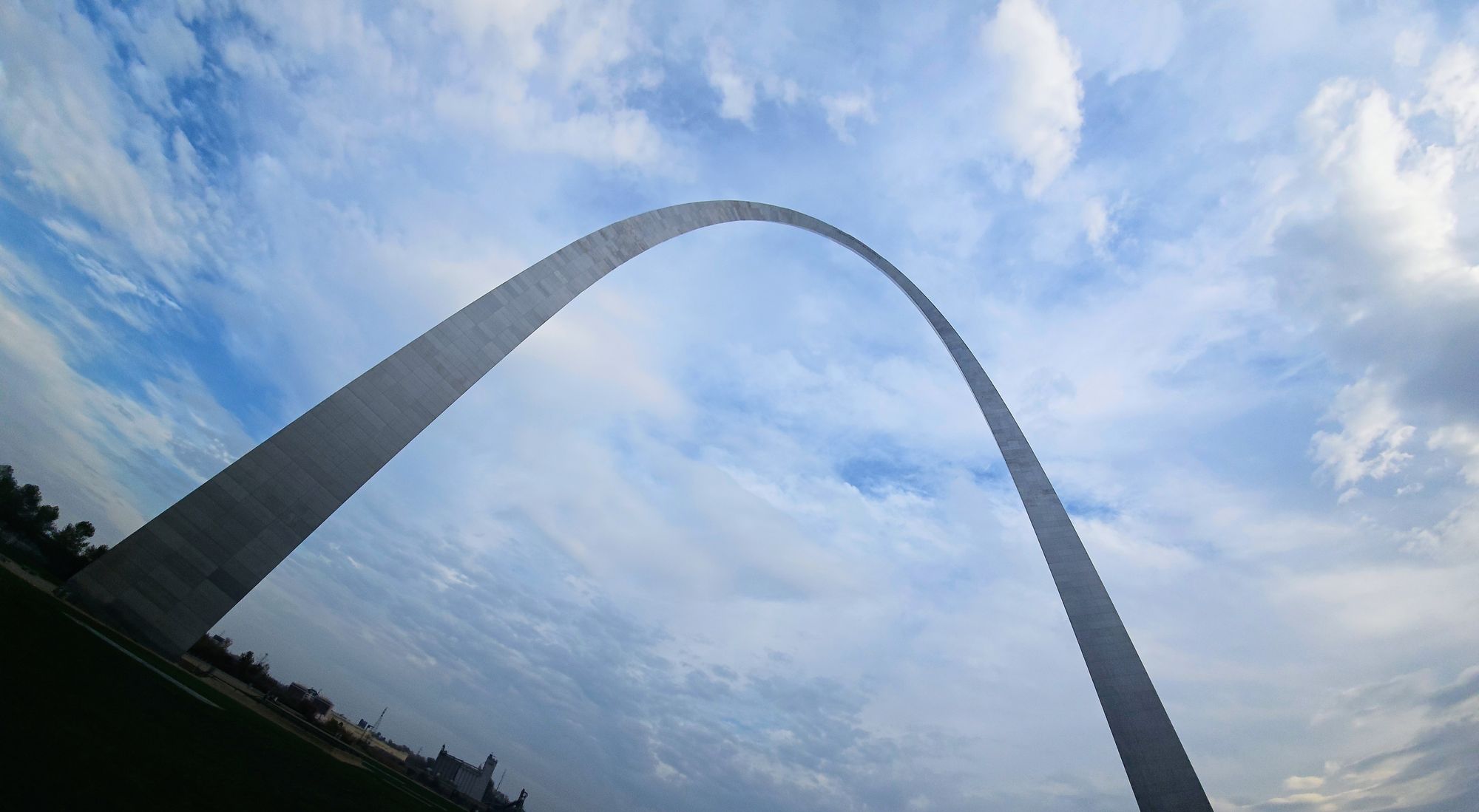
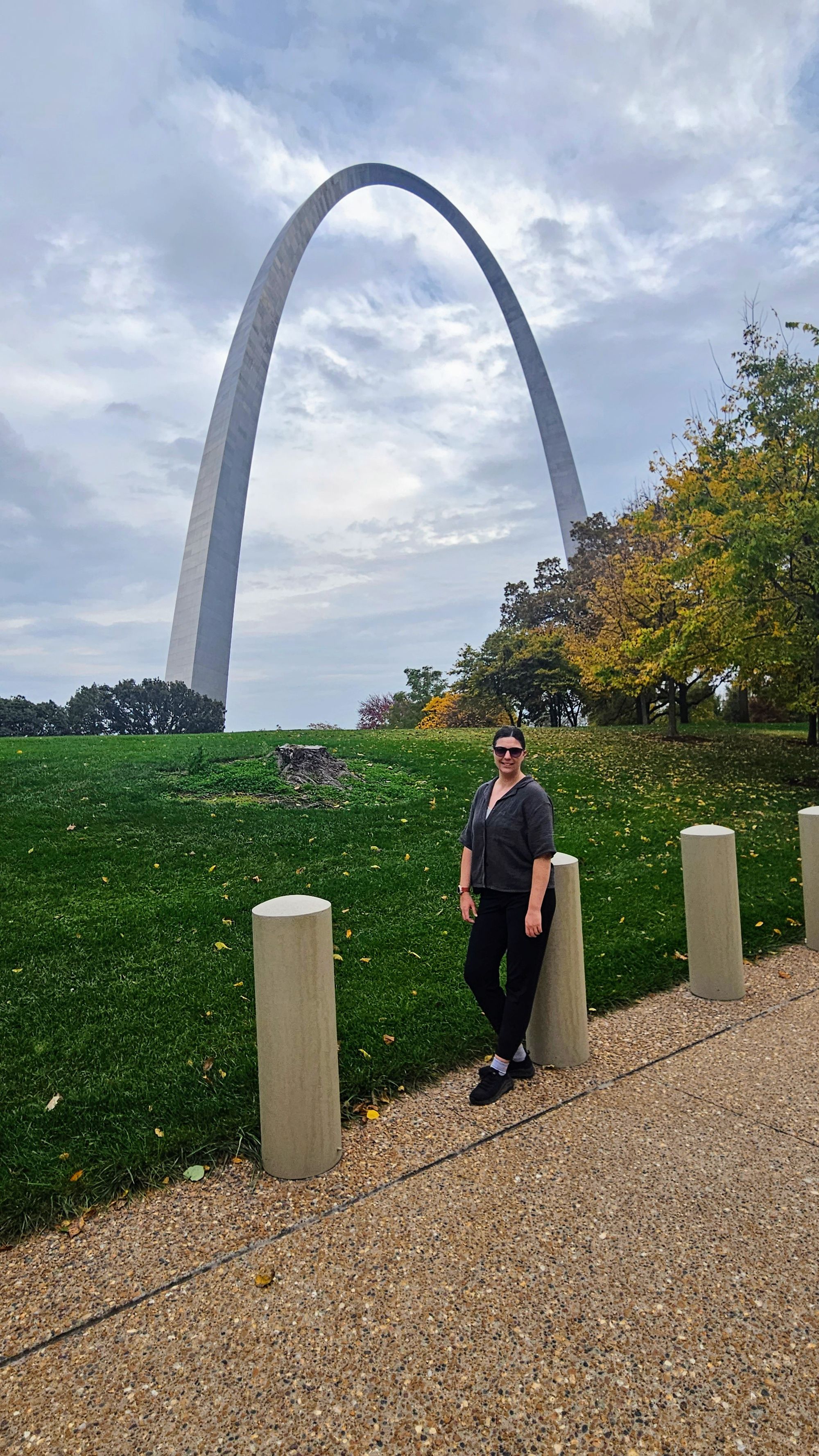
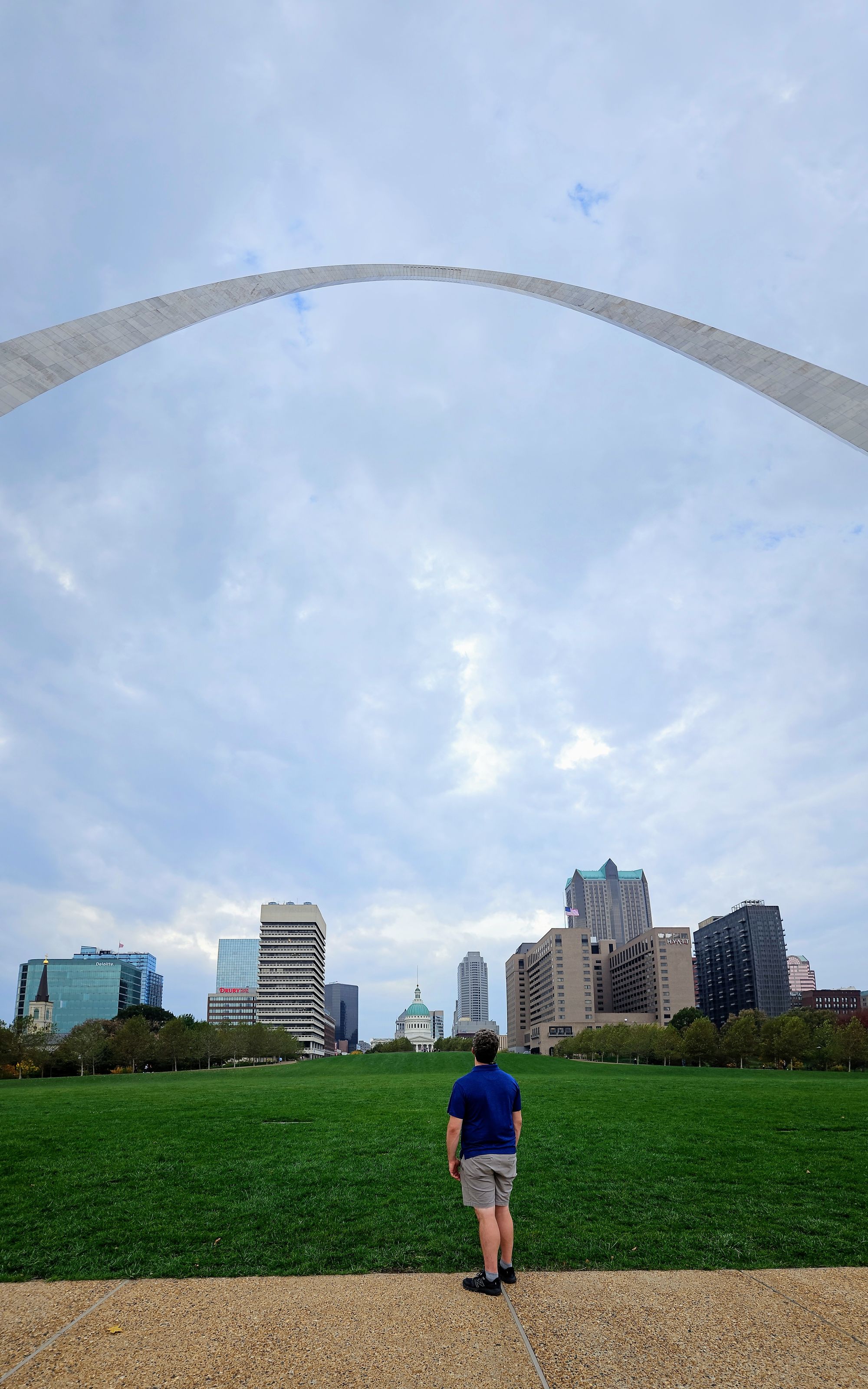
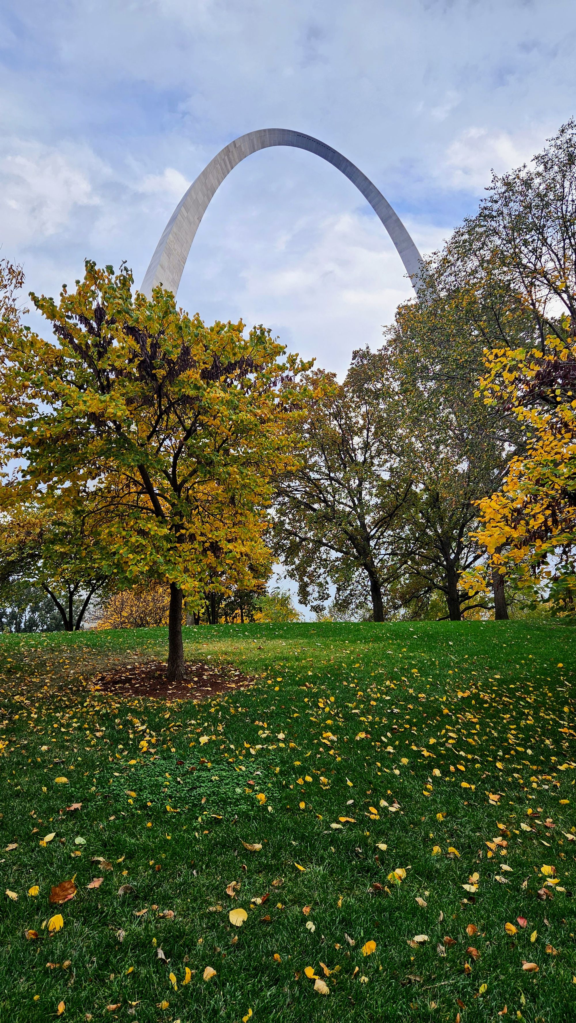
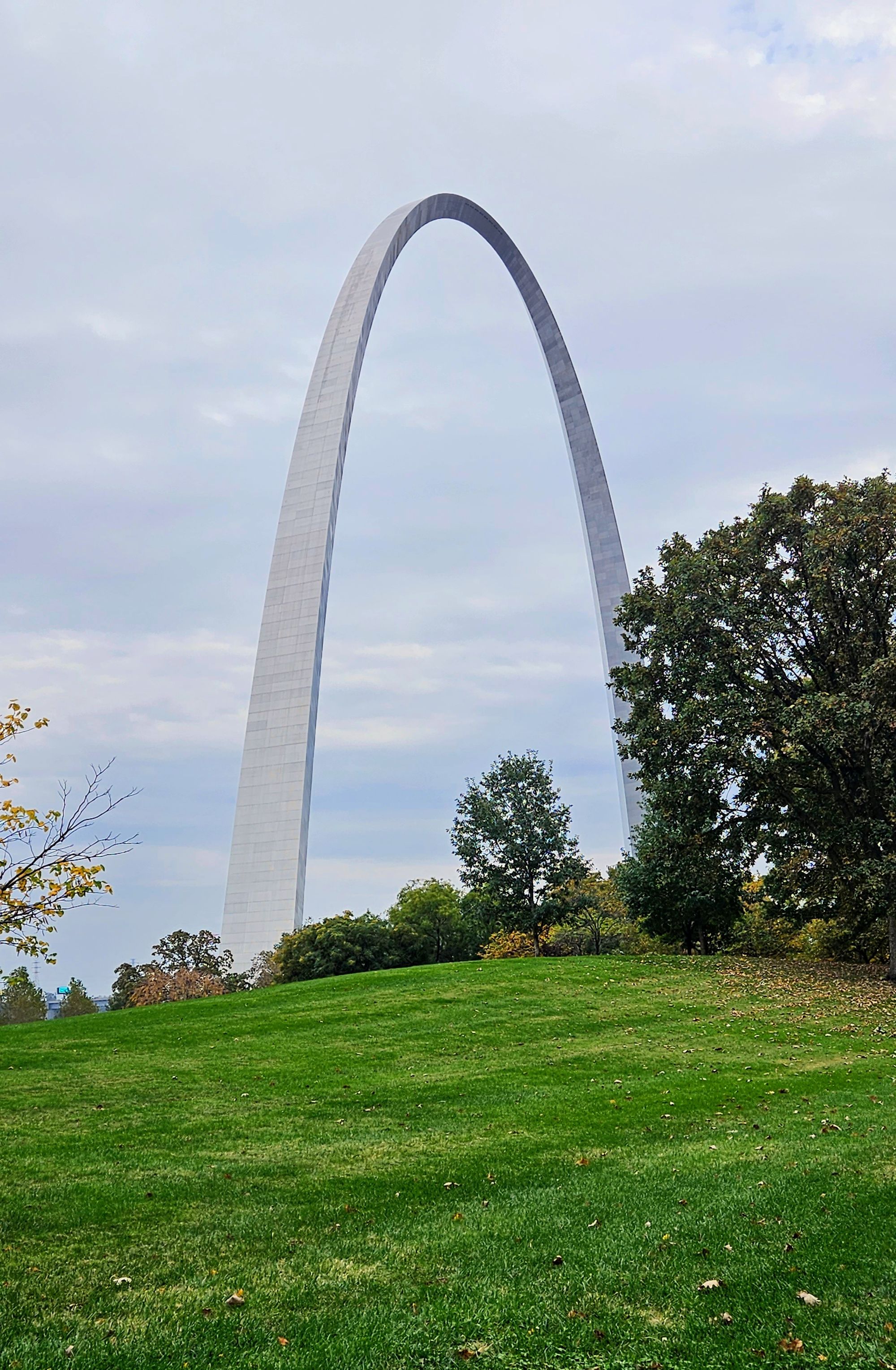
There is a lot to say about Gateway Arch, but we'll just cover the basics. The Arch was constructed in 1963 and completed in 1965. The design was actually a result of an architecture competition, where the goal was to create a monument indicative of the westward expansion. What better than a literal gateway? We saw the other designs; the arch is the clear winner in our minds. Before the Arch existed, the area was a national memorial called the Jefferson Expansion Memorial. For many decades after the Arch's construction, the name remained, until 2018, when it was renamed for the crown jewel of the city. Now, no one is mad about the site being called Gateway Arch. It's easier to remember and it highlights the crown jewel. What's infuriating to national park purists is that it's assigned the coveted National Park identity. I could write an entire blog post on why this "National Park" sticks out like a sore thumb, but the bottom line is, Congress allowed the designation as an economic move. That's not what our country's parks should stand for, and to let an inner city relic that's obviously a memorial or monument get this designation rips down the boundaries that keep the National Parks significant. If more places like the Arch get the green light to become National Parks, the future of "America's best idea" is going to be very glum.
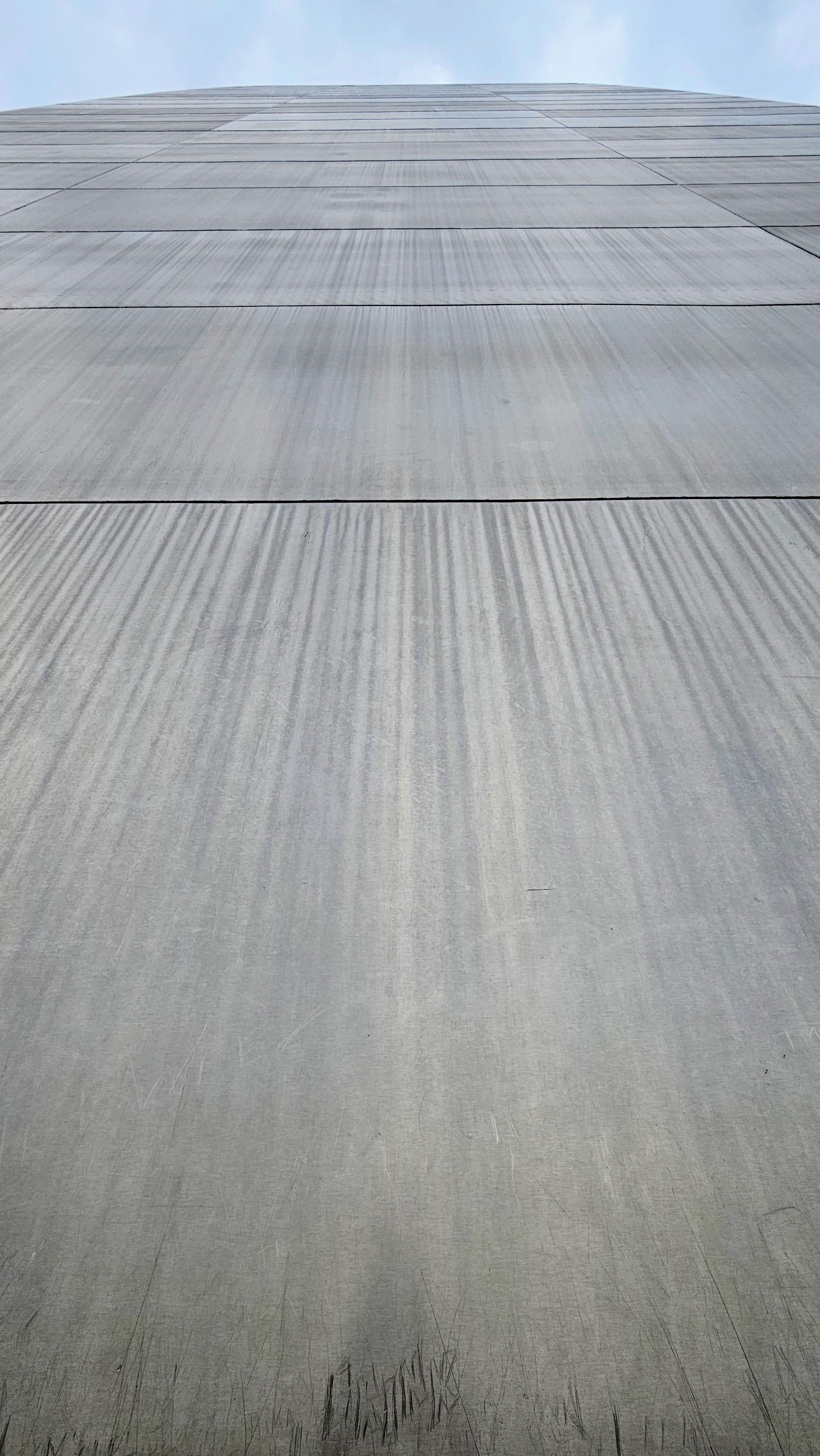
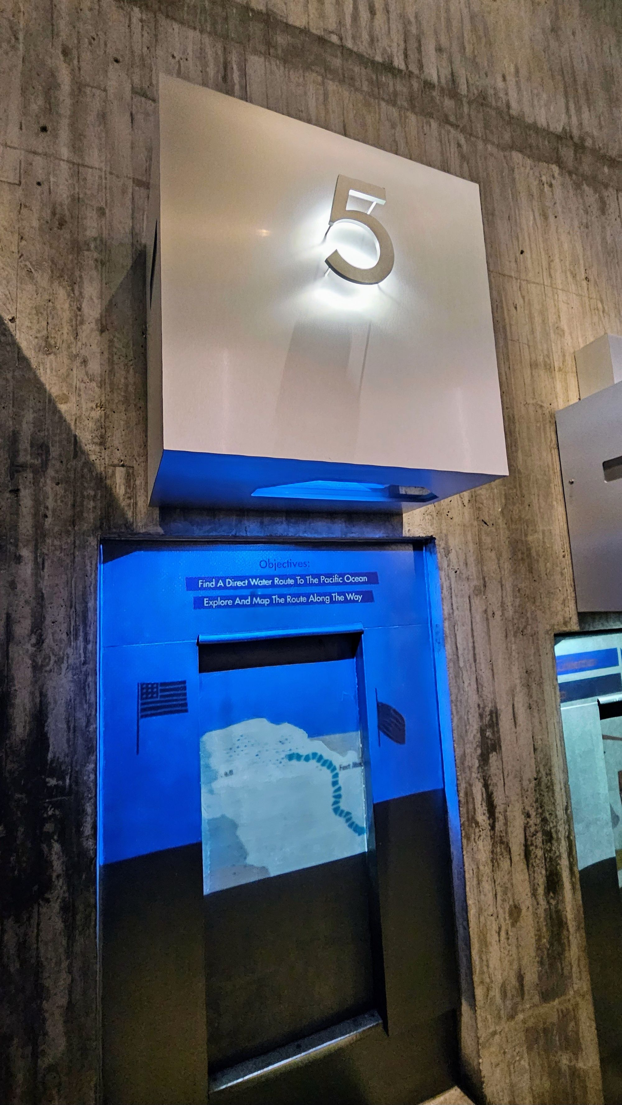
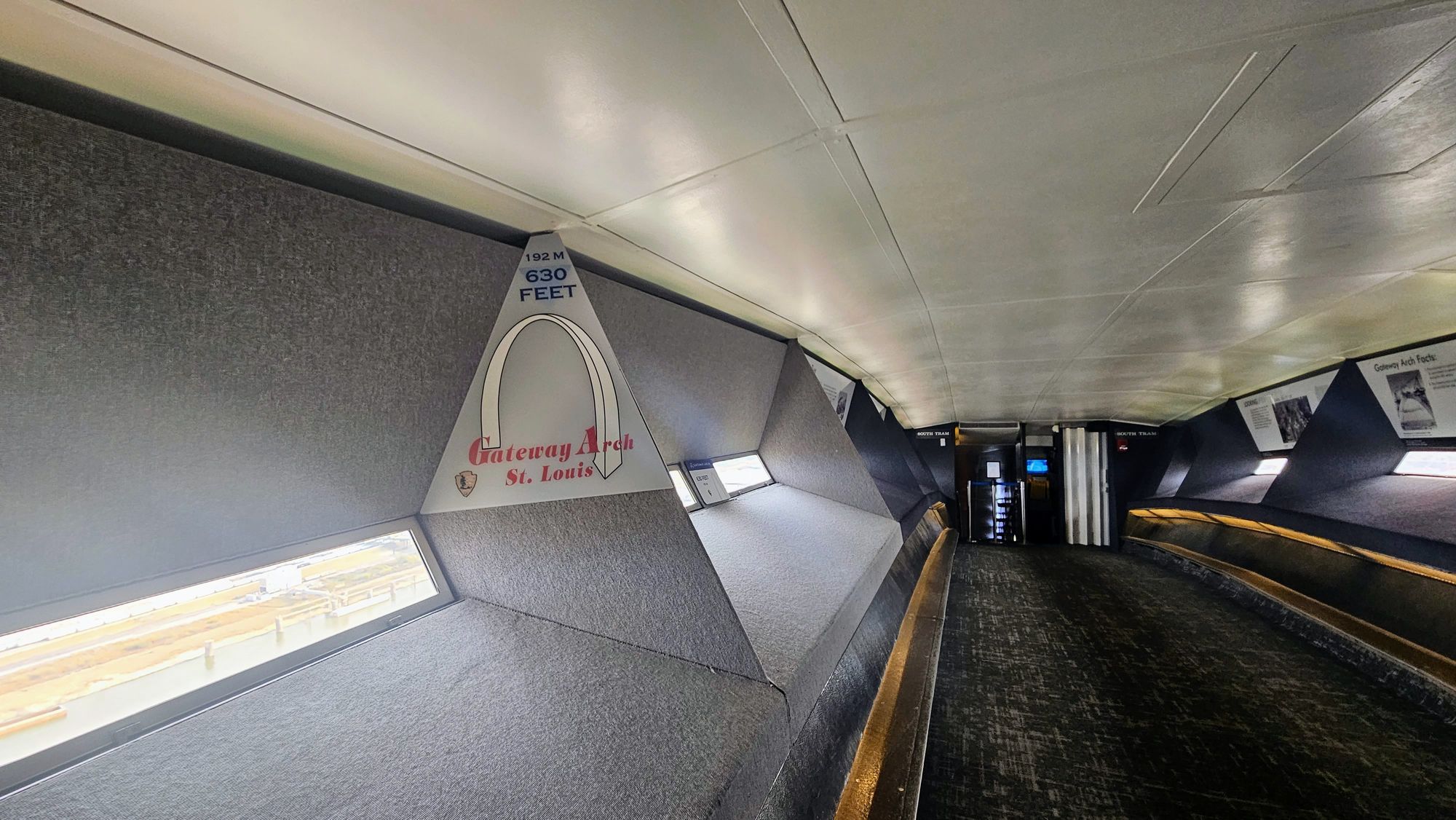
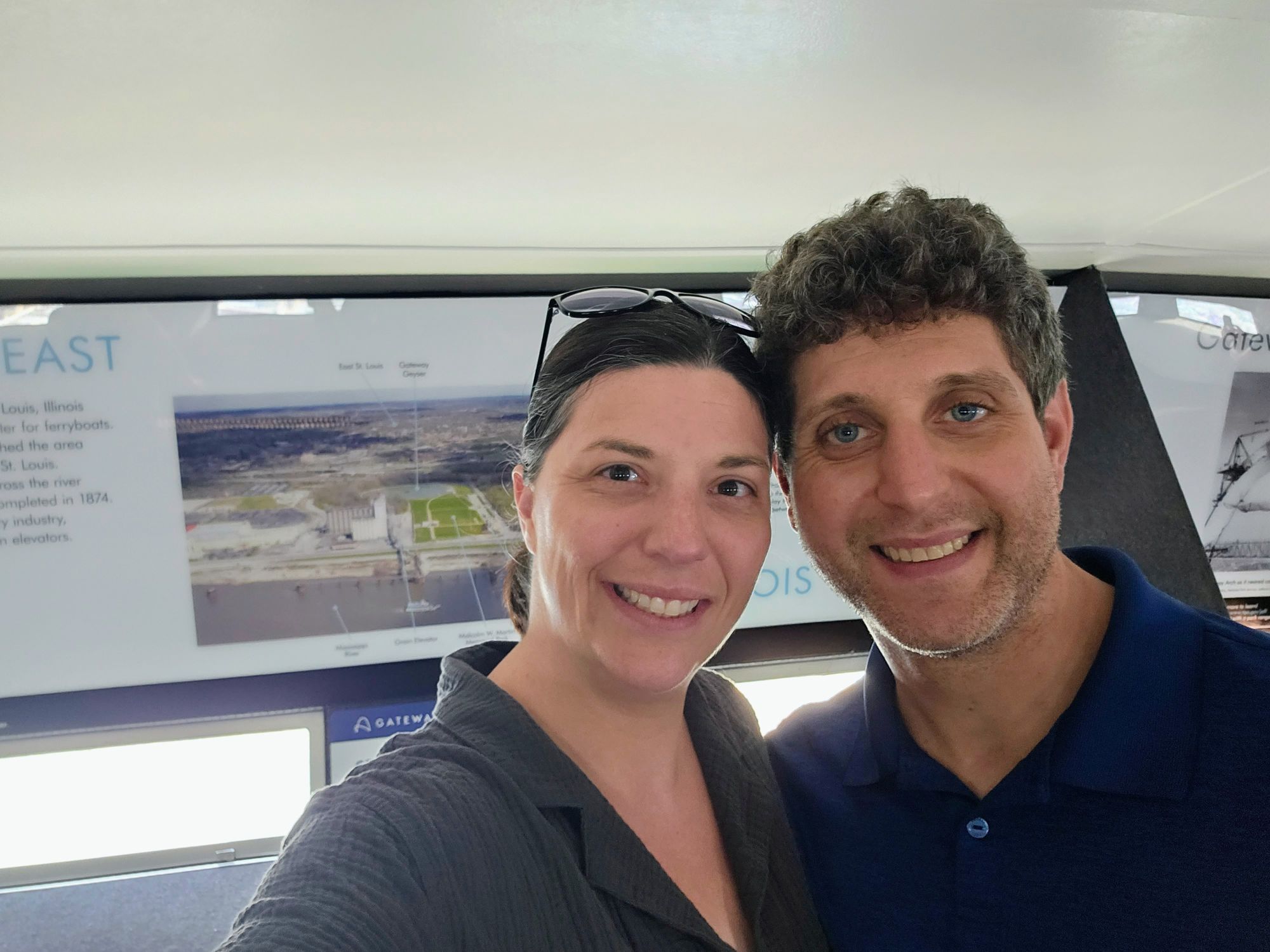
Alright, now that that's off my chest, we can talk about all the good things about the Arch. A new Visitor Center/museum was built only a few years ago, and it's gorgeous. The exhibits are spectacular and teach about the Arch, westward expansion, and even the wildlife that's been found in this area over the centuries. The Arch itself took our breath away. At 650ft tall, it's the country's largest manmade monument. Last year when we were in Allegheny National Forest, we got to visit the town that constructed the steel pieces for the Arch. There is even a mini replica there. Seeing the real thing almost exactly a year later felt like we were coming full circle.
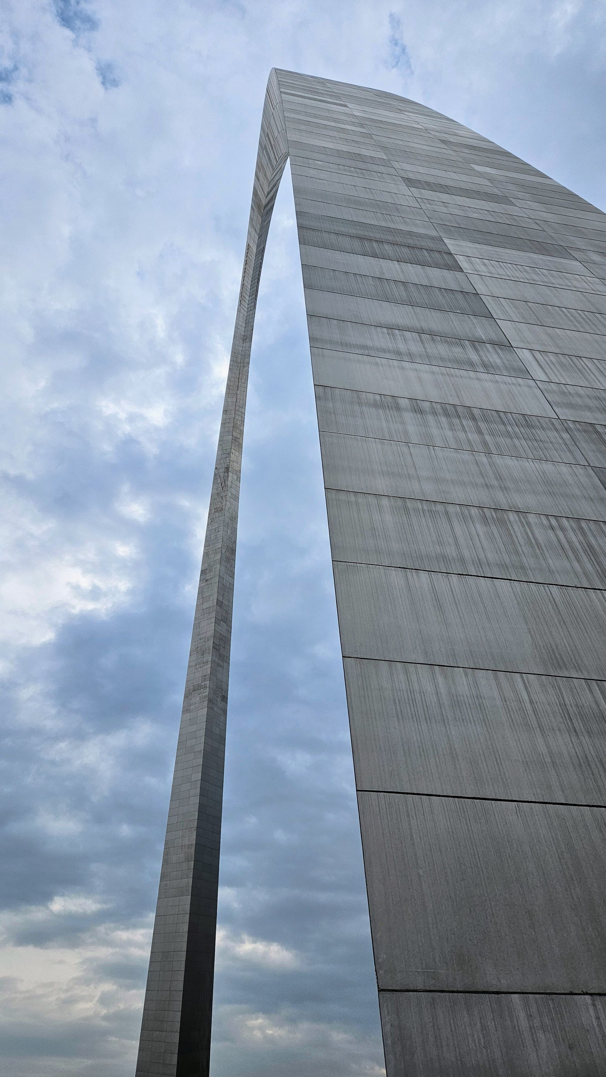
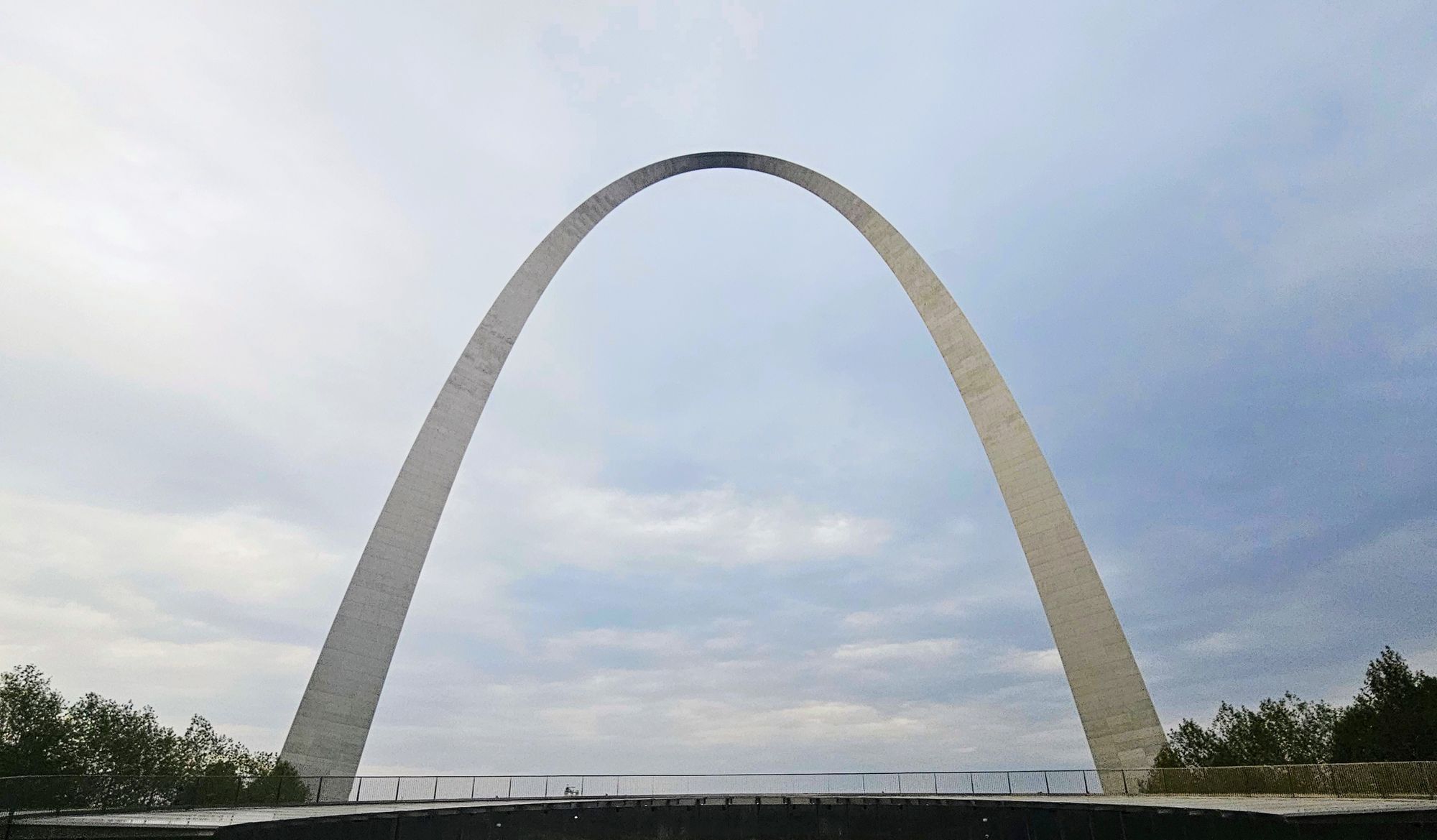
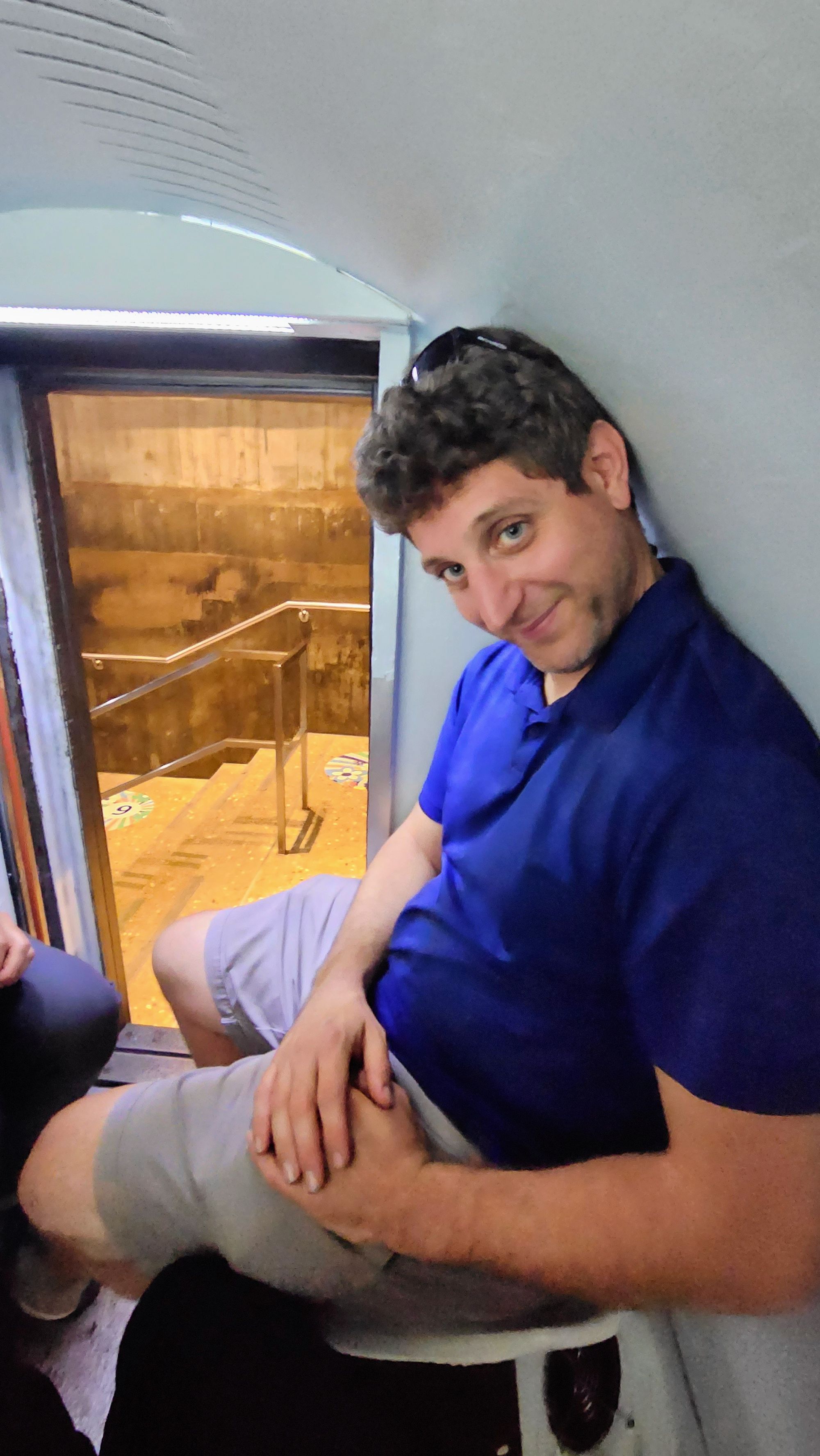
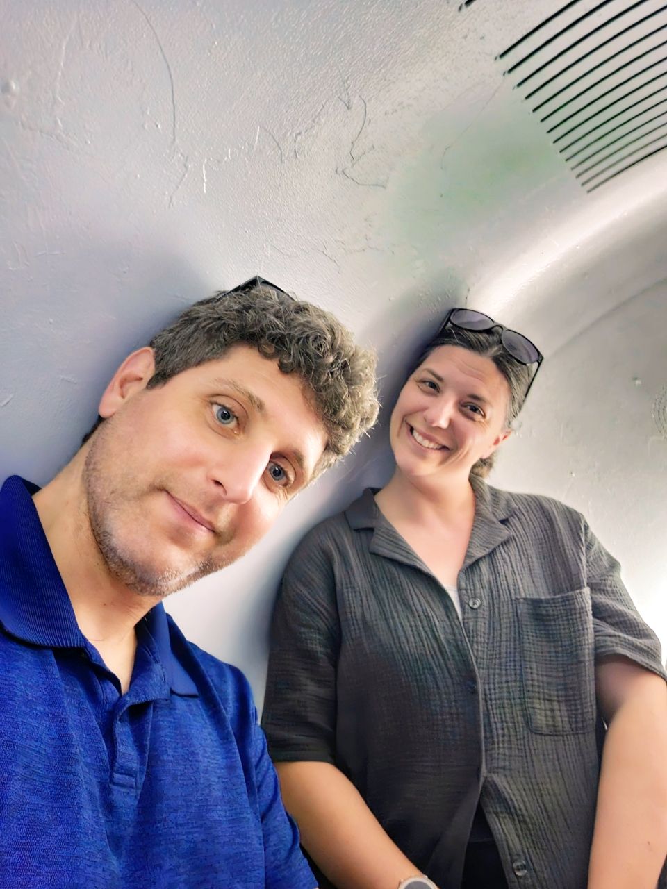
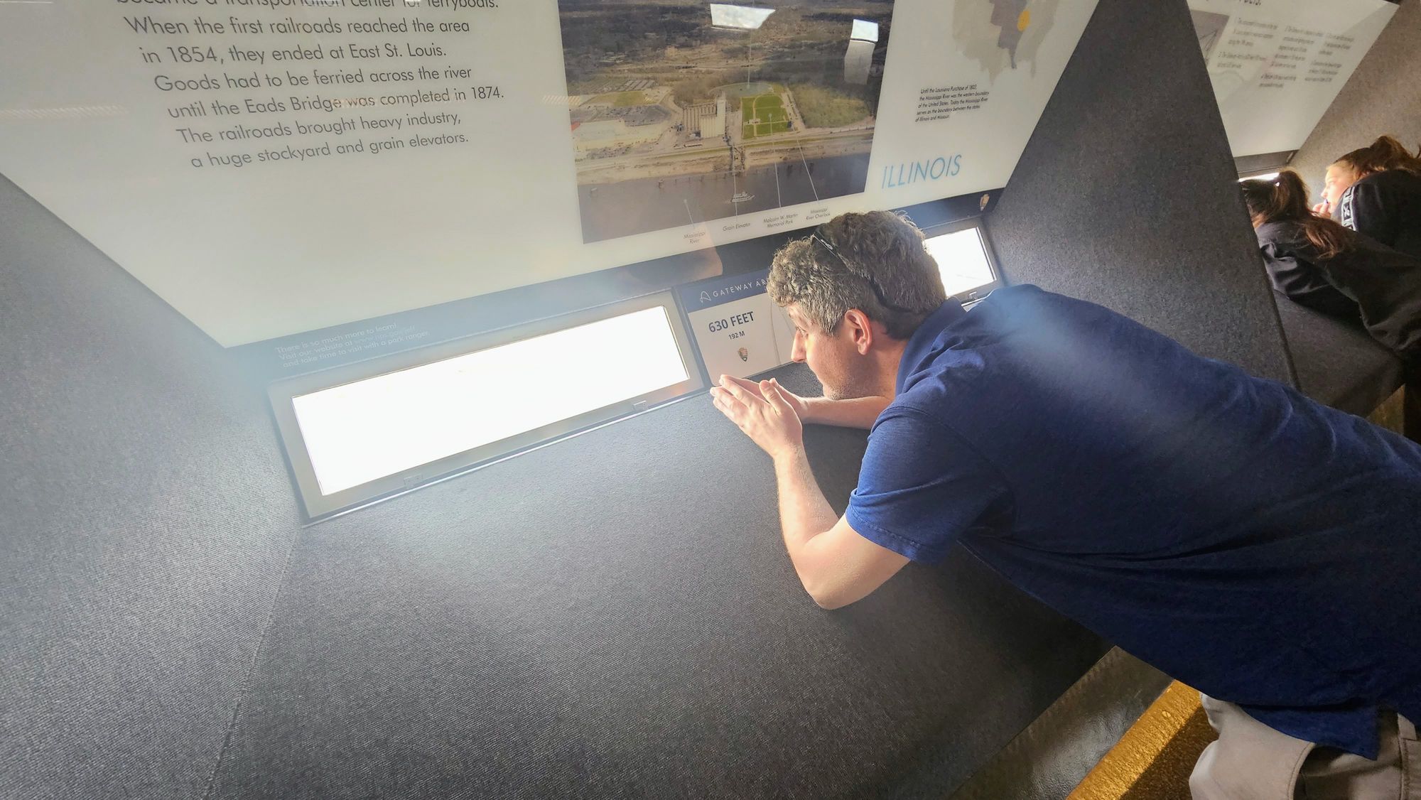
Many people wonder if the tram ride to the top of the Arch is worth it. The tram wasn't original to the construction. It was added later and took a lot of brainstorming on how to make it work. Traveling on a curve like that poses some challenges. The tram ended up being designed as 1/3 elevator, 1/3 escalator, and 1/3 Ferris wheel. More of a capsule than a tram, each only fits 5 people maximum, and it is a tight squeeze. You will bang your head somewhere. That's just a given. The ride is only a few minutes, and once at the top, you'll feel a bit uneasy walking on the curved floor. As you can tell from the outside, the windows are tiny. These windows are part of the original design, only until the trams were built, maintenance workers were the only people looking out them. Now, visitors need to take turns bending over to peer out these narrow openings. The views are wonderful - what you can see of them. We did enjoy our ride; everyone who takes the tram is kind of bonded. It's one of those experiences that you can't quite describe. So if you want to truly understand what it's like, then go for it.
Truthfully, we were more mesmerized by the documentary. As you've probably noticed with all our dam visits, we love impressive feats of engineering. The Gateway Arch is beyond impressive. The level of critical thinking and flexibility that needed to happen to create something so tall and shapely, plus the precision of each steel piece, were already jaw-dropping. Then we learned that no workers died during the construction. And, on the final day, there was a race against the sun to fit the remaining piece into place before the Arch expanded from the sun's heat. The city of St. Louis gathered below as the Arch's highest point was lifted into the sky, carrying an American flag, and then carefully placed.
Our Gateway Arch visit was a helpful boost after our tumultuous drive day, but we were still feeling pretty miserable. We felt like we had nothing left to give. We wanted to enjoy the city but found ourselves dragging. We wanted to soak in the fall foliage in our beautiful campground, but even taking a walk around felt exhausting. We always say that one of the best things about RV life is, if we aren't enjoying a place, we can leave. We can chase our own happiness, and when we find it after a dip, it feels so good. We knew we weren't able to appreciate St. Louis in our current frame of mind, and someday we could return in better spirits. And so, we decided to skip our riverboat cruise the next day, and instead, pack up and head out of Missouri.
We left MO early to try and boost our morale in a different location. Did the change of scenery work?
↓ ↓ ↓ Sign up to be notified of new blog posts! ↓ ↓ ↓