The Sonoran Desert: Saguaros and Beyond

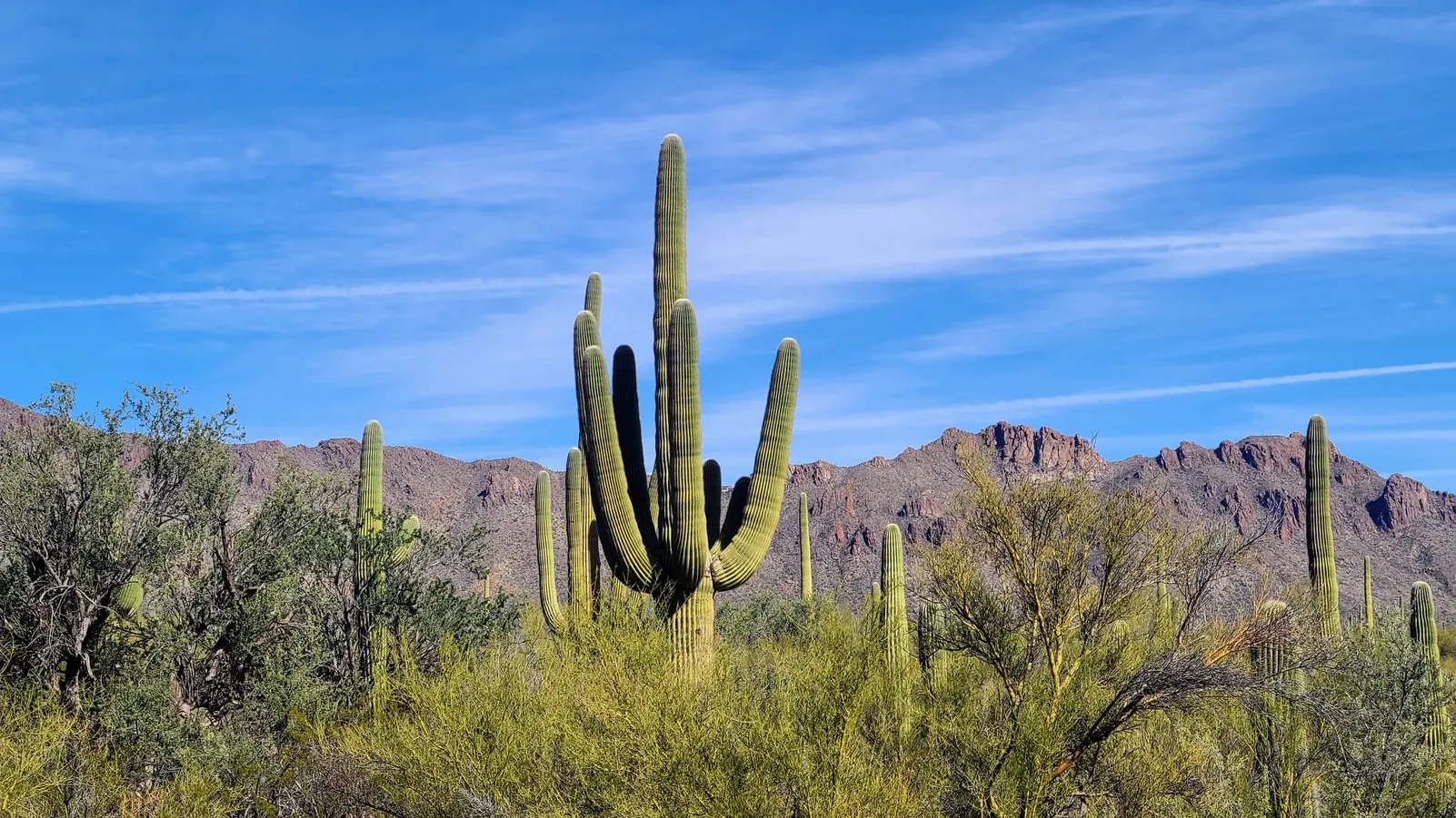
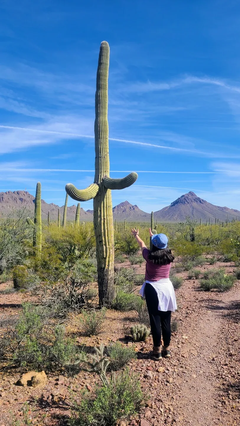
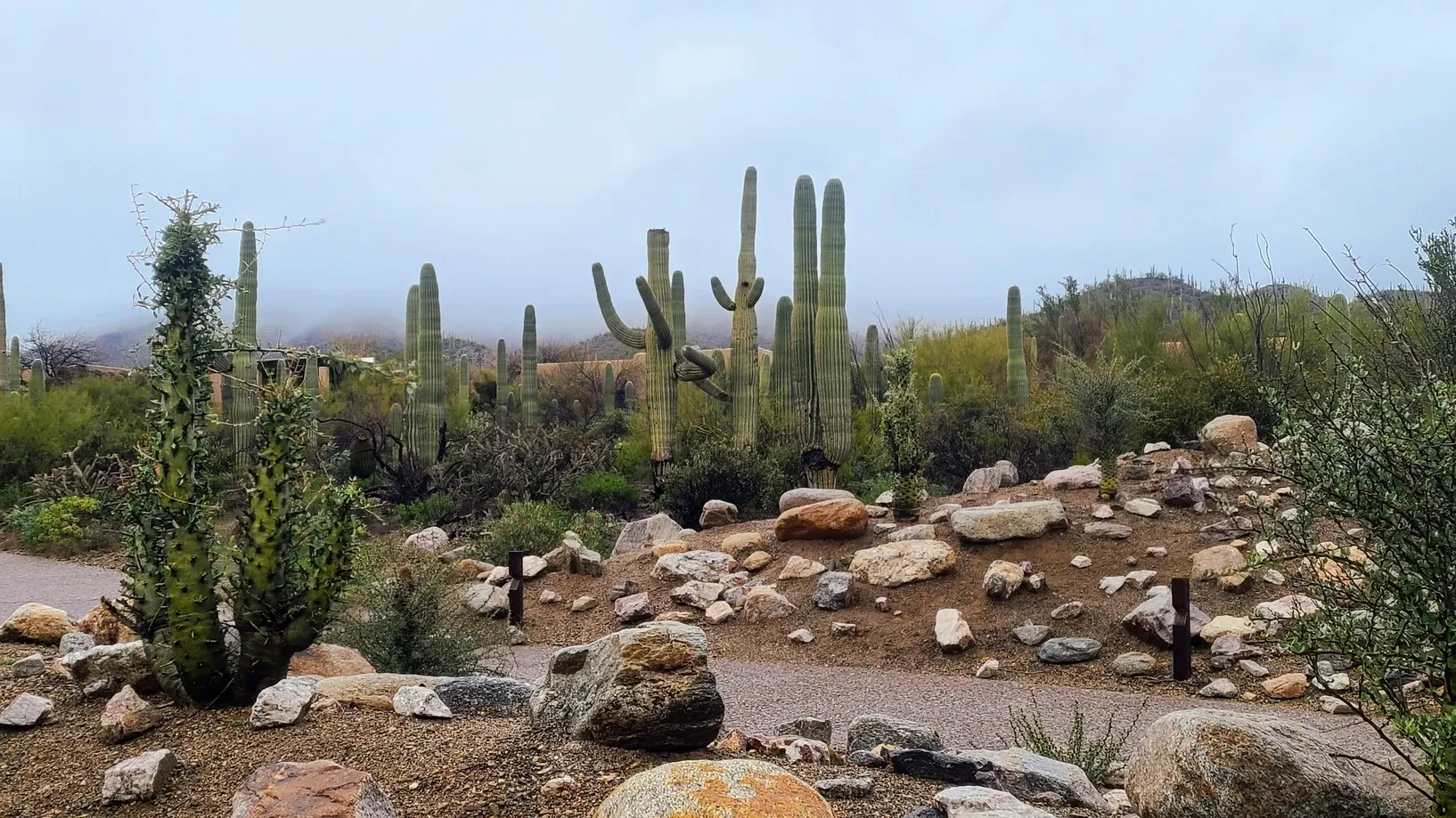
We had left Big Bend only days before we reached our second National Park of the year, Saguaro. Located in the Sonoran Desert, these cacti are only found in this part of the world, due to the fact that this desert has two rainy seasons, producing enough water for these giant cacti to retain. We were ready to see these saguaros in all their majestic beauty, but we assumed that the overall landscape would be less variant than at Big Bend. After all, the preservation of this land is only for the saguaros...right? Well, it turns out we were mistaken. The night after we tucked ourselves into our site at Gilbert Ray Campground just outside the park boundaries, I ventured onto the Saguaro page of nps.gov and was greeted by an informative 20-minute video. It explained the different elevations at the park, and how at each elevation lives different flora and fauna. Walk the trails at Saguaro West and you'll be surrounded by desert species: cacti, snakes, lizards, scorpions, and more. Hike up the mountains of Saguaro East and you'll eventually find yourself in a more forested environment, where the species need water and colder climates to survive. I soaked up the details like a cactus storing water, and the next day I excitedly shared all that I had learned with Anthony, when we went on our first hike among the saguaros.
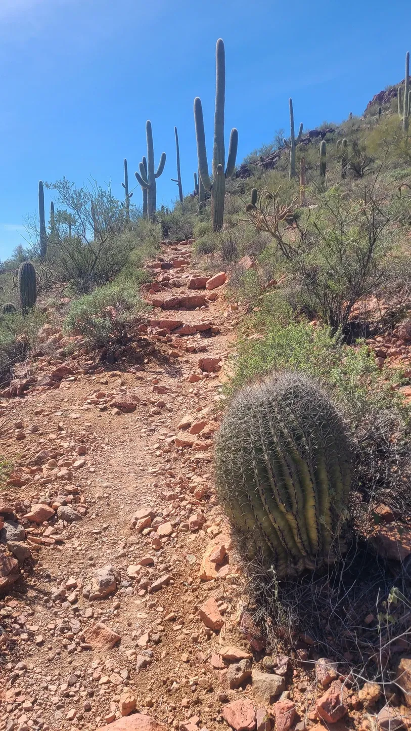
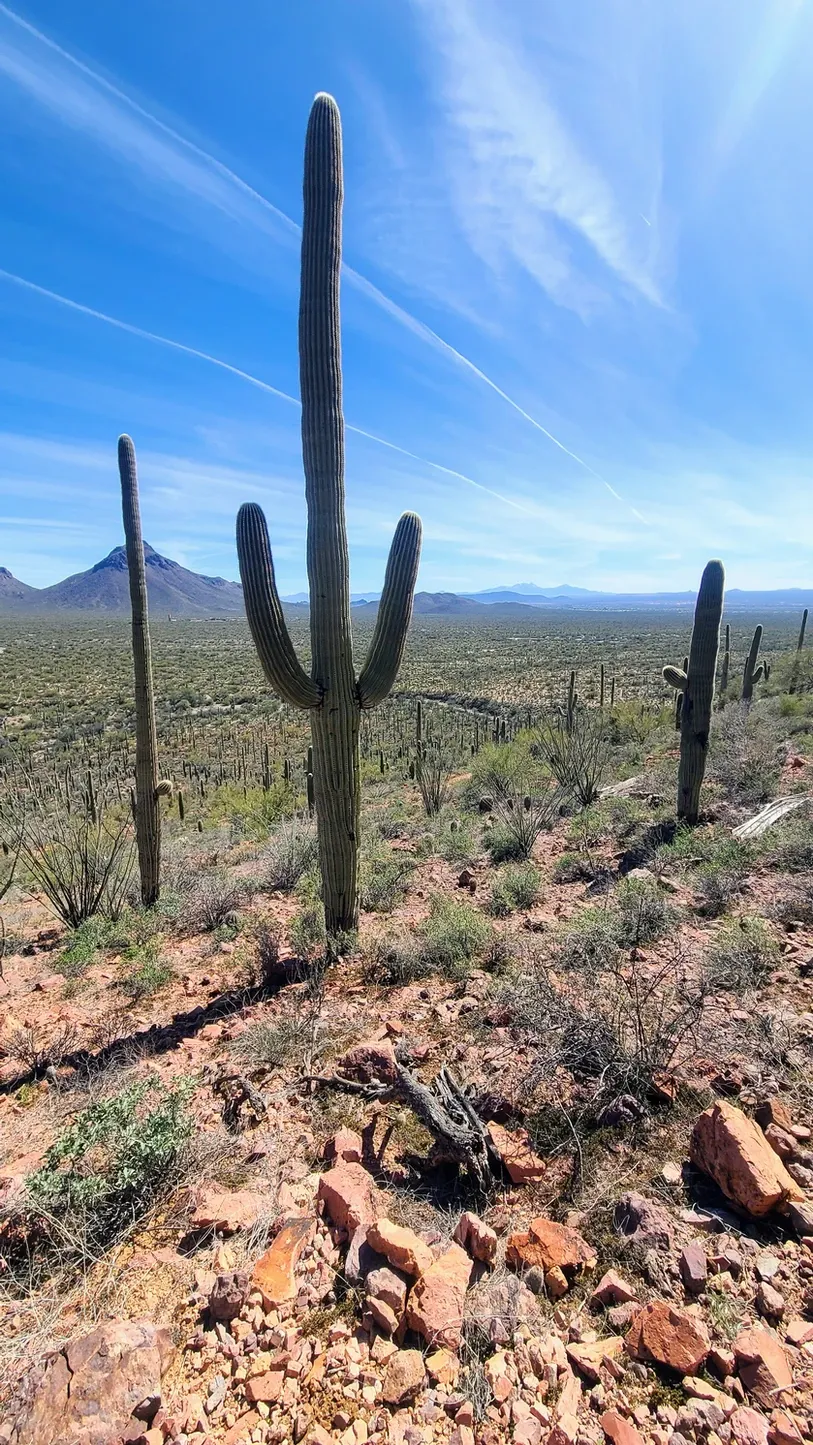
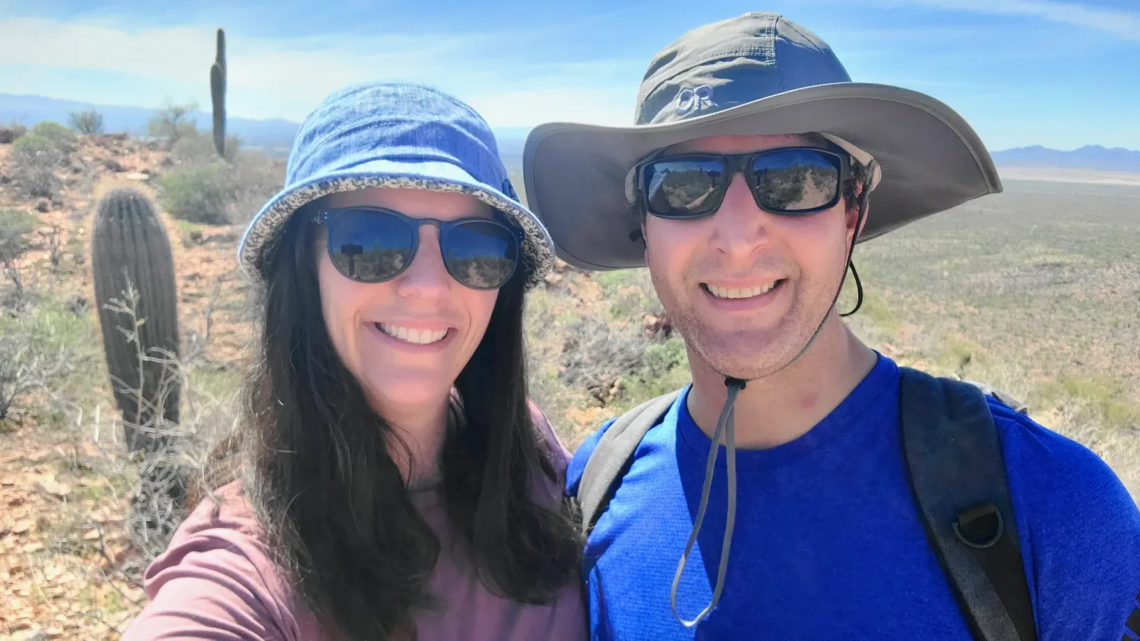
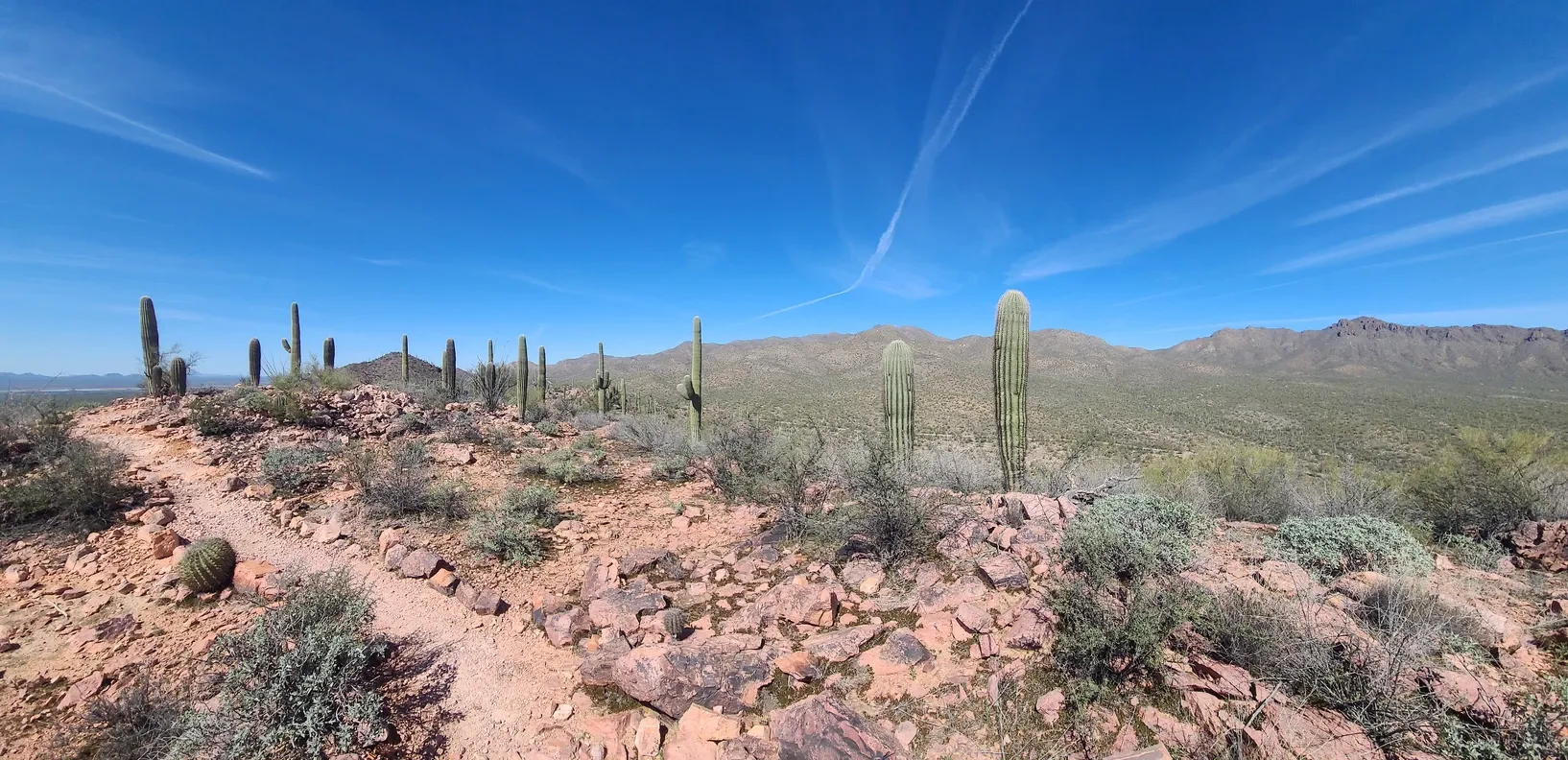
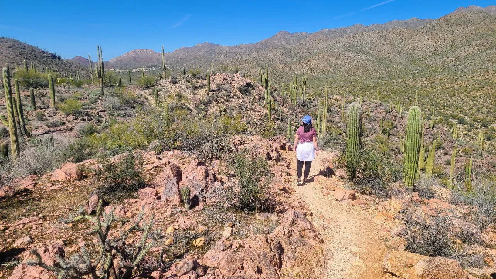
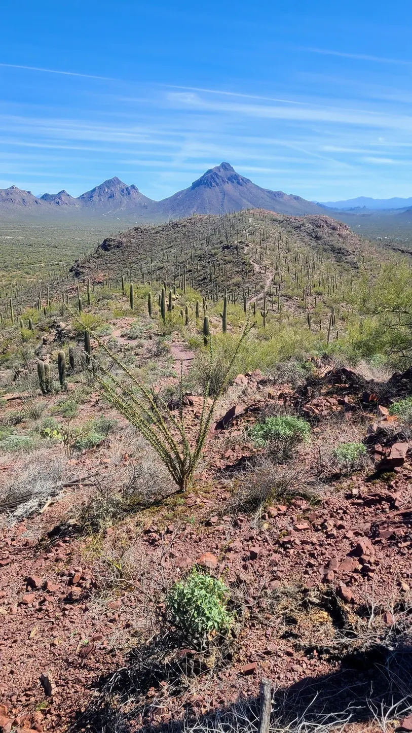
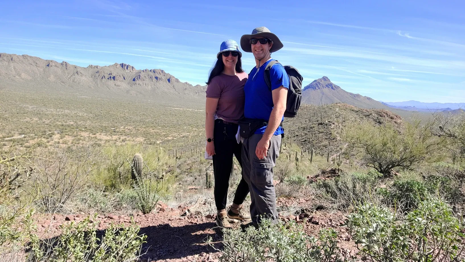
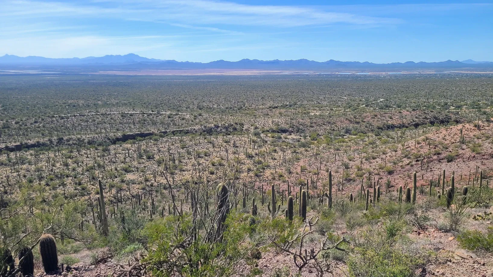
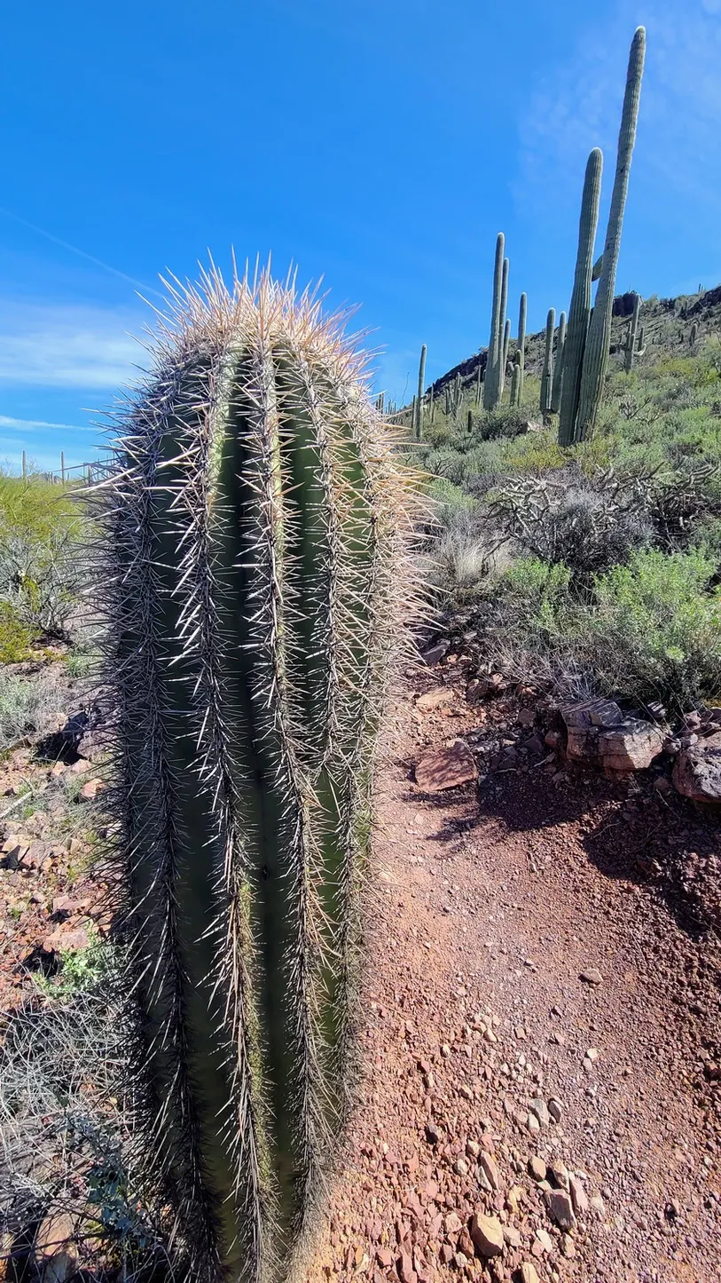
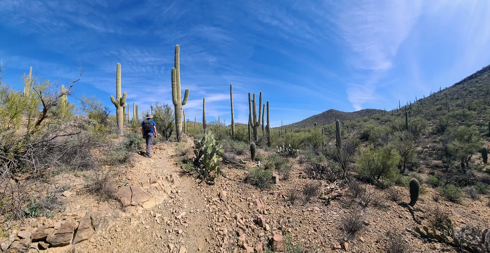
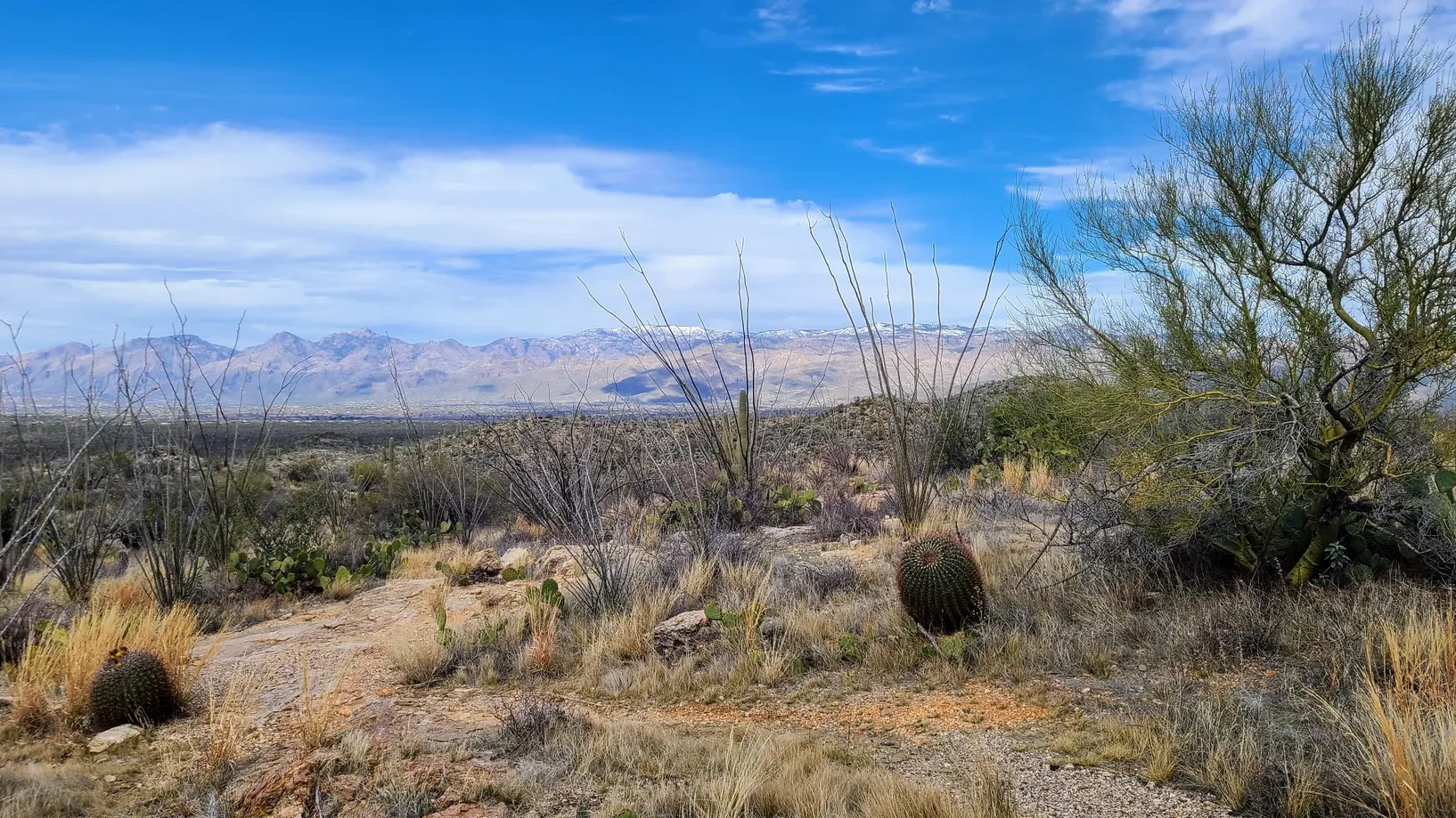
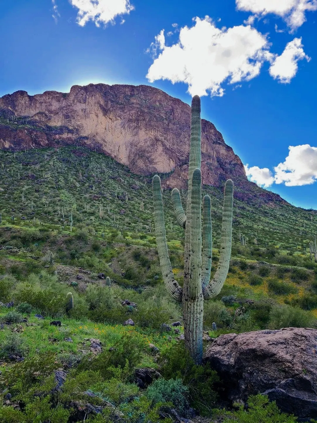
We hiked Brown Mountain from the trailhead right across the street from our campground entrance. It's a Tucson Mountain Park trail, and while Brown Mountain is not tall, it offers incredible views from the ridge. The trail's distance wasn't clear when we began, probably because some hikers don't complete the entire loop, but we did the whole thing and clocked 5.3 miles. The hike went by fast. Everywhere we looked there was something to see, whether it was a beautifully formed saguaro, bunches of prickly pears, distant mountains, or swarms of bees desperate to get water out of the few puddles along the trail. Besides some switchbacks and loose rocks, the hike was fairly easy. We would agree with the moderate rating on AllTrails. The ridge at the top of the mountain was the best part. From afar the saguaros look like funky little antennas sticking out of the hills. The whole hike was a little surreal, as we grappled with the fact that we were actually there, hiking a region we had wanted to visit for a very long time.

We spent the two hours of our hike enjoying the scenery and talking about the landscape. We made plans to visit both sides of Saguaro National Park so that we could more fully understand what the NPS video was describing. Would we truly be able to tell the difference in ecosystems from one side to the next?
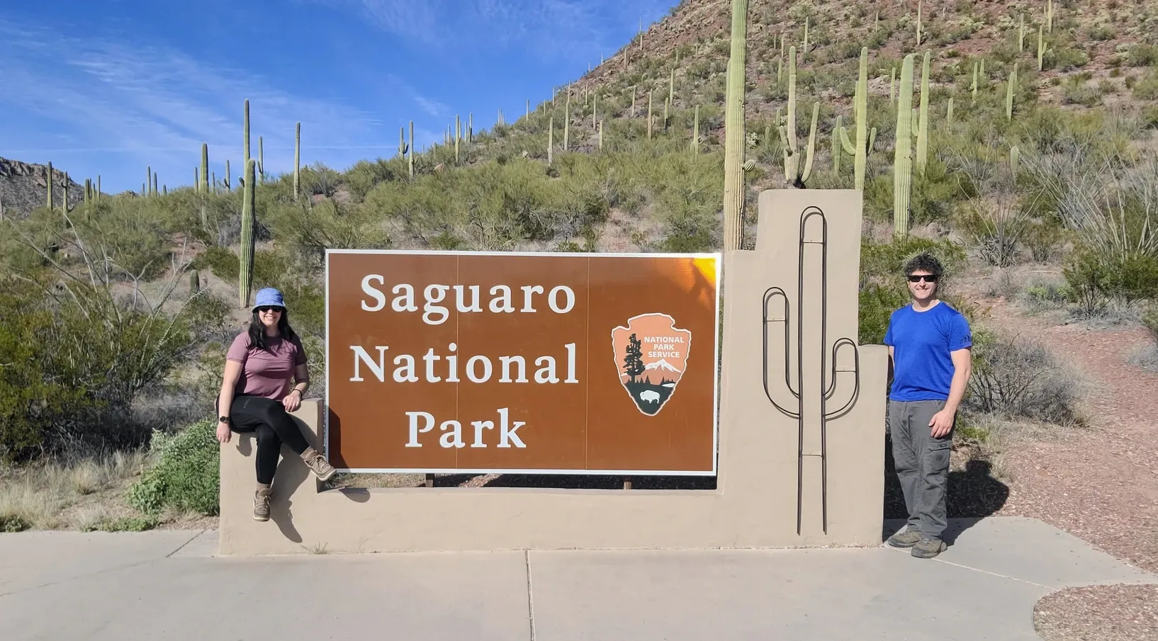
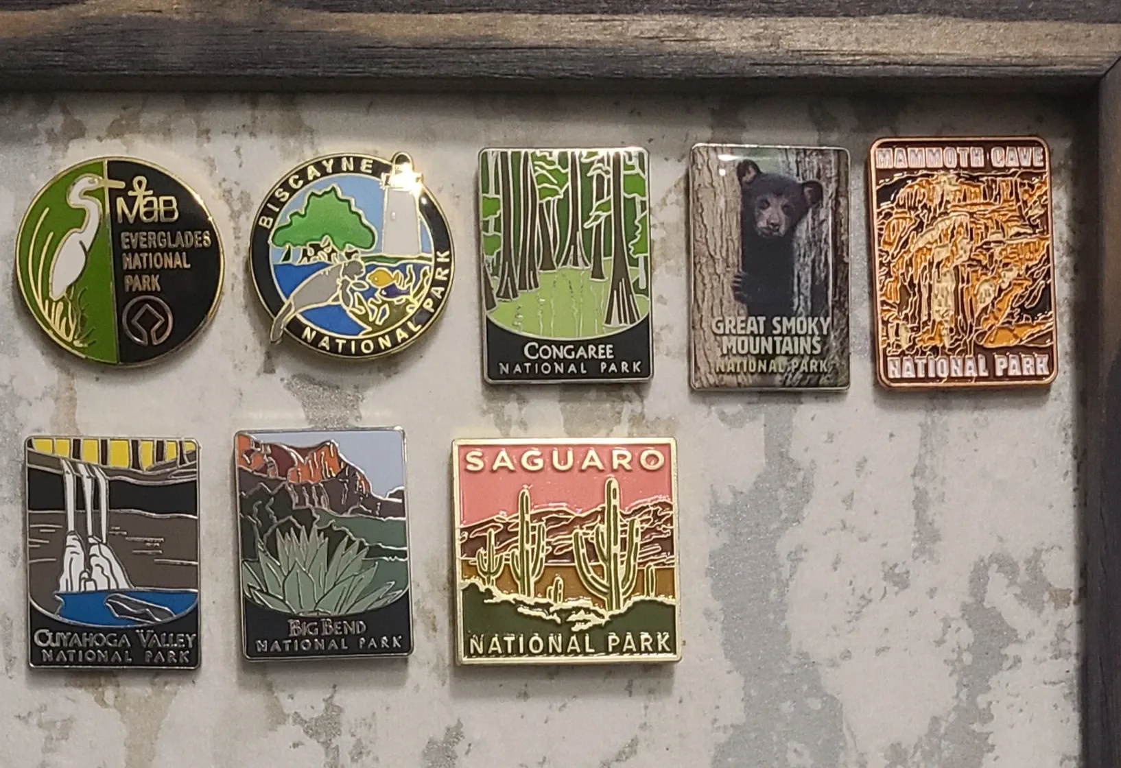
Saguaro West was just up the street from Brown Mountain, so we headed over there after our hike. The Red Hills Visitor's Center is set up like a hacienda, with a lovely indoor-outdoor vibe. We purchased our National Park pin for our board and then stayed for a 15-minute video presentation in the theater. We won't give away the surprise at the end of this video, but we highly recommend you stay until the end. The video itself showcased an entirely different set of information from the website video, which I appreciated. It talked about the Natives of the land and how they see the saguaro as symbolizing their ancestors. The plants do indeed have some human-like features. They do grow arms, after all! When walking among them, you almost can't help but see them as reaching out for a hug, or sometimes to engage in a boxing match. The main message of the video, though, was to respect the land and all the species in it. At the end of the day, we are here on this earth because of what it's providing for us.
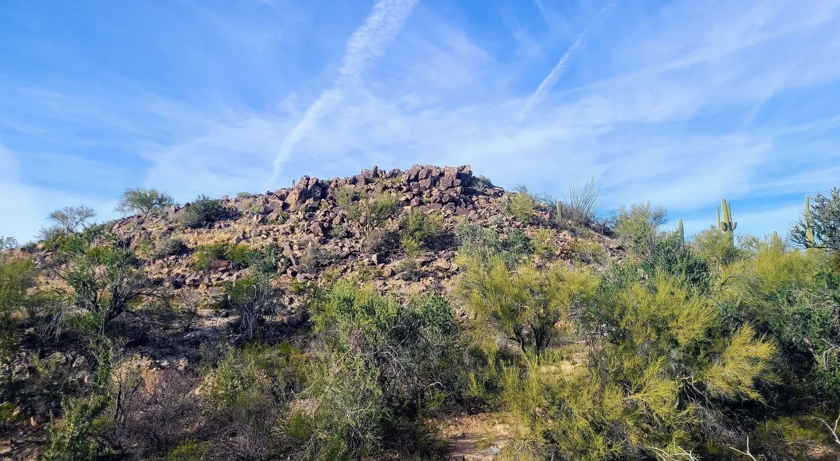
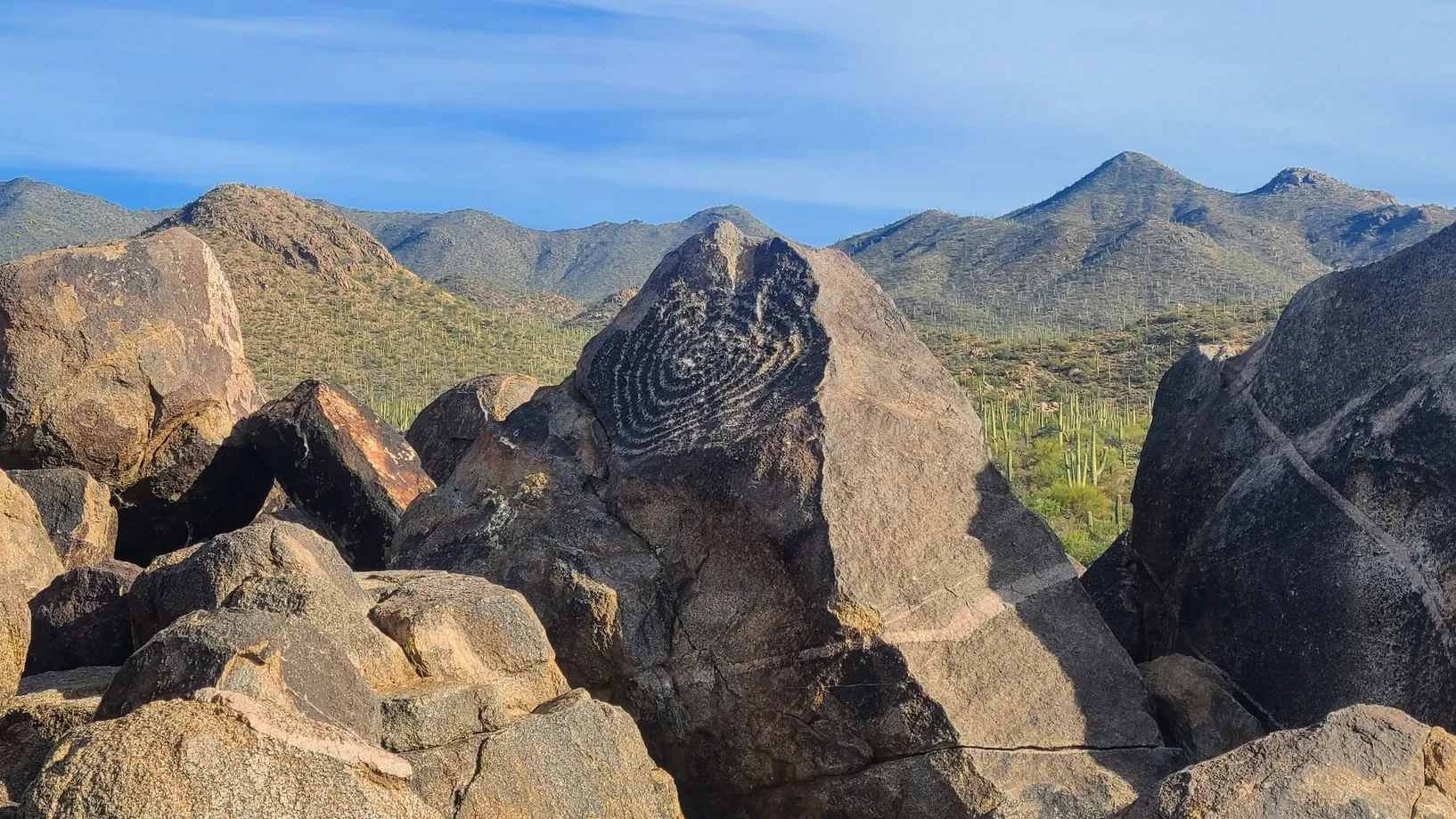
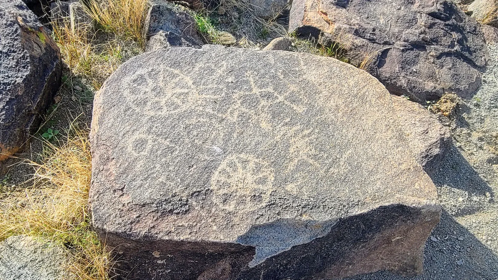
We left the Visitor's Center and took a drive up Golden Gate Road to Signal Hill. There's a beautiful picnic area and a couple of hiking trails. The Signal Hill Trail itself is only about a 1/2 mile roundtrip, or you can continue beyond it. We chose to do the short trail only since we had already done our long hike. Signal Hill not only offers a beautiful view, but there are also petroglyphs carved into the rocks.
Besides a few small lizards, we didn't see too much wildlife on our hiking day. The snakes are typically dormant in wintertime, so we didn't need to worry about what lurks under the nearby rocks. Ever since Texas we've been waiting patiently to see our first javelina, but it hasn't happened yet. Never heard of one? We hadn't either, but they're a big deal around here.
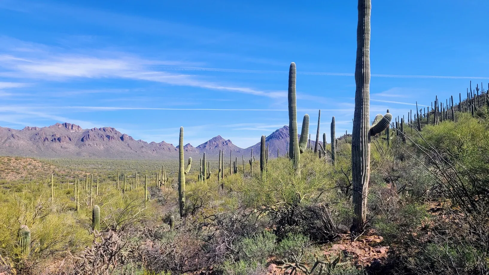
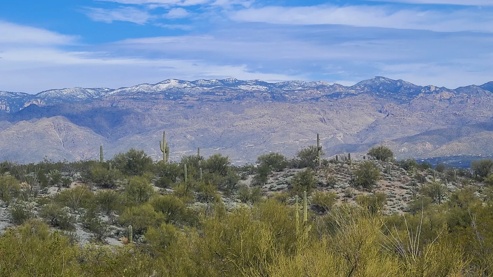
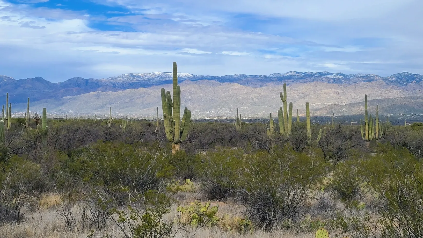
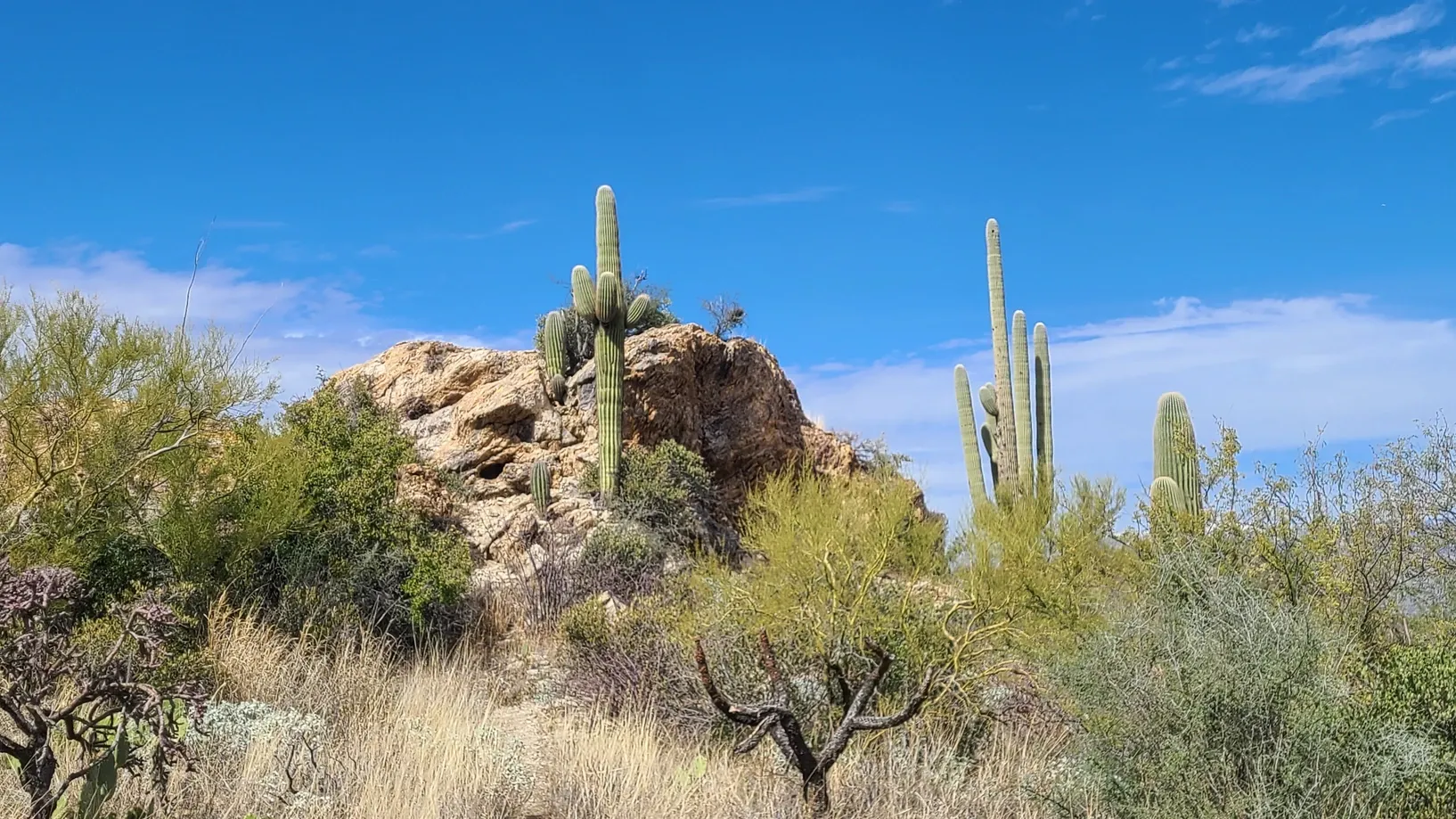
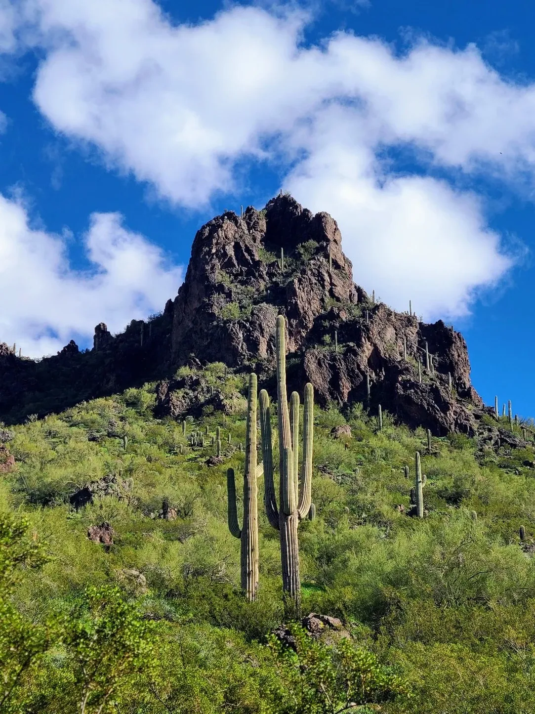
The next day, we drove the 50 minutes to the East side of Saguaro. We combined our plans with some errand-running in the city to optimize the drive distance. We opted out of hiking on this day, even though a longer hiking trail could have taken us into new ecosystems. Instead we decided to get out our ebikes for the first time since last summer. We were due for a ride. We rode the Cactus Forest Loop, the paved trail that runs from the West (Rincon) Visitor's Center. It was a cooler day, but there were many bikes on the road, sharing space with the vehicles. We treated ourselves to a scenic drive, not going too fast but instead soaking in the surroundings. Even from the lower elevation, we noticed a difference in the landscape. The saguaros were a bit lighter in color, likely due to the cooler air. The mountains were taller and some were snow-capped. There are also ancient granite rock formations including the Javelina Rocks.

Because the two sides of Saguaro National Park are separated by the entire city of Tucson, many wonder, if they have a limited time to spend, which side should they visit? There is some debate, but most say that West is best. This depends. West Saguaro is definitely the place to go to see the abundance of saguaro cacti. If you're looking for easier hikes, nature trails, and education, West is the place to be. If you'd rather go deeper into nature by taking a longer hike, East Saguaro is the choice. The east side has the Rincon Mountains, which are the taller mountains.
We really enjoyed staying on the west side of Tucson and feel like we covered only a small part of the vast array of activities offered there. We were a stone's throw away from various museums and other attractions, but only had time for one. On our final day in Tucson, we went to the Arizona-Sonora Desert Museum. We New Englanders really are fish out of water sometimes. The day was calling for cold and rain, and so we figured a museum made sense. Uhhh, hello? This is the Southwest. It's a desert museum. Of course most of it was open-air. Duh. It was all good though. We bundled up and got to enjoy a morning of a practically empty museum. To call this place a museum is underselling it. It's like a wildlife center, botanical garden, aquarium, earth science center, and aviary all in one. Admission is a little expensive at almost $30, but this is why. You get a lot for the price. We invite you to take a look at their website, which has a lot of great information on the Sonoran Desert.

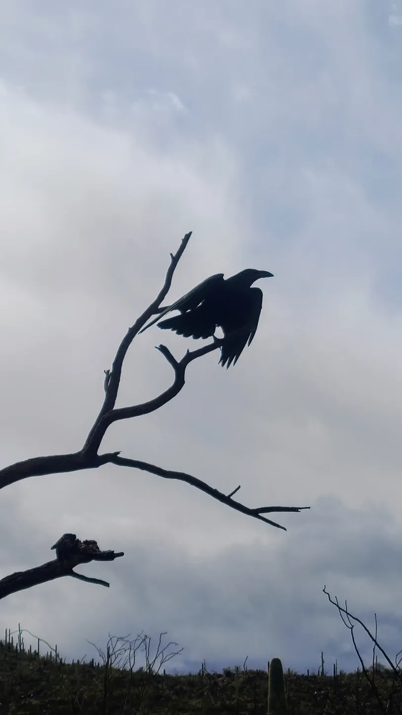
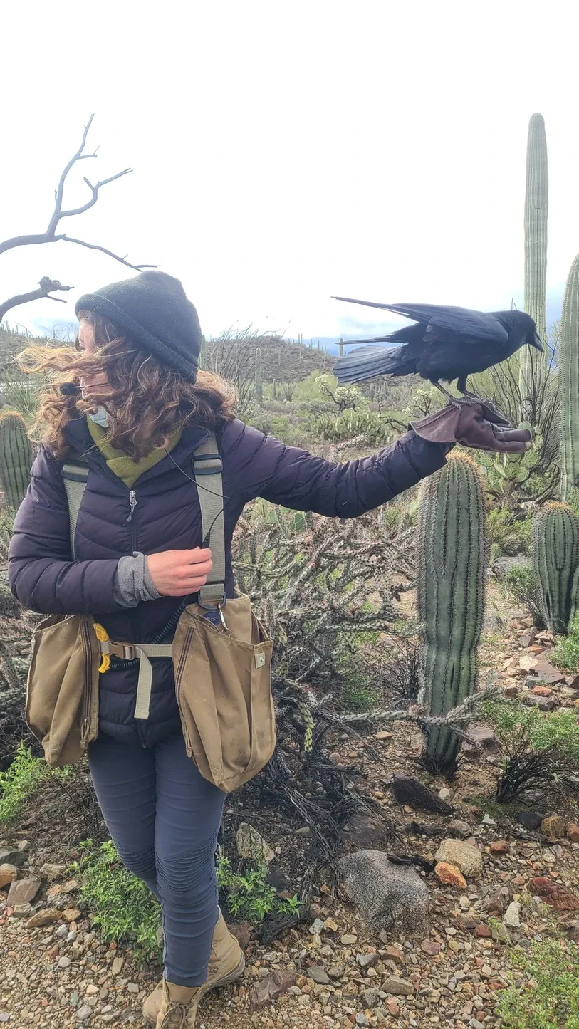
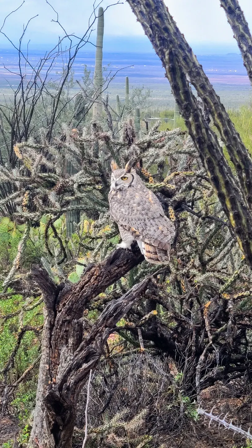
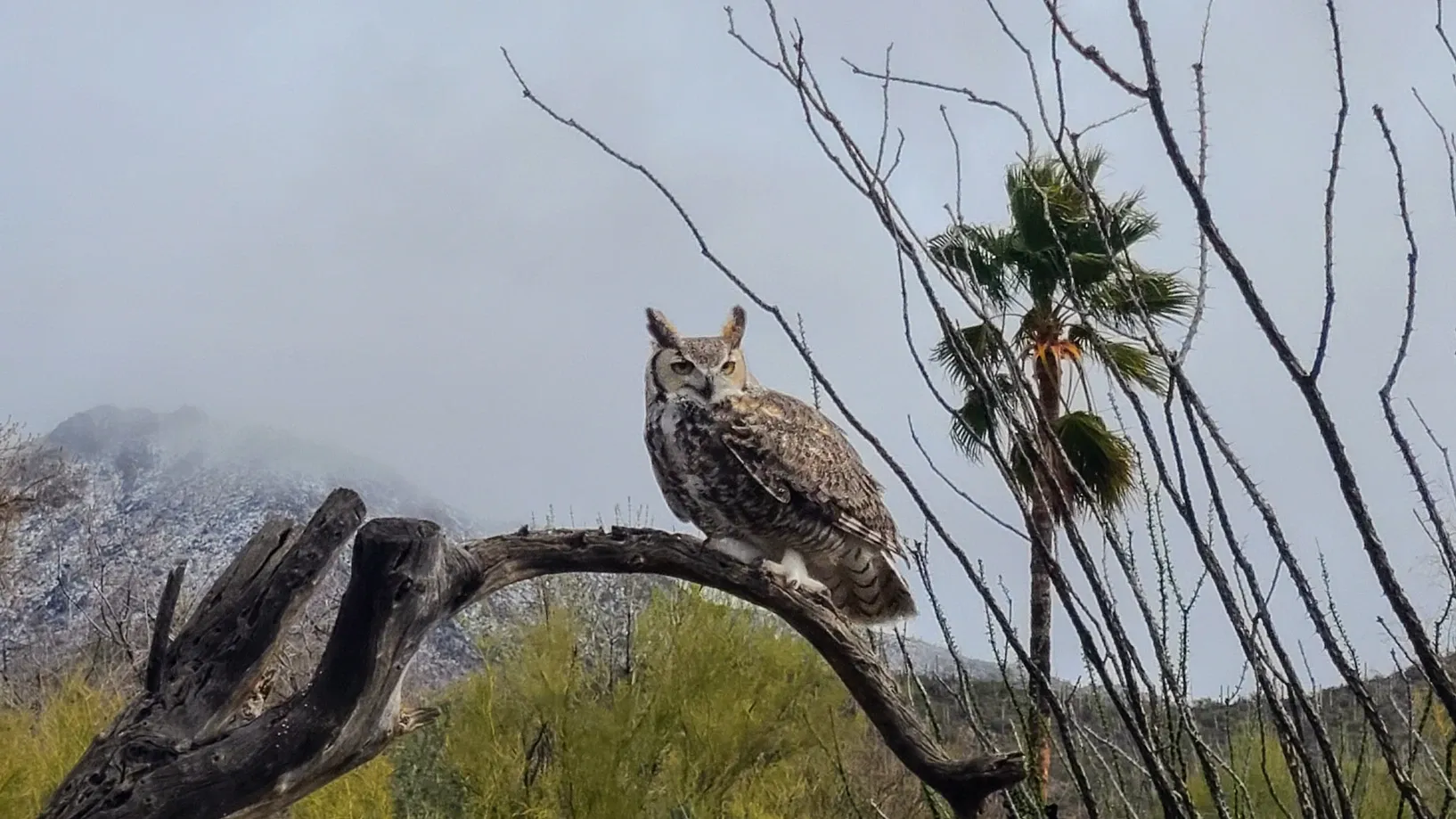
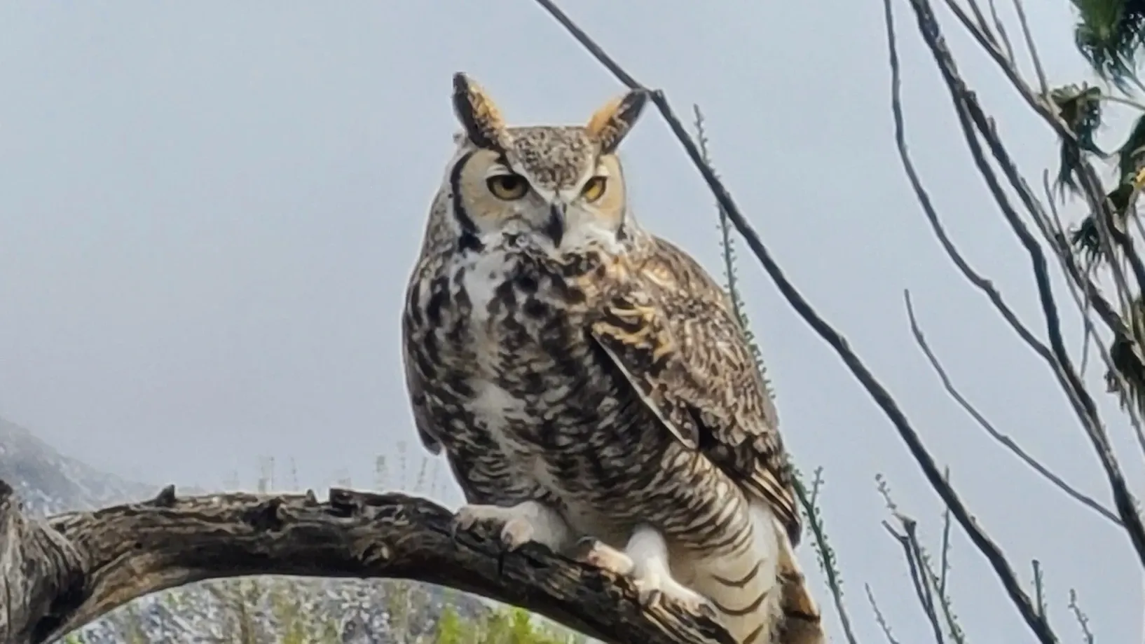
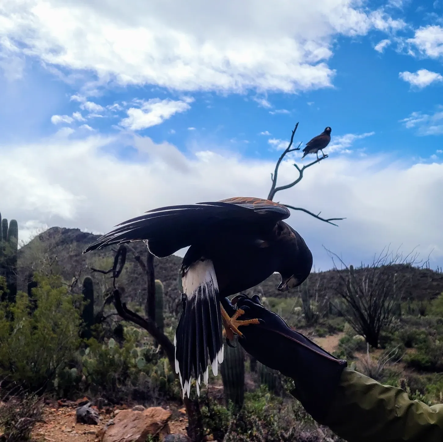
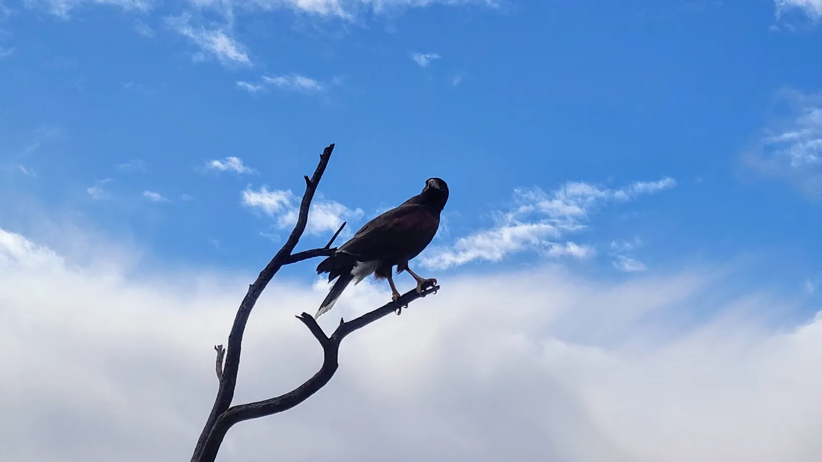
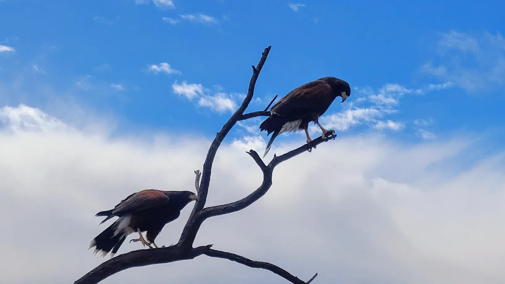
We made sure to arrive early enough to see the Raptor Free Flight. This demonstration takes place every day except Wednesdays. Trainers release different birds for flight around the museum grounds. The staff said that on nice days, they typically see crowds of up to 250 people at the raptor flight. Our less delightful weather gave us an up-close-and-personal view with about 25 of our "intrepid" peers (that's what the raptor flight narrator called us). The wind was picking up, but we were still able to see three avian species: the Arizona Raven, the Great Horned Owl, and the Harris' Hawk. The raptor flight is just a name for this demonstration, as only two of the three of these are actually raptors, with the raven being the odd man out. Raptor or not, seeing these birds fly so close to us was incredible. I took a bunch of video clips and stitched them together so you can see these birds in flight. You'll notice that in some clips, the sky looks a lot bluer. We had our moments of sunshine as the clouds cleared and the rain let up. After the raptor flight, we had wonderfully clear weather as we explored the rest of the museum.

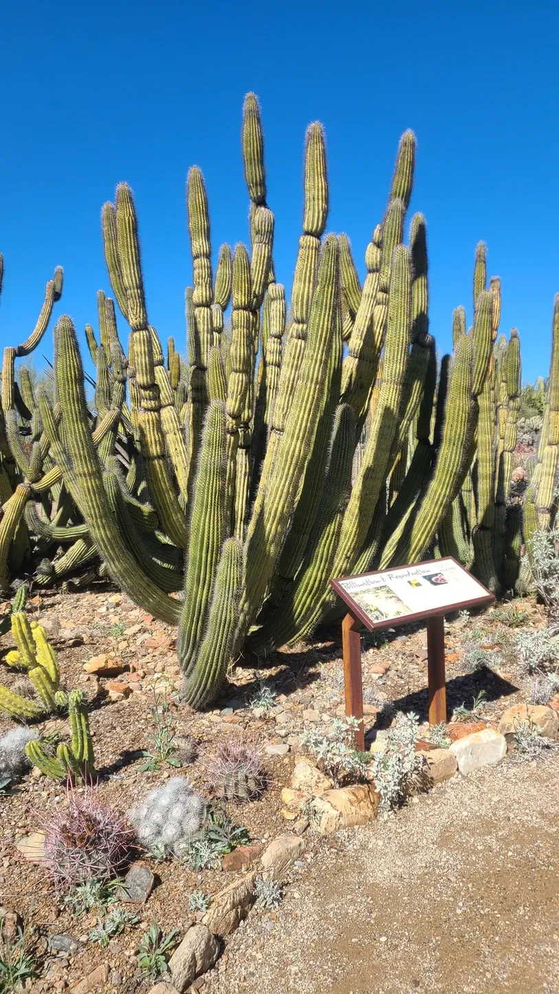
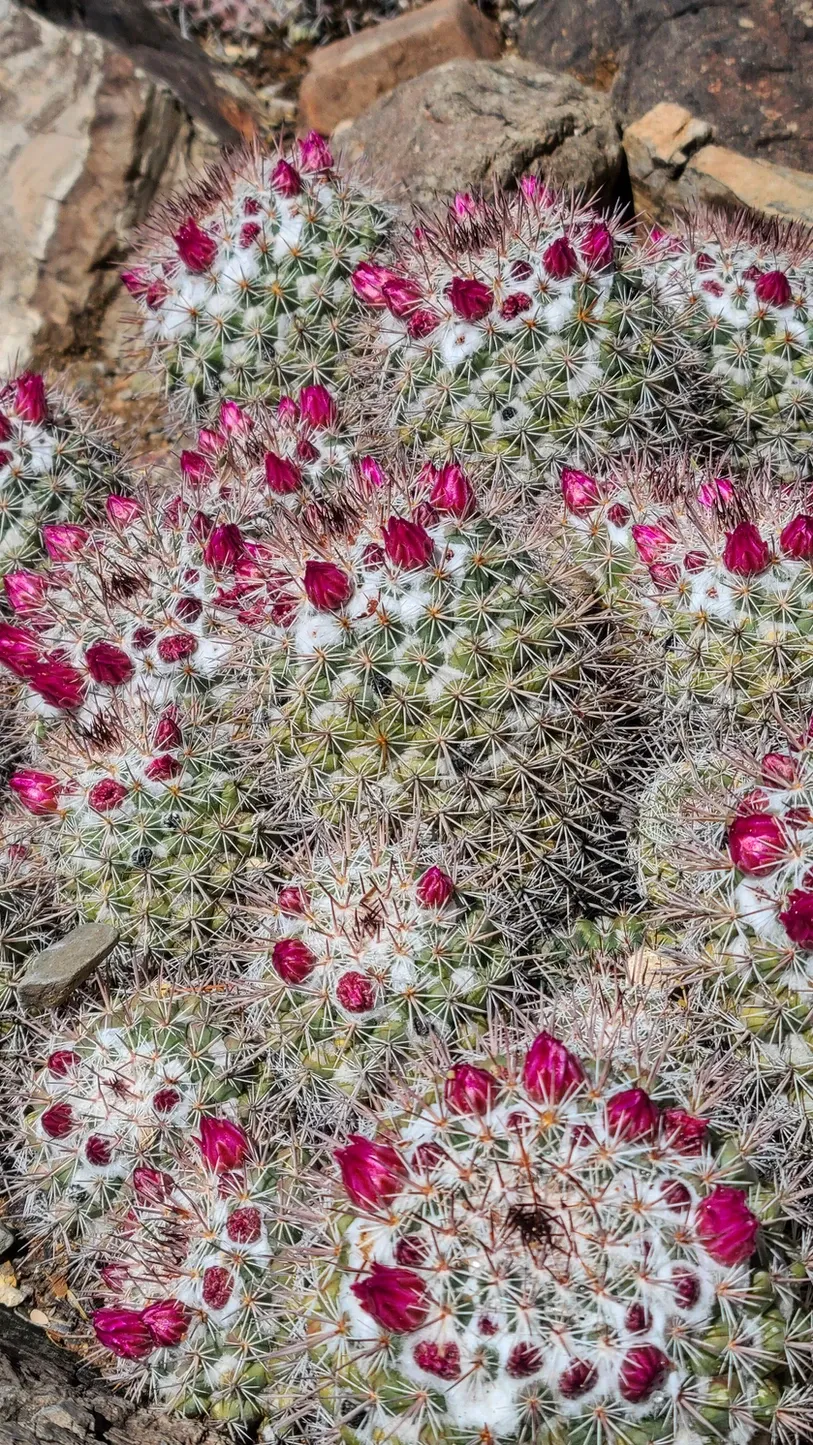
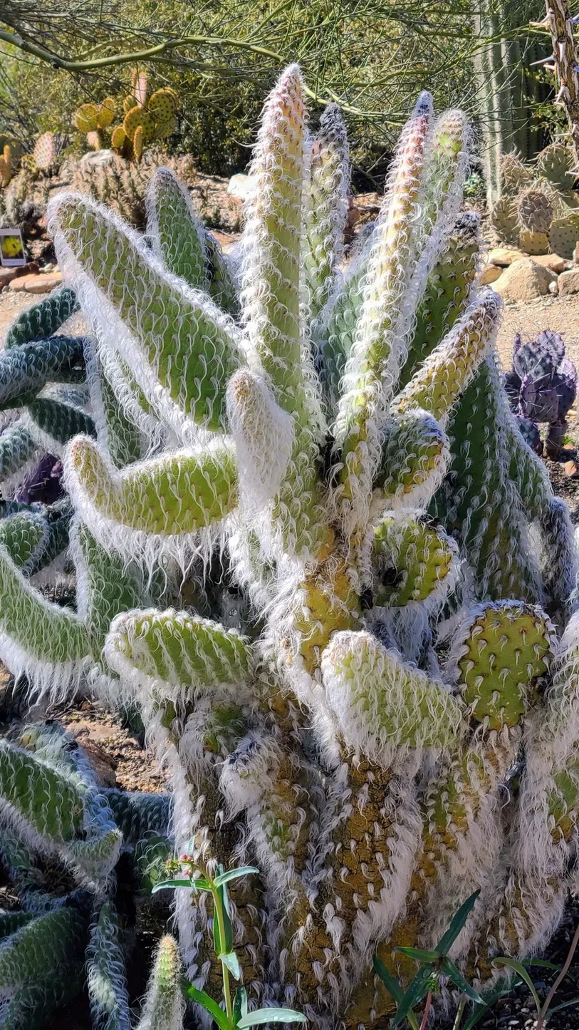
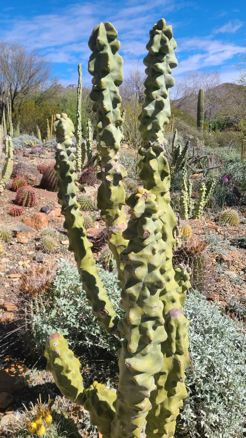
We walked every part of the museum, but the highlights for us were the arthropod exhibit where we got to view scorpions under a blacklight, the cactus garden where we got overwhelmed by the number of different cacti that are found in this region of Arizona, and the hummingbird aviary, because they're just the cutest and seeing them up close gave us a whole new perspective on them. Did you know their wings reflect differently in different lights?

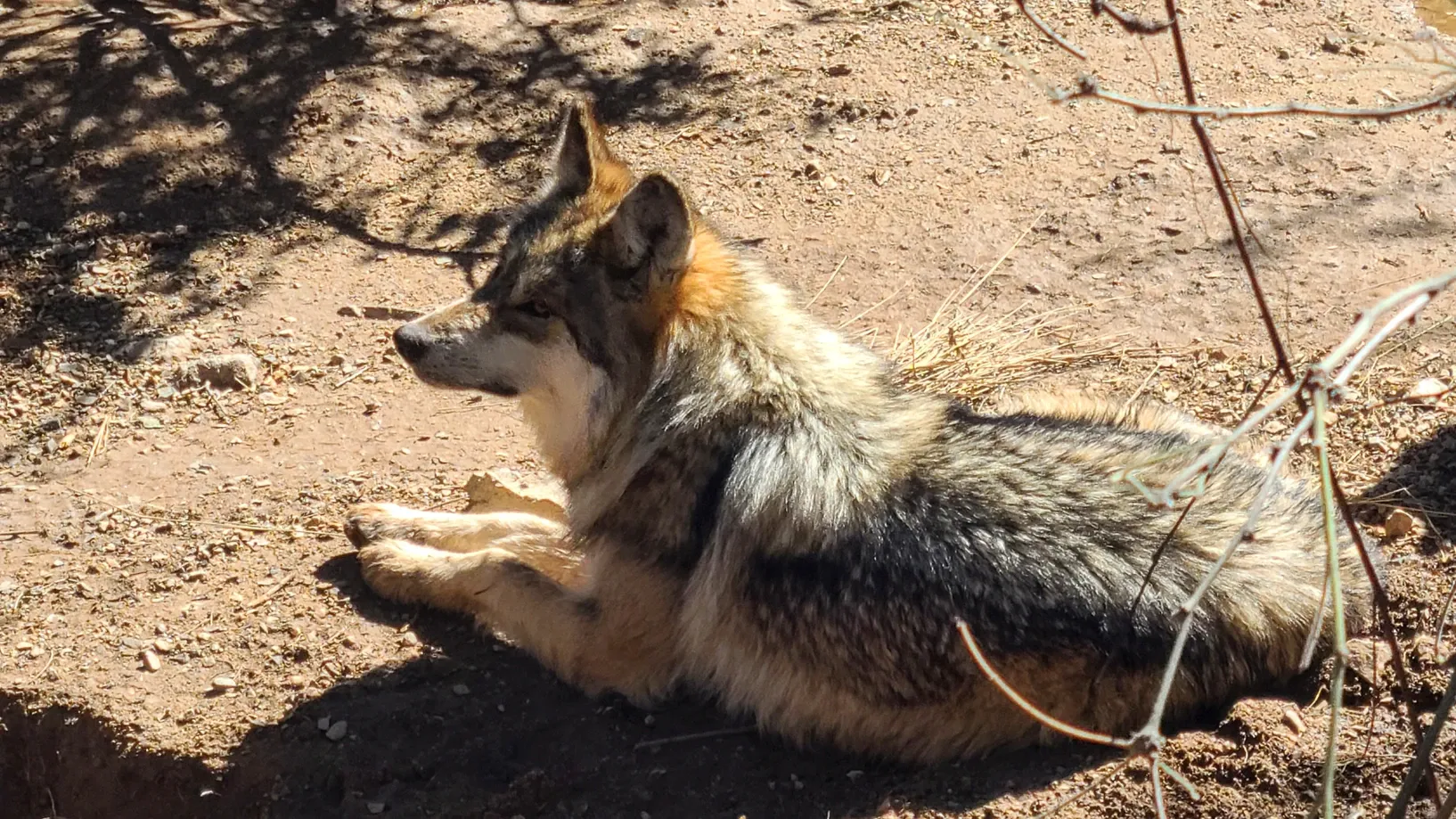
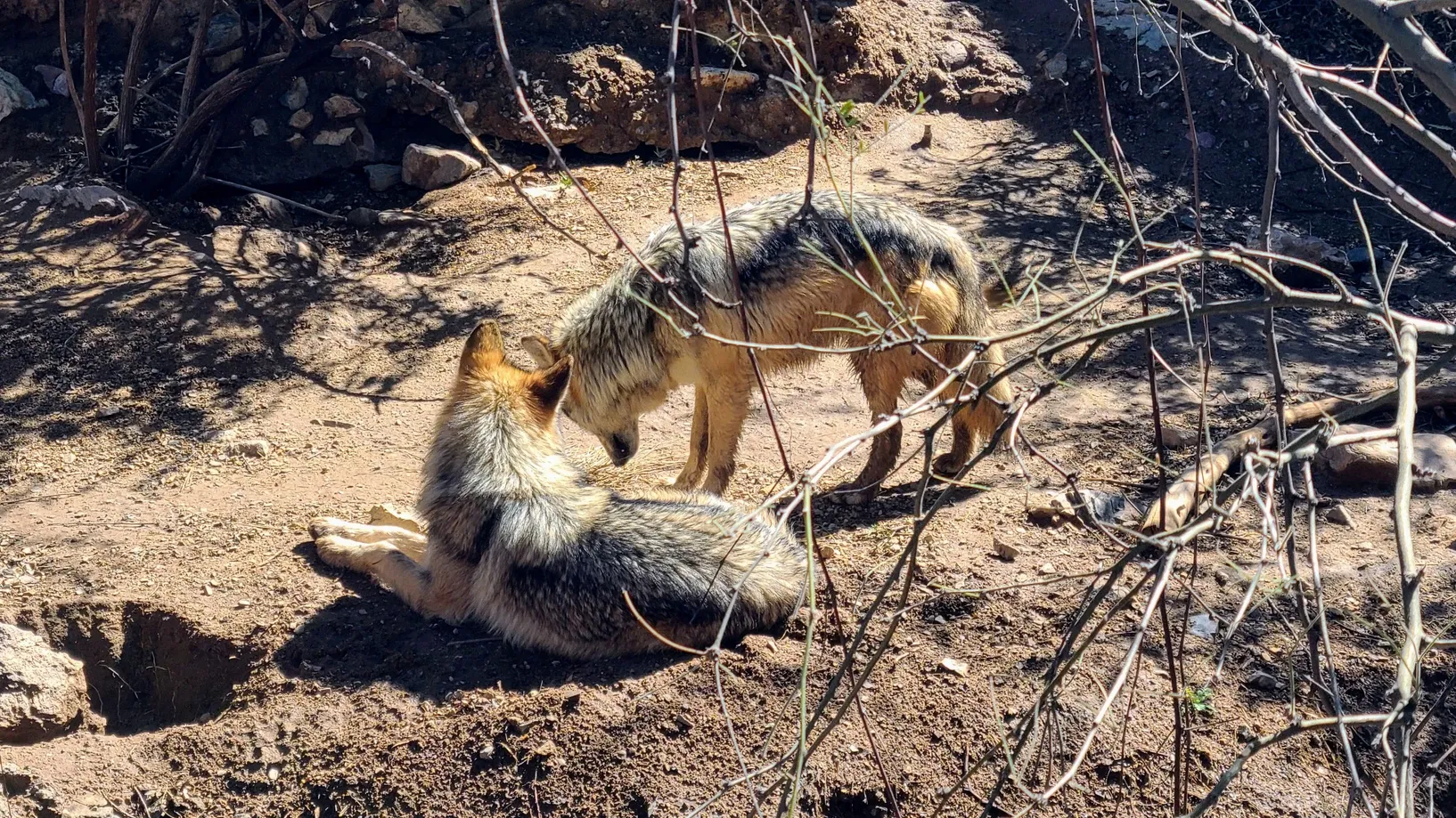
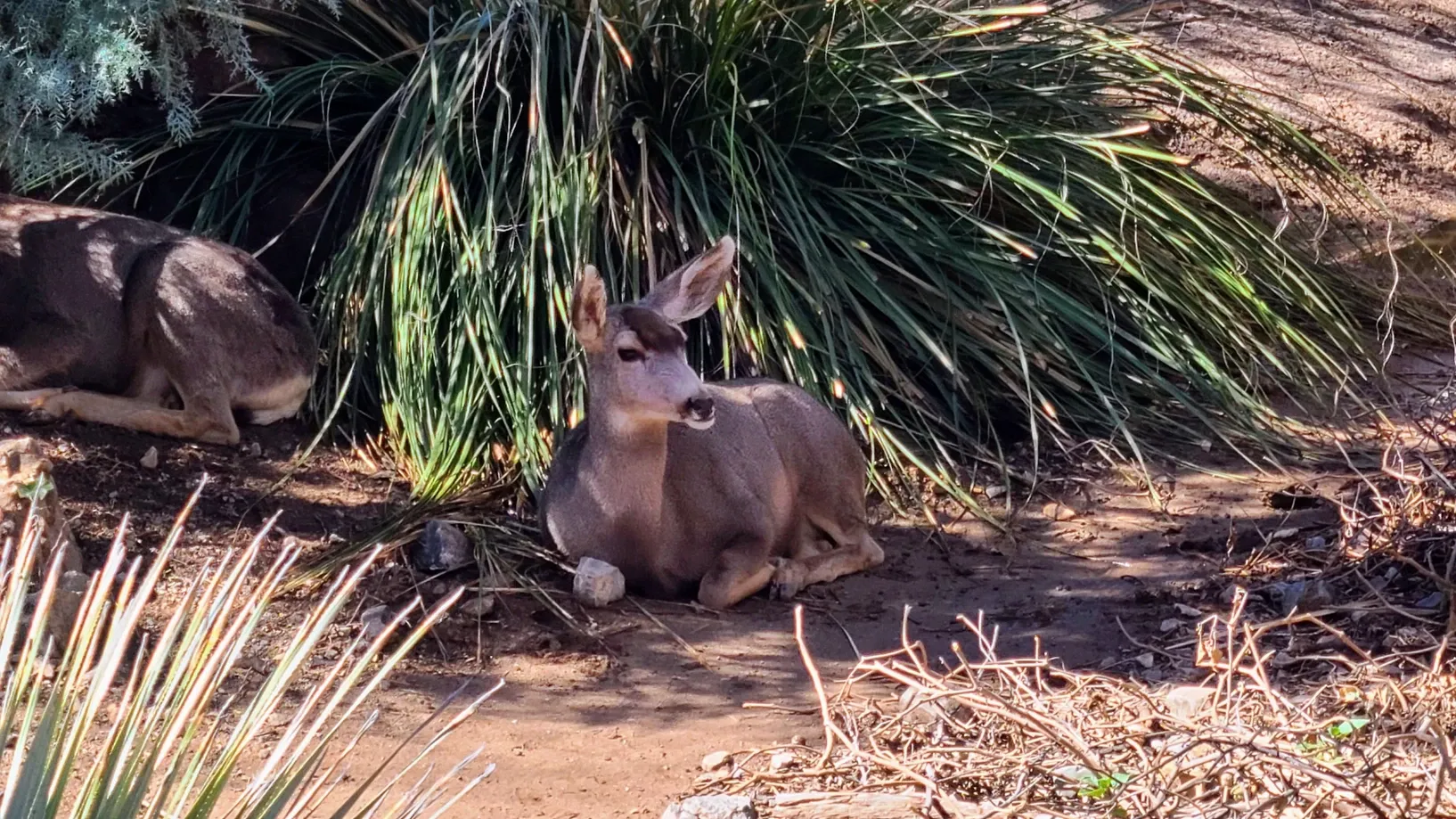
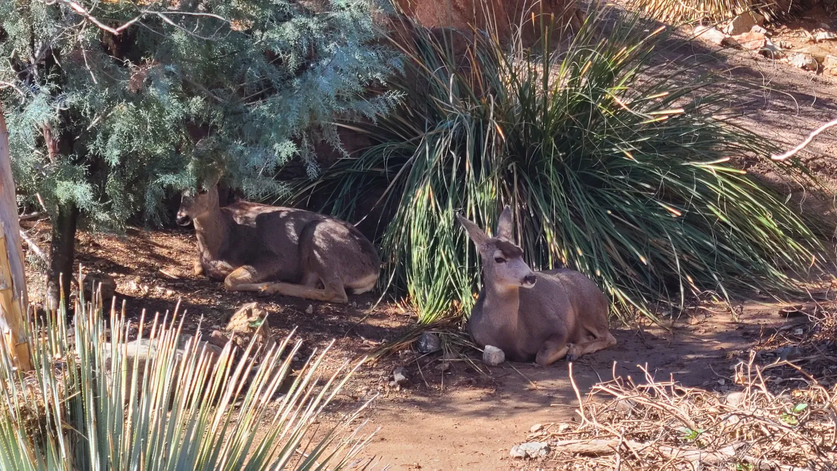
The winter season made for a slow day at the zoo. The bighorn sheep had been moved out of the museum and the bear was hibernating. We did however get to see wolves, deer, a beaver, and an otter.
We could have stayed a bit longer and waited for the Theater Program, which the docents were quick to tell us would be indoors in the heat, but since the weather cleared up, we had one more stop we wanted to make.
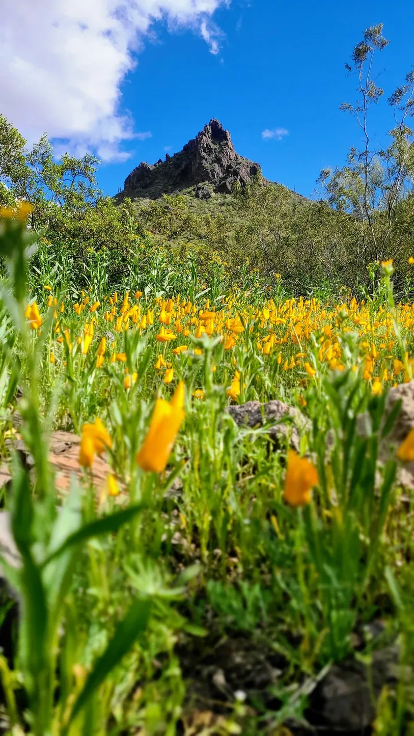
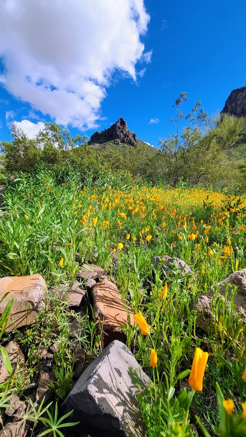
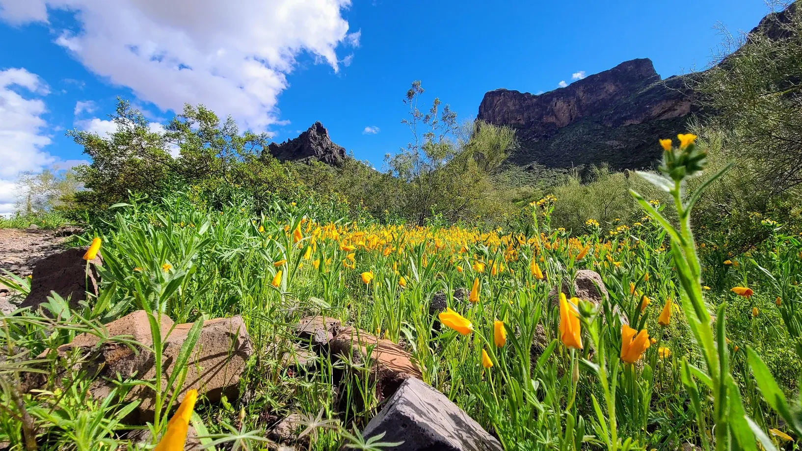
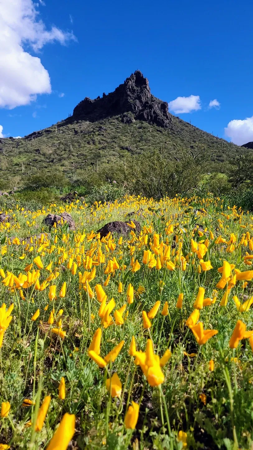
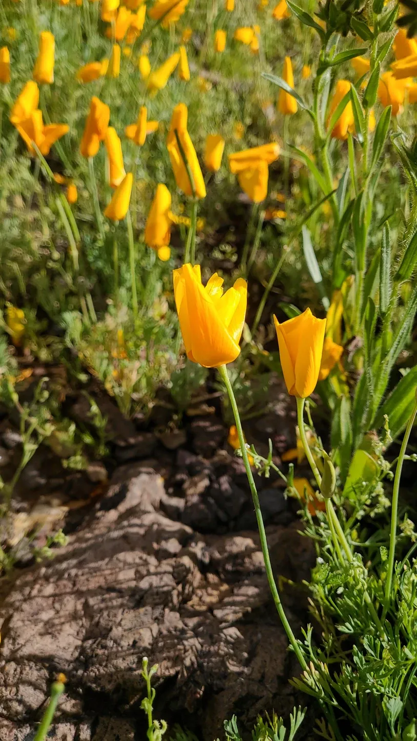
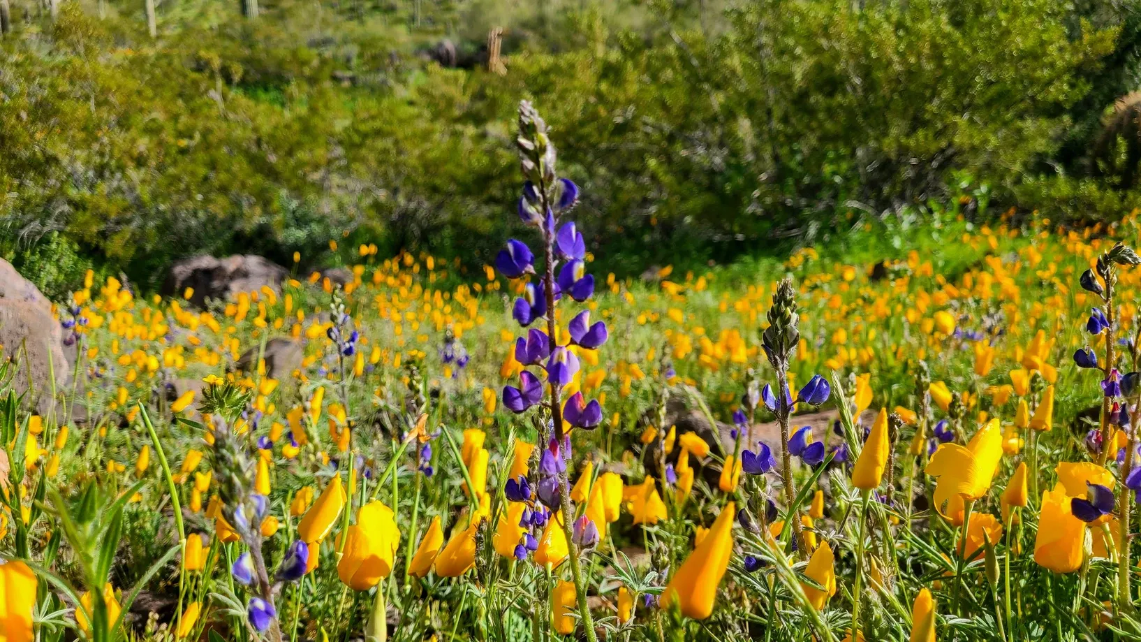
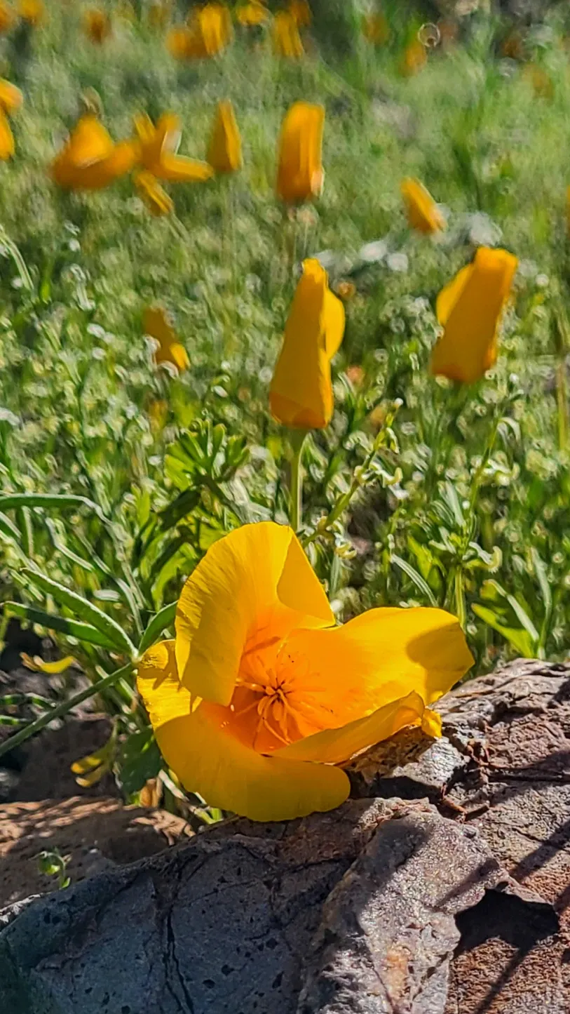
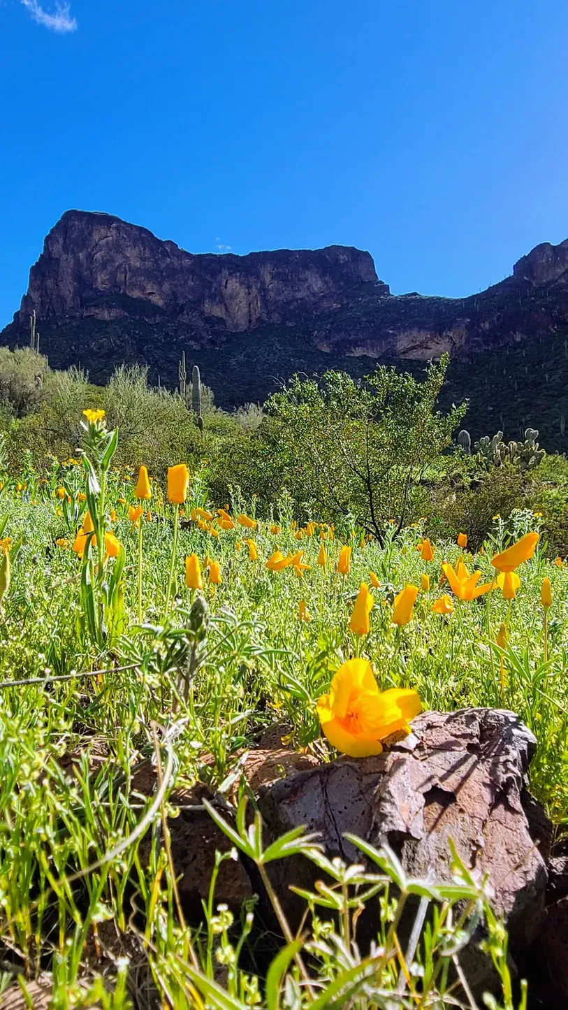
About an hour outside of West Tucson is Picacho Peak State Park, a mountain park right off I-10. But don't be fooled by its proximity to civilization. This park is beautiful at all times of year, but we were tipped off to the start of the Mexican Goldpoppy superbloom. Each year for just a couple of weeks, the poppies bloom, dotting the area with bright yellow hues. Scattered among the poppies are lupines, complementing the yellow with their deep purple petals. One look at the photos and I knew I had to take some for myself. We drove up to the park late afternoon, just as the sun was casting a glow on the wildflowers. We hiked the Nature and Calloway Trails, and I spent most of that time constantly stopping to squat down to ground level with my camera. When I was finally satisfied with my footage, we finished our hike. Unbeknownst to us, the Calloway trail is rated as "easy" and the ranger made it sound as such, but the end of that trail has some pretty steep steps which lead to the most disappointing overlook ever. I didn't even take photos from it, since it was just a view of some houses with the interstate behind them. The real views are the peak itself. The park has three peaks, with Picacho Peak in the middle. If you're brave enough, you can hike the Hunter's Trail all the way up to the peak, and at certain points along the way hikers are met with metal rails to help with the scrambles. Perhaps an endeavor for next time, but our Calloway climb was enough exercise for us. On our way down, the sun was setting behind the mountains, casting shadows on the earth below. Picturesque views all around...well, except for that overlook. Knowing now that this beautiful place is right off I-10 and has RV camping, it's going on our list for a future stay.
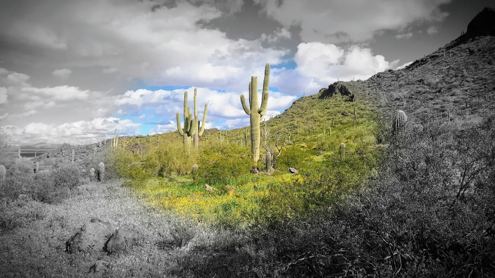
After our Brown Mountain hiking day, I posted some photos on social media. In the caption, I talked about our cancelled 2020 roadtrip. One of the places we were supposed to visit was Saguaro National Park, and so to finally get there was extra special. Sometimes when you dream about a place for that long, the real thing can be a let-down. This was not the case with Saguaro. It was just as wonderful as we had expected.