The Utah Redemption Tour: Meeting the Goblins


In 2019, I put in countless manhours planning an epic roadtrip from Wyoming, through Utah, and into the Southwest. We affectionately called it the Canyon Trip, scheduled for late summer/early fall 2020. Then a virus flushed that whole trip down the toilet, but I'm happy to report that all the planning didn't go to waste. Since we began full-time RVing, we've hit many of the Canyon Trip destinations, and I've referred back to my plans to help us decide what to see and do. Factoring in our completely different slower-travel lifestyle, of course.
Over 3 years into the RV Life, and we are finally hitting southern Utah, one of the biggest parts of our 2020 trip. Looking back at our itinerary, we can't help but raise a few eyebrows. Really? Barely even a day to spend in Arches? We just spent a whole week there and still could have stayed longer. But times are different now...in some ways.
Then again, I read Past Nicole talking about how we must stop in Goblin Valley to see the "weird formations." Once a weird geology lover, always a weird geology lover. Only this time, we don't need to make a quick stop. We can spend multiple days there! Between Canyonlands and Capitol Reef, I booked us a camping spot for 3 nights at Goblin Valley State Park.

Located off state route 24 and surrounded by nothing but land and cows, Goblin Valley is not a typical tourist destination. The closest "big" town is Green River 50 minutes away, and the closest town is Hanksville 30 minutes south. Most people who come here are driving route 24 because it's the road that leads from I-70 to the big kahunas like Capitol Reef and Glen Canyon. However, this place is worth more than being a "stop along the way."
The Crowds
Don't let this "not a typical tourist destination" fool you, though. Goblin Valley State Park gets crowded, especially in the nice weather. The campground fills up, as does the main parking lot. However, compared to the craziness of the Mighty 5 national parks, you can get some reprieve, and that's what we hoped for when we planned our stay. Because the "goblins," aka mushroom-shaped rock formations are the main draw, that's where we found the most people. There are enough rocks that we could escape the constant photobombing, but our real solitude came when we ventured to other parts of the state park.
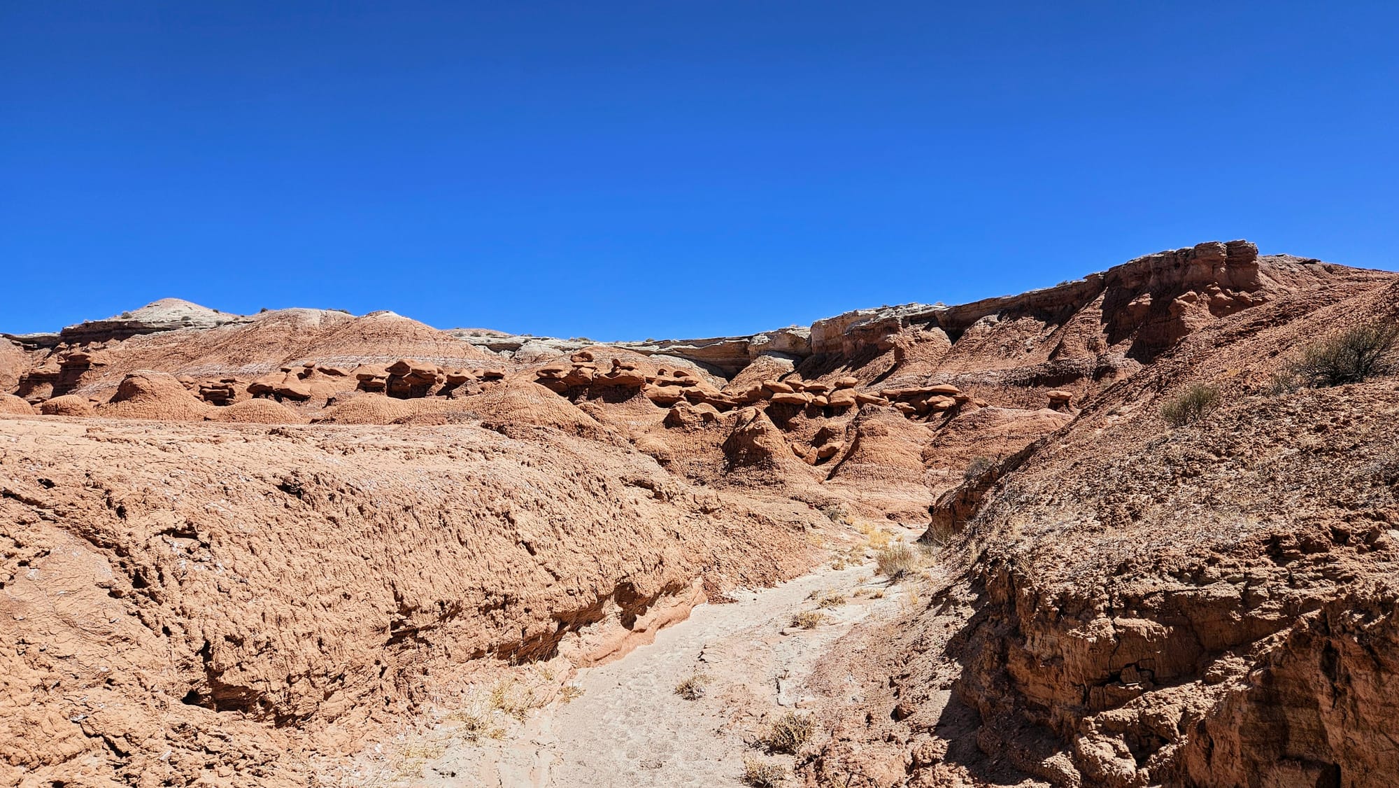
The Geology
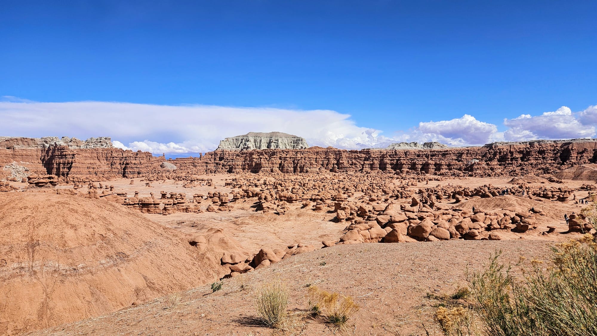
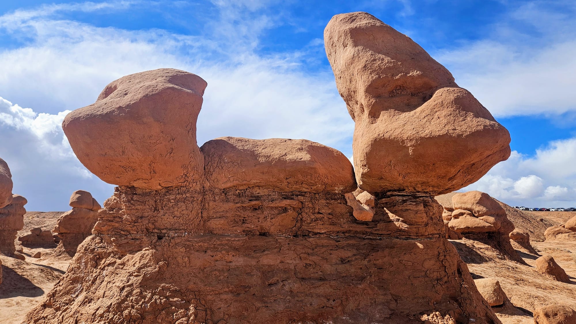
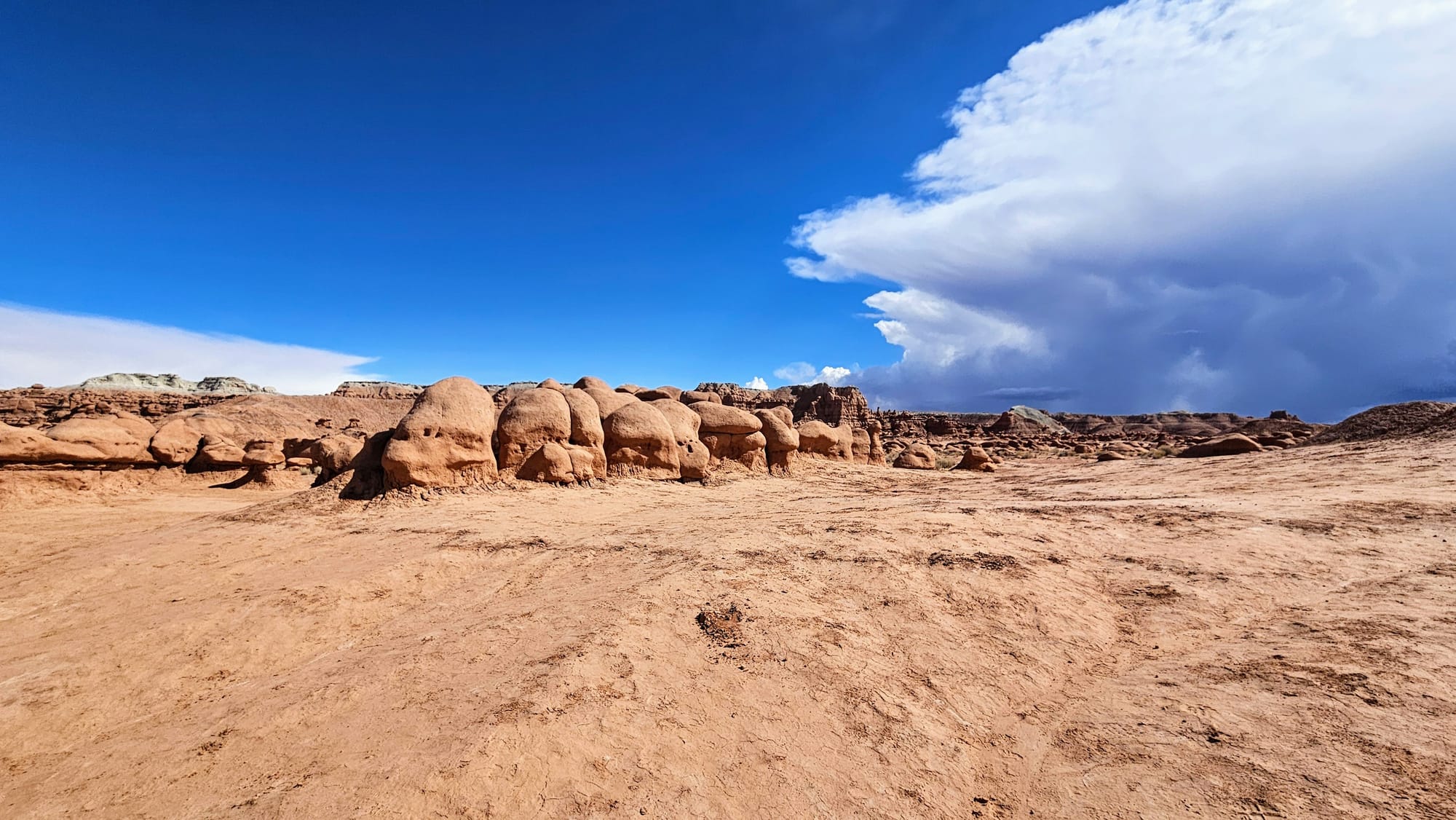
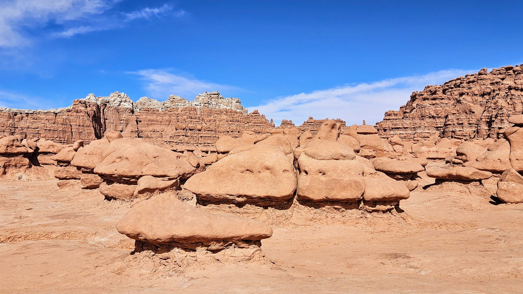
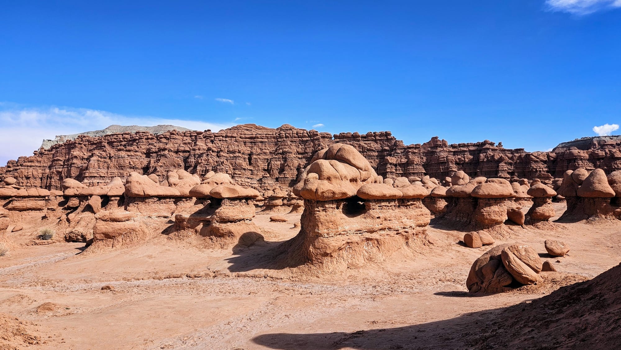
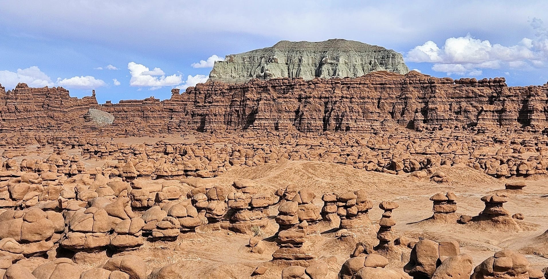
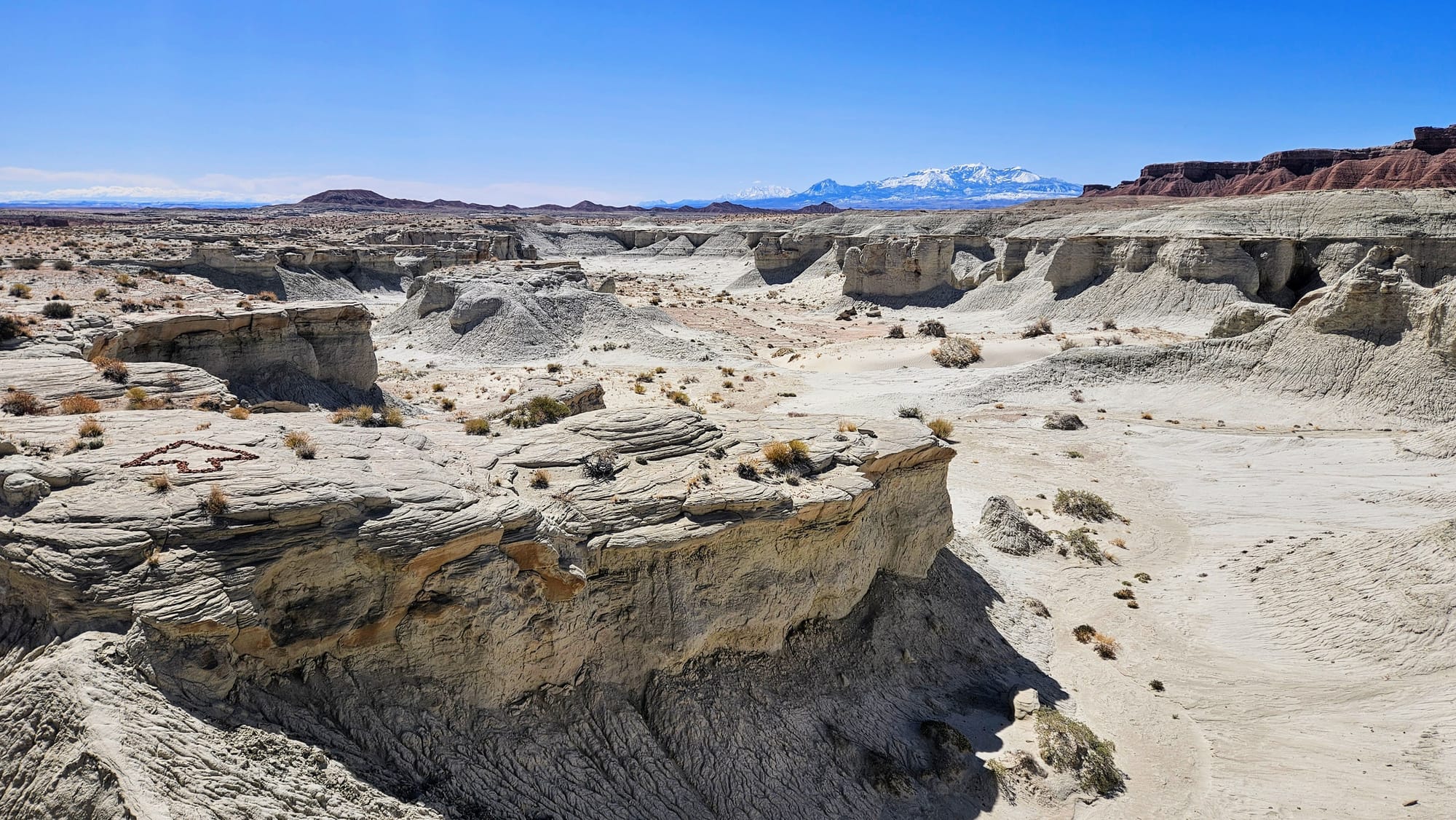
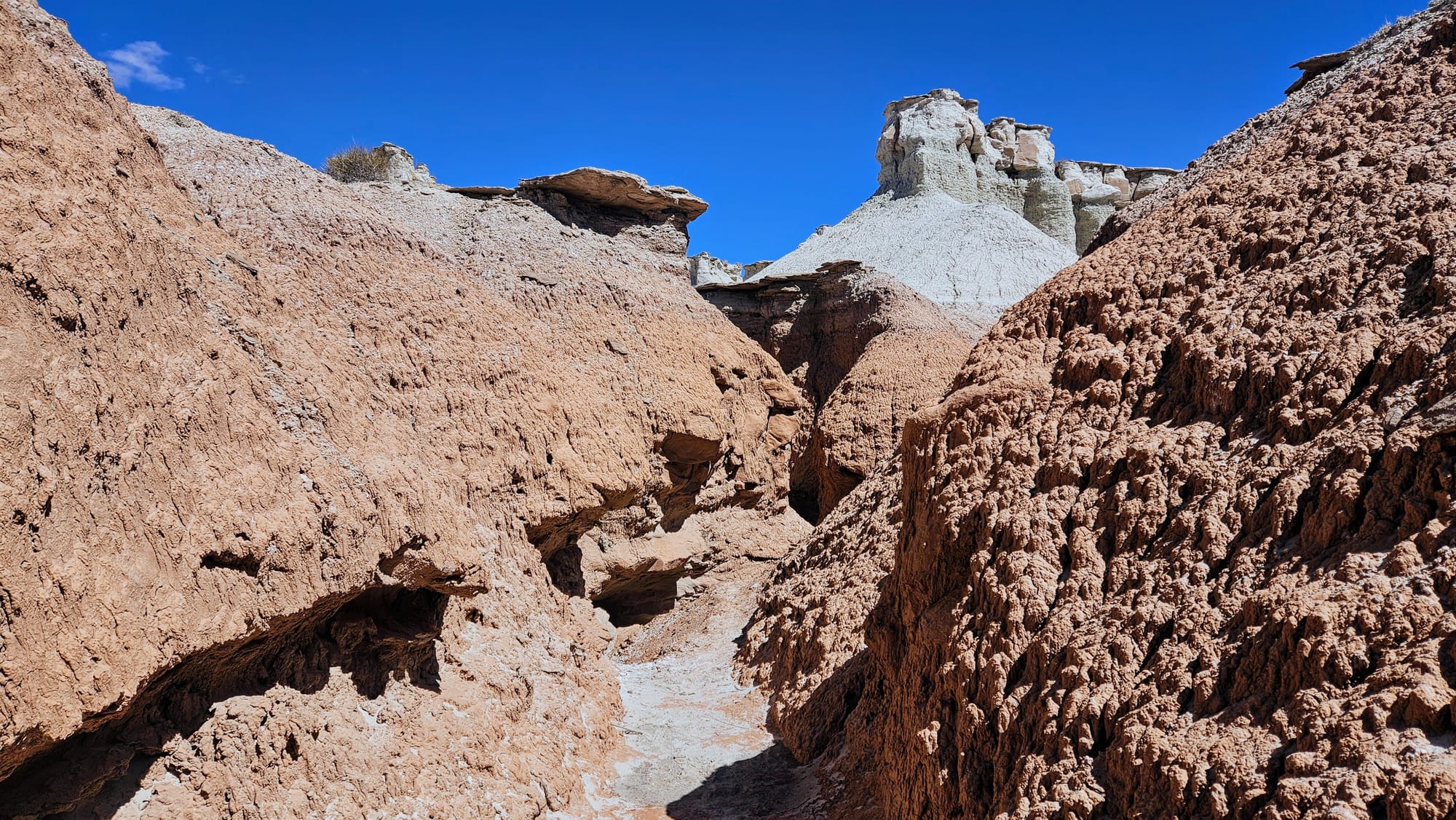
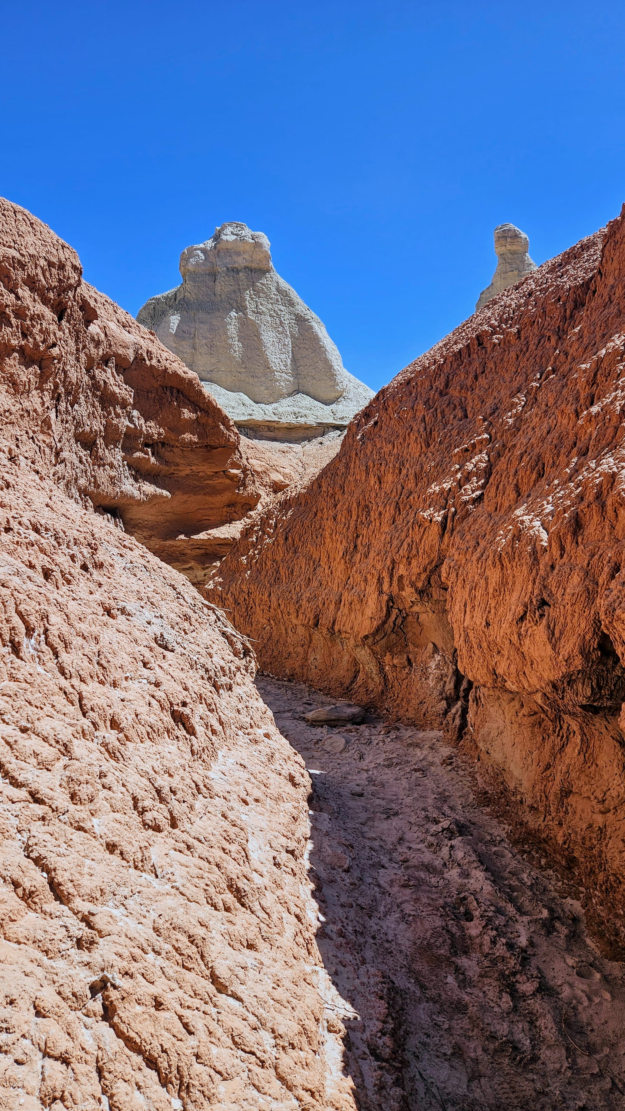
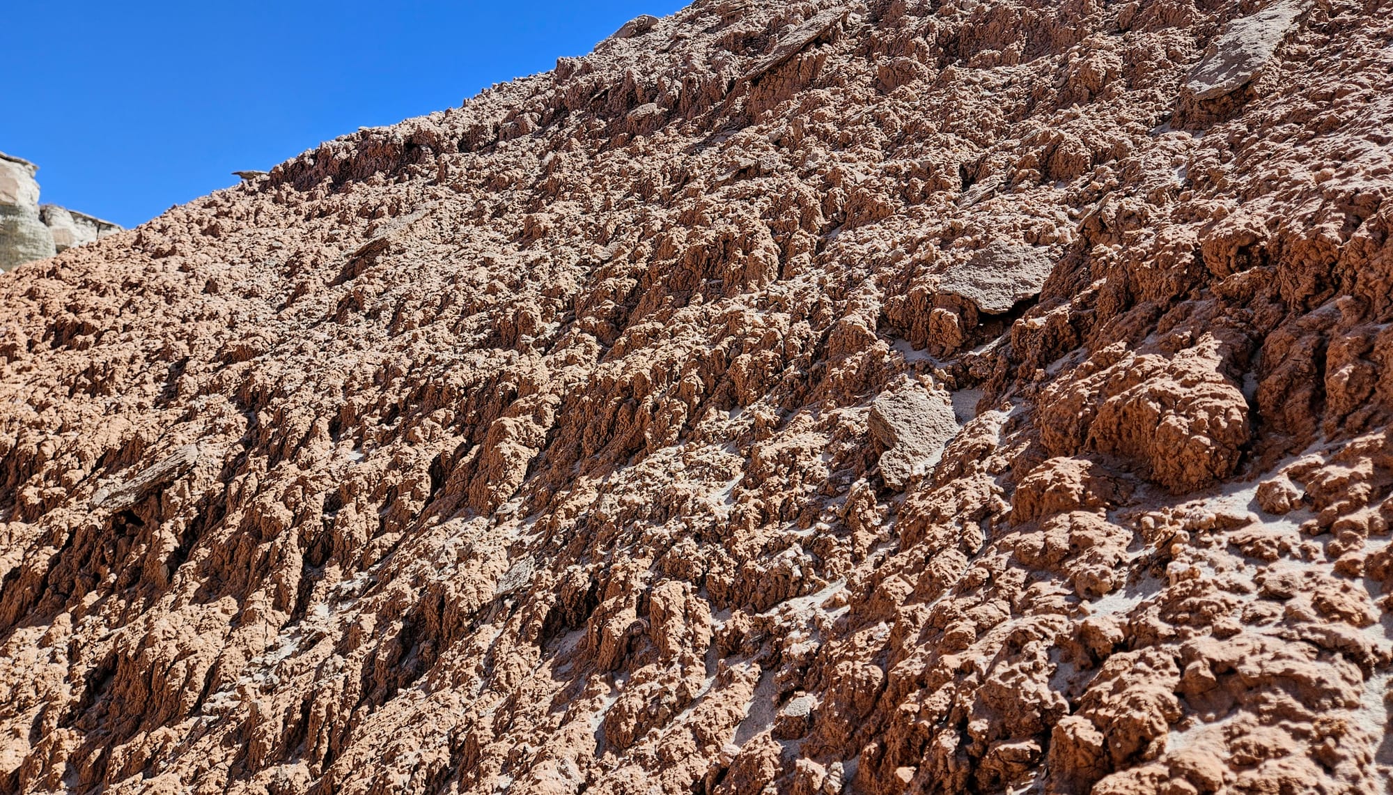
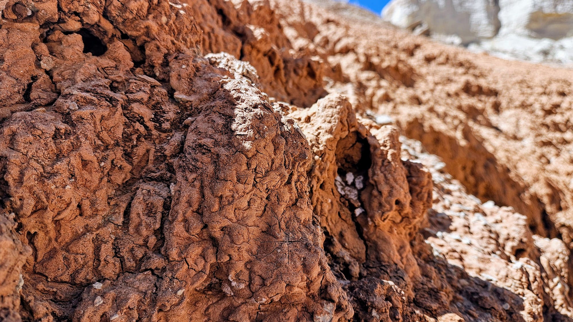
Most of the region is made up of Entrada sandstone, deposited during the Jurassic Period around 150 million years ago. It's the same sandstone that is found in Arches, and as you've seen, is very sensitive to erosion. The rock is extremely porous, which allows water to seep in. Then, when temperatures dip below freezing, the water expands, creating cracks and holes in the rock. Over time, the freezing and thawing process creates the unique shapes of the formations. Arches are formed when the top of the rock erodes upon a harder, more impervious base. However, you won't find arches at Goblin Valley. You will find otherworldly shaped hoodoos, unlike formations you see elsewhere. Why is this? This land used to be a tidal flat, on the edge of an inland sea. The minerals deposited here were muddy siltstone, softer than the sandstone at Arches and other regions of southern Utah. Thus, when wind and water eroded the stone, it created these goblinesque formations, shaped so oddly because of the mixing of the harder and softer stone layers. Look closely at the photos and you will see that the bases of these formations are softer and crumblier than the tops. Even today, winds, rainstorms, and varying temperatures contribute to the constant shaping of these goblins, and eventually, to their collapse. Sandstone regions such as this are great places to see evolution demonstrated before your eyes.
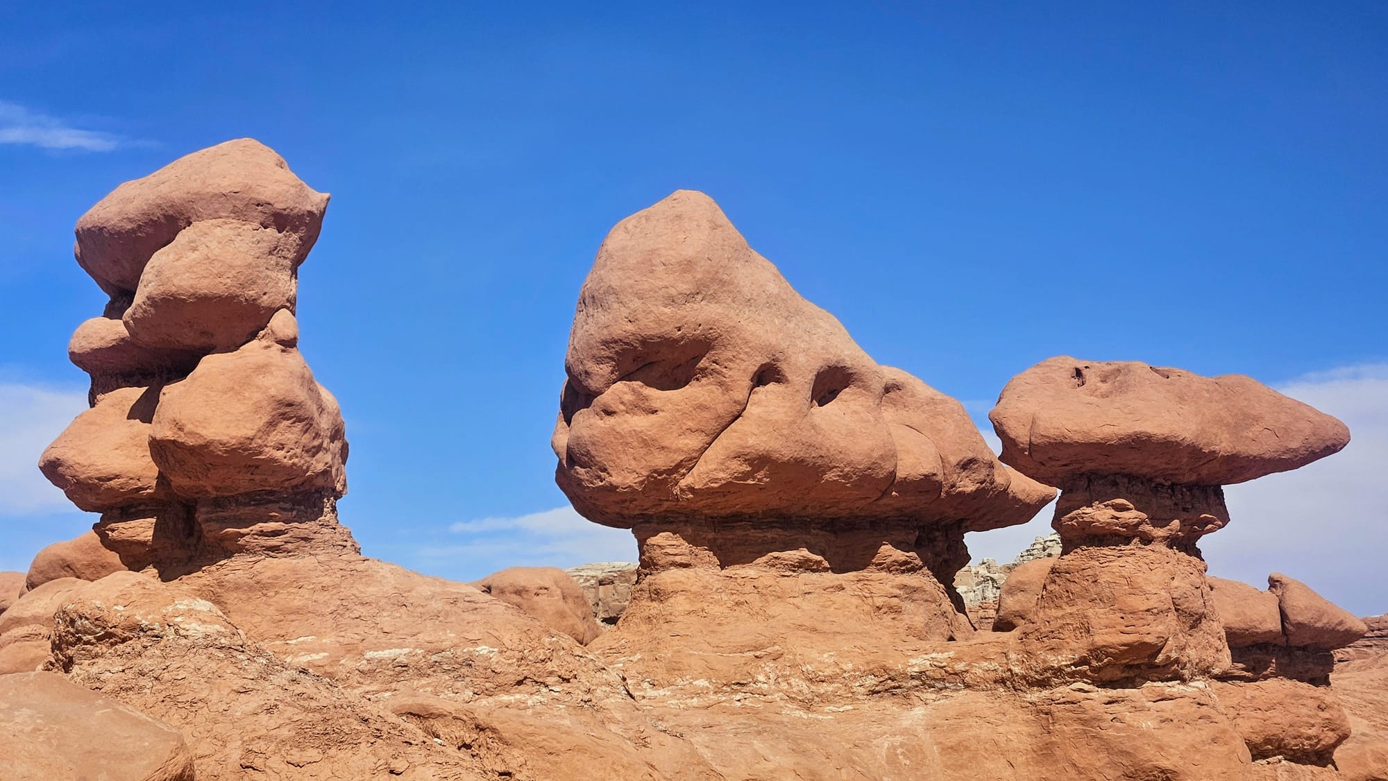
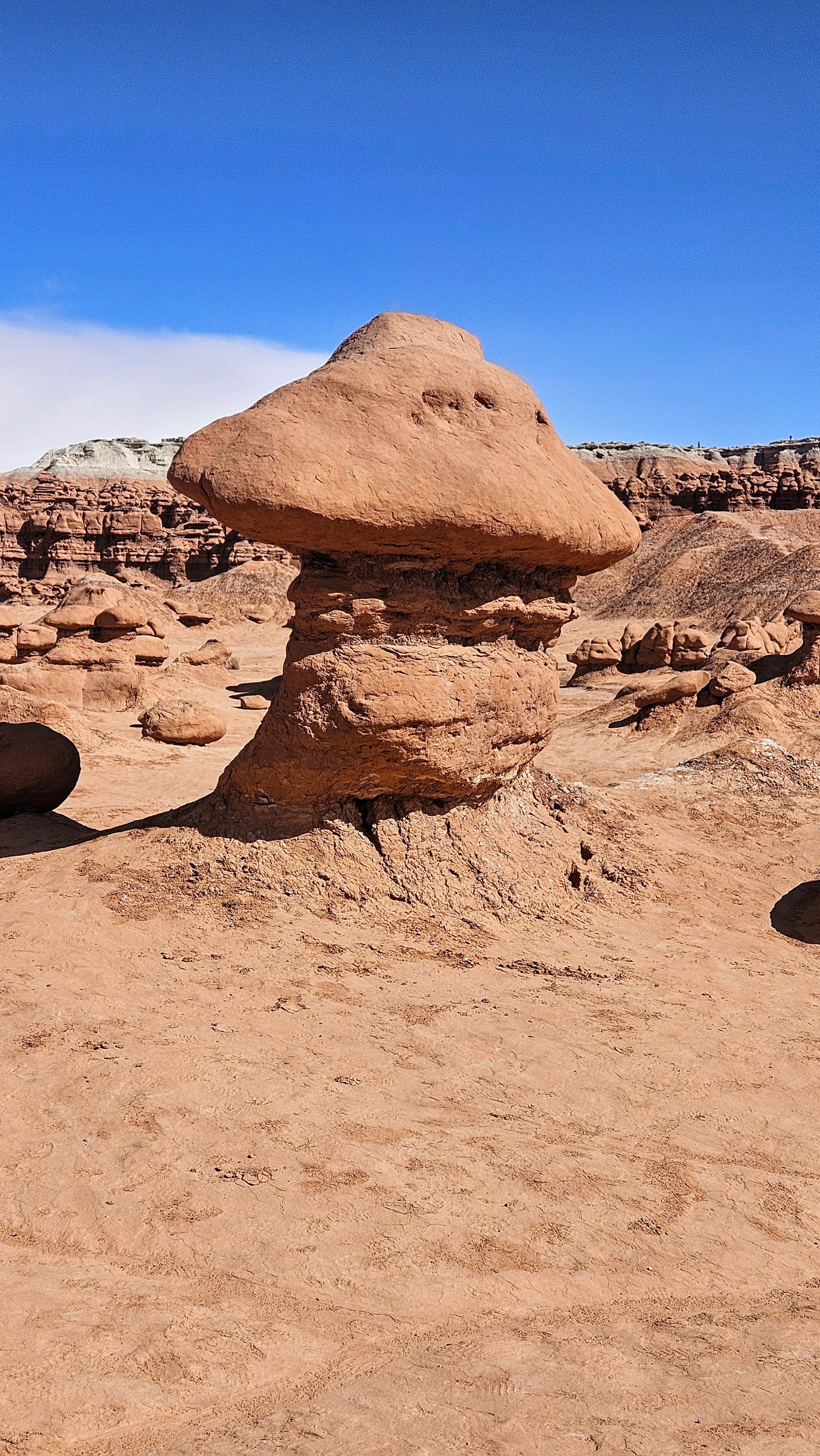
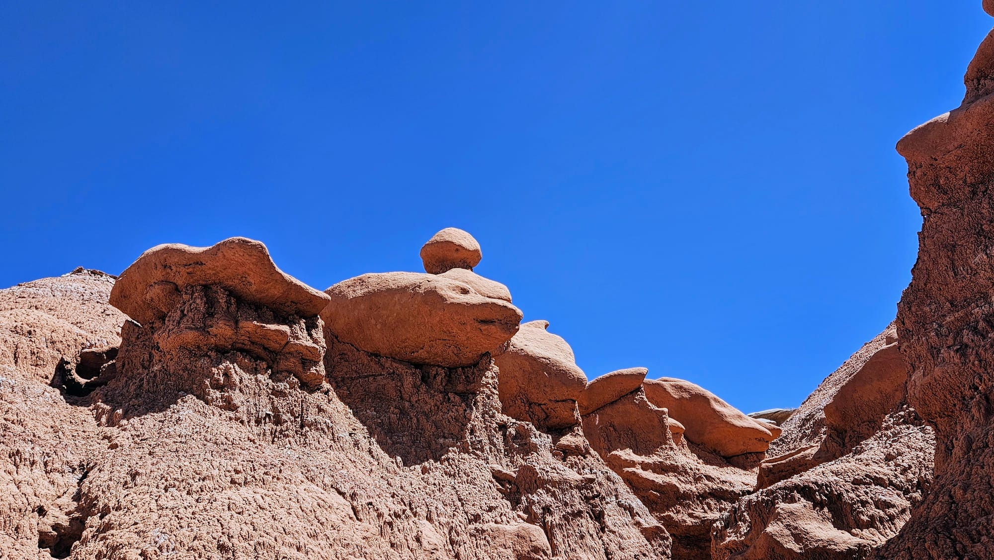
Goblins, once known as mushrooms (you can see why!)
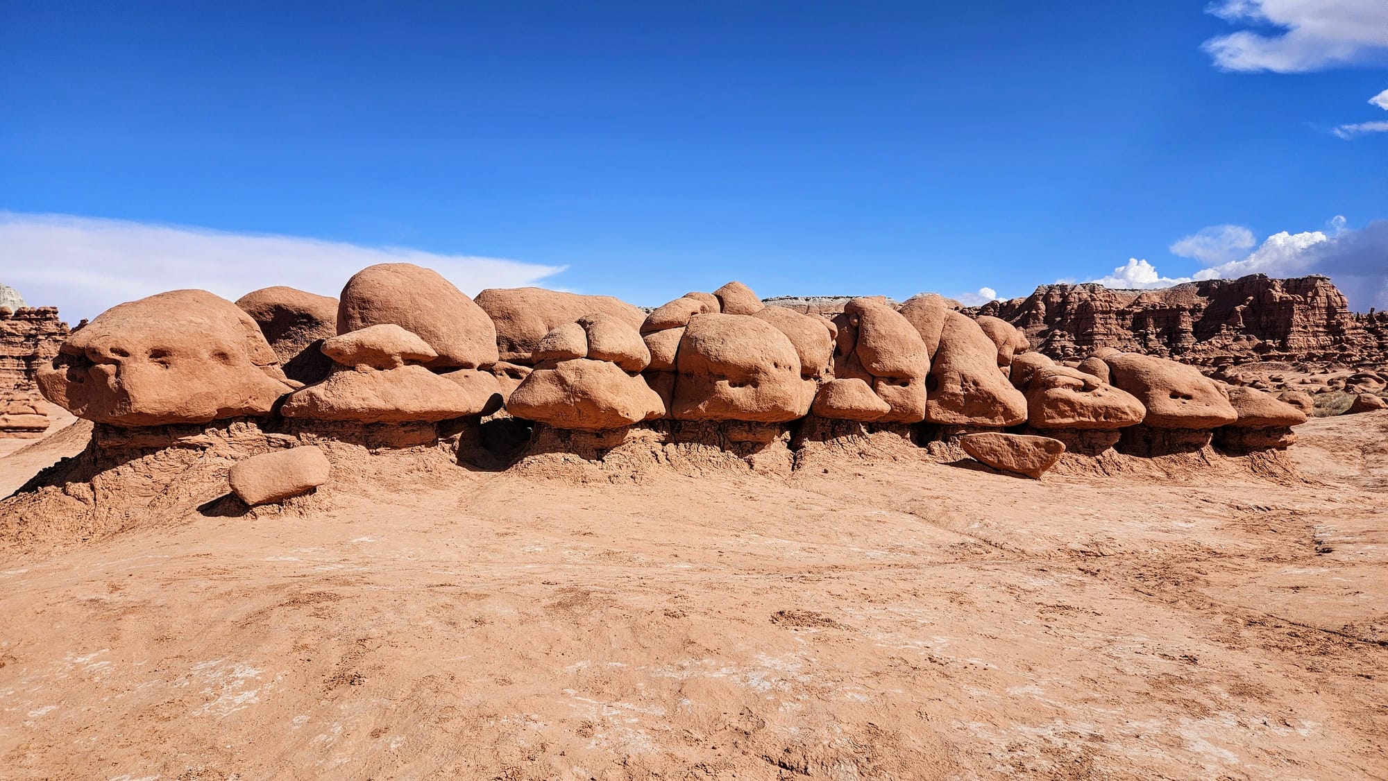
Goblin Valley is less than 4 square miles, which is an impressively small area where these formations are concentrated, thanks to the tidal flat from ages ago. However, other parts of the state park yield different but equally important geological features.
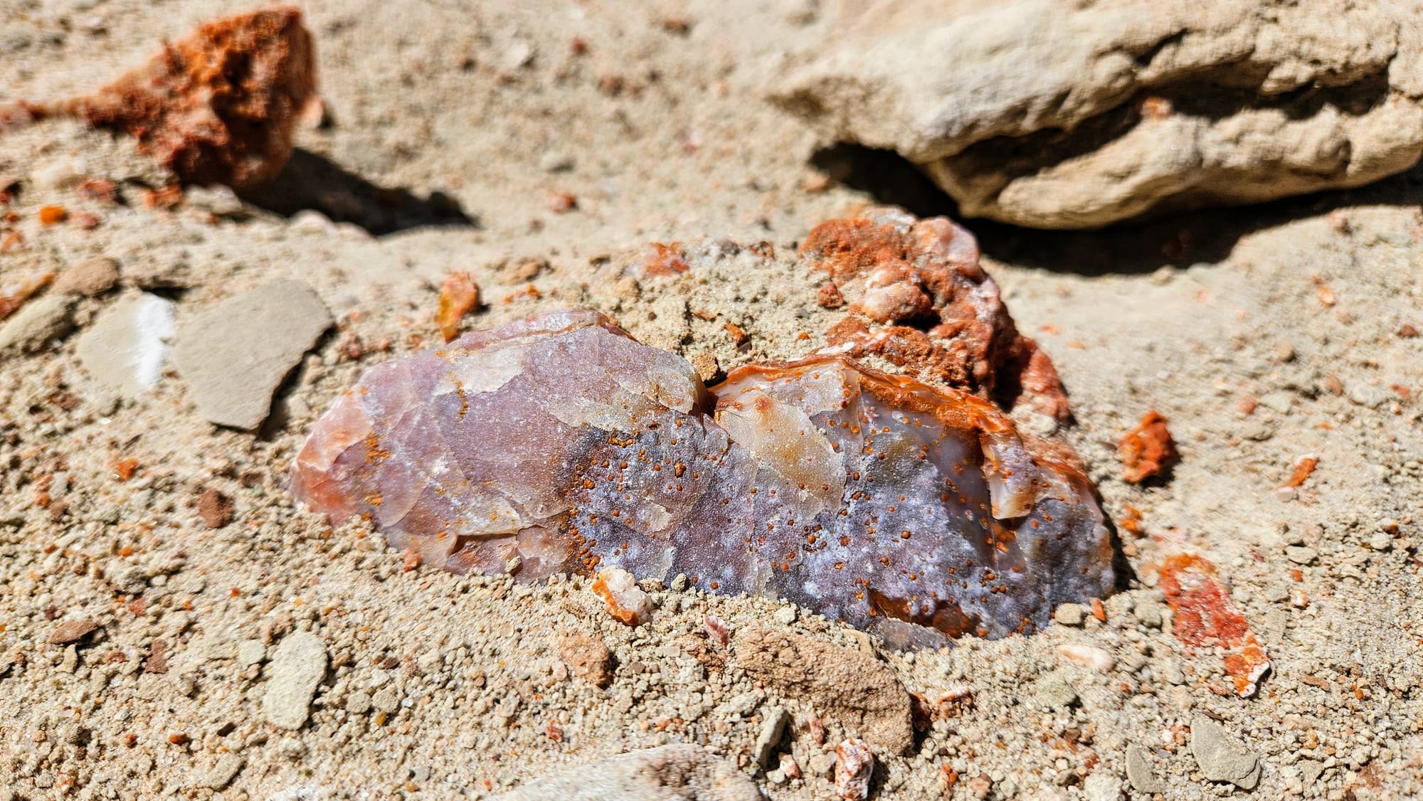
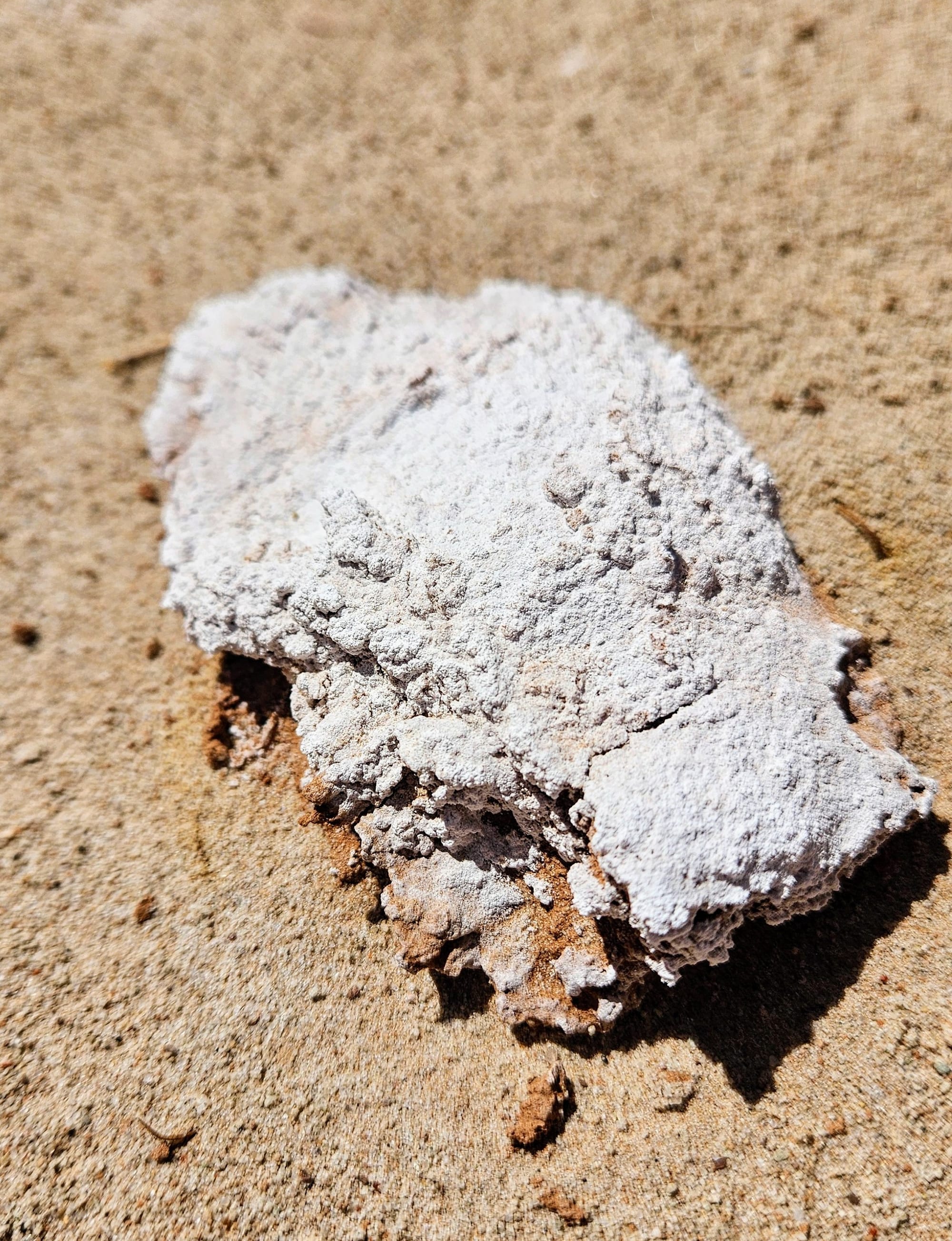
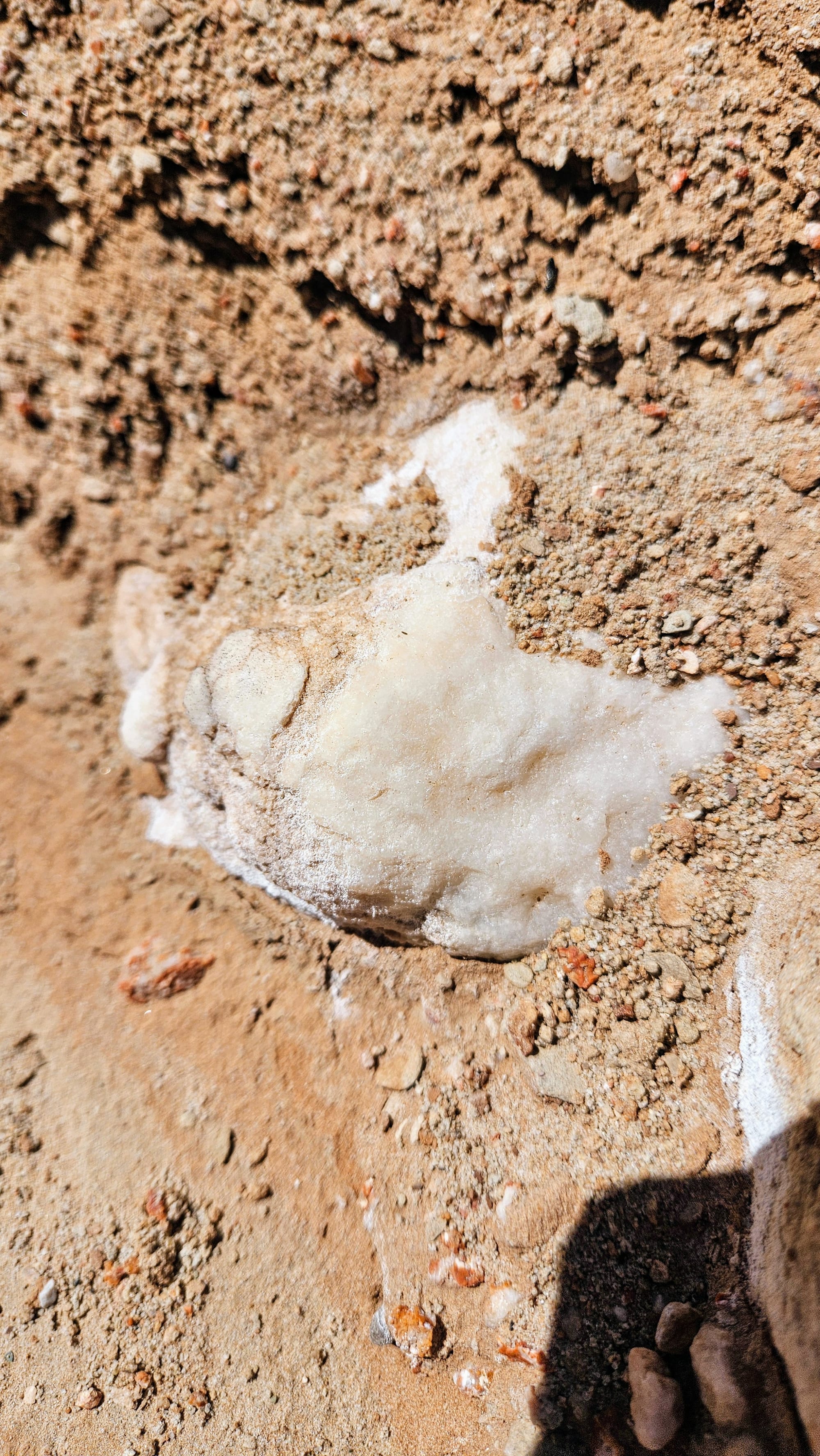
The upper layers of rock in Goblin Valley form the Curtis formation, where you will see much lighter gray colored Navajo sandstone. This sandstone, also deposited during the Jurassic Period, shows evidence of the inland sea and is rich with minerals such as quartz, mica, feldspar, magnetite, and more.

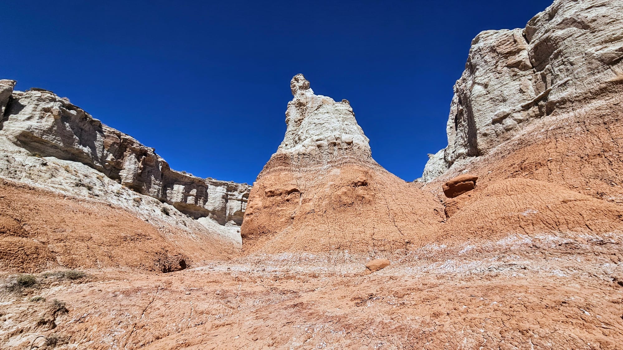
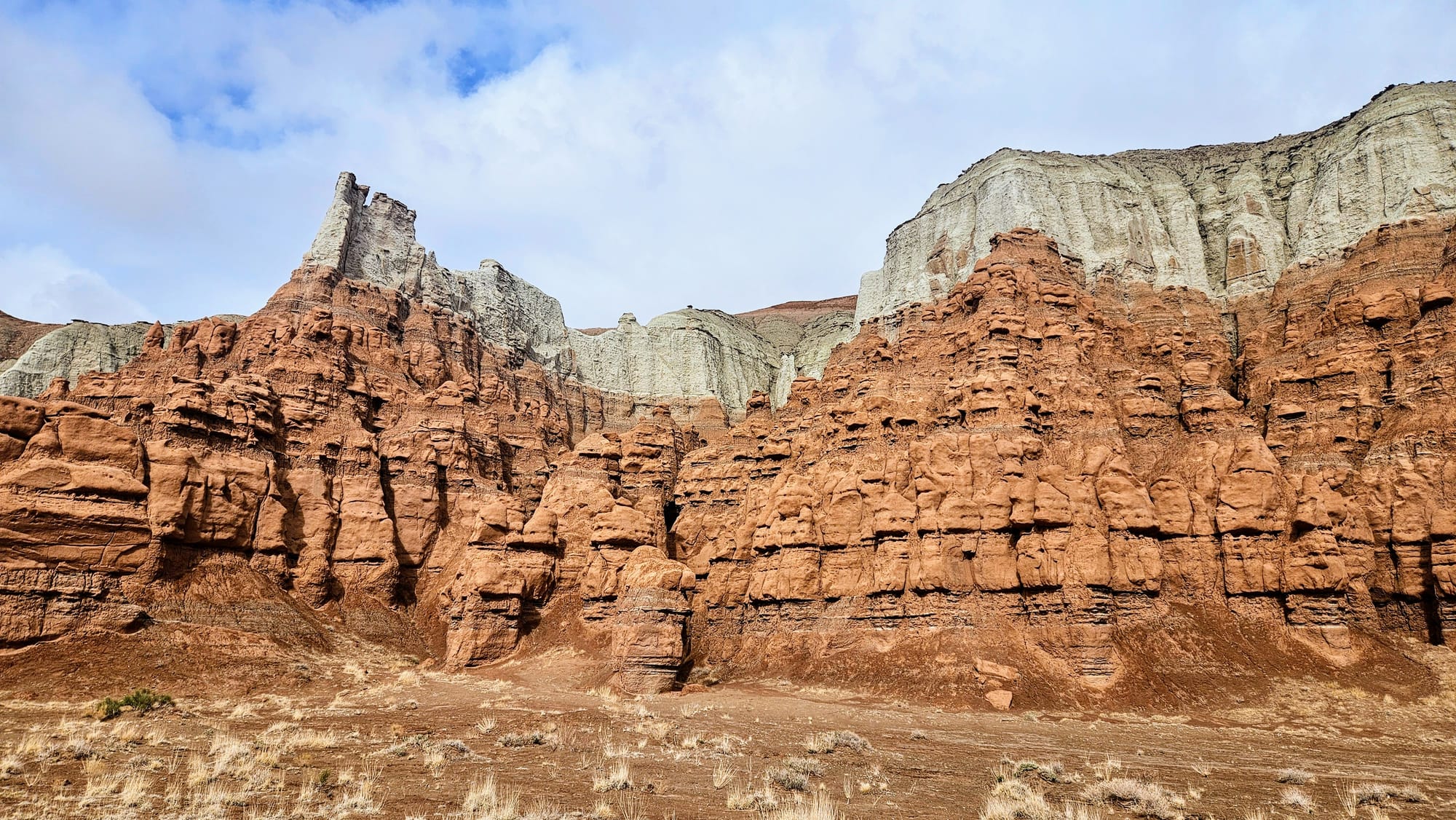
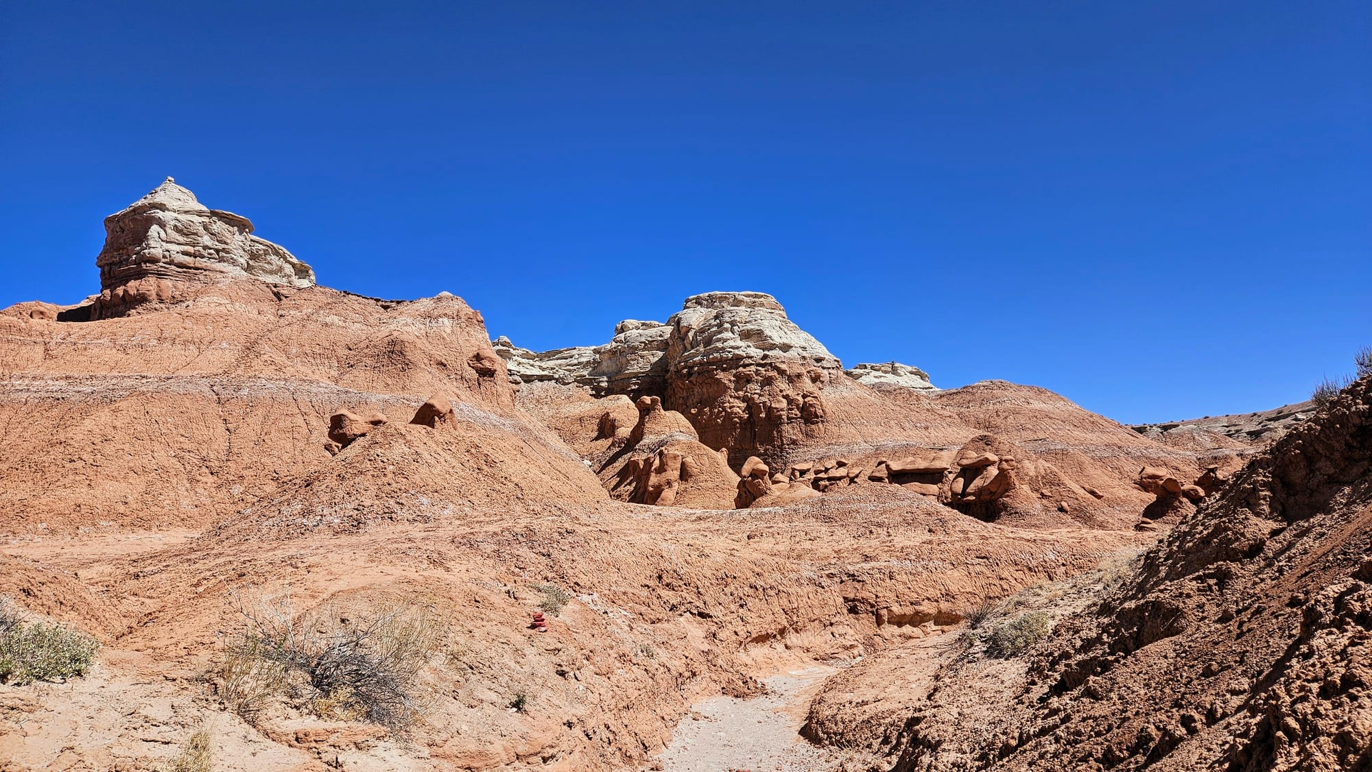
See where the rich brown Entrada sandstone meets the gray Navajo sandstone?
Both within and beyond the state park boundaries are ample places to explore canyons, caves, mesas, and rock formations, but only in Goblin Valley will you find yourself in a totally unique Jurassic Park.
Unique exploration of a unique landscape
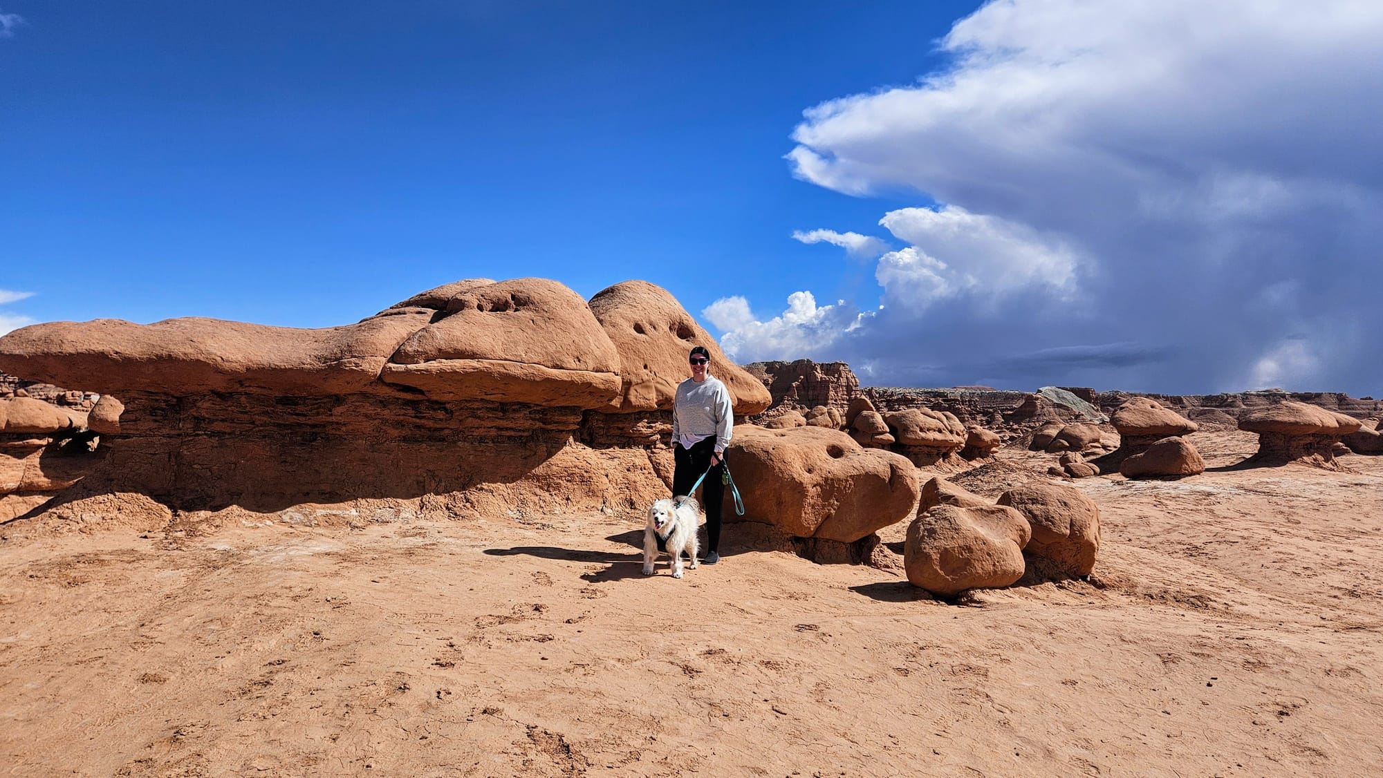
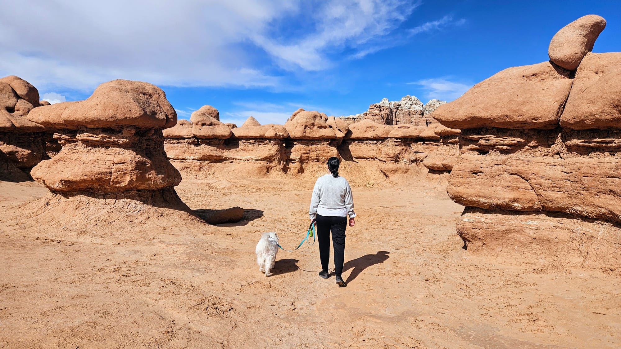
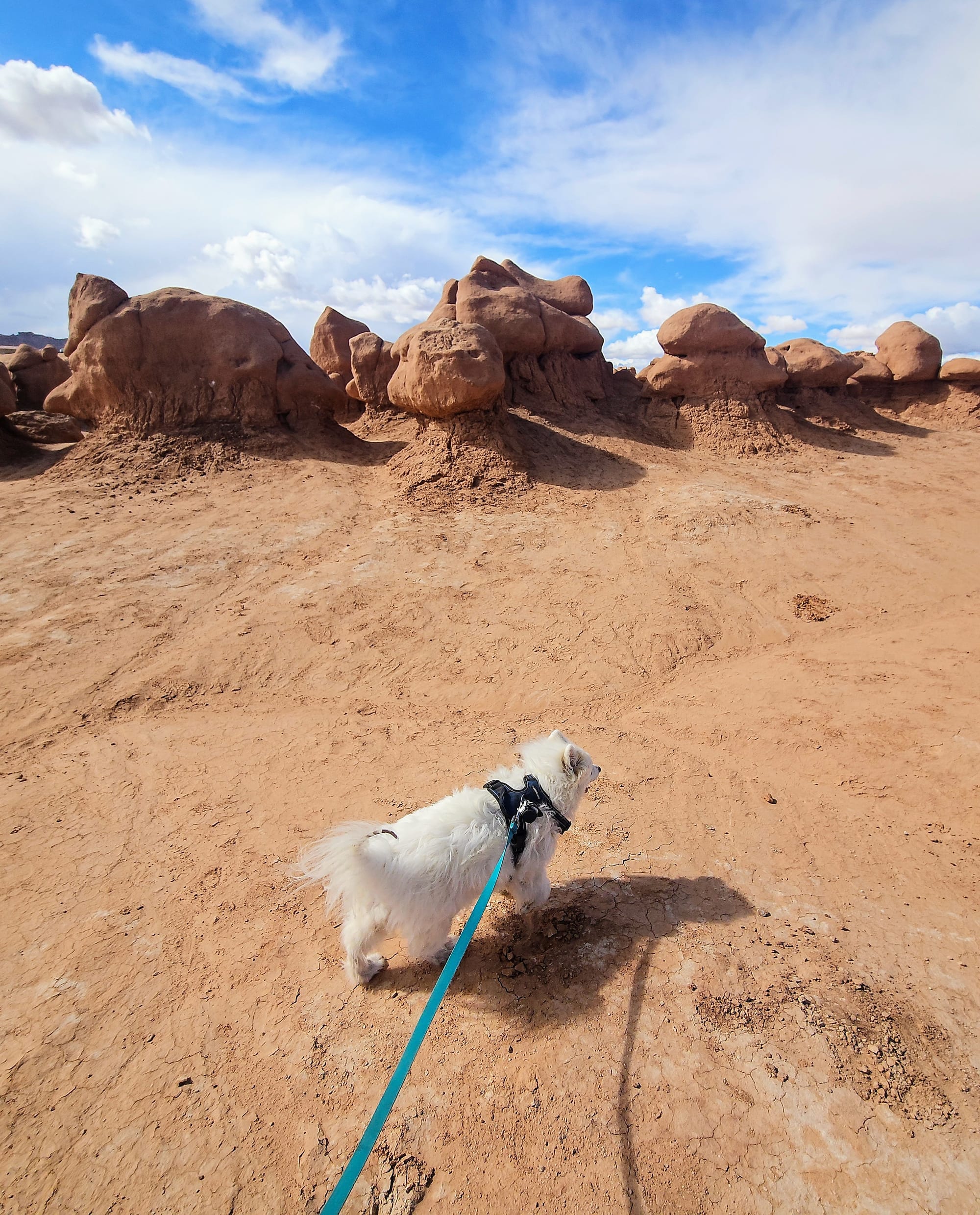
We had gotten so used to treading lightly at the national parks, but Goblin Valley invites you to play. Once you descend into the valley, you are allowed to go wherever the winds take you...as long as you don't take the place of the winds and decimate the formations. However, you can walk and climb among them, and you can even bring your furry friend! Leashed dogs are allowed in the valley and on the state park trails.
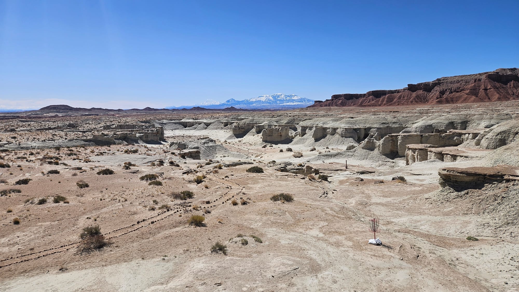
Past Nicole was only half-correct in saying that there are no designated trails. This is true for the valley. All Trails has a few "trails" that you can try to follow, but it's way more fun to just romp around among the hoodoos. Other parts of the state park do have designated trails, though, for hikers and mountain bikes. There is even disc golf, and I must say, it is probably the coolest – and hardest – disc gold course I've ever seen in my life!
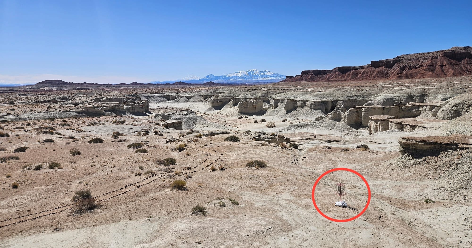
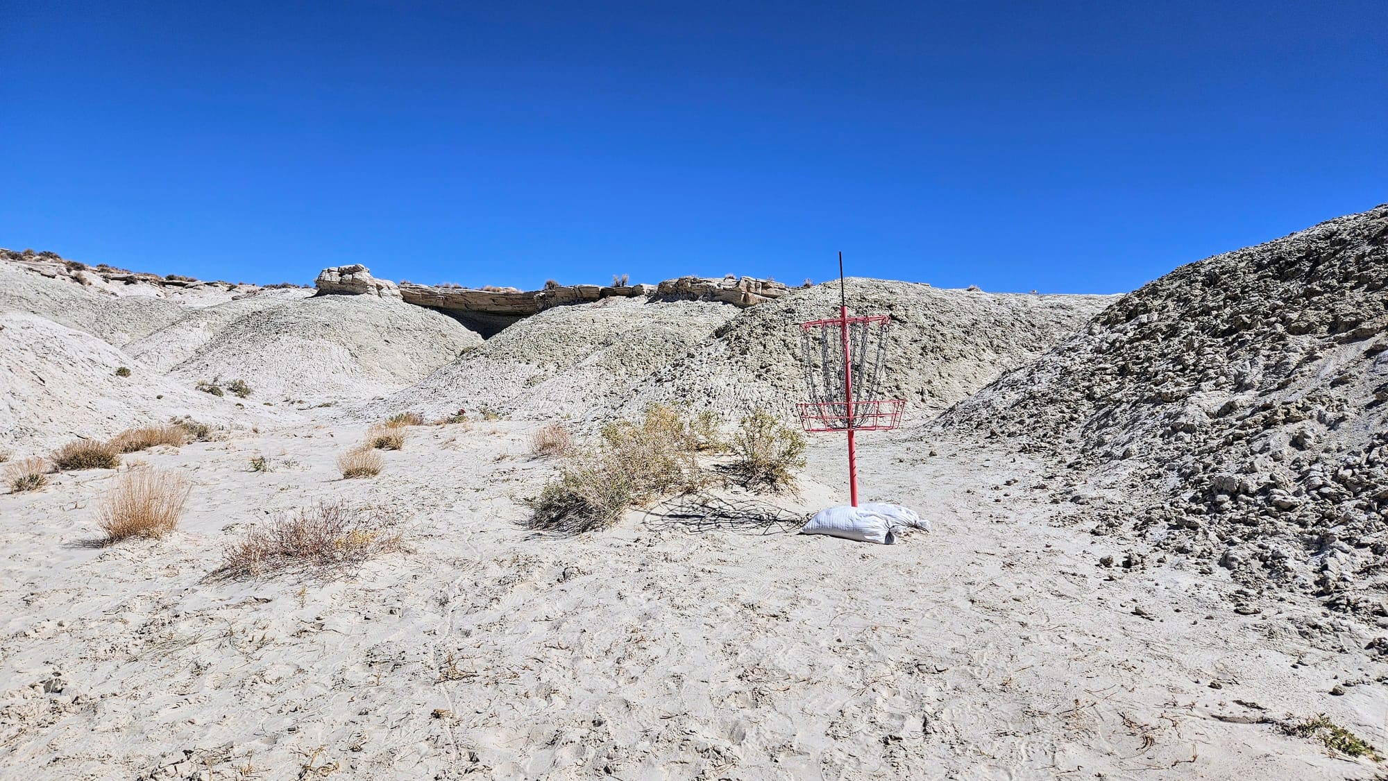
Nothing to see here. Just a disc golf course on the rim of a canyon.
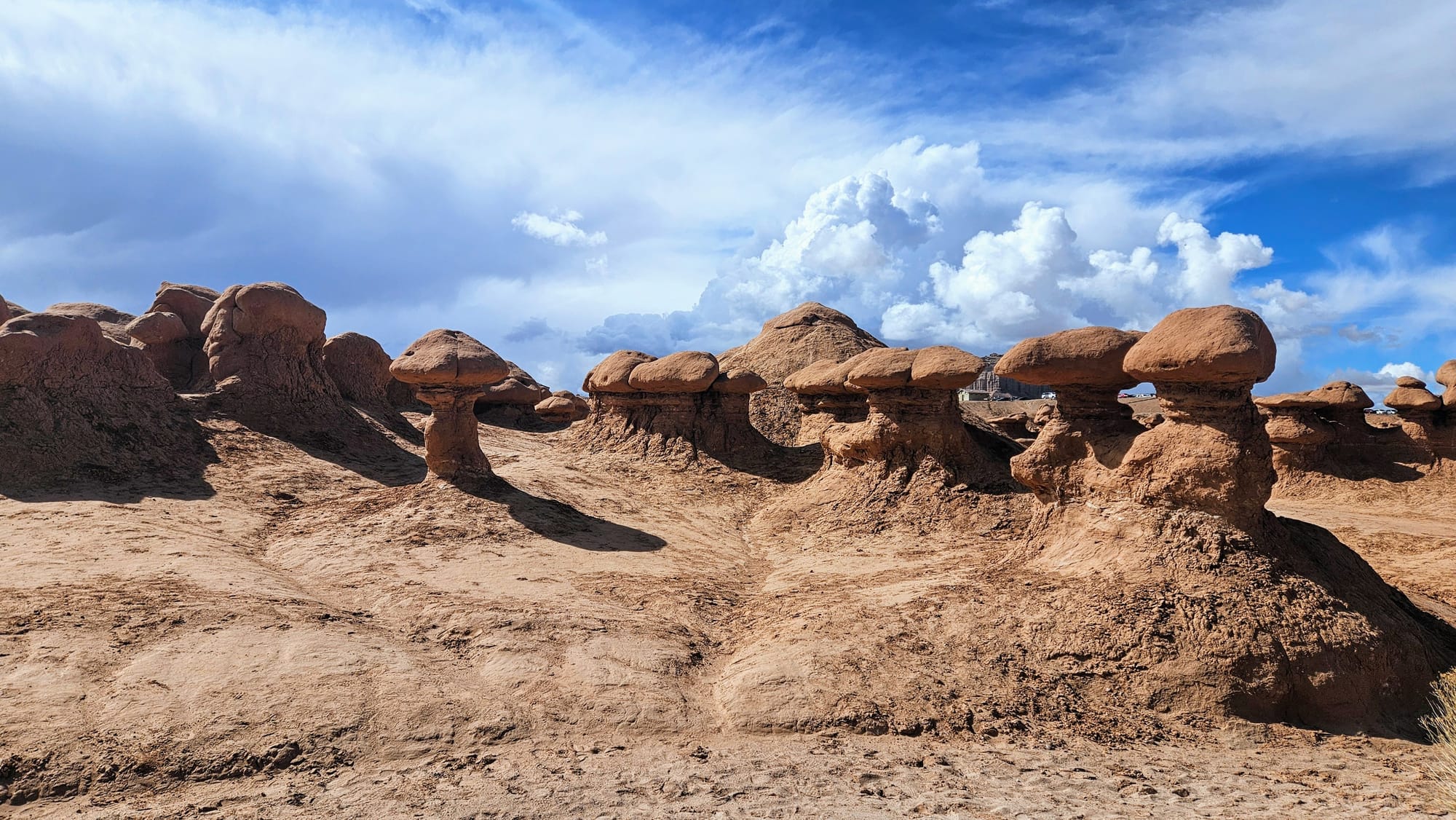
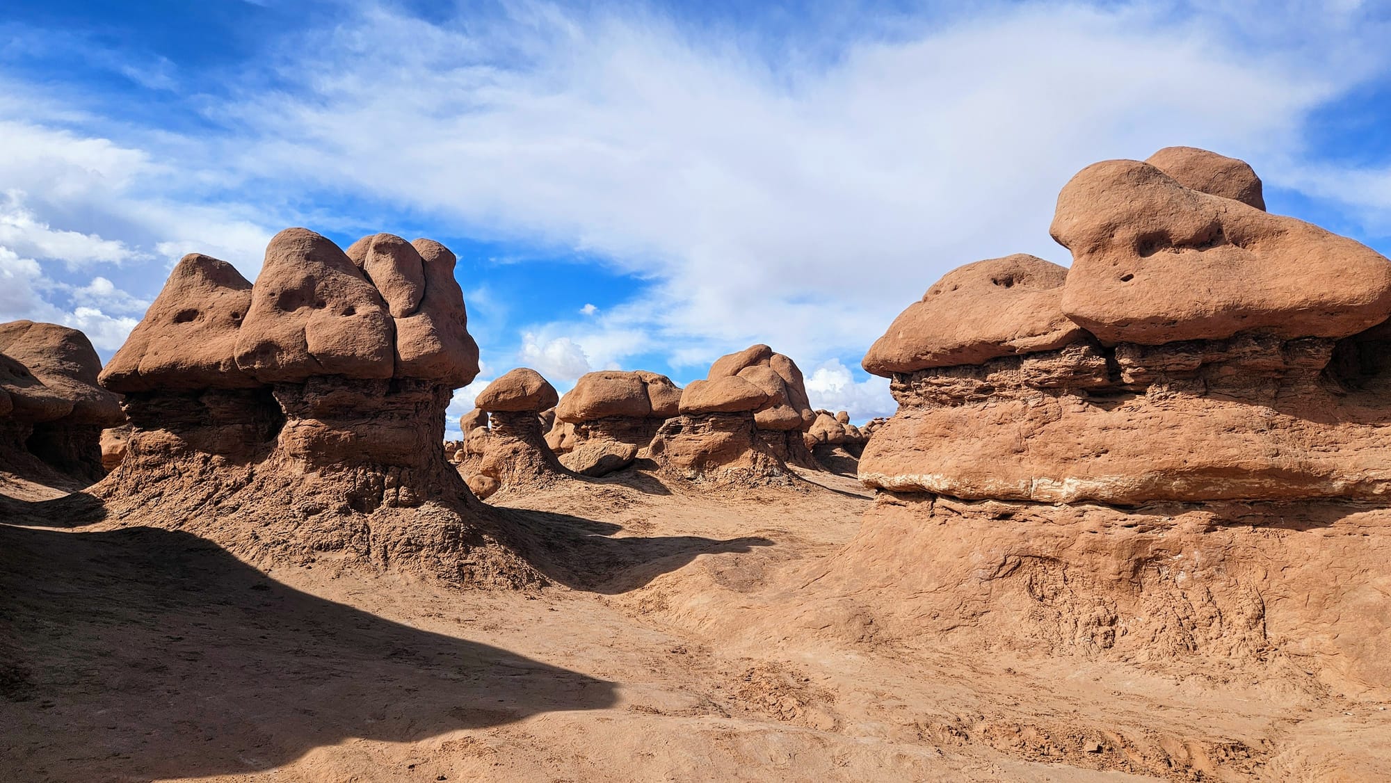
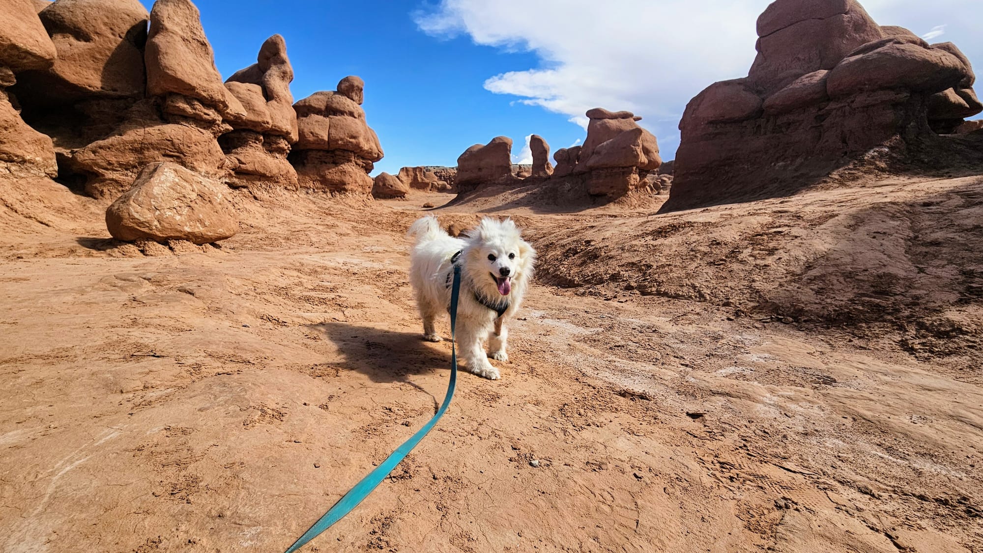
Valley of the Goblins
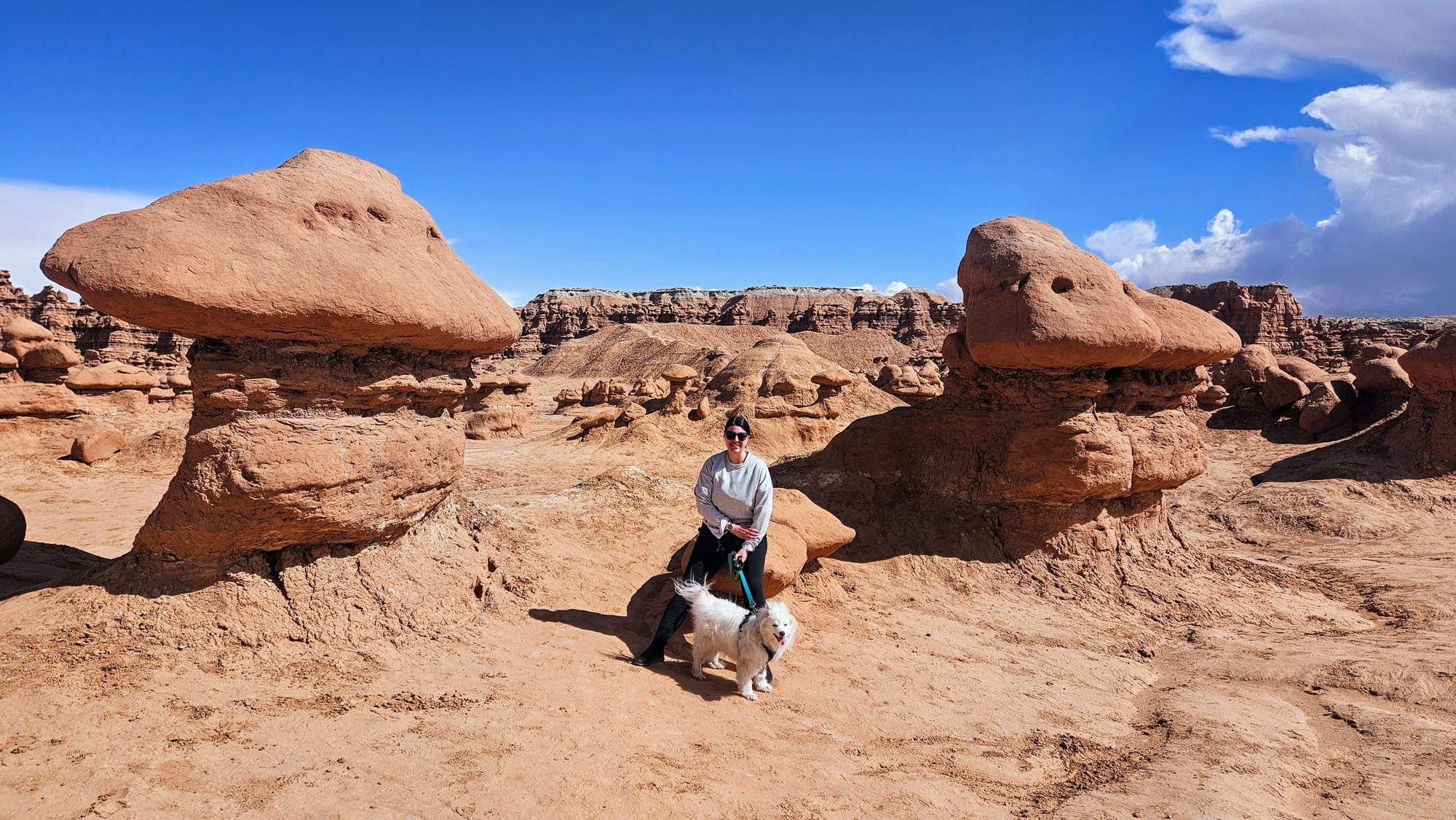
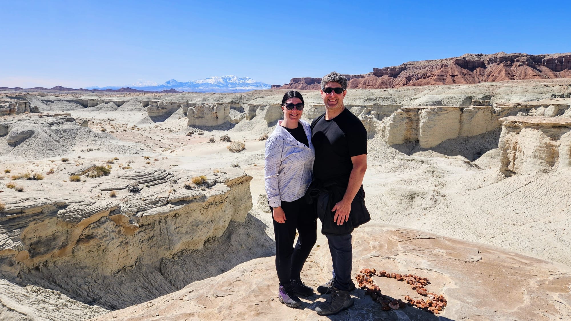
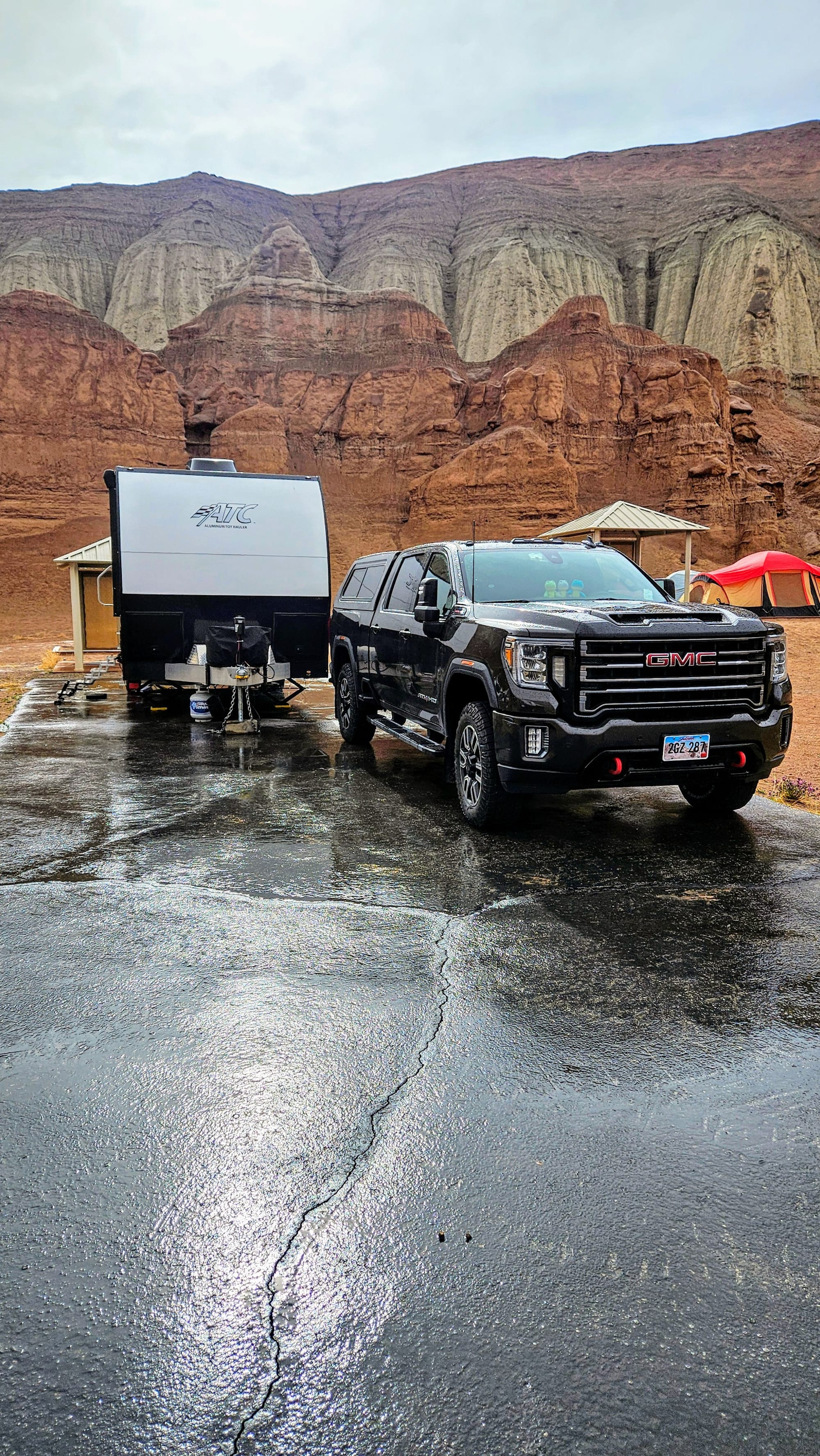
The winter storms followed us to Goblin Valley on our drive day, but thankfully they rolled out that night, giving us beautiful weather for our two days of exploring. Our first full day at the park was on a Friday, and we had just enough clouds to shield us from the intense desert sunshine. We think our fellow visitors were also happy to have nice weather, because they came out to the valley in droves. When we arrived to the main parking lot, only a few spots were left. There is a picnic area and overlook of the hoodoos, but the real fun starts when you descend a staircase into the valley.
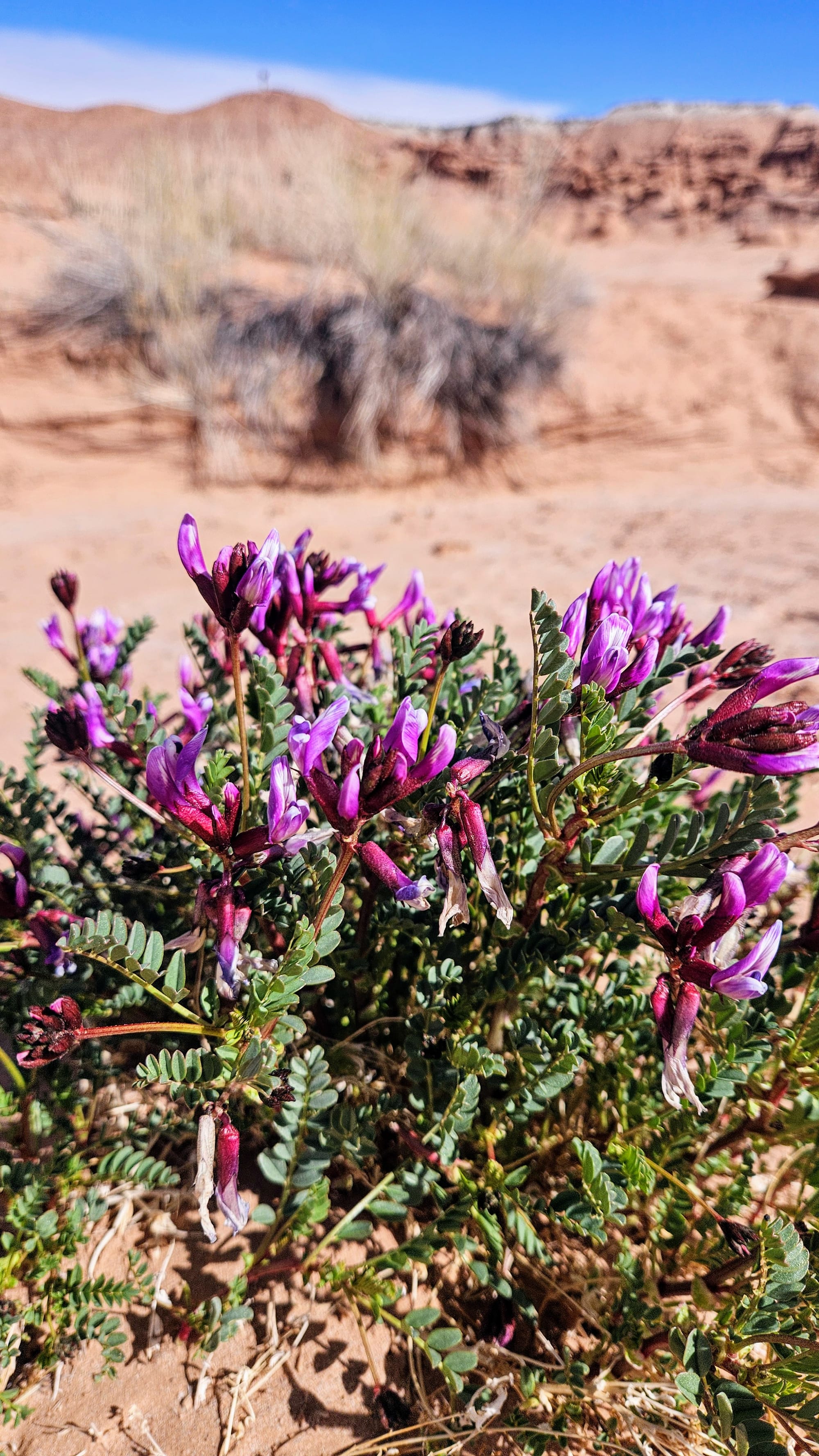
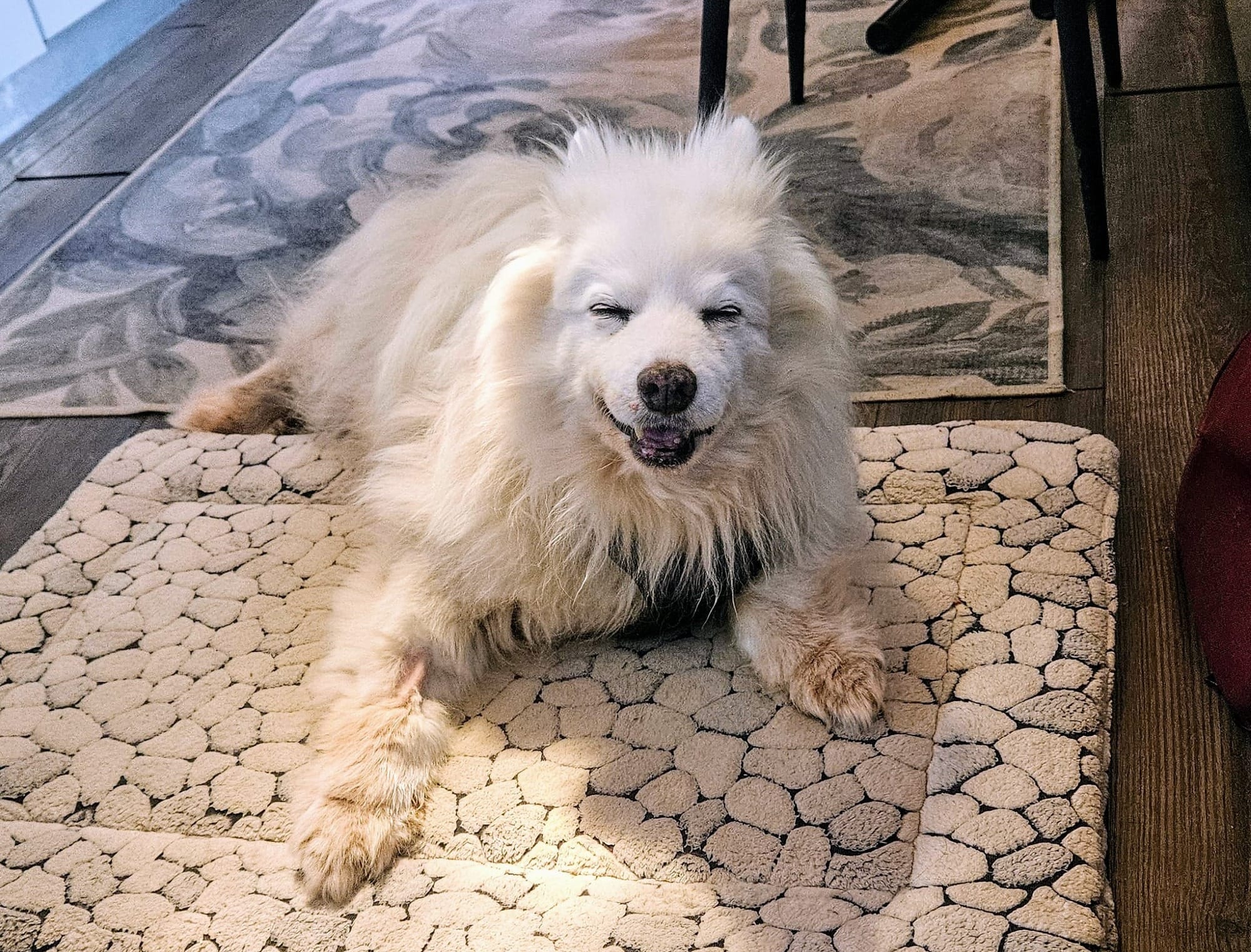
Our dog, who has decided to age backwards this year in his sister's honor, joined us for our exploration. We meandered all around the hoodoos, in and out of washes and up between the formations. Some flowers on the valley floor were starting to bloom for spring, and in the distance we were surrounded by tall mesas. In our travels, we always remember fondly the places that transported us to another planet. Valley of the Goblins does just that. That flying saucer of a storm cloud helped set the mood even more. We swear we had nice weather this day!
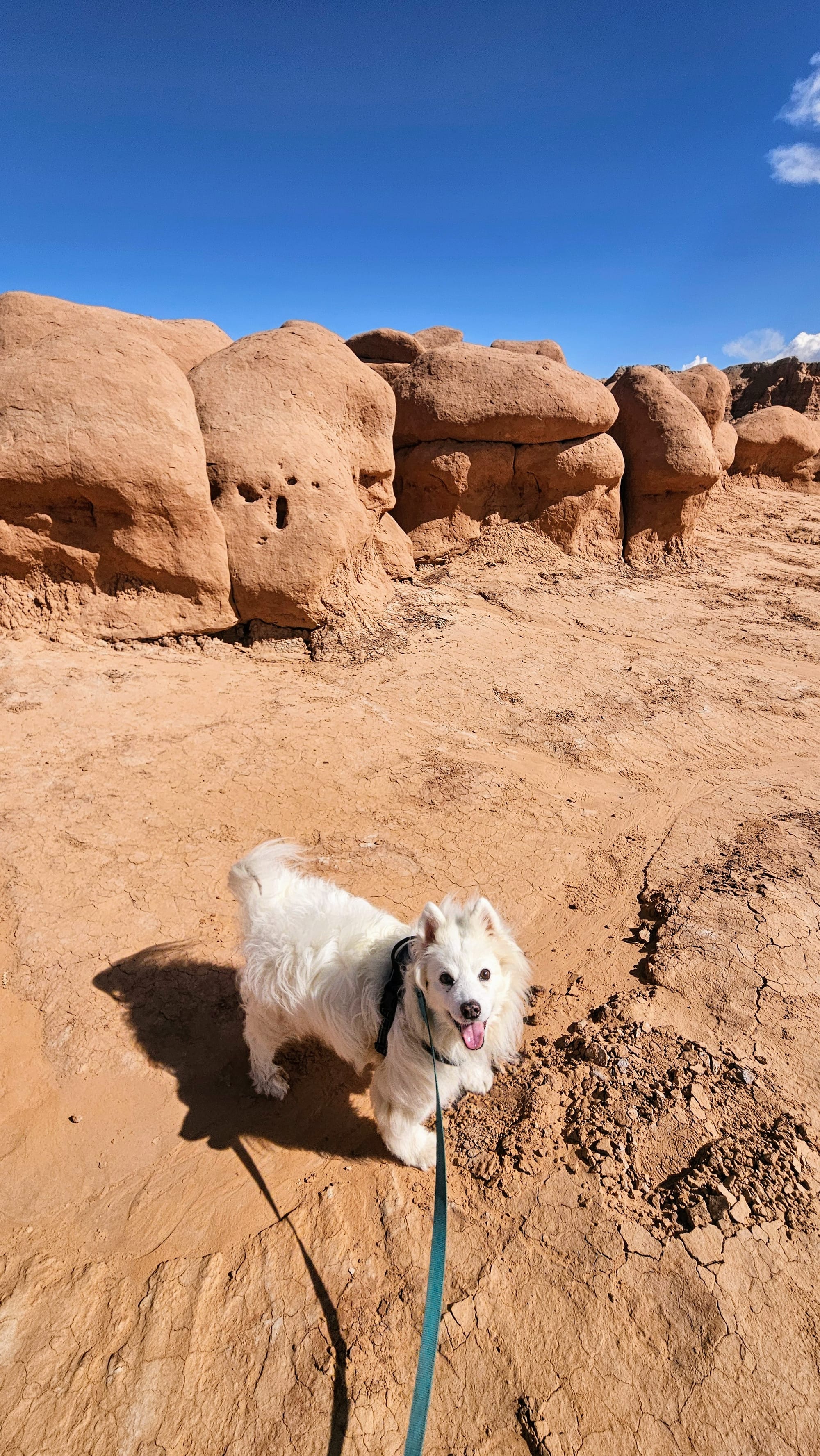
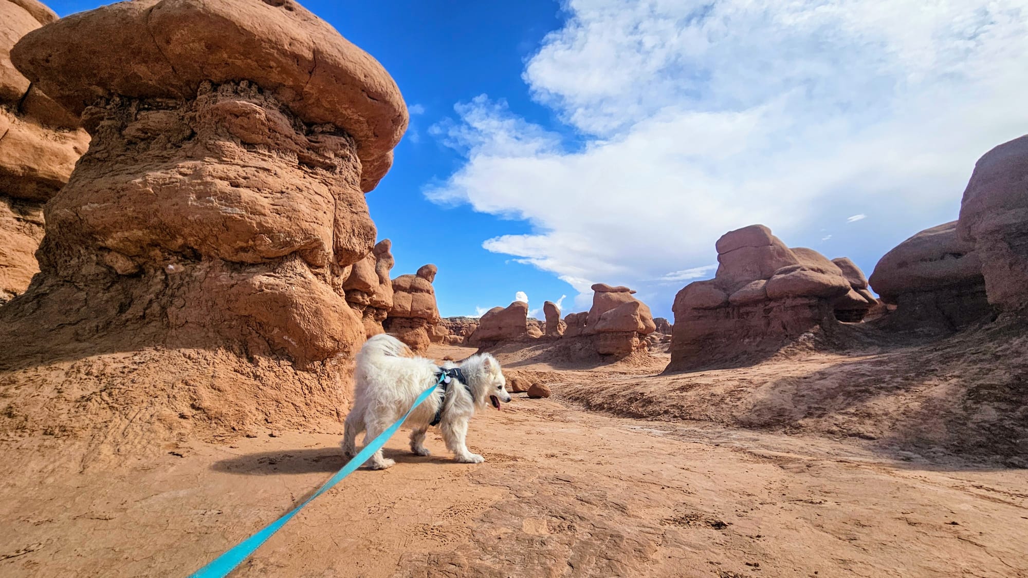
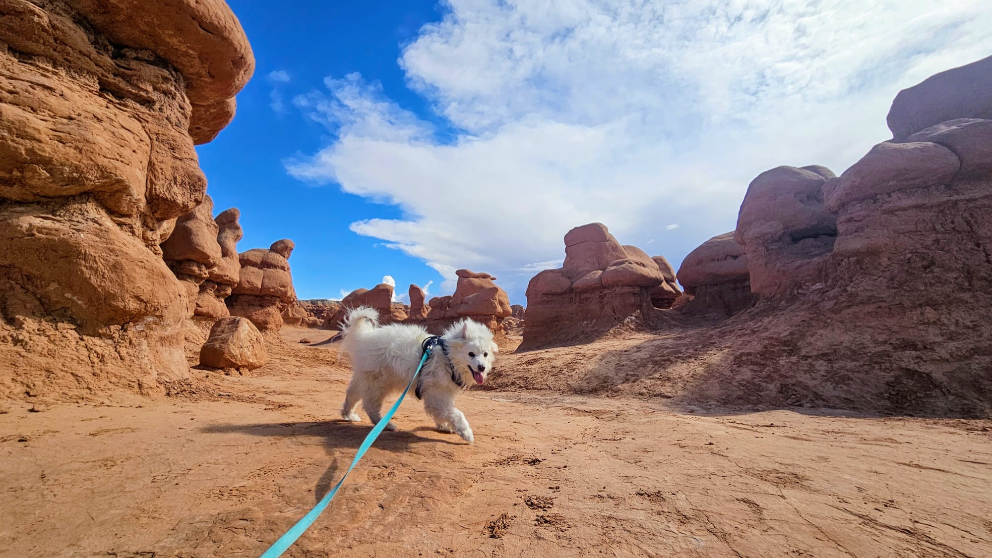
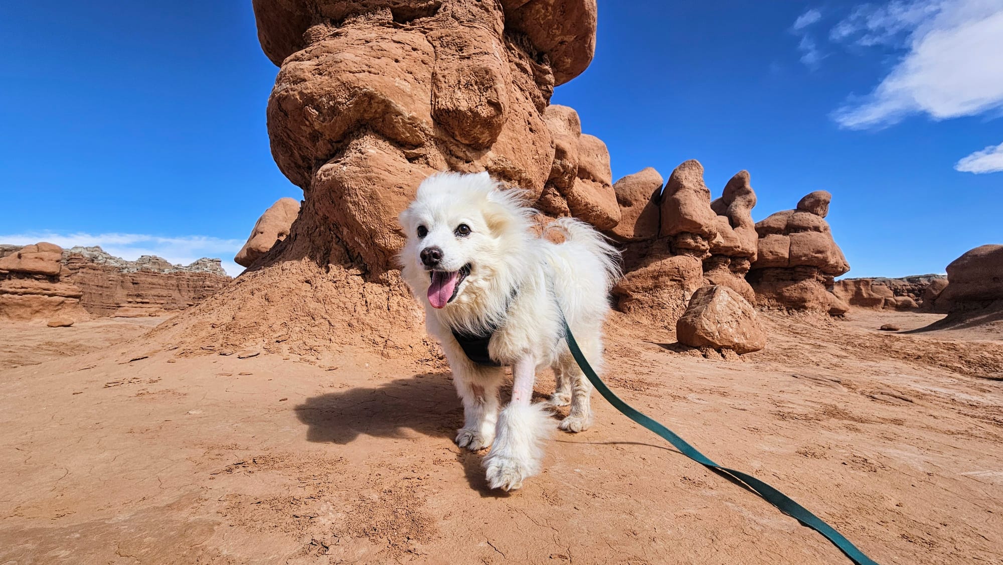
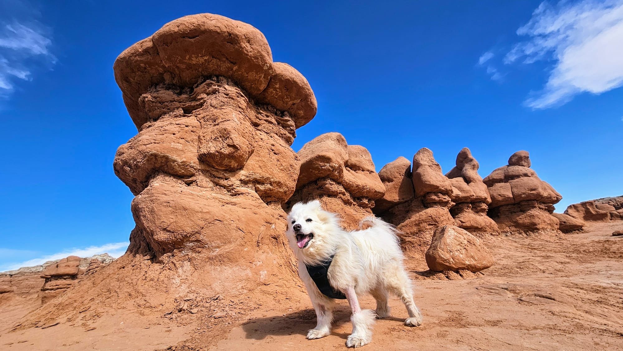
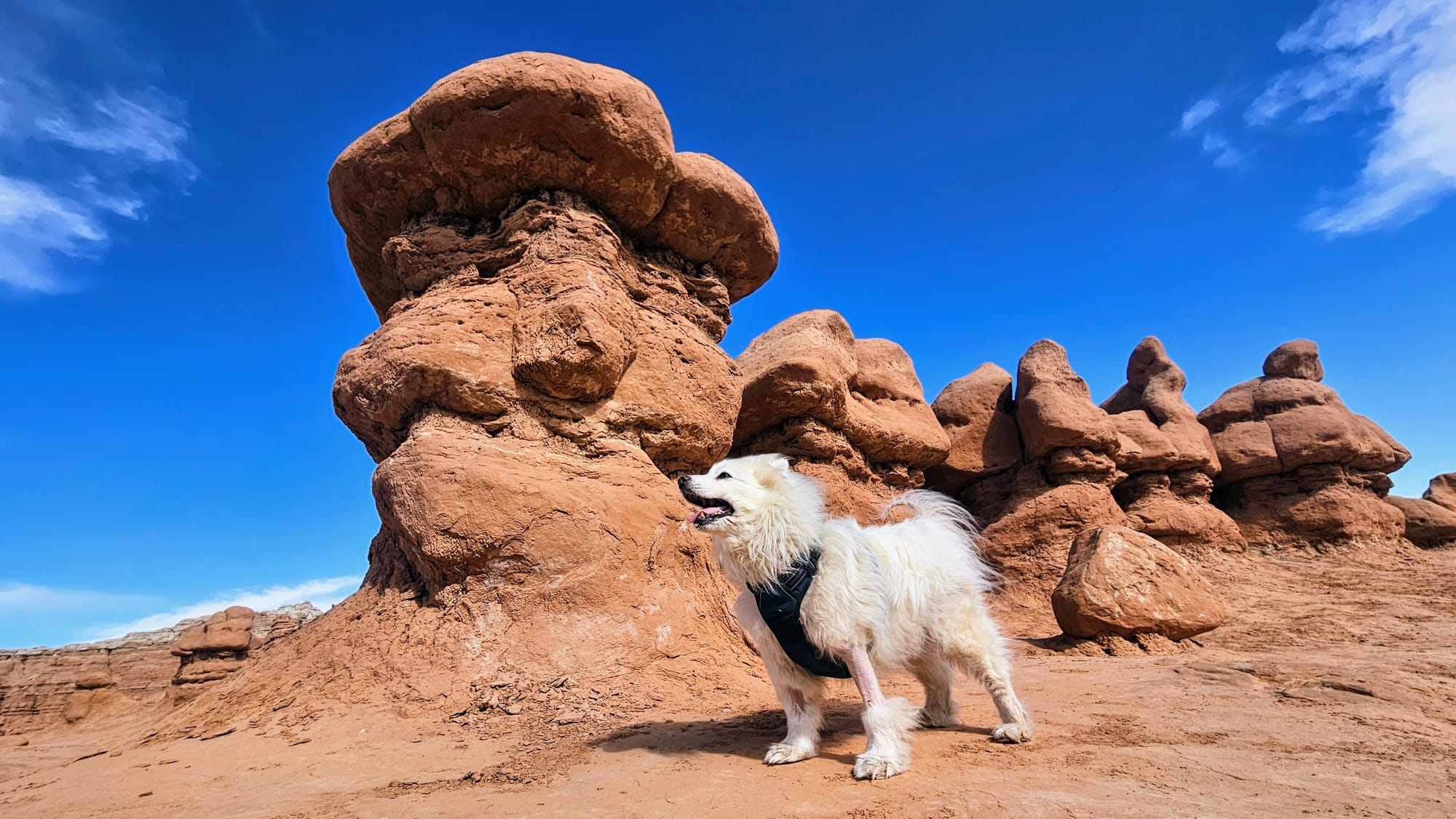
Tanner beauty shots! Leash off only for the photos.
Our poodle-legged pup is officially turning the color of sandstone, but since he's still recovering from his surgery, he can't get groomed. He's a walking demonstration of just how easily the sandstone blows in the wind! Guess now his name finally makes sense because he's a lot tanner than he was before.
A hike for the ages, and through the ages
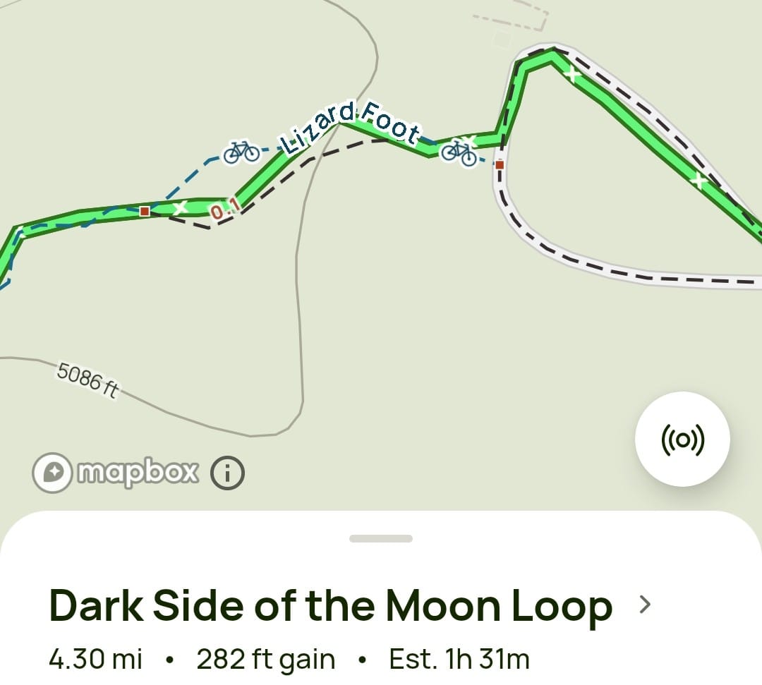
Our final day at Goblin Valley called for no rain and bright sunshine. We were itching to take a real hike. We checked All Trails and decided on the Dark Side of the Moon loop, 4.3 miles through the Curtis formation. Instead of driving to the trailhead, we opted to walk from the campground, taking part of the Entrada Trail and adding another half-mile to our trek each way.
We needed to follow the All Trails map closely to find our way. The trail signs at the upper parking lot mentioned the Curtis Bench Trail, and the rest were mountain bike trails. Looking closely at the map, we saw that we were supposed to share part of our hike with the bikes, and so we continued up a small hill, until we reached another juncture. The Dark Side of the Moon Trail is listed on All Trails, but to reach it we'd need to first take Lizard Foot and then Desert View.
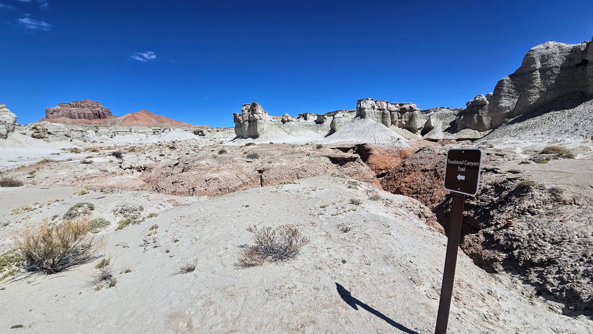
The next juncture was at Toadstool Canyon Trail, the canyon whose rim we were standing on. This was also the start of the disc golf course. We stopped on the rim to take a few pictures before heading back up to Lizard Foot.
Just then, a family with two young girls came through on their mountain bikes. Even though we were the only two groups there, we struggled to share the narrow trail. The little girls wanted to go fast down the hills, and so we'd move over for them to speed past us. Then they'd struggle going up the hills, at which point we'd pass them. After a couple of back-and-forths, we decided to change course. We didn't want to ruin their good time, and we also wanted to go at our own pace without constantly watching our backs for bikes.
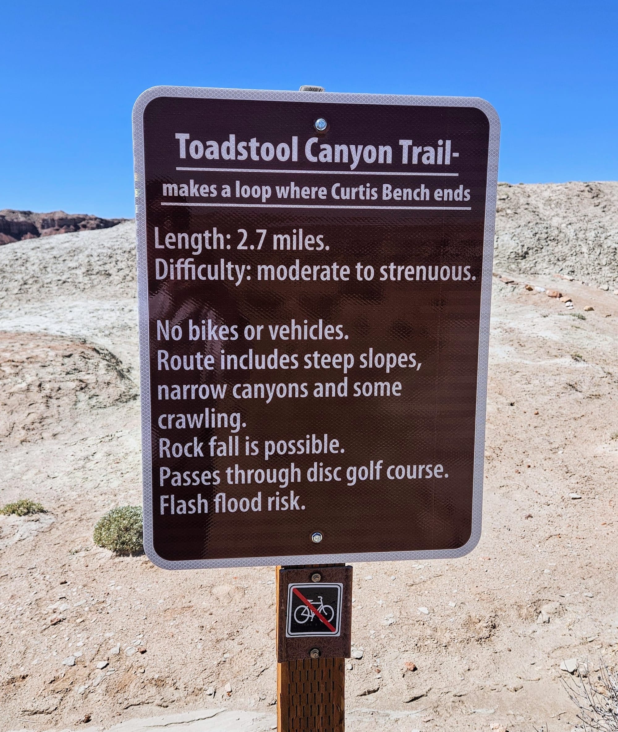
We thought Toadstool Canyon Trail looked great, and the sign said it was only 2.7 miles. Shorter than we planned to do, but according to the sign, also more strenuous. We saw it as an even exchange. And, since the trail loops back at Curtis Bench, perhaps we could tack on some more distance on part of the Curtis Bench Trail.
Our surprisingly rare day of 0% chance precipitation paid off, because our impromptu change of plans led us straight into the canyon.
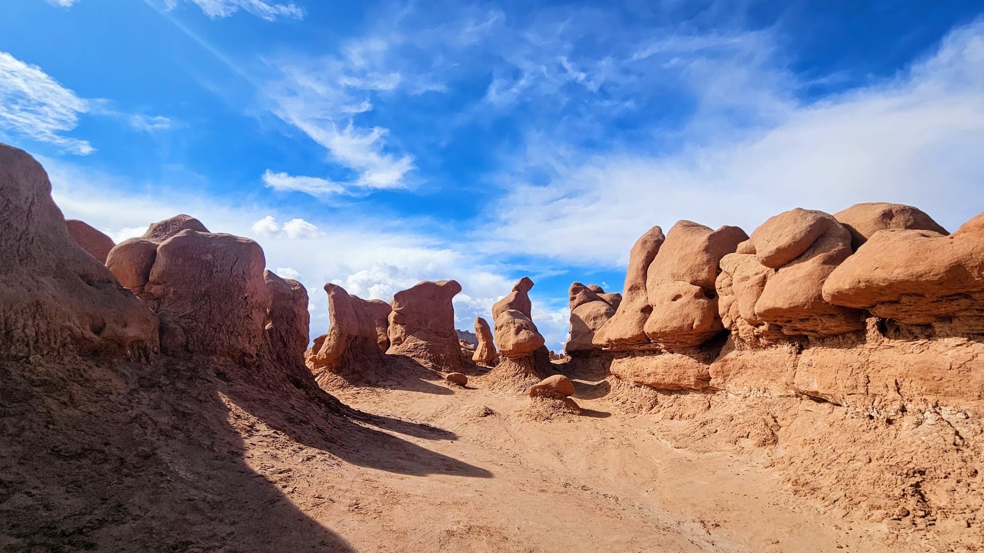
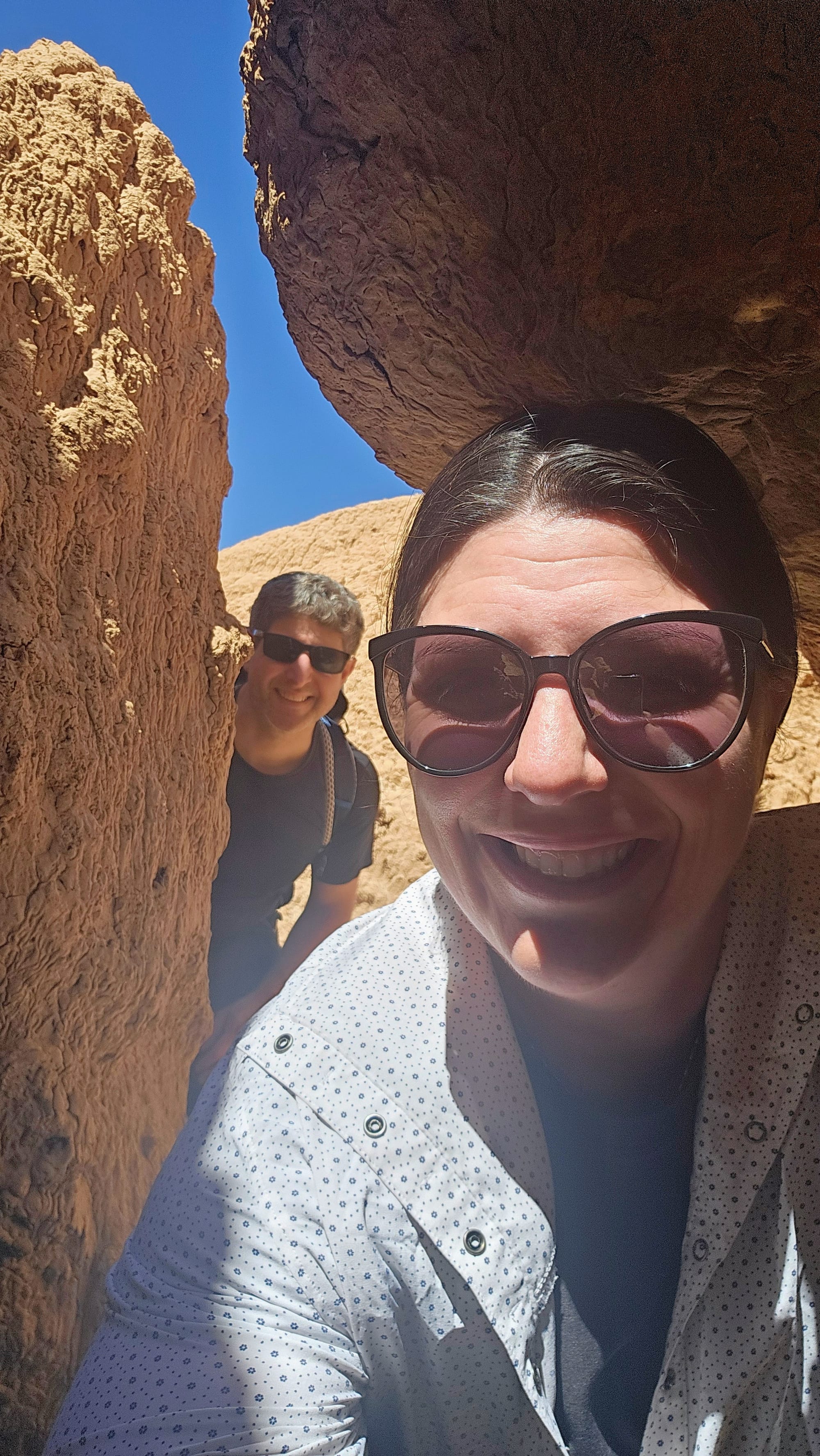
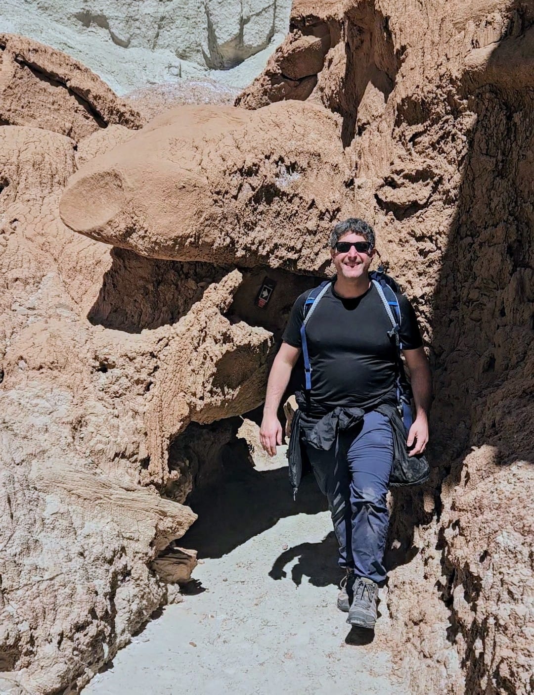
The first part was an absolute delight! We weaved our way through the canyon, crawling under the rocks, and seeing the textures of the sandstone up close.
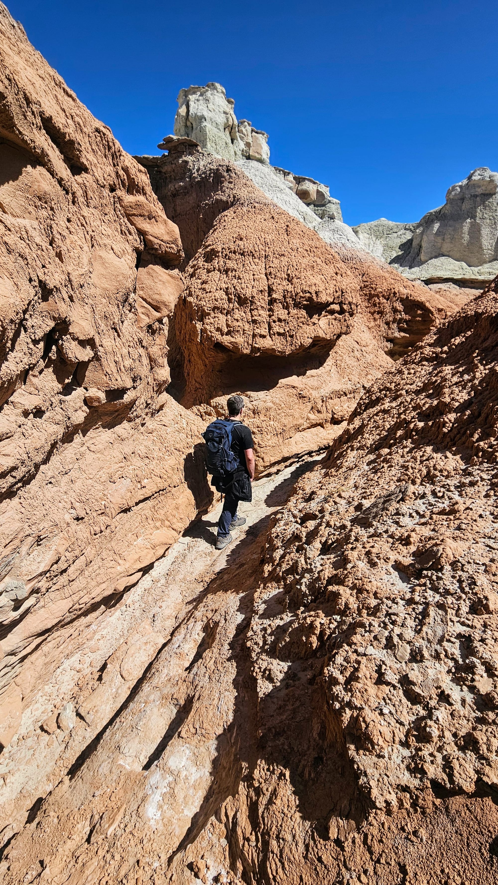
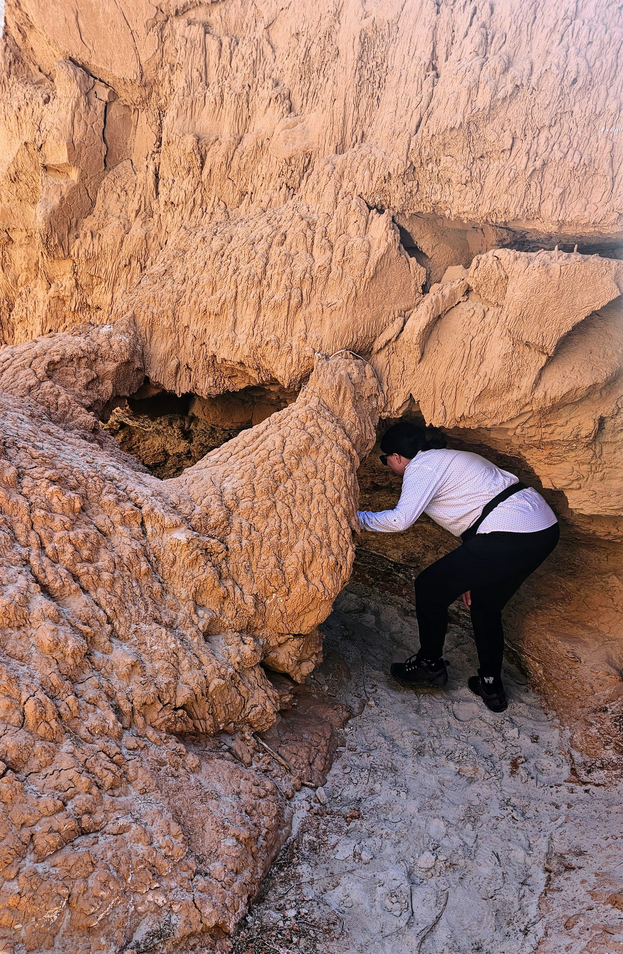
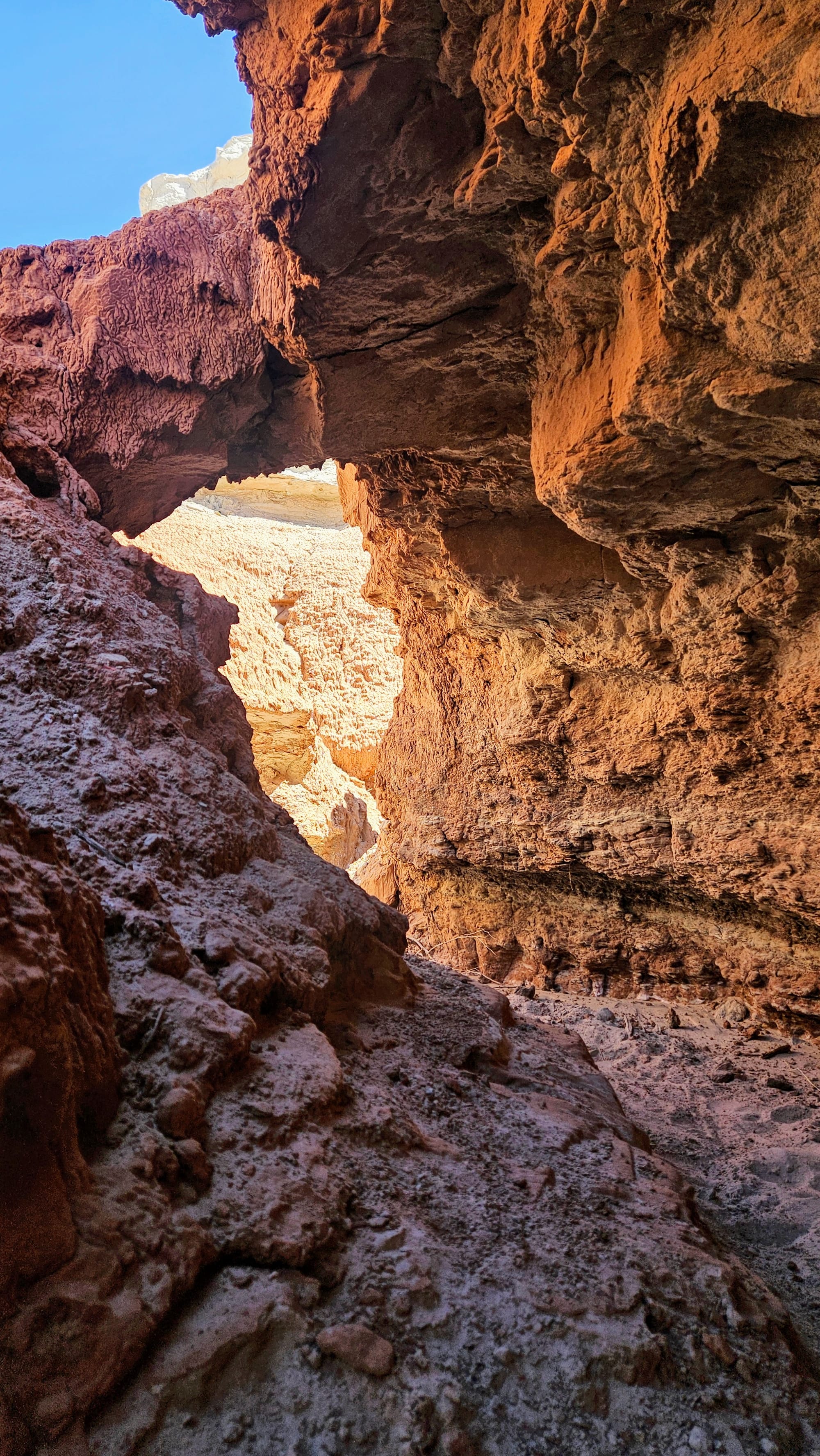
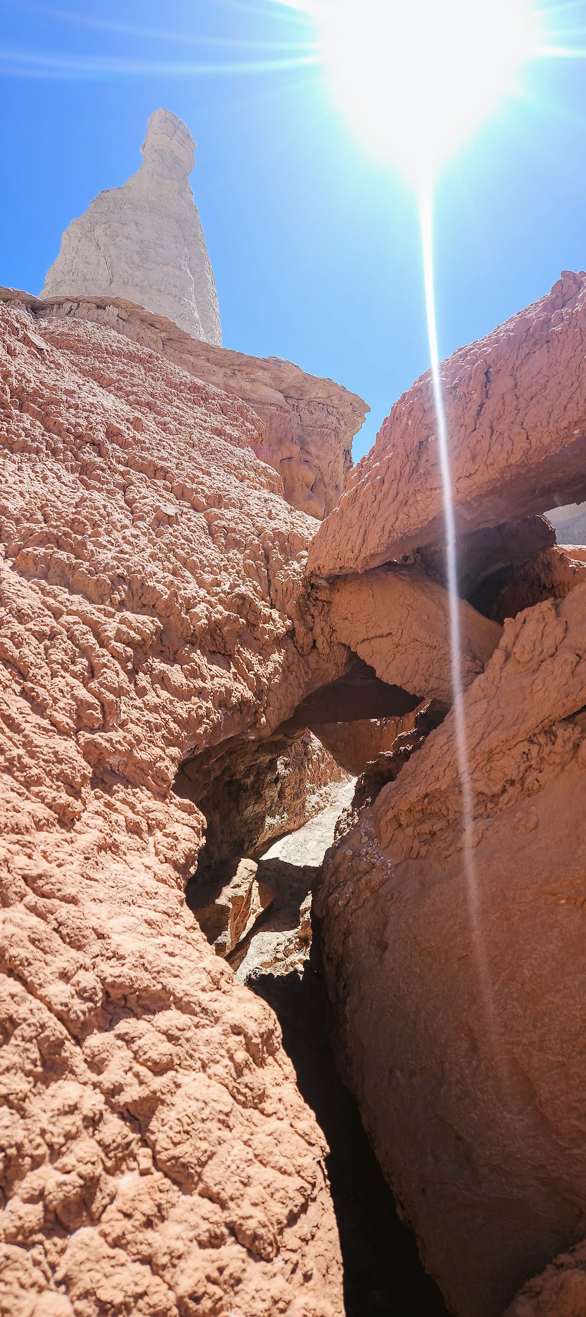
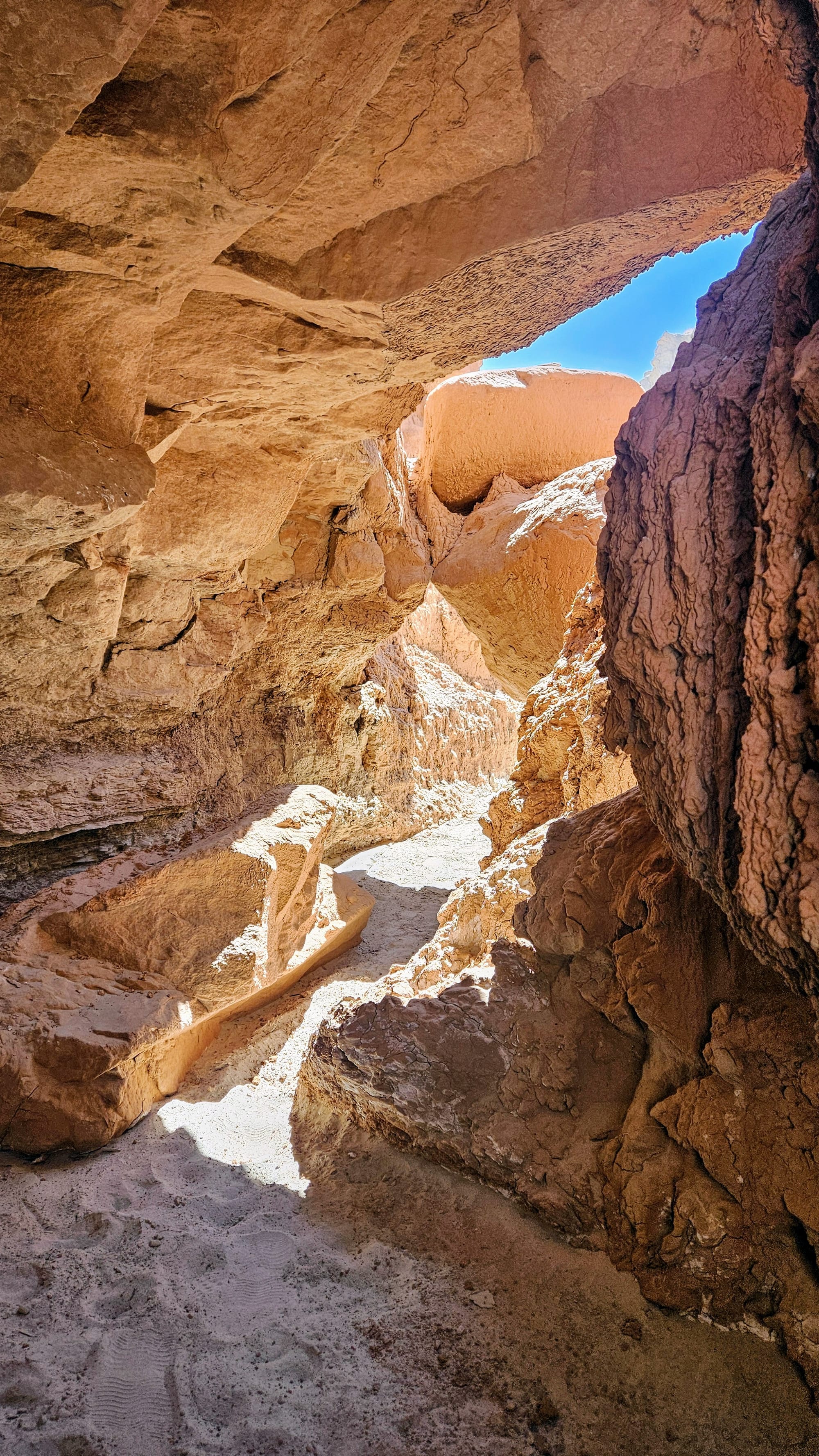
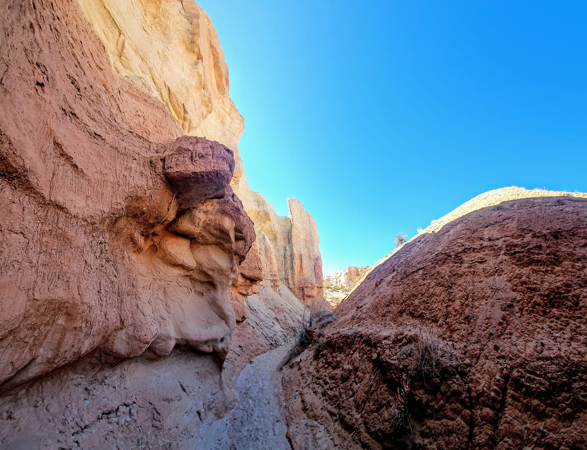
Then we hiked the wash, where we saw all the shimmering minerals of the Curtis formation. Our inner geology nerds went wild. The best part was seeing what looked like hard sandstone layers, only to touch it and have it crumble in our hands.

Soon, we re-entered the Entrada formation, and little goblins began popping up around our path.
We were so distracted by our surroundings, that soon we realized that we had traveled 2.25 miles and still hadn't seen Curtis Bench. Wasn't this supposed to be a 2.7mi trail total? I checked the map, and it had us so far past the Curtis Bench Trail, that if we kept going, we'd soon hit the park boundary.
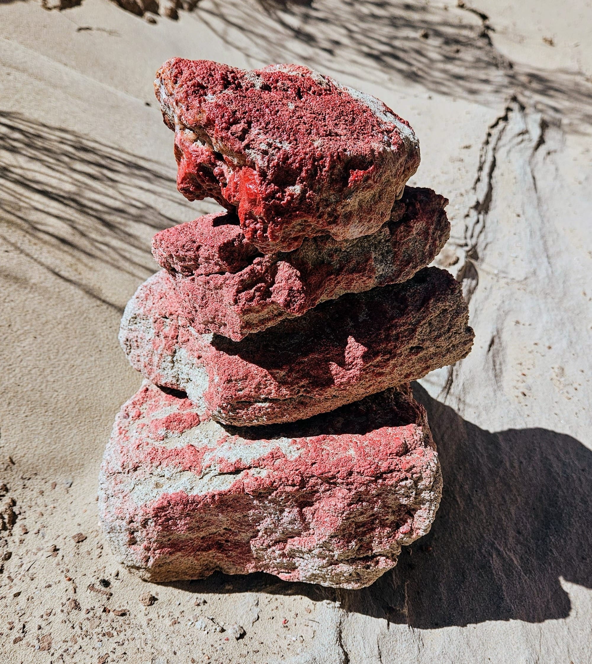
We turned around and tried to retrace our steps back to where the Curtis Bench Trail is on the map, but our trail never even got close to it. Almost a half-mile after turning around, we began seeing trail markers again. For most of the trail, posts and red painted cairns dotted the way. It's also an easy trail to follow because it goes along the wash. What was confusing, though, was that the first post we found was facing us, with an arrow pointing in the direction we just came from. Did that mean we were still on trail? But if we were, then why did all the trail markers stop after that?
Totally confused, we had no choice but to retrace our steps all the way back out to the Toadstool Canyon trailhead. Along the way, we saw no evidence that we ever took a wrong turn. We saw more trail posts and cairns, plus the end of the disc golf course. We saw signs (now facing us) telling us we were on the Toadstool Canyon Trail.
We wanted a longer hike, and we got it. Including our Entrada Trail hike from the campground, we should have clocked somewhere between 3.7 and 4 miles. We ended up clocking 5.25.
There was only so much we could do to try and figure out how we had gone so far beyond our expected distance. We had no cell service, so could only use the All Trails maps we had downloaded. Toadstool Canyon wasn't one of them. When we got back to our campsite, we discovered why. Toadstool Canyon Trail isn't even on All Trails! It's also not on the hiking trail map of the state park. However, we did find a description of it on the state park website, very similar to what the trailhead sign said. 2.7 miles total, moderate to strenuous, don't go in the rain or you'll die.
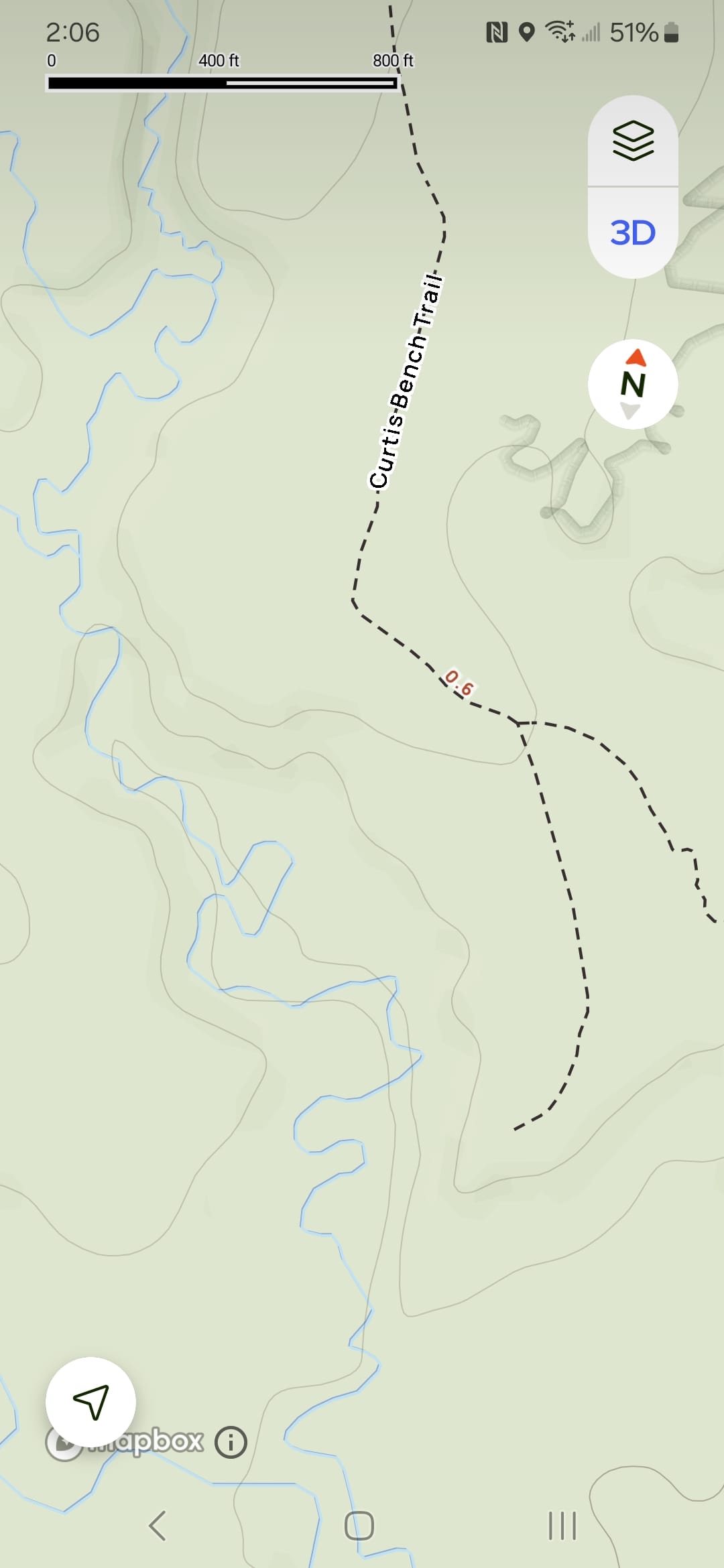
The whole "loops at Curtis Bench" thing is the most confusing part. Curtis Bench is on a totally different elevation. Based on the topographical map, it looks to be at least 60ft higher than the canyon wash. In Navajo sandstone territory, not Entrada sandstone territory, where we were. And there was absolutely no way to climb up there without destroying delicate formations. Do the state park staff think we can fly?
We determined that "loops at Curtis Bench" maybe didn't mean the trail. Perhaps whoever wrote the trail description (someone who is clearly not a hiker) meant that if you look up and see Curtis Bench, this is where the trail loops. Only, did we ever see a loop? No. Well, maybe. There was one point where the wash split, but we saw no signs or cairns on the other split.
Days later, while researching for this blog post, I came across a post on the Goblin Valley Instagram announcing that the Toadstool Canyon Trail was open. This announcement was made in February. This explains a lot: the trail not being on All Trails or the state park map, and the general confusion around where it actually goes and for how long. It must be a new trail!
Besides the fact that the mystery of this trail left us very frustrated, we would recommend it 100%. This was one of our favorite trails so far this year, and that's saying something. Besides the slot canyon part and the fact that you're walking on sand the whole time, the trail is easy. We would recommend starting at the rim of Toadstool Canyon, descending into the canyon, and walking the wash as far as you'd like. Then, turn around and come back. Or, if you do find the elusive "loop" at the end, please tell us where it is! We just assume that someday, someone will record the trail on All Trails, and we'll solve once and for all the mystery of the Toadstool Canyon Trail.
The Campground
Even though the campground is in the state park, to get to any of the fun attractions is either a hefty walk or a short drive. The campground was very nice, though, and situated us exactly where we needed to be. The sites have no hookups, but there are plenty of central spigots, many that you can reach from your site if you use a long hose. There is also a dump station. Some sites are for tents only. Ours was a long back-in for an RV and also had a tent pad. There are also a couple yurts available for rent. Each site has its own covered picnic table. While we don't have many goblins at the campground, the views of the rock layers are lovely.
The campground fills up quickly, but we saw some dispersed camping just outside the state park boundaries. For RVs, there aren't many other options nearby, unless you want to drive a half-hour from Hanksville.
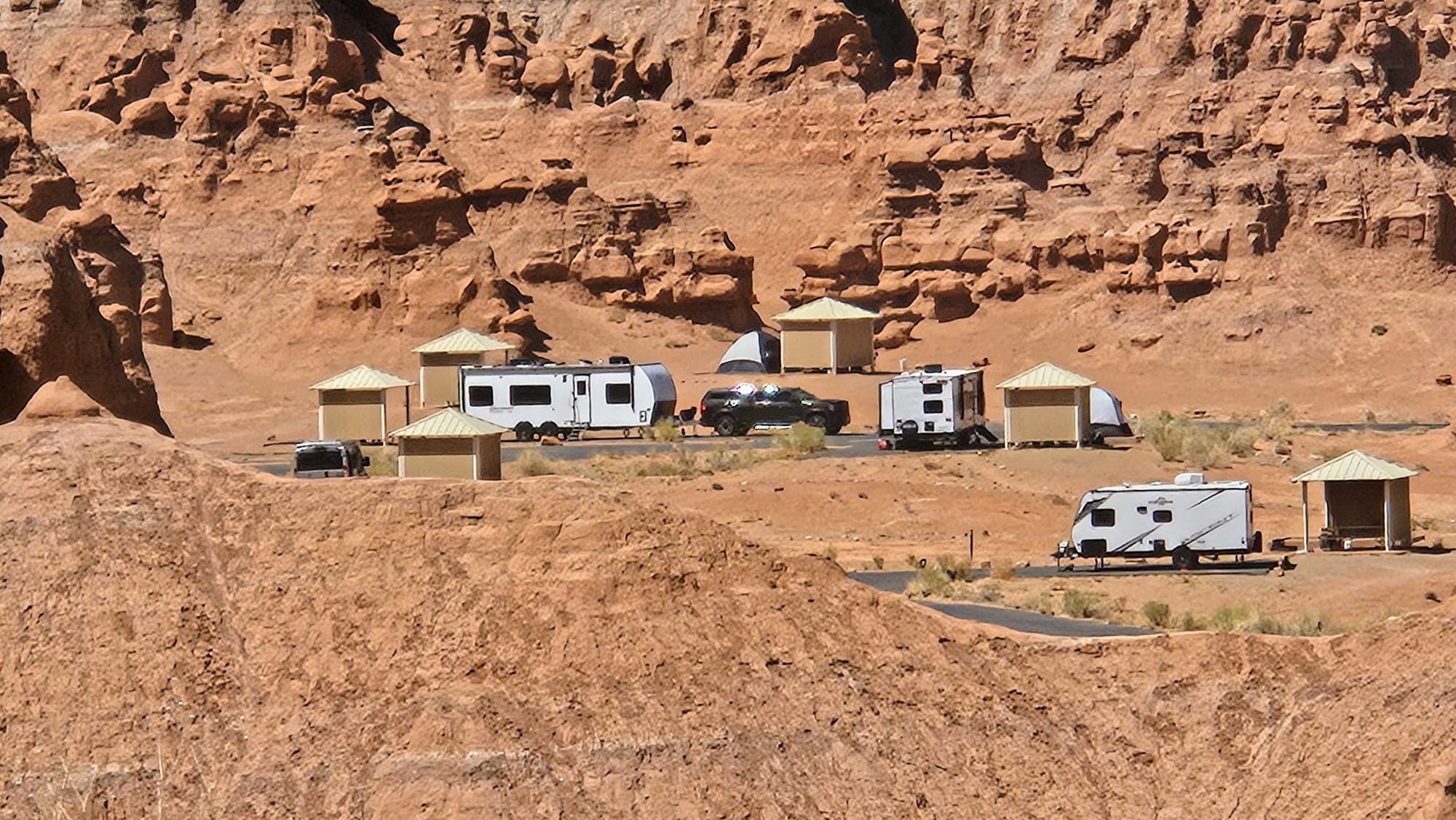
Site #15, no hookups, back-in, firepit, covered picnic table, tent pad
Campground recommended? Yes
Site recommended? Yes
No matter where you land in southern Utah, if you can make it to Goblin Valley State Park, add it to your itinerary. If 2019 Nicole hadn't been dazzled by its weirdness during the Canyon Trip planning, we might have passed this one by. Just another win gifted to us from 6 years in the past.
Sign up for blog post notifications here. Right now, we're doing daily blogs as we recap our Utah Redemption Tour!