Breaking up with the RV Life app GPS already

This post contains affiliate links. We may receive a commission for items purchased through these links. Thanks for supporting our blog!
After a month living in our new cottage in Myrtle Beach, we switched gears again and packed ourselves into the RV for our first official trip as part-time RVers. We won't lie – we were pretty reluctant. Our increased space and stability worked wonders to lift our spirits. We felt ourselves slowly coming back online, but we feared we hadn't had enough recuperating time before hitting the road again.
So when we discovered our first issue before even pulling out of our Myrtle Beach campground, reality hit. Not only were we not emotionally ready to travel again, but we wouldn't even have one of our essential components: our RV GPS.
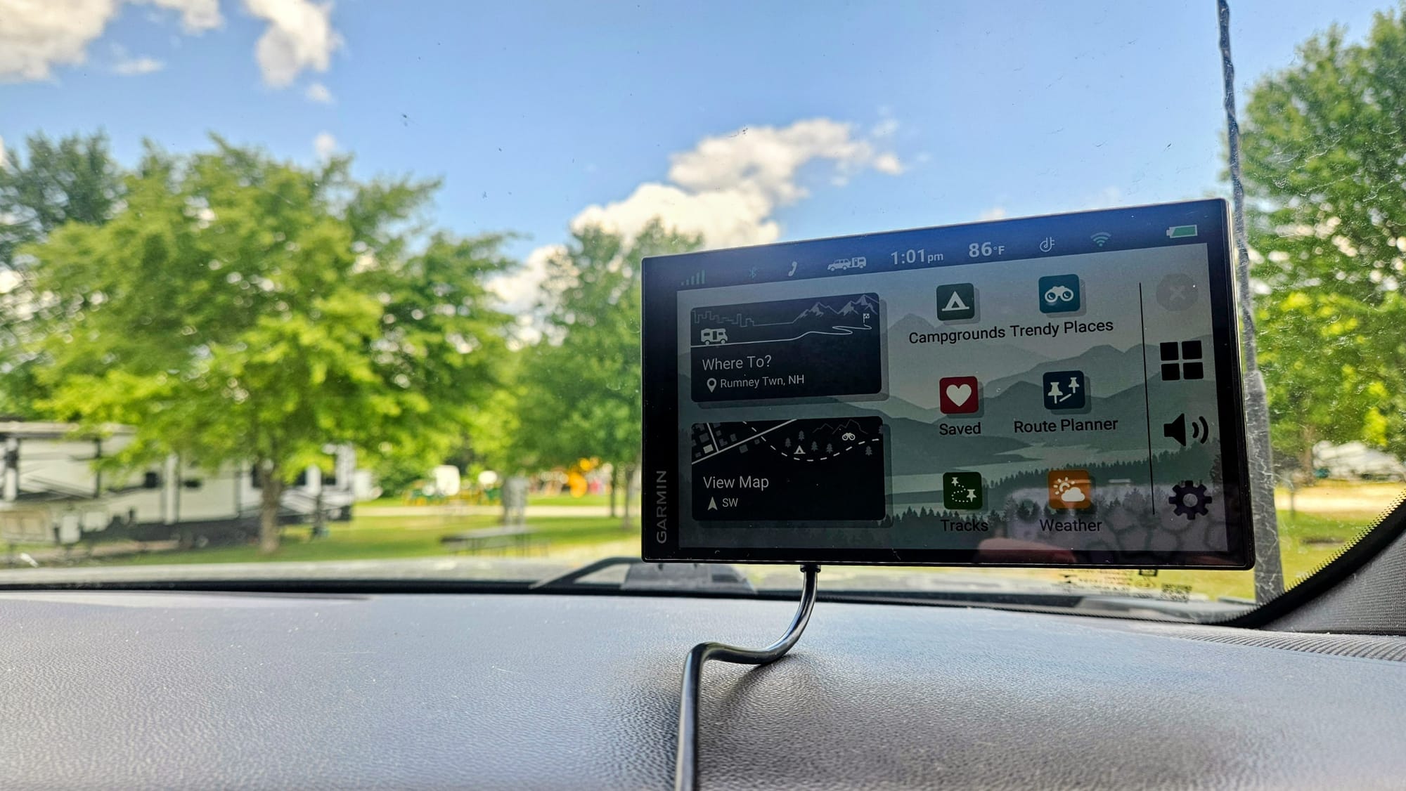
We purchased our Garmin before we even had our trailer. We're from the Northeast, land of narrow roads, tight turns, low clearances, and tricky navigation. A reliable GPS made for RVers was a necessity. We took that baby down to the dealer when we picked up our trailer, so we could use it on the drive up. It's been part of our dashboard setup ever since. Of course we've had our occasional issues with it, as no GPS is perfect, but it's saved us from some scary routes that wouldn't be suitable for larger vehicles.
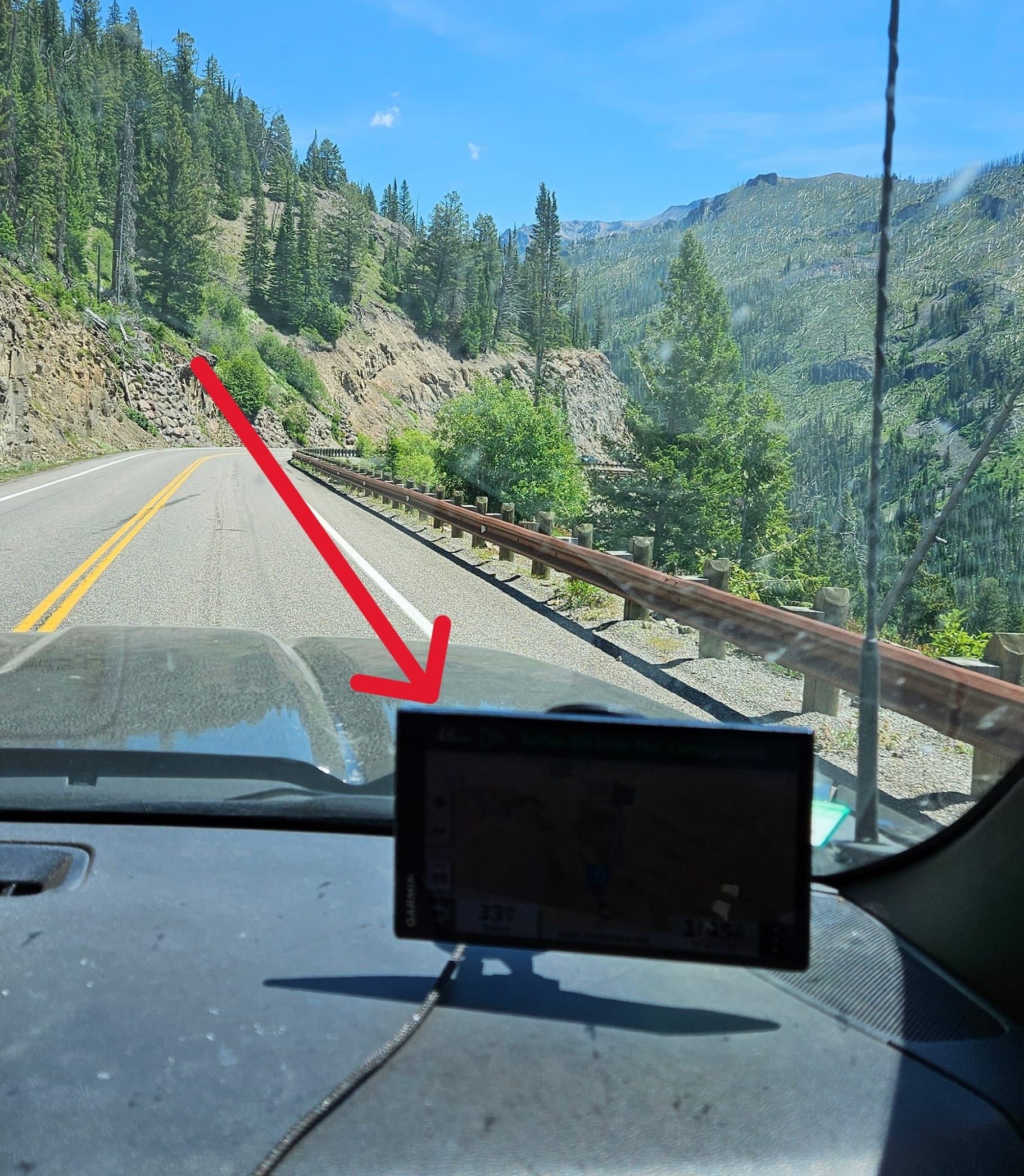
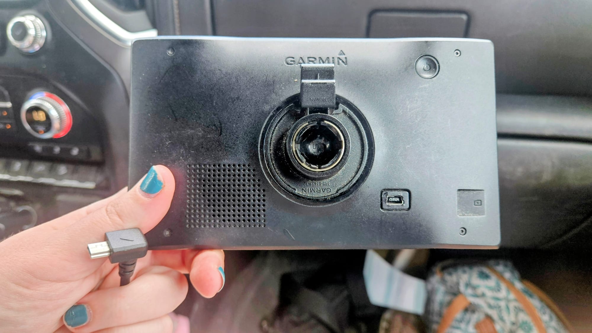
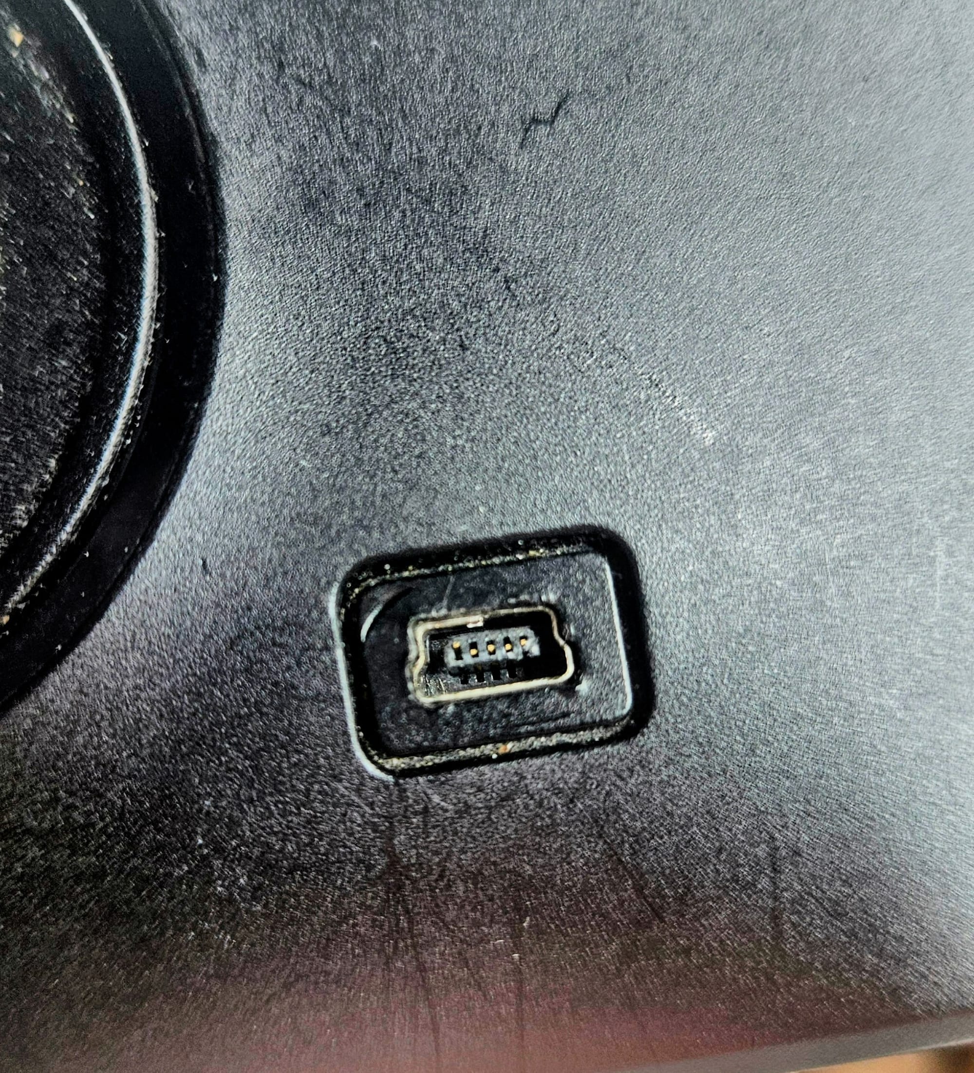
At first, we thought only the USB cord was busted, but soon after, we discovered that both sides of the connecting points were warped. The USB connector seemed to have split, and we're guessing it broke the device's USB port when we tried to plug it in for our drive. We think it was our fault; Myrtle Beach had been going through a massive heat wave, but since we weren't staying in the RV, we were only running one AC. The Garmin was stored in the bedroom, where it likely got hot enough to warp the metal just enough that the plug wouldn't connect. Lesson learned; we need to remember to store our devices in a more climate-controlled space.
We'd be traveling too quickly to order a new one right away, so we had to face the fact that we'd be without our Garmin for many miles. But, we had two redeeming assets. First, most of these routes, we've taken multiple times before. We needed to get from Myrtle Beach to Virginia, and then from Virginia to New England. It's arguably the worst part of the country to not have an RV-specific GPS, but we hoped memory would serve us well. Second, we had a backup. Because we have a subscription to RV Life, we have access to their app, which has an RV GPS. We decided to use it to supplement our Google Maps routes. Whenever the two apps differed in their directions, we could either assume RV Life was helping us avoid something, or we'd manually check for obstacles and restrictions before making our own decision on where to go.
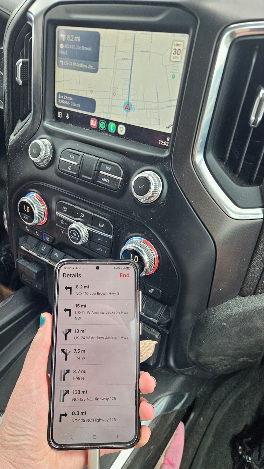
We almost immediately defied the RV Life GPS. On route 501 out of Myrtle Beach, it was taking us through traffic, but Google Maps suggested a route that avoided it. I checked the roads on Street View and determined that we'd be fine taking the Google Maps appointed route. These decision points happened many more times as we made our way through NC and into VA. Then, as we left the DC metro area and headed west towards the Shenandoah Valley, we relied more heavily on the RV Life GPS to navigate us through the tiny mountain roads.
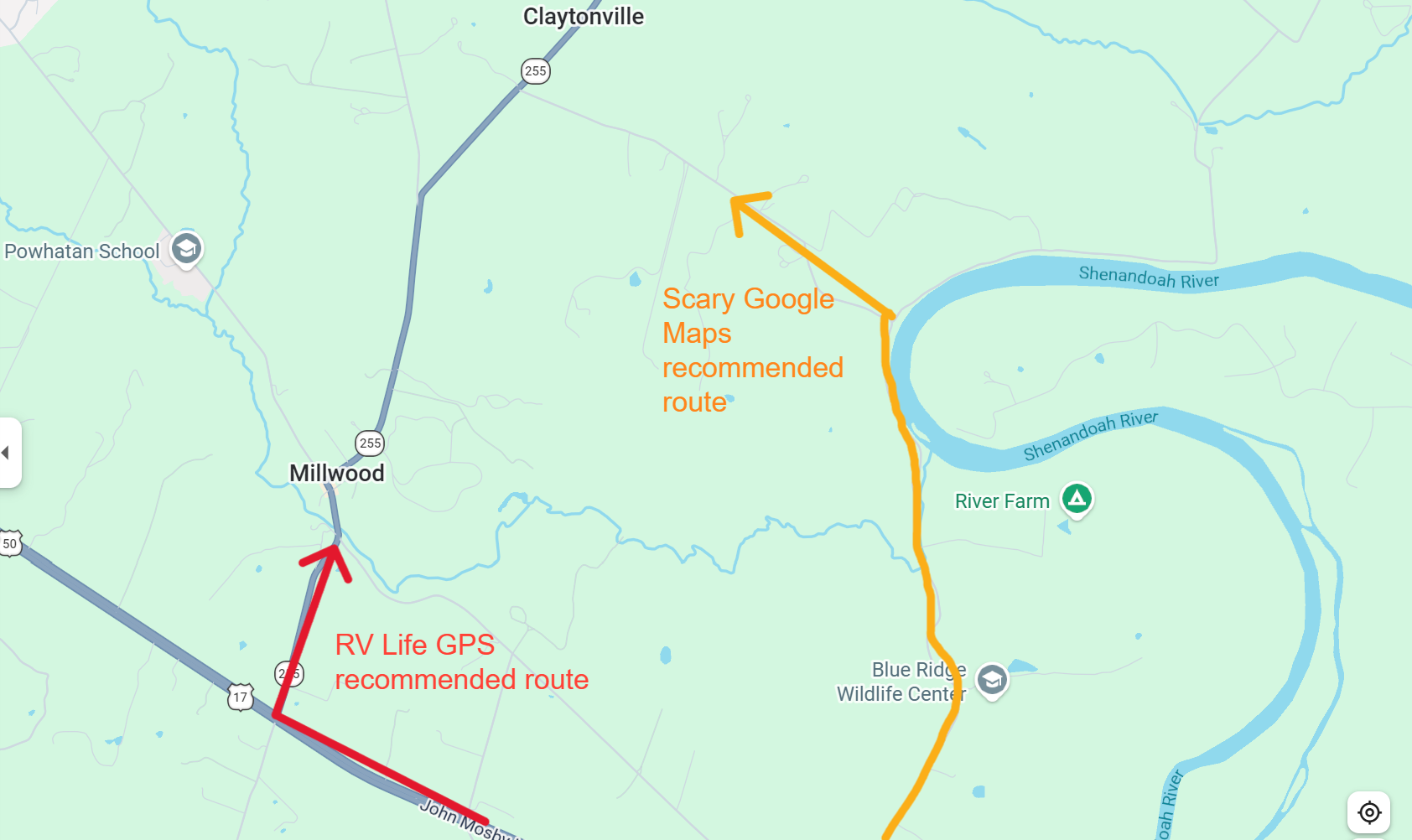
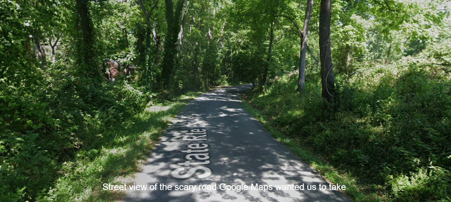
The day before we left Shenandoah, I planned our route to get us to I-70, so we could get back to Baltimore and meet back up with I-95 to continue north. When I entered navigation on the RV Life app, I was concerned at what I saw.
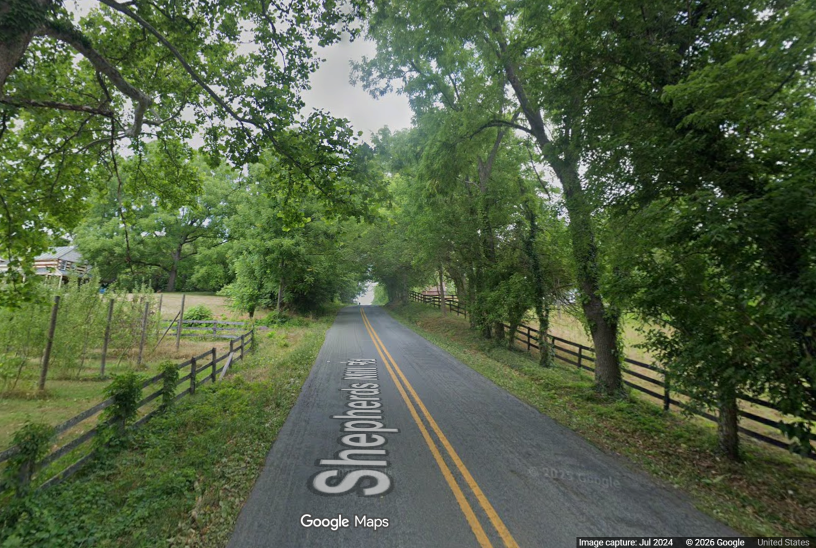
Evidently, it wanted us to take our rig through the land of low branches, and my detective work proved further why this was a bad idea. See the image capture date on the bottom right of the Street View photo? July 2024. Aka, the same time of year we'd be making our drive. Aka, the most luscious time of year. Those branches would be voluptuous.
Google Maps suggested a different cut-through, but I defied both. I wanted to stick with main roads if I could, which left going all the way to I-81 and taking that to I-70, taking US340 to shave off a little time, or heading east right away on route 7, hopefully meeting up with I-70 somewhere north of Leesburg.
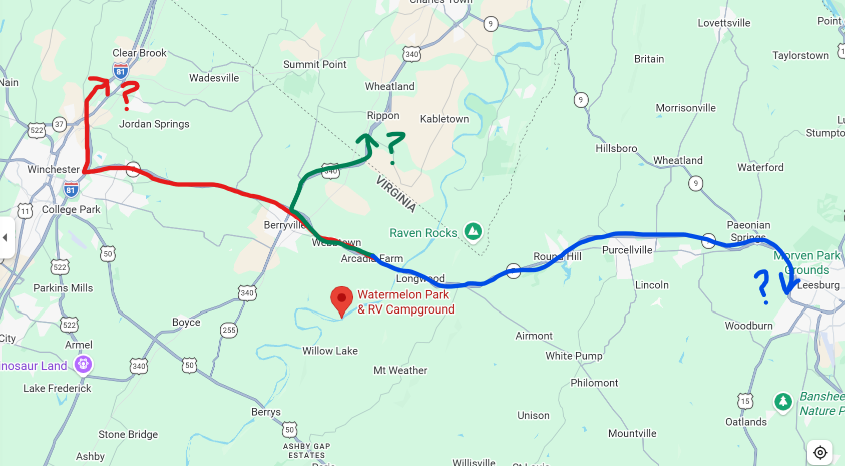
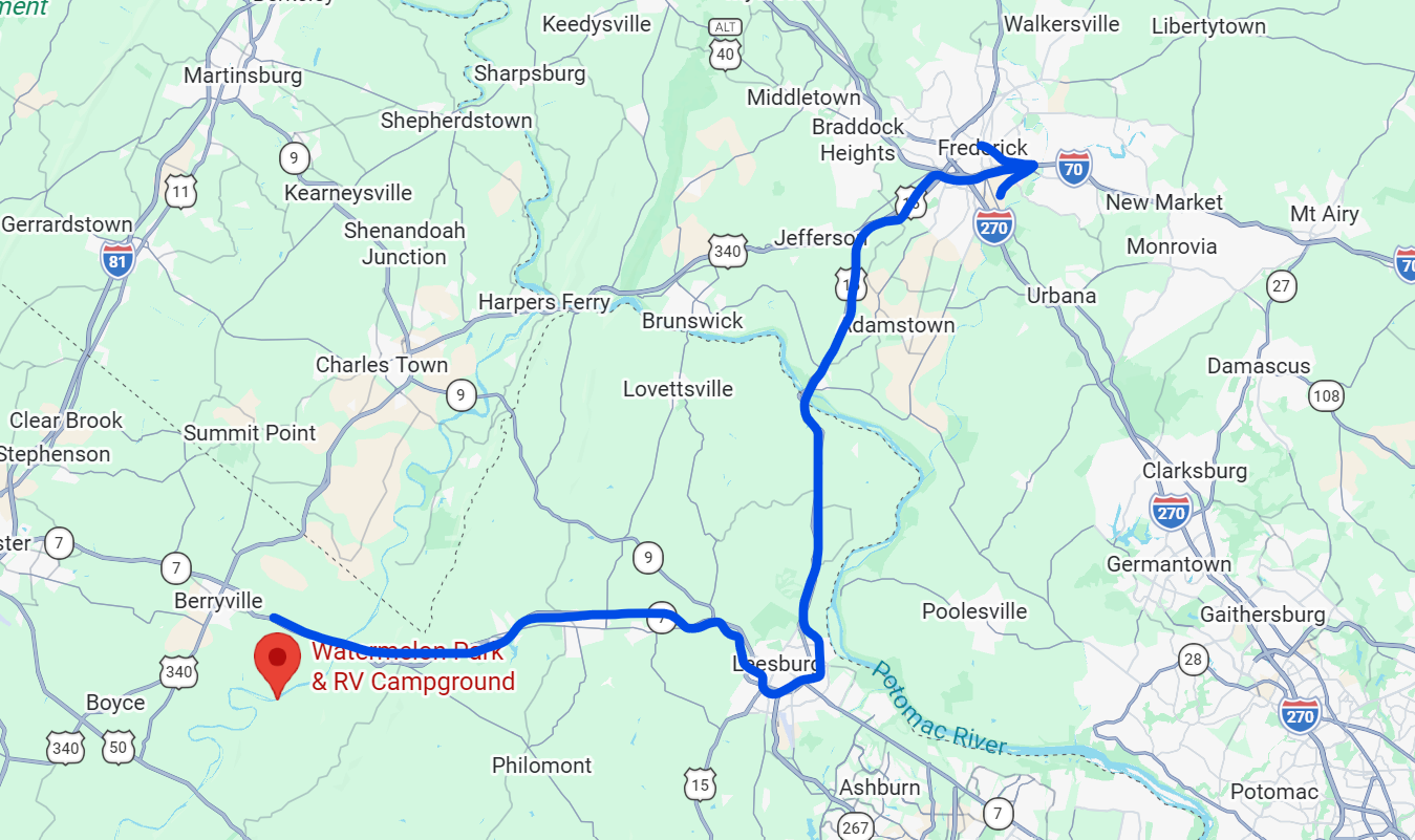
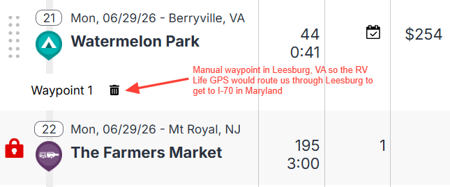
We're not big fans of I-81 and would prefer to not head west in order to go east, and so I created a waypoint in RV Trip Wizard to route us through Leesburg. I checked route 15, the connecting road from route 7 to I-70, and it looked fine for our RV, and so I made this our manual route using the waypoint. And if you're wondering how I knew route 7 was good, we took it quite a few times going back and forth to wedding celebrations. Besides a couple steep grades going through Appalachian Trail territory, it was a very traversable road.
This is probably a good time to note that, this year, we've had a lot of problems with Google Maps. We joke that Google is relying too heavily on AI software development when they should really still be using humans. We've lost count of how many times Maps tells us to go a route that's both longer and further than an alternative, or how many times it makes us take lefts onto busy or divided roads, when taking rights would be quicker and easier.
So what I did next was, for many reasons, dumb da-dumb dumb dumb.
We were on I-70 east approaching Baltimore. Our goal was to get on I-695 to go around the city, and then merge onto I-95 north. The RV Life GPS told us to take I-695N, but Google Maps said we could save 8 minutes by taking I-695S. Both go around Baltimore, but 695N was showing construction symbols. Perhaps the RV Life GPS hadn't yet caught onto the fact that there was more traffic that direction. The good thing about the app is, because it's connected to the internet, it does update with traffic, but it doesn't seem as real-time as Maps. The Garmin doesn't have as much ability to update routes and ETA based on traffic, so we always knew that, if we hit traffic, our ETA would be off until the satellite updates, which always took a long time.
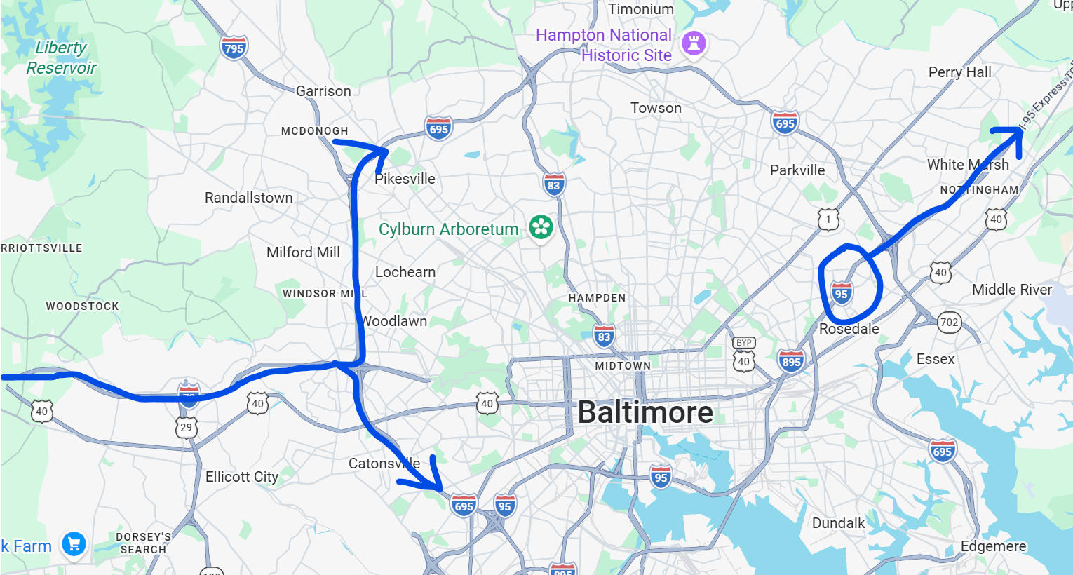
This is where my confidence of "knowing the roads" shot a little too high. We decided to save 8 minutes by taking I-695S, and only a few minutes later, we were told to get on I-95. "Wow, that was fast!" I exclaimed. Yeah, Nicole, it was fast...because you weren't actually around Baltimore yet.
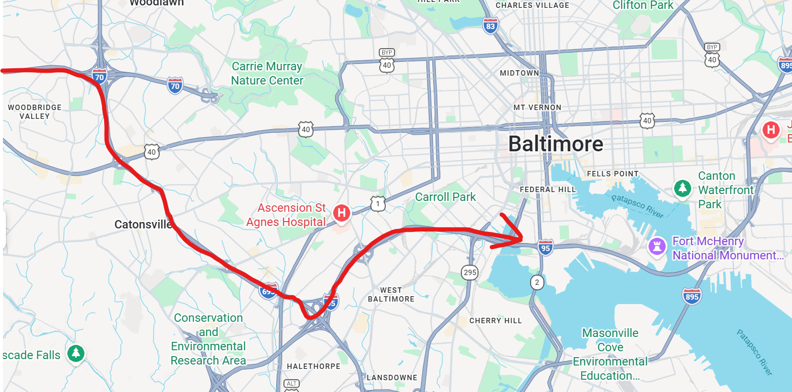
Google Maps doesn't know we're towing an RV. Google Maps thinks it's fine to save 8 minutes by getting on I-95 further south. But there is something along that route that is not RV-compatible:
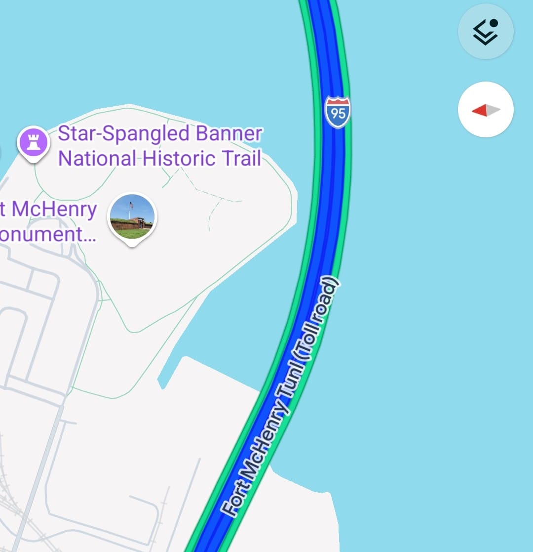
We were now only 2 minutes from going into a tunnel, and I scrambled to find an alternative route. I pulled up the RV Life navigation to see if we had any other options. It was telling us to get off the next exit, in the city, and make a U-turn on a busy road. How about NO?! We drove past that exit, hoping the app would update and tell us an alternative at the next exit – the final one before entering the tunnel.
The app updated, but not with an alternative. With an "F this, you're screwed, just go through the tunnel." WHAT?! Is this even allowed?!
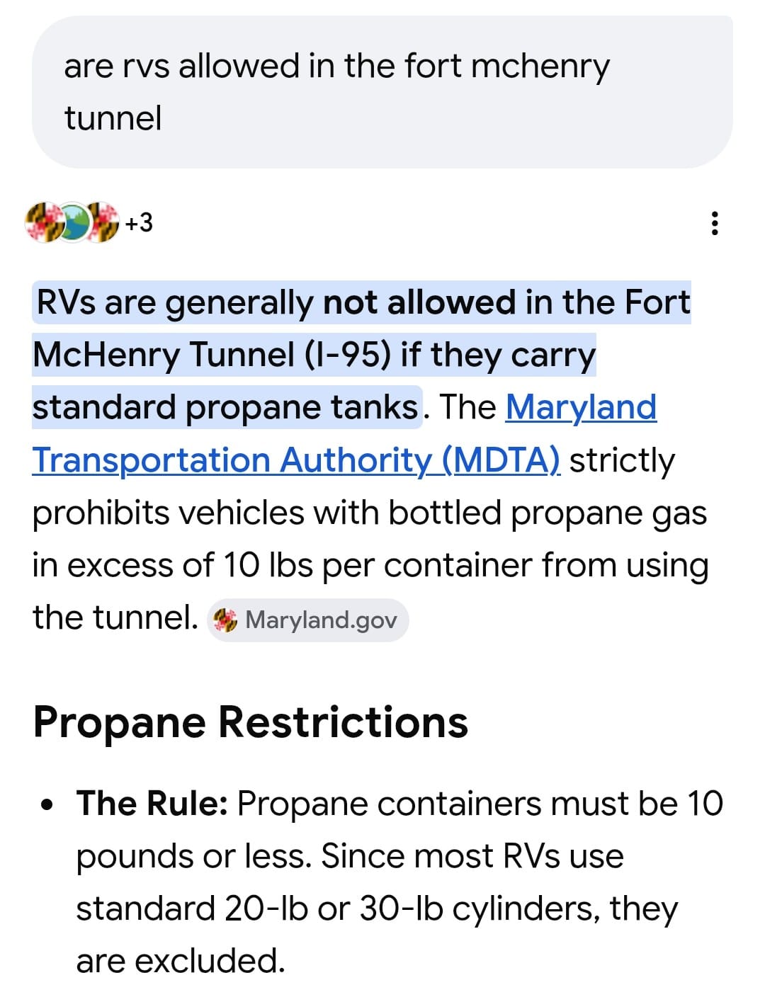
With less than a minute to spare, I quickly Googled "Fort McHenry Tunnel restrictions," and first saw that "large propane tanks" were not allowed. This was consistent with the signs we had seen saying "no hazmats." We saw nothing about no RVs, nor did we see height or length restrictions. But upon my second search, specifically asking, "Are RVs allowed in the Fort McHenry Tunnel?" this popped up:
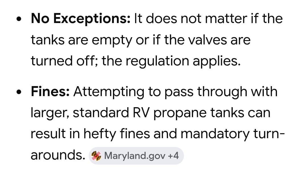
Feeling the adrenaline coursing through my veins, I frantically looked around for a pull-off, but we had passed all of them. That's when Anthony hit me with, "It's pay-by-plate, so no one's gonna stop us!" Spoken like a true Aquarius. "BUT THERE MIGHT BE A COP AND HE MIGHT SEE US AND PULL US OVER!" I yelled. Spoken like a true Gemini. But at that point, I had to override all my anxiety, because we were descending into the tunnel.
I took no photos because I didn't want "proof" of our illegal traverse. Yes, I'm aware I'm writing the story here, anyway.
The funny thing is, the tunnel itself was quite pleasant. It was wide, bright, clean, and short. We were through to the other side in no time. Will the pay-by-plate come back to bite us in the butt and slap us with a hefty fine? Time will tell.
At this point, I looked at the map, wondering why on earth the RV Life app threw up its hands in defeat, instead of routing us around I-695 going the other direction. Then I realized...
The Francis Scott Key Bridge is out. There is no way around Baltimore in that direction. I obviously knew this. I even wrote about it not that long ago. Absolute rookie mistake. But on the bright side, we did save ourselves 8 minutes!
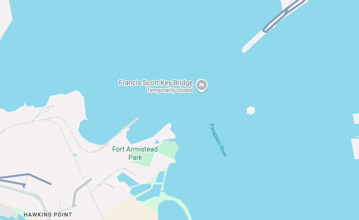
So technically, this wasn't the GPS' fault, except for the very end when it thought the only option was to go through a tunnel illegally. But what happened next was a true glitch in the software.
Once on the other side of the city, we knew all we had to do was continue up I-95, but the GPS kept telling us to take I-695 west of the city. Why? After realizing my earlier mistake, I was tempted to listen, but no. I knew this was the right way. I knew Google Maps was right. And unless they added new restrictions over the Susquehanna River, I knew we could take all the upcoming bridges.
I told Anthony to stay the course, while I dove into the RV Life app to see what was going on. I tried cancelling the GPS navigation and going back in, but it continued telling us to turn around and head west. The total time to get to NJ was saying 4.5 hours!
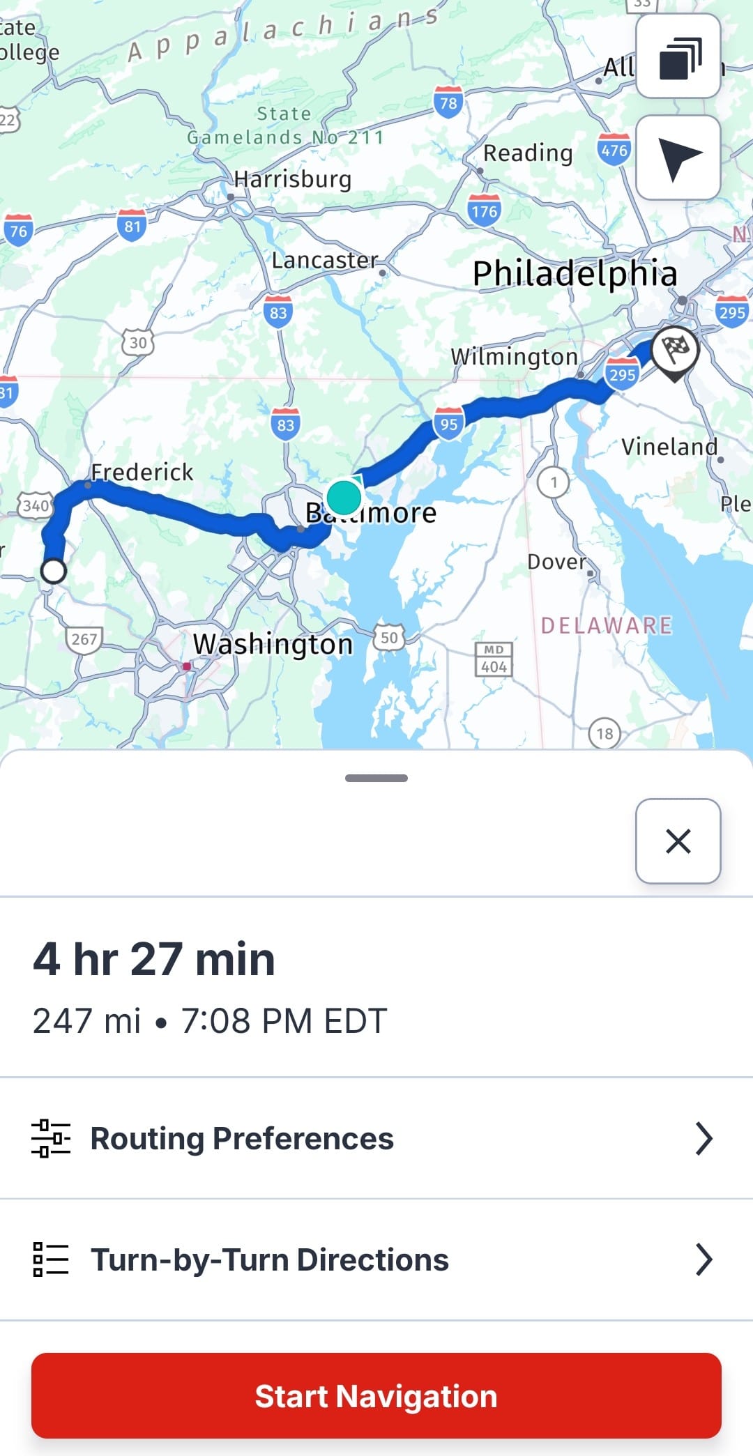
I zoomed in on the map and saw the problem. It was taking us to the waypoint in Leesburg, then turning us around and bringing us all the way back. Apparently, there's something in the programming that keeps waypoints, even after one has gone past it.
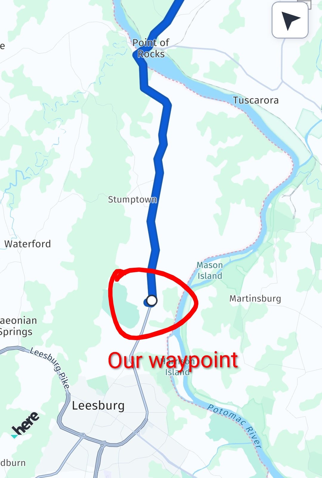
A waypoint, by definition, is a point along a route, most often a pass-through stop. I don't know why the app would be programmed to keep a waypoint that's already been passed through, except that it's probably a detail in the code that needs fixing. It would be one thing if I was still putting in my starting point as "Watermelon Park," but I wasn't. It gave me an option to start at my "current location," and I chose that. It didn't matter.
I tried to go into the app and remove the waypoint, but I couldn't find a way to do it. A big reason why I always use desktop for trip planning is, it's easy to look at my trip itinerary and the map at the same time. The app's map doesn't have an overlay of our itinerary. Plus, on desktop, there is a very obvious "delete" button for waypoints. Not so much on the app.
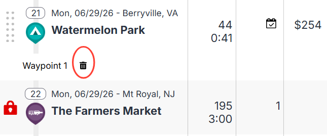
Finally, I found a way to get directions without the waypoint. I couldn't use my itinerary destination. Instead, I had to type in the street address for our destination and start a whole new navigation route.
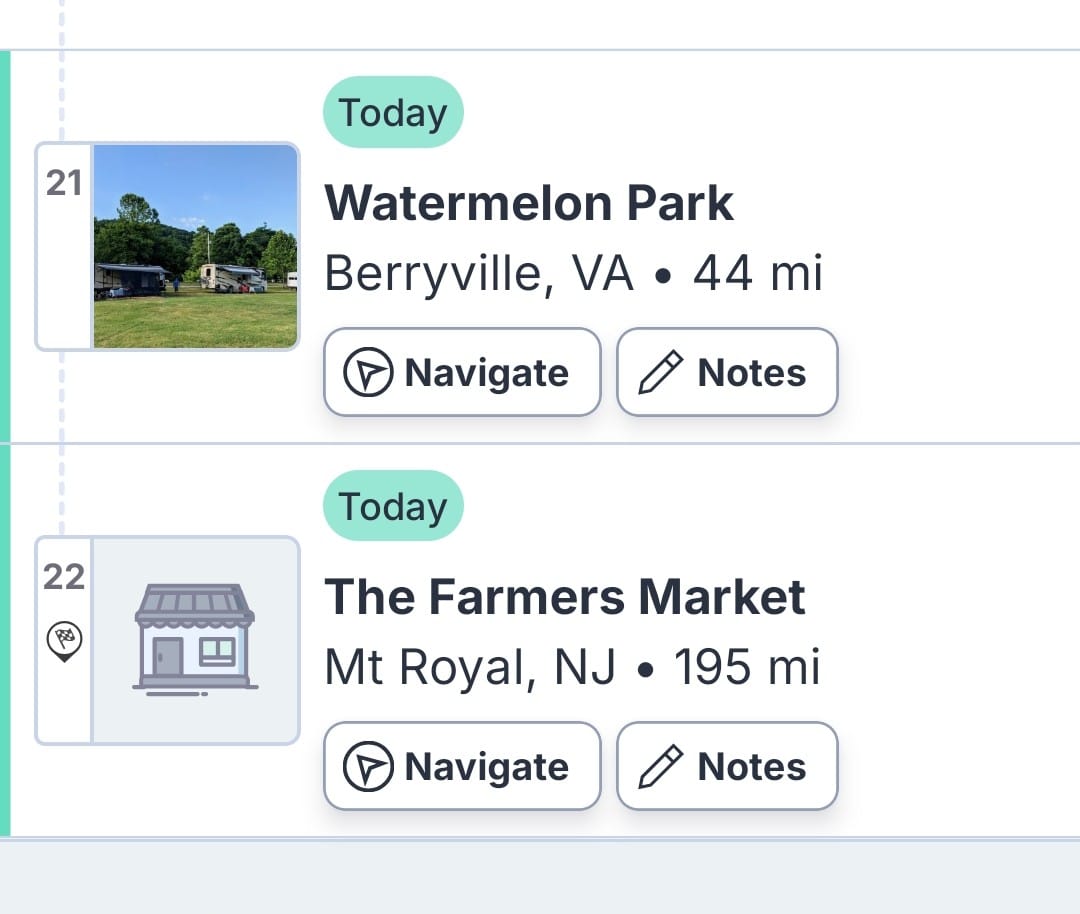
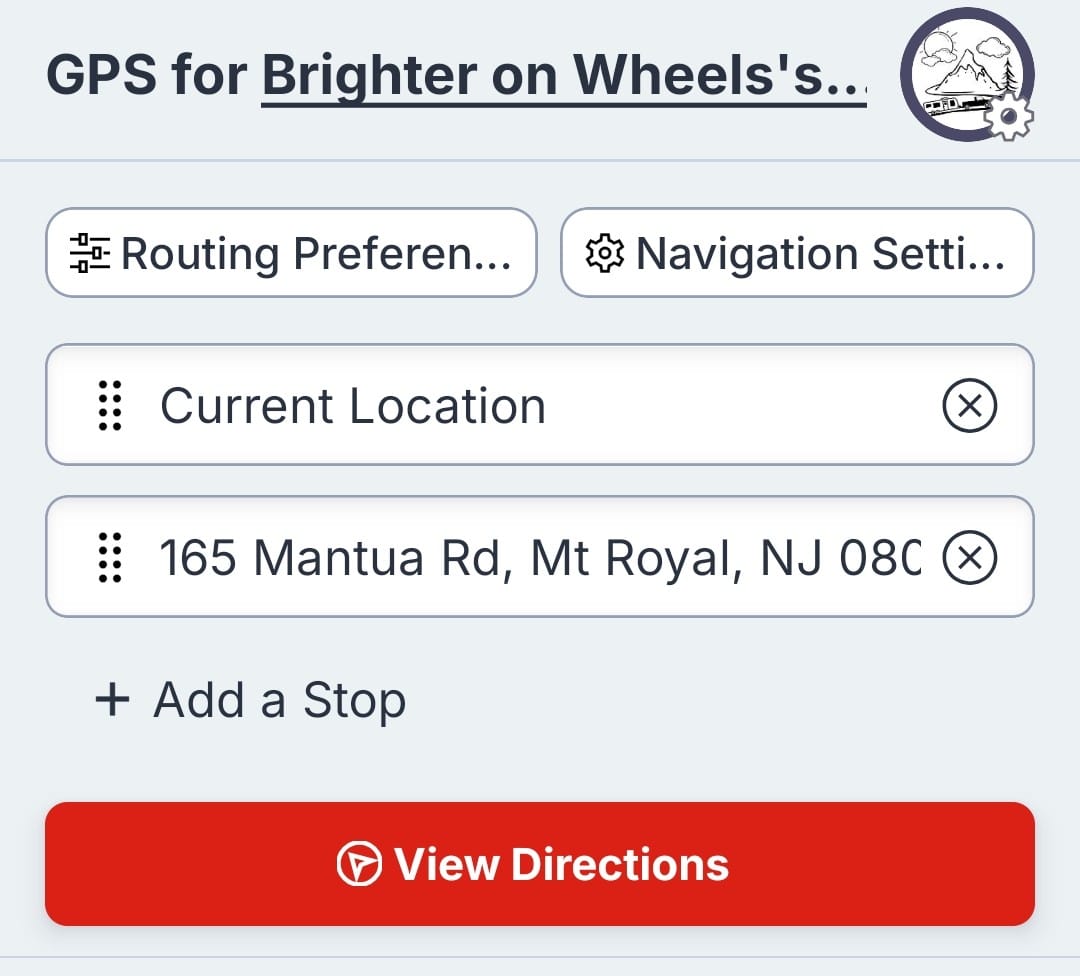
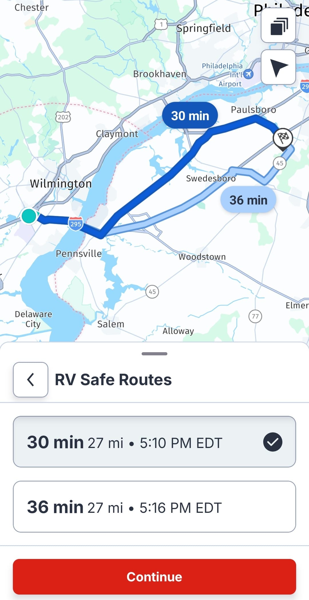
Left: My itinerary starting and ending points that I couldn't use. Middle: Putting in the street address for our destination. Right: Finally a correct route and ETA!
Thank God I didn't let my Key Bridge flub make me doubt future decisions, because we would have lost a ton of time backtracking for no reason. Instead, we found our way to I-295 and over the Delaware Memorial Bridge. We mostly used Google Maps and the written directions from our Harvest Host.
That night, I faced a daunting task. Our continued trek north meant it was time for the behemoth.
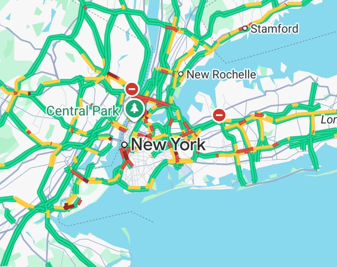
Circumventing NYC is overwhelming even with a reliable RV GPS, and we've done it all different ways, with varying levels of success. This is actually the only area where I've used the RV Life GPS, to compare it to our Garmin. On our launch day, I set both GPS devices to see if they'd agree to take us the Garden State Parkway after getting over the Hudson. Then on our crazy voyage off Long Island in Season 2, we used all 3 GPS devices to figure out a way to avoid the George Washington Bridge. Didn't exactly succeed on that one. This time, the RV Life GPS was the best choice we had. Scratch that. Our brains were the best choice we had. But the point is, we wouldn't be able to rely on Google Maps because there are too many height restrictions in the tri-state area.
First things first: We did not want to take the George Washington. We decided to route ourselves over the Cuomo. Recently, we had been choosing the Newburgh-Beacon Bridge, but this is far out of the way, especially because our destination was in Narragansett, RI. Neither GPS wanted to route us over the Cuomo, so I decided to take matters into my own hands. We needed to get from I-95 to I-287, and I knew where the interchange was. Taking I-287 around the city would be slightly out of the way, but easy to navigate with an RV.
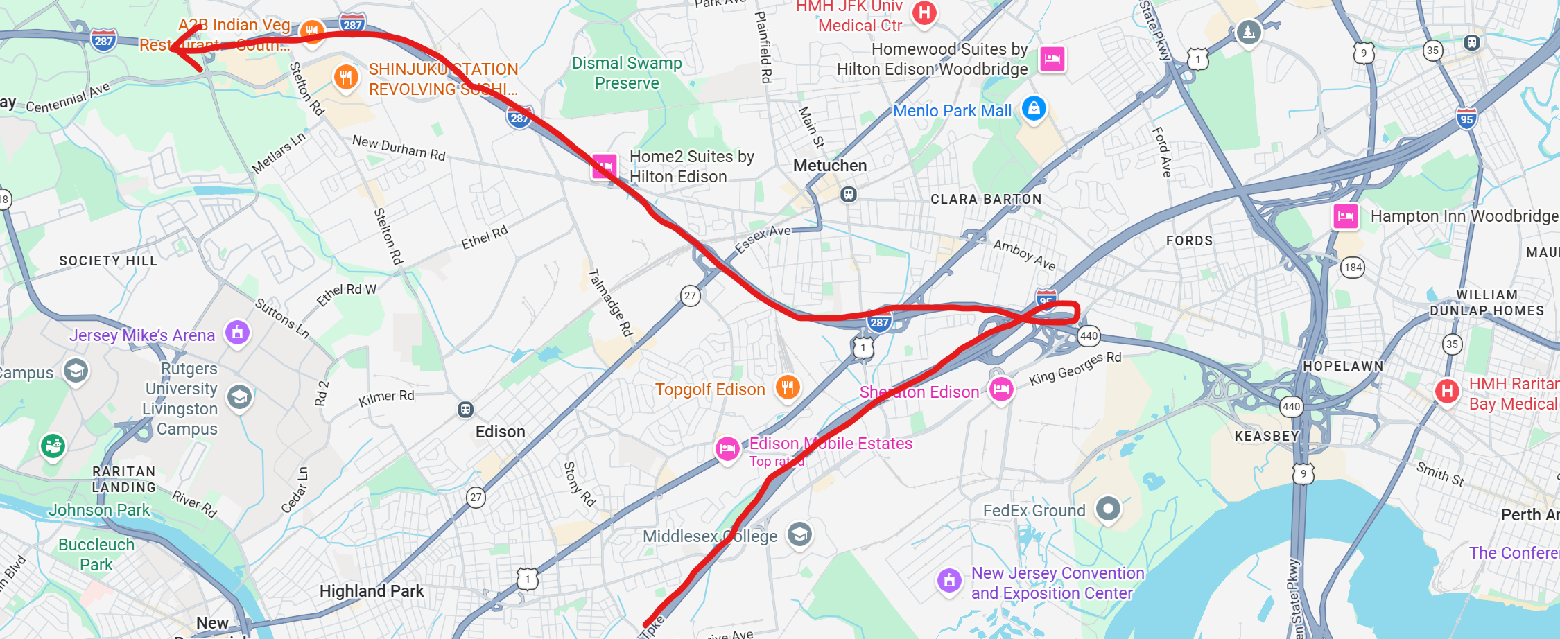
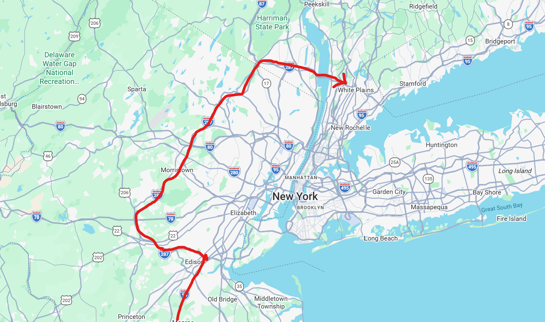
Google Maps caught on pretty quickly that the Cuomo was a viable option. Unsurprisingly, the traffic was clearer going over that bridge versus the GW, and so eventually, Maps offered the option of taking the Garden State Parkway to I-287. We had done this before and I knew it was quicker, but I wasn't confident in my ability to manually route us this way. Now that Google Maps showed me the route, we could just follow it. The Garden State Parkway is intimidating at first because there are low clearance bridges. However, most of them are much higher than standard RV heights, and the lowest clearances are at the far sides of the bridge, not the middle, because they're arched. We don't have a terribly tall trailer, and we've taken the parkway enough times to feel comfortable navigating it without an RV GPS.
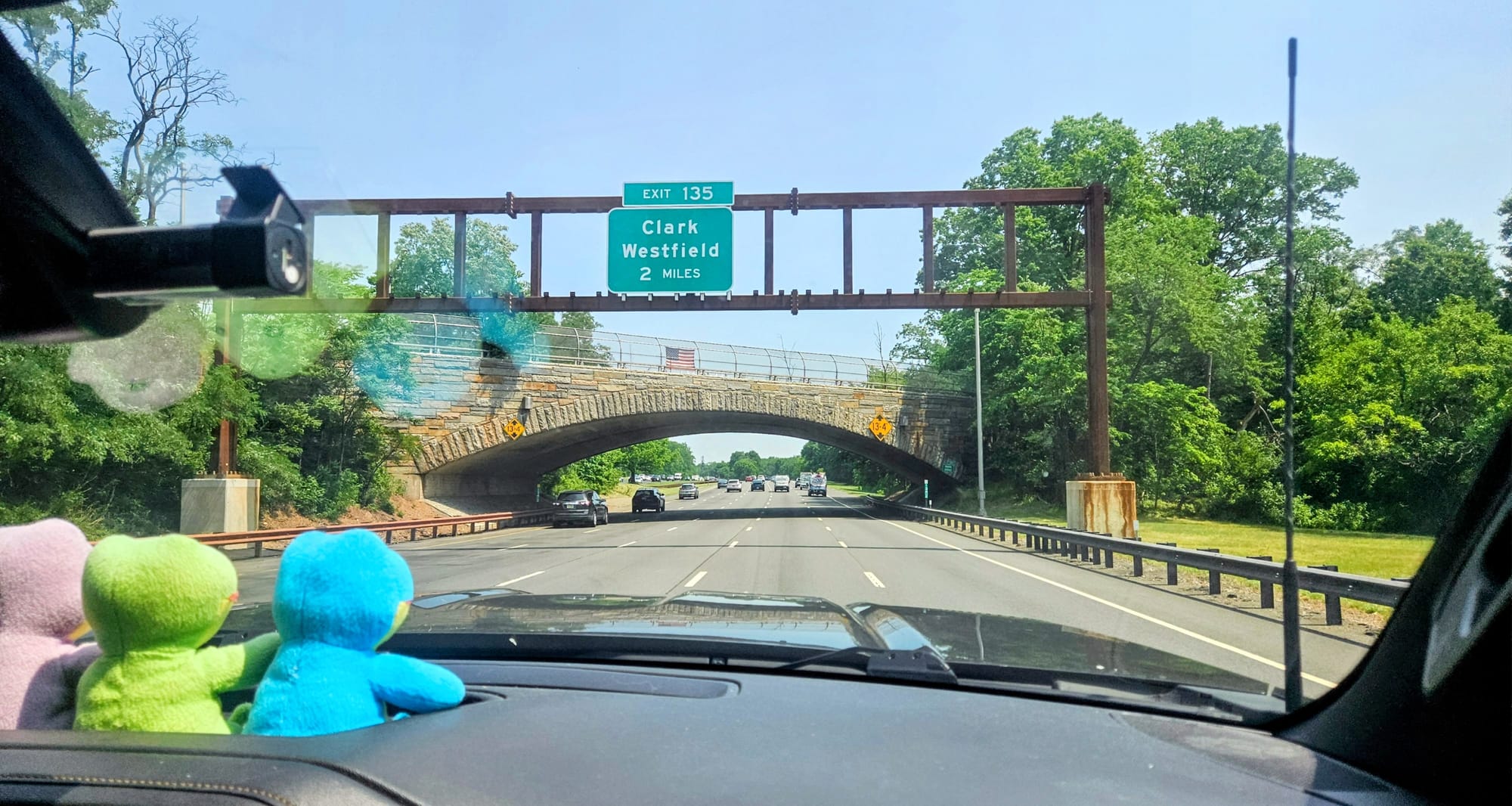
Oh wait, but we have an RV GPS. What was RV Life saying to do?
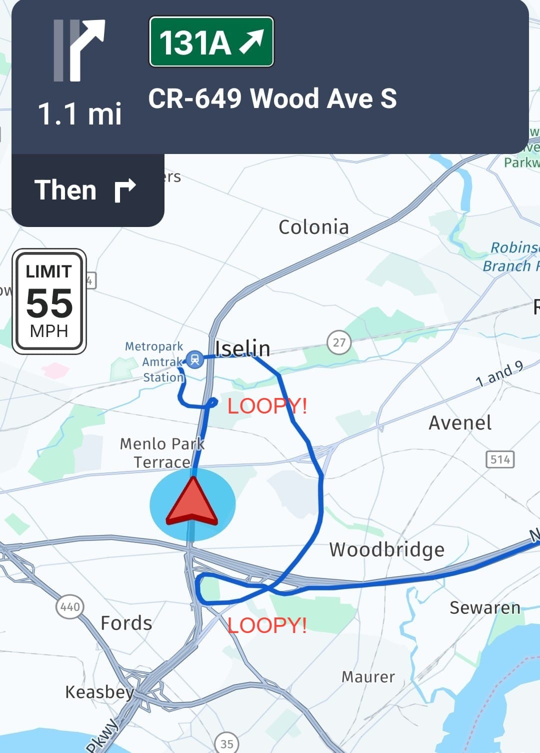
Even after we were well on our way up the Garden State Parkway, it still kept telling us to get off, turn around, and go towards the GW Bridge. We see. So it's totally fine waving the white flag and leading us through a restricted tunnel, but it won't reroute us up a parkway that has no RV restrictions. Got it.
Meanwhile, this year's Google Maps idiocy continued. At one point, the route over the GW had little enough traffic that it became the faster of the routes by 4 minutes. By default, Maps switched the route. If memory serves me right, back in the day, the default was to stay the course, and if we wanted to take the new route, we had to press the button to "OK" the new route. Now, if we don't press anything, it times out and assumes the new navigation. This is stupid. It shouldn't do that.
So we just ignored Maps and kept on towards the Cuomo. Eventually, it recalculated. And the RV Life GPS? We don't know. We stopped looking at it.
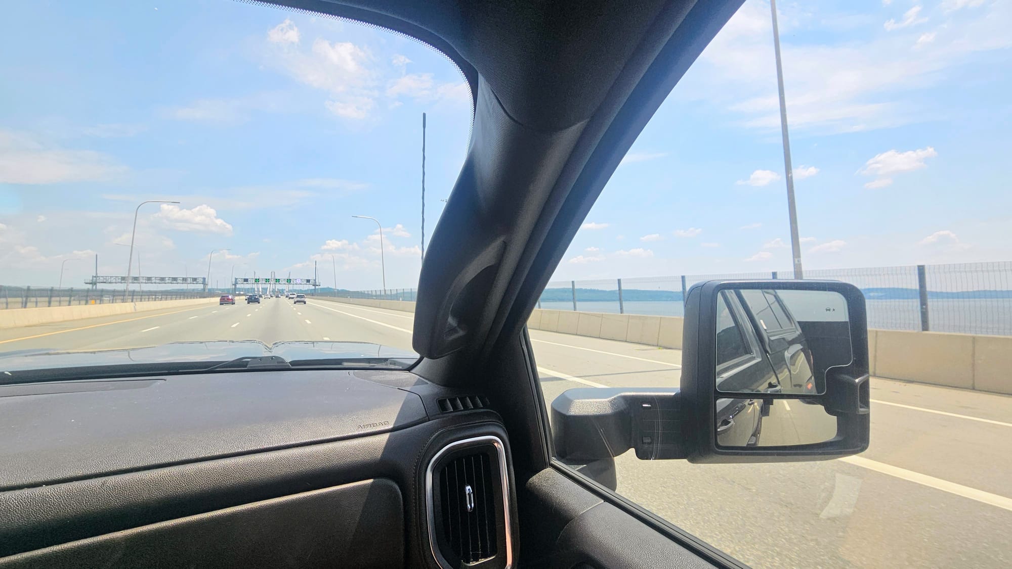
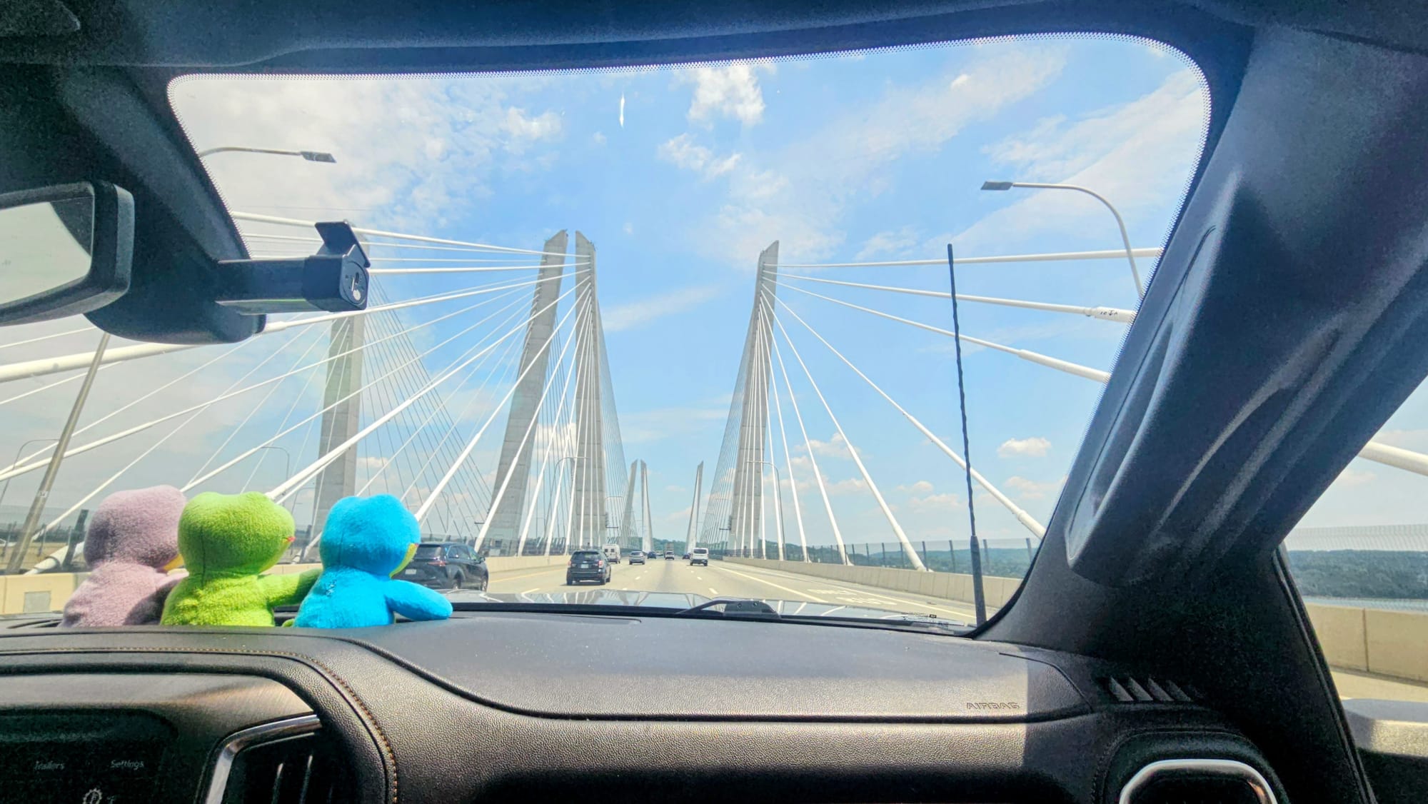
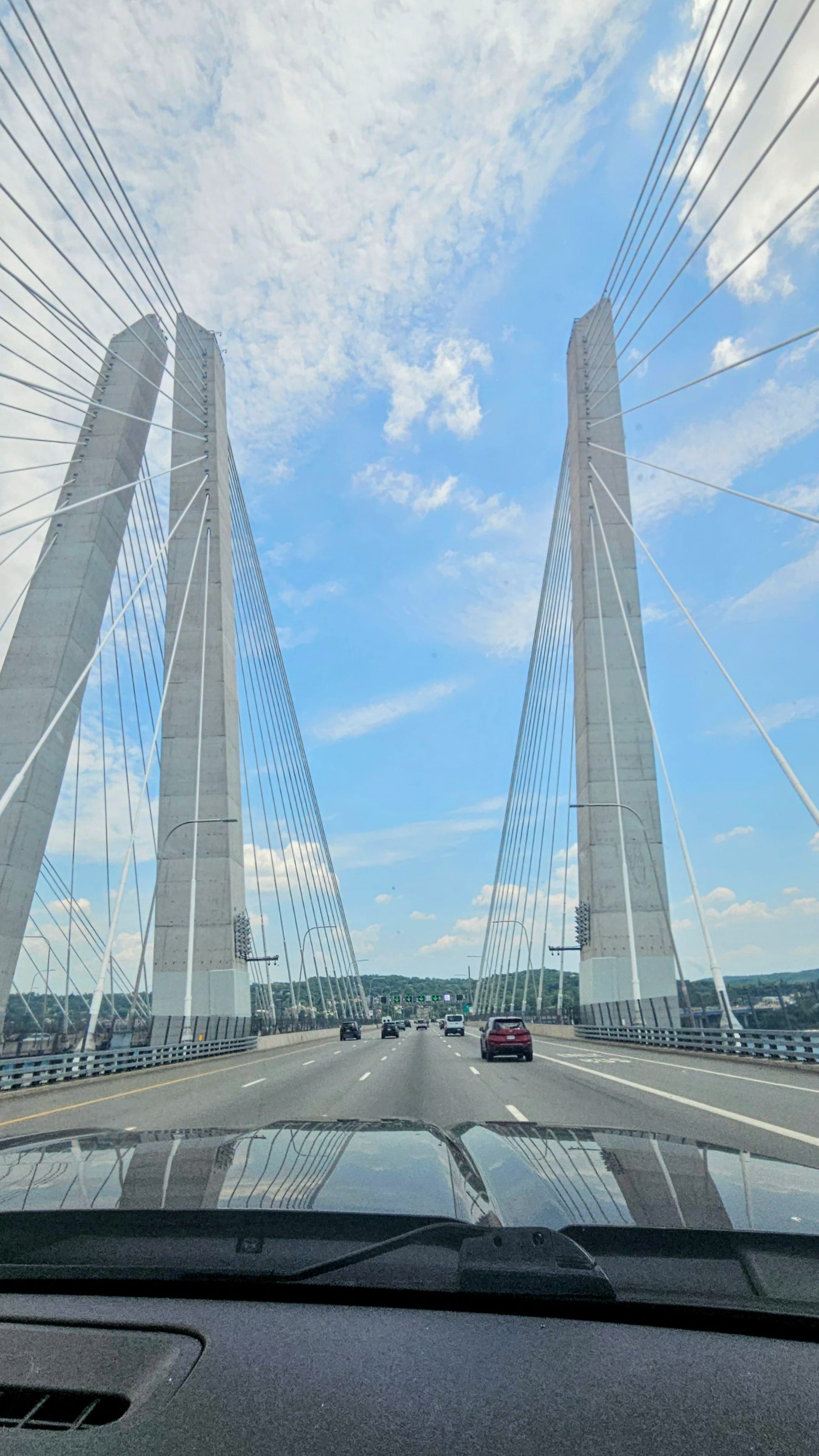
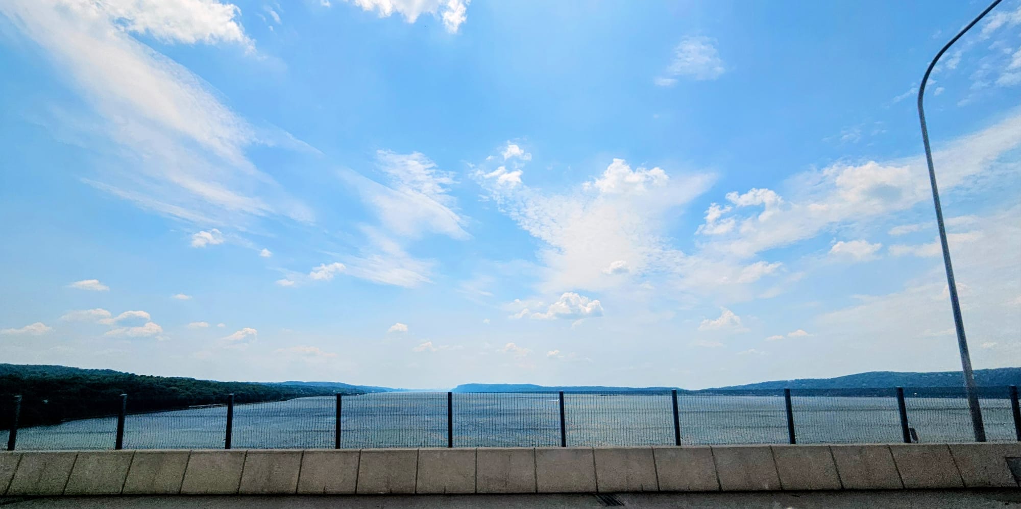
Over the Cuomo we go!
The way we see it, an RV GPS' top priority should be to keep RVers safe and legal on the road. We've already had too many instances where the RV Life app causes panic or routes us through daunting situations, without giving us easy ways to make manual changes on the fly. We gave it a try, but if it can't function optimally in our home region, we wouldn't be able to trust it enough in unfamiliar territory. As soon as we had a campground stay long enough to get a packaged delivered, we got ourselves a new Garmin RV 795, the same version we had for 5 years. RV life is stressful enough without needing to worry extra about navigation.
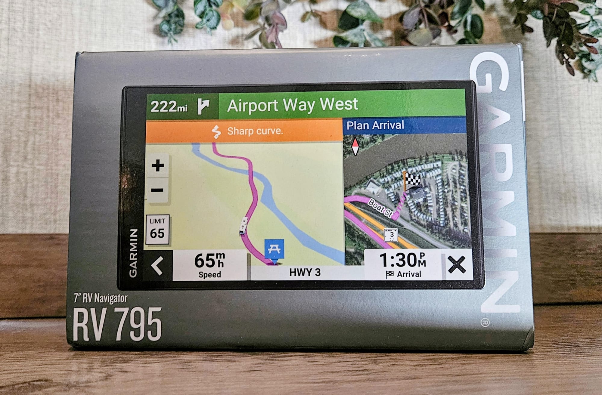
That being said, I still love planning with RV Trip Wizard's desktop version. I'll continue using it proudly as my main planning software. I'll even keep adding waypoints! But only to calculate estimated travel time when I plan. Navigation will be the Garmin's job. We're so relieved to finally have our new one gracing our dashboard.