The Utah Redemption Tour: Is Capitol Reef the Least Mighty of the Mighty 5?

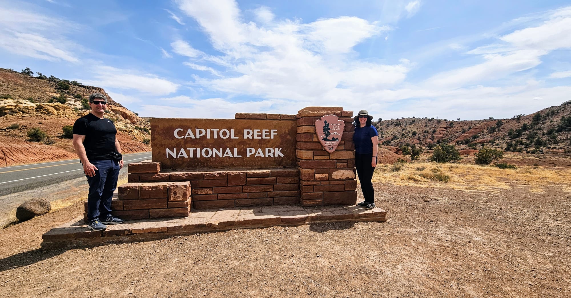
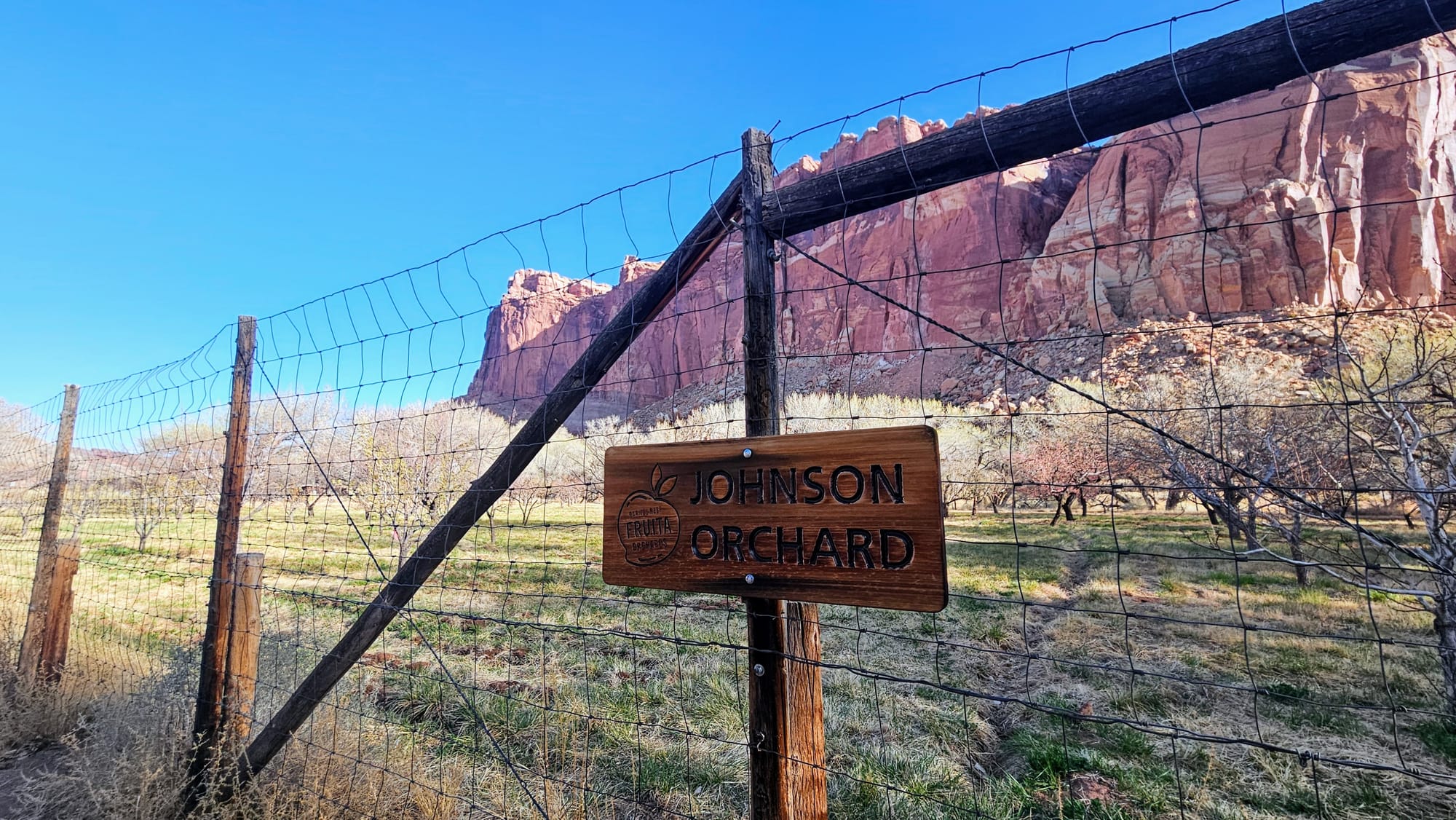
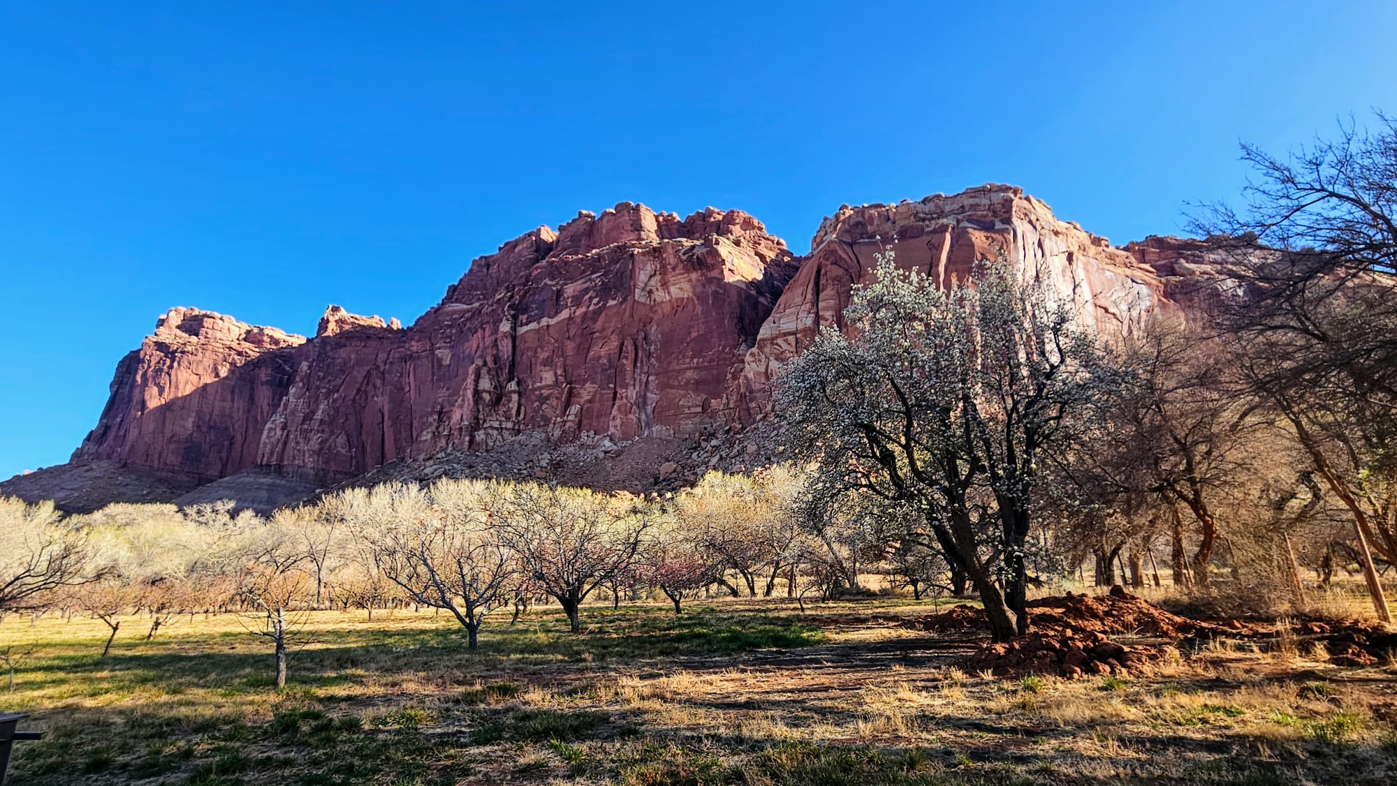
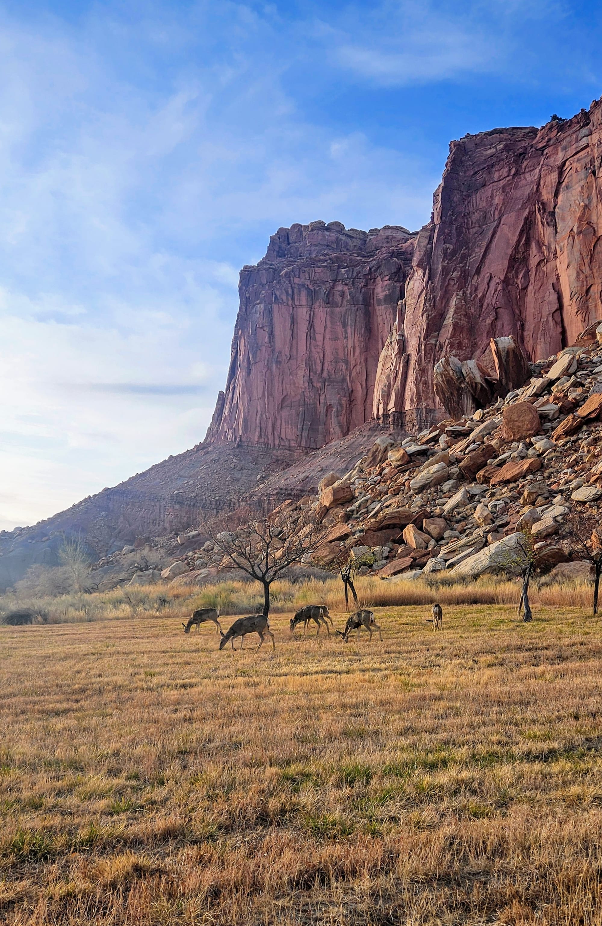
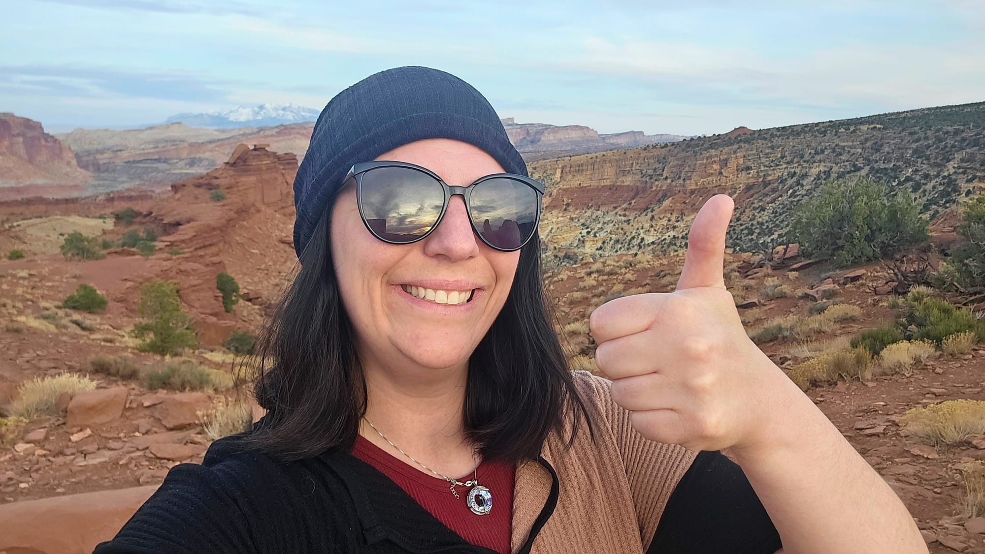
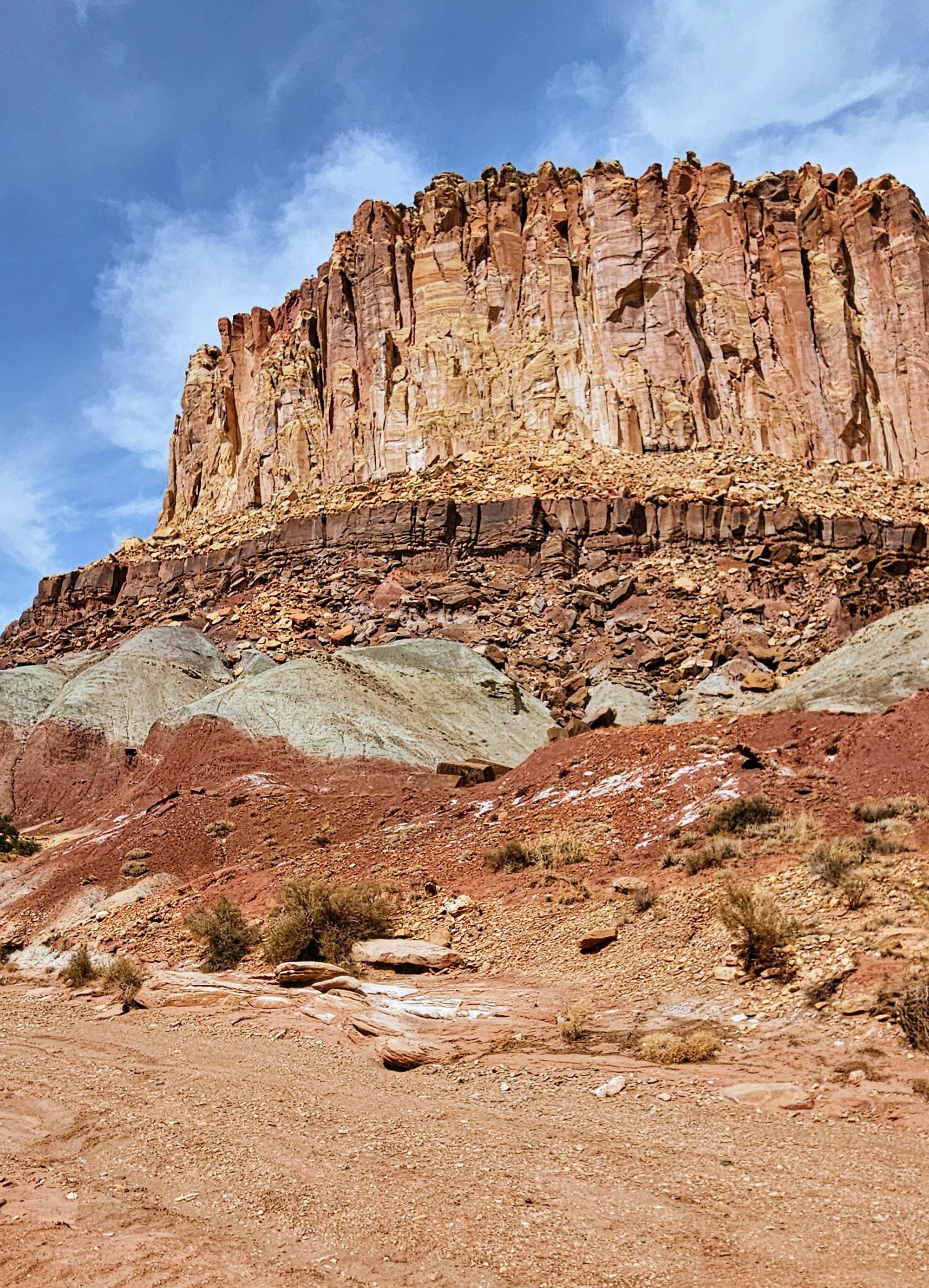
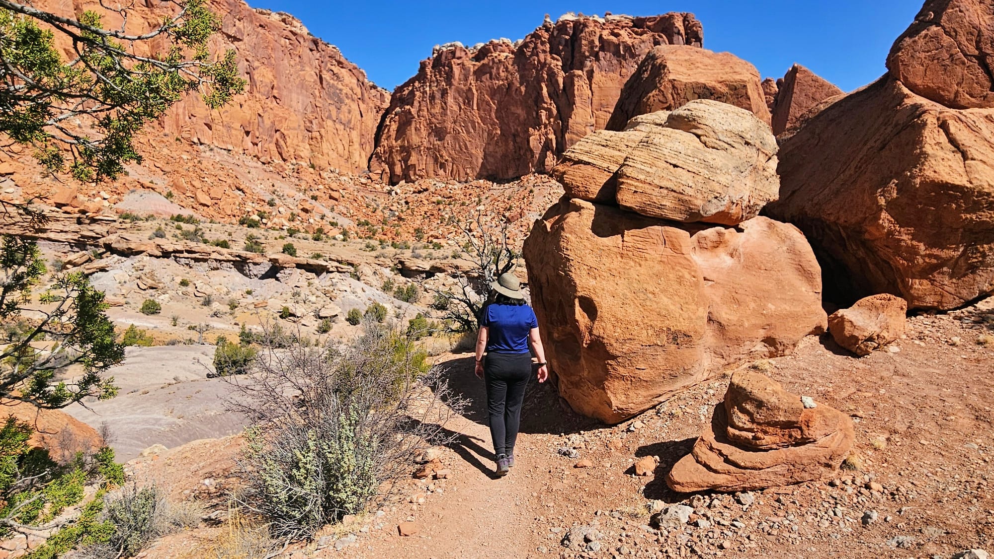
Capitol Reef felt completely different from the other two national parks we had visited so far in Utah. State route 24 runs straight through the park, and so before we even deliberately went, we had already seen several of the featured rock formations, as well as some of the orchards and historic sites of the town of Fruita. We came upon spring for the first time this year, getting to see green leaves and fruit blossoms. Capitol Reef is often described as an oasis in the desert, and that's how it felt. We had a reprieve from the dusty, rusty sandstone and instead got to plant our feet on actual grass! But then we'd look up and see many similar rock formations to what we've gotten accustomed to in our redemption tour. We could spot the various mineral deposits that create layers of color in the rocks. We could see where wind, water, and temperature fluctuations have impacted their shapes.
The Name
Contrary to popular belief, Capitol Reef wasn't named after a barrier reef in water. You might think that due to its history as a shallow sea. In reality, the term was used to depict a barrier to travel, but not directly related to any specific ocean reef. Rather, the reef refers to the rocks, which made travel difficult to impossible back before the roads were constructed.
"Capitol" does, however, refer to the US Capitol Dome. One rock formation in particular carries this name, but many other formations in the park are similarly dome shaped.
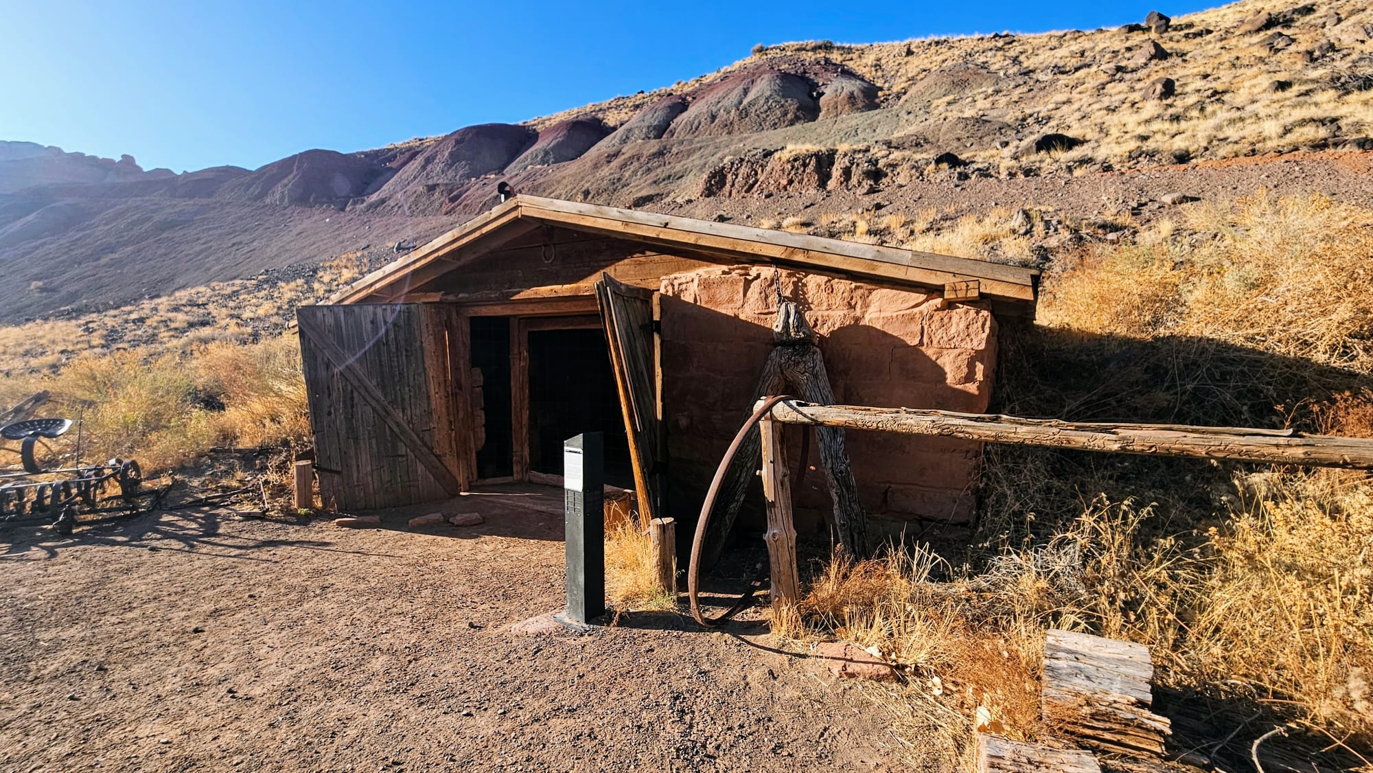
There was no doubt that Capitol Reef was beautiful, but we wanted to find the same level of inspiration that we found at Arches and Canyonlands. Perhaps that was a big ask, but that's why we first decided to explore Fruita. We had been focusing mostly on the geology of each place up to this point, because how couldn't we? This part of Utah has some of the most unique geology anywhere. But now that we knew about these rocks and how they were formed, we pivoted to learn about the history of Mormon pioneers that settled in Fruita and surrounding towns. This was a good choice. We leaned into the park's uniqueness and came away inspired.
We tend to stick with a routine when we visit national parks for the first time. We often prioritize scenic drives and a few hikes, when it's applicable to do so. Our research showed that Capitol Reef had all the offerings: An 8-mile scenic drive among rock cliffs and into washes, plus ample choices for hiking and scenic views. We had 3 full days in the area and planned at least 1 activity per day, squeezed in around our work schedules.
We already covered most of day 1, which was our trip to Fruita for baked goodies, historic site visits, and wildlife rendezvous. However, we also had evening plans.
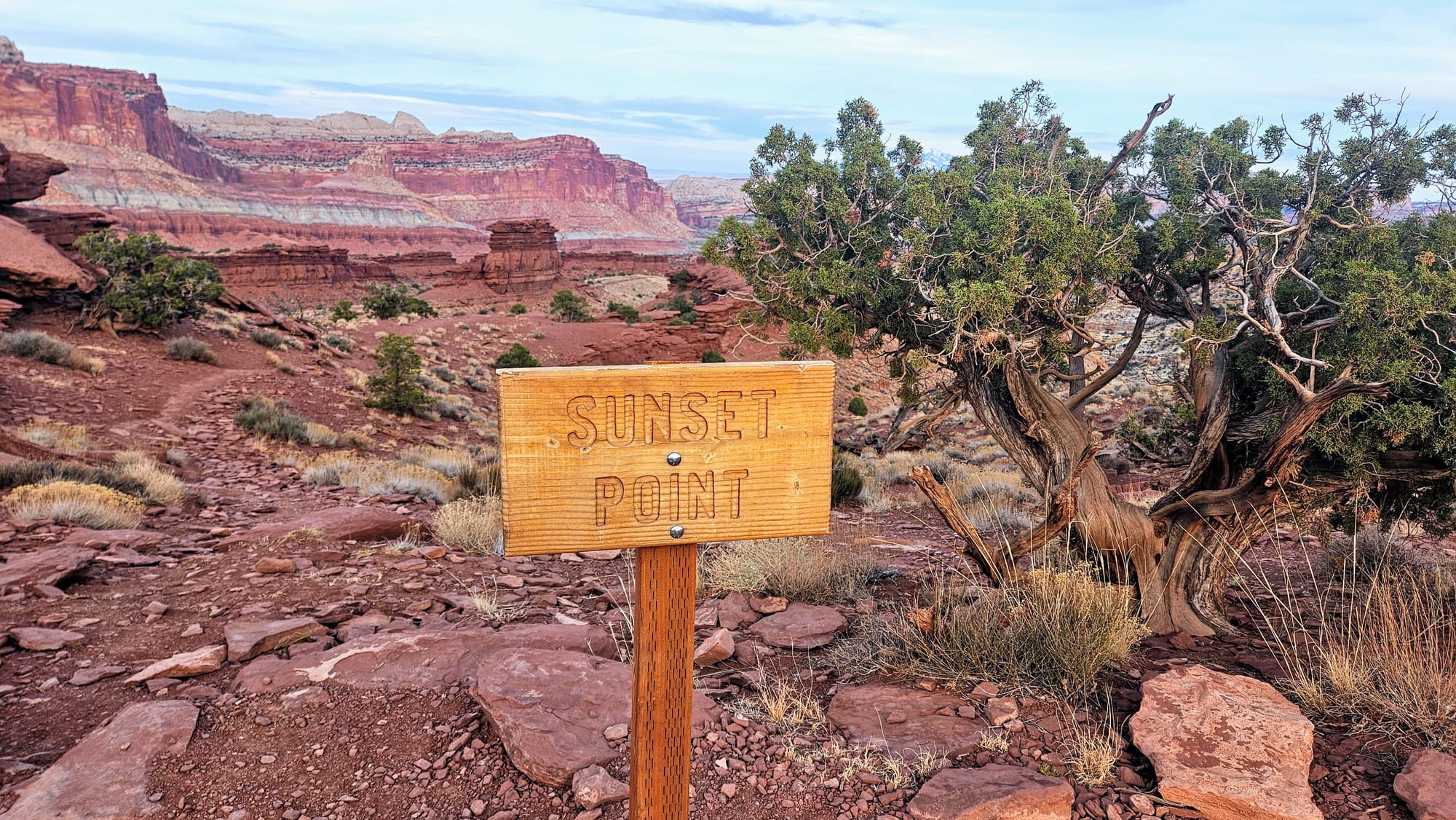
Day 1 (evening): Sunset at Sunset Point
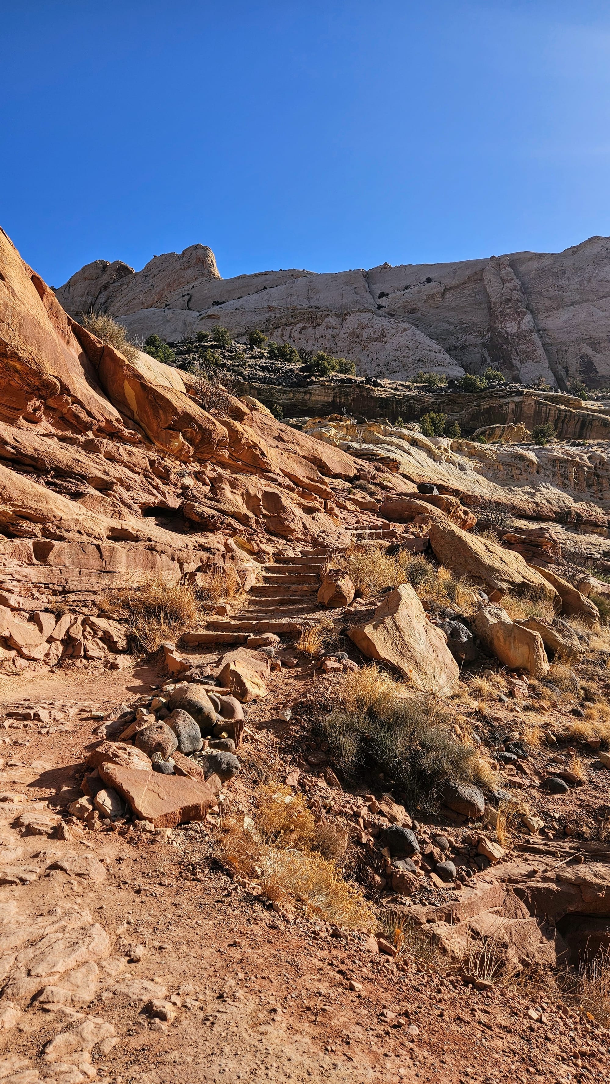
Sunset Point is 1 of 3 overlooks grouped together on the western side of the park. The NPS app said that it's a top recommendation for an easy hike to watch the sunset. Aptly named, then? Well you just wait!
We made plans to hit all 3 of the overlooks, starting with Panorama Point, and then driving up a winding, gravel road to the parking lot with Goosenecks Overlook and Sunset Point. The sun would set a little before 8pm, so our plan was to be at Sunset Point a short while before that.
Panorama Point is the easiest to access, because once the unpaved Goosenecks Road begins, it's a little bit rough and doesn't allow long vehicles. Small RVs can fit in the Panorama Point lot, and I immediately thought how awesome it would be to park the RV, have dinner, and then watch the sunset from this overlook.
As expected, Panorama Point has panoramic views. We could see the twisting Goosenecks Road below and tons of rocks and mountains. The path to the overlook is short and uphill. Once at the top, there are lots of places to climb around to get different vantage points.
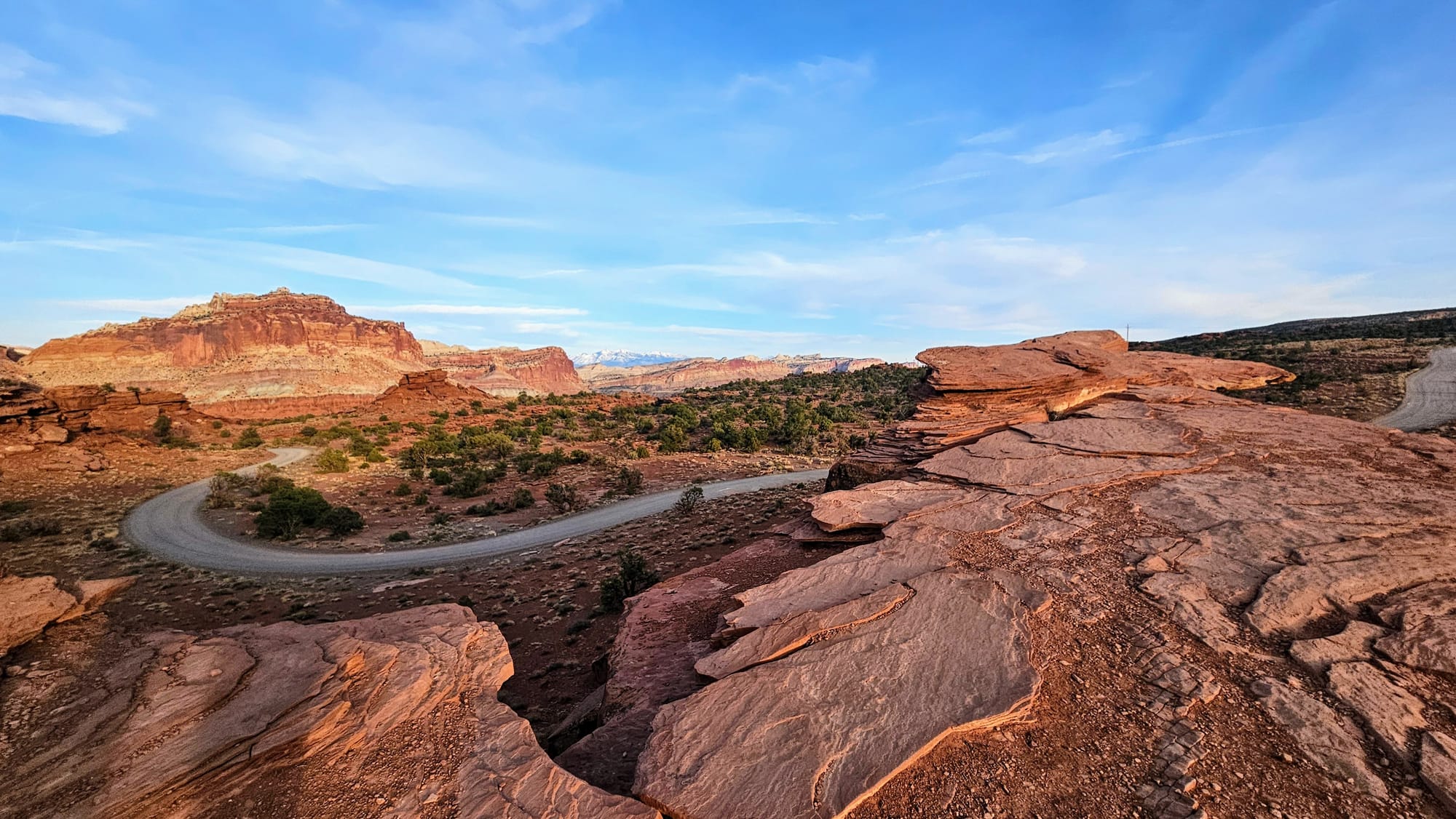
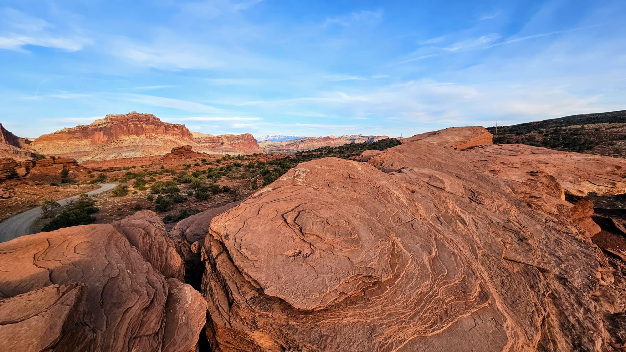
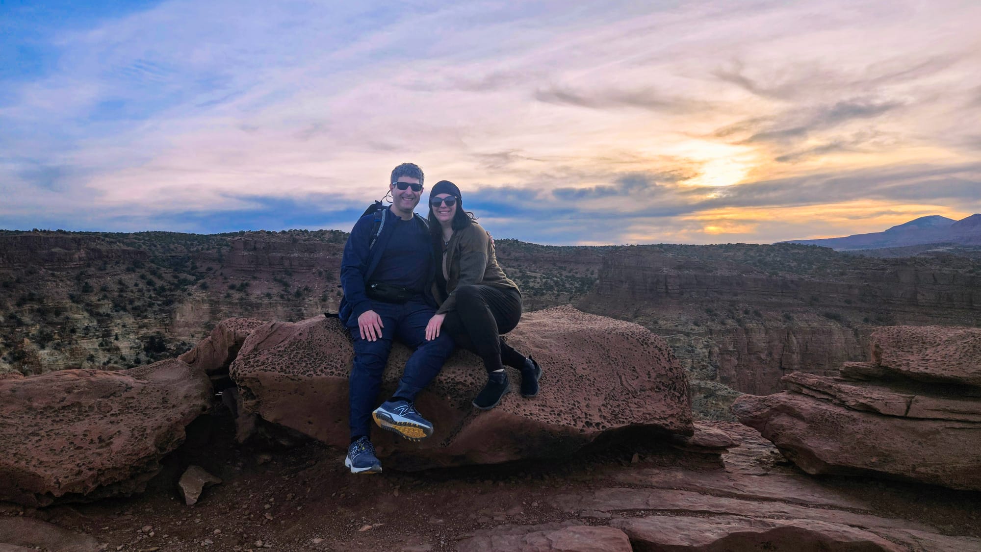
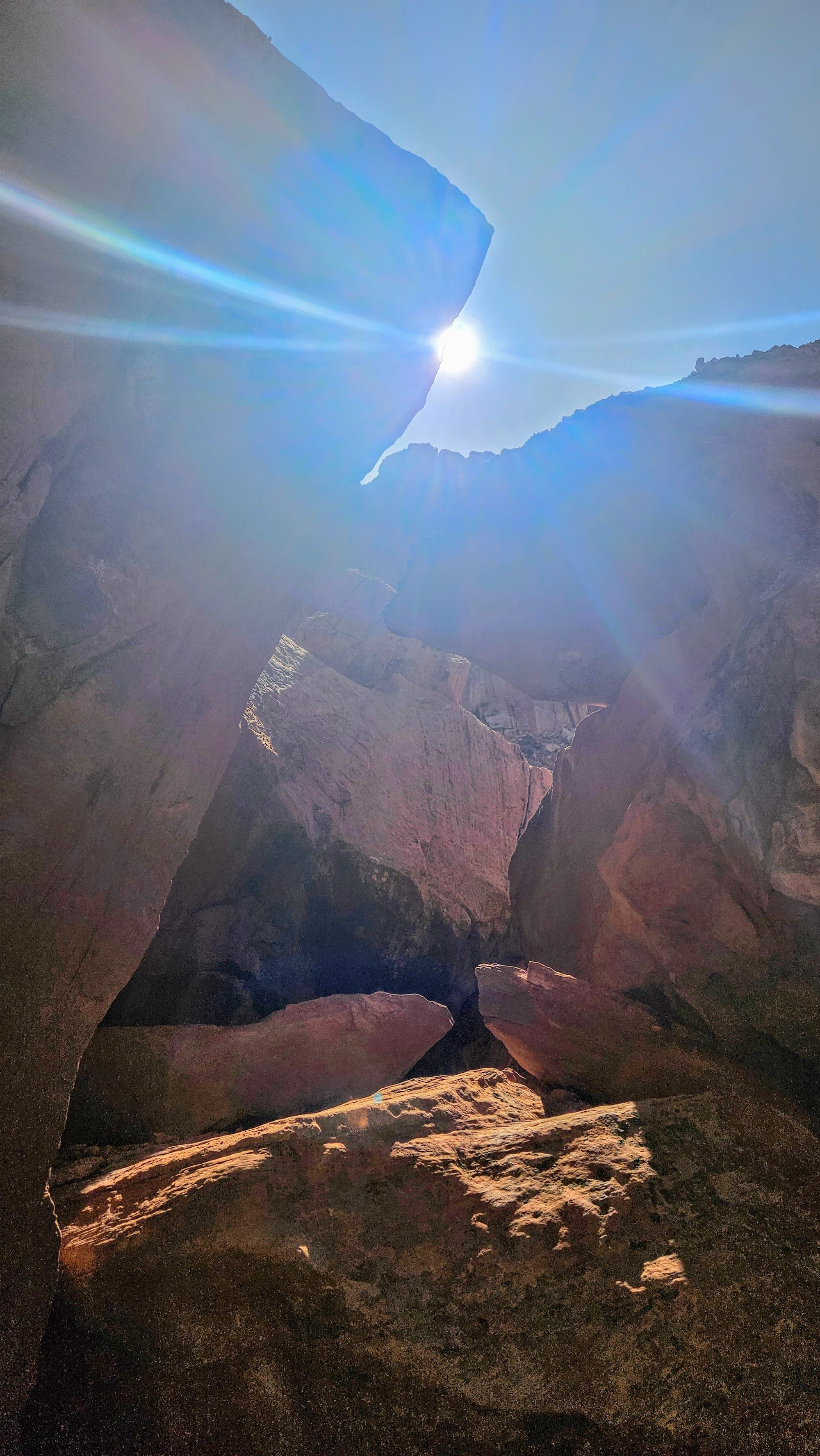
Then we drove Goosenecks Road up to the busiest parking lot we had seen at the park yet! Word had surely gotten out about Sunset Point. First, though, we climbed up a bunch of rocks to Goosenecks Overlook. We had the overlook to ourselves and took some pictures of the almost-setting sun.
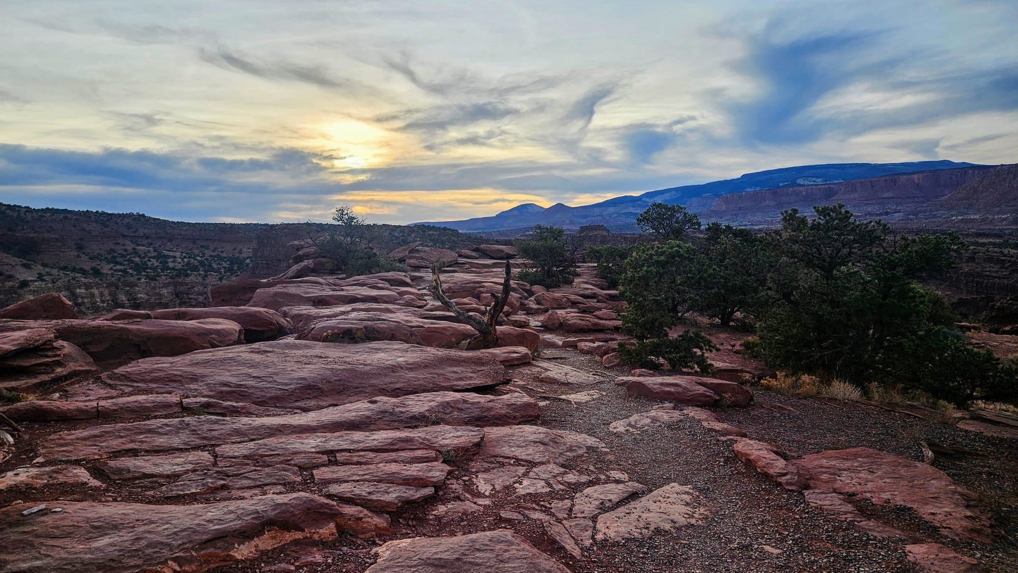
But wait...if Goosenecks Overlook faced west, why wasn't this the place to watch the sunset? The Sunset Point trail was across the parking lot and would take us east. We were confused. But, considering the clouds had come in and we were pretty sure sunset would be a dud anyway, we now turned our excursion into a quest. We had many pressing questions that needed to be answered. Why were we about to hike east to see the sunset? Would there be a view to the west once we got up there?
We headed back to the parking lot and proceeded to walk the .4 miles up to Sunset Point. Along the way, we kept turning back to see if the sun was showing any vibrancy as it set, but it kept getting more and more shrouded. Then we'd face forward again, looking in the distance to see where the actual Sunset Point was.
Then, we came upon it. Facing east. The bench at the overlook faced east. All the people there were also facing east. We felt like we were in some sort of Twilight Zone!
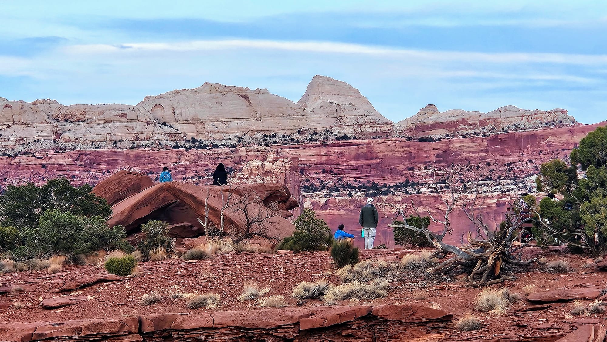
My best guess was that Sunset Point was actually some sort of "alpenglow point," where when the sun set behind you, you could see it reflect off the rock faces. But then why call it Sunset Point? Surely there is a better way to explain what you'll see here, instead of NPS telling us it's a great place to see the sunset.
Even if this overlook faces east for the glow effect, what was everyone doing there now? The glow tends to happen before sunset, because the sun still needs to be high enough to reflect off the rocks. Also, did these people not turn around and notice that there would be no sunset tonight? At least not enough of one to cast a glow. Well, it wasn't a great answer, but we felt we solved the mystery. Sunset Point is not actually Sunset Point...unless you count the sunset reflected in my sunglasses.
We left "Sunset" Point and wondered if we should return to Goosenecks, but we knew it wouldn't be worth it. I snapped one last photo from the parking lot, of a sun that decided to snuggle up in the clouds tonight.
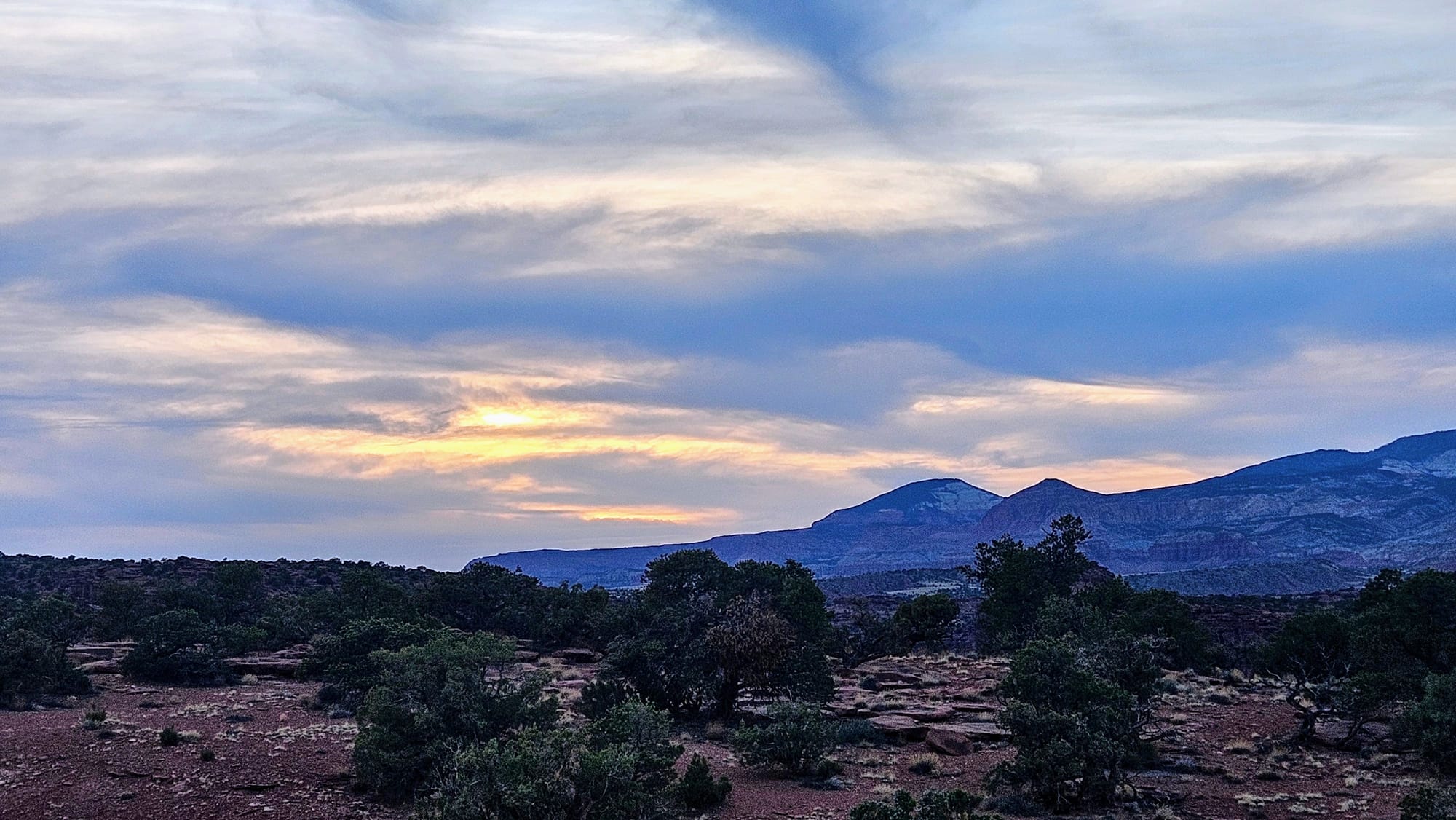
As soon as we got back to the rig, I did some research to see if I was onto something with my alpenglow theory. Sure enough, another part of nps.gov did say that you can watch the colors change on the rocks at Sunset Point. Lots of reviewers on Google and TripAdvisor recommended that you show up 45-60 minutes before sunset to see the glow. Precisely. Then there was one reviewer who said that Sunset Point is better for watching the sunset because it's "not as crowded as Goosenecks." Um, the Goosenecks that was completely empty when we went? And also, even if this is usually true, it's probably because, oh I don't know, Goosenecks actually has a real sunset view?!
When we told my mom this story, she found it so deceptively hilarious that she did some research of her own. She told me that it's possible Bryce Canyon might do something similar. Evidently rangers made Sunset and Sunrise Points to lure visitors to the overlooks. Well. We shall see what we find. TBD.
Day 2: Scenic Drive
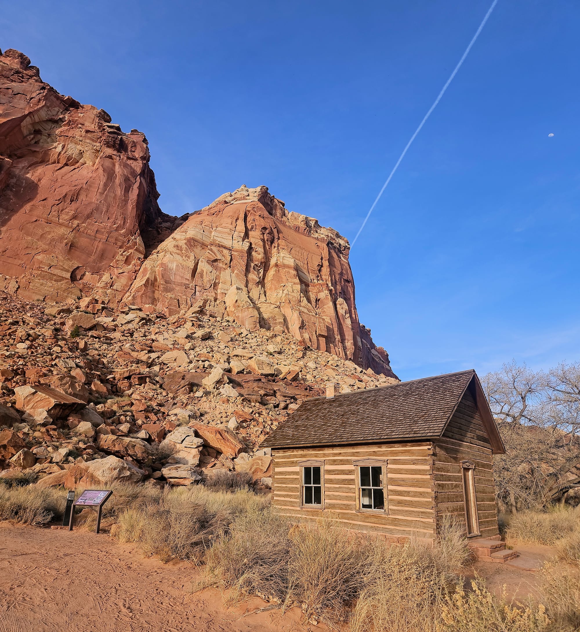
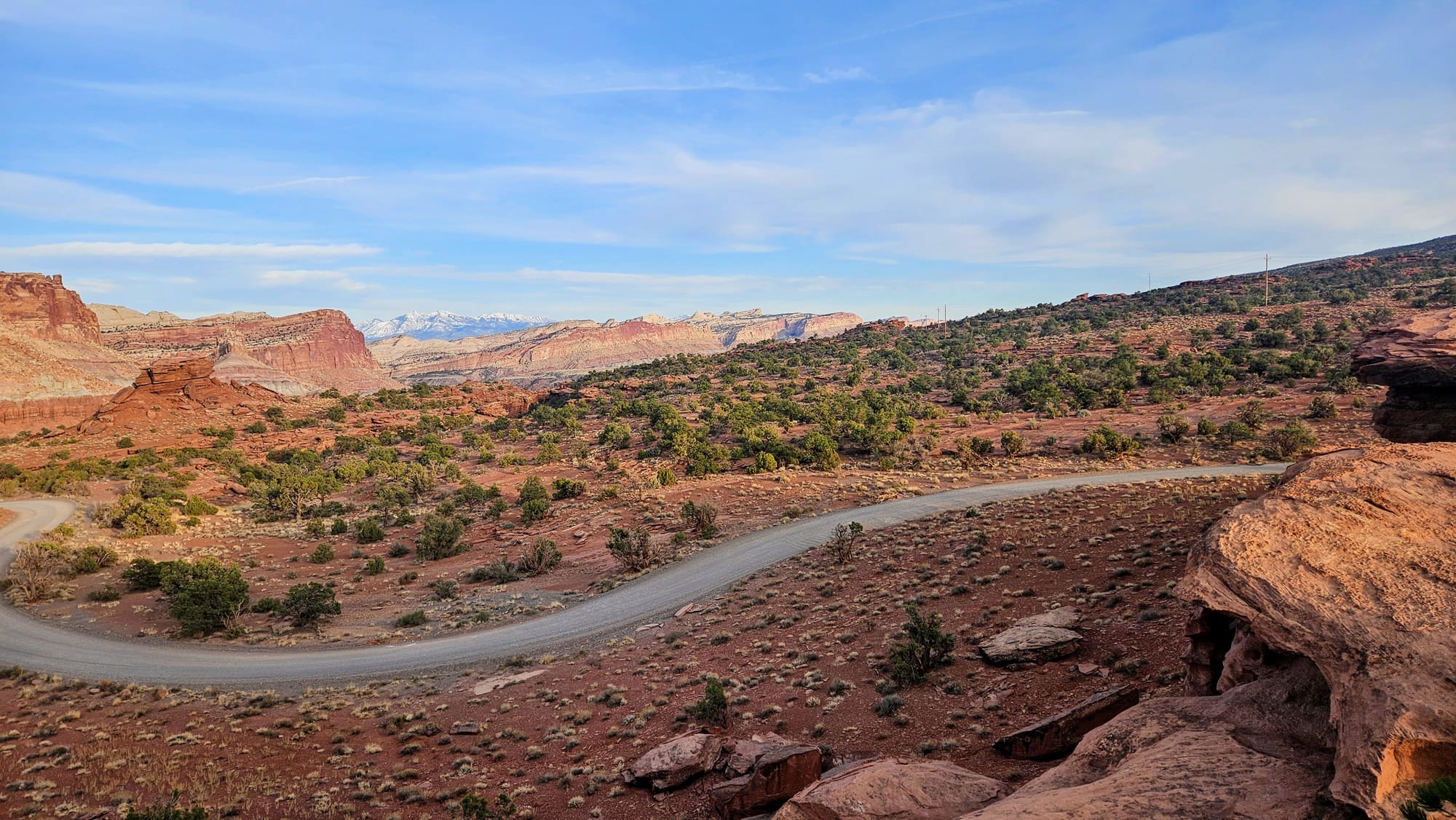
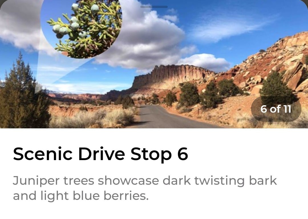
We kept seeing alerts that the scenic drive would be closed for rehabilitation sometime in April, but when we visited, it was still open. There were a few construction flags and bumps along the way, but no real obstacles. The scenic drive officially starts past the Gifford Homestead and is an out-and-back road, with two dirt spurs you can take if you wish. We, of course, found the self-guided audio tour on the NPS app and listened to the commentary along our journey.
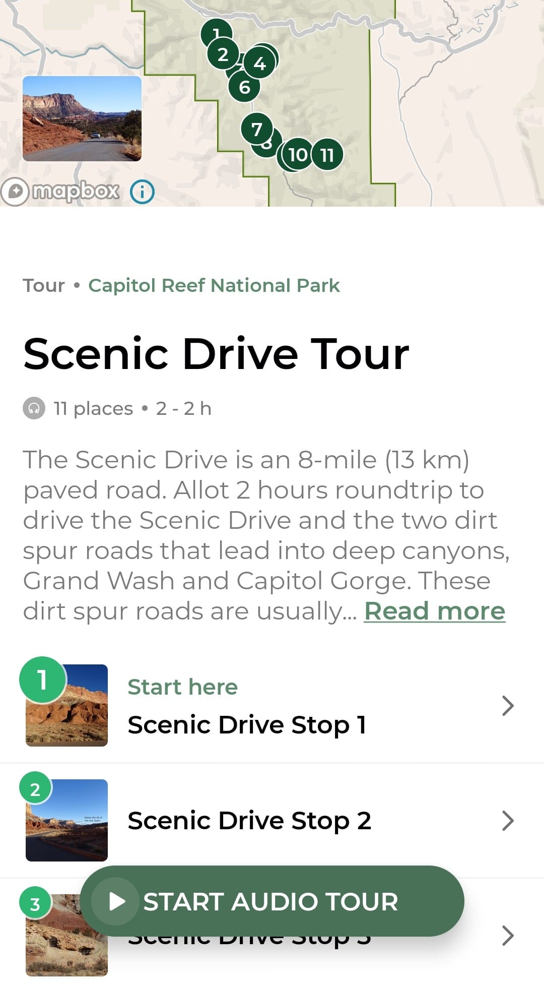
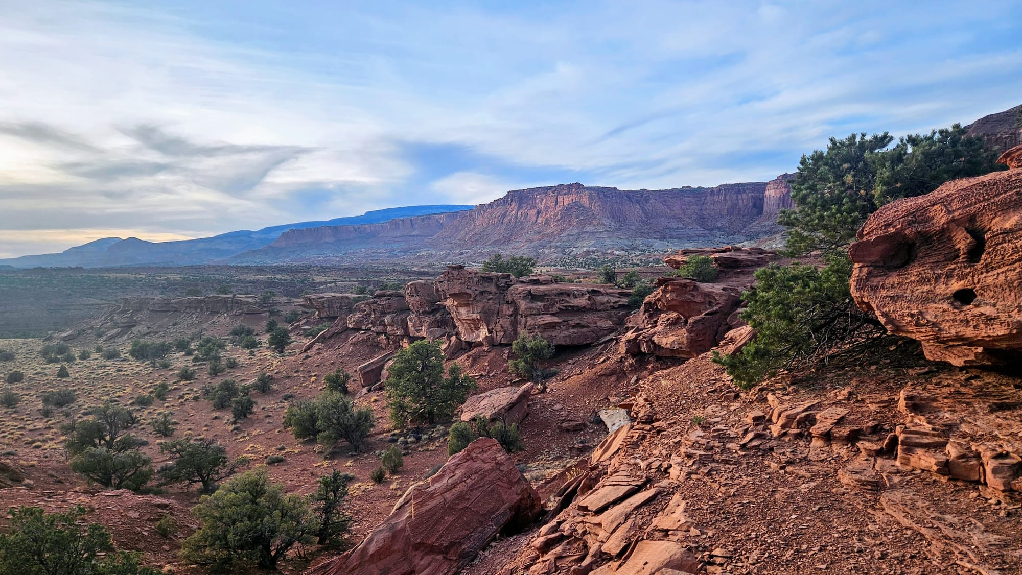
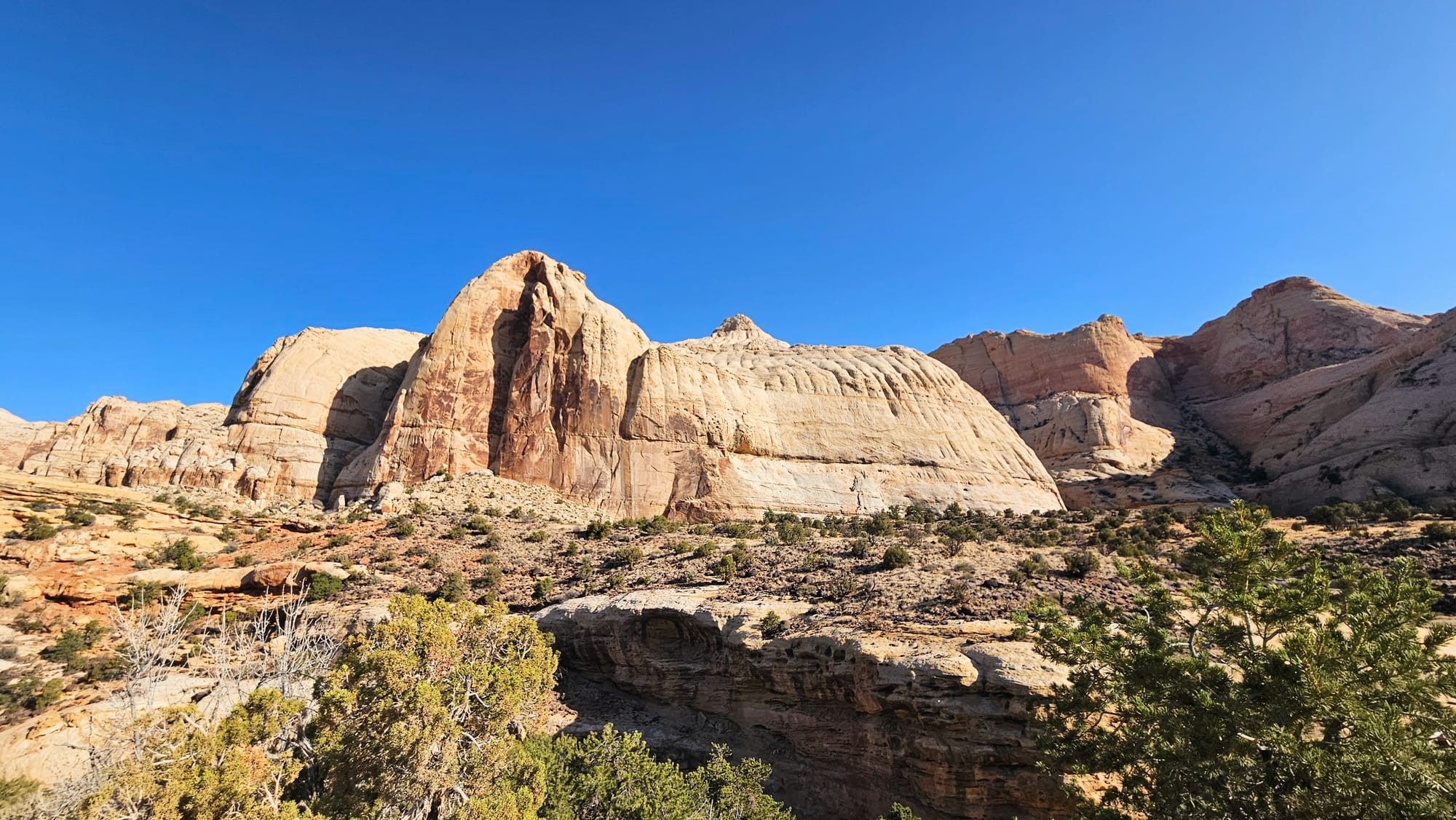
The scenic drive took us to several pullouts and we were told about the Waterpocket Fold, which is a fault line that runs underneath Capitol Reef. This fault line caused the rocks on the western side to be pushed up higher than those on the eastern side, creating a monocline, or a tilt of the rocks from west to east.
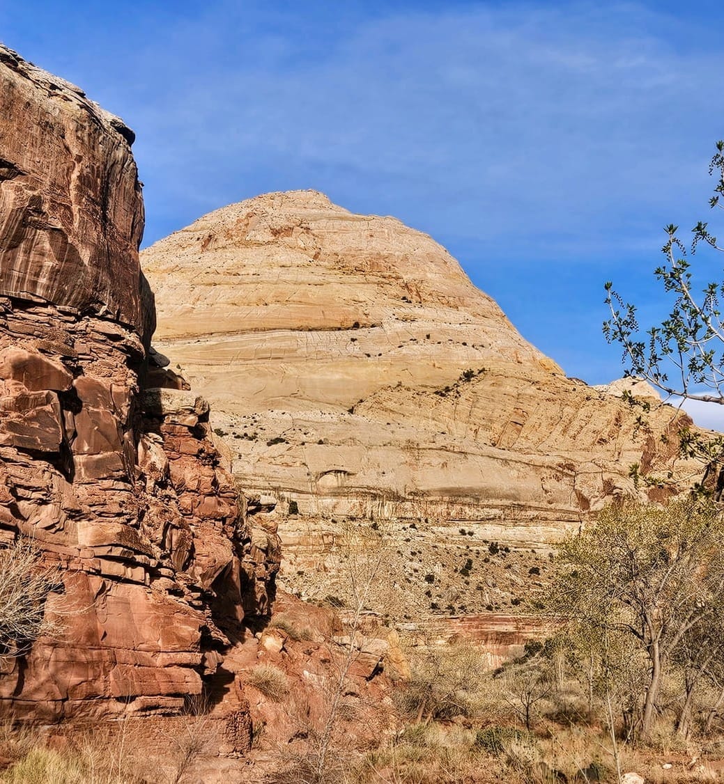
We learned about the layers of rock that make up the cliffs: The wall of Wingate Sandstone, the Kayenta Formation which contains a lot of the greenery and vegetation, and finally the gray-white Navajo Sandstone, shaped into domes by the wind.
This scenic drive is also where we discovered that juniper trees are conifers. IYKYK.
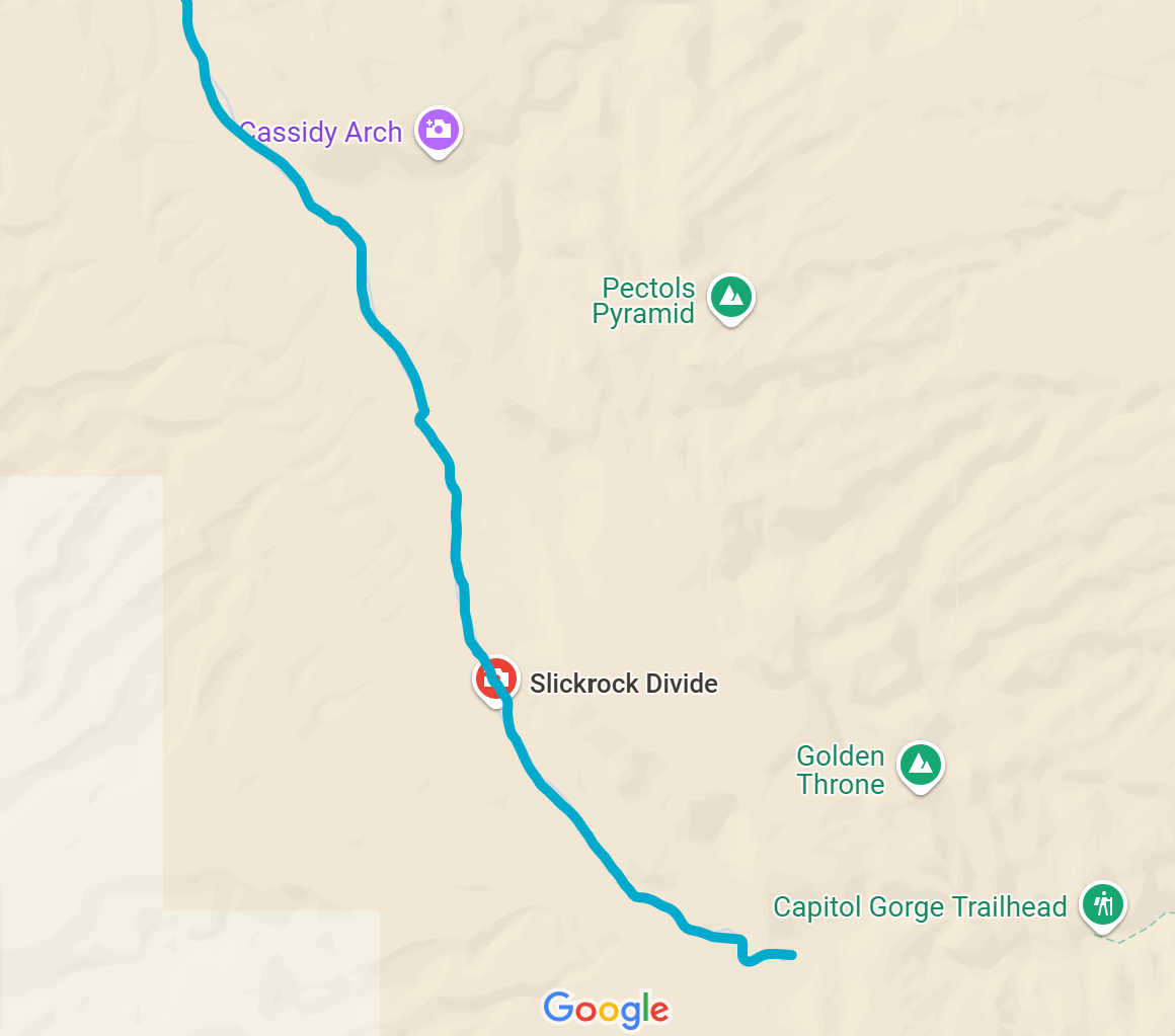
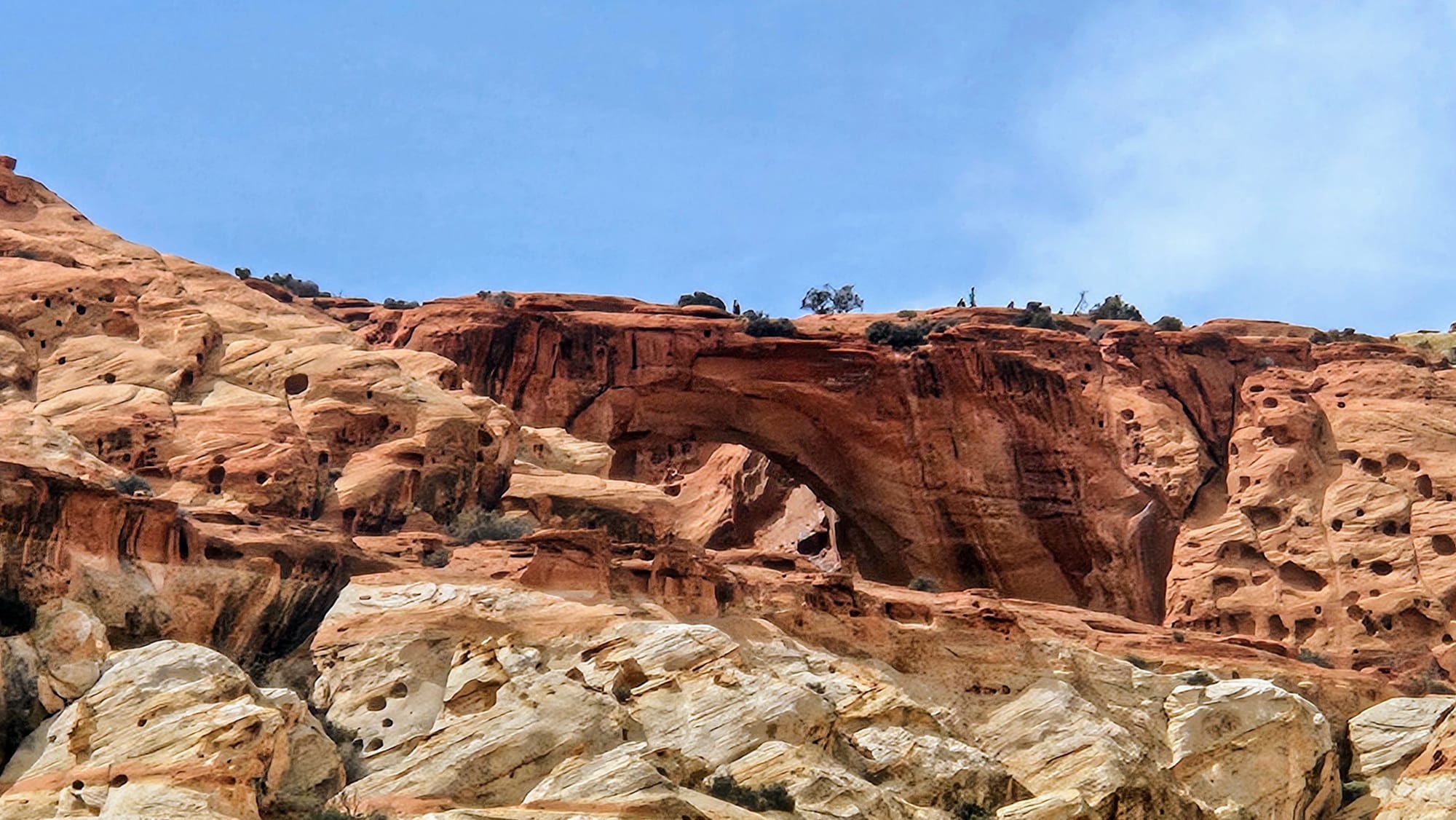
The two unpaved spurs along the self-guided tour are Grand Wash Road and Capitol Gorge Road. We took Grand Wash Road, but it was crowded and narrow. We needed to pull off to the side several times to let other vehicles pass, which was often on a rather precarious edge of the road. One of the popular trails, the half-mile trek to Cassidy Arch, is along this road. The trailhead for Cassidy Arch was the most crowded we saw in the park. We didn't hike, but we had a distant viewpoint from the road. That was enough for us. We had seen a lot of arches lately.
Capitol Gorge Road continues at the end of Scenic Drive Road, but we decided to turn back. We didn't feel like roughing it on an unpaved road again, especially not knowing how crowded it would be. Honestly, we were also a little underwhelmed. Such a strange and almost insulting thing to say in such a gorgeous place, but this scenic drive just wasn't our favorite. Maybe it's because we already knew a lot about how this area was formed, or maybe we were feeling oversaturated by all the information we had obtained from the other two national parks. Cramming this much adventure into a small time period is tiring. We decided we'd rather cut our scenic drive short so we could regroup and be ready for our third and final day in the park.
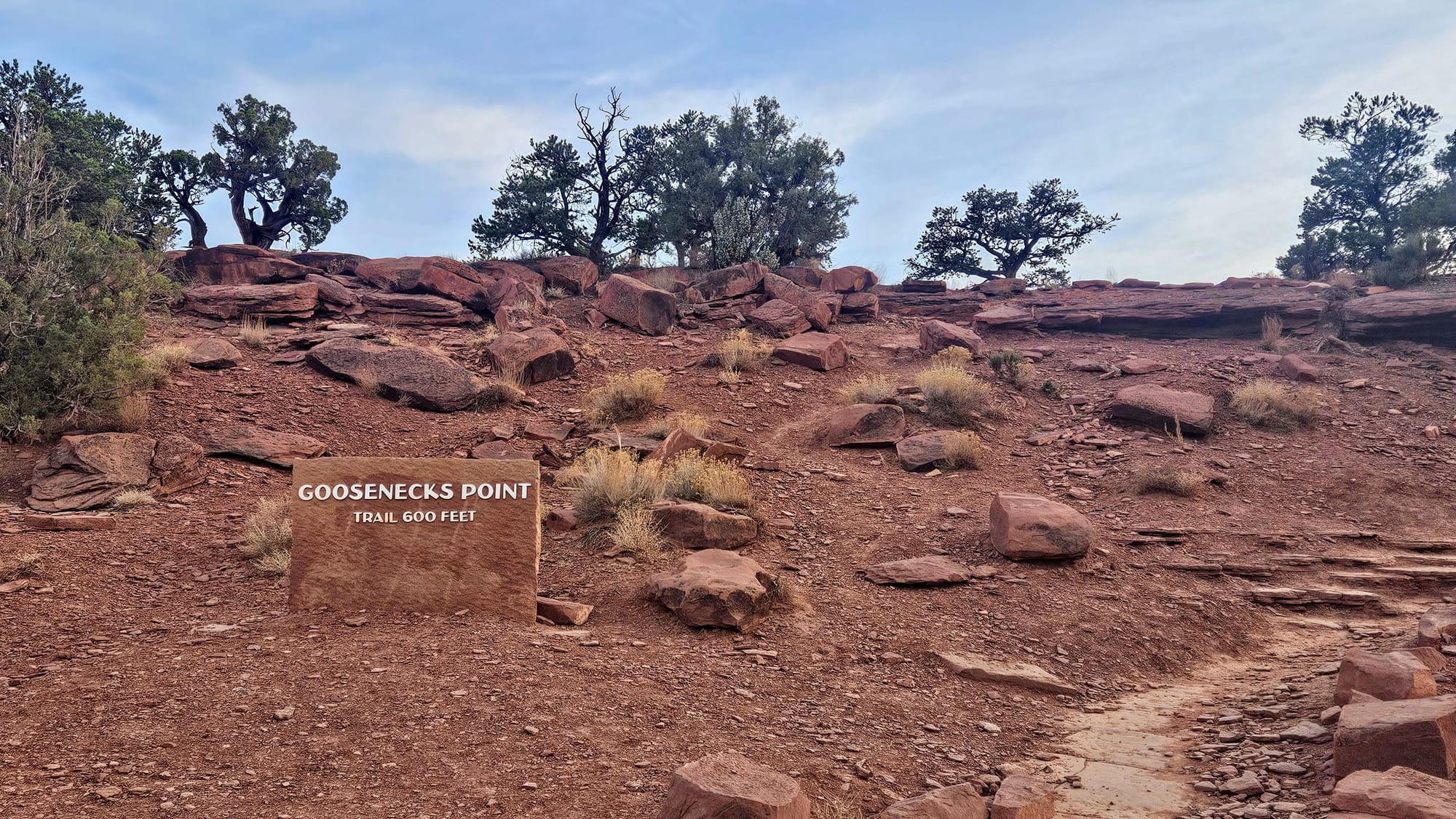
Day 3: Hikes to Hickman Natural Bridge and Chimney Rock
The real source of our fatigue was the information overwhelm. We had been learning so much about this part of Utah, that eventually we found ourselves trapped in a corner. When we were given information, either we already knew it and therefore gained nothing from it, or it was new and therefore added to our oversaturation. We needed an activity that would allow us to soak in the scenery while turning our brains off for a bit. This is what we love about hiking. We can take hikes that are informative, or we can just hike for the love of nature and exercise. This time, we sought the latter.
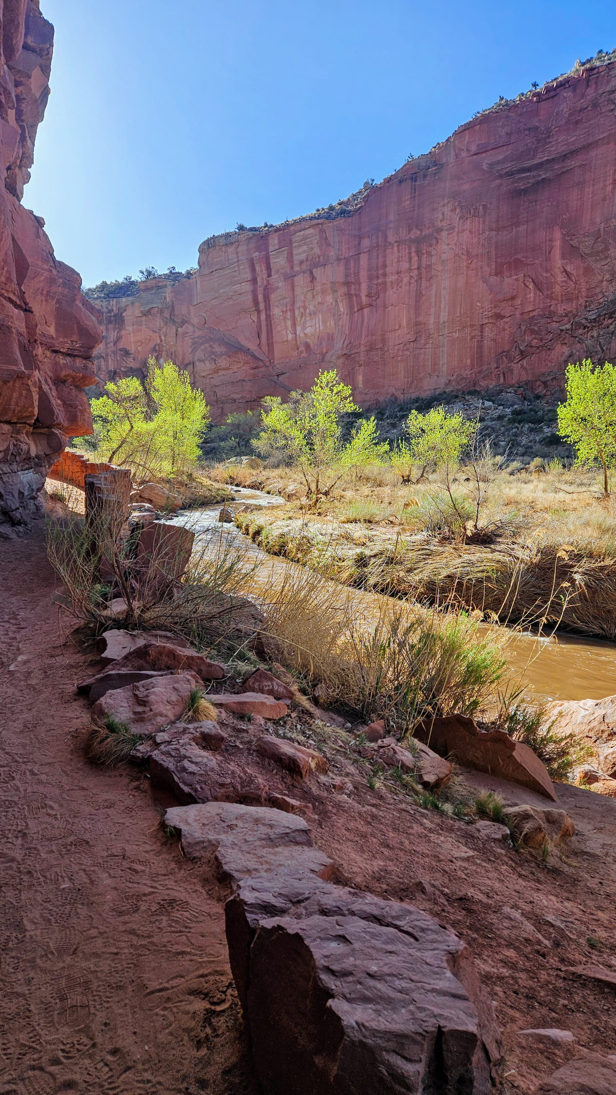
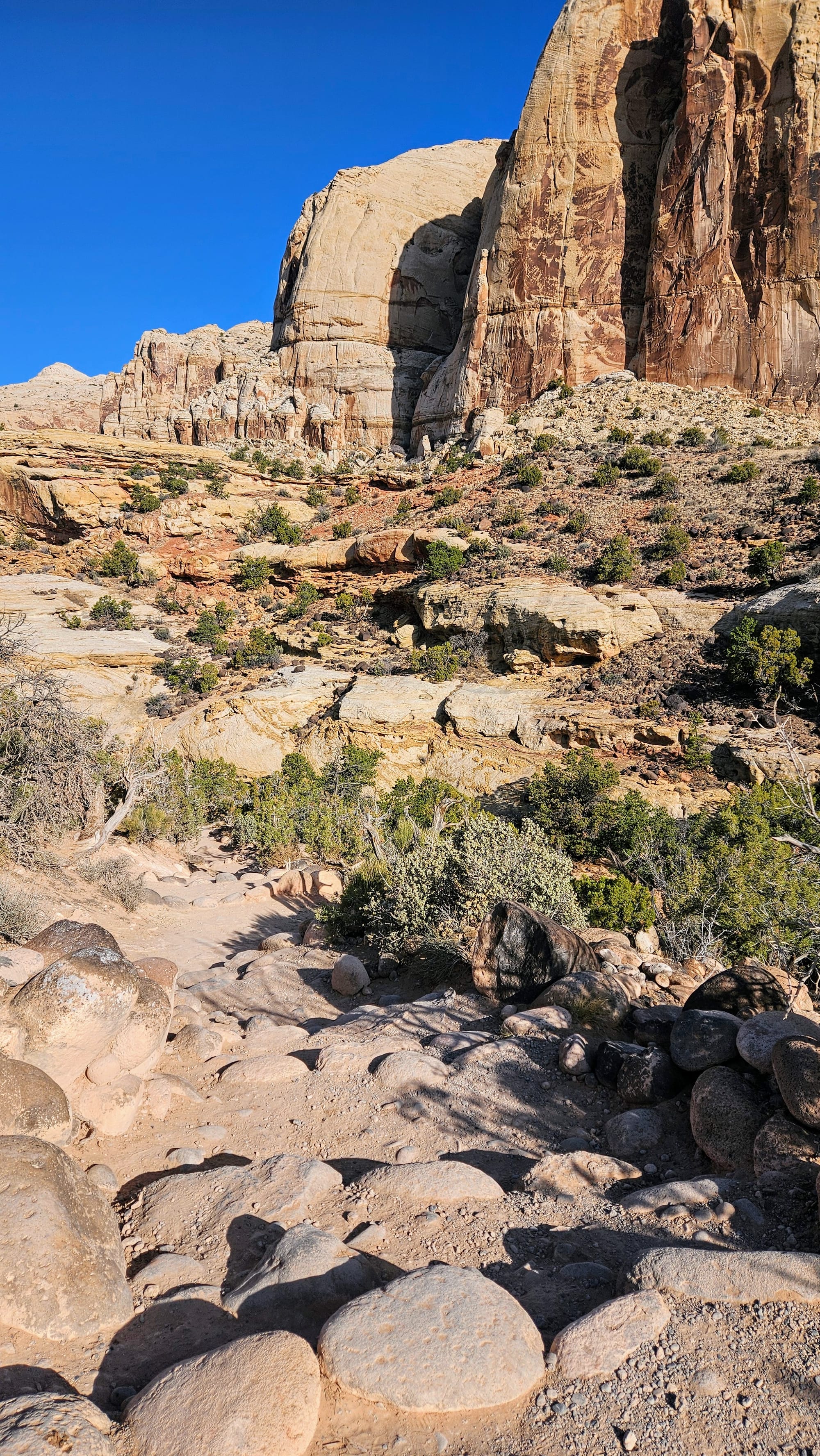
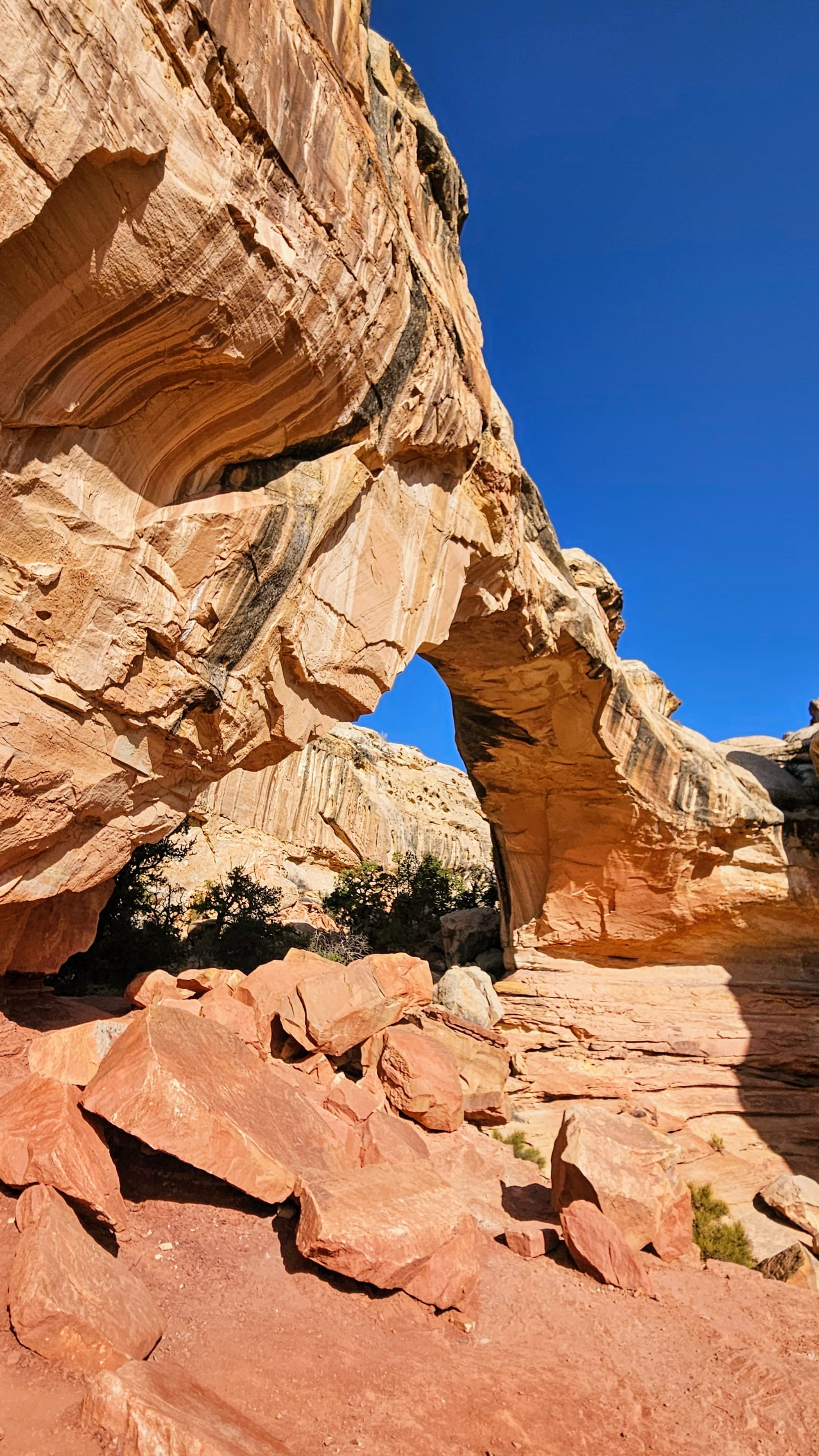
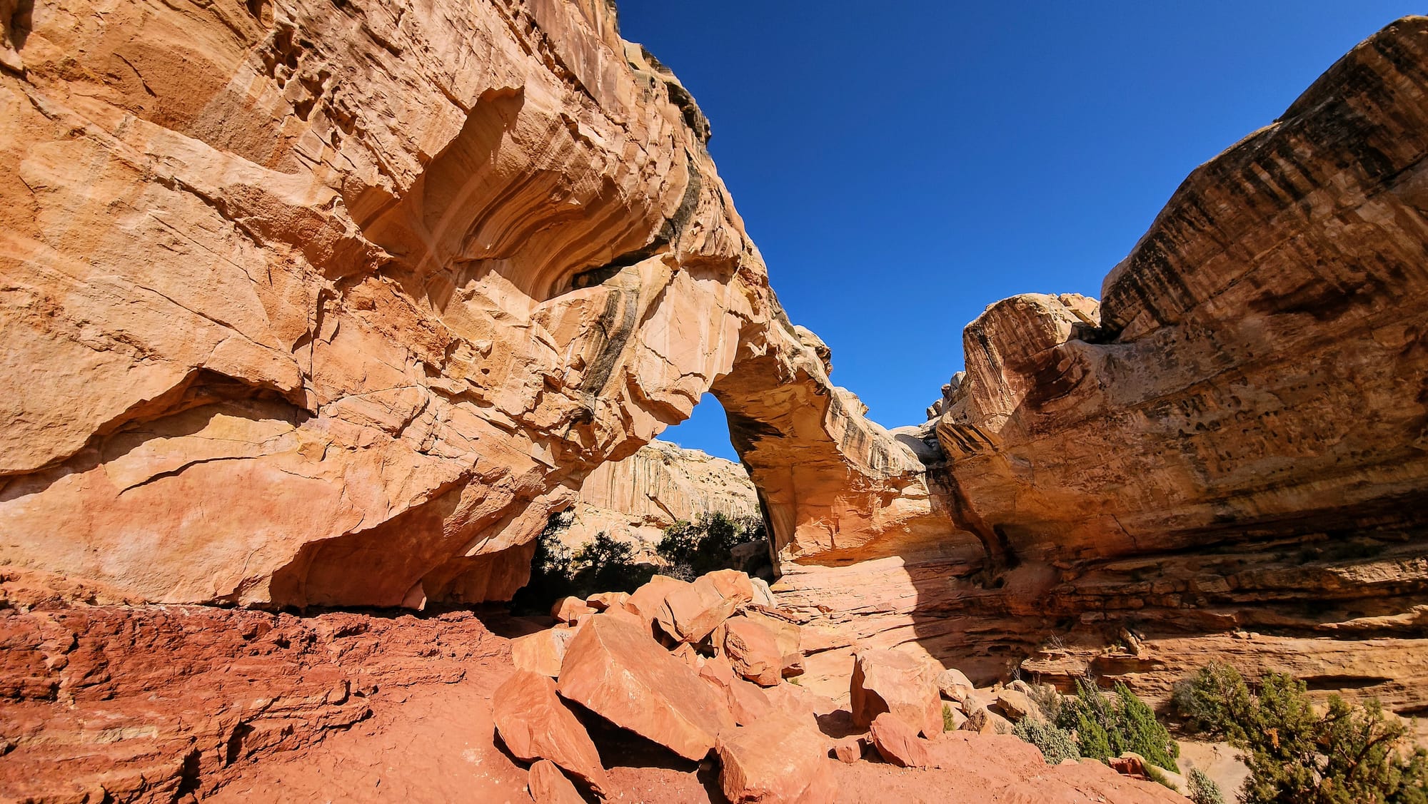
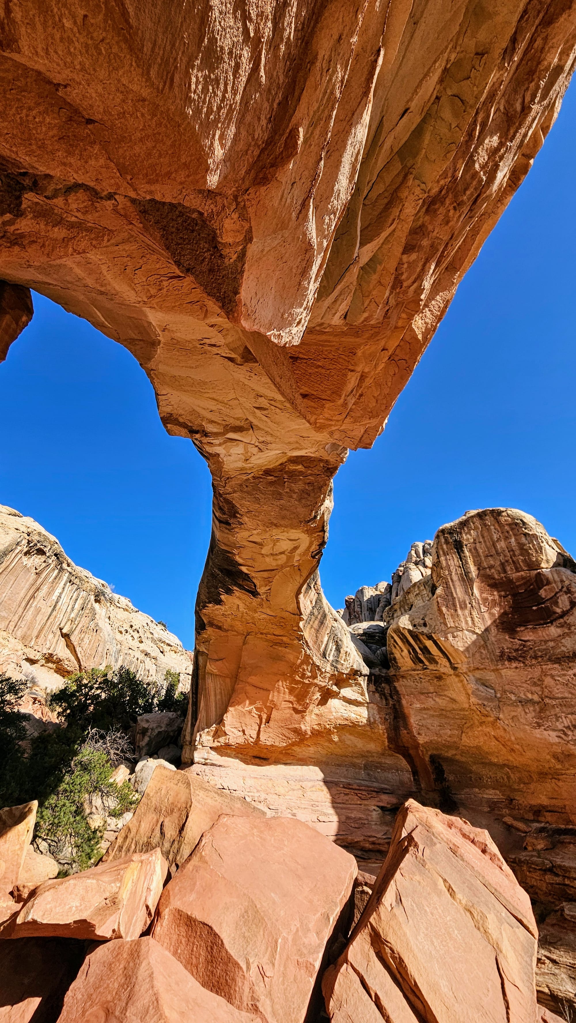
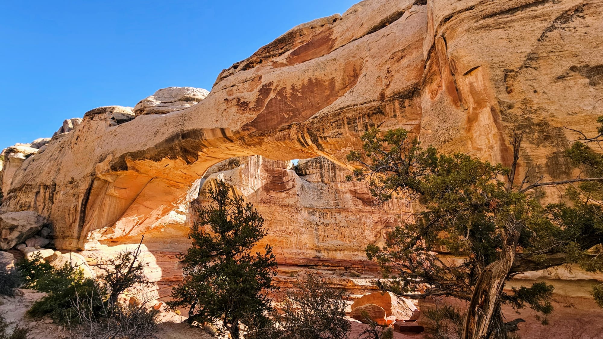
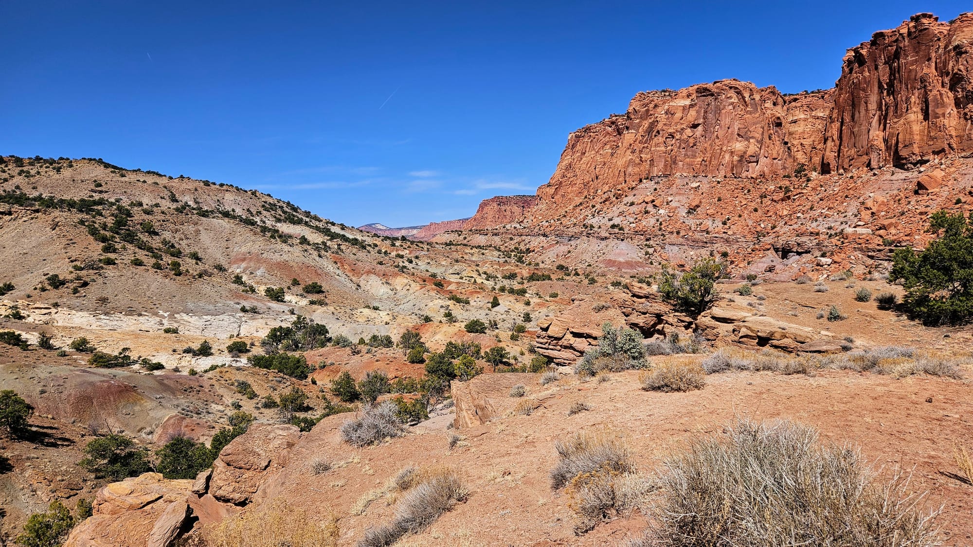
Hickman Natural Bridge is a 1.8 mile trail that leads to and under a natural bridge. Yes, a natural bridge is still technically an arch, but this one was formed by running water erosion, and a whole bunch of other technicalities that are exactly the kind of oversaturated information load we didn't want. The trail met our preferred specs with its relative shortness and moderate rating, and we'd see some pretty things. Onward we went!
The beginning of the trail runs alongside the Fremont River before it ascends upward and along a canyon, where it splits with the adjacent rim trail.
We were feeling good, at least until a man passed us on the steps and told me, "Put away your damn phone." I had it out to snap one photo and already had it back in my pocket by the time he passed us, but also, excuse me?! This is absolutely not the attitude we want when we're trying to hike our own hike. Perhaps he should try and do the same. I was not expecting him to say anything, so I didn't even register at first what he had said, or else I would have had a wonderful list of retorts to choose from. Like, he does realize my "phone" was also serving as my camera and All Trails map, yes? What am I supposed to do, not capture memories on my hike? Not share my photos to over a thousand people on my blog and social media? And if he's worried that I'm not mindfully engaging, perhaps he would like to learn what I do for a living.
We turned the interaction around and used it to spur us on. We conquered that hike with the greatest stamina, and took plenty of photos along the way!
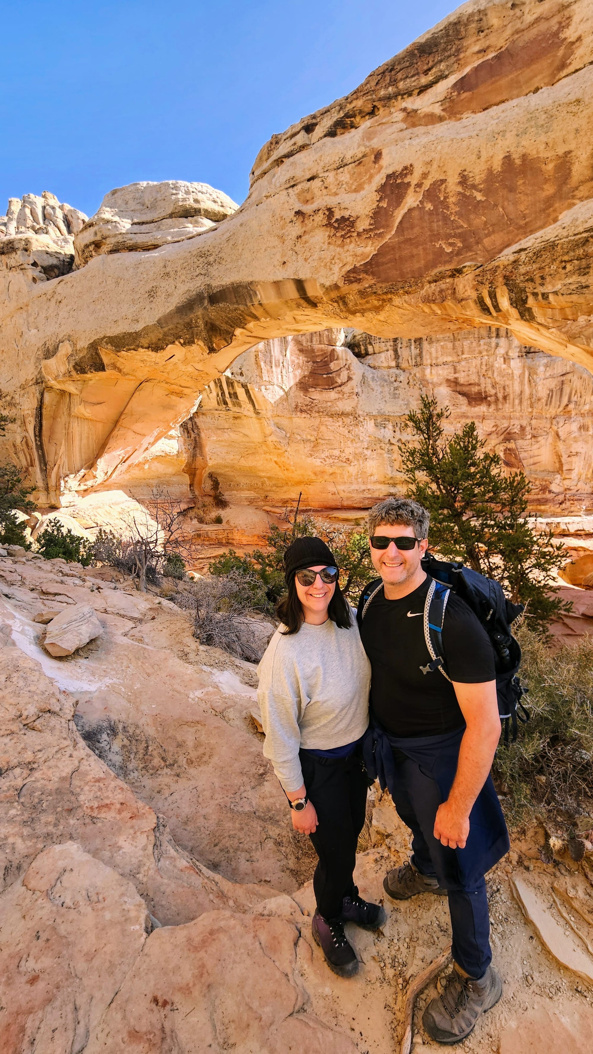
Then we made our final climb to the bridge. We think we hiked between waves of people, because when we got to the parking lot, there were a lot of cars, despite us getting there early. "Backwards visitation" at work. Everyone advises to go early, but when we do, we're caught with all the other people who took the same advice. However, we passed most people on their way out, and when we got to the bridge, there were only a few people there.
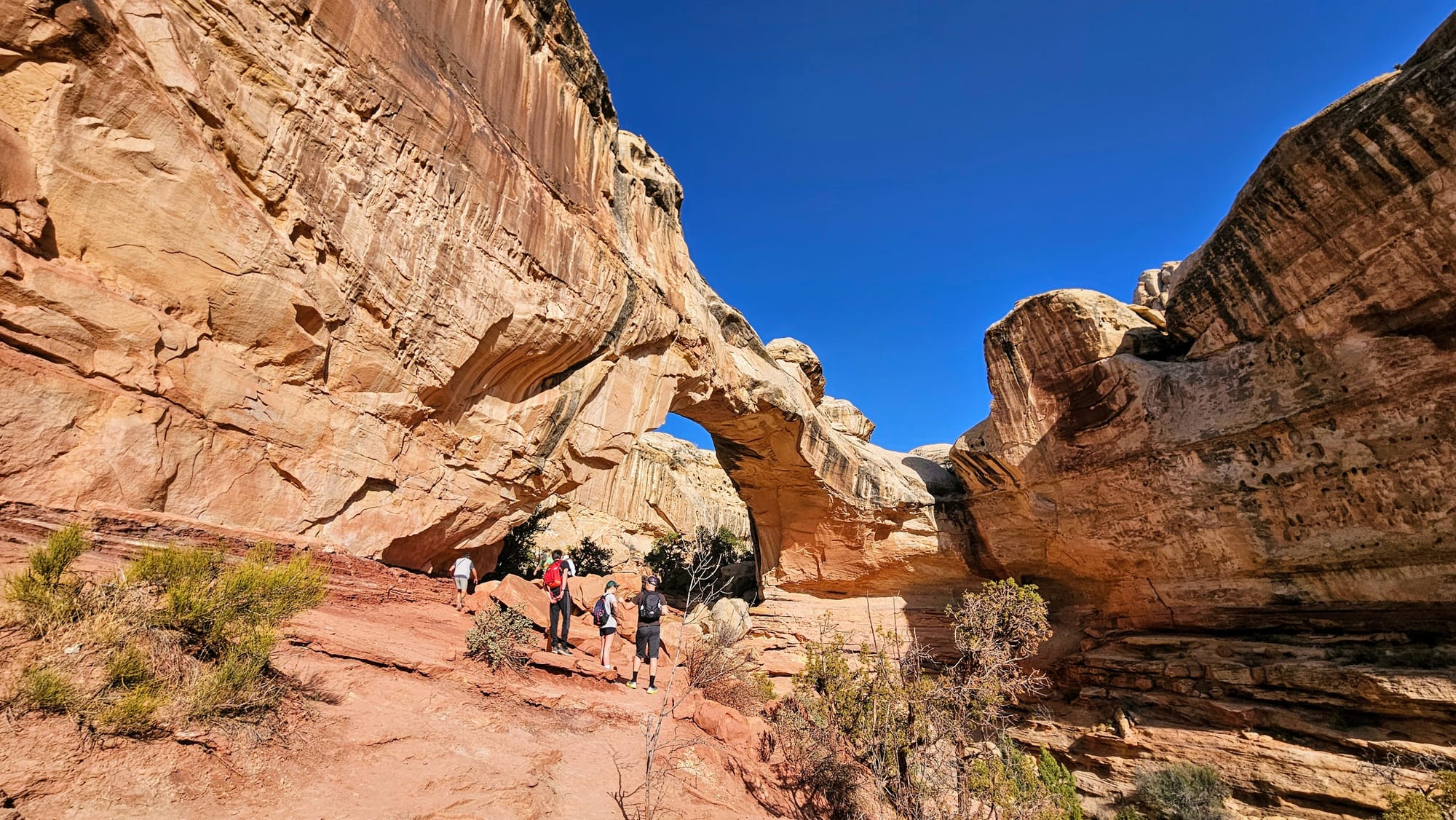
They cleared out pretty quickly, and we were able to get some photos under and around the bridge without worrying about getting photobombed.
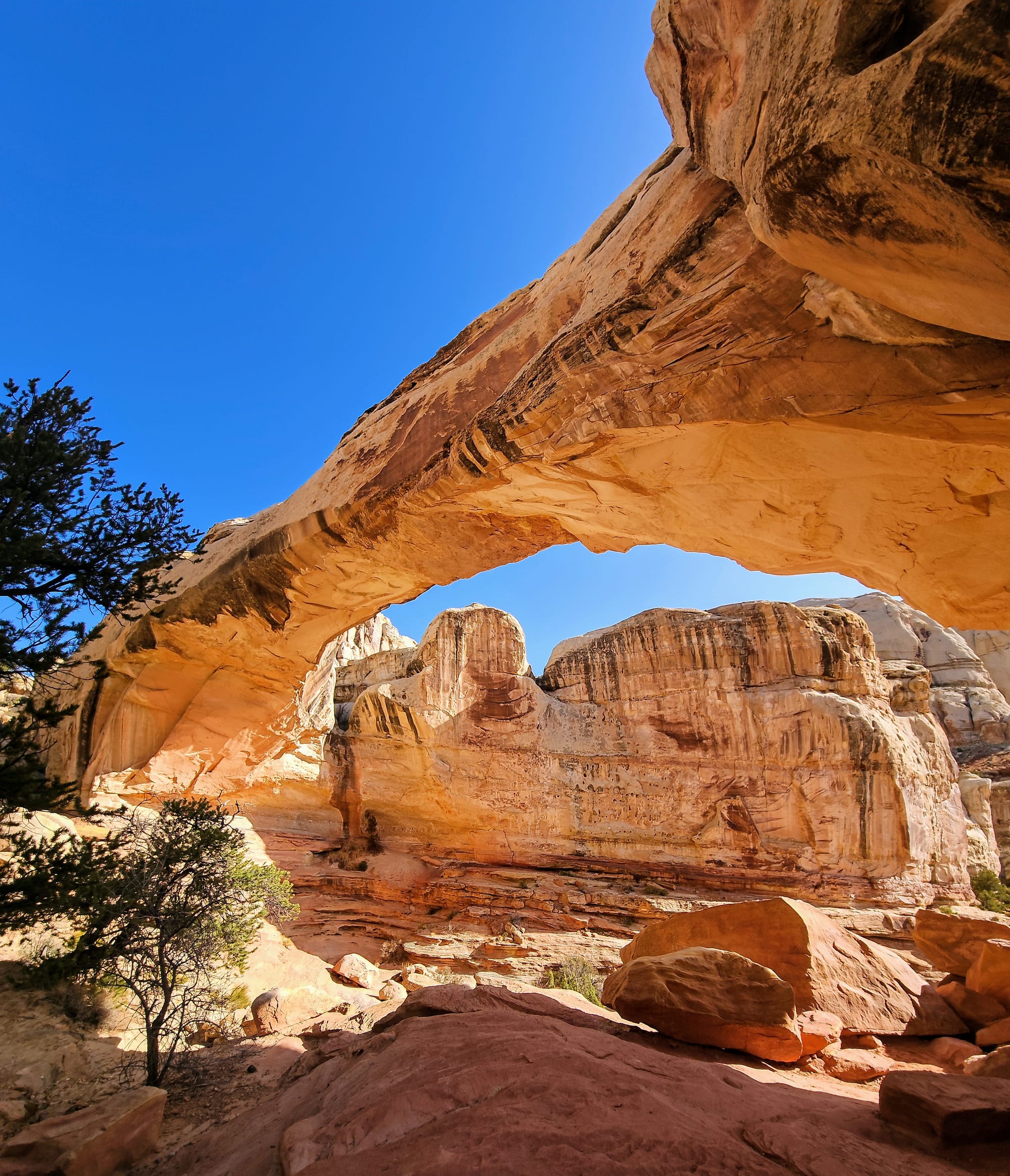
From here, the trail looped around and gave us views of another canyon and Pectols Pyramid.
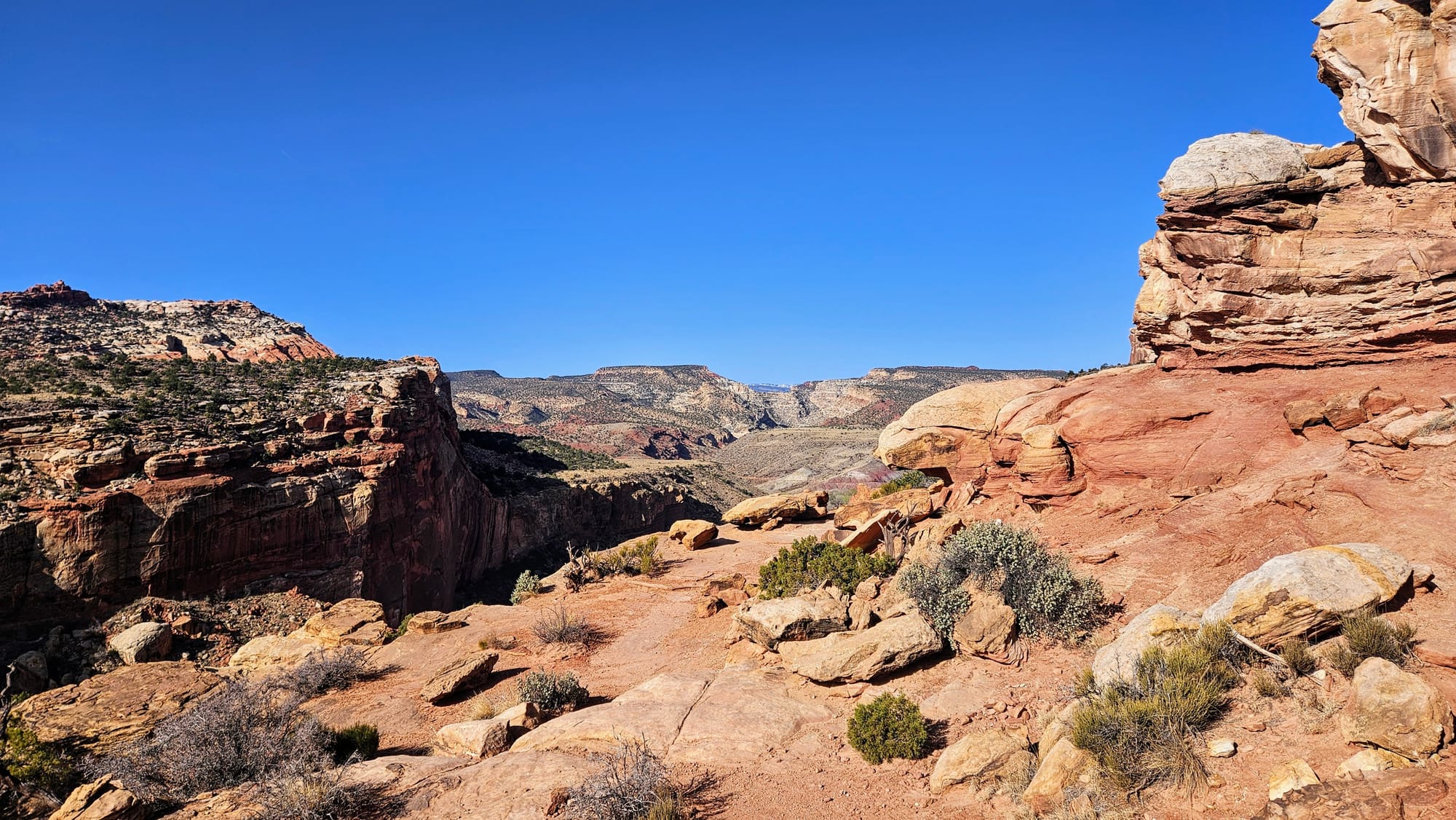
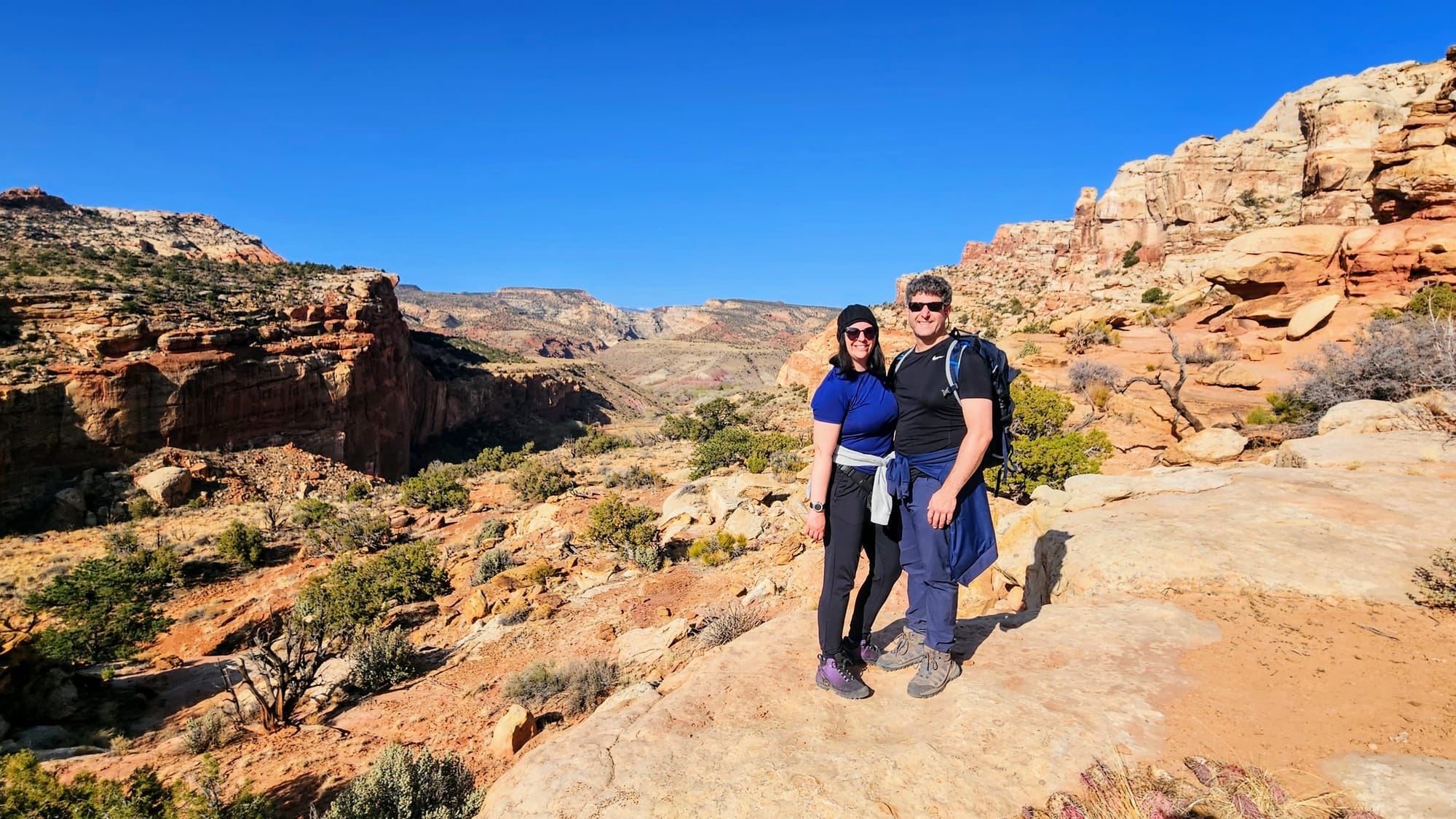
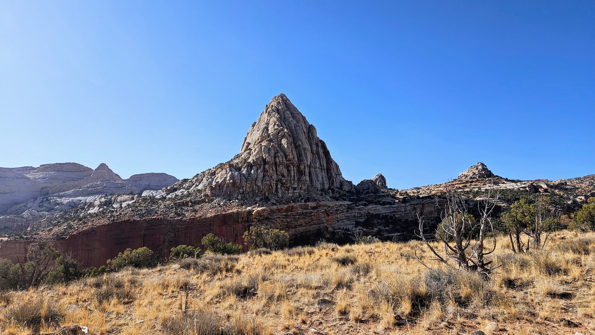
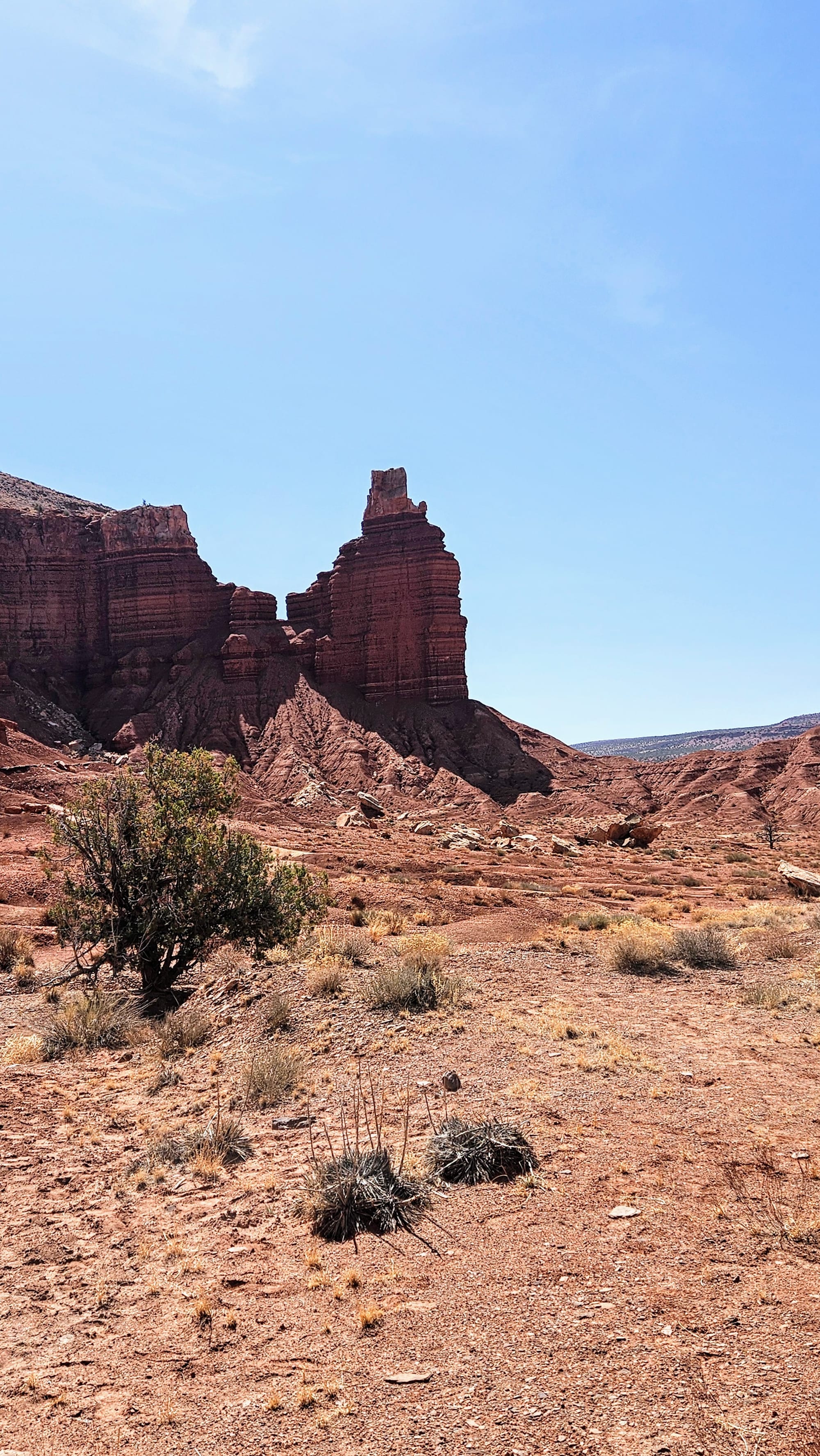
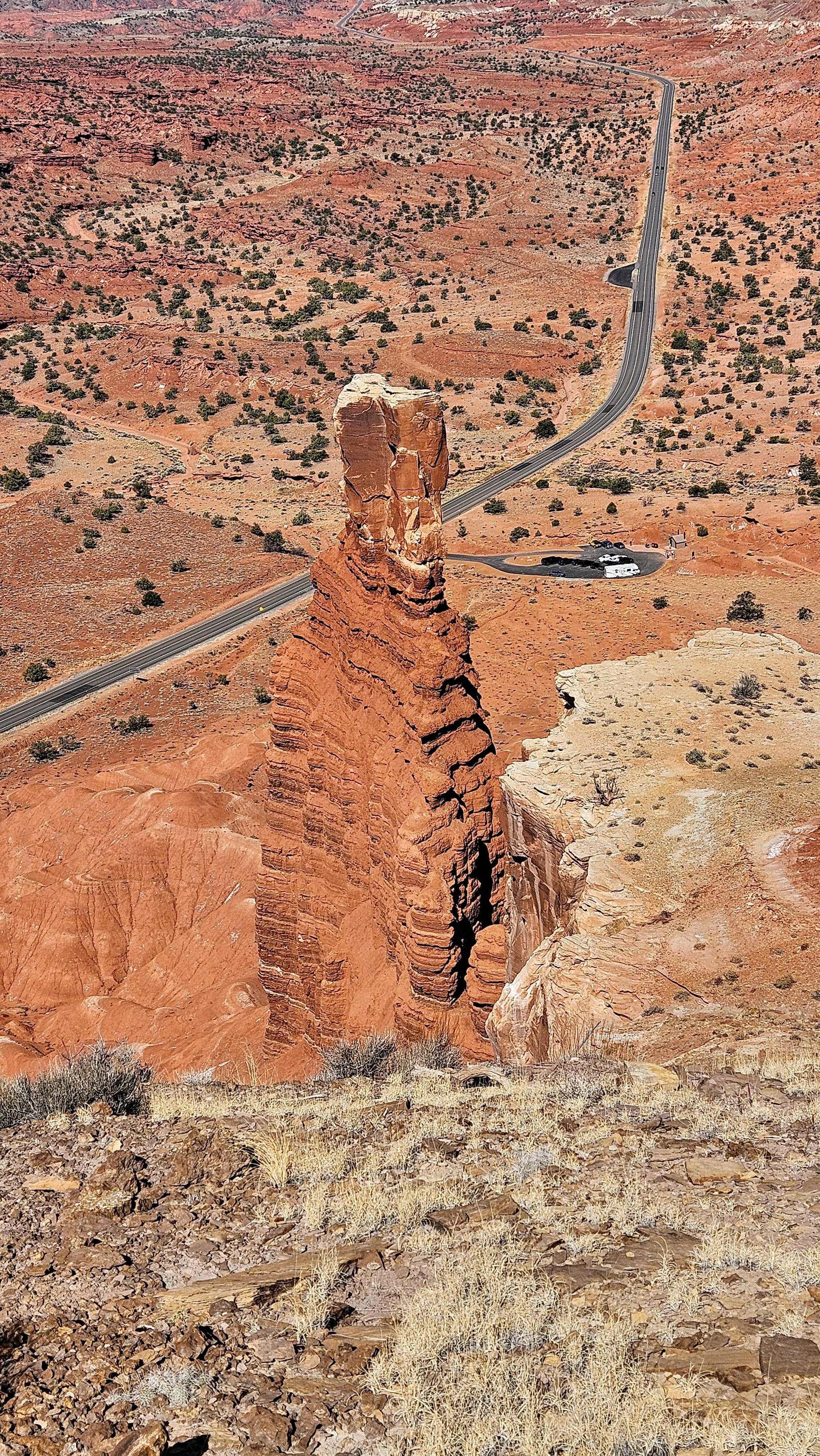
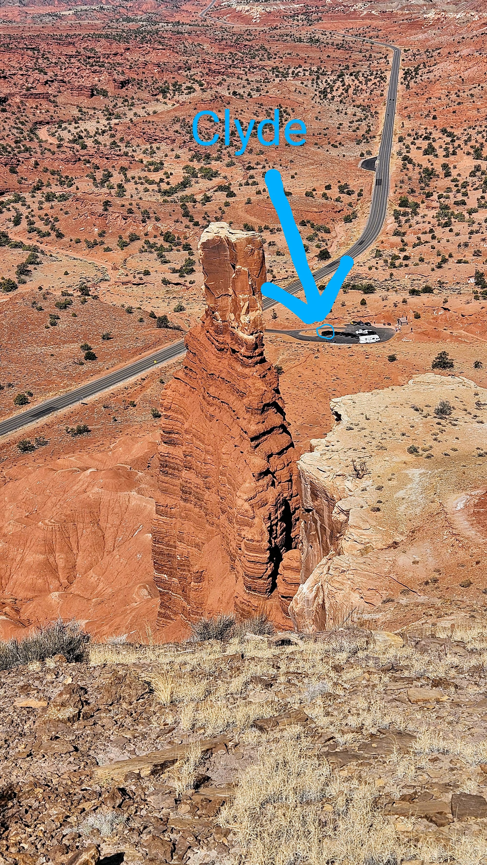
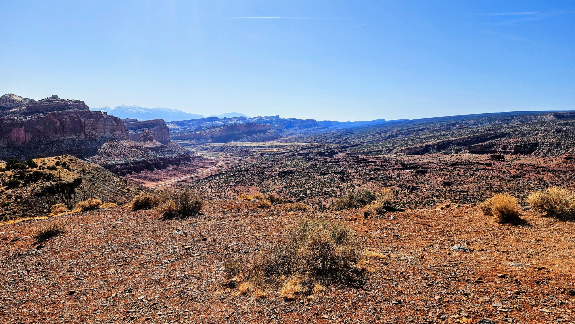
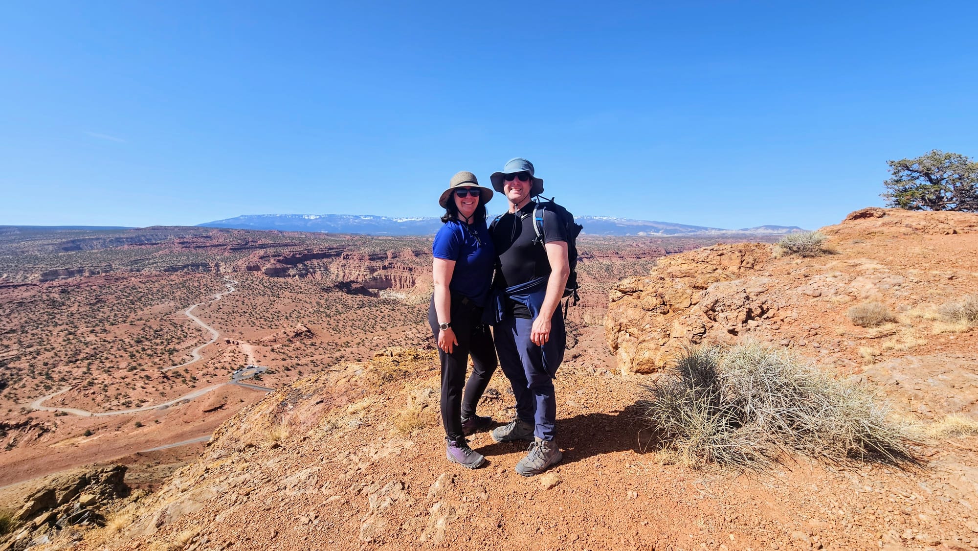
Our next hike was the Chimney Rock Loop, a trail we had passed by several times driving into and out of the park. We could see Chimney Rock from the road, but we knew this trail would be a climb to a higher vantage point. Unlike the "easy" moderate level of Hickman Bridge, this trail would be a more difficult moderate and total 3.7 miles. All Trails said to take the loop counterclockwise, but we wanted to get the ascent over with. A grueling choice, but we think we made the right one. We got to the Chimney Rock Overlook, and after that, we got to enjoy the rest of the hike and the views, with only a little bit more gain at the end.
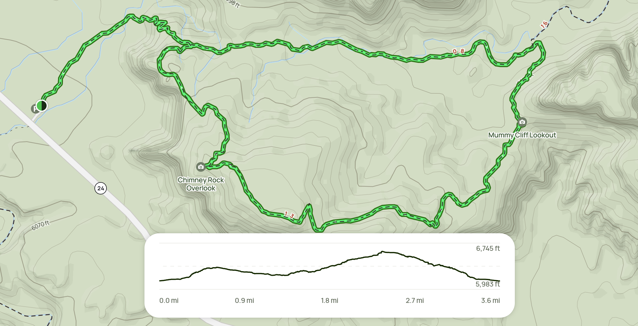
This was where we really hit our stride. We let go of our overwhelm and soaked in the beauty around us, and our bodies definitely thanked us for the movement. Our day of hiking was a success, and we're glad we ended our Capitol Reef visit on a high note. Nearly 7,000 feet, to be exact.
A little illustration of just how high we climbed!
We started off strong with Capitol Reef National Park, got a bit lost in the middle, and then found our way back to full enjoyment. All we needed to do was see the reasons this park is special beyond the obvious. Even still, we pegged this park as the one that lifts out of the Mighty 5. If someone said they didn't have time to visit all 5 parks and asked us which they should skip, we'd say Capitol Reef. Yes, this was before visiting Bryce and Zion, but we don't think we're making a leap here saying that those two parks are some of the best anywhere. Poor Capitol Reef, though. Pick it up and place it anywhere else, and this national park would be a shining star. It just has some really big competition in Utah.
We're not exactly of the popular opinion here, according to visitor statistics. Of the Mighty 5, Canyonlands is the least visited. But there's a simple explanation for that. People have limited time and Arches takes priority. Even we prioritized Arches. Only now, whenever our second visit happens, we already know we'll be spending more time in Canyonlands. As for Capitol Reef? If we're passing through on Utah 24, we'd be more than happy to stop for a bit. Will we go out of our way to make a return visit? Probably not. The rest of the Utah national parks are just that freaking good...or so we hear.
And that, of course, means we are headed out of Capitol Reef and down to Bryce Canyon National Park, one of our most anticipated destinations of the Utah Redemption Tour. Will it live up to the hype? Find out in the next post!